Ecological dynamics
The Clayey Uplands ecological site contains a mix of grasses, forbs, shrubs, succulents; and, occasionally, trees. Higher-seral communities are grasslands with scattered shrubs, while lower-seral communities are dominated by shrubs or weedy forbs. While warm-season plants dominate this site, the relative abundance of cool-season plants increases in response to moisture in the spring and late fall.
There are numerous variables such as elevation, latitude, hydrology, soil depth, fire frequency, grazing dynamics, and anthropogenic effects that influence plant communities. This site is dominated by warm-season plants. Elevation generally increases as the plateaus gently climb to the west, and proximity to greater warm season moisture from the Gulf of Mexico increases toward the east. Thus both of these factors result in an increase in the relative amount of warm-season moisture to the east. As elevation increases toward its upper extreme (about 7,500 feet) near the foot of the Rocky Mountains, cool-season plants become most abundant within this site. Therefore, blue grama and broom snakeweed are particularly abundant in the east; while western wheatgrass, fringed sage, and wormwood increase their presence as one travels west.
Since the Canadian Plateaus LRU is bounded by areas with strongly-contrasting geology and geomorphology, the Clayey Uplands site does not transition smoothly into adjacent ecological sites of other LRUs at its upper and lower elevations. Rather, the landscape transitions at the upper end into the Rocky Mountain Province (MLRAs 49 and 48A) or the Volcanic Plateaus LRU of MLRA 70A, and at the lower end to the Mesozoic Canyons and Breaks LRU of 70A.
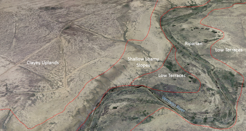
While the Clayey Uplands site occupies rather subdued geomorphic positions, even gentle undulations cause certain landform positions to receive run-on moisture from adjacent positions. While major run-on-landforms such as alluvial flats and floodplains are covered by unique ecological sites, swales and small toeslopes are included within the concept of the Clayey Uplands site. In these positions, we find higher total production, and a greater relative abundance of grasses such as western wheatgrass and vine mesquite.
The Clayey Upland site does occur above Dakota Sandstone bedrock in locations, so long as contact with lithic sandstone occurs below 20 inches (50 centimeters). Where the soil depth to a restrictive sandstone layer approaches 20 inches (50 centimeters), a transition occurs to the Lithic Sandstone ecological site. Along this gradient, shrubs generally increase in abundance and trees such as oneseed juniper and twoneedle pinyon often appear, as do sideoats grama and silvery bluestem.
Plant tables have not been developed for this site. Until such time as they can be updated, use the plant tables in the referenced literature that correlates to this concept (refer to the Correlation to Associated Published Sites section below). With respect to the imperfect alignment of such correlations, be aware of these shortcomings in their applicability to conservation planning.
Early work by Kuchler (1964) identified the potential natural vegetation type for the Canadian Plateaus LRU as that of the grama/buffalograss short grass prairie. The Clayey Uplands ecological site is dominated by short grasses, but also contains a mix of shrubs, forbs, and succulents. As is typical of plant communities, pronounced annual variations in precipitation translate to considerable short-term fluctuations in annual production within a given plant community phase.
The climate gradient across the CP LRU shows a greater distribution of C3 plants such as western wheatgrass, green needle grass, bottlebrush squirreltail, and purple prairie clover where temperatures are cooler, and moisture is more abundant. Where surface texture trends toward clay loam, western wheatgrass, galleta, and vine-mesquite grass increase. Where the plateau bedrock is Cretaceous shale and the site trends toward a surface texture of clay loam with an increase in salt in the profile, alkali sacaton and four-wing saltbush increase.
Fire is a disturbance regime that reduces succulents and shrubs while stimulating grasses and forbs. Not all fires are equal. According to Gebow (2001), fire effects in the same location will vary, especially with fire timing, both seasonally and within the scheme of year-to-year moisture variation. Precipitation during seasons before and after fire has a major effect on recovery of plants. Fire promotes rhizomatous plant species, such as western wheatgrass, that can take advantage of below-ground rhizomes from which tillering is rapidly initiated.
Information from Legacy Sites That Correlate to This Concept:
(From clayey upland-RO70AY002NM)This site is grassland dotted with occasional shrubs. Mid-grasses are dominant with short-grasses which can take advantage of the soils with high water-holding capacities. Shrubs and half-shrubs are sparsely scattered. Few woody plants are indigenous to this site. Forbs are a minor component of the potential plant community.
Approximately 95 percent of the annual yield are from species that furnish forage for grazing animals. Continuous grazing during the growing season will cause the more desirable forage plants such as western wheatgrass, vine-mesquite, sideoats grama and fourwing saltbush to decrease. The species most likely to invade this site is sleepygrass. Species most likely to increase are blue grama, alkali sacaton, buffalograss, creeping muhly, ring muhly and broom snakeweed. Cholla cactus may also increase. As the ecological condition deteriorates, it is accompanied by a sharp increase in blue grama. Continuous heavy grazing will cause blue grama to form a low, dense turf, which is low in productivity. The plant community may be dominated either by blue grama/galleta and alkali sacaton/galleta. Continuous heavy grazing will result in a loss of vegetative cover causing a large area of denuded soil and the productivity of this site is greatly reduced. Most of the mid-grasses will disappear as deterioration advances. In some areas there may be large patches of sleepygrass and a variety of annual and perennial forbs. A system of deferred grazing, which varies the time of grazing and rest in a pasture during consecutive years, is needed to maintain or improve the plant community. Spring rest from April through June is needed for western wheatgrass to grow and reproduce. This allows alkali sacaton sufficient time to green up before grazing it intensively.
Annual production by plant type
Plant Type------------------Low (Lb/Acre)------RV (Lb/Acre)------High(Lb/Acre)
Grass/Grasslike---------330---------------------660---------------------1000
Shrub/Vine-----------------30-----------------------60----------------------100
Forb---------------------------10-----------------------20-----------------------40
Total---------------------------370--------------------740---------------------1140
Community 1.1 plant community composition
Common Name-------------Symbol--------Scientific Name-------Annual Production (Lb/Acre)
GRASS/GRASSLIKE
1 blue grama-----------------BOGR2---------Bouteloua gracilis--------------200–240
2 western wheatgrass---PASM-----------Pascopyrum smithii----------160–200
3 alkali sacaton-------------SPAI-------------Sporobolus airoides----------160–200
4 James' galleta------------PLJA------------Pleuraphis jamesii-------------80–120
5 vine mesquite-------------PAOB-----------Panicum obtusum-------------40–80
6 sideoats grama----------BOCU-----------Bouteloua curtipendula------8–40
7 buffalograss--------------BODA2----------Bouteloua dactyloides-------8–40
8 New Jersey muhly-----MUTO-----------Muhlenbergia torreyana-----8–40
FORB
9 ragweed--------------------AMBRO---------Ambrosia--------------------------8–24
10 Forb, perennial----------2FP---------------Forb, perennial-------------------8–24
11 Forb, annual--------------2FA---------------Forb, annual-----------------------8–24
SHRUB/VINE
12 fourwing saltbush------ATCA2----------Atriplex canescens------------16–48
13 pale desert-thorn-------LYPA-------------Lycium pallidum-----------------16–48
14 winterfat-------------------KRLA2-----------Krascheninnikovia lanata----8–24
The approximate species composition of the potential plant community is as follows:
Plant---------------------------Percent composition by weight
Western wheatgrass---15
Sideoats grama----------10
Vine-mesquite-------------5
Alkali sacaton--------------25
Spike muhly-----------------5
Blue grama------------------20
Galleta------------------------15
Four-wing saltbush------5
From the San Miguel County (NM630) manuscript: The potential plant community is mainly blue grama, western wheatgrass, galleta, and sideoats grama. As the range deteriorates, the preferred species decrease and a dense, low turf of blue grama and ring muhly that is low in productivity develops. Grazing management should be designed to increase the productivity and reproduction of western wheatgrass, sideoats grama, and winterfat.
Production table as taken from NM630 manuscript with production in lbs./ac and percent species composition by weight.
Production for Partri Soil: Favorable - 1500; normal - 950; unfavorable - 450. Composition: Blue grama - 30; Western wheatgrass - 20; Sideoats grama - 10; Galleta - 10; Winterfat, - 5; Bottlebrush squirreltail - 5; ring muhly - 5; wolfstail - 5
From the Partri component of the PB map unit in the Mora County (NM638) manuscript: The potential natural plant community on this unit is mainly blue grama, western wheatgrass, sideoats grama, and galleta. As the potential natural plant community deteriorates, the western wheatgrass and sideoats grama decrease and a dense, and the blue grama forms a dense, low turf. Grazing management should be designed to increase the productivity and reproduction of western wheatgrass, sideoats grama, and blue grama.
Plants that commonly occur on this site include:
Grasses: blue grama, western wheatgrass, galleta grass, bottlebrush squirreltail, ring muhly, sand dropseed, threeawn, buffalo grass, vine mesquitegrass, and alkali sacaton.
Forbs: penstemon, fleabane daisy, scarlet globemallow, gaura, wooly indianwheat, purple prairie clover, dotted gayfeather, prairie coneflower, and slimflower scurfpea.
Shrubs/succulents: fringed sage, broom snakeweed, winterfat, fourwing saltbush, and prickly pear.
State 1
Reference State
This state represents the most ecologically stable state in terms of resistance to erosion. Moreover, this state has the highest potential for productivity and plant diversity.
Community 1.1
Diverse Grasses and Shrubs
Blue Grama-Western Wheatgrass-Sand Dropseed-Vine Mesquite/Alkali Sacaton
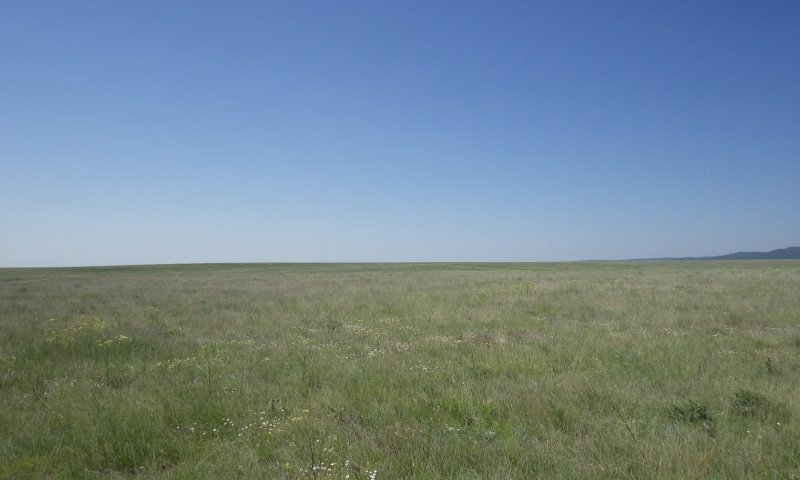
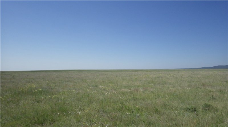
Figure 5. Community 1.1 on the Las Vegas National Wildlife Refuge in June of 2015. Note the high production and abundance of western wheatgrass.
This community is dominated by grasses, but also contains a number of forb species and the occasional shrub. Foliar cover is between 75 and 90 percent, and bare ground is typically less than 15 percent. Total canopy cover of warm season grasses is between 50 and 75 percent, and cool-season grass cover can be as high as 30 percent. Forbs and shrubs account for up to 10 percent and 3 percent cover, respectively. Annual production averages around 1,300 pounds per acre, but can range between 1,000 and 1,800 lbs/ac, depending mostly on annual weather patterns.
This community exists where season-long grazing has not been practiced in a number of years. Blue grama is the dominant grass, but western wheatgrass and alkali sacaton are major players—the latter being more common on soils developed from the marine shales of the Carlisle and Pierre Formations. While forbs represent a small percentage of foliar cover, their species richness is quite high—leading to colorful displays following major rain events. Shrubs are a very minor component—with broom snakeweed being more common at lower elevations and eastern latitudes and fringed sage is more common toward the higher/cooler end of the spatial/climatic gradient.
This plant community optimizes energy flow, hydrologic function, and nutrient cycling. The diverse root systems take advantage of moisture from both close to the surface as well as deeper in the soil profile. High canopy cover protects the soil surface from raindrop impact; fibrous roots of grasses and good soil structure also promote infiltration of rainwater and prevent erosion. With periodic herbivory and fire, decomposition is active, creating soil organic matter, which enhances “plant available water” needed for plant vigor.
Community 1.2
Diverse Grasses and Shrubs
Blue Grama-Broom Snakeweed-Fringed Sage-Western Wheatgrass-Sand Dropseed-Vine Mesquite/Alkali Sacaton
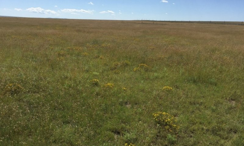
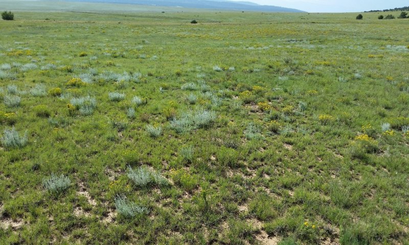
Figure 6. Community 1.2. Note the high percentage of herbaceous cover and the relatively low percentage of shrubs. While difficult to see in this image, there is a considerable amount of western wheatgrass across this area. Springer area; 9-18-17
This community is dominated by grasses, but also contains a number of forb species and the occasional shrub. Foliar cover is between 75 and 90 percent, and bare ground is typically less than 15 percent. Total canopy cover of warm season grasses is between 50 and 75 percent, and cool-season grass cover can be as high as 30 percent. Forbs and shrubs account for up to 10 percent and 3 percent cover, respectively. Annual production averages around 1,300 pounds per acre, but can range between 1,000 and 1,800 lbs/ac, depending mostly on annual weather patterns.
This community exists where season-long grazing has not been practiced in a number of years. Blue grama is the dominant grass, but western wheatgrass and alkali sacaton are major players—the latter being more common on soils developed from the marine shales of the Carlisle and Pierre Formations. While forbs represent a small percentage of foliar cover, their species richness is quite high—leading to colorful displays following major rain events. Shrubs are a very minor component—with broom snakeweed being more common at lower elevations and eastern latitudes and fringed sage is more common toward the higher/cooler end of the spatial/climatic gradient.
This plant community optimizes energy flow, hydrologic function, and nutrient cycling. The diverse root systems take advantage of moisture from both close to the surface as well as deeper in the soil profile. High canopy cover protects the soil surface from raindrop impact; fibrous roots of grasses and good soil structure also promote infiltration of rainwater and prevent erosion. With periodic herbivory and fire, decomposition is active, creating soil organic matter, which enhances “plant available water” needed for plant vigor.
Community 1.3
At-Risk: Sod-bound blue grama /shrubs
Blue Grama-Broom Snakeweed-Fringed Sage-Ring Muhly-Galleta-Threeawn
Shrubs >10%
This community is dominated by low-growing blue grama, but also contains abundant shrubs. Highly palatable and grazing-sensitive grasses are almost entirely confined to run-on microsites or sheltered in the understories of woody species. Lower-seral grasses such as galleta and threeawn are common. The combined canopy cover of broom snakeweed and fringed sage is ≥ 10%. Foliar cover is typically between 60 and 80 percent, and bare ground ranges from 10 to 35 percent. Annual production averages around 1,000 lbs/ac, but can span between 800 and 1,250 lbs/ac, depending mostly on annual weather patterns.
This community exists where season-long grazing has been practiced long enough that species composition has been markedly altered, and species richness and total productivity have been reduced considerably. Blue grama is usually the dominant grass. It generally occurs in sod-bound form, but does not form a monoculture. In response to prolonged herbivory, grazing-tolerant grasses such as galleta, threeawn, and ring muhly have increased in abundance; while those most sensitive to herbivory have been all but extirpated. Shrubs are a major component—with broom snakeweed being more common at lower elevations and eastern latitudes and fringed sage is more common toward the higher/cooler end of the spatial/climatic gradient. Low-seral forbs such as kochia, annual sunflower, purple tansyaster, hairy false goldenaster, and trailing fleabane are also quite abundant.
This plant community has developed due to an increase in shrub vigor and a decrease in grass vigor. Under heavy, continuous herbivory, the depth of grass roots decreases—giving shrubs a competitive advantage in acquiring water and nutrients. As the turnover of grass roots diminishes, energy flow begins to lessen due to a decrease in soil organic matter. While prolonged grazing would have been uncommon prior to the introduction of livestock, fire was an important factor in keeping shrub species from gaining a competitive advantage and stimulating the growth of grasses.
Community 1.4
At-risk: Sod-bound blue grama
Blue Grama-Broom Snakeweed-Fringed Sage-Ring Muhly-Galleta-Threeawn
Shrubs <10%
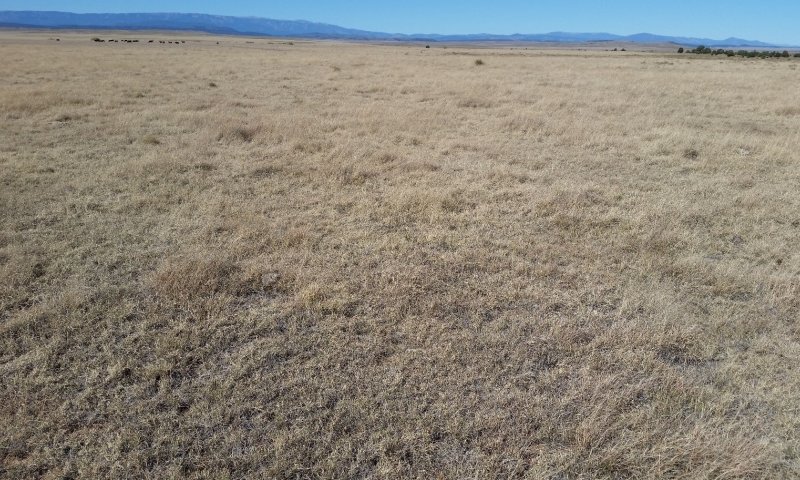
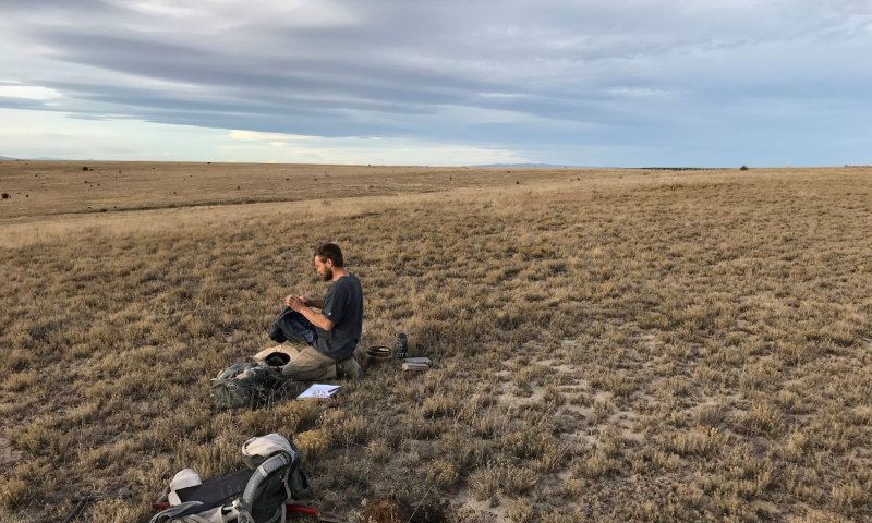
Figure 7. Community 1.4 in San Miguel County—October of 2017. While shrubs are poorly-represented and grass cover is considerable, species richness is quite low. Palatable and grazing-sensitive species have been all but extirpated.
This community is dominated by sod-bound blue grama, and also contains significant amounts of shrubs. Highly palatable and grazing-sensitive grasses are almost entirely absent, and confined to run-on microsites or sheltered in the understories of woody species. Lower-seral grasses such as galleta and threeawn are common. The combined canopy cover of broom snakeweed and fringed sage is < 10%. Foliar cover is typically between 65 and 90 percent, and bare ground ranges from 5 to 30 percent. Annual production averages around 1,150 lbs/ac, but can span between 900 and 1,400 lbs/ac, depending mostly on annual weather patterns.
This community exists in areas where season-long grazing has been practiced long enough that species composition has been markedly altered, and species richness and total productivity have been reduced considerably. These areas have subsequently experienced fire and/or herbicide treatments. Blue grama is either dominant grass, or is codominant with galleta. In response to prolonged herbivory, grazing-tolerant grasses such as galleta, threeawn, and ring muhly have increased in abundance; while those sensitive to herbivory have been all but extirpated. Shrubs are an important component—with broom snakeweed being more common at lower elevations and eastern latitudes and fringed sage is more common toward the higher/cooler end of the spatial/climatic gradient. However, the abundance of shrubs has diminished in response to chemical treatments and/or fire. Low-seral forbs such as kochia, annual sunflower, purple tansyaster, hairy false goldenaster, and trailing fleabane are quite abundant.
Pathway P-1.1A
Community 1.1 to 1.2
Diverse Grasses and Shrubs
Blue Grama-Western Wheatgrass-Sand Dropseed-Vine Mesquite/Alkali Sacaton
Diverse Grasses and Shrubs
Blue Grama-Broom Snakeweed-Fringed Sage-Western Wheatgrass-Sand Dropseed-Vine Mesquite/Alkali Sacaton
This pathway represents a period of heavy grazing, typically season-long, which advantages the growth and reproduction of shrubs and suppresses herbaceous species that are more palatable and/or less resilient under grazing pressure. Under a continuous grazing regime, and in the absence of fire and/or chemical treatments, broom snakeweed and fringed sage increase in abundance and vigor. Conversely, western wheatgrass, vine mesquite, and alkali sacaton will diminish unless given significant periods of rest during their growing seasons.
Pathway P-1.2A
Community 1.2 to 1.1
Diverse Grasses and Shrubs
Blue Grama-Broom Snakeweed-Fringed Sage-Western Wheatgrass-Sand Dropseed-Vine Mesquite/Alkali Sacaton
Diverse Grasses and Shrubs
Blue Grama-Western Wheatgrass-Sand Dropseed-Vine Mesquite/Alkali Sacaton
This pathway represents prescribed grazing and/or rest from stocking. In either case, herbaceous plants that are palatable and/or sensitive to grazing increase in vigor and abundance, and shrubs are at a competitive disadvantage. This community pathway is facilitated by wetter-than-average growing seasons and by fire. This pathway, which expresses itself an increase in herbaceous cover at the expense of shrubs, can also involve a late summer drought which kills broom snakeweed.
Pathway P-1.2B
Community 1.2 to 1.3
Diverse Grasses and Shrubs
Blue Grama-Broom Snakeweed-Fringed Sage-Western Wheatgrass-Sand Dropseed-Vine Mesquite/Alkali Sacaton
At-Risk: Sod-bound blue grama /shrubs
Blue Grama-Broom Snakeweed-Fringed Sage-Ring Muhly-Galleta-Threeawn
Shrubs >10%
This pathway represents an extended period of season-long grazing, which advantages the growth and reproduction of shrubs and suppresses herbaceous species—particularly those that are more palatable and/or less resilient under grazing pressure. In this process, growth rates and biomass of grasses are reduced. Western wheatgrass, alkali sacaton, and vine mesquite are affected to a disproportionately high degree—often only surviving in run-on microsites and under the canopies of larger shrubs.
Pathway P-1.3A
Community 1.3 to 1.4
At-Risk: Sod-bound blue grama /shrubs
Blue Grama-Broom Snakeweed-Fringed Sage-Ring Muhly-Galleta-Threeawn
Shrubs >10%
At-risk: Sod-bound blue grama
Blue Grama-Broom Snakeweed-Fringed Sage-Ring Muhly-Galleta-Threeawn
Shrubs <10%
This pathway represents fire and/or chemical treatment. In either case, shrubs are suppressed, giving a competitive advantage to herbaceous species.
Pathway P-1.4A
Community 1.4 to 1.1
At-risk: Sod-bound blue grama
Blue Grama-Broom Snakeweed-Fringed Sage-Ring Muhly-Galleta-Threeawn
Shrubs <10%
Diverse Grasses and Shrubs
Blue Grama-Western Wheatgrass-Sand Dropseed-Vine Mesquite/Alkali Sacaton
This pathway represents prescribed grazing or rest from grazing. In either case, herbaceous plants that are palatable and/or sensitive to grazing increase in vigor and abundance, and shrubs are at a competitive disadvantage. If not absolutely necessary, wetter-than-average growing seasons facilitate this transition. More than one occurrence of fire or application of herbicide may be required to favor this pathway over 1.4B. This pathway, which expresses itself an increase in herbaceous cover at the expense of shrubs, can also involve a late summer drought which kills broom snakeweed.
Pathway P-1.4B
Community 1.4 to 1.3
At-risk: Sod-bound blue grama
Blue Grama-Broom Snakeweed-Fringed Sage-Ring Muhly-Galleta-Threeawn
Shrubs <10%
At-Risk: Sod-bound blue grama /shrubs
Blue Grama-Broom Snakeweed-Fringed Sage-Ring Muhly-Galleta-Threeawn
Shrubs >10%
This pathway represents an extended period of season-long grazing, which advantages the growth and reproduction of shrubs and suppresses herbaceous species. This pathway may also occur in response to drought.
Context dependence. Extended Period of Grazing or Drought
Community 2.1
2.1 Shrubs, sod-bound blue grama, low-seral grasses, and annual forbs. Broom Snakeweed-Fringed Sage-Blue Grama-Threeawn-Ring Muhly with Annual Forbs
Community 2.2
2.2 Sod-bound blue grama, low-seral grasses, and annual forbs. Blue Grama-Ring Muhly-Threeawn with Annual Forbs
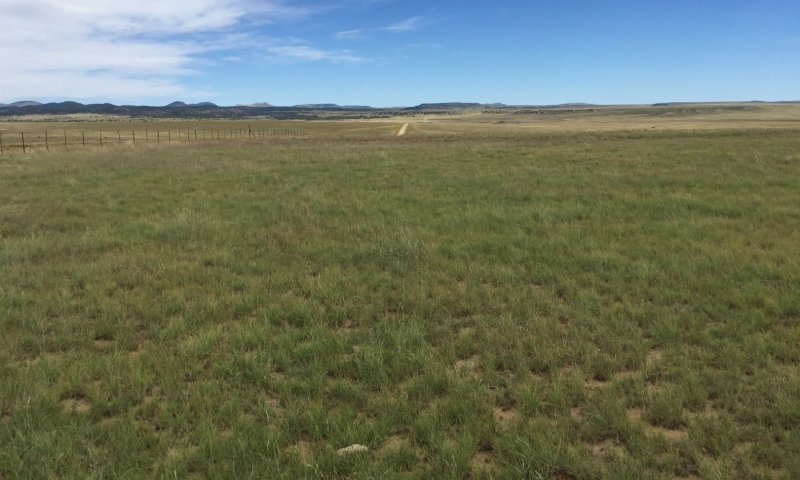
Figure 8. Community 2.2 in Colfax County in September of 2017. This community is transitioning toward State 1, and exhibits unusually high grass production.
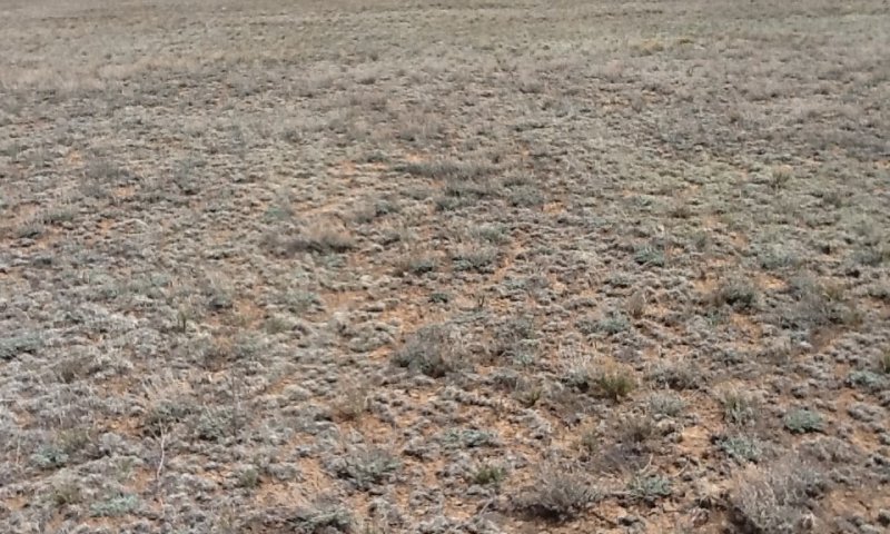
Figure 9. Community 2.2 in San Miguel County in September of 2017. This community is transitioning toward community 2.1, as evidenced by poor grass production and shrub cover near 10 percent.
Shrubs, sod-bound blue grama, low seral grasses, and annual forbs. Broom Snakeweed-Fringed Sage-Blue Grama-Threeawn-Ring Muhly with Annual Forbs
This is a grass-dominated plant community that lacks the diversity found in State 1. Blue grama is the dominant grass, but its vigor and rooting depth are significantly reduced—leaving it highly vulnerable to drought stress. Low seral grasses such as ring muhly and threeawn are well-represented, as are “weedy” forbs such as kochia, annual sunflower, trailing fleabane, and purple tansyaster. The combined canopy cover of broom snakeweed and fringed sage is < 10%. Foliar cover is typically between 50 and 80 percent, and bare ground ranges from 15 to 45 percent. Annual production averages around 850 lbs/ac, but can span between 600 and 1150 lbs/ac, depending mostly on annual weather patterns.
Pathway P-2.1A
Community 2.1 to 2.2
2.1 Shrubs, sod-bound blue grama, low-seral grasses, and annual forbs. Broom Snakeweed-Fringed Sage-Blue Grama-Threeawn-Ring Muhly with Annual Forbs
2.2 Sod-bound blue grama, low-seral grasses, and annual forbs. Blue Grama-Ring Muhly-Threeawn with Annual Forbs
This pathway represents fire, chemical treatment, or a late summer drought. In either case, shrubs are suppressed, giving a competitive advantage to herbaceous species. In the latter case, drought stress kills broom snakeweed.
Context dependence. Shrub Suppression
Pathway P-2.2A
Community 2.2 to 2.1
2.2 Sod-bound blue grama, low-seral grasses, and annual forbs. Blue Grama-Ring Muhly-Threeawn with Annual Forbs
2.1 Shrubs, sod-bound blue grama, low-seral grasses, and annual forbs. Broom Snakeweed-Fringed Sage-Blue Grama-Threeawn-Ring Muhly with Annual Forbs
This pathway represents an interval following fire or chemical treatment, during which shrubs re-establish their dominance. Once the site has crossed into State 2, this reversion to shrub-dominance appears to be the path of least resistance.
State 3
Post-Cropped State
Community 3.1
Post-Cropped
Various Annual and Perennial Forbs
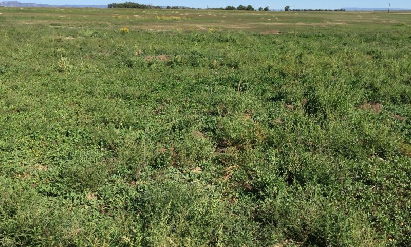
Figure 10. Community 3.1 in Colfax County in September of 2017. While production is at the upper end for this phase, both grasses and shrubs are entirely absent. Field bindweed, Russian thistle, and pigweed are codominant here.
This plant community is typically seen following a period of planting of dryland, or in some rare cases, irrigated crops with regular episodes of plowing. Other possible vectors for this state could include heavy land use activities such as areas former cattle watering or corral sites. The disturbance events may have occurred several years to decades ago, and were not successfully replanted into native grassland following abandonment. Efforts to replanting may have failed due to lack of favorable precipitation timing or failure to include some type of irrigation to ensure success. The existing plant community is dominated by low-seral forbs—many of which are annuals. Species composition depends on which pioneer species were present in the seedbank prior to plowing and which were transported via wind or animals. Grasses are either poorly represented or entirely absent. Foliar cover is typically between 50 and 85 percent, and bare ground ranges from 15 to 45 percent. Annual production averages around 800 lbs/ac, but can span between 600 and 1200 lbs/ac, depending mostly on annual weather patterns.
Resilience management. No management needed to maintain this state.
Transition T1A
State 1 to 2
Slow variables: Continued encroachment by shrubs, coupled with the loss of herbaceous plant production, leads to decreases in total canopy cover and exposure to erosion events which will reduce topsoil and its high soil organic matter content. The result is an increase in the rate of wind and water erosion—leading to the loss of topsoil and an associated decrease in available water and nutrients.
Trigger event: History of fire management, removal of large predators, and heavy grazing set the stage for transition mechanism. This might be in the form of a severe drought which can weaken or kill perennial grasses, resulting in a loss in canopy cover. Threshold: The vigor and cover of perennial grasses is reduced to a point at which perennial grasses die and soil surfaces become highly susceptible to erosion.
Constraints to recovery. Moisture, flexibility in the grazing program, as well as potential to implement fire management can all have an impact in ability for recovery.
Context dependence. Seasonal and annual patterns of moisture delivery with regards to the rate and amounts of precipitation. Prolonged dry periods, especially during the growing season, can prevent recovery or encourage the transition. When coupled with continued, undisciplined grazing program, transition will be enhanced.
Transition T1B
State 1 to 3
Trigger event(s): Mechanical soil surface disturbance, such as plowing activities or vehicle traffic causes the disruption of soil structure at the surface and kills perennial plants. The structure disturbance has an immediate effect of decomposing humus thereby diminishing the soil organic matter content that may have taken decades or centuries to develop. The soil surface is 100% bare ground for a period of time where its exposure can make it susceptible to wind and water erosion. Each successive disturbance event further diminishes these soil surface properties and may cause a dense plow layer to form in the subsurface which prevents air and water from entering the soil, thereby reducing its ability to support plant life and furthering its vulnerability to erosion.
Slow variables: Once crop planting ceases, pioneer species (mostly annual forbs) establish and their abundance gradually increases.
Threshold: After repeated cycles and/or the applications of herbicides, the native seedbank is exhausted.
Constraints to recovery. Loss of topsoil (usually entire "A" horizon) such that soil properties are severely degraded. This includes:
1. loss of organic matter which is important for processes such as nutrient cycling, moisture infiltration and retention, decreased bulk density;
2. impaired soil hydrology where coarser surface textures had allowed better infiltration of precipitation. This moisture would then become retained at the boundary to a higher-clay subsurface horizon therefore providing better soil moisture storage for shallow rooting plants such as grasses.
3. exposure of existing plant roots to the atmosphere where desiccation can weaken and cause mortality in perennial grasses.
Context dependence. Seasonal and annual patterns of moisture delivery with regards to the rate and amounts of precipitation can greatly affect the severity of soil degradation following periods of plowing. Soil disturbance during prolonged dry periods, especially during the growing season, will encourage this transition. When coupled with a continued, undisciplined grazing program, transition will be enhanced.
Restoration pathway R2A
State 2 to 1
Restoration is dependent on techniques that focus on increased plant canopy cover from perennial grasses, increased species biodiversity, shrub control, and managed grazing. The goal is to focus on an increase in the competitive advantage of various perennial grass species through physical, chemical, and biological management practices. This restoration pathway will likely require long-term, multifaceted approaches and may require some high-energy inputs.
In order to return to State 1:
1. erosion needs to be halted, this may be directly tied to increases in plant canopy
2. grazing is managed to optimize perennial grass recovery and increase plant canopy (may be requirement to initiate the recovery)
3. some re-introduction of extirpated plant species may be required
4. period favorable weather patterns may be necessary to initiate recovery
5. time
Context dependence. Seasonal and annual patterns of moisture delivery with regards to the rate and amounts of precipitation are critical to the success of any restoration program. Flexibility in timing needs to be built into the restoration strategy. Prolonged dry periods, especially during the growing season, can prevent recovery of plant species and set the stage for failure.
Flexibility in livestock grazing program is needed to allow plant community to recover without added animal stressors.
Transition T2A
State 2 to 3
Trigger event(s): Mechanical soil surface disturbance, such as plowing activities or vehicle traffic causes the disruption of soil structure at the surface and kills perennial plants. The structure disturbance has an immediate effect of decomposing humus thereby diminishing the soil organic matter content that may have taken decades or centuries to develop. The soil surface is 100% bare ground for a period of time where its exposure can make it susceptible to wind and water erosion. Each successive disturbance event further diminishes these soil surface properties and may cause a dense plow layer to form in the subsurface which prevents air and water from entering the soil, thereby reducing its ability to support plant life and furthering its vulnerability to erosion.
Slow variables: Once crop planting ceases, pioneer species (mostly annual forbs) establish and their abundance gradually increases.
Threshold: After repeated cycles and/or the applications of herbicides, the native seedbank is exhausted.
Constraints to recovery. Loss of topsoil (usually entire "A" horizon) such that soil properties are severely degraded. This includes:
1. loss of organic matter which is important for processes such as nutrient cycling, moisture infiltration and retention, decreased bulk density;
2. impaired soil hydrology where coarser surface textures had allowed better infiltration of precipitation. This moisture would then become retained at the boundary to a higher-clay subsurface horizon therefore providing better soil moisture storage for shallow rooting plants such as grasses.
3. exposure of existing plant roots to the atmosphere where desiccation can weaken and cause mortality in perennial grasses.
Context dependence. Seasonal and annual patterns of moisture delivery with regards to the rate and amounts of precipitation can greatly affect the severity of soil degradation following periods of plowing. Soil disturbance during prolonged dry periods, especially during the growing season, will encourage this transition. When coupled with a continued, undisciplined grazing program, transition will be enhanced.
Restoration pathway R3A
State 3 to 1
The native plant community is re-established
Context dependence. Restoration activities will require a large investment in resources to revert a former cropland back into a functioning shortgrass prairie. The restoration will need to be tailored to the specific needs of a particular field or pasture and the expectations for the desired outcome. The possible list of restoration activities includes:
1. reseeding - applying a desired seedbank to recover plant biodiversity
2. irrigation - ensuring the success of seeding activities, without which a low probability of recovery is expected.
3. return of topsoil material - it is possible that any recovery in the ecosystem will be hindered without some return of topsoil properties, which will include organic matter and may also require application a coarser textured medium to improve soil hydrology.
4. Maintenance of the recovery process - multiple attempts at seeding may be necessary as not all species will see success per any application. Weed-control practices will also be necessary.
5. favorable weather patterns
6. time
Restoration pathway R3B
State 3 to 2
Restoring native grasslands.
Context dependence. Restoration activities will require a large investment in resources to revert a former cropland back into a functioning shortgrass prairie. The restoration will need to be tailored to the specific needs of a particular field or pasture and the expectations for the desired outcome. The possible list of restoration activities includes:
1. reseeding - applying a desired seedbank to recover plant biodiversity
2. irrigation - ensuring the success of seeding activities, without which a low probability of recovery is expected.
3. return of topsoil material - it is possible that any recovery in the ecosystem will be hindered without some return of topsoil properties, which will include organic matter and may also require application a coarser textured medium to improve soil hydrology.
4. Maintenance of the recovery process - multiple attempts at seeding may be necessary as not all species will see success per any application. Weed-control practices will also be necessary.
5. favorable weather patterns
6. time


