Major Land Resource Area 070B
Pecos and Canadian River Basins
Accessed: 04/09/2026
Description
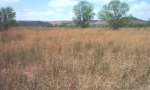
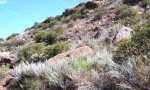
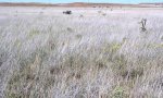
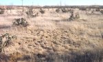
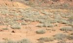
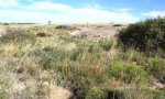
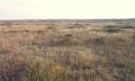
MLRA 70B represents the southern terminus of Land Resource Region G, the Western Great Plains. The entirety of this MLRA is within two primary river basins carved out of the Great Plains by the Canadian and Pecos rivers. The basins are characterized by the Tucumcari Basin portion of the Canadian River and the Pecos River Basin with its associated Mescalero Sand Plain, Artesia Group saline red beds, and piedmont deposits. This MLRA constitutes the transition from the Basin and Range Province of the west to the Southern High Plains, with its Ogallala aquifer-bearing deposits, to the east. Most of the MLRA is rangeland punctuated by extensive areas of petroleum extraction in the south and east parts of the Pecos Basin. In smaller areas along waterways, diverted water from the main river or shallow water tables provide irrigation to bottomland fields.
Key publications
Next steps
-
1
Select an ecological site
Select an ecological site using the list, keys, photos, briefcase, or quick search option located on this page. -
2
Explore the ecological site description
Next, learn more about the selected ecological site and its characteristic dynamics by browsing the ecological site description and exploring alternative state and transition model formats.
Ecological site list
Ecological site map
Basemap
Find me
Find point
Full screen
Zoom in to display soil survey map units for an area of interest, and zoom out to display MLRAs. Select a map unit polygon to view ecological sites correlated to that map unit. View a brief description of an ecological site by clicking on its name in the map popup. Soil survey correlations may not be accurate, and ecological site classification of a location should always be verified in the field. Each selection may require the transfer of several hundred KB of data.
Ecological site keys
Ecological site photos
Print Options
Sections
Font
Other
Briefcase
Add ecological sites and Major Land Resource Areas to your briefcase by clicking on the briefcase (![]() ) icon wherever it occurs. Drag and drop items to reorder. Cookies are used to store briefcase items between browsing sessions. Because of this, the number of items that can be added to your briefcase is limited, and briefcase items added on one device and browser cannot be accessed from another device or browser. Users who do not wish to place cookies on their devices should not use the briefcase tool. Briefcase cookies serve no other purpose than described here and are deleted whenever browsing history is cleared.
) icon wherever it occurs. Drag and drop items to reorder. Cookies are used to store briefcase items between browsing sessions. Because of this, the number of items that can be added to your briefcase is limited, and briefcase items added on one device and browser cannot be accessed from another device or browser. Users who do not wish to place cookies on their devices should not use the briefcase tool. Briefcase cookies serve no other purpose than described here and are deleted whenever browsing history is cleared.
Ecological sites
Major Land Resource Areas
The Ecosystem Dynamics Interpretive Tool is an information system framework developed by the USDA-ARS Jornada Experimental Range, USDA Natural Resources Conservation Service, and New Mexico State University.