Clay Loam 12-18" PZ
Scenario model
Current ecosystem state
Select a state
Management practices/drivers
Select a transition or restoration pathway
- Transition T1A More details
- Transition T1B More details
- Restoration pathway R2A More details
- Restoration pathway R3A More details
-
No transition or restoration pathway between the selected states has been described
Target ecosystem state
Select a state
Description
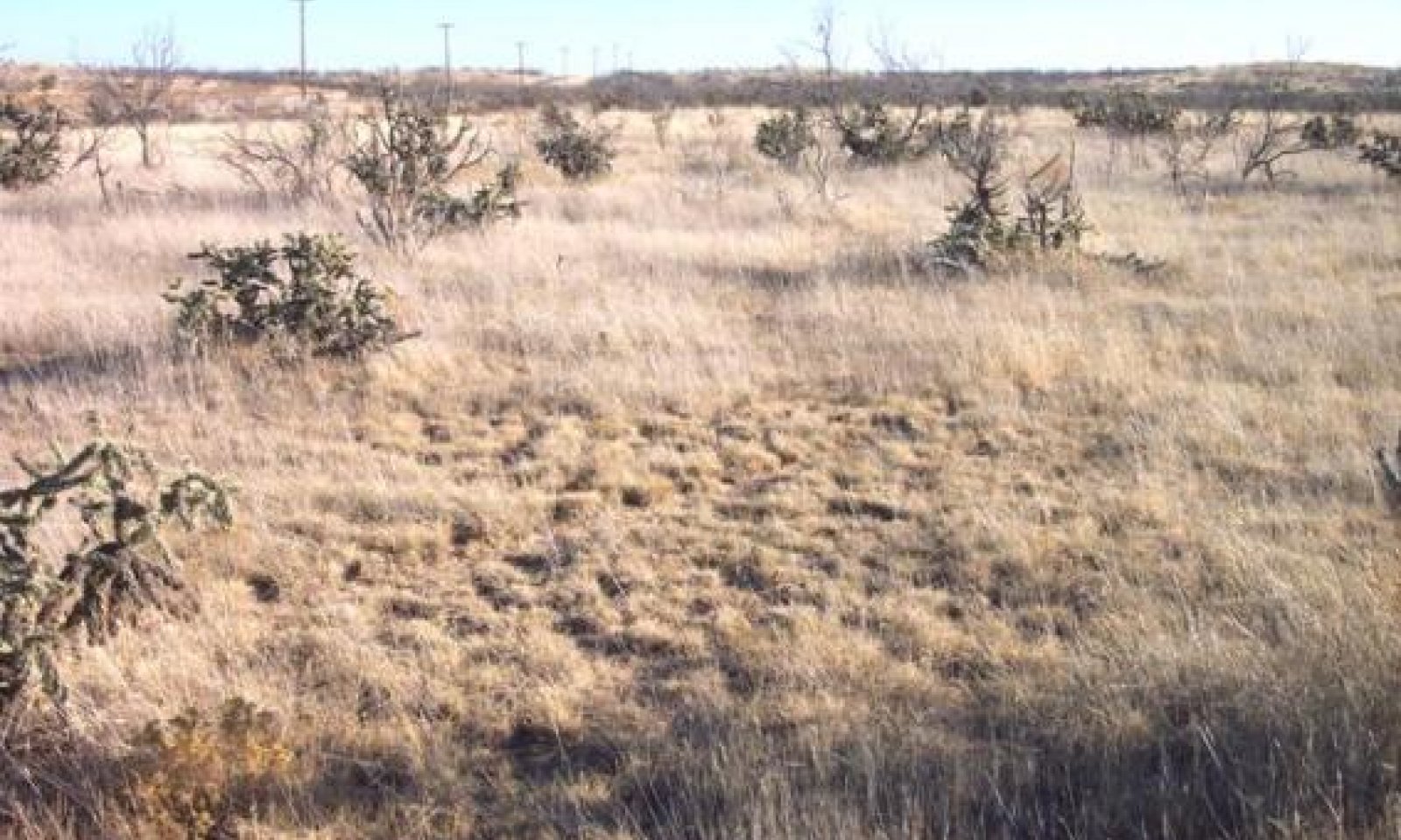
The historic climax plant community (HCPC) for the Clay Loam site is best characterized as shortgrass dominant with a few midgrasses, few forbs, and scattered shrubs. Midgrasses occur in areas that receive extra moisture. Forbs vary greatly from year to year depending on amount and timing of precipitation. Shrubs are mostly scattered with isolated small pockets of thicker cover. The site would be classified as a grassland in the HCPC, and can shift toward a shrubland with the invasion of woody shrubs.
Submodel
Description
The plant community in this state is dominated by shortgrasses. There is a pronounced increase in shrub cover exceeding 20 percent canopy cover. Blue grama is decreasing and galleta is increasing. The site is somewhat stable but is moving towards a shrub-dominated community. Cover is adequate for soil protection.
Submodel
Description
The plant community in this state is dominated by a deteriorating plant community of shortgrasses. Perennial grasses show low vigor. Plant residues are very low. Surface erosion are visible. Rangeland health factors are moving away from the HCPC. Plant group functions and site stability are impaired.
Submodel
Mechanism
Moderate Continuous Grazing with no deferment, No Fire (over a period of ten to twenty years), and Brush Invasion of cholla and mesquite have lead to the shift from a grassland state to a shortgrass/shrubland state.
Mechanism
Heavy Continuous Grazing with no deferment periods and excessive stocking rate, No fire, and Long-term Drought (greater than twenty years) have lead to the shift from a grassland state to a degraded shortgrass state.
Mechanism
With the implementation of the following conservation practices: prescribed grazing including growing season rest, and selective Brush and Pest Management (applications every four to five years), the shortgrass/shrubland state can be restored back to the grassland state of a shortgrass-dominated community.
Relevant conservation practices
| Practice | External resources |
|---|---|
|
Brush Management |
|
|
Prescribed Grazing |
|
|
Integrated Pest Management (IPM) |
Mechanism
With the implementation of the following conservation practices: prescribed grazing including growing season rest, selective Brush and Pest Management (applications every four to five years), and selective re-seeding (over a five to six year period), the degraded shortgrass state can be restored back to the grassland state of a shortgrass-dominated community.
Relevant conservation practices
| Practice | External resources |
|---|---|
|
Brush Management |
|
|
Prescribed Grazing |
|
|
Range Planting |
|
|
Integrated Pest Management (IPM) |
Model keys
Briefcase
Add ecological sites and Major Land Resource Areas to your briefcase by clicking on the briefcase (![]() ) icon wherever it occurs. Drag and drop items to reorder. Cookies are used to store briefcase items between browsing sessions. Because of this, the number of items that can be added to your briefcase is limited, and briefcase items added on one device and browser cannot be accessed from another device or browser. Users who do not wish to place cookies on their devices should not use the briefcase tool. Briefcase cookies serve no other purpose than described here and are deleted whenever browsing history is cleared.
) icon wherever it occurs. Drag and drop items to reorder. Cookies are used to store briefcase items between browsing sessions. Because of this, the number of items that can be added to your briefcase is limited, and briefcase items added on one device and browser cannot be accessed from another device or browser. Users who do not wish to place cookies on their devices should not use the briefcase tool. Briefcase cookies serve no other purpose than described here and are deleted whenever browsing history is cleared.
Ecological sites
Major Land Resource Areas
The Ecosystem Dynamics Interpretive Tool is an information system framework developed by the USDA-ARS Jornada Experimental Range, USDA Natural Resources Conservation Service, and New Mexico State University.


