Playa 16-21" PZ
Scenario model
Current ecosystem state
Select a state
Management practices/drivers
Select a transition or restoration pathway
-
Transition T1A
prolonged inundation
More details -
Restoration pathway R2A
prolonged drought conditions
More details -
Transition T2A
frequent prolonged inundation
More details -
Restoration pathway R3A
less frequent inundation
More details -
No transition or restoration pathway between the selected states has been described
Target ecosystem state
Select a state
State 1
Infrequent to Occasional Flooding State - Dryer State


Description
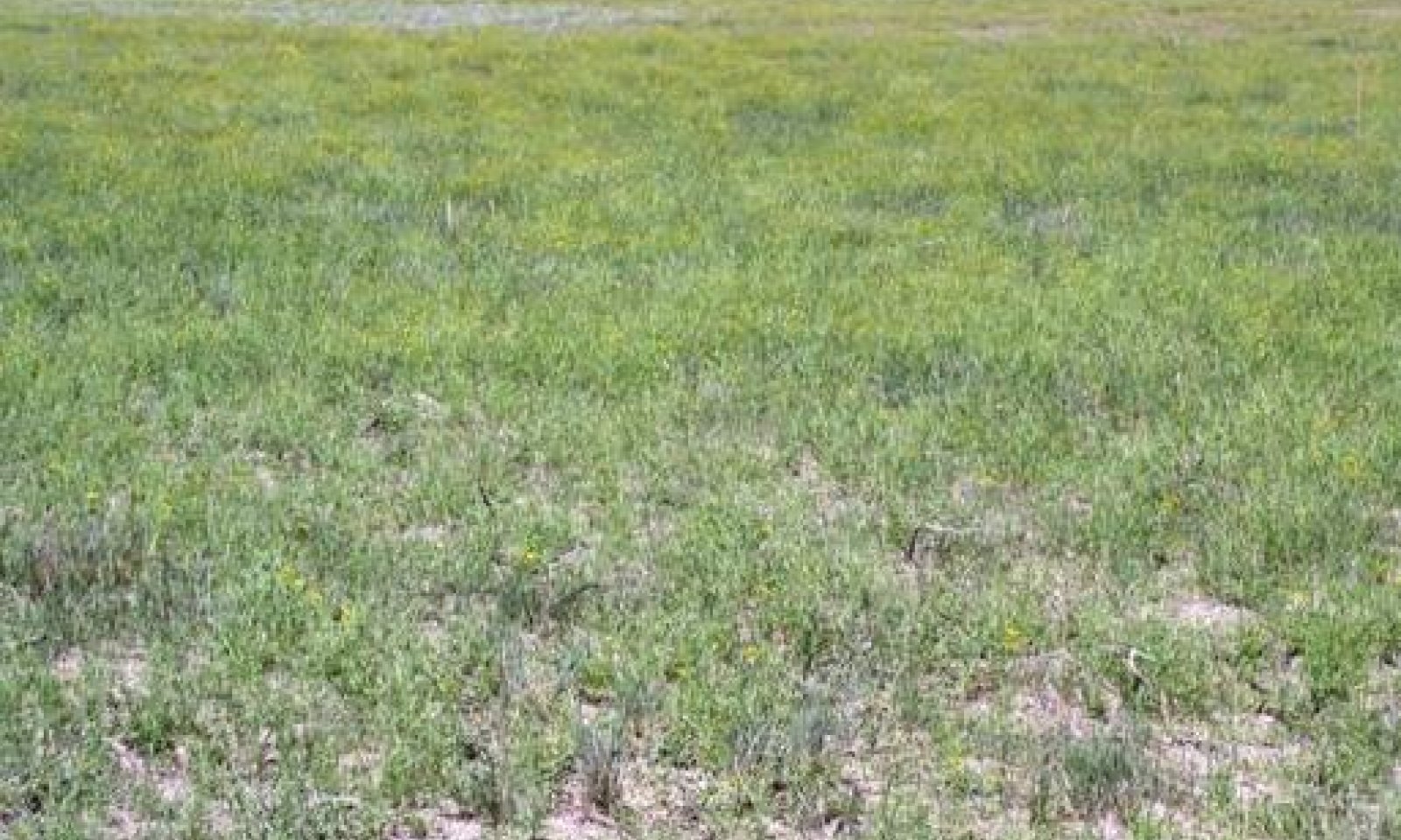
The Midgrass/Forb Community – Dryer (1.1) is dominated by western wheatgrass with lesser amounts of buffalograss, vine mesquite, white tridens and barnyardgrass. Grass-like species such as creeping spikerush may occur in micro-depressions on some playas. Grass and grass-like species make up approximately 50-60 percent of the total site production. Forbs common to the dryer phase of the playa include coreopsis and frogfruit with occasional snow-on-the-mountain, curlycup gumweed, primrose species, and silverleaf nightshade. Forb production ranges from 40-50 percent, depending on moisture. Dryer phase playas generally do not support woody vegetation. Total annual production can range from 1,700 to 3,300 pounds per acre depending on rainfall.
The Grass-likes/Forbs/Annuals Community (1.2) is the result of long-term overgrazing, no fire (over 10-20 years) and infrequent flooding. Western wheatgrass, vine mesquite, white tridens and buffalograss will decrease as spike sedges, rushes and barnyardgrass increase. The percent bare ground can increase to >40 percent. Annual forbs and grasses will fill the voids. Overall plant diversity and production has decreased. Total site production is approximately 900 to 1,500 pounds per acre. With careful grazing management, this plant community may be moved towards the reference community (dryer phase).
Submodel
Description
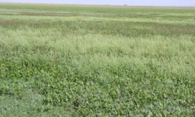
The Grass-likes/Emergent Hydrophytic Plant Community is a direct result of moderately frequent inundation. Creeping spikerush dominates the wetter phase with lesser amounts of saltmarsh aster, curly dock and smartweed. Western wheatgrass can still be found around the outer edges of the playa. Total site production is approximately 1,700 to 2,800 pounds per acre. Most of the hydrophytic perennials exhibit a surprising ability for their root stocks to go into dormancy when the playas become dry.
Submodel
Description
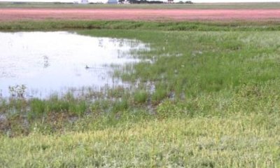
On playas that are frequently inundated for long periods, the plant community will move towards the Grass-likes/Hydrophytic Plant Community (Wettest State) (3.1). This is a very variable plant community with rushes/sedges, knotgrass, curly dock, and California loosestrife typically occurring along the shallow water edge. Pennsylvania smartweed will be the dominant plant species in the deeper water areas. In order for smartweed to germinate and thrive, late spring rains (May) are especially beneficial. Total site production is approximately 1,700 to 3,200 pounds per acre.
Submodel
Transition T1A


Mechanism
With moderately frequent inundation, depth of water, and duration of inundation, the Dryer State plant communities (State 1) will transition to the Wetter State plant community.
Restoration pathway R2A


Mechanism
With Infrequent Inundation and Shorter Duration of Inundation, the Wetter State will be restored back to the Dryer State.
Transition T2A


Mechanism
With Frequent Inundation, Depth of Water and Long Periods of Inundation, the Wetter State will transition to the Wettest State.
Model keys
Briefcase
Add ecological sites and Major Land Resource Areas to your briefcase by clicking on the briefcase (![]() ) icon wherever it occurs. Drag and drop items to reorder. Cookies are used to store briefcase items between browsing sessions. Because of this, the number of items that can be added to your briefcase is limited, and briefcase items added on one device and browser cannot be accessed from another device or browser. Users who do not wish to place cookies on their devices should not use the briefcase tool. Briefcase cookies serve no other purpose than described here and are deleted whenever browsing history is cleared.
) icon wherever it occurs. Drag and drop items to reorder. Cookies are used to store briefcase items between browsing sessions. Because of this, the number of items that can be added to your briefcase is limited, and briefcase items added on one device and browser cannot be accessed from another device or browser. Users who do not wish to place cookies on their devices should not use the briefcase tool. Briefcase cookies serve no other purpose than described here and are deleted whenever browsing history is cleared.
Ecological sites
Major Land Resource Areas
The Ecosystem Dynamics Interpretive Tool is an information system framework developed by the USDA-ARS Jornada Experimental Range, USDA Natural Resources Conservation Service, and New Mexico State University.

