Poor Fens
Scenario model
Current ecosystem state
Select a state
Management practices/drivers
Select a transition or restoration pathway
- Transition 1.A More details
- Transition 1.B More details
- Restoration pathway 2 More details
- Transition 2.A More details
- Restoration pathway 3.A More details
- Transition 3.A More details
-
No transition or restoration pathway between the selected states has been described
Target ecosystem state
Select a state
State 1
Reference Phases


Description
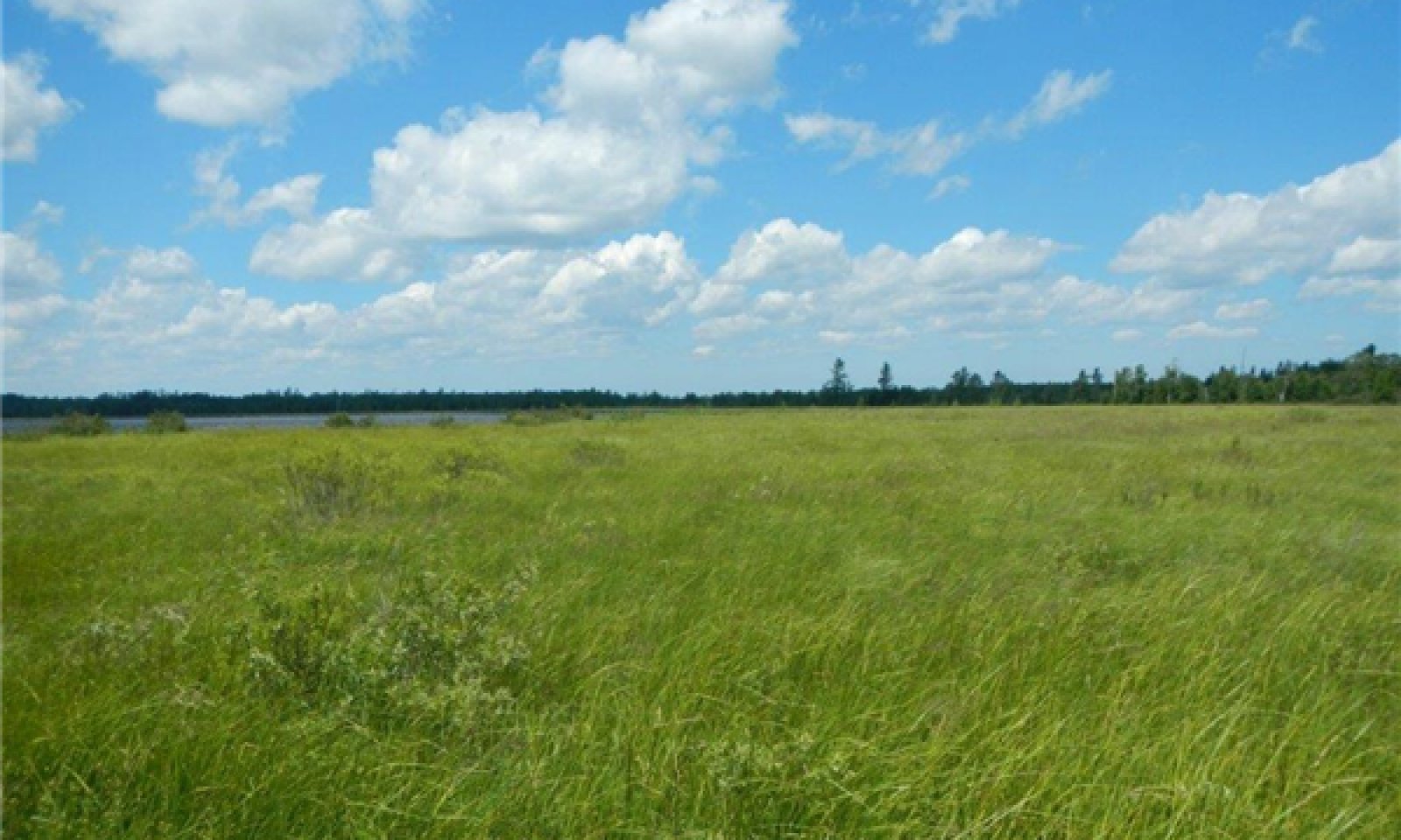
There are two main community phases of Reference State 1 for the Poor Fen ecological site, a Sedges/Shrubs phase (1.1) and a Sedges/Sphagnum phase (1.2). Despite the fen hydrology, both are nutrient-limited plant communities, they are especially low in calcium and potassium ions. The mineral uplands that contribute groundwater to this site are low in base-forming cations and rich in iron and aluminum which promote acidic conditions. The fen-like characteristics of this site are due to the flushing action of groundwater flow-through; this prevents a build-up of highly acidic conditions found within Peat Bog ecological sites. This excess of water on the site leads to a mainly treeless condition, except on slightly higher and thus drier micro-sites. The cycle between two main phases is largely governed by the speed with which water passes through the system and effects on oxygen availability. Highly oxygenated water and fluctuating water tables give rise to phase 1.1 Sedges-Shrubs. Circumstances like downstream obstructions or zones of reduced hydraulic conductivity slow the overall flow rate, increasing the opportunity for biological activity to decrease oxygenation below the tolerance for trees and shrubs. This promotes phase 1.2 Sedges-Sphagnum. If mosses continue to accumulate, the site may eventually convert to a Sphagnum lawn, i.e. a predominantly moss community (Crum 1988). Nevertheless, if the groundwater-dominant hydrology remains in force the Sphagnum-dominated site will remain a Poor Fen.
Submodel
Description
The ponded state is relatively common on this site; however the duration is usually less than an entire growing season. Brief ponding occurs during spring snowmelt and after heavy rains. Short duration ponding followed by significant lateral flow seldom results in vegetation change. However, ponding that lasts longer than one growing season will likely cause significant vegetation changes (Weltzin et al. 2000). Emergent aquatic species (such as cattails and bulrushes) will be favored initially followed by submerged aquatic plants in deeper areas. Woody species will be drowned-out but remain as standing dead trees or shrubs thus indicating former moisture conditions. Large wetlands often have naturally-occurring surface micro-topographic and elevational changes across the site; these conditions produce long-term ponded areas interspersed with short-term ponded areas. Temporary pools of various durations tend increase plant and animal diversity of a site(Rydin and Jeglum 2013). Also, waterfowl, furbearers, reptiles and amphibians, some fishes and numerous arthropods can benefit from well designed and maintained man-made impoundments within wetland complexes. On the negative side, inadvertent ponding may kill valuable upstream timber; and in general, reduce habitat for some rare native species such as swamp-pink orchids (Arethusa bulbosa) and possibly cause the spread of invasive or less desirable species such as purple loosestrife. By maintaining natural wetland hydrology, which included ponded areas, we are investing in ecosystem maintenance and fostering vital ecosystem services.
Submodel
State 3
Drained Phases


Description
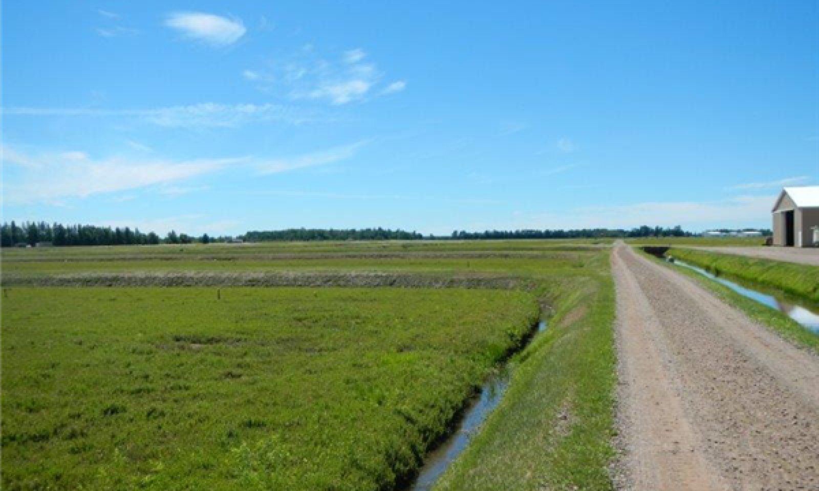
The drained state is mainly an artificial creation. In contrast to other regions of the Midwest where wetlands were drained for agriculture on a large scale, this MLRA was not, largely due to short growing seasons and acidic soils. Drainage in this area are mostly related to construction projects. Wetlands are protected by law but highway construction is an exception; many roads cross wetland sites and each one changes the local hydrology somewhat. Constructing a roadbed across these sites perpendicular to groundwater flow inevitably causes a drier downstream side and a wetter upstream side, vegetation will respond accordingly to these disturbances (Hribljan 2012). Agricultural drainage on these sites is a major construction project in itself. Well-maintained systems of ditches, dikes, water control structures and functional outlets are needed to effectively lower the water table on these sites. These efforts were abandoned many years ago, but in some cases, the remnants remain and are plainly visible. Farming may have been tried, but currently commercial cranberry bogs are the only viable agricultural use of these sites. Another drainage scenario involves climate change. Prolonged drought may have effects similar to drainage, such as native species extirpation and peatland subsidence (Hribljan 2012).
Submodel
Mechanism
Prolonged inundation: the transition from a seasonally ponded to a continuously ponded state is caused by either natural or artificial means. In pre-settlement times, beaver (Castor canadensis) dams were the most common cause (Cohen and Kost 2008). In some areas, beavers have returned and resumed dam building. Beavers are attracted to flowing water, so not every Poor Fen site is subject to their activity. However beaver dams can back up water for a considerable distance and beavers are diligent in maintaining their structures, so the upstream effects of beaver dams may not be readily apparent on the ground. In the post-European settlement era, man-made impoundments most the common cause of prolonged inundation and they are typically very large (Hribljan 2012). A system of dams, dikes and weirs on creeks, rivers and lakes maintains their water level. In this region, Powell Marsh, the Manitowish chain of lakes, the Eagle River chain of lakes, the Three Lakes chain of lakes, the Rainbow Flowage, the Willow Flowage, the Turtle-Flambeau Flowage, Lake Alice, the Hat Rapids Flowage, Boom Lake and the Rhinelander Flowage all have artificially maintained water levels that have inundated thousands of acres of lake-margin Poor Fens. Also, inadvertent ponding may be caused by poorly designed road-building, poorly maintained or abandoned drainage systems, or catastrophic flooding (Hribljan2012).
Mechanism
Artificial drainage: transition from a natural fen drainage pattern to an artificially drained condition would require constructing deep ditches with effective outlets. Ineffective outlets lead to water in ditches that doesn’t flow. Some ditches outlet to rivers, but most outlet to lakes. High water levels in the outlet water body will undoubtedly back up water into the ditches. Outlet water bodies that have water control structures on them that can be opened during excessively wet periods are more effective. Temporary drainage to facilitate repairs on dams, roadways and embankments are another common practice with largely unknown consequences. However, introduction of invasive species is one possible result of drainage (Zedler 2000). Post-drainage subsidence of organic soil layers is common; the lowering of the surface through drying and oxidation can proceed at 1 to 2 cm/year until a stable level is reached (Leifeld et al. 2011). Currently, wetlands are protected by law and manipulations of wetlands are by permit-only. Past drainage practices have left a legacy of land-use mistakes and damaged ecosystems. The value of the ecosystem services of Poor Fens and wetlands in general (flood water retention, surface water purification, habitat for plants and animals) mostly outstrips their development value (Millennium Ecosystem Assessment 2005).
Mechanism
Natural drainage: Drainage can also occur under natural conditions. Beaver dams deteriorate and eventually wash-out. Streams, over time, may cut deeper channels and thereby drain larger areas. Drought may also cause wetland drainage. Following these events, natural short-term ponding patterns may re-emerge. Subsequent to natural drainage, invasive species such as exotic varieties of reed canary grass (Phalaris arundinacea) and Phragmites australis (common reed) as well as purple loosestrife (Lythrum salicaria) may recolonize the site. In the case of man-made impoundments, manipulating water levels to mimic natural drainage patterns presents technological and possibly legal challenges.
Mechanism
This transition from a Ponded State to a Drained Poor Fen phase is often for the purpose of cranberry production. Ponds in Poor Fens, typically upstream from cranberry bogs, are drained to supply water for cranberry harvest. This water is also used for frost protection during the growing season, flooding the bog over-winter, or weed control. These ponds are not designed or managed for wildlife habitat.
Mechanism
Restored wetland hydrology: Wetland restoration is becoming more commonplace. Oftentimes restoration involves backfilling ditches and closing outlets, i. e. reducing drainage of the ecosystem. The intention is to recreate the hydrologic conditions that led to a functioning wetland ecosystem. Unfortunately, it is not always easy to restore wetlands to their former state (Zedler 2000). Typically, fewer native species are found in restored wetlands. Also, invasive species are a serious problem in restored wetlands, they are tenacious competitors, respond well to disturbance and lack some of valuable traits of the natives they have supplanted. There is no reason not to try to restore wetland hydrology; the hydrologic benefits alone can justify the effort. However, the technology must improve to fully realize the potential.
Mechanism
Prolonged inundation: Cranberry production areas may be ponded for extended periods. Sometimes cranberry operations have unused or abandoned bogs, which often remain ponded and are held in reserve. On a larger scale, most of the numerous flowages of the region have water levels that are changed seasonally, alternately ponding and draining some former Poor Fen sites. Some of the 146 dams in 94D are opened in fall and closed in spring, reversing the natural flood patterns. According the WI DNR online environmental assessment of the Rest Lake Dam, this reversal occurs on the Manitowish River floodplain downstream from that particular dam. Impacts to Poor Fens occur mostly upstream, on sites adjacent to the Manitowish chain of lakes. It is probable that some of these Poor Fens sites have artificially altered hydrology; they are frequently ponded deeper than would occur naturally and then drained rapidly.
Model keys
Briefcase
Add ecological sites and Major Land Resource Areas to your briefcase by clicking on the briefcase (![]() ) icon wherever it occurs. Drag and drop items to reorder. Cookies are used to store briefcase items between browsing sessions. Because of this, the number of items that can be added to your briefcase is limited, and briefcase items added on one device and browser cannot be accessed from another device or browser. Users who do not wish to place cookies on their devices should not use the briefcase tool. Briefcase cookies serve no other purpose than described here and are deleted whenever browsing history is cleared.
) icon wherever it occurs. Drag and drop items to reorder. Cookies are used to store briefcase items between browsing sessions. Because of this, the number of items that can be added to your briefcase is limited, and briefcase items added on one device and browser cannot be accessed from another device or browser. Users who do not wish to place cookies on their devices should not use the briefcase tool. Briefcase cookies serve no other purpose than described here and are deleted whenever browsing history is cleared.
Ecological sites
Major Land Resource Areas
The Ecosystem Dynamics Interpretive Tool is an information system framework developed by the USDA-ARS Jornada Experimental Range, USDA Natural Resources Conservation Service, and New Mexico State University.


