Natural Resources
Conservation Service
Ecological site F094DY016WI
Mucky Floodplains
Accessed: 02/11/2026
General information
Provisional. A provisional ecological site description has undergone quality control and quality assurance review. It contains a working state and transition model and enough information to identify the ecological site.

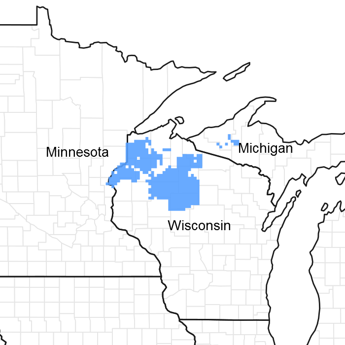
Figure 1. Mapped extent
Areas shown in blue indicate the maximum mapped extent of this ecological site. Other ecological sites likely occur within the highlighted areas. It is also possible for this ecological site to occur outside of highlighted areas if detailed soil survey has not been completed or recently updated.
MLRA notes
Major Land Resource Area (MLRA): 094D–Northern Highland Sandy Pitted Outwash
The Northern Highland Sandy Drift, aka MLRA 94D, lies mostly in northern Wisconsin with a few narrow outwash channels extending into the upper peninsula of Michigan. MLRA 94D encompasses 1.364 million acres and is surrounded by much larger, geologically different MLRAs. MLRA 94D is characterized mainly by sandy and gravelly soils formed in outwash sediments deposited by melt-water streams from late Wisconsin-Age glaciers, which receded from the area about 10,000 years before present (Attig 1985), and by peat soils that cover about 30% of the area. Mucky Floodplain ecological sites occupy about 20,000 acres in MLRA 94D.
Classification relationships
MLRA 94D is an LRU sized area that will reclassified as such in the near future. This change is justified as long the unit remains intact. The boundaries between 94D and adjacent MLRAs are justified based on clear geomorphic and soil parent material differences: sandy drift--outwash and till-- in 94D and loess mantled loamy till in the neighboring areas.
Ecological site concept
ATTENTION: This ecological site meets the NESH 2014 requirements for PROVISIONAL. A provisional ecological site is established after broad ecological site concepts are identified and an initial state-and-transition model is drafted. Following quality control and quality assurance reviews of the ecological site concepts, an identification number and name for the provisional ecological site are entered into ESIS. A provisional ecological site may include literature reviews, land use history information, some soils data, legacy data, ocular estimates for canopy and/or species composition by weight, and even some line-point intercept information. A provisional ecological site does not meet the NESH 2014 standards for an Approved ESD, but does provide the conceptual framework of soil-site correlation for the development of the ESD. For more information about this ecological site, please contact your local NRCS office.
The Mucky Floodplain ecological site is annually flooded, and in addition, extended periods of ponding occur in numerous patches across this site. The extensive ponding precludes the growth trees most of the site. The vegetation on this site is clearly dominated by sedges, grasses and forbs. However, as is typical in alluvial areas, small landform and elevational differences cause interspersed patches of water-tolerant trees (mostly tamarack) and shrubs such as alder, willows (Salix spp.), redosier dogwood (Cornus sericea)and Spirea species. The soils are, for the most part, very poorly drained Histosols that contain thin layers of mineral sediments within the organic profile; these mineral layers indicate that were major flooding events in the past which carried and re-deposited mineral sediments from upstream. This site represents the wettest of the non-aquatic ecological sites in the region due to both frequent flooding and long duration ponding.
Associated sites
| F094DY017WI |
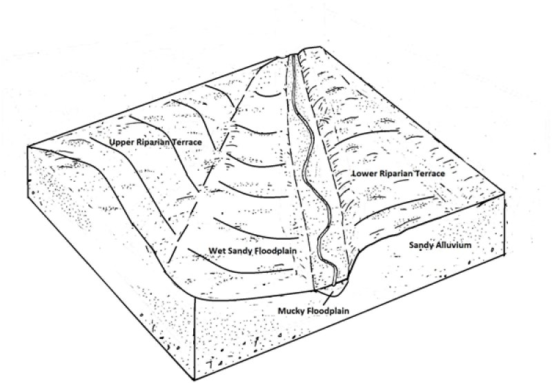
Wet Sandy Floodplains Mucky Floodplains occasionally have Wet Sandy Floodplains within them. |
|---|
Table 1. Dominant plant species
| Tree |
(1) Larix laricina |
|---|---|
| Shrub |
(1) Alnus incana |
| Herbaceous |
(1) Carex stricta |
Click on box and path labels to scroll to the respective text.
