Natural Resources
Conservation Service
Ecological site F094DY017WI
Wet Sandy Floodplains
Accessed: 02/11/2026
General information
Provisional. A provisional ecological site description has undergone quality control and quality assurance review. It contains a working state and transition model and enough information to identify the ecological site.

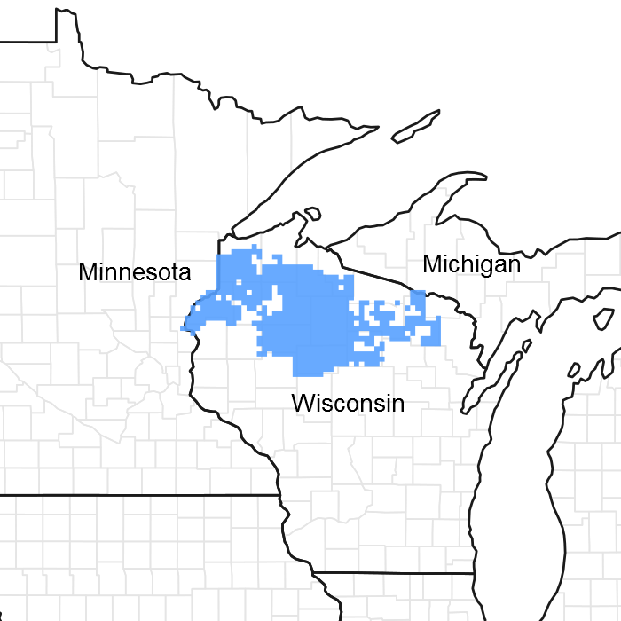
Figure 1. Mapped extent
Areas shown in blue indicate the maximum mapped extent of this ecological site. Other ecological sites likely occur within the highlighted areas. It is also possible for this ecological site to occur outside of highlighted areas if detailed soil survey has not been completed or recently updated.
MLRA notes
Major Land Resource Area (MLRA): 094D–Northern Highland Sandy Pitted Outwash
The Wet Sandy Floodplains ecological site occupies about 5000 acres in MLRA 94D.
Ecological site concept
ATTENTION: This ecological site meets the NESH 2014 requirements for PROVISIONAL. A provisional ecological site is established after broad ecological site concepts are identified and an initial state-and-transition model is drafted. Following quality control and quality assurance reviews of the ecological site concepts, an identification number and name for the provisional ecological site are entered into ESIS. A provisional ecological site may include literature reviews, land use history information, some soils data, legacy data, ocular estimates for canopy and/or species composition by weight, and even some line-point intercept information. A provisional ecological site does not meet the NESH 2014 standards for an Approved ESD, but does provide the conceptual framework of soil-site correlation for the development of the ESD. For more information about this ecological site, please contact your local NRCS office.
The Wet Sandy Floodplains ecological site is occasionally flooded and has a poorly drained sandy soil stratified with thin loamy layers and a thin mucky surface layer. This is a wetland site on which woody vegetation is common, however the tree canopy cover is only about 25 to 50%. There is a high shrub abundance, but there are also areas dominated by grasses, sedges and rushes. Numerous alluvial landforms and features such as natural levees, low stream terraces, cutbanks and meander scars occur on this site; the result is patchwork of sites that provide a variety of habitats for both wetland and upland plants.
Associated sites
| F094DY016WI |
Mucky Floodplains Wey Sandy Floodplains occasionally have Mucky Floodplains within them. |
|---|---|
| F094DY018WI |
Lower Riparian Terraces This site is often upslope from Wet Sandy Floodplains ecological sites. |
Similar sites
| F094DY010WI |
Wet Sandy Depressions This site has similar wetness, but without the flooding. |
|---|
Table 1. Dominant plant species
| Tree |
(1) Acer rubrum |
|---|---|
| Shrub |
(1) Alnus incana |
| Herbaceous |
(1) Calamagrostis canadensis |
Click on box and path labels to scroll to the respective text.
