
Natural Resources
Conservation Service
Ecological site F097XA004MI
Dry Sandy Lake Plain
Last updated: 1/16/2024
Accessed: 02/07/2026
General information
Approved. An approved ecological site description has undergone quality control and quality assurance review. It contains a working state and transition model, enough information to identify the ecological site, and full documentation for all ecosystem states contained in the state and transition model.
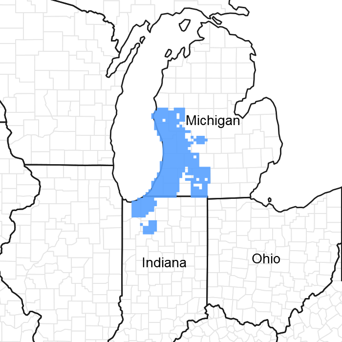
Figure 1. Mapped extent
Areas shown in blue indicate the maximum mapped extent of this ecological site. Other ecological sites likely occur within the highlighted areas. It is also possible for this ecological site to occur outside of highlighted areas if detailed soil survey has not been completed or recently updated.
MLRA notes
Major Land Resource Area (MLRA): 097X–Southwestern Michigan Fruit and Vegetable Crop Belt
MLRA 97 wraps around the southern end of Lake Michigan covering portions of Michigan, Illinois and Indiana corresponding to a major lake-moderated fruit-growing region (Natural Resources Conservation Service 2006), largely corresponding to Forest Service subsections 222Ja and 222Jb. The ecological site inference area for MLRA 97 excludes most of the Illinois portion of the MLRA, because the lake plain is less sandy and less lake-moderated there, but instead includes a significant portion of MLRA 98, following sandy lake plains and fruit-growing moraines northward into Muskegon County, Michigan (following subsections 222 Ja and 222Jb). The western boundary is Lake Michigan and the eastern boundary is roughly the extent of lake ameliorated climate. The northern boundary is defined by a major floristic boundary where vegetation switches from dominance of predominantly central hardwoods species to one of mainly northern forestland species. The southern boundary is defined by a predominantly prairie flora. The triple juxtaposition of central hardwood, prairie, and northern woodland species in the southern portion of the region make this among the more plant species rich areas of the country (Kartesz, 2011; Swink & Wilhelm, 1994). The ecological site inference area is further subdivided along a line where the average annual snowfall drops below 160 cm (64 inches) just south of Benton Harbor. North of this line is the Lake Michigan Snow Belt.
Soil map units where Sandy Lake Plain is a major component cover about 341,000 acres (138,000 ha) or about 16% of this area, and are mostly in subsection 222Ja.
Classification relationships
This ecological site concept has community phases equivalent to: 9 NatureServe Systems (NatureServe, 2014)
13 National Vegetation Classification (NVC) Associations (NatureServe, 2014)
8 Michigan Natural Features Inventory (MNFI) Communities (Kost et al. 2010)
This ecological site concept has equivalent classifications in the following alternative ecological land type classifications
3 United State Forest Service Ecological Land Type Phases (ELTP) (Cleland et al, 1994) 2-3 Kotar Habitat Types (Burger and Kotar, 2003)
These are elaborated under “Other References”.
Ecological site concept
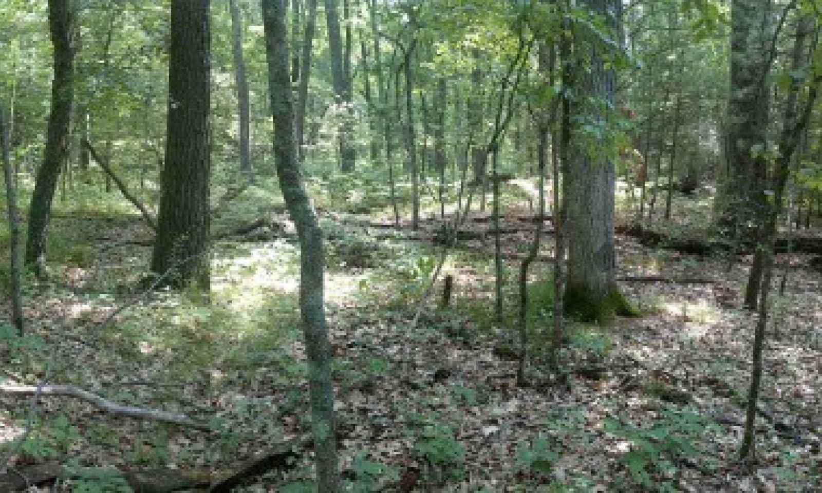
The central concept of the Sandy Lake Plain is deep sands (>90% sands >200 cm deep) with low base saturation (pHs <5.5 and/or Spodosols), and water tables usually deeper than 200 cm (excessively drained or well drained) on portions of the lake plain within the Lake Michigan Snow Belt. Intergrades can have water table depths as shallow as 150 cm (well drained – deep water table phase). Slopes are gentle (less than 15%), and as such do not include sand dunes within 1-2 km from Lake Michigan. Sites support vegetation composed of support low-nutrient tolerant, drought tolerant, and fire tolerant species at early successional phases, but due to the adequate precipitation and lack of fire in some landscape contexts, species composition converges towards a reduced subset of the regional mesophytic climax species. Early successional stages include dry sand prairie and black oak savanna. Mid-successional stages are dominated by black oak (Quercus velutina) with varying degrees of white pine (Pinus strobus) and white oak (Q. alba). Late successional forests have increasing amounts of white pine, red maple (Acer rubrum), red oak (Quercus rubra), and American beech (Fagus grandifolia). Understories vary from grasses and sedges, bracken fern, heaths, to mesophytic herbs.
Inland sites along the Indiana and Illinois portions are less ameliorated by Lake Michigan. Unlike sites to the north under similar landscape positions, sites in the southernmost lake plain almost completely lack fire sensitive beech, hemlock, and white pine as well as the corresponding latest successional phases, and are therefore excluded from the Sandy Lake Plain site concept. Unlike much of outwash sands in inland areas of southern Michigan, the Sandy Lake Plain lacks finer textured lamellae or carbonates in the substratum, and hickory (Carya spp.) is missing as a major canopy component.
Associated sites
| F097XA006MI |
Moist Acidic Sandy Flatwoods Moist Sandy Lake Plain has a shallower water table and is in lower landscape positions than Sandy Lake Plain. |
|---|---|
| F097XA010MI |
Sandy Slopes Sandy Slopes have steeper slopes than Sandy Lake Plain. |
Similar sites
| F097XB033IN |
Chicago Dry Sandy Lake Plain Chicago Dry Sandy Lake Plain has a warmer summer and greater proportion of prairie species. |
|---|
Table 1. Dominant plant species
| Tree |
(1) Quercus velutina |
|---|---|
| Shrub |
Not specified |
| Herbaceous |
(1) Piptochaetium avenaceum |
Physiographic features
The surface of this area is covered mainly by lacustrine deposits over glacial till. The lake plain consists of sands deposited by high energy shoreline processes which reworked glacial outwash deltas of post-glacial Lake Chicago. Broad sandy lake plains map units are associated with outwash deltas. Dune and swale topography characterizes some areas in which sandy lake plain map units occur on ridges within a matrix of moderately well drained to poorly drain swales. Elevations range from 180 m (near lake level) to 230 m above sea level.
Bedrock has no influence on local topography or soils in this area. Bedrock is buried beneath 10-200 m (33-656 feet) of surface deposits and consists primarily of limestone and dolomite in Indiana and sandstone and shale in Michigan.
Table 2. Representative physiographic features
| Landforms |
(1)
Lake plain
(2) Dune (3) Beach ridge |
|---|---|
| Runoff class | Negligible to low |
| Flooding frequency | None |
| Ponding frequency | None |
| Elevation | 591 – 755 ft |
| Slope | 15% |
| Water table depth | 39 in |
| Aspect | Aspect is not a significant factor |
Climatic features
The southeastern Lake Michigan lake plain and adjacent lake influenced moraines have a humid warm continental climate with cold winters and warm summers.
Just over half of the precipitation is distributed during the warmer half of the year with a significant portion of the precipitation occurring as heavy downpours during thunderstorms. Thunderstorm activity is enhanced inland by lake breeze fronts, while it is diminished near the lakeshore by the stabilizing effect of the cooler lake waters. Occasionally, thunderstorm microbursts cause localized high winds which open single tree gaps in forest canopies, or more rarely, tornados and derechos (severe straight-line winds) open larger gaps. Fall storms bring more frequent strong winds, but with impacts moderated by the lack of leaves (wind resistance) in the canopy. During July, average precipitation lags potential evapotranspiration, resulting in droughty conditions in the upper soil horizons of upland sites. During dry years, this droughty period is extended into August and September, resulting in dry fuels and potential for wildfire over oak and pine dominated areas.
Winter precipitation is enhanced by lake effect snows, with 1.6 to 2.4 m (40-95 inches) falling annually within the snow belt. Peak snowfall occurs at intermediate distances from the lake where topography enhances uplift. The combination of heavier winter snowfall, lake-delayed spring warm up, and frequent wetlands all contribute to relatively lower fire frequencies relative to inland locations with similarly droughty soils.
The area falls within USDA Hardiness zones 6a and 6b and has delayed spring warm up until after the last killing frosts, allowing for a wide range of fruit crops to be grown.
Table 3. Representative climatic features
| Frost-free period (characteristic range) | 118-142 days |
|---|---|
| Freeze-free period (characteristic range) | 147-187 days |
| Precipitation total (characteristic range) | 34-39 in |
| Frost-free period (actual range) | 116-149 days |
| Freeze-free period (actual range) | 141-195 days |
| Precipitation total (actual range) | 33-41 in |
| Frost-free period (average) | 129 days |
| Freeze-free period (average) | 163 days |
| Precipitation total (average) | 37 in |
Figure 2. Monthly precipitation range
Figure 3. Monthly minimum temperature range
Figure 4. Monthly maximum temperature range
Figure 5. Monthly average minimum and maximum temperature
Figure 6. Annual precipitation pattern
Figure 7. Annual average temperature pattern
Climate stations used
-
(1) ALLEGAN 5NE [USC00200128], Allegan, MI
-
(2) GRAND HAVEN FIRE DEPT [USC00203290], Grand Haven, MI
-
(3) HOLLAND WTP [USC00203858], Holland, MI
-
(4) BLOOMINGDALE [USC00200864], Bloomingdale, MI
-
(5) EAU CLAIRE 4 NE [USC00202445], Dowagiac, MI
-
(6) MUSKEGON CO AP [USW00014840], Muskegon, MI
-
(7) BENTON HARBOR AP [USW00094871], Benton Harbor, MI
Influencing water features
Hydrology has little direct impact on this ecological site as the water table is mostly below rooting depth. However, areas grading towards moderately well drained may have more water availability during droughts, especially for deeper rooted species. Likewise, the presence or absence of lakes, streams, and wetlands may have provided fuel breaks which affected historic fire return intervals on a given location and therefore dominant species.
Soil features
Sandy soils on the lake plain generally classify as excessively drained Typic Udipsamments (Plainfield series). These soils are generally 90-100% sand to a depth greater than 200 cm (80 inch) with no lamellae. The well sorted lacustrine sand parent material lacks carbonates and clay, resulting in predominately low pH values (unless limed) and low cation exchange capacities. Areas with eolian parent material ranges into the fine sand texture class (Oakville series), but are similar to the modal concept in all other properties. The A horizon is generally very dark brown to very dark gray and around 10-15 cm (4-6 inches) thick with a 0-5 cm (0-2 inch) layer of partially decomposed leaf litter on top. Occasionally a well-developed, lighter grayish colored E horizon may occur over a darker/browner Bw or Bs horizon. The soils closer to Lake Michigan tend to develop horizons with weak spodic characteristics and may classify as Spodic Udipsamments (Plainfield taxajunct) or Entic Haplorthods (Grattan). Sites with histories of grassland or savanna vegetation may develop thicker A horizons exceeding 25 cm (10 inches). These soils classify as having umbric epipedons and thus, classify as Psammentic Humudepts (no series, not mapped). Soils with loamy sand and sandy loam bands, the Lamellic Udipsamments (i.e. Coloma and Chelsea series) are sometimes associated with the edge of lake plain in the vicinity of finer glacial outwash and till, but are generally higher in pH and frequently have richer understories and therefore are outside the site concept.
Low available water holding capacity is an important property of these sandy soils, and these properties make vegetation more susceptible to drought. More deeply rooted species (e.g. pines, oaks) are partially spared from mild droughts by accessing deeper soil moisture or that moisture retained from past wetter periods. However, during periods of near to below normal temperatures and near to above normal precipitation (when potential evapotranspiration does not exceed rainfall) moisture is not a limiting factor as is soil fertility.
Sandy soils are likely more nitrogen limited than are most other upland soils. Nitrogen in ecosystems normally accumulates through atmospheric deposition (lightning) and nitrogen-fixing microorganisms. Nitrogen, once acquired into an ecosystem, is retained in soil organic matter or in biomass. Nitrogen, however, is lost through volatilization by fire or from post-fire leaching (Johnson and Turner, 2014), or through timber harvests. Sandy soils, with their higher rates of hydraulic conductivity, are particularly vulnerable to leaching of such nutrients. Insulation by a thick snowpack, or otherwise more moderate winter temperatures, such that occurs in the Lake Michigan snowbelt region, are thought to reduce frost induced mortality of soil microorganisms, thereby helping to biologically sequester inorganic nitrogen and reduce the amount that is lost to leaching (Henne, Hu, and Cleland, 2007). A snowpack may also help reduce spring fire frequency by maintaining leaf litter moisture (from meltwater and compaction) (Schaetzl 2002). Because of reduced fire frequencies, litter and associated nutrients persist and are able to be incorporated into the A horizon as organic matter and in subsequent plant biomass. Geographic variation in soil nitrogen availability, however, is not mapped in soil surveys, since nitrogen is considered a highly labile soil dynamic property. Nevertheless, natural community succession can result in changes in soil fertility that, once established, helps to perpetuate a component of of mesophytic, nitrogen-loving species such as sugar maple (Acer saccharum) and basswood (Tilia americana) than would normally be infrequent on droughty base poor soils (Mokma and Vance 1989). However, upon initiation of agriculture, soil nitrogen content is almost universally amended with the application of fertilizers, likely rendering it outside the natural range of variation for the reference conditions.
Spodic development in these soils often correlates with the occurrence of late successional mesophytic forests. Spodic development requires acidic and persistent leaf litter (especially hemlock - Tsuga canadensis, and various pine species) as a source for organic acids, which are essential to the podzolization process. Thick snowpacks assist in maintaining unfrozen soil conditions, allowing the acids to leach into the lower soil profile, and as they do, they complex with iron and aluminum compounds. In upland settings, such suitable conditions tend mainly to occur under a heavy snowpack (Schaetzl, 2002; Schaetzl, Luehmann, and Rothstein, 2015). Areas which burn more frequently do not retain leaf litter to generate organic acids, and areas outside the snowbelt do not have the spring flux of moisture necessary to carry the acids into the lower profile. The accumulation of organic matter in the spodic B horizon contributes to an increase in both cation exchange capacity and available water holding capacity. However, it is not clear that the properties of a spodic horizon are in and of themselves the most dominant factor in soil moisture and fertility relations, as compared to the direct effects of the snowmelt itself, or of a more fertile A horizon.
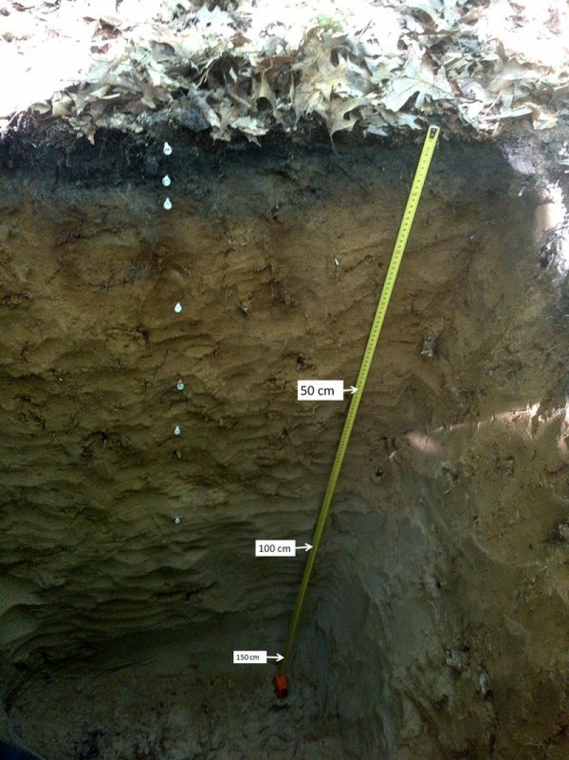
Figure 8. Soil profile of Plainfield sand, Ottawa County, MI
Table 4. Representative soil features
| Parent material |
(1)
Glaciolacustrine deposits
(2) Eolian sands |
|---|---|
| Surface texture |
(1) Sand (2) Fine sand |
| Family particle size |
(1) Sandy |
| Drainage class | Somewhat excessively drained to excessively drained |
| Permeability class | Moderately rapid to rapid |
| Soil depth | 80 in |
| Surface fragment cover <=3" | 1% |
| Surface fragment cover >3" | Not specified |
| Available water capacity (0-39.4in) |
1.57 – 3.94 in |
| Calcium carbonate equivalent (0-39.4in) |
Not specified |
| Soil reaction (1:1 water) (0-19.7in) |
3.5 – 5.5 |
| Subsurface fragment volume <=3" (0-59.1in) |
10% |
| Subsurface fragment volume >3" (0-59.1in) |
5% |
Ecological dynamics
The reference state is characterized by a relatively heterogeneous fire frequency (fire return interval 5-1000 years) that varies geographically depending on landscape context as well as local climate trends. Fire intervals discussed below are inferred based on Landfire Models (U.S. Department of the Interior, Geological Survey, 2008) which estimates the historic frequency and severity of wildfire nation-wide by plant community type. Under the present day climate with ample annual snowfall and associated moist litter, it is likely that longer fire return intervals are favored. Additionally, the coolness of the lake waters would have inhibited the growth of spring lighting storms until they moved further inland. Areas of the sandy lake plain with high fire frequency prior to European-American settlement were on larger expanses of dry sandy uplands adjacent to the Kalamazoo and Muskegon River valleys. It is likely that in these localities native peoples played a disproportionate role in ignitions (Rabe, Comer, and Albert, 1995).
The most mesophytic, least fire prone, and most nutrient rich community phase, was dominated by sugar maple and beech. Maple became established regionally about 9200 years ago. Beech became established about 6800 years ago (Wang, 2013). It historically occurred on about 34 percent of the area based on relative amounts of each presettlement vegetation cover types in Albert et al (1995). Mesophytic vegetation tended to be more prevalent near Lake Michigan. These mesophytic associations may have remained relatively stable as evidence of multidecadal drought which caused decline in beech region wide had little effect on beech in the Lake Michigan snowbelt (Booth et al, 2012).
Late successional communities with regular, but infrequent fire were dominated by white pine and white oak. Pines dominated the area approximately 11800 years ago (Wang, 2013). Establishment of oak began about 9200 years ago. Prior to European-American settlement of the area, about 39 percent of this ecological site was in this phase.
Similar locations interrupted by wetlands tend towards shade tolerant and mesophytic vegetation, with red maple and red oak becoming intermixed with the white pine. Some of these areas may have increased in coverage more recently due to increased deer browse and fire suppression. Prior to European-American settlement of the area, about 20 percent of this ecological site was in this phase.
The high fire frequency phases are characterized by fire return intervals of 5-25 years and vegetation composed of grasslands and oak-pine savannas. Prior to European- American settlement of the area, about 7% percent of this ecological site was in some stage of early successional non-forest vegetation. The existence a “natural” fire regime in the humid Eastern United States has been questioned on the grounds that dry lightning rarely occurred here (in contrast with the dry West and the lightning rich Southeast), and that fire ecosystems in the region are predominantly artifacts of widespread burning by Native Americans (Nowacki and Abrams, 2008; Kay, 2007; Mann, 2005). However, the influence of Native American settlements on fire regimes may have been more localized that previously assumed (Munoz, Mladenoff, Schroeder, and William, 2014; Marlon et al, 2013). Fire adapted species and ecosystems evolved long before humanity and in many cases were established prior to Native American occupation (Changnon, 2002; Howe, 1994). However, the relationship of fire frequency and ostensibly fire-sustained plant communities is a complicated interaction of herbivore pressure and drought (i.e. more or less fire “needed” depending on circumstances) (Noss, 2013; McEwan, Dyer, and Pederson, 2011). Landscape continuity or fragmentation may affect the potential size of a fire and thereby mitigating the need for frequent local ignition sources (Lafon, 2010; Frost, 1998). Many of the sun-loving species associated with prairies may have first expanded into southwestern Michigan 8000-6000 years ago during the peak of the Hypsithermal dry period (Anderson, 2006), and were thereafter sustained during more humid phases either as large patches through human ignited fires, or in smaller populations restricted to forest edges on low productivity sites. Associations composed of these drought and fire adapted species likely expanded or contracted in area with the fluctuation of ignition sources and climatic factors.
Based on satellite imagery (U.S. Department of the Interior, Geological Survey, 2011), currently, 52% of the ecological site is in natural vegetation (49 % forested; 3% open; more or less State 1). The species composition is slightly altered from the reference state with the addition of exotic species, but most of the communities remain dominated by native species. The relative proportions of community phases have likely shifted toward higher amounts of later successional phase 1.5 and lesser amounts of fire maintained phases 1.2 and 1.3. About 41% of the ecological site is in intensively managed as agriculture (13%), urban and suburban development (25%), or other managed vegetation (more or less State 2). Another 3% is in open condition (miscellaneous disturbed soil or logged areas in satellite imagery), which may or may not correspond to the areas infested with invasive species (more or less State 3).
Invasive species are generally uncommon in undisturbed forests of sandy lake plains, but certain land uses like agriculture or community phases with sugar maple result in additional soil nitrogen, which make them more favorable to invasion by non-native species such as multiflora rose (Rosa multiflora) (Huebner et al., 2014).
State and transition model
More interactive model formats are also available.
View Interactive Models
Click on state and transition labels to scroll to the respective text
Ecosystem states
State 1 submodel, plant communities
State 2 submodel, plant communities
State 3 submodel, plant communities
State 1
Reference
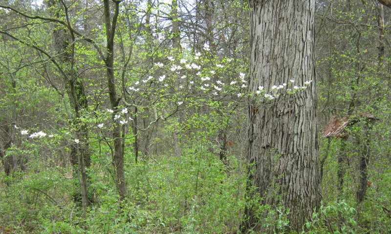
Figure 9. Quercus alba and Cornus florida
Prior to European-American settlement of the area, about 39 percent was in phase 1.1 (white pine-white oak or other pine or oak dominated forests; Albert, et al., 1995). About 34 percent of the vegetation was dominated by very shade tolerant species such as beech (Fagus grandifolia) and hemlock (Tsuga canadensis) (beech-sugar maple-hemlock or beech-sugar maple forests roughly equal to phase 1.6) and about 20% was dominated by a mix of white pine (Pinus strobus) and mesophytic species (white pine-hardwood or pine-hemlock forests, roughly equivalent to phase 1.5). About 7 percent of the area was open oak-pine barrens and other early successional phase (collectively in phases 1.2, 1.3, and 1.4). The most frequent canopy associates are black oak, white oak, and white pine. The understory in closed forest phases is composed of shade tolerant spring-blooming forbs. Disturbance from canopy openings and/or fire favors grasses and prairie forbs in the understory. On occasion, larger openings may allow for establishment of big tooth aspen (Populus grandidentata) or thickets of sassafras (Sassafras albidum) (Phase 1.4). Historically, these small gaps would have been too small to be mappable using General Land Survey notes.
Community 1.1
Xerophytic Forest: White Oak-White Pine/Flowering Dogwood/

Figure 10. White oak white pine panoramic
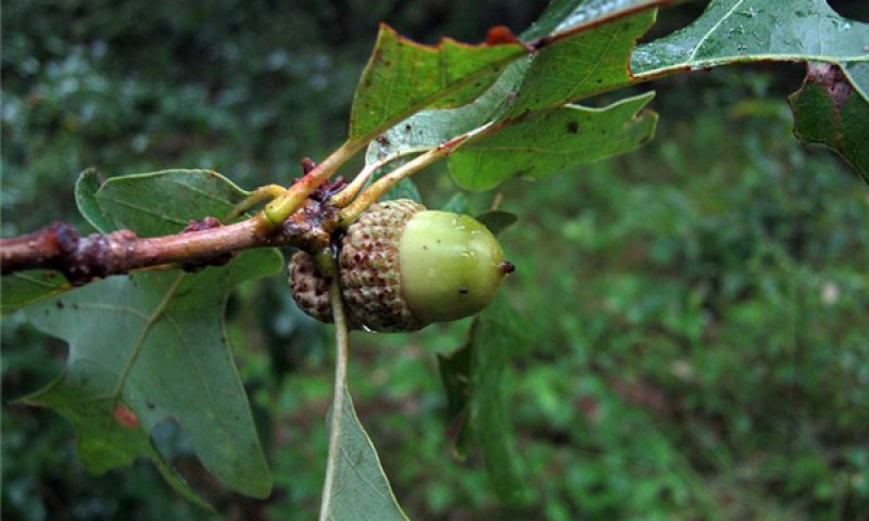
Figure 11. White oak (Quercus alba)
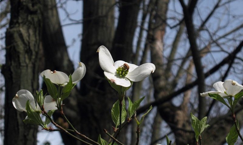
Figure 12. Flowering dogwood (Cornus florida)
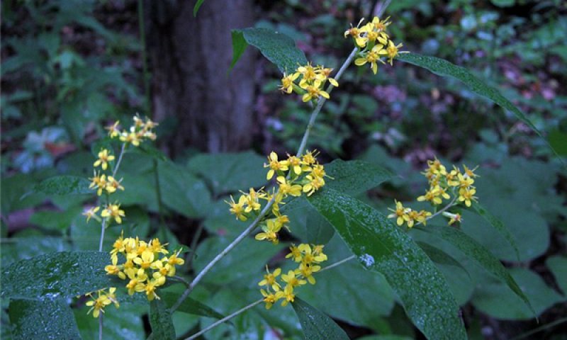
Figure 13. Goldenrod (Solidago caesia)
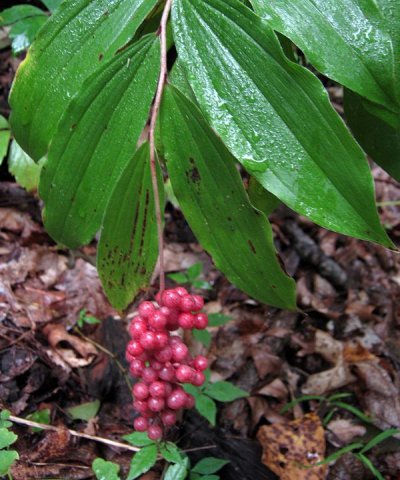
Figure 14. Solomons plume (Maianthemum racemosum)
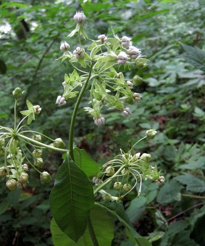
Figure 15. Poke milkweed (Asclepias exaltata)
Phase 1.1 is characterized by moderately shade tolerate species which tolerate and recruit with the help of moderately long surface fire return intervals (50-80 years). Surface fire intervals as short as 10 years may have occurred, but not over a sustained basis as it would have precluded white pine recruitment. Stands are generally greater than 50 years old. Crown cover is 60 to 80 percent or more, and 15 to 25 m (50-80 feet) tall with occasional super canopy white pine greater than 35 m (120 feet). Many of the species have thick bark and survive the typically low intensity understory fires. Species density is around 26 (12-49) per 400 m² and 5 (4-6) per m². Fire return intervals mean that species that are fire sensitive as seedlings and saplings such as white pine have time to reach a more fire tolerant adult stage. Thinner barked species such as maples, beech, and red oak are generally at a disadvantage with fire, but these species generally increase in importance with longer the fire intervals. Areas with higher water tables are more susceptible to maple dominance. Once maple becomes dominant, a natural threshold is reached where the stand becomes less prone to burn on the basis of shade and leaf litter properties. However, areas with locally high deer browse may transition more quickly to red maple dominated phase 1.5.
Forest overstory. White oak (Quercus alba) and black oak (Quercus velutina) occupy the canopy (15-25 m; 50-80 feet) with regular occurrence of emergent white pine (Pinus strobus) (25-30 m; 80-100 feet). The subcanopy (5-15 m; 16-50 feet) has sparse occurrence immature white oak and red maple (Acer rubrum) and mature flowering dogwood.
Forest understory. The understory is generally sparsely vegetated with frequent Pennsylvania sedge (Carex pensylvanica) and bracken fern (Pteridium aquilinum) in the herb layer with occasional shade tolerant forbs such as Canada mayflowers and Solomon’s plume (Maianthemum spp.). The shrub layer is occupied by witch-hazel (Hamamelis virginiana), service berry (Amelanchier spp.), and various immature tree species.
Table 5. Soil surface cover
| Tree basal cover | 0.4-1.0% |
|---|---|
| Shrub/vine/liana basal cover | 0.0-0.1% |
| Grass/grasslike basal cover | 0.0-0.1% |
| Forb basal cover | 0.00-0.01% |
| Non-vascular plants | 0-2% |
| Biological crusts | 0% |
| Litter | 84-99% |
| Surface fragments >0.25" and <=3" | 0% |
| Surface fragments >3" | 0% |
| Bedrock | 0% |
| Water | 0% |
| Bare ground | 0-1% |
Table 6. Woody ground cover
| Downed wood, fine-small (<0.40" diameter; 1-hour fuels) | 3-5% N* |
|---|---|
| Downed wood, fine-medium (0.40-0.99" diameter; 10-hour fuels) | 0-2% N* |
| Downed wood, fine-large (1.00-2.99" diameter; 100-hour fuels) | 0-3% N* |
| Downed wood, coarse-small (3.00-8.99" diameter; 1,000-hour fuels) | 0-1% N* |
| Downed wood, coarse-large (>9.00" diameter; 10,000-hour fuels) | 0-1% N* |
| Tree snags** (hard***) | – |
| Tree snags** (soft***) | – |
| Tree snag count** (hard***) | 0-80 per acre |
| Tree snag count** (hard***) | 0-80 per acre |
* Decomposition Classes: N - no or little integration with the soil surface; I - partial to nearly full integration with the soil surface.
** >10.16cm diameter at 1.3716m above ground and >1.8288m height--if less diameter OR height use applicable down wood type; for pinyon and juniper, use 0.3048m above ground.
*** Hard - tree is dead with most or all of bark intact; Soft - most of bark has sloughed off.
Table 7. Canopy structure (% cover)
| Height Above Ground (ft) | Tree | Shrub/Vine | Grass/ Grasslike |
Forb |
|---|---|---|---|---|
| <0.5 | 0-5% | 1-5% | 0-10% | 1-5% |
| >0.5 <= 1 | 1-10% | 1-10% | 0-10% | 0-15% |
| >1 <= 2 | 5-20% | 0-25% | 0-2% | 1-15% |
| >2 <= 4.5 | 2-15% | 0-15% | 0-1% | 0-15% |
| >4.5 <= 13 | 5-80% | 0-15% | – | – |
| >13 <= 40 | 85-90% | 0-5% | – | – |
| >40 <= 80 | 75-90% | 0-1% | – | – |
| >80 <= 120 | 0-90% | – | – | – |
| >120 | – | – | – | – |
Community 1.2
Woodland: Black Oak-White Oak/Black Oatgrass-Lupine
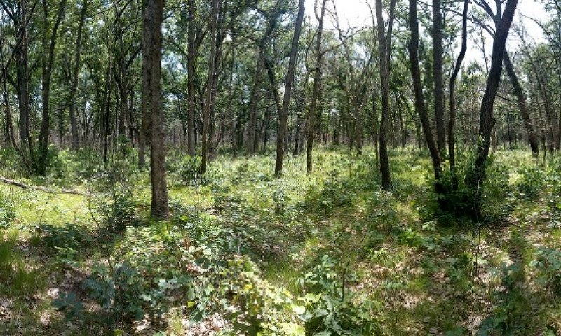
Figure 16. Oak Woodland
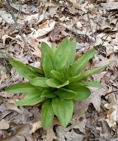
Figure 17. American-columbo (Frasera caroliniensis)
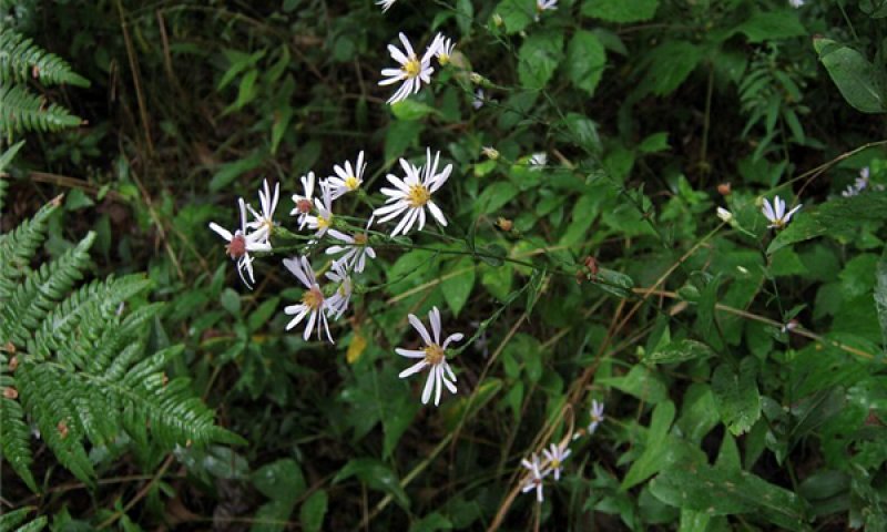
Figure 18. Smooth aster (Symphyotrichum laeve)
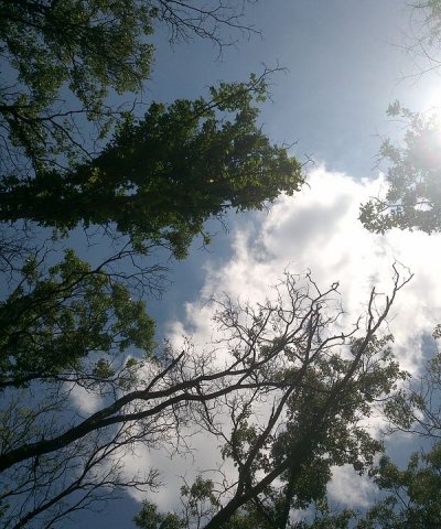
Figure 19. Canopy view looking up.
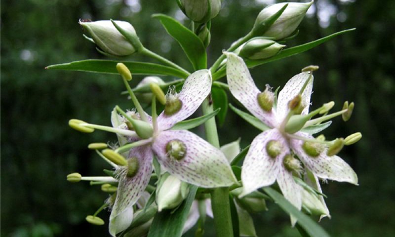
Figure 20. American-columbo (Frasera caroliniensis)
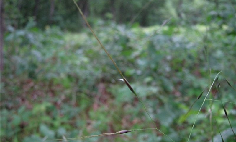
Figure 21. Black oatgrass or needlegrass (Piptochaetium avenaceum)
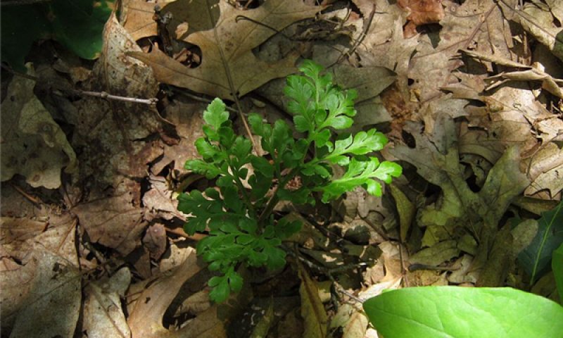
Figure 22. Leather grape-fern (Sceptridium multifidum)
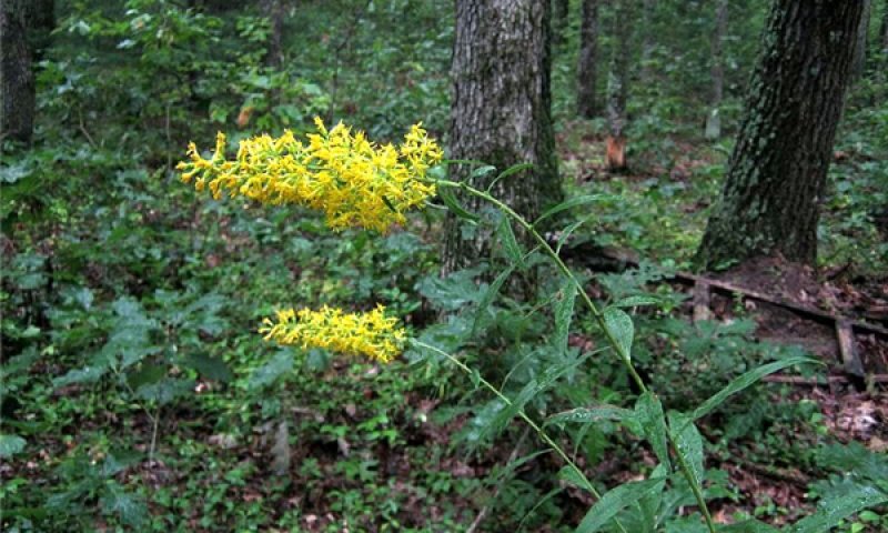
Figure 23. Showy goldenrod (Solidago speciosa)
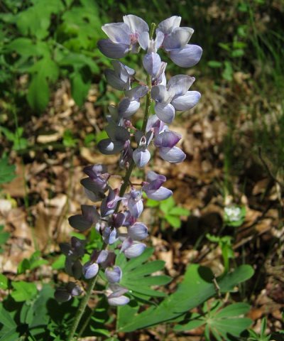
Figure 24. Lupine (Lupinus perennis)
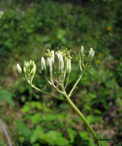
Figure 25. Pale Indian-plantain (Arnoglossum atriplicifolium)
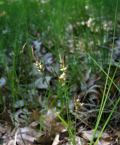
Figure 26. Pennsylvania sedge (Carex pensylvanica)
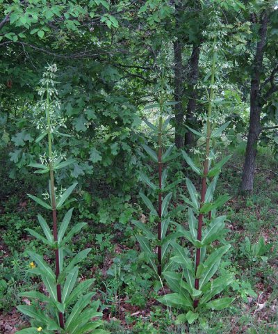
Figure 27. American-columbo (Frasera caroliniensis)
Phase 1.2 is oak woodland, with crown cover open enough for a mostly cool season grass and sedge understory. This phase is maintained with surface fires occurring about every 10 years. Canopy cover is 10 to 25 percent (savanna) or up to 60 percent (woodland), with trees 5 to 20 m (16 to 65 feet) tall. Species density is around 30 (18-35) per 400 m² and 5 (4-8) per m². White pine, if present, are fire resistant adults residual from earlier longer fire return intervals. Phases 1.2 and 1.3 can occur together in a matrix, each representing one end the tree canopy cover spectrum. A key extant example in Allegan County, Michigan once occupied 23 km², most of which is now mostly closed canopy forest. One remnant barrens occupies an area of 30 ha (74 acres) (about 1.1 by 0.4 km) with average crown closure of 25 to 50 percent (10 to 40 m continuous crown with 10 to 50 m wide openings. Several completely treeless areas greater than 1000 m² and minimum widths of greater than 30 m occur in an approximately 2 ha (5 acre) portion averaging 20 percent crown closure of mostly single trees less than 15 m tall.
Forest overstory. Black oak (Quercus velutina) and white oak (Q. alba) are the most important canopy species. White pine (Pinus strobus) and white oak are important constituents of the subcanopy. Few other species occur in the overstory.
Forest understory. For the most part the species composition in the understory is a mosaic of forest and prairie species. The understory is dominated by cool season graminoids like black oatgrass (Piptochaetium avenaceum) and Pennsylvania sedge (Carex pensylvanica). Forbs with intermediate and low shade tolerance are common, such as wild lupine (Lupinus perennis), and various late-blooming Composites (e.g. Solidago spp., Helianthus divaricatus, Symphyotrichum spp.).
Community 1.3
Barrens: Black Oak/Little Bluestem
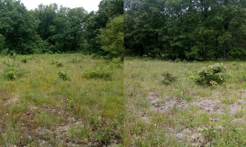
Figure 28. Oak barrens panorama.
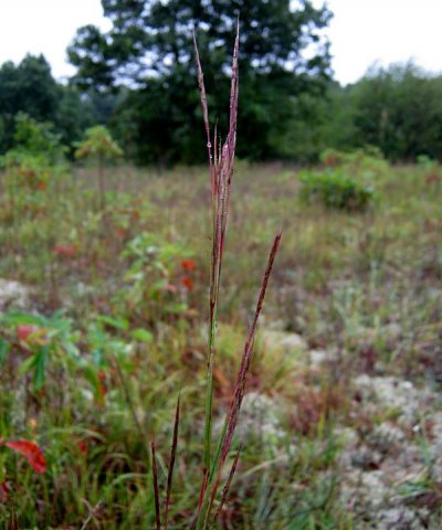
Figure 29. Little bluestem (Schizachyrium scoparium)
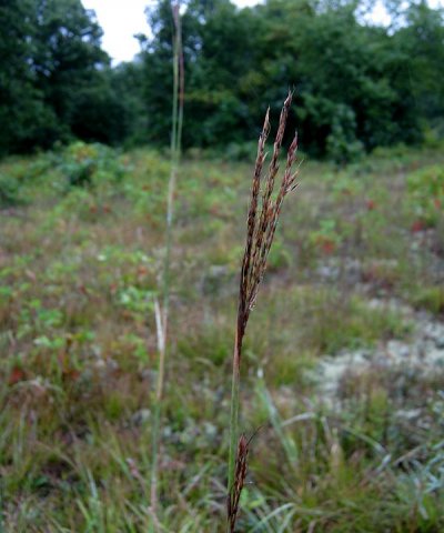
Figure 30. Big bluestem (Andropogon gerardii)
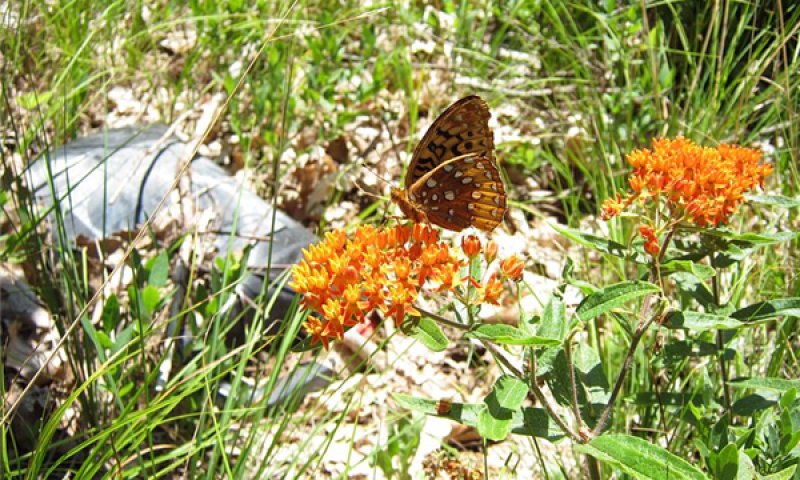
Figure 31. Butterflyweed (Asclepias tuberosa) with fritillary (Speyeria sp.)
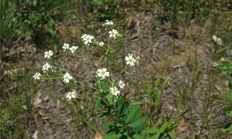
Figure 32. Flowering spurge (Euphorbia corollata)
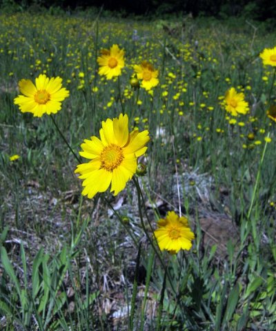
Figure 33. Sand coreopsis (Coreopsis lanceolata)
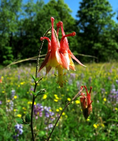
Figure 34. Columbine (Aquilegia canadensis)
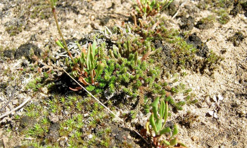
Figure 35. Sand spike-moss (Selaginella rupestris)
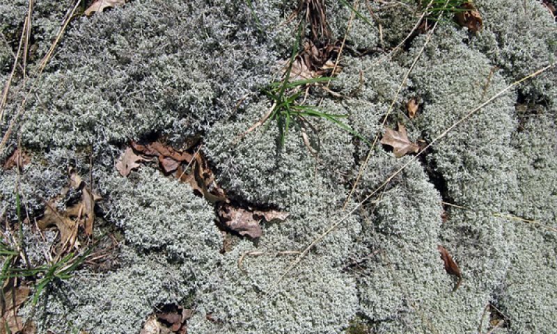
Figure 36. Reindeer lichen (Cladonia rangiferina)
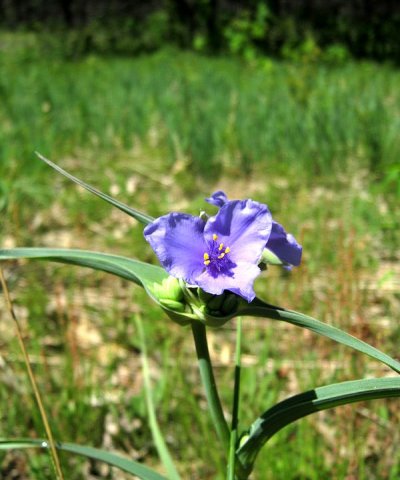
Figure 37. Spiderwort (Tradescantia ohiensis)
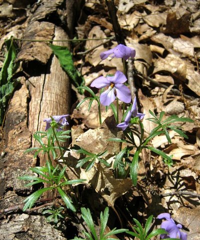
Figure 38. Birdfoot violet (Viola pedata)
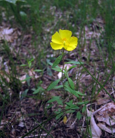
Figure 39. Frostweed (Crocanthemum canadense)
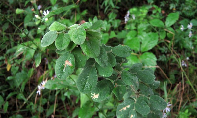
Figure 40. Hairy bush-clover (Lespedeza hirta)
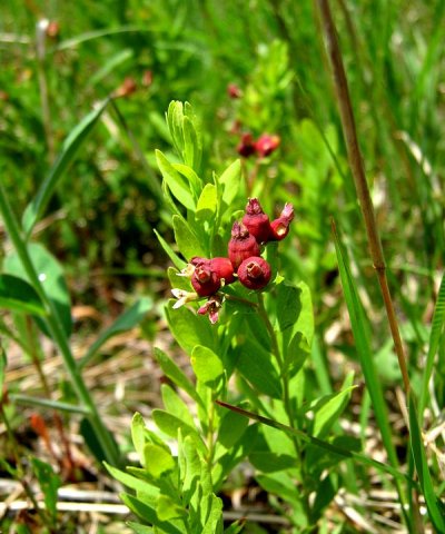
Figure 41. Bastard toadflax (Comandra umbellata)
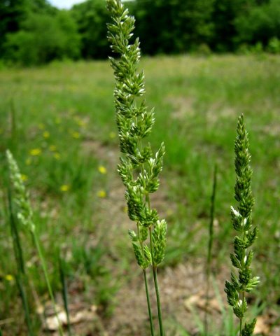
Figure 42. Junegrass (Koeleria macrantha)
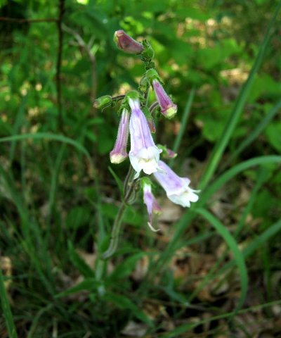
Figure 43. Hairy beard-tongue (Penstemon hirsutus)
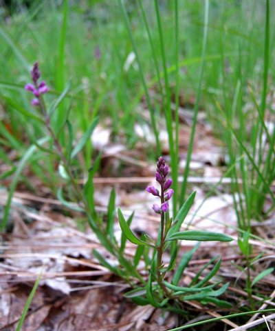
Figure 44. Milkwort (Polygala polygama)
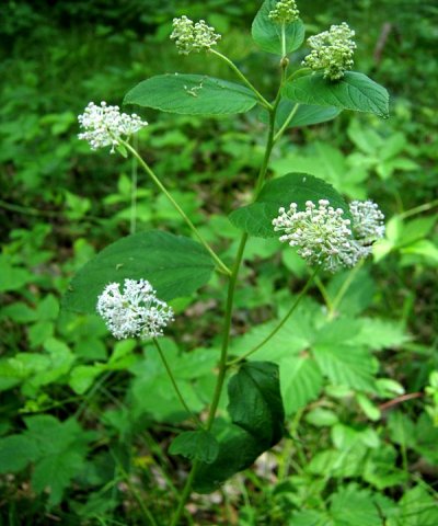
Figure 45. New Jersey tea (Ceanothus americanus)
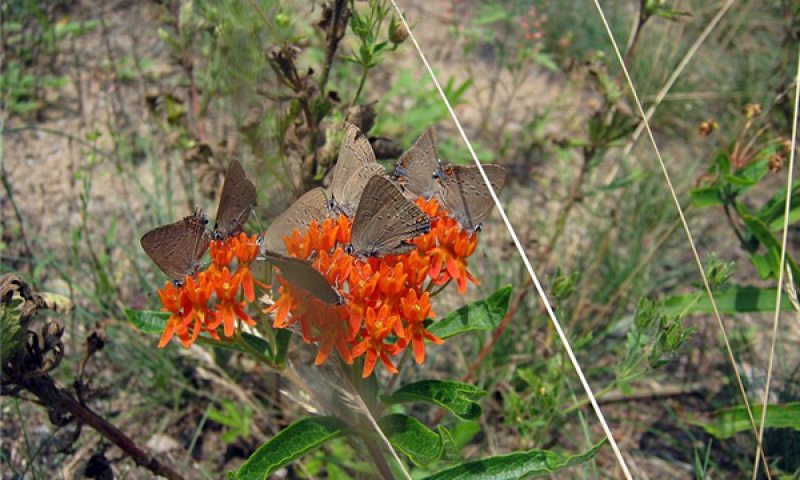
Figure 46. Butterflyweed (Asclepias tuberosa) with banded hairstreaks (Satyrium calanus)
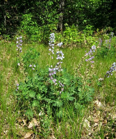
Figure 47. Lupine (Lupinus perennis)
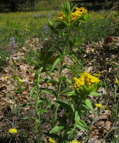
Figure 48. Hairy puccoon (Lithospermum caroliniense)
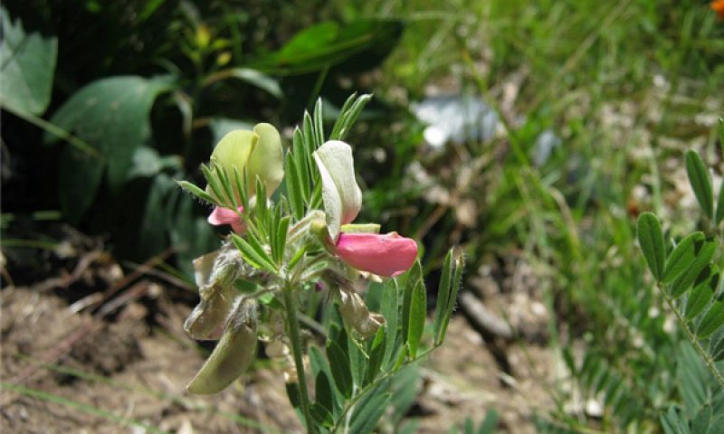
Figure 49. Goats-rue pea (Tephrosia virginiana)
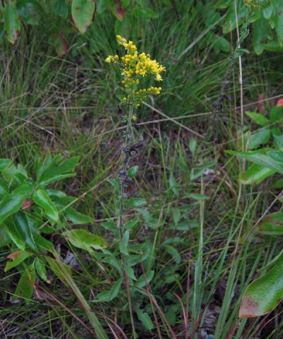
Figure 50. Gray goldenrod (Solidago nemoralis)
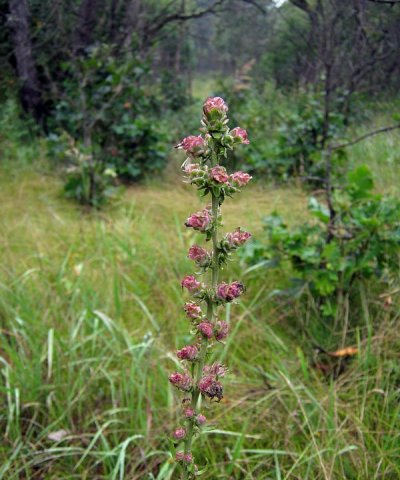
Figure 51. Rough blazing-star (Liatris aspera)
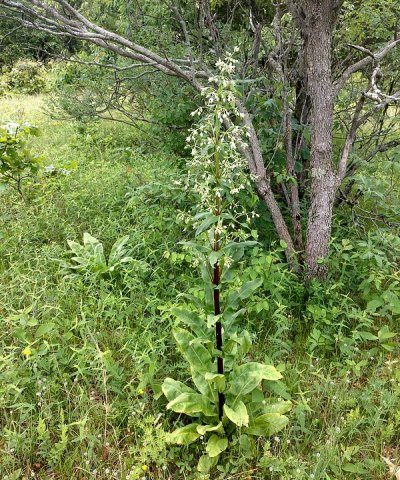
Figure 52. American-columbo (Frasera caroliniensis)
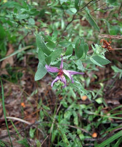
Figure 53. Silky aster (Symphyotrichum sericeum)
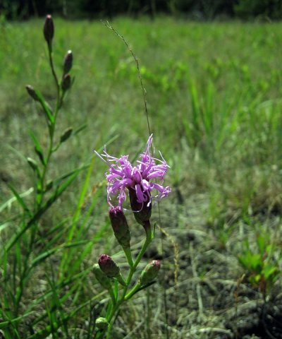
Figure 54. Cylindrical blazing-star (Liatris cylindracea)
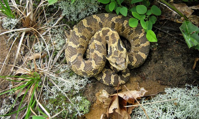
Figure 55. Eastern hognose snake (Heterodon platirhinos)
Phase 1.3 ranges in canopy closure from 0 to 10 percent (prairie to savanna) in crown closure. Dominant ground cover is warm season grasses (e.g. bluestems – Andropogon and Schizachyrium) and forbs. Maintenance of low tree cover may require fire on the order of every 1 to 5 years years. The presence of fire resistant trees, particularly mature white pine, in the sparse overstory is mainly a function of persistence from previous longer fire intervals that have allowed survival of fire vulnerable seedling and sapling stages. During dry years, flowering of forbs like lupine is limited except in patches sheltered in the partial shade provided by the scattered oak (H. Keough, USFS wildlife biologist, 2014 personal communication). Grasses are mostly 0.5 to 1 m (1.5 to 3 feet) tall depending on seasonal moisture availability. Isolated patches of big bluestem may reach to 1 to 2 m (3-6 feet).Species density is around 18 (9-28) per 400 m² and 7 per m². Phases 1.2 and 1.3 occur together in a matrix, each representing one end of the tree canopy cover spectrum. A key extant example in Allegan County, Michigan once occupied 23 km², most of which is now mostly closed canopy forest. One remnant barrens occupies an area of 30 ha (74 acres) (about 1.1 by 0.4 km) with average crown closure of 25 to 50 percent (continuous tree crowns in patches 10 to 40 m wide separated with opening 10 to 50 m wide). Several completely treeless areas greater than 1000 m² and minimum widths of greater than 30 m occur in an approximately 2 ha (5 acre) portion averaging 20 percent crown closure by mostly single trees less than 15 m tall.
Forest overstory. The overstory is very sparse, usually as clusters of 1-3 trees, with black oak (Quercus velutina) and white oak (Q. alba) the most important constituents.
Forest understory. Direct sunlight is able to reach the majority of the understory. Species composition in the understory is dominated by warm season grasses such as little and big bluestems (Schizachyrium scoparium and Andropogon gerardii). The best examples of this community phase has a high diversity of sand prairie forbs such as the blazing stars (Liatris spp.), coreopsis (Coreopsis lanceolata), western sunflower (Helianthus occidentalis), spiderwort (Tradescantia ohiensis), butterflyweed (Asclepias tuberosa), Tephrosia (Tephrosia virginiana), and flowering spurge (Euphorbia corollata). Closer to the partial shade of trees are forbs such as lupine (Lupinus perennis), columbine (Aquilegia canadensis), and American columbo (Frasera caroliniensis). Areas of bare ground may be colonized by reindeer lichen (Cladina spp.), prickly pear cacti (Opuntia humifusa), and spike-moss (Selaginella rupestris).
Community 1.4
Clonal Forest: Bigtooth Aspen-Sassafras//Bracken Fern
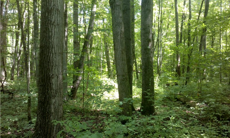
Figure 56. Bigtooth aspen grove.
Phase 1.4 is an undifferentiated group of woody pioneer communities which are commonly established after a blowdown or catastrophic fire. Stands generally remain fire free for more than 10 years or indefinitely. Stands are 10 to 40 years old. If large scale windthrow or crown fire occurs after a clone is well established, stands may regenerate and remain in this phase for a longer period of time. Canopy closure is 10 to 100 percent with trees 5 to 25 m (16 to 80 feet) tall. Depending on seed source or adjacent preexisting canopy components, a single clonal tree species may become the dominant. Disturbance from canopy openings or fire favors species such as sassafras, bracken fern, and green brier. On occasion, larger openings may allow for establishment of big tooth aspen (phase 1.3). Historically, clones were limited in extent such that they were not mappable as a major forest type using General Land Survey Office notes. Both bigtooth aspen and sassafras are vigorous sprouters after fire and can also be expected to seed into openings after a fire (Carey, 1994). Sassafras is shade tolerant at young ages and intolerant as it matures, making it more adaptable to smaller canopy openings than big tooth aspen (Barnes and Wagner, 2004). Although trembling aspen often co-occurs with bigtooth aspen, there is a greater tendency for bigtooth aspen to occur on low nutrient conditions.
Forest overstory. The overstory is initially colonized and dominated by a single, fast-growing, clonal pioneer species such as aspen (Populus grandidentata most commonly), sassafras (Sassafras albidum), or sumac (Rhus spp.). Additional species may increase in importance over time as this community phase gives way to other types through succession.
Forest understory. The understory is variable and changing, depending on original community composition prior to creation of this community phase, and subsequent disturbances such as fire.
Community 1.5
Dry-Mesophytic Forest: Red Maple-Red Oak/Greenbrier/Bracken Fern
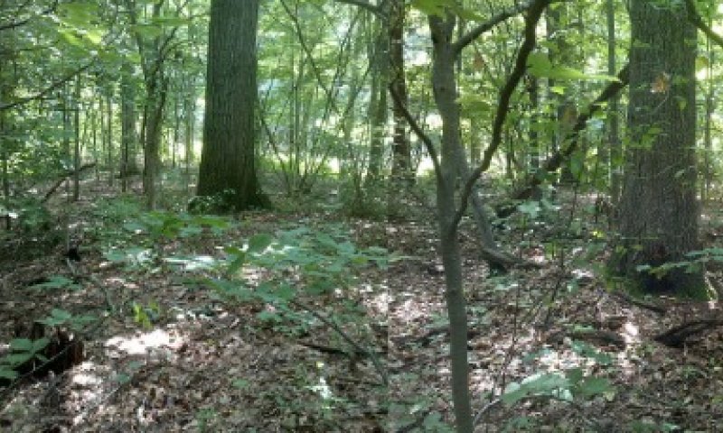
Figure 57. Forest panorama.
Phase 1.5 consists of closed forest dominated by mesophytic, low nutrient demanding species such as red maple and red oak. These species also tend to have thinner bark than the reference phase, and therefore more sensitive to fire. Stands are frequently adjacent wetter areas or have a deep water table associated with expression of this community phase. Canopy is 80 to 100 percent closed, and 20 to 25 m (60-80 feet) tall with white pines occasionally exceeding 32 m. Stands are 40 to 150 years old with limited or inconsequential surface fire frequency. Species density is around 14 (7-23) per 400 m² and 3 per m².
Forest overstory. Red maple (Acer rubra) and red oak (Quercus rubra) are key elements in the overstory which distinguish this community phase from the other oak dominated phases. White oak, black oak, and white pine remain important constituents, but are not always dominant. Beech (Fagus grandiflora) is frequently found in the subcanopy.
Forest understory. Roundleaf green briar (Smilax rotundifolia) is a key element in the understory which distinguishes this community phase from other forested phases. The understory is sparsely vegetated with heaths (Ericaceae – Vaccinium, Gaylussacia, Chimaphila, and Gaultheria), bracken fern (Pteridium aquilinum), and occasional shade tolerant forbs.
Community 1.6
Mesophytic Forest: Sugar Maple-Beech//Solomon’s Seal
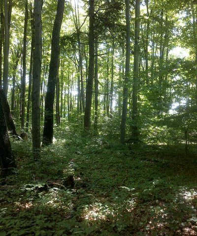
Figure 58. Beech-Maple-Hemlock Forest
Phase 1.6 is dominated by very shade tolerant species like sugar maple and beech. Canopy closure is 80 to 100 percent, and about 25 to 30 m (80 to 100 feet) tall. Stands may exceed 150 years and have no consequential fire regimes. Hemlock may be occasional to frequent. Stands closest to Lake Michigan have the greatest potential of succeeding to this phase. Soils are often more developed with darker spodic horizons. The presence of sugar maple suggests that soils have become enriched with nitrogen, and therefore less limiting to higher nutrient demanding species.
Forest overstory. Overstory is dominated by sugar maple (Acer saccharum) and beech (Fagus grandifolia), with minor amounts of hemlock (Tsuga canadensis), red oak (Quercus rubra), and basswood (Tilia americana).
Forest understory. Understory is potentially composed of a variety of mesophytic herbs, although only Solomon’s seal (Polygonatum pubescens) was documented from the single observation made within this community phase. Other mesophytic species as found in other late successional community phases of this ecological site concept are expected to occur with a wider sample.
Pathway 1.1B
Community 1.1 to 1.4


Thunderstorms or tornados are capable of removing large areas of canopy every 1000 years or so, allowing light to reach the understory. This allows colonization and spread of suckering tree species. This can also be achieved through clearcuts.
Conservation practices
| Forest Stand Improvement |
|---|
Pathway 1.1C
Community 1.1 to 1.4


Canopy is partially opened by drought induced mortality with a mixed severity fire about every 200 years. Alternatively, selective harvest with prescribed fire can achieve the same results. Closed canopy forests typically lack significant prairie grass and forb understories that when opened up with fire or mechanical means become initially dominated with recalcitrant bracken-Pennsylvania sedge understories (H. Keough, Wildlife Biologist, Huron-Manistee National Forests, 2014 personal communication). Restoration to more open barrens community phases is likely more successful if done gradually, leaving patchy shaded and undisturbed ground less favorable to the uninterrupted dominance of a single rhizomatous species. Reintroductions of key prairie species may need consideration, especially if a seed bank no longer exists due to the number of decades have elapsed since the sunlight could reach the forest floor and where the adjacent landscape no longer provides habitat reserves with these species.
Conservation practices
| Prescribed Burning | |
|---|---|
| Forest Stand Improvement |
Pathway 1.1A
Community 1.1 to 1.5


Without fire for a period of more than 80 years, succession takes place and increases the proportion of mesophytic (thin leaf - thin barked - shade tolerant) species. The speed of succession can be accelerated by differential browse of oak by white tailed deer, favoring red maple. Succession is also enhanced where there is a deep water table exists or when adjacent stands are dominated by mesophytic species.
Pathway 1.2A
Community 1.2 to 1.1


Without fire for a period of about 50 years, succession takes place and increases the proportion of trees versus herbaceous plants. With crown closure in the overstory there is much reduced light reaching the understory. Grass cover becomes discontinuous and leaf litter becomes the dominant fuel source for wildfire.
Conservation practices
| Tree/Shrub Site Preparation | |
|---|---|
| Tree/Shrub Establishment |
Pathway 1.2B
Community 1.2 to 1.4


Canopy is reduced to less than 10 percent by drought induced mortality and crown fire at a frequency of every 500 years. Alternatively, selective harvest with prescribed fire can achieve the same results.
Conservation practices
| Prescribed Burning | |
|---|---|
| Early Successional Habitat Development/Management | |
| Forest Stand Improvement |
Pathway 1.3A
Community 1.3 to 1.2


If drought is reduced and fire frequency falls to less than once every 10 years, oaks and occasional white pine are able to reach maturity, increasing the crown closure. The understory shifts in relative dominance from warm season to cool season grasses.
Conservation practices
| Tree/Shrub Site Preparation | |
|---|---|
| Tree/Shrub Establishment |
Pathway 1.3B
Community 1.3 to 1.4


If drought is reduced and fire frequency falls to much lower than once every 10 years, clonal pioneer tree species, if present nearby, form thickets and eventually closed forests. The amount of grassy understory is reduced, and becomes more dominated by leaf litter of less pyrogenic species.
Pathway 1.4A
Community 1.4 to 1.5


Without fire or other disturbances, succession takes place. After 40 years, shade tolerant species begin to dominate the understory and subcanopy. Thicket forming trees like aspen and sassafras start to succumb to heart rot or wind throw after about 80 years. Over time, attempts to regenerate the clonal stands with clearcuts become less effective due to less vigor of the clones and more competition with resprouting by shade tolerant trees.
Pathway 1.5B
Community 1.5 to 1.2


Mixed severity fire on the order of every 200 years or windthrow every 1000 years can partially open the canopy and increase the amount of light reaching the ground, allowing a grassy understory to develop. If followed with occasional fire and drought, the survival of suckering thin-barked species such as maple or aspen, will be limited and allow black or white oaks to recruit and to gain dominance. This can also be achieved with timber harvest, provided that prescribed fire or herbicide is used to prevent regeneration of the prior canopy dominants.
Conservation practices
| Prescribed Burning | |
|---|---|
| Forest Stand Improvement |
Pathway 1.5C
Community 1.5 to 1.4


Thunderstorms or tornados are capable of removing large areas of canopy on the order of every 1000 years, allowing light to reach the understory. If initially accompanied with fire, pioneer tree seedlings can become established on the exposed mineral soil. Otherwise, pioneer species may become established clonally if blow down is adjacent to existing colonies of pioneer species. This can also be achieved through clearcuts under certain conditions.
Conservation practices
| Prescribed Burning | |
|---|---|
| Forest Stand Improvement |
Pathway 1.5A
Community 1.5 to 1.6


After an additional 70 years under humid climatic conditions with a lack of wildfire, soil organic matter increases and increasing the suitability for mesophytic species. Sugar maple or basswood becomes established from adjacent richer sites. Maple and basswood leaf litter locally increases the amount of soil nitrogen and calcium. The increase in nutrient levels further increases the suitability for sugar maple. Very shade tolerant beech, sugar maple, and occasionally hemlock in the overstory preclude the recruitment of red maple, oaks, and pine.
Pathway 1.6A
Community 1.6 to 1.4


Thunderstorms or tornados are capable of removing large areas of canopy about once in every 1000 years, allowing light to reach the understory. This allows colonization and spread of suckering pioneer tree species under the right circumstances. This can also be achieved through clearcuts under similar circumstances.
Conservation practices
| Early Successional Habitat Development/Management | |
|---|---|
| Forest Stand Improvement |
State 2
Plantation
State 2 is a planted state consisting of a variable number of woody perennial crops, ranging from short term (5-15 years) ornamental shrubs or Christmas trees to long term (50-100 years) forestry products from red pine, scots pine, or jack pine.
Community 2.1
Red Pine Plantation
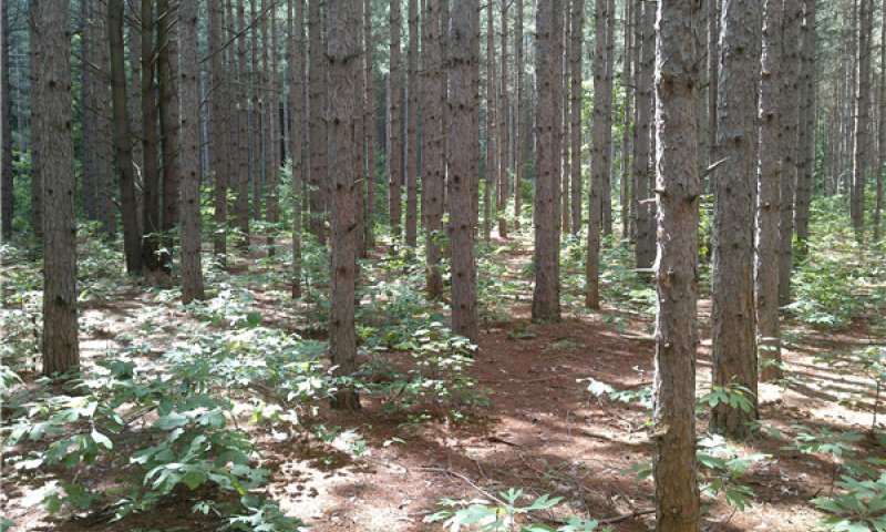
Figure 59. Red pine plantation
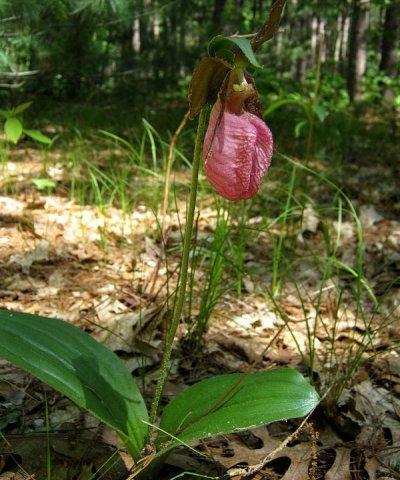
Figure 60. Pink lady-slipper (Cypripedium acaule)
Phase 2.1 is an undifferentiated assemblage of semi-natural and cultural plant communities of woody plants planted for ornamental or wood production purpose. Commonly planted species for wood products are red pine (Pinus resinosa), white pine (Pinus strobus), scots pine (Pinus sylvestris), and jack pine (Pinus banksiana). Ornamental species cultivated primarily for use as Christmas trees include white pine, Scots pine, Douglas-fir (Pseudotsuga menziesii), Norway spruce (Picea abies), white spruce (Picea glauca), Colorado blue spruce (Picea pungens), Fraser fir (Abies fraseri), and white fir (Abies concolor).
Forest overstory. Red pine (Pinus resinosa) is the typical native pine grown on these sites. Scots pine (Pinus sylvestris) is the most commonly planted non-native species.
Forest understory. Understory can be very sparse under a heavy layer of needle duff and shade. Where canopy gaps occur or where fire consumes excess duff, the species composition is more or less consistent with that of other forested phases. However, pink lady’s slipper (Cypripedium acaule) is more commonly observed in pine plantations than in other community phases (based on plots within this ecological site, but also consistent with observations in plantations in other portions of Michigan).
State 3
Disturbed
State 3 is a result of timber harvesting with heavy soil disturbance (e.g. timber landings), or cultivation followed by abandonment. This process often results in the introduction of non-native invasive species from unwashed harvest equipment, as well as a mixture of weedy natives. Over time the open community may also be colonized by native prairie species or succeed slowly with native pioneer trees.
Community 3.1
Spotted Knapweed
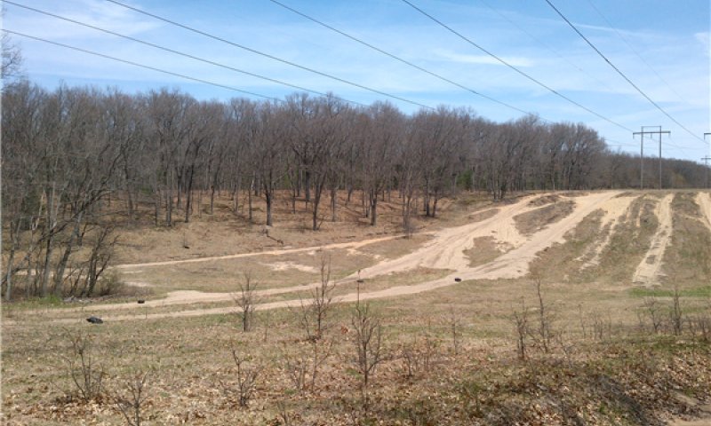
Figure 61. Power line right of way with typical weedy vegetation and bare ground.
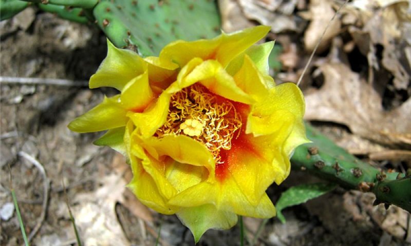
Figure 62. Prickly-pear (Opuntia humifusa)
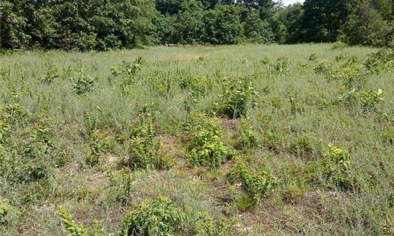
Figure 63. Knapweed and bush-clover
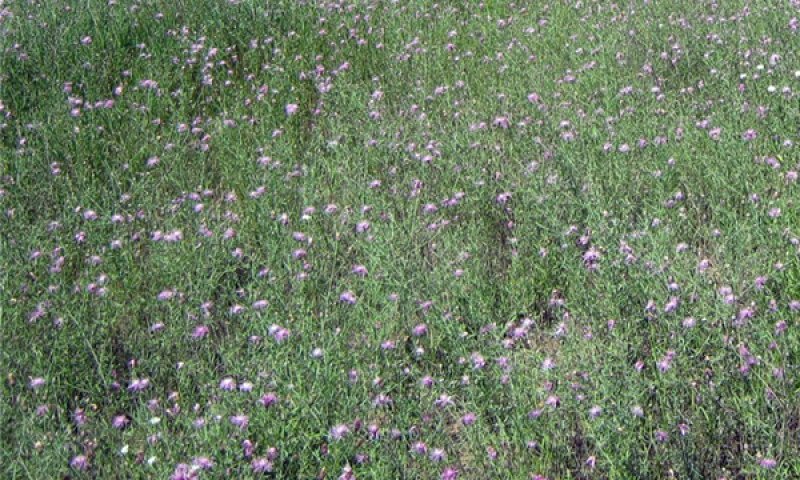
Figure 64. Spotted knapweed (Centaurea stoebe)
Phase 3.1 represents a set of undifferentiated disturbed plant communities, but smooth brome (Bromus inermis) and spotted knapweed (Centaurea stoebe), both non-native invasive species, are particularly characteristic. This phase can be dominant along roads and timber landings. There is frequently bare ground which provides suitable habitat for lichens, other non-native invasive species, and native bare-soil species (e.g. spike moss, pinweed) which would otherwise be rare.
Forest overstory. The overstory is sparse by definition, but is potentially composed of the same species as other early successional community phases, such as black oak (Quercus velutina) and black cherry (Prunus serotina).
Forest understory. The understory of this community phase is dominated by a small number of non-native invasive species such as spotted knapweed (Centaurea stoebe), smooth brome, or Canada bluegrass (Poa compressa). A number of other native and non-native species can exist, but a disproportionate number of them are recently disturbed bare ground obligates or “weeds”.
Transition T1A
State 1 to 2
The site is harvested and then cultivated, followed by planting of woody crop species.
Transition T1B
State 1 to 3
The site is harvested then cultivated, followed by abandonment. Cultivation eliminates most of the existing perennial plant species and disrupts soil biota. This favors establishment of native annual, biennials, and short-lived perennials. The unsanitary use of mechanized equipment or livestock can be vectors responsible for the introduction of seed or other propagules non-native invasive species such as knapweed. Allelopathy in some invasive species can delay the long term reestablishment of native species.
Restoration pathway R2
State 2 to 1
Restoration can hypothetically occur spontaneously over a period of 100 to 300 years depending on the lifespan and shade tolerance of the overstory crop species. Normally however, harvest is required to be followed by reestablishment of native species depending on desired community phase of the reference state. In many cases, advanced regeneration of late successional species is apparent before harvest. In many cases follow up treatment for non-native invasive species may be necessary do to earlier introductions from planting or harvest equipment.
Conservation practices
| Brush Management | |
|---|---|
| Tree/Shrub Site Preparation | |
| Tree/Shrub Establishment | |
| Restoration and Management of Rare and Declining Habitats | |
| Forest Stand Improvement | |
| Herbaceous Weed Control |
Transition T2
State 2 to 3
The site is harvested followed by abandonment. The unsanitary use of mechanized equipment or livestock can be vectors responsible for the introduction of seed or other propagules of non-native invasive species such as knapweed. Allelopathy in some invasive species can delay the long term reestablishment of native species.
Restoration pathway R3
State 3 to 1
Restoration requires treatment of non-native invasive species followed by reintroduction of native plant species. Without intervention, native species may slowly recolonize the site and succession towards invaded versions of the reference communities would occur.
Conservation practices
| Brush Management | |
|---|---|
| Tree/Shrub Site Preparation | |
| Tree/Shrub Establishment | |
| Restoration and Management of Rare and Declining Habitats | |
| Herbaceous Weed Control |
Transition T3
State 3 to 2
Conversion from an abandoned field to a plantation requires elimination or reduction of competing native and non-native species, followed by planting of the desired crop species.
Additional community tables
Table 8. Community 1.1 forest overstory composition
| Common name | Symbol | Scientific name | Nativity | Height (ft) | Canopy cover (%) | Diameter (in) | Basal area (square ft/acre) |
|---|---|---|---|---|---|---|---|
|
Tree
|
|||||||
| black oak | QUVE | Quercus velutina | Native | 35.5–78.6 | 45–75 | 12.1–29.7 | – |
| white oak | QUAL | Quercus alba | Native | 11.4–35.2 | 2–40 | – | – |
| red maple | ACRU | Acer rubrum | Native | 12.6–37.1 | 5–40 | – | – |
| white oak | QUAL | Quercus alba | Native | 20.3–72.2 | 4–35 | 6.6–16.2 | – |
| eastern white pine | PIST | Pinus strobus | Native | 32.8–90.8 | 5–30 | 9.3–30.8 | – |
| northern red oak | QURU | Quercus rubra | Native | 32.8–82 | 0–15 | 24.1–29.1 | – |
| flowering dogwood | COFL2 | Cornus florida | Native | 16.4–32.8 | 0–10 | – | – |
| black oak | QUVE | Quercus velutina | Native | 16.4–32.8 | 1–10 | – | – |
| red maple | ACRU | Acer rubrum | Native | 16.4–60 | 0–5 | 4.4–7 | – |
| sugar maple | ACSA3 | Acer saccharum | Native | 16.4–32.8 | 0–5 | – | – |
| black cherry | PRSE2 | Prunus serotina | Native | 11.5–32.8 | 1–5 | 9 | – |
| eastern white pine | PIST | Pinus strobus | Native | 8.4–32.8 | 1–5 | – | – |
| bigtooth aspen | POGR4 | Populus grandidentata | Native | 49.2–79.4 | 0–3 | 20.3 | – |
| American beech | FAGR | Fagus grandifolia | Native | 8.6–41 | 0–3 | – | – |
| sassafras | SAAL5 | Sassafras albidum | Native | 16.4–32.8 | 0–1 | – | – |
|
Vine/Liana
|
|||||||
| roundleaf greenbrier | SMRO | Smilax rotundifolia | Native | 6.6–32.8 | 0–1 | – | – |
| summer grape | VIAE | Vitis aestivalis | Native | 16.4–65.6 | 0–1 | – | – |
Table 9. Community 1.1 forest understory composition
| Common name | Symbol | Scientific name | Nativity | Height (ft) | Canopy cover (%) | |
|---|---|---|---|---|---|---|
|
Grass/grass-like (Graminoids)
|
||||||
| Pennsylvania sedge | CAPE6 | Carex pensylvanica | Native | 0.3–0.8 | 3–10 | |
| wavy hairgrass | DEFL | Deschampsia flexuosa | Native | 0.3–0.8 | 0–0.3 | |
| oldpasture bluegrass | POSA | Poa saltuensis | Native | 1.2–3.3 | 0–0.1 | |
| broadleaf rosette grass | DILA8 | Dichanthelium latifolium | Native | 1.6–3.3 | 0–0.1 | |
| eastern bottlebrush grass | ELHY | Elymus hystrix | Native | 1.6–3.3 | 0–0.1 | |
| bearded shorthusk | BRER2 | Brachyelytrum erectum | Native | 0.8–1.6 | 0–0.1 | |
| hairy woodland brome | BRPU6 | Bromus pubescens | Native | 0.8–1.6 | 0–0.1 | |
| blackseed speargrass | PIAV | Piptochaetium avenaceum | Native | 1.1–2.7 | 0–0.1 | |
|
Forb/Herb
|
||||||
| Canada mayflower | MACA4 | Maianthemum canadense | Native | 0–0.3 | 0–5 | |
| hairy Solomon's seal | POPU4 | Polygonatum pubescens | Native | 0.5–1.3 | 0–1 | |
| feathery false lily of the valley | MARA7 | Maianthemum racemosum | Native | 0.4–1.1 | 0.1–1 | |
| Clayton's sweetroot | OSCL | Osmorhiza claytonii | Native | 0.6–1.1 | 0–1 | |
| licorice bedstraw | GACI2 | Galium circaezans | Native | 0.3–0.8 | 0–1 | |
| mayapple | POPE | Podophyllum peltatum | Native | 0.9–2.2 | 0–1 | |
| spreading dogbane | APAN2 | Apocynum androsaemifolium | Native | 0.8–1.6 | 0–0.3 | |
| partridgeberry | MIRE | Mitchella repens | Native | 0–0.3 | 0–0.3 | |
| common dandelion | TAOF | Taraxacum officinale | Introduced | 0–0.3 | 0–0.1 | |
| bigleaf aster | EUMA27 | Eurybia macrophylla | Native | 0.3–0.8 | 0–0.1 | |
| spotted geranium | GEMA | Geranium maculatum | Native | 0.3–0.8 | 0–0.1 | |
| woodland sunflower | HEDI2 | Helianthus divaricatus | Native | 0.3–0.8 | 0–0.1 | |
| American lopseed | PHLE5 | Phryma leptostachya | Native | 0.3–0.8 | 0–0.1 | |
| gray goldenrod | SONE | Solidago nemoralis | Native | 0.3–0.8 | 0–0.1 | |
| Indianpipe | MOUN3 | Monotropa uniflora | Native | 0.2–0.6 | 0–0.1 | |
| sweetscented joe pye weed | EUPU21 | Eutrochium purpureum | Native | 1.6–3.3 | 0–0.1 | |
| common cinquefoil | POSI2 | Potentilla simplex | Native | 0–0.6 | 0–0.1 | |
| smooth Solomon's seal | POBI2 | Polygonatum biflorum | Native | 0.4–1 | 0–0.1 | |
| American cancer-root | COAM | Conopholis americana | Native | 0.3–0.8 | 0–0.1 | |
| European lily of the valley | COMA7 | Convallaria majalis | Introduced | 0.3–0.8 | 0–0.1 | |
| common St. Johnswort | HYPE | Hypericum perforatum | Introduced | 0.8–1.6 | 0–0.1 | |
| wild sarsaparilla | ARNU2 | Aralia nudicaulis | Native | 0.6–1.6 | 0–0.1 | |
| garlic mustard | ALPE4 | Alliaria petiolata | Introduced | 0.3–1.6 | 0–0.1 | |
| lanceleaf figwort | SCLA | Scrophularia lanceolata | Native | 1.6–3.3 | 0–0.1 | |
| white vervain | VEUR | Verbena urticifolia | Native | – | – | |
| poke milkweed | ASEX | Asclepias exaltata | Native | – | – | |
| panicledleaf ticktrefoil | DEPA6 | Desmodium paniculatum | Native | – | – | |
|
Fern/fern ally
|
||||||
| western brackenfern | PTAQ | Pteridium aquilinum | Native | 0.9–2.2 | 0–10 | |
|
Shrub/Subshrub
|
||||||
| lowbush blueberry | VAAN | Vaccinium angustifolium | Native | 0.4–1.3 | 0–10 | |
| black huckleberry | GABA | Gaylussacia baccata | Native | 0.5–1.6 | 0–3 | |
| eastern teaberry | GAPR2 | Gaultheria procumbens | Native | 0–0.3 | 0–2 | |
| northern spicebush | LIBE3 | Lindera benzoin | Native | 1.6–3.3 | 0–1 | |
| mapleleaf viburnum | VIAC | Viburnum acerifolium | Native | 1.6–4.9 | 0–0.5 | |
| mapleleaf viburnum | VIAC | Viburnum acerifolium | Native | 0.6–1.6 | 0–0.3 | |
| Carolina rose | ROCA4 | Rosa carolina | Native | 0.7–1.5 | 0–0.3 | |
| northern dewberry | RUFL | Rubus flagellaris | Native | 0.2–0.9 | 0–0.3 | |
| chokecherry | PRVI | Prunus virginiana | Native | 1.6–3.3 | 0–0.3 | |
| blackberry | RUBUS | Rubus | Native | – | 0–0.1 | |
| chokecherry | PRVI | Prunus virginiana | Native | 0.8–1.6 | 0–0.1 | |
| New Jersey tea | CEAM | Ceanothus americanus | Native | 0.3–1.6 | 0–0.1 | |
| kinnikinnick | ARUV | Arctostaphylos uva-ursi | Native | 0–0.8 | 0–0.1 | |
| eastern prickly gooseberry | RICY | Ribes cynosbati | Native | 0.8–1.6 | 0–0.1 | |
| gray dogwood | CORA6 | Cornus racemosa | Native | 1.6–3.3 | 0–0.1 | |
| striped prince's pine | CHMA3 | Chimaphila maculata | Native | 0–0.3 | 0–0.1 | |
| pipsissewa | CHUM | Chimaphila umbellata | Native | 0–0.3 | 0–0.1 | |
| hawthorn | CRATA | Crataegus | Native | 0.6–1.2 | 0–0.1 | |
| hawthorn | CRATA | Crataegus | Native | 3.3–6.6 | 0–0.1 | |
| common buckthorn | RHCA3 | Rhamnus cathartica | Introduced | 1.6–6.6 | 0–0.1 | |
| American bladdernut | STTR | Staphylea trifolia | Native | 3.3–6.6 | 0–0.1 | |
|
Tree
|
||||||
| white oak | QUAL | Quercus alba | Native | 1.6–9.8 | 0.1–3 | |
| black cherry | PRSE2 | Prunus serotina | Native | 1.9–9.6 | 1–3 | |
| flowering dogwood | COFL2 | Cornus florida | Native | 4.9–12 | 0–3 | |
| sassafras | SAAL5 | Sassafras albidum | Native | 0.4–1.6 | 0.3–3 | |
| sassafras | SAAL5 | Sassafras albidum | Native | 3.3–10.9 | 0.3–3 | |
| American witchhazel | HAVI4 | Hamamelis virginiana | Native | 2.2–15.7 | 0–3 | |
| black oak | QUVE | Quercus velutina | Native | 0.3–1.5 | 0–2 | |
| white oak | QUAL | Quercus alba | Native | 0.4–1.4 | 0.1–2 | |
| eastern white pine | PIST | Pinus strobus | Native | 4.5–13.1 | 0.1–1 | |
| black cherry | PRSE2 | Prunus serotina | Native | 0.4–1.3 | 0.1–1 | |
| white ash | FRAM2 | Fraxinus americana | Native | 1.6–6.6 | 0–1 | |
| northern red oak | QURU | Quercus rubra | Native | 0.4–1.6 | 0–1 | |
| white ash | FRAM2 | Fraxinus americana | Native | 0.7–1.6 | 0–1 | |
| red maple | ACRU | Acer rubrum | Native | 2.3–14.9 | 0.4–1 | |
| red maple | ACRU | Acer rubrum | Native | 0.3–1.3 | 0.2–1 | |
| eastern white pine | PIST | Pinus strobus | Native | 0–0.3 | 0.1–0.4 | |
| common serviceberry | AMAR3 | Amelanchier arborea | Native | 2.7–9.2 | 0–0.4 | |
| green ash | FRPE | Fraxinus pennsylvanica | Native | 1.9–6 | 0–0.3 | |
| common serviceberry | AMAR3 | Amelanchier arborea | Native | 0.4–1 | 0–0.3 | |
| American basswood | TIAM | Tilia americana | Native | 0.3–1.2 | 0–0.3 | |
| American witchhazel | HAVI4 | Hamamelis virginiana | Native | 0.8–1.6 | 0–0.2 | |
| northern red oak | QURU | Quercus rubra | Native | 2.2–5.7 | 0–0.2 | |
| black oak | QUVE | Quercus velutina | Native | 1.6–3.3 | 0–0.1 | |
| American beech | FAGR | Fagus grandifolia | Native | 6.6–16.4 | 0–0.1 | |
| bitternut hickory | CACO15 | Carya cordiformis | Native | 0.8–1.6 | 0–0.1 | |
| bigtooth aspen | POGR4 | Populus grandidentata | Native | 1.6–3.3 | 0–0.1 | |
| green ash | FRPE | Fraxinus pennsylvanica | Native | 0.3–1.6 | 0–0.1 | |
| flowering dogwood | COFL2 | Cornus florida | Native | 0–0.3 | 0–0.1 | |
|
Vine/Liana
|
||||||
| roundleaf greenbrier | SMRO | Smilax rotundifolia | Native | 1.6–9.8 | 0–10 | |
| roundleaf greenbrier | SMRO | Smilax rotundifolia | Native | 0.4–1.6 | 0–3 | |
| summer grape | VIAE | Vitis aestivalis | Native | 0.2–0.6 | 0–1 | |
| eastern poison ivy | TORA2 | Toxicodendron radicans | Native | 0.1–0.8 | 0–1 | |
| Virginia creeper | PAQU2 | Parthenocissus quinquefolia | Native | 0–0.3 | 0–1 | |
| riverbank grape | VIRI | Vitis riparia | Native | 0.2–0.6 | 0–0.3 | |
| American bittersweet | CESC | Celastrus scandens | Native | 0.8–1.6 | 0–0.1 | |
| common periwinkle | VIMI2 | Vinca minor | Introduced | 0–0.3 | 0–0.1 | |
| eastern poison ivy | TORA2 | Toxicodendron radicans | Native | 3.3–6.6 | 0–0.1 | |
Table 10. Community 1.2 forest overstory composition
| Common name | Symbol | Scientific name | Nativity | Height (ft) | Canopy cover (%) | Diameter (in) | Basal area (square ft/acre) |
|---|---|---|---|---|---|---|---|
|
Tree
|
|||||||
| black oak | QUVE | Quercus velutina | Native | 29–67.3 | 25–70 | 6.1–22 | – |
| white oak | QUAL | Quercus alba | Native | 16.4–65.6 | 15–50 | 6.2–13.4 | – |
| white oak | QUAL | Quercus alba | Native | 13.7–38.5 | 20–40 | – | – |
| eastern white pine | PIST | Pinus strobus | Native | 5.5–37.1 | 0–20 | 5.2–7.1 | – |
| black oak | QUVE | Quercus velutina | Native | 10.1–32.8 | 1–5 | – | – |
| black cherry | PRSE2 | Prunus serotina | Native | 11.5–32.8 | 1–3 | 9.8 | – |
| sassafras | SAAL5 | Sassafras albidum | Native | 16.5–32.8 | 1–3 | – | – |
Table 11. Community 1.2 forest understory composition
| Common name | Symbol | Scientific name | Nativity | Height (ft) | Canopy cover (%) | |
|---|---|---|---|---|---|---|
|
Grass/grass-like (Graminoids)
|
||||||
| Pennsylvania sedge | CAPE6 | Carex pensylvanica | Native | 0.5–1.2 | 15–55 | |
| blackseed speargrass | PIAV | Piptochaetium avenaceum | Native | 0.8–2.9 | 5–20 | |
| Canada bluegrass | POCO | Poa compressa | Introduced | 0.6–1.8 | 0–20 | |
| big bluestem | ANGE | Andropogon gerardii | Native | 0.9–3.3 | 0–3 | |
| little bluestem | SCSC | Schizachyrium scoparium | Native | 0.8–1.6 | 0–0.4 | |
| Kentucky bluegrass | POPR | Poa pratensis | Introduced | 0.5–1 | 0–0.2 | |
| slender wheatgrass | ELTR7 | Elymus trachycaulus | Native | 0.8–2.5 | 0–0.2 | |
| variable panicgrass | DICO2 | Dichanthelium commutatum | Native | 0.3–0.8 | 0–0.1 | |
| wirestem muhly | MUFR2 | Muhlenbergia frondosa | Native | – | – | |
|
Forb/Herb
|
||||||
| sundial lupine | LUPE3 | Lupinus perennis | Native | 0.3–1.1 | 0–10 | |
| hairy bedstraw | GAPI2 | Galium pilosum | Native | 0.4–0.9 | 0–1 | |
| rattlesnakeweed | HIVE | Hieracium venosum | Native | 0–0.3 | 0–1 | |
| blackeyed Susan | RUHI2 | Rudbeckia hirta | Native | 0.5–1.6 | 0–0.5 | |
| butterfly milkweed | ASTU | Asclepias tuberosa | Native | 0.3–0.8 | 0–0.4 | |
| bluebell bellflower | CARO2 | Campanula rotundifolia | Native | 0.8–1.6 | 0–0.4 | |
| flowering spurge | EUCO10 | Euphorbia corollata | Native | 0.5–1.3 | 0.2–0.4 | |
| Indianpipe | MOUN3 | Monotropa uniflora | Native | 0–0.3 | 0–0.3 | |
| Cuman ragweed | AMPS | Ambrosia psilostachya | Unknown | 0.3–0.8 | 0–0.3 | |
| bastard toadflax | COUM | Comandra umbellata | Native | 0.4–1 | 0–0.3 | |
| common St. Johnswort | HYPE | Hypericum perforatum | Introduced | 1.2–2.5 | 0–0.3 | |
| clammy groundcherry | PHHE5 | Physalis heterophylla | Native | 0.3–0.8 | 0–0.2 | |
| prairie fleabane | ERST3 | Erigeron strigosus | Native | 0.3–1.6 | 0–0.2 | |
| Virginia strawberry | FRVI | Fragaria virginiana | Native | 0–0.3 | 0–0.2 | |
| Ontario blazing star | LICY | Liatris cylindracea | Native | 0.3–1.6 | 0–0.2 | |
| Canadian lousewort | PECA | Pedicularis canadensis | Native | 0.3–0.8 | 0–0.2 | |
| smooth Solomon's seal | POBI2 | Polygonatum biflorum | Native | 0.4–1 | 0–0.2 | |
| common cinquefoil | POSI2 | Potentilla simplex | Native | 0–0.3 | 0–0.2 | |
| smooth blue aster | SYLA3 | Symphyotrichum laeve | Native | 0.8–1.6 | 0–0.2 | |
| Parlin's pussytoes | ANPA9 | Antennaria parlinii | Native | 0–0.3 | 0–0.1 | |
| licorice bedstraw | GACI2 | Galium circaezans | Native | 0–0.3 | 0–0.1 | |
| American columbo | FRCA2 | Frasera caroliniensis | Native | 0.8–6.6 | 0–0.1 | |
| spotted geranium | GEMA | Geranium maculatum | Native | 0.3–0.8 | 0–0.1 | |
| woodland sunflower | HEDI2 | Helianthus divaricatus | Native | 1.2–2.5 | 0–0.1 | |
| meadow hawkweed | HICA10 | Hieracium caespitosum | Introduced | 0.8–1.6 | 0–0.1 | |
| feathery false lily of the valley | MARA7 | Maianthemum racemosum | Native | 0.3–0.9 | 0–0.1 | |
| common sheep sorrel | RUAC3 | Rumex acetosella | Introduced | 0.2–0.6 | 0–0.1 | |
| common dandelion | TAOF | Taraxacum officinale | Introduced | 0.3–0.8 | 0–0.1 | |
| spreading dogbane | APAN2 | Apocynum androsaemifolium | Native | 0.6–1.2 | 0–0.1 | |
| red columbine | AQCA | Aquilegia canadensis | Native | 0.3–0.8 | 0–0.1 | |
| wild sarsaparilla | ARNU2 | Aralia nudicaulis | Native | 0.3–0.8 | 0–0.1 | |
| showy goldenrod | SOSP2 | Solidago speciosa | Native | – | – | |
| Oakes' evening primrose | OEOA | Oenothera oakesiana | Native | – | – | |
| white arrowleaf aster | SYUR | Symphyotrichum urophyllum | Native | – | – | |
| panicledleaf ticktrefoil | DEPA6 | Desmodium paniculatum | Native | – | – | |
| pale Indian plantain | ARAT | Arnoglossum atriplicifolium | Native | – | – | |
|
Fern/fern ally
|
||||||
| western brackenfern | PTAQ | Pteridium aquilinum | Native | 0.8–1.6 | 0–1 | |
|
Shrub/Subshrub
|
||||||
| lowbush blueberry | VAAN | Vaccinium angustifolium | Native | 0.5–1.1 | 0–10 | |
| chokecherry | PRVI | Prunus virginiana | Native | 0.7–1.4 | 0–1 | |
| autumn olive | ELUM | Elaeagnus umbellata | Introduced | 3.3–6.6 | 0–1 | |
| Carolina rose | ROCA4 | Rosa carolina | Native | 0.4–1 | 0.2–0.4 | |
| northern dewberry | RUFL | Rubus flagellaris | Native | 0.4–1 | 0–0.4 | |
| gray dogwood | CORA6 | Cornus racemosa | Native | 1.6–3.3 | 0–0.2 | |
| gray dogwood | CORA6 | Cornus racemosa | Native | 0.3–1.6 | 0–0.1 | |
| southern arrowwood | VIRE7 | Viburnum recognitum | Native | 1.6–3.3 | 0–0.1 | |
| striped prince's pine | CHMA3 | Chimaphila maculata | Native | 0–0.3 | 0–0.1 | |
| chokecherry | PRVI | Prunus virginiana | Native | 2.5–4.9 | 0–0.1 | |
|
Tree
|
||||||
| white oak | QUAL | Quercus alba | Native | 0.4–1.4 | 5–15 | |
| white oak | QUAL | Quercus alba | Native | 2.8–10 | 4–10 | |
| black oak | QUVE | Quercus velutina | Native | 0.4–1.4 | 3–10 | |
| black cherry | PRSE2 | Prunus serotina | Native | 2–8.5 | 2–4 | |
| sassafras | SAAL5 | Sassafras albidum | Native | 0.4–1.4 | 1–3 | |
| black cherry | PRSE2 | Prunus serotina | Native | 0.4–1.5 | 1–3 | |
| sassafras | SAAL5 | Sassafras albidum | Native | 1.6–10.7 | 0.4–1 | |
| common serviceberry | AMAR3 | Amelanchier arborea | Native | 0.6–1.6 | 0–1 | |
| flowering dogwood | COFL2 | Cornus florida | Native | 1.8–9 | 0–1 | |
| common serviceberry | AMAR3 | Amelanchier arborea | Native | 2.2–8.7 | 0–0.5 | |
| flowering dogwood | COFL2 | Cornus florida | Native | 0.2–1.6 | 0–0.3 | |
| American beech | FAGR | Fagus grandifolia | Native | 1.6–3.3 | 0–0.2 | |
| American elm | ULAM | Ulmus americana | Native | 0–0.3 | 0–0.1 | |
| eastern white pine | PIST | Pinus strobus | Native | 1.6–3.3 | 0–0.1 | |
| red maple | ACRU | Acer rubrum | Native | 0.6–1.2 | 0–0.1 | |
| red maple | ACRU | Acer rubrum | Native | 2.5–4.9 | 0–0.1 | |
| American witchhazel | HAVI4 | Hamamelis virginiana | Native | 0.8–1.6 | 0–0.1 | |
| black walnut | JUNI | Juglans nigra | Native | 0.4–0.8 | 0–0.1 | |
| American elm | ULAM | Ulmus americana | Native | 6.6–16.4 | 0–0.1 | |
| eastern white pine | PIST | Pinus strobus | Native | 0.8–1.6 | 0–0.1 | |
|
Vine/Liana
|
||||||
| eastern poison ivy | TORA2 | Toxicodendron radicans | Native | 0.7–1.4 | 0–0.1 | |
| eastern poison ivy | TORA2 | Toxicodendron radicans | Native | 3.3–6.6 | 0–0.1 | |
Table 12. Community 1.3 forest overstory composition
| Common name | Symbol | Scientific name | Nativity | Height (ft) | Canopy cover (%) | Diameter (in) | Basal area (square ft/acre) |
|---|---|---|---|---|---|---|---|
|
Tree
|
|||||||
| white oak | QUAL | Quercus alba | Native | 16.4–65.6 | 3–10 | – | – |
| black oak | QUVE | Quercus velutina | Native | 29–67.3 | 1–5 | – | – |
| white oak | QUAL | Quercus alba | Native | 13.7–38.5 | 1–4 | – | – |
| black oak | QUVE | Quercus velutina | Native | 10.1–32.8 | 0.4–2 | – | – |
| black cherry | PRSE2 | Prunus serotina | Native | 11.5–32.8 | 0–1 | – | – |
Table 13. Community 1.3 forest understory composition
| Common name | Symbol | Scientific name | Nativity | Height (ft) | Canopy cover (%) | |
|---|---|---|---|---|---|---|
|
Grass/grass-like (Graminoids)
|
||||||
| little bluestem | SCSC | Schizachyrium scoparium | Native | 0.7–2.5 | 25–65 | |
| Pennsylvania sedge | CAPE6 | Carex pensylvanica | Native | 0.7–1.4 | 0–30 | |
| poverty oatgrass | DASP2 | Danthonia spicata | Native | 0–0.8 | 0–10 | |
| big bluestem | ANGE | Andropogon gerardii | Native | 0.9–6.6 | 0–2 | |
| prairie Junegrass | KOMA | Koeleria macrantha | Native | 0.8–1.6 | 0–2 | |
| starved panicgrass | DIDE4 | Dichanthelium depauperatum | Native | 0.3–0.8 | 0–1 | |
| Canada bluegrass | POCO | Poa compressa | Introduced | 0.3–0.8 | 0–1 | |
| Great Plains flatsedge | CYLU2 | Cyperus lupulinus | Native | 0.3–0.8 | 0–0.3 | |
| variable panicgrass | DICO2 | Dichanthelium commutatum | Native | 0.3–0.8 | 0–0.3 | |
| Indiangrass | SONU2 | Sorghastrum nutans | Native | – | – | |
| arrowfeather threeawn | ARPU8 | Aristida purpurascens | Native | – | – | |
|
Forb/Herb
|
||||||
| sundial lupine | LUPE3 | Lupinus perennis | Native | 0.3–0.8 | 0–15 | |
| lanceleaf tickseed | COLA5 | Coreopsis lanceolata | Native | 0.7–1.4 | 0–5 | |
| common sheep sorrel | RUAC3 | Rumex acetosella | Introduced | 0.3–1.3 | 0–5 | |
| spotted knapweed | CEST8 | Centaurea stoebe | Introduced | 0.3–1.6 | 0–3 | |
| meadow hawkweed | HICA10 | Hieracium caespitosum | Introduced | 0.3–0.8 | 0–3 | |
| spotted beebalm | MOPU | Monarda punctata | Native | 0.3–0.8 | 0–2 | |
| racemed milkwort | POPO | Polygala polygama | Native | 0.3–0.8 | 0–2 | |
| rabbitfoot clover | TRAR4 | Trifolium arvense | Introduced | 0–0.3 | 0–2 | |
| field sagewort | ARCA12 | Artemisia campestris | Native | 0.3–0.8 | 0–2 | |
| bastard toadflax | COUM | Comandra umbellata | Native | 0.3–0.8 | 0–2 | |
| flowering spurge | EUCO10 | Euphorbia corollata | Native | 0.3–0.8 | 0–2 | |
| American columbo | FRCA2 | Frasera caroliniensis | Native | 0.8–6.6 | 0–2 | |
| smooth blue aster | SYLA3 | Symphyotrichum laeve | Native | 0.3–0.8 | 0–0.4 | |
| Cuman ragweed | AMPS | Ambrosia psilostachya | Unknown | 0.3–0.8 | 0–0.3 | |
| Carolina puccoon | LICA13 | Lithospermum caroliniense | Native | 0.6–1.2 | 0–0.3 | |
| common mullein | VETH | Verbascum thapsus | Introduced | 0–3.3 | 0–0.3 | |
| tall blazing star | LIAS | Liatris aspera | Native | 0.8–1.6 | 0–0.2 | |
| bluejacket | TROH | Tradescantia ohiensis | Native | 0.8–1.6 | 0–0.2 | |
| Ontario blazing star | LICY | Liatris cylindracea | Native | 0.8–1.6 | 0–0.1 | |
| Virginia tephrosia | TEVI | Tephrosia virginiana | Native | 0.3–0.8 | 0–0.1 | |
| butterfly milkweed | ASTU | Asclepias tuberosa | Native | 0.3–0.8 | 0–0.1 | |
| hairy lespedeza | LEHI2 | Lespedeza hirta | Native | – | – | |
| rabbit-tobacco | PSOB3 | Pseudognaphalium obtusifolium | Native | – | – | |
| woodland sunflower | HEDI2 | Helianthus divaricatus | Native | – | – | |
| fewleaf sunflower | HEOC2 | Helianthus occidentalis | Native | – | – | |
| western silver aster | SYSE2 | Symphyotrichum sericeum | Native | – | – | |
| coastal jointweed | POAR4 | Polygonella articulata | Native | – | – | |
| birdfoot violet | VIPE | Viola pedata | Native | – | – | |
| gray goldenrod | SONE | Solidago nemoralis | Native | – | – | |
| wild bergamot | MOFI | Monarda fistulosa | Native | – | – | |
| old man's whiskers | GETR | Geum triflorum | Native | – | – | |
| false boneset | BREU | Brickellia eupatorioides | Native | – | – | |
| grooved flax | LISU4 | Linum sulcatum | Native | – | – | |
| whorled milkweed | ASVE | Asclepias verticillata | Native | – | – | |
| red columbine | AQCA | Aquilegia canadensis | Native | – | – | |
|
Fern/fern ally
|
||||||
| western brackenfern | PTAQ | Pteridium aquilinum | Native | 0.8–1.6 | 0–2 | |
| northern selaginella | SERU | Selaginella rupestris | Native | 0–0.3 | 0–0.4 | |
|
Shrub/Subshrub
|
||||||
| devil's-tongue | OPHU | Opuntia humifusa | Native | 0–0.3 | 0–3 | |
| Carolina rose | ROCA4 | Rosa carolina | Native | 0.8–1.6 | 0–0.2 | |
| northern dewberry | RUFL | Rubus flagellaris | Native | 0.3–0.8 | 0–0.2 | |
| New Jersey tea | CEAM | Ceanothus americanus | Native | – | – | |
|
Tree
|
||||||
| sassafras | SAAL5 | Sassafras albidum | Native | 0.4–1.6 | 0–4 | |
| black cherry | PRSE2 | Prunus serotina | Native | 5.3–13.1 | 0–2 | |
| black oak | QUVE | Quercus velutina | Native | 1.6–4.6 | 0.2–1 | |
| black oak | QUVE | Quercus velutina | Native | 0.8–1.6 | 0.2–1 | |
| sassafras | SAAL5 | Sassafras albidum | Native | 1.6–3.3 | 0–1 | |
| black cherry | PRSE2 | Prunus serotina | Native | 0.8–1.6 | 0–0.5 | |
| white oak | QUAL | Quercus alba | Native | 0.8–1.6 | 0.1–0.5 | |
| eastern white pine | PIST | Pinus strobus | Native | 0–1.6 | 0–0.3 | |
| red pine | PIRE | Pinus resinosa | Native | 1.6–6.6 | 0–0.3 | |
| white oak | QUAL | Quercus alba | Native | 1.6–6.6 | 0–0.2 | |
|
Biological Crusts
|
||||||
| greygreen reindeer lichen | CLRA60 | Cladina rangiferina | Native | – | 10–20 | |
Table 14. Community 1.4 forest overstory composition
| Common name | Symbol | Scientific name | Nativity | Height (ft) | Canopy cover (%) | Diameter (in) | Basal area (square ft/acre) |
|---|---|---|---|---|---|---|---|
|
Tree
|
|||||||
| bigtooth aspen | POGR4 | Populus grandidentata | Native | – | 0–95 | – | – |
| sassafras | SAAL5 | Sassafras albidum | Native | – | 0–95 | – | – |
| winged sumac | RHCO | Rhus copallinum | Native | – | 0–95 | – | – |
| staghorn sumac | RHTY | Rhus typhina | Native | – | 0–95 | – | – |
| quaking aspen | POTR5 | Populus tremuloides | Native | – | 0–95 | – | – |
Table 15. Community 1.4 forest understory composition
| Common name | Symbol | Scientific name | Nativity | Height (ft) | Canopy cover (%) | |
|---|---|---|---|---|---|---|
|
Grass/grass-like (Graminoids)
|
||||||
| Pennsylvania sedge | CAPE6 | Carex pensylvanica | Native | – | 0–50 | |
|
Fern/fern ally
|
||||||
| western brackenfern | PTAQ | Pteridium aquilinum | Native | – | 0–50 | |
|
Shrub/Subshrub
|
||||||
| Allegheny blackberry | RUAL | Rubus allegheniensis | Native | – | 0–50 | |
Table 16. Community 1.5 forest overstory composition
| Common name | Symbol | Scientific name | Nativity | Height (ft) | Canopy cover (%) | Diameter (in) | Basal area (square ft/acre) |
|---|---|---|---|---|---|---|---|
|
Tree
|
|||||||
| black oak | QUVE | Quercus velutina | Native | 32.8–80.7 | 0–70 | 18.3–26.4 | – |
| white oak | QUAL | Quercus alba | Native | 32.8–80.7 | 25–65 | 11.5–14.7 | – |
| red maple | ACRU | Acer rubrum | Native | 32.8–80.7 | 10–45 | – | – |
| American beech | FAGR | Fagus grandifolia | Native | 5.3–43.2 | 0–30 | – | – |
| American beech | FAGR | Fagus grandifolia | Native | 32.8–80.7 | 0–25 | 32.5 | – |
| eastern white pine | PIST | Pinus strobus | Native | 32.8–80.7 | 0–20 | 6.1–27 | – |
| eastern hemlock | TSCA | Tsuga canadensis | Native | – | 0–20 | 13 | – |
| red maple | ACRU | Acer rubrum | Native | 11–32.8 | 5–20 | 3.8–4 | – |
| northern red oak | QURU | Quercus rubra | Native | 36–80.7 | 0–15 | 32.5 | – |
| flowering dogwood | COFL2 | Cornus florida | Native | – | 0–5 | – | – |
| eastern white pine | PIST | Pinus strobus | Native | 14.4–43.6 | 0–3 | – | – |
| northern red oak | QURU | Quercus rubra | Native | 16.4–32.8 | 0–2 | – | – |
| black oak | QUVE | Quercus velutina | Native | 16.4–32.8 | 0–0.4 | – | – |
| black cherry | PRSE2 | Prunus serotina | Native | 6.6–32.8 | 0–0.3 | – | – |
Table 17. Community 1.5 forest understory composition
| Common name | Symbol | Scientific name | Nativity | Height (ft) | Canopy cover (%) | |
|---|---|---|---|---|---|---|
|
Grass/grass-like (Graminoids)
|
||||||
| sedge | CAREX | Carex | Native | – | 0–0.4 | |
| Pennsylvania sedge | CAPE6 | Carex pensylvanica | Native | 0.3–0.8 | 0–0.1 | |
|
Forb/Herb
|
||||||
| Canada mayflower | MACA4 | Maianthemum canadense | Native | 0–0.3 | 0–1 | |
| partridgeberry | MIRE | Mitchella repens | Native | – | 0–1 | |
| hairy Solomon's seal | POPU4 | Polygonatum pubescens | Native | 0.1–0.5 | 0–1 | |
| wild sarsaparilla | ARNU2 | Aralia nudicaulis | Native | – | 0–0.4 | |
| feathery false lily of the valley | MARA7 | Maianthemum racemosum | Native | 0.3–0.8 | 0–0.1 | |
| beechdrops | EPVI2 | Epifagus virginiana | Native | – | 0–0.1 | |
| starflower | TRBO2 | Trientalis borealis | Native | 0–0.3 | 0–0.1 | |
|
Fern/fern ally
|
||||||
| shining clubmoss | HULU2 | Huperzia lucidula | Native | 0.3–0.8 | 0–0.1 | |
|
Shrub/Subshrub
|
||||||
| eastern teaberry | GAPR2 | Gaultheria procumbens | Native | 0–0.3 | 0–1 | |
| lowbush blueberry | VAAN | Vaccinium angustifolium | Native | 0.3–0.8 | 0–1 | |
| mapleleaf viburnum | VIAC | Viburnum acerifolium | Native | 0.1–1.3 | 0–1 | |
| black huckleberry | GABA | Gaylussacia baccata | Native | 0.3–0.8 | 0–0.1 | |
| mapleleaf viburnum | VIAC | Viburnum acerifolium | Native | 3.3–6.6 | 0–0.1 | |
|
Tree
|
||||||
| American witchhazel | HAVI4 | Hamamelis virginiana | Native | 5.3–16.4 | 0–20 | |
| American beech | FAGR | Fagus grandifolia | Native | 5.4–16.1 | 0–5 | |
| flowering dogwood | COFL2 | Cornus florida | Native | 6.6–16.4 | 0–3 | |
| eastern white pine | PIST | Pinus strobus | Native | 6.3–15.9 | 0–2 | |
| red maple | ACRU | Acer rubrum | Native | 6–14.8 | 0.1–1 | |
| red maple | ACRU | Acer rubrum | Native | 0.3–0.8 | 0.1–1 | |
| black cherry | PRSE2 | Prunus serotina | Native | 3.9–9.8 | 0–1 | |
| sassafras | SAAL5 | Sassafras albidum | Native | 0.2–0.6 | 0–1 | |
| common serviceberry | AMAR3 | Amelanchier arborea | Native | 3.9–9.8 | 0–1 | |
| American witchhazel | HAVI4 | Hamamelis virginiana | Native | 0–0.3 | 0–1 | |
| sassafras | SAAL5 | Sassafras albidum | Native | 6.6–16.4 | 0–0.3 | |
| eastern white pine | PIST | Pinus strobus | Native | 0–0.8 | 0–0.1 | |
| northern red oak | QURU | Quercus rubra | Native | 0.3–1.6 | 0–0.1 | |
| black cherry | PRSE2 | Prunus serotina | Native | 0.3–0.8 | 0–0.1 | |
| common serviceberry | AMAR3 | Amelanchier arborea | Native | 0.1–0.5 | 0–0.1 | |
| American beech | FAGR | Fagus grandifolia | Native | 0–0.3 | 0–0.1 | |
| flowering dogwood | COFL2 | Cornus florida | Native | 0–1.2 | 0–0.1 | |
|
Vine/Liana
|
||||||
| roundleaf greenbrier | SMRO | Smilax rotundifolia | Native | 0.3–1.6 | 5–25 | |
| roundleaf greenbrier | SMRO | Smilax rotundifolia | Native | 1.6–16.4 | 1–4 | |
| summer grape | VIAE | Vitis aestivalis | Native | 0–16.4 | 0–0.2 | |
|
Nonvascular
|
||||||
| polytrichum moss | POLYT5 | Polytrichum | Native | – | 0–0.1 | |
Table 18. Community 1.6 forest overstory composition
| Common name | Symbol | Scientific name | Nativity | Height (ft) | Canopy cover (%) | Diameter (in) | Basal area (square ft/acre) |
|---|---|---|---|---|---|---|---|
|
Tree
|
|||||||
| sugar maple | ACSA3 | Acer saccharum | Native | – | 80 | 21.7 | – |
| American beech | FAGR | Fagus grandifolia | Native | – | 45 | 23.7 | – |
| red maple | ACRU | Acer rubrum | Native | – | 45 | – | – |
| eastern hemlock | TSCA | Tsuga canadensis | Native | – | 25 | – | – |
| American basswood | TIAM | Tilia americana | Native | – | – | – | – |
Table 19. Community 1.6 forest understory composition
| Common name | Symbol | Scientific name | Nativity | Height (ft) | Canopy cover (%) | |
|---|---|---|---|---|---|---|
|
Forb/Herb
|
||||||
| hairy Solomon's seal | POPU4 | Polygonatum pubescens | Native | 0–1.6 | 0.2 | |
| Clayton's sweetroot | OSCL | Osmorhiza claytonii | Native | – | – | |
|
Tree
|
||||||
| sugar maple | ACSA3 | Acer saccharum | Native | 0–1.6 | 45 | |
| American beech | FAGR | Fagus grandifolia | Native | 1.6–16.4 | 2 | |
| black cherry | PRSE2 | Prunus serotina | Native | 1.6–16.4 | 2 | |
| northern red oak | QURU | Quercus rubra | Native | 1.6–16.4 | 1 | |
| green ash | FRPE | Fraxinus pennsylvanica | Native | 1.6–16.4 | 1 | |
| sassafras | SAAL5 | Sassafras albidum | Native | 0–1.6 | 1 | |
| hophornbeam | OSVI | Ostrya virginiana | Native | 1.6–16.4 | 0.2 | |
|
Vine/Liana
|
||||||
| summer grape | VIAE | Vitis aestivalis | Native | 1.6–16.4 | 1 | |
| roundleaf greenbrier | SMRO | Smilax rotundifolia | Native | 1.6–16.4 | 1 | |
Table 20. Community 2.1 forest overstory composition
| Common name | Symbol | Scientific name | Nativity | Height (ft) | Canopy cover (%) | Diameter (in) | Basal area (square ft/acre) |
|---|---|---|---|---|---|---|---|
|
Tree
|
|||||||
| red pine | PIRE | Pinus resinosa | Native | 32.8–62.3 | 60–85 | 7.1–12.5 | – |
| black oak | QUVE | Quercus velutina | Native | 32.8– | 1–3 | – | – |
| red maple | ACRU | Acer rubrum | Native | 16.4–32.8 | 1–3 | – | – |
| black cherry | PRSE2 | Prunus serotina | Native | 32.8– | 0.1–0.3 | – | – |
| white oak | QUAL | Quercus alba | Native | 16.4–32.8 | 0–0.2 | – | – |
Table 21. Community 2.1 forest understory composition
| Common name | Symbol | Scientific name | Nativity | Height (ft) | Canopy cover (%) | |
|---|---|---|---|---|---|---|
|
Grass/grass-like (Graminoids)
|
||||||
| broadleaf rosette grass | DILA8 | Dichanthelium latifolium | Native | 0–1.6 | 0–2 | |
| starved panicgrass | DIDE4 | Dichanthelium depauperatum | Native | 0–0.8 | 0–0.3 | |
| variable panicgrass | DICO2 | Dichanthelium commutatum | Native | 0–0.8 | 0–0.3 | |
| poverty oatgrass | DASP2 | Danthonia spicata | Native | 0–0.8 | 0–0.3 | |
|
Forb/Herb
|
||||||
| moccasin flower | CYAC3 | Cypripedium acaule | Native | 0–0.3 | 0.4–1 | |
| Canada mayflower | MACA4 | Maianthemum canadense | Native | 0–0.3 | 1 | |
| common sheep sorrel | RUAC3 | Rumex acetosella | Introduced | 0–0.3 | 0–0.3 | |
| flat-top goldentop | EUGR5 | Euthamia graminifolia | Native | 0–1.6 | 0–0.3 | |
| hawkweed | HIERA | Hieracium | Unknown | 0–0.8 | 0–0.3 | |
| giant goldenrod | SOGI | Solidago gigantea | Native | 0.8–1.6 | 0–0.3 | |
| flowering spurge | EUCO10 | Euphorbia corollata | Native | 0.8–1.6 | 0–0.1 | |
| meadow hawkweed | HICA10 | Hieracium caespitosum | Introduced | 0–0.3 | 0–0.1 | |
| partridgeberry | MIRE | Mitchella repens | Native | 0–0.3 | 0–0.1 | |
| narrowleaf cowwheat | MELI2 | Melampyrum lineare | Native | 0.3–0.8 | 0–0.1 | |
|
Fern/fern ally
|
||||||
| western brackenfern | PTAQ | Pteridium aquilinum | Native | – | 0–0.3 | |
|
Shrub/Subshrub
|
||||||
| Allegheny blackberry | RUAL | Rubus allegheniensis | Native | 1.6–3.3 | 0–10 | |
| northern dewberry | RUFL | Rubus flagellaris | Native | 0–0.8 | 0–0.3 | |
| striped prince's pine | CHMA3 | Chimaphila maculata | Native | 0–0.3 | 0–0.1 | |
|
Tree
|
||||||
| American beech | FAGR | Fagus grandifolia | Native | 1.6–6.6 | 5–25 | |
| black locust | ROPS | Robinia pseudoacacia | Introduced | 1.6–6.6 | 0–10 | |
| sassafras | SAAL5 | Sassafras albidum | Native | 0.3–1.6 | 0–3 | |
| black oak | QUVE | Quercus velutina | Native | 0.3–1.6 | 1–2 | |
| white oak | QUAL | Quercus alba | Native | 1.6–6.6 | 0–2 | |
| white oak | QUAL | Quercus alba | Native | 0.3–1.6 | 0–2 | |
| sassafras | SAAL5 | Sassafras albidum | Native | 1.6–16.4 | 0–2 | |
| Scots pine | PISY | Pinus sylvestris | Introduced | 1.6–6.6 | 0–2 | |
| red maple | ACRU | Acer rubrum | Native | 1.6–6.6 | 1 | |
| black oak | QUVE | Quercus velutina | Native | 1.6–6.6 | 0.4–1 | |
| black cherry | PRSE2 | Prunus serotina | Native | 0–0.8 | 1 | |
| eastern white pine | PIST | Pinus strobus | Native | 1.6–3.3 | 0–0.3 | |
| eastern white pine | PIST | Pinus strobus | Native | 0.3–1.6 | 0–0.3 | |
| northern red oak | QURU | Quercus rubra | Native | 1.6–6.6 | 0–0.3 | |
| bigtooth aspen | POGR4 | Populus grandidentata | Native | 1.6–6.6 | 0–0.3 | |
| white ash | FRAM2 | Fraxinus americana | Native | 1.6–6.6 | 0–0.3 | |
| sugar maple | ACSA3 | Acer saccharum | Native | 0–1.6 | 0–0.3 | |
| common serviceberry | AMAR3 | Amelanchier arborea | Native | 0–1.6 | 0.1–0.3 | |
| green ash | FRPE | Fraxinus pennsylvanica | Native | 1.6–3.3 | 0–0.1 | |
| common serviceberry | AMAR3 | Amelanchier arborea | Native | 1.6–3.3 | 0–0.1 | |
| black cherry | PRSE2 | Prunus serotina | Native | 1.6–3.3 | 0–0.1 | |
|
Vine/Liana
|
||||||
| roundleaf greenbrier | SMRO | Smilax rotundifolia | Native | 0.8–1.6 | 0–0.1 | |
| eastern poison ivy | TORA2 | Toxicodendron radicans | Native | 0.3–0.8 | 0–0.1 | |
|
Nonvascular
|
||||||
| Schreber's big red stem moss | PLSC70 | Pleurozium schreberi | Native | – | 0–0.1 | |
| leucobryum moss | LEUCO9 | Leucobryum | Native | – | 0–0.1 | |
| dicranum moss | DICRA8 | Dicranum | Native | – | 0–0.1 | |
Table 22. Community 3.1 forest understory composition
| Common name | Symbol | Scientific name | Nativity | Height (ft) | Canopy cover (%) | |
|---|---|---|---|---|---|---|
|
Grass/grass-like (Graminoids)
|
||||||
| smooth brome | BRIN2 | Bromus inermis | Native | – | 5 | |
| poverty oatgrass | DASP2 | Danthonia spicata | Native | – | 1 | |
| big bluestem | ANGE | Andropogon gerardii | Native | – | 0.2 | |
| Pennsylvania sedge | CAPE6 | Carex pensylvanica | Native | – | 0.2 | |
| Great Plains flatsedge | CYLU2 | Cyperus lupulinus | Native | – | 0.2 | |
| purple lovegrass | ERSP | Eragrostis spectabilis | Native | – | 0.2 | |
| little bluestem | SCSC | Schizachyrium scoparium | Native | – | 0.2 | |
|
Forb/Herb
|
||||||
| spotted knapweed | CEST8 | Centaurea stoebe | Introduced | – | 95 | |
| panicledleaf ticktrefoil | DEPA6 | Desmodium paniculatum | Native | – | 10 | |
| sulphur cinquefoil | PORE5 | Potentilla recta | Introduced | – | 5 | |
| common sheep sorrel | RUAC3 | Rumex acetosella | Introduced | – | 2 | |
| hoary alyssum | BEIN2 | Berteroa incana | Introduced | – | 2 | |
| common mullein | VETH | Verbascum thapsus | Introduced | – | 1 | |
| common St. Johnswort | HYPE | Hypericum perforatum | Introduced | – | 1 | |
| Deptford pink | DIAR | Dianthus armeria | Introduced | – | 1 | |
| slender yellow woodsorrel | OXDI2 | Oxalis dillenii | Native | – | 0.2 | |
| narrowleaf plantain | PLLA | Plantago lanceolata | Introduced | – | 0.2 | |
| common plantain | PLMA2 | Plantago major | Introduced | – | 0.2 | |
| annual ragweed | AMAR2 | Ambrosia artemisiifolia | Native | – | 0.2 | |
| butterfly milkweed | ASTU | Asclepias tuberosa | Native | – | 0.2 | |
| lanceleaf tickseed | COLA5 | Coreopsis lanceolata | Native | – | 0.2 | |
| flowering spurge | EUCO10 | Euphorbia corollata | Native | – | 0.2 | |
| poverty rush | JUTE | Juncus tenuis | Native | – | 0.2 | |
| Cleland's evening primrose | OECL3 | Oenothera clelandii | Native | – | 0.2 | |
| gray goldenrod | SONE | Solidago nemoralis | Native | – | 0.2 | |
| prairie fleabane | ERST3 | Erigeron strigosus | Native | – | 0.1 | |
| birdfoot violet | VIPE | Viola pedata | Native | – | – | |
|
Fern/fern ally
|
||||||
| northern selaginella | SERU | Selaginella rupestris | Native | – | – | |
| western brackenfern | PTAQ | Pteridium aquilinum | Native | – | – | |
|
Shrub/Subshrub
|
||||||
| northern dewberry | RUFL | Rubus flagellaris | Native | – | 1 | |
| devil's-tongue | OPHU | Opuntia humifusa | Native | – | 0.2 | |
| chokecherry | PRVI | Prunus virginiana | Native | – | 0.2 | |
| Carolina rose | ROCA4 | Rosa carolina | Native | – | 0.2 | |
|
Tree
|
||||||
| black cherry | PRSE2 | Prunus serotina | Native | – | 1 | |
| black oak | QUVE | Quercus velutina | Native | – | 1 | |
| white oak | QUAL | Quercus alba | Native | – | 0.2 | |
| sassafras | SAAL5 | Sassafras albidum | Native | – | 0.2 | |
Interpretations
Animal community
The following wildlife species discussion emphasizes species of economic (game or fur trapping) or conservation concern which have suitable habitat within one or more community phases within the site concept or that are ecologically significant to the structure of community phases. The major references used to determine habitat suitability are NatureServe (2014), MNFI (2014), Harding, (1997), Chartier, et al.(2011), Brewer, et al. (1991), and Ehrlich, et al. (1988).Vertebrate nomenclature is consistent with NatureServe (2014).
Mammals
Large Herbivores
The largest herbivore in the region is white-tailed deer (Odocoileus virginianus), a browser that occupies a wide range of cover phases. Agricultural conversion and forest fragmentation, both of which are favorable to deer forage, and the extirpation of most natural predators has resulted in excess populations of deer across the entire area. Excess deer browse limits the continued recruitment of hemlock into the overstory and severely reduces the diversity of forbs in the understory (Rooney, 2001).
Larger grazing species such as elk or wapiti (Cervus elaphus canadensis) have historically occupied more open habitats in the region, but elk was extirpated from the region by the late 1800s.
Large Predators
Formerly, gray wolf (Canis lupus), American black bear (Ursus americanus), and cougar (Puma concolor), were among the top predators occupying all community phases. By the late 1800s these species were extirpated from the area through excess hunting and habitat conversion. Bobcat (Lynx rufus) and fisher (Pekania pennanti) ranked among the medium sized predators until they too were extirpated by the late 1800s. However, bear and bobcats may yet occur at the northern end of this ecological site concept, in Muskegon and Newaygo Counties, Michigan, adjacent to where they can still be hunted legally.
At present, the only native carnivore capable of preying on deer is the coyote (Canis latrans), which occupies all community phases. Medium-sized mammalian predators include gray fox (Urocyon cinereoargenteus) and red fox (Vulpes vulpes), both of which occupy wide range of community phases, however, gray fox prefers more forested phases.
Small Mammals
Small predators that occur across the span of community phases include striped skunk (Mephitis mephitis) and long-tailed weasel (Mustela frenata). Both forested and open phases of this ecological site provide suitable habitats for eastern cottontail (Sylvilagus floridanus) and a various deermice and voles (Cricetidae) and shrews (Soricidae).
Among these of conservation concern is the woodland vole (Microtus pinetorum), which has the potential to occur in any of the forested phases.
Among the small arboreal mammals, eastern fox squirrel (Sciurus niger) and eastern gray squirrel (Sciurus carolinensis) are among the more conspicuous, being diurnal. Both squirrels are adaptable to this ecological site concept in community phases that contain nut bearing trees such as beech and oak. They also require cavities in trees or snags for hibernation and initial nesting. Fox squirrels favor more open and early successional forest, whereas the gray squirrels tend to be more common in more heavily forested areas.
Birds
Wild turkey (Meleagris gallopavo) is a large omnivorous bird that occupies a range of community phases within this ecological site concept. After becoming extirpated from Michigan due to over-hunting, wild turkey was successfully re-established across the entire region. Allegan County was the initial location in Michigan where turkeys became re-established in 1954 (Brewer, et al., 1991). Winter survivorship is maximized by availability of nut trees such as beech or oak, which are generally abundant in most forested community phases of this ecological site.
Ruffed grouse (Bonasa umbellus) occurs in a range of early successional forest community phases (1.2, 1.3, 1.4), but has a particular affinity for young aspen clones (phase 1.4).
Passenger pigeon (Ectopistes migratorius) and blue jay (Cyanocitta cristata) are historically important components of the avifauna responsible for the long distant dispersal of nut trees (beech and oaks), that occur in forested phases of this ecological site concept (Webb, 1986; Johnson & Webb III, 1989). The passenger pigeon is now extinct.
Woodpeckers such as Pileated woodpecker (Dryocopus pileatus) and red-bellied woodpecker (Melanerpes carolinus) are important creators of tree and snag cavities, in which they and many other animal taxa depend for nesting. As such, their frequency would be expected to increase with stand age and associated tree mortality.
Commonly occurring year-round residents in a broad range of habitats includes American robin (Turdus migratorius), cedar waxwing (Bombycilla cedrorum), American goldfinch (Spinus tristis), blue jay (Cyanocitta cristata), northern cardinal (Cardinalis cardinalis), northern flicker (Colaptes auratus), tufted titmouse (Baeolophus bicolor), and white-breasted nuthatch (Sitta carolinensis) (Chartier, Baldy, & Brenneman, 2011; eBird, 2014).
The following are commonly occurring migratory species that breed in open or shrubby early successional community phases: eastern towhee (Pipilo erythrophthalmus), chipping sparrow (Spizella passerina), indigo bunting (Passerina cyanea), field sparrow (Spizella pusilla), blue-gray gnatcatcher (Polioptila caerulea), gray catbird (Dumetella carolinensis). Less commonly occurring is Prairie Warbler (Setophaga discolor), a species of conservation interest that occupies open oak-pine barrens phases of this ecological site (Chartier, Baldy, & Brenneman, 2011; eBird, 2014).
The following are migratory bird species which commonly breed in forested community phases: red-eyed vireo (Vireo olivaceus), ovenbird (Seiurus aurocapilla), eastern wood-pewee (Contopus virens), yellow-throated vireo (Vireo flavifrons), and American redstart (Setophaga ruticilla). Scarlet tanager (Piranga olivacea) tends to occur in oak forest. The pine warbler (Setophaga pinus) is associated with forests with a pine component. Late successional beech-maple forests may be suitable for wood thrush (Hylocichla mustelina) and hooded warbler (Setophaga citrina) (Chartier, Baldy, & Brenneman, 2011; eBird, 2014).
Reptiles
Garter snakes (Thamnophis sirtalis) prey upon soft invertebrates and amphibian across a wide range of habitats, including Sandy Lake Plain. Hognose snakes (Heterodon platirhinos), toad specialists, also occupy a wide range of cover types, but have a preference for sandy sites where they can most easily burrow. Blue racer (Coluber constrictor foxii) and Midland Ratsnake (Pantherophis spiloides, of the “black ratsnake” species complex) are the largest snakes in the area, preying upon small mammals and birds. Ratsnakes, which are of conservation interest, are partially arboreal, and would likely occupy forested community phases with a suitable amount of down woody debris.
Eastern box turtle (Terrapene carolina carolina) is a terrestrial turtle that finds suitable habitat among a mixture of cover types, but is most frequent near water sources. Box turtles also require some degree of down woody debris for protective cover, as would be expected in later successional phases. In addition to their preferred forage habitats, most turtles also prefer bare terrestrial microsites in sand (or other suitably friable soils) in order to bury a clutch of eggs.
Amphibians
Wood frogs (Lithobates sylvaticus) are the most frequently encountered amphibians in wooded community phases. Toads (Anaxyrus americanus and A. fowleri) can be encountered under a wider range of cover types. Frogs and toads require small water bodies or wetland to occur nearby in which to breed. The red-backed salamander (Plethodon cinereus), which doesn’t require water to breed, may occur in late successional forest phases where humus and rotting logs maintain a high moisture environment.
Invertebrates
Ants can be significant seed dispersers and insect predators. Alleghany Mound Ants (Formica exsectoides) is among the more prominent and aggressive species making large mounds in a range of sandy ecological sites in forest edge or openings. Considerable ant induced plant mortality can occur in proximity of ant mounds whereby only Carex pensylvanica is allow to survive directly on the mounds.
Lepidoptera (butterflies and moths) of conservation concern in the Sandy Lake Plain include: frosted elfin [butterfly] (Callophrys irus), Persius dusky wing [butterfly] (Erynnis persius persius), Ottoe skipper [butterfly] (Hesperia ottoe), Karner blue [butterfly] (Lycaeides melissa samuelis), blazing star borer [moth] (Papaipema beeriana), Sprague's pygarctia [moth] (Pygarctia spraguei). Larval host species on which these species are dependent include: lupine (Lupinus perennis) - Frosted elfin, Persius dusky wing, and Karner blue; blazing star (Liatris spp.) - blazing star borer; flowering spurge (Euphorbia corollata) - Sprague's pygarctia; little bluestem (Schizachyrium scoparium) and possibly other grasses - Ottoe skipper. Management for these species depends on having a diversity of nectaring forb species as well as key larval host plants, which are characteristic of early successional, fire-dependent, plant communities (Phases 1.2, 1.3). Local species viability depends on each fire event leaving unburned refugia to leave eggs or larvae unconsumed by fire. Large wildfires often burn unevenly and leave natural refugia. However, in small managed areas, prescribed fire should be employed judiciously to avoid burning the entire habitat.
Non-native invasive species
Hemlock woolly adelgid (Adelges tsugae) is currently devastating hemlock in the Southern Appalachians (Hessl & Pederson, 2013). Should this serious pest spread northwestward, it would potentially alter the late successional community phases by permanently eliminating hemlock as an important canopy component.
The scale insect, Cryptococcus fagisuga, is a vector of two different fungi responsible for beech bark disease, is a serious threat to the continued existence of beech, and have begun to spread into sites relatively close to this ecological site (O’Brien, et al., 2001).
Domesticated Livestock
This ecological site is not important in domesticated livestock production in this region. Open vegetation phases most suitable for livestock are subject to low productivity and drought, without irrigation and fertilizers.
Hydrological functions
This ecological site is a hydrological source, with much of the water from precipitation passing through into the groundwater.
Recreational uses
Recreational opportunities are mainly camping, hunting, hiking, botanizing, and bird watching.
Wood products
Red Maple (Acer rubrum)
Managed through a variety of silivicultural systems, including clearcutting, and regenerates by stump sprouting, but sometimes suppressed with herbicide and fire where oak is desired.
Wood is used for furniture, and cabinetry. It is a moderate density firewood (dry specific gravity: 0.54).
Northern Red Oak (Quercus rubra)
Managed by group selection and shelterwood systems, and typically requires presence of advance regeneration.
Wood is generally marketed with other related red oaks, and is used in flooring, furniture, cabinetry, etc. It is a high density firewood (dry specific gravity: 0.63).
Black Oak (Quercus velutina)
Managed by group selection and shelterwood harvest.
Wood is grouped with other related red oaks, and is used in flooring, furniture, and cabinetry. It is a high density firewood (dry specific gravity: 0.61).
American Beech (Fagus grandifolia)
Managed primarily by single tree selection systems.
Wood is very dense and is used in flooring, tool handles, and crates. It is a high density firewood (dry specific gravity: 0.64).
Sassafras (Sassafras albidum)
Not typically managed for wood products, due to its small size. Can be managed by clearcut and aggressively regenerates by root suckers.
Wood is used in fence posts, pallets and crates , but is rarely of merchantable size for larger products. It is moderate density firewood (dry specific gravity: 0.46).
Eastern White Pine (Pinus strobus)
Frequently grown in plantations, but can regenerate naturally under various harvest methods like shelter wood and single tree or group selection.
Wood is used for general construction (dimensional lumber), poles, pulp and paper products and was formerly used for tall masts in ship building. It is a low density firewood (dry specific gravity: 0.35).
White Oak (Quercus alba)
Managed by group selection or shelterwood harvest systems.
Wood is grouped with other related white oaks, and is used in furniture and is uniquely suitable (above all other woods) for its use in wine barrels and other applications were water resistance is required, such as boat building. It is a high density firewood (dry specific gravity: 0.68).
Black Cherry (Prunus serotina)
Managed most typically with selection harvests, but can be clearcut to release advance regeneration.
Wood is highly valued for cabinetry and fine furniture. It is moderate density firewood (dry specific gravity: 0.50).
Sugar Maple (Acer saccharum)
Managed primarily by single tree selection systems.
Wood is used for furniture, and cabinetry. It is a high density firewood (dry specific gravity: 0.63).
Eastern Hemlock (Tsuga canadensis)
Managed by single tree or group selection. Historically, larger stands established with white pine after fire prepared the seed bed. Otherwise it naturally regenerates under shade of other species, especially on rotting logs in mature forests.
Wood is used primarily as pulp, but formerly used for roofing, boxes and crates. Seldom cut due to value for wildlife winter cover. It is low density firewood (dry specific gravity: 0.40).
Bigtooth Aspen (Populus grandidentata)
Managed by clearcutting and aggressively regenerates by root suckers.
Wood, along with other aspen species (sometimes called “popple”) is used primarily for pulp and paper products and particle board. It is a low density firewood (dry specific gravity: 0.39).
Sources include Miles & Smith (2009) and Burns & Honkala (1990), and Andy Henriksen expert knowledge.
Other products
Wild blueberries and blackberries may be sought in some early successional communities.
Table 23. Representative site productivity
| Common name | Symbol | Site index low | Site index high | CMAI low | CMAI high | Age of CMAI | Site index curve code | Site index curve basis | Citation |
|---|---|---|---|---|---|---|---|---|---|
| eastern white pine | PIST | 58 | 58 | 115 | 115 | – | – | – | |
| bigtooth aspen | POGR4 | 84 | 90 | 96 | 99 | – | – | – | |
| northern red oak | QURU | 65 | 80 | 47 | 62 | – | – | – | |
| black oak | QUVE | 65 | 68 | 47 | 50 | – | – | – | |
| white oak | QUAL | 62 | 62 | 45 | 45 | – | – | – |
Supporting information
Inventory data references
Depending on logistics, three levels of sampling intensity was employed in order to get minimum cover and stratum data needed to classify vegetation according to FGDC (2008):
High intensity plot: ocular estimated cover species by stratum for every vascular plant species found within a 20 x 20 m square plot. The plot was divided into 4 quarters wherein cover was estimated in each and averaged; cover estimates by species was adjusted to be consistent with estimated total understory and overstory cover. There were 4 fixed strata (Field 0-0.5 m, Shrub 0.5-5 m, Subcanopy 5-15 m, Canopy 15+m) for woody taxa, and single unlimited stratum for herbaceous taxa. The average top and bottom heights were estimated by species within each stratum. A variable radius plots using a prism from center of plot was used to estimate stem basal area; diameters (cm) and canopy heights (m) for all trees in variable radius plots. Species density was estimated from an inventory of species rooted within each of 4, 1 m² plots, centered in each quarter plot, and also taken from species totals found in the total 400 m² plot area.
Medium intensity plot: ocular estimated cover of each species by stratum for an indefinite area 5-10 m wide. A variable radius plots was also conducted in most instances to estimate basal area, diameter and heights. Species area estimate were not conducted for medium intensity plots, since the sampling area was not defined.
Low intensity plot: basal area by species was estimated with a variable radius plot. Basal area estimates were converted to cover equivalence in proportion to their basal areas, and consistent with the total canopy closure. Estimated ocular cover for most vascular plant found within 5-10 m radius for the most common strata that each species is found. There were no diameter or height measurements in the low intensity plots.
There were a total of 9 High intensity plots and 5 medium intensity plots in 2014 distributed in Allegan, Muskegon, and Ottawa Counties. A total of 6 low intensity vegetation points were conducted in 2014, and another 2 were conducted in 2013. Plots were assigned community phases after exploratory UPGMA cluster analysis of these data combined with data collected from adjacent moderately well drained and somewhat poorly drained soils types: phase 1.1 - 6 plots; phase 1.2 - 4-plots; phase 1.3 - 3 plots; 1.5 – 4 plots; and phase 1.6 – 1 plot. Phase 1.4 was inferred based on field reconnaissance and Landfire models. Data were averaged and rounded to the nearest percent (<5) or five percent (>5), and hard metric stratum heights and tree diameters were converted to feet and inches for display purposes.
Type locality
| Location 1: Ottawa County, MI | |
|---|---|
| Latitude | 42° 2′ 10″ |
| Longitude | 86° 7′ 14″ |
| General legal description | Forested game management area. Black oak, white oak in the overstory, with beech and dogwood understory. |
References
-
USDA, N. 2018 (Date accessed). The PLANTS Database. http://plants.usda.gov.
Other references
Sandy Lake Plain as a land type concept is equivalent to the United States Forest Service Outwash Plains Ecological Land Type (ELT) 10, but only phases 10, 11, 12 which lack loamy banding and water tables within 200 cm. This ELT is based conceptually on both outwash and lake plain land forms. With additional spodic horizon development the sandy lake plain is similar in soil properties to Ice Contact Hill ELTs 20 and 30, but these ELTs are conceptually limited to dissimilar landforms.
Community Phase correlated to Michigan Natural Features Inventory Communities:
1.1 Dry-mesic Northern Forest
1.2 Dry Southern Forest Oak Barrens
1.3 Dry Sand Prairie Dry-mesic Prairie Oak Barrens
Oak-Pine Barrens
1.4 Dry-mesic Northern Forest
1.5 Dry-mesic Southern Forest Mesic Northern Forest
1.6 Mesic Northern Forest
Community phase as they relate to National Vegetation Classification Associations:
1.1 Pinus strobus - Quercus alba / (Corylus americana, Gaylussacia baccata) Forest Pinus strobus / Vaccinium spp. Forest
1.2 Quercus velutina - (Quercus ellipsoidalis) - Quercus alba / Deschampsia flexuosa Woodland Quercus velutina - Quercus alba / Vaccinium (angustifolium, pallidum) / Carex pensylvanica Forest
1.3 Pinus strobus - Quercus alba - (Quercus velutina) / Andropogon gerardii Wooded Herbaceous Vegetation
Quercus velutina - (Quercus alba) - Quercus ellipsoidalis / Schizachyrium scoparium - Lupinus perennis Wooded Herbaceous Vegetation Schizachyrium scoparium - Danthonia spicata - Carex pensylvanica - (Viola pedata) Herbaceous Vegetation
Schizachyrium scoparium - Sorghastrum nutans - Andropogon gerardii - Lespedeza capitata Sand Herbaceous Vegetation
1.4 Populus tremuloides - Betula papyrifera - (Acer rubrum, Populus grandidentata) Forest
1.5 Pinus strobus - Tsuga canadensis Great Lakes Forest
Quercus rubra - Quercus alba - (Quercus velutina, Acer rubrum) / Viburnum acerifolium Forest
1.6 Acer saccharum - Fagus grandifolia - Betula spp. / Maianthemum canadense Forest Tsuga canadensis - Fagus grandifolia - (Acer saccharum) Great Lakes Forest
Community phases correlated to NatureServe Systems:
1.1 Laurentian-Acadian Pine-Hemlock-Hardwood Forest Laurentian-Acadian Northern Pine-(Oak) Forest
1.2 North-Central Interior Dry Oak Forest and Woodland
North-Central Oak Barrens
1.3 Laurentian Pine-Oak Barrens North-Central Oak Barrens
North-Central Interior Sand and Gravel Tallgrass Prairie
1.4 Laurentian-Acadian Northern Hardwoods Forest
1.5 Laurentian-Acadian Pine-Hemlock-Hardwood Forest North-Central Interior Dry-Mesic Oak Forest and Woodland
1.6 North-Central Interior Beech-Maple Forest
1.6 Laurentian-Acadian Pine-Hemlock-Hardwood Forest
Community phases correlated to Kotar Types 1.2, 1.3 PVCd Pinus strobus/Vaccinium-Cladina
1.1 ,1.5 PArVHa Pinus strobus-Acer rubrum/Vaccinium-Hamamelis virginiana
1.5 PArVVb Pinus strobus-Acer rubrum/Vaccinium-Viburnum acerifolium
1.6 AFO Acer saccharum-Fagus grandiflora/Osmorhiza claytonii
Acknowledgments
The following individuals made substantive comments regarding the development of this ESD: Richard A. Corner, USFS; Andy Henriksen, NRCS; Heather Keough, USFS; Noel Pavlovic, USGS; Matt Sands, USFS; and Randy Schaetzl, Michigan State University.
Literature Cited
Albert, D. A. et al., 1995. Vegetation circa 1800 of Michigan. Michigan's native landscape as interpreted from the General Land Office Surveys 1816-1856 (digital map), Lansing: Michigan Natural Features Inventory.
Anderson, R. C. 2006. Evolution and origin of the Central Grassland of North America: climate, fire, and mammalian grazers. Journal of the Torrey Botanical Society 133(4), 2006, pp. 626–647.
Barnes, B. V. & Wagner, W. H., 2004. Michigan trees: a guide to the trees of the Great Lakes region. Ann Arbor (Michigan): University of Michigan Press. Brewer, R., McPeek, G. A. & Adams Jr., R. J., 1991. The atlas of breeding birds of Michigan. East Lansing, Michigan: Michigan State University Press.
Burger, T. L. & Kotar, J., 2003. A Guide to Forest Communities and Habitat Types of Michigan. Madison, Wisconsin: Department of Forest Ecology and Management, University of Wisconsin.
Burns, R. M. & Honkala , B. H., 1990. Silvics of North America: 1. Conifers; 2. Hardwoods. Agriculture Handbook 654. U.S. Department of Agriculture, Forest Service, Washington, DC. vol.2, 877 pp.
Booth. R. K., S. T. Jackson, V. A. Sousa, M. E. Sullivan, T. A. Minckley, and M. J. Clifford. 2012. Multi-decadal drought and amplified moisture variability drove rapid forest community change in a humid region. Ecology, 93:219–226.
Carey, J. H., 1994. Fire Effects Information System: Populus grandidentata. [Online]
Accessed 23 08 2013 http://www.fs.fed.us/database/feis/
Changnon, S. A., K. E. Kunkel, and D. Winstanley. 2002. Climate factors that caused the unique tall grass prairie in the central United States. Physical Geography, 23:4, 259-280.
Chartier, A. T., Baldy, J. J. & Brenneman, J. M., 2011. The Second Michigan Breeding Bird Atlas. Accessed November 2014.http://www.mibirdatlas.org/MichiganBreedingBirdAtlasII.aspx [].
Cleland, D. T. et al., 1994. Field guide: Ecological classification and inventory system of the Huron-Manistee National Forests, s.l.: USDA Forest Service, North Central Forest Experiment Station.
eBird, 2014. An online database of bird distribution and abundance.
Access November 2014. http://www.ebird.org
FGDC. 2008. National Vegetation classification standard, version 2. Federal Geographic Data Committee (FGDC), FGDC-STD-005-2008. Vegetation Subcommittee, U.S. Geological Survey, Reston, VA.
Ehrlich, P. R., Dobkin, D. S. & Wheye, D., 1988. Birder's handbook. s.l.: Simon and Schuster New York.
Frost, C. C. 1998. Presettlement fire frequency regimes of the United States: a first approximation. Pages 70-8 1 in T. L. Pruden and L. A. Brennan (eds.). Fire in ecosystem management: shifting the paradigm from suppression to prescription. Tall Timbers Fire Ecology Conference Proceedings, No. 20. Tall Timbers Research Station, Tallahassee, FL.
Harding, J. H., 1997. Amphibians and reptiles of the Great Lakes region. Ann Arbor, Michigan: University of Michigan Press.
Henne, P. D., Hu, F. S., & Cleland, D. T. 2007. Lake-effect snow as the dominant control of mesic-forest distribution in Michigan, USA. Journal of Ecology, 95(3), 517-529. Hessl, A. & Pederson, N., 2013. Hemlock Legacy Project (HeLP) A paleoecological requiem for eastern hemlock. Progress in Physical Geography, 37(1), pp. 114--129.
Howe, H. F. 1994. Response of early- and late-flowering plants to fire season in experimental prairies. Ecological Applications 4:121-133.
Huebner, C. D., J. Steinman, T. F. Hutchinson, T. E. Ristau, and A. A. Royo. 2014. The distribution of a non-native (Rosa multiflora) and native (Kalmia latifolia) shrub in mature closed-canopy forests across soil fertility gradients. Plant Soil 377:259–276.
Kay, C.E. 2007. Are lightning fires unnatural? A comparison of aboriginal and lightning ignition rates in the United States. Pages 16–28 in R.E. Masters and K.E.M. Galley (eds.). Proceedings of the 23rd Tall Timbers Fire Ecology Conference: Fire in Grassland and Shrubland Ecosystems. Tall Timbers Research Station, Tallahassee, FL.
Johnson, D. W., & Turner, J. 2014. Nitrogen budgets of forest ecosystems: A review. Forest Ecology and Management, 318, 370-379.
Johnson, W. C. & Webb III, T., 1989. The role of blue jays (Cyanocitta cristata L.) in the postglacial dispersal of fagaceous trees in eastern North America. Journal of Biogeography, Volume 16, pp. 561--571.
Kartesz, J. T., 2011. Density Gradient Map Samples Produced From BONAP's Floristic Synthesis.
Accessed May 2011. http://bonap.org/diversity/diversity/diversity.html
Kost, M. A. et al., 2010. Natural Communities of Michigan: Classification and Description, Lansing, MI: Michigan Natural Features Inventory.
Lafon, C. W. (2010). Fire in the American South: vegetation impacts, history, and climatic relations. Geography Compass, 4(8), 919-944.
Mann, C. C. 2005. 1491: New revelations of the Americas before Columbus. Random House LLC.
Marlon, J. R., P. J. Bartlein, A. Daniau, S. P. Harrison, S. Y. Maezumi, M. J. Power, W. Tinner, and B. Vanniére. 2013. Global biomass burning: a synthesis and review of Holocene paleofire records and their controls.Quaternary Science Reviews 65:5-25
McEwan, R. W., J. M. Dyer, and N. Pederson. 2011. Multiple interacting ecosystem drivers: toward an encompassing hypothesis of oak forest dynamics across eastern North America. Ecography 34: 244-256.
Miles, P. D. & Smith, W. B., 2009. Specific gravity and other properties of wood and bark for 156 tree species found in North America. Res. Note NRS-38. Newtown Square, PA: U.S. Department of Agriculture, Forest Service, Northern Research Station. 35 pp.
MNFI, 2014. Michigan Natural Features Inventory Rare Species Explorer [Web Database]. Accessed November 2014. http://mnfi.anr.msu.edu/explorer/search.cfm
Mokma, D.L. and G.F. Vance. 1989. Forest vegetation and origin of some spodic horizons, Michigan. Geoderma 43:311-324.
Munoz, S. E., D. J. Mladenoff, S. Schroeder, and J. W. William. 2014. Defining the spatial patterns of historical land use associated with the indigenous societies of eastern North America.Journal of Biogeography 41: 2195–2210.
Natural Resources Conservation Service. 2006. Land Resource Regions and Major Land Resource Areas of the United States, the Caribbean, and the Pacific Basin. United States Department of Agriculture Handbook 296. http://www.nrcs.usda.gov/Internet/FSE_DOCUMENTS/nrcs142p2_050898.pdf
NatureServe, 2014. An online encyclopedia of life [web application]. NatureServe, Arlington, VA, http:// www. natureserve. org/explorer
Nowacki, G.J., Abrams, M.D., 2008. The demise of fire and “mesophication” of forests in the eastern United States. BioScience 58, 123-138.
Noss, R. F., 2013. Physical Factors: Rock, Soil, Landform, Water, and Wind. In: Forgotten Grasslands of the South. Washington (District of Columbia): Island Press, pp. 117-180. Rooney, T. P., 2001. Deer impacts on forest ecosystems: a North American perspective. Forestry, Volume 74, pp. 201--208.
Rabe, M. L., P. J. Comer, and D. A. Albert. 1995. Enhancing habitat for the Karner blue butterfly: restoration of the oak-pine barrens in southwest Michigan. In Proceedings of the Midwest Oak Savanna Conference.
Schaetzl, R.J. 2002. A Spodosol-Entisol transition in northern Michigan. Soil Science Society of America Journal 66:1272–1284.
Schaetzl, R. J., M. D. Luehmann, and D. Rothstein. 2015. Pulses of podzolization: the relative importance of spring snowmelt, summer storms, and fall rains on spodosol development. Soil Science Society of America Journal 79:117–131.
Swink, F. & Wilhelm, G., 1994. Plants of the Chicago Region. Indianapolis(Indiana): Indiana Academy of Science.
U.S. Department of the Interior, Geological Survey, 2008. LANDFIRE: LANDFIRE 1.1.0 Vegetation Dynamics Models: Zone 51. Available at: http://www.landfire.gov/zip/51LFNAT_Veg_Models_v1.zip [Accessed August, 2012].
U.S. Department of the Interior, Geological Survey, 2011. LANDFIRE: LANDFIRE 1.1.0 Existing Vegetation Type layer. Available at: http://landfire.cr.usgs.gov/viewer/[Accessed August, 2012].
Wang, Y. 2013. Vegetation and climate changes at Spicer Lake, Indiana, during the Holocene. A thesis submitted in partial fulfillment of the requirements for the degree of Master of Science (Geography) at the University Of Wisconsin-Madison. 79 pp.
Webb, S. L., 1986. Potential role of passenger pigeons and other vertebrates in the rapid Holocene migrations of nut trees. Quaternary Research, Volume 26, pp. 367-375.
Contributors
Gregory J. Schmidt
Greg J. Schmidt
Approval
Nels Barrett, 1/16/2024
Rangeland health reference sheet
Interpreting Indicators of Rangeland Health is a qualitative assessment protocol used to determine ecosystem condition based on benchmark characteristics described in the Reference Sheet. A suite of 17 (or more) indicators are typically considered in an assessment. The ecological site(s) representative of an assessment location must be known prior to applying the protocol and must be verified based on soils and climate. Current plant community cannot be used to identify the ecological site.
| Author(s)/participant(s) | |
|---|---|
| Contact for lead author | |
| Date | 01/16/2024 |
| Approved by | Nels Barrett |
| Approval date | |
| Composition (Indicators 10 and 12) based on | Annual Production |
Indicators
-
Number and extent of rills:
-
Presence of water flow patterns:
-
Number and height of erosional pedestals or terracettes:
-
Bare ground from Ecological Site Description or other studies (rock, litter, lichen, moss, plant canopy are not bare ground):
-
Number of gullies and erosion associated with gullies:
-
Extent of wind scoured, blowouts and/or depositional areas:
-
Amount of litter movement (describe size and distance expected to travel):
-
Soil surface (top few mm) resistance to erosion (stability values are averages - most sites will show a range of values):
-
Soil surface structure and SOM content (include type of structure and A-horizon color and thickness):
-
Effect of community phase composition (relative proportion of different functional groups) and spatial distribution on infiltration and runoff:
-
Presence and thickness of compaction layer (usually none; describe soil profile features which may be mistaken for compaction on this site):
-
Functional/Structural Groups (list in order of descending dominance by above-ground annual-production or live foliar cover using symbols: >>, >, = to indicate much greater than, greater than, and equal to):
Dominant:
Sub-dominant:
Other:
Additional:
-
Amount of plant mortality and decadence (include which functional groups are expected to show mortality or decadence):
-
Average percent litter cover (%) and depth ( in):
-
Expected annual annual-production (this is TOTAL above-ground annual-production, not just forage annual-production):
-
Potential invasive (including noxious) species (native and non-native). List species which BOTH characterize degraded states and have the potential to become a dominant or co-dominant species on the ecological site if their future establishment and growth is not actively controlled by management interventions. Species that become dominant for only one to several years (e.g., short-term response to drought or wildfire) are not invasive plants. Note that unlike other indicators, we are describing what is NOT expected in the reference state for the ecological site:
-
Perennial plant reproductive capability:
Print Options
Sections
Font
Other
The Ecosystem Dynamics Interpretive Tool is an information system framework developed by the USDA-ARS Jornada Experimental Range, USDA Natural Resources Conservation Service, and New Mexico State University.
Click on box and path labels to scroll to the respective text.