
Natural Resources
Conservation Service
Ecological site F097XA006MI
Moist Acidic Sandy Flatwoods
Last updated: 1/16/2024
Accessed: 02/07/2026
General information
Approved. An approved ecological site description has undergone quality control and quality assurance review. It contains a working state and transition model, enough information to identify the ecological site, and full documentation for all ecosystem states contained in the state and transition model.
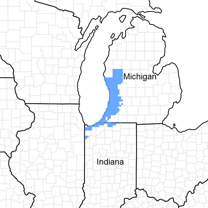
Figure 1. Mapped extent
Areas shown in blue indicate the maximum mapped extent of this ecological site. Other ecological sites likely occur within the highlighted areas. It is also possible for this ecological site to occur outside of highlighted areas if detailed soil survey has not been completed or recently updated.
MLRA notes
Major Land Resource Area (MLRA): 097X–Southwestern Michigan Fruit and Vegetable Crop Belt
Major land resource area (MLRA) 97 wraps around the southern end of Lake Michigan, covering portions of Michigan, Illinois, and Indiana corresponding to a major lake-moderated fruit-growing region. The subunit of the MLRA corresponding to the extent of this ecological site description, however, is Forest Service subsections 222Ja and 222Jb. As such, it excludes most of the Illinois portion of the MLRA because the lake plain is less sandy and less lake-moderated there. Northward the subsections include a significant portion of MLRA 98, following sandy lake plains and fruit-growing moraines northward into Muskegon County, Michigan. The western boundary is Lake Michigan and the eastern boundary is roughly the extent of lake-ameliorated climate. The northern boundary is defined by a major floristic boundary where vegetation switches from one of predominantly central hardwoods species to one of mainly northern woodland species. The southern boundary is defined by a predominantly prairie flora. The triple juxtaposition of central hardwood, prairie, and northern woodland species in the southern portion of the region make this among the more plant species rich areas of the country (Kartesz, 2011; Swink & Wilhelm, 1994).
Soil map units where Acidic Sandy Flatwoods is a major component cover about 173,906 acres (70,377 ha) or about 8.5 percent of this area, but mostly in subsection 222Ja.
Classification relationships
This ecological site concept has community phases equivalent to:
2 NatureServe systems
3 National Vegetation Classification (NVC) associations
6 or 7 Michigan Natural Features Inventory (MNFI) communities
1 or 2 Indiana Division of Nature Preserves communities
This ecological site concept has equivalent classifications in the following alternative ecological land type classifications
2 United State Forest Service ecological land type phases (ELTP)
1 Kotar habitat type
These are elaborated under “Other References”.
Ecological site concept
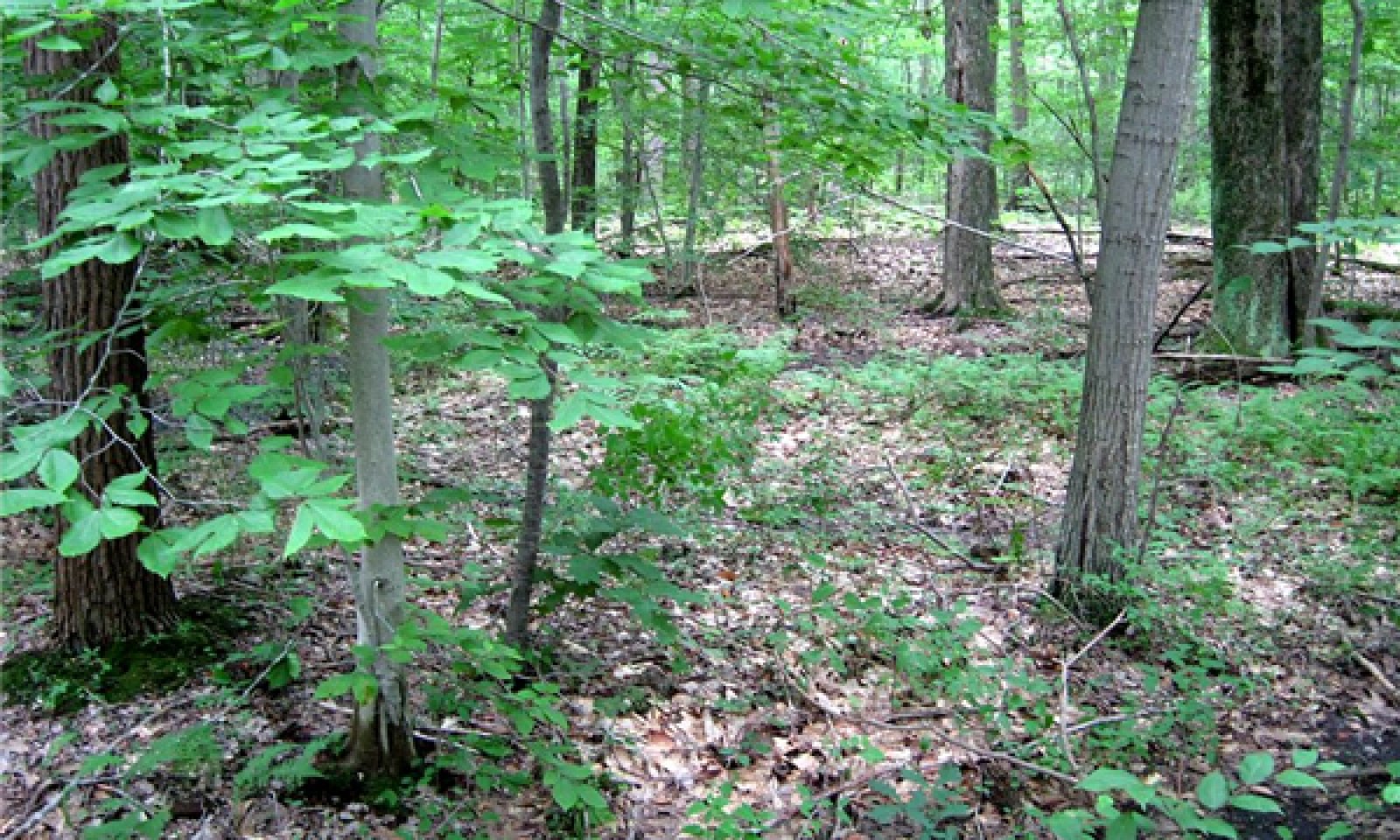
The central concept of the Acidic Sandy Flatwoods is sands (>70% sands >50 cm deep) with low base saturation (pHs <5.5 and/or Spodosols) and high seasonal water tables intermediate in wetness between wetland and uplands (somewhat poorly drained to moderately well drained). Such sites support vegetation composed of xerophytic and mesophytic species which tolerate low nutrient conditions. Late successional forest dominates the area, but small areas of barrens and grasslands do occur. Characteristic species include red maple (Acer rubrum), red oak (Quercus rubra), American beech (Fagus grandifolia), black gum (Nyssa sylvatica) in forested sites with ferns, greenbrier (Smilax rotundifolia), and heaths (Ericaceae) in the understory. Open sites tend to have various warm season grasses, sedges, and rushes and scattered oak and pine.
Sites with loamier surface textures, shallower depths to clay, higher base saturation, or that are wetter or dryer belong to other ecological sites.
Associated sites
| F097XA007MI |
Wet Acidic Sandy Flatwoods Occurs on adjacent poorly drained sites. |
|---|---|
| F097XA004MI |
Dry Sandy Lake Plain Occurs on adjacent well or excessively drained sites. |
Similar sites
| F097XA012MI |
Moist Sandy Depression Has a higher pH. |
|---|---|
| F097XB035IN |
Chicago Moist Sandy Swale Has a higher pH, a warmer growing season, and a proportionally greater prairie flora. |
Table 1. Dominant plant species
| Tree |
(1) Acer rubrum |
|---|---|
| Shrub |
(1) Smilax rotundifolia |
| Herbaceous |
(1) Pteridium aquilinum |
Physiographic features
The surface of this area is covered mainly with glacial till and lacustrine deposits. The lake plain consists of sands deposited by high-energy shoreline processes, which reworked glacial outwash deltas of post-glacial Lake Chicago. Some areas have relict shoreline features of alternating dune and swale topography wherein this ecological site is found in the margin of wet swales. Some higher areas (>200 m elevation; 656 feet) are underlain with a dense glacial till aquatard, usually deeper than 2 meters (80 inches), which is responsible for perched water tables. The adjacent wetlands in these sites tend to be acidic Newton soils. The site becomes more minerotrophic due to the influence of the calcareous till where the depths to till is within 50 to 100 cm (20 to 40 inches) converging with Rimer and Selfridge soils.
This site also occurs on the margins of broad flat plains with a high regional water table due to low elevations relative to lake level (which is at 176 m; 577 feet) and undrained by rivers or creeks. In these lower areas, groundwater has a larger catchment area and is consequently more minerotrophic, resulting in richer adjacent wetland ecological sites in Granby or Kingsville soils.
Bedrock has no influence on local topography or soils in this area. Bedrock is buried beneath 10 to 200 m (33 to 656 feet) of surface deposits and consists primarily of limestone and dolomite in Indiana, and sandstone and shale in Michigan.
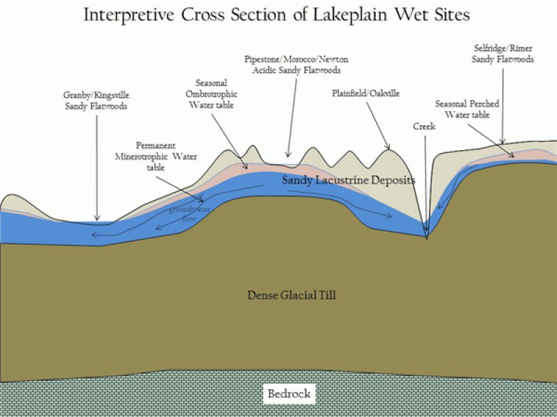
Figure 2. Landscape Cross Section
Table 2. Representative physiographic features
| Landforms |
(1)
Lake plain
(2) Interdune |
|---|---|
| Runoff class | Negligible to low |
| Flooding frequency | None |
| Ponding duration | Very brief (4 to 48 hours) |
| Ponding frequency | None to occasional |
| Elevation | 591 – 755 ft |
| Slope | 3% |
| Ponding depth | 4 in |
| Water table depth | 10 – 39 in |
| Aspect | Aspect is not a significant factor |
Climatic features
The southeastern Lake Michigan lake plain and adjacent lake influenced moraines have a humid warm continental climate with cold winters and warm summers.
Just over half of the precipitation is distributed during the warmer half of the year with a significant portion of the precipitation occurring as heavy downpours during thunderstorms. Thunderstorm activity is enhanced inland by lake breeze fronts, while it is diminished near the lakeshore by the stabilizing effect of the cooler lake waters. Occasionally, thunderstorm microbursts cause localized high winds which open single tree gaps in forest canopies, or more rarely, tornados and derechos (severe straight-line winds) open larger gaps. Fall storms bring more frequent strong winds, but with impacts moderated by the lack of leaves (wind resistance) in the canopy. During July, average precipitation lags potential evapotranspiration, resulting in droughty conditions in the upper soil horizons of upland sites. During dry years, this droughty period is extended into August and September, resulting in dry fuels and potential for wildfire over oak and pine dominated areas.
Winter precipitation is enhanced by lake effect snows, with 1.6 to 2.4 m (40-95 inches) falling annually within the snow belt. Peak snowfall occurs at intermediate distances from the lake where topography enhances uplift. The combination of heavier winter snowfall, lake-delayed spring warm up, and frequent wetlands all contribute to relatively lower fire frequencies relative to inland locations with similarly droughty soils.
The area falls within USDA Hardiness zones 6a and 6b and has delayed spring warm up until after the last killing frosts, allowing for a wide range of fruit crops to be grown.
Table 3. Representative climatic features
| Frost-free period (characteristic range) | 123-149 days |
|---|---|
| Freeze-free period (characteristic range) | 149-196 days |
| Precipitation total (characteristic range) | 36-40 in |
| Frost-free period (actual range) | 117-160 days |
| Freeze-free period (actual range) | 143-202 days |
| Precipitation total (actual range) | 33-41 in |
| Frost-free period (average) | 137 days |
| Freeze-free period (average) | 173 days |
| Precipitation total (average) | 37 in |
Figure 3. Monthly precipitation range
Figure 4. Monthly minimum temperature range
Figure 5. Monthly maximum temperature range
Figure 6. Monthly average minimum and maximum temperature
Figure 7. Annual precipitation pattern
Figure 8. Annual average temperature pattern
Climate stations used
-
(1) HOLLAND WTP [USC00203858], Holland, MI
-
(2) HOLLAND TULIP CITY AP [USW00004839], Holland, MI
-
(3) GRAND HAVEN FIRE DEPT [USC00203290], Grand Haven, MI
-
(4) INDIANA DUNES NATL LKS [USC00124244], Chesterton, IN
-
(5) MUSKEGON CO AP [USW00014840], Muskegon, MI
-
(6) VALPARAISO WTR WKS [USC00128999], Valparaiso, IN
-
(7) ALLEGAN 5NE [USC00200128], Allegan, MI
-
(8) BLOOMINGDALE [USC00200864], Bloomingdale, MI
-
(9) EAU CLAIRE 4 NE [USC00202445], Dowagiac, MI
-
(10) SOUTH HAVEN [USC00207690], South Haven, MI
-
(11) BENTON HARBOR AP [USW00094871], Benton Harbor, MI
Influencing water features
Hydrology is a definitive feature of this ecological site. Changes in water table occur normally on a weekly to monthly basis. The modal concept for Acidic Sandy Flatwoods is not wetland, but an upland-wetland ecotone, which may or may not be adjacent to wetlands. Given this transitional status, particularly wet summers or a series of dry years would potentially result in dramatic shifts in species composition. Most areas, however, have a pit and mound microtopography, which allows the coexistence of wetland and upland taxa spanning these normal variations in climate.
Depressional areas pond only for durations long enough for the “temporarily flooded” modifier in the Cowardin wetland classification system, but wetter sites may range to “seasonally flooded” which would constitute hydric soil inclusions.
Hydogeomorphically, the sites are members of either mineral flats or upland (recharge) depression wetland landscapes, which are primarily affected by local precipitation, and are not influenced by stream flooding or by significant runoff and seepage from higher landscape positions. The combination of sandy substrate and precipitation-dominated hydrology is key in maintaining the site’s acidity.
Soil features
Soils generally classify as somewhat poorly drained Aquic Udipsamments (Morocco series) and Typic Endoaquods (Pipestone series). Soils are generally 80 to 100 percent sand to a depth greater than 200 cm (80 inch). Fluctuating water table from local precipitation and a lack of clay in the sandy parent material maintains low pH and low base saturation. The A horizon is generally black and around 10 cm (4 inches) thick and may be mucky sands on the wetter sites. There is frequently a well-developed, lighter colored E horizon over a darker, browner Bw or Bhs horizon. Where substantial hard, root-restricting ortstein is developed in the B horizon and the soils classify as Typic Duraquods (Saugatuck series). Spodosols (Endoaquods and Duraquods) are most frequently expressed northward in this area.
The seasonally high water table may restrict rooting depth for some species, which, when combined with the low available water holding capacities of the sandy textures, results in potential moisture stress in summer. Such sites are often termed “hydroxeric,” and can favor a persistent, sparsely treed, grassland phase, because grasses and sedges can best take advantage of seasonal moisture availability by becoming dormant when it becomes too dry (Noss, 2013). As a site becomes more forested, increased water utilization by trees may cause the water table to drop and increase the available oxygenated rooting volume. Deeper water tables combined with an increased incidence of tip-up mounds allow more opportunities for less hydrophytic species.
The low base saturation of the soil limits the site to species adapted to acidic, low nutrient conditions, which includes a disproportionate number species with more efficient types of mycorrhizal relationships to extract nutrients from the soil (ectomycorrhizal and ericoid forms which serve members of the Fagaceae, Pinaceae, and Ericaceae), tissues with high carbon to nitrogen ratios, and thick, hard, or evergreen leaves (Malloch, et al., 1980; Givnish, 2002; Read, 1991). Sites with calcareous clay-loam till within depths of 100 to 200 cm (40 to 80 inches) may also behave in ways similar to this site in as much as the rooting zone lacks nutrients to support a flora otherwise associated with till soils.
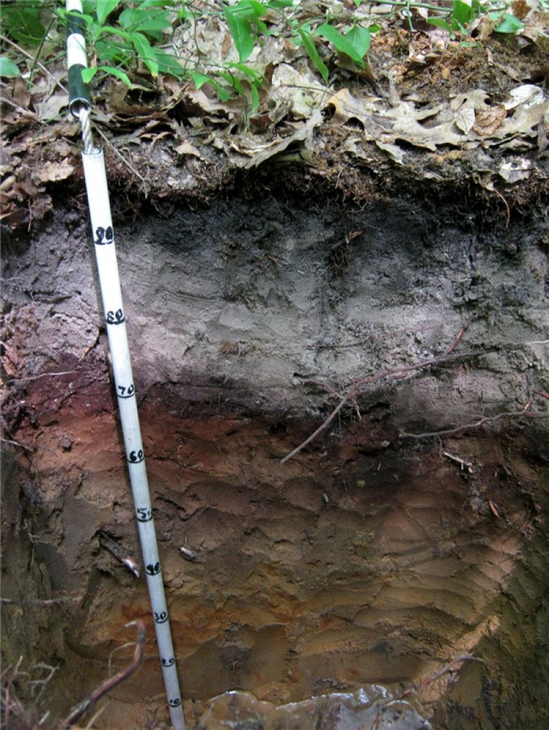
Figure 9. Pipestone soil series (10 cm increments)
Table 4. Representative soil features
| Parent material |
(1)
Lacustrine deposits
|
|---|---|
| Surface texture |
(1) Mucky sand (2) Fine sand (3) Sand |
| Family particle size |
(1) Sandy |
| Drainage class | Somewhat poorly drained |
| Permeability class | Moderately rapid to rapid |
| Soil depth | 80 in |
| Surface fragment cover <=3" | 1% |
| Surface fragment cover >3" | Not specified |
| Available water capacity (0-39.4in) |
1.57 – 3.94 in |
| Calcium carbonate equivalent (0-39.4in) |
Not specified |
| Soil reaction (1:1 water) (0-19.7in) |
3.5 – 5.5 |
| Subsurface fragment volume <=3" (0-59.1in) |
10% |
| Subsurface fragment volume >3" (0-59.1in) |
5% |
Ecological dynamics
The reference state is characterized by a relatively low fire frequency (fire return interval >100 years) and a trend towards shade tolerant and mesophytic vegetation. Prior to European-American settlement of the area, about 98 percent of this ecological site was in this phase.
The high fire frequency phases are characterized by fire return intervals of 5 to 25 years and vegetation composed of grasslands and oak-pine savannas. Prior to European-American settlement of the area, about 2 percent of this ecological site was in this state.
Because wet acidic sands are relative outliers in a region otherwise dominated by calcareous tills, many species occur here that are disjuncts from their main ranges in unglaciated areas to the south (e.g. Rhexia virginica). Several species are disjuncts from the Gulf and Atlantic Coastal Plains where they are found in similarly acidic sandy sites (Reznicek, 1994; Sorrie & Weakley, 2001); although, most of these are more characteristic of adjacent, wetter ecological sites.
Presently, 43 percent of the ecological site is forested, which is more or less consistent with most phases within the reference condition. About 46 percent of the ecological site is in intensively managed agriculture, urban development, or other managed vegetation addressed as state 2. Another 11 percent is in open condition, which may be either a post agricultural phase of state 2 or something resembling natural vegetation in the more open phases of the reference state.
The lowest (shallowest water table) portions of the Acidic Sandy Flatwoods ecological site typically have pit and mound topography, which results in a complex mosaic of seasonally ponded and unponded ground surfaces within 1 to 10 meters distance. Many of the ponded sites are ponded for long enough to be considered poorly drained and support a sparse ground cover and hydrophytic vegetation. At the scale of a typical vegetation plot (100 to 400 m²), the difference between the Acidic Sandy Flatwoods site concept and the adjacent Wet Acidic Sandy site concept is which portion of the microtopography constitutes the majority of the area. Where microtopography does not exist, there is less hydrophytic vegetation.
State and transition model
More interactive model formats are also available.
View Interactive Models
Click on state and transition labels to scroll to the respective text
Ecosystem states
State 1 submodel, plant communities
Communities 1 and 5 (additional pathways)
State 2 submodel, plant communities
State 1
Reference State
Prior to European-American settlement of the area, about 70 percent of the vegetation was dominated by very shade-tolerant species such as beech (Fagus grandifolia) and hemlock (Tsuga canadensis) (phase 1.2) and about 28 percent was dominated by a mix of white pine (Pinus strobus), oaks (Quercus spp.), and other hardwoods (phase 1.1; Albert, et al., 1995). Hemlock does not occur in northern Indiana, so there phase 1.2 was characterized by beech only. Because forests are still recovering from past logging, most forests today are intermediate in succession as phase 1.1. Red maple (Acer rubrum) overwhelmingly dominates the canopy, but beech can be found in high numbers in the understory, supporting the contention that future stands will naturally succeed to phase 1.2 beech-dominated forests. The most frequent canopy associates are red oak and black gum. Although usually not abundant in this region, black gum (Nyssa sylvatica) is a reliable indicator of acidic sites like these. Acid tolerant shrubs (e.g. blueberries, Vaccinium spp.; swamp or bristly dewberry, Rubus hispidus), forbs (e.g. partridge berry, Mitchella repens; Indian cucumber, Medeola virginiana), and ferns (e.g. cinnamon fern, Osmundastrum cinnamomeum; New York fern, Parathelypteris noveboracensis) are found in the understory. Disturbance from canopy openings or fire, favors species such as sassafras (Sassafras albidum), bracken fern (Pteridium aquilinum) and greenbrier (Smilax rotundifolia). On occasion, larger openings may allow for establishment of big tooth aspen (Populus grandidentata) (phase 1.3). Historically, these small gaps would have been too small to be mappable using General Land Office survey notes. The fire return intervals for the reference state range from greater than 1,000 years for a northern hardwoods-hemlock dominated system to crown fires about every 290 years with understory fires every 70 years for a pine-oak dominated system (U.S. Department of the Interior, Geological Survey, 2008).
Community 1.1
Red Maple-Red Oak/Greenbrier/Bracken Fern

Figure 10. Beech understory
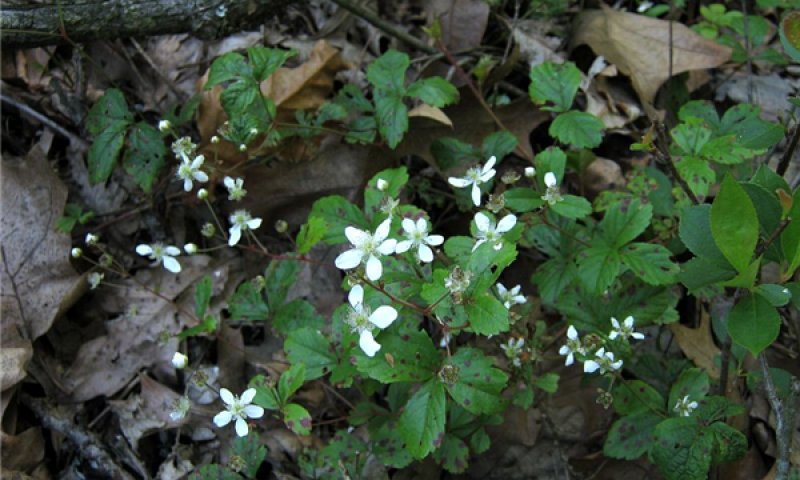
Figure 11. Swamp dewberry (Rubus hispidus)
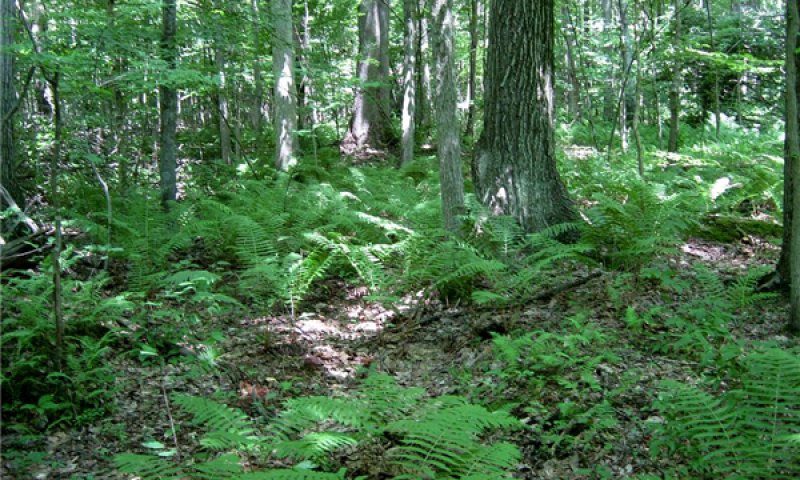
Figure 12. Red oak with cinnamon fern understory
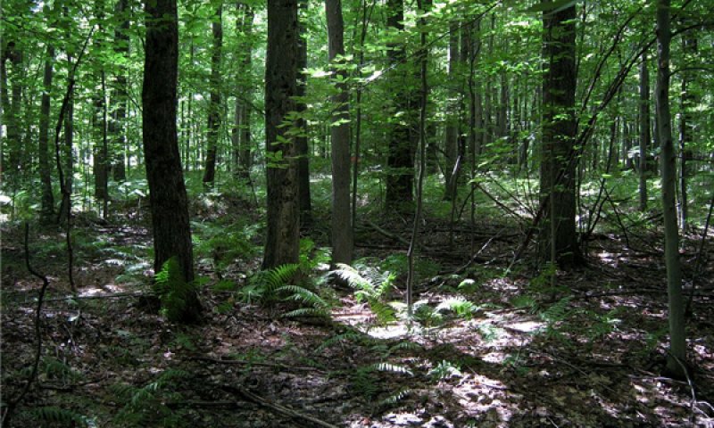
Figure 13. Red maple with cinnamon fern understory
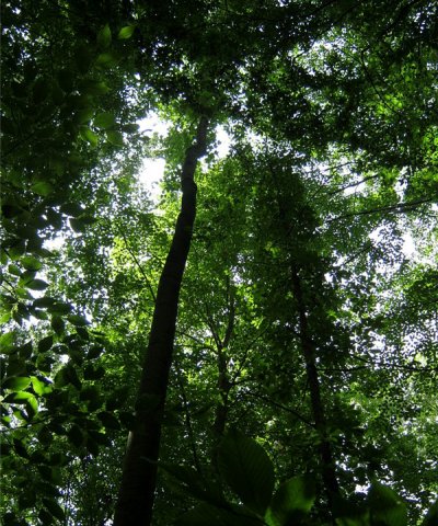
Figure 14. Overstory showing narrow black gum crown.
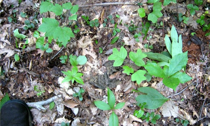
Figure 15. Understory seedlings and forbs.
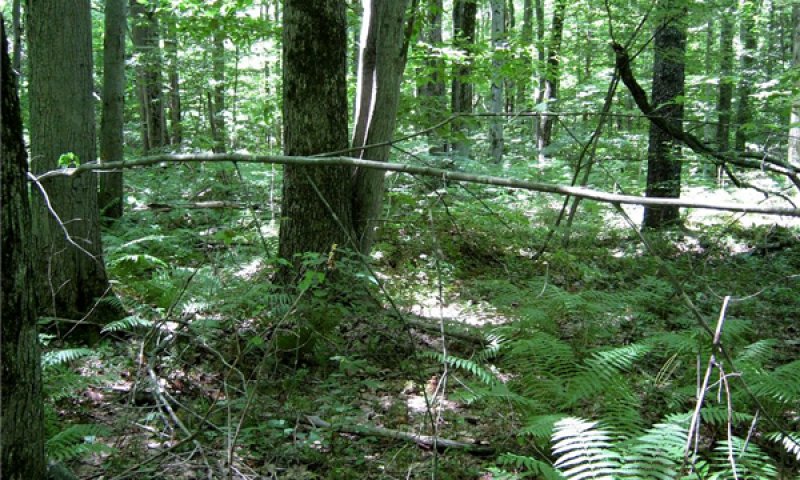
Figure 16. Red maple forest with cinnamon fern understory
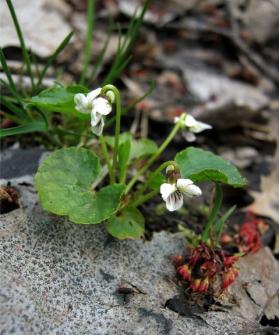
Figure 17. Viola macloskeyi
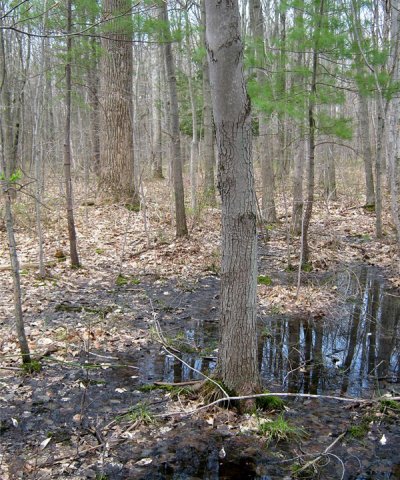
Figure 18. Vernal pools
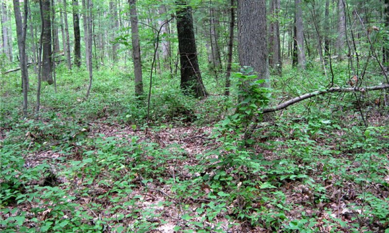
Figure 19. Greenbrier dominated understory
This phase consists of a mix of long-lived early successional and shade-intolerant, mid-successional gap replacers, and a few shade-tolerant understory species. It is maintained with occasional wind throw canopy gaps, understory fires (25 to 100 year return intervals) and succession from larger gaps passing through earlier phase 1.3. Red maple is not as shade tolerant as beech, but can resprout vigorously after a fire. If allowed to grow to maturity, red maple has thick enough bark to become somewhat fire resistant (Tirmenstein, 1991); therefore, moderately long fire intervals are favorable in maintaining some level of red maple. Mature black gum, tuliptree (Liriodendron tulipifera), and sassafras are moderately fire resistant due to their thick barks, in contrast to red maple and beech. Understory fire in southern Michigan is documented to result in increases in sassafras, tuliptree, and viburnum (Viburnum spp.) species (Neumann & Dickmann, 2001). However, in long-term absence of fire, predominantly single-tree canopy gaps will systematically favor recruitment of shade-tolerant species.
Forest overstory. Red maple overwhelmingly dominates the canopy, but beech can be found in high numbers in the understory, supporting the contention that future stands will naturally succeed to phase 1.2 beech-dominated forests. The most frequent canopy associates are red oak (Quercus rubra) and black gum. Although usually not abundant in this region, black gum is a reliable indicator of acidic sites like these. Tuliptree is a frequent associate south of Ottawa County. Pin oak (Quercus palustris) is frequently found in stands where wetlands are adjacent, but becomes rare at the northern limits of its range in Muskegon County. Isolated eastern white pine and tuliptree are known to exceed 30 m (100 feet), but were not captured in the plots. [Field data used to generate the figures in the tables below were collected according to the National Vegetation Classification Standards, in which overstory is defined as 5 m (16.4 feet) and above. A tuliptree, measured in 2011 in Allegan State Game area at 98.5 cm (38.8 inches) wide and 38 m (124.7 feet) tall, was incorporated into the canopy composition tables below.]
Forest understory. Acid tolerant shrubs (e.g. blueberries, bristly dewberry), forbs (e.g. partridge berry, Indian cucumber), and ferns (e.g. cinnamon fern, New York fern) are found in the understory.
Table 5. Soil surface cover
| Tree basal cover | 0.5-1.0% |
|---|---|
| Shrub/vine/liana basal cover | 5-10% |
| Grass/grasslike basal cover | 0.1-2.0% |
| Forb basal cover | 0.5-5.0% |
| Non-vascular plants | 0.1-2.0% |
| Biological crusts | 0% |
| Litter | 60-90% |
| Surface fragments >0.25" and <=3" | 0% |
| Surface fragments >3" | 0% |
| Bedrock | 0% |
| Water | 0% |
| Bare ground | 0% |
Table 6. Woody ground cover
| Downed wood, fine-small (<0.40" diameter; 1-hour fuels) | 2-3% N* |
|---|---|
| Downed wood, fine-medium (0.40-0.99" diameter; 10-hour fuels) | 2-3% N* |
| Downed wood, fine-large (1.00-2.99" diameter; 100-hour fuels) | 1-1% N* |
| Downed wood, coarse-small (3.00-8.99" diameter; 1,000-hour fuels) | 0-2% N* |
| Downed wood, coarse-large (>9.00" diameter; 10,000-hour fuels) | 0-2% |
| Tree snags** (hard***) | – |
| Tree snags** (soft***) | – |
| Tree snag count** (hard***) | 0-17 per acre |
| Tree snag count** (hard***) | 0-12 per acre |
* Decomposition Classes: N - no or little integration with the soil surface; I - partial to nearly full integration with the soil surface.
** >10.16cm diameter at 1.3716m above ground and >1.8288m height--if less diameter OR height use applicable down wood type; for pinyon and juniper, use 0.3048m above ground.
*** Hard - tree is dead with most or all of bark intact; Soft - most of bark has sloughed off.
Table 7. Canopy structure (% cover)
| Height Above Ground (ft) | Tree | Shrub/Vine | Grass/ Grasslike |
Forb |
|---|---|---|---|---|
| <0.5 | 1-5% | 5-15% | 0-5% | 1-15% |
| >0.5 <= 1 | 1-5% | 2-10% | 0-2% | 0-15% |
| >1 <= 2 | 2-10% | 2-10% | 0-2% | 0-15% |
| >2 <= 4.5 | 2-10% | 0-2% | – | – |
| >4.5 <= 13 | 35-45% | 0-2% | – | – |
| >13 <= 40 | 30-80% | – | – | – |
| >40 <= 80 | 100-100% | – | – | – |
| >80 <= 120 | 25-40% | – | – | – |
| >120 | 0-1% | – | – | – |
Community 1.2
American Beech-Eastern Hemlock/New York Fern
This phase consists of mostly late-successional shade-tolerant species. It is maintained by allowing more than 100 to 200 years passing without larger windthrow or fire events. Long-lived early-mid successional tree species such as white pine, tulip tree, red oak, and red maple may persist at low or decreasing densities. Beech has thin bark, making it vulnerable to fire injury in even a light understory burn; although, it can stump sprout. Hemlock is highly vulnerable to fire in all is stages and is intolerant of moisture stress. Where fire does occur, stands of hemlock can be fire initiated, given that litter is removed allowing germination in mineral soil rather than exclusively on rotting logs (Carey, 1993).
Forest overstory. Beech and hemlock dominate the overstory. Other species that dominate in phase 1.1 are found in very low abundance. Hemlock does not occur in northern Indiana, so there phase 1.2 is characterized primarily by beech. Another very shade-tolerant species, sugar maple, which normally co-dominates late successional forests with beech in this region, is generally absent due to poor nutrient conditions.
Community 1.3
Bigtooth Aspen-Sassafras/Roundleaf Greenbrier/Bracken Fern
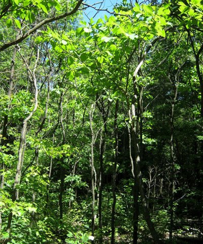
Figure 20. Sassafras thicket
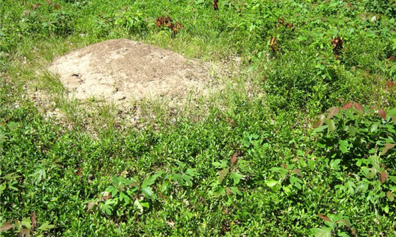
Figure 21. Sassafras and blueberry with an ant mound
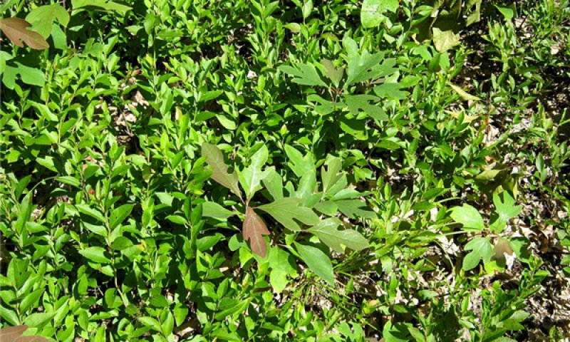
Figure 22. Sassafras and lowbush blueberry
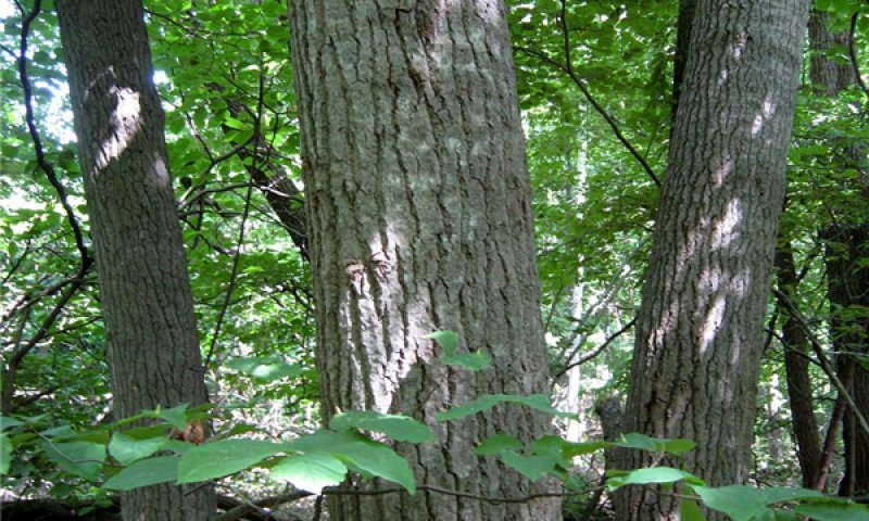
Figure 23. Bigtooth aspen grove
Disturbance from canopy openings or fire favors species such as sassafras, bracken fern, and green brier. On occasion, larger openings may allow for establishment of big tooth aspen (phase 1.3). Historically, these small gaps would have been too small to be mappable using General Land Survey Office notes. Both bigtooth aspen and sassafras are vigorous sprouters after fire and can also be expected to seed into openings after a fire (Carey, 1994). Sassafras is shade tolerant at young ages and intolerant as it matures, making it more adaptable to smaller canopy openings than big tooth aspen (Barnes and Wagner, 2004). Although trembling aspen often co-occurs with bigtooth aspen, there is a greater tendency for bigtooth aspen to occur on low nutrient conditions. Tuliptree, if able to establish at this stage, is tall and long-lived and so would persist into phase 1.1.
Forest overstory. Characteristically, the forest overstory consists of an even aged stand of sassafras or aspen.
Forest understory. Commonly other clonal species such as bracken fern and lowbush blueberry are found.
Community 1.4
Little Bluestem-Bracken fern
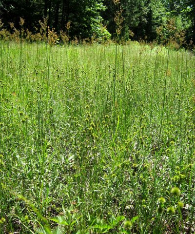
Figure 24. Two-tiered rush canopy
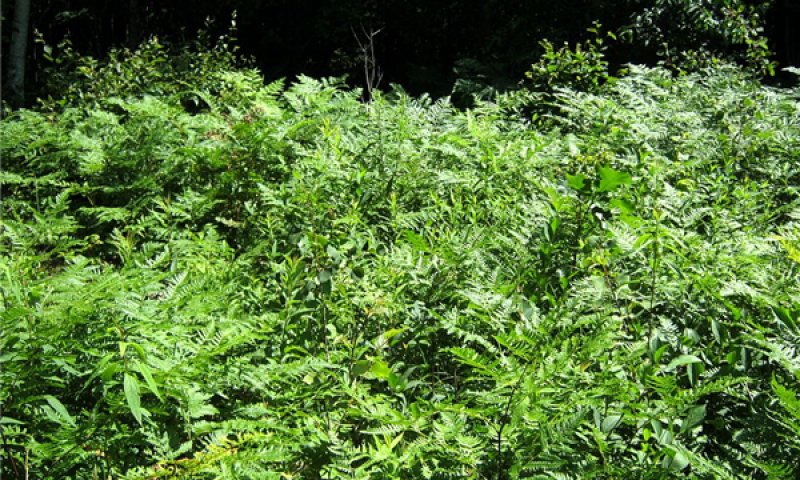
Figure 25. Bracken
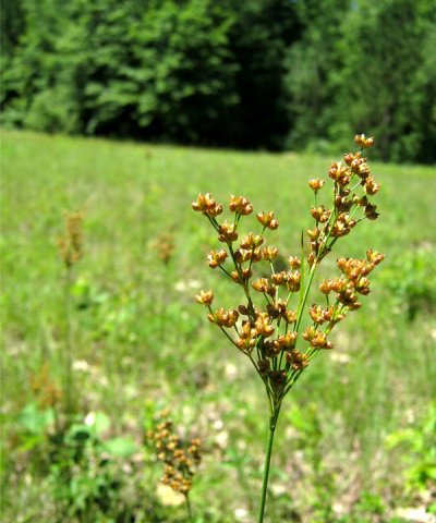
Figure 26. Juncus biflorus
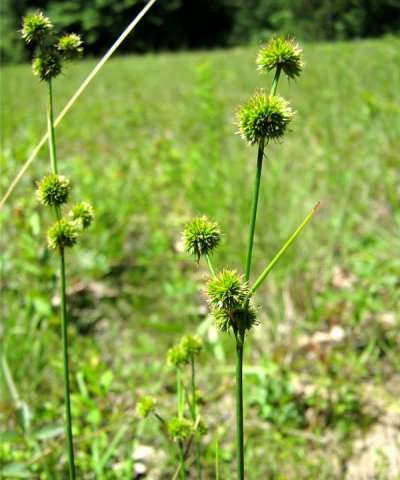
Figure 27. Juncus brachycarpus
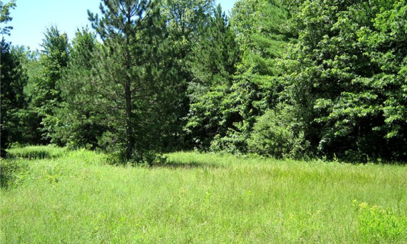
Figure 28. Wet-mesic sand prairie
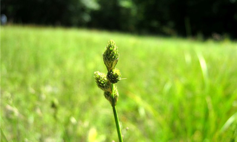
Figure 29. Carex scoparia
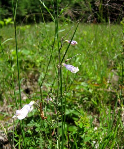
Figure 30. Penstemon hirsutus
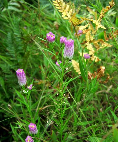
Figure 31. Polygala sanguinea
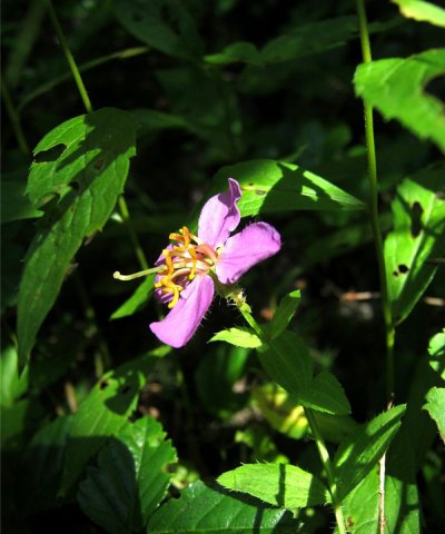
Figure 32. Meadow beauty (Rhexia virginica)

Figure 33. Colic-root (Aletris farinosa)
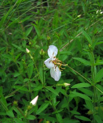
Figure 34. Maryland meadow-beauty (Rhexia mariana)
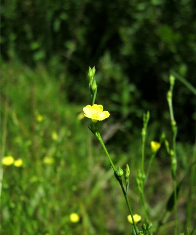
Figure 35. Flax (Linum medium)
Prior to European-American settlement of the area, only about 0.3 percent of the area within this ecological site was open grassland. Historic and modern occurrences of wet-mesic sand prairie are found most frequently as isolated wetter pockets in a matrix of dry uplands. In these contexts, fire could be expected to be more frequent than where wetland forms a high proportion of the landscape. The fire return intervals for the high fire frequency community phases based on the adjacent upland pine-oak barrens (U.S. Department of the Interior, Geological Survey, 2008), is 140 years for a crown fire and about every 3 years for understory fires. Crown-severity fires that reoccur within 15 years would maintain a wet-mesic sand prairies phase. The fire return intervals for the high fire frequency community phases based on the adjacent upland pine-oak barrens (U.S. Department of the Interior, Geological Survey, 2008), is 140 years for a crown fire and about every 3 years for understory fires. Crown-severity fires that reoccur within 15 years would maintain a wet-mesic sand prairies phase.
Forest understory. “Typical” prairie warm season (C4) grasses such as big bluestem (Andropogon gerardii) and little bluestem (Schizachyrium scoparium) are likely to be frequent if site is adjacent to open, well- drained uplands, but the high water table brings with it a strong element of sedges and rushes, many with local distributions (e.g. Juncus brachycarpus). Likewise, the forb component may have some widespread sand prairie and old field elements (e.g. Symphyotrichum spp., Lespedeza capitata, Vernonia missurica, Pteridium aquilinum) as well as distinctive coastal plain marsh species (e.g. Rhexia virginica).
Community 1.5
White Oak-White Pine/Bracken Fern-Little Bluestem
This phase represents a range of canopy closures that maintain a white oak (Quercus alba), black oak (Quercus velutina), and white pine overstory with an understory characteristic of wet-mesic sand prairie, phase 1.4. A few of the understory species may depend on the partial shade provided in phase 1.5. Prior to European-American settlement of the area, only about 2.3 percent of the area within this ecological site was open grassland and barrens. Historic and modern occurrences of wet-mesic versions of oak-pine barrens are found most frequently as isolated wetter pockets in a matrix of dry uplands. In these contexts, fire could be expected to be more frequent than where wetland forms a high proportion of the landscape. The fire return intervals for the high fire frequency community phases based on the adjacent upland pine-oak barrens (U.S. Department of the Interior, Geological Survey, 2008), is 140 years for a crown fire and about every 3 years for understory fires. Crown-severity fires that reoccur within 15 years would maintain a wet-mesic sand prairies phase.
Pathway 1.1A
Community 1.1 to 1.2
Over time (35 to 70) years, very shade-tolerant species become established and increase in size with or without significant canopy gaps. Natural mortality of existing members of the canopy would occur, but less shade-tolerant species would fail to recruit without significant canopy gaps (>1 tree). As a result, canopy composition would systematically shift from less shade-tolerant to very shade-tolerant species.
Pathway 1.1B
Community 1.1 to 1.3


Large canopy gap of at least four or more large canopy trees (> 400 m²) caused by intense fire or wind event allows the recruitment of less shade-tolerant species like sassafras, tuliptree, or bigtooth aspen, or the clonal regeneration of sassafras or bigtooth aspen from adjacent stands. However, frequent recurrence of such events would constitute a change to high fire frequency phases.
Pathway 1.1C
Community 1.1 to 1.4


Large blowdowns or clearcuts in combination with increased fire frequency caused by drought years with dry lightning ignition or prescribed fire allows establishment of shade-intolerant grasses, rushes, and sedges. Repeated fires in short succession may be required for the elimination of fire suppressing species such as red maple, due to their ability to stump sprout. Larger red maples may store enough energy in their roots that, unless they are initially uprooted by wind, may require herbicide application to hasten the process.
Pathway 1.1D
Community 1.1 to 1.5
Increased fire frequency caused by drought years with dry lightning ignition or prescribed fire allows establishment of shade-intolerant grasses, rushes, sedges, white and black oaks, and white pine. Repeated fires in short succession may be required for the elimination of fire suppressing species such as red maple, due to their ability to stump sprout. Larger red maples may store enough energy in their roots that, unless they are initially uprooted by wind, may require herbicide application to hasten the process.
Pathway 1.2A
Community 1.2 to 1.3
Large canopy gap of at least four or more large canopy trees (> 400 m²) caused by intense fire or wind event allows the recruitment of less shade-tolerant species like sassafras, tuliptree, and/ or bigtooth aspen, or the clonal regeneration of sassafras or bigtooth aspen from adjacent stands. However, frequent recurrence of such events would constitute a change to high fire frequency phase.
Pathway 1.3A
Community 1.3 to 1.1


Over time (0 to 35 years), intermediate (red oak) and shade-tolerant (red maple) species become established and increase in size under pioneer species. Natural mortality of short-lived pioneer species (sassafras and aspen) would occur without replacement, or would be exceeded in height by taller mid-successional species and shaded out.
Pathway 1.4A
Community 1.4 to 1.5
Reduced fire frequency caused by a return to moister climate or fire suppression would quickly result in increased oak cover, due to their ability to stump sprout and thick fire resistant bark. Fire return intervals on the order greater than 15 years would allow some white pine to become large enough to survive low intensity fires. However, fire return intervals exceeding 50 years results in closed canopy oak-pine forest.
Pathway 1.5A
Community 1.5 to 1.1
Reduced fire frequency (greater than 70 years), caused by wetter climate or fire suppression, allows for fire-intolerant trees to become established. As species such as red maple and aspen increase in cover over oak and pine species, the ground litter becomes more fire resistant. Maple and aspen litter tends to lay flat and remain moist, whereas oak leaves curl up and dry out quickly. Pine needles contain flammable resins.
Pathway 1.5B
Community 1.5 to 1.4
Large blowdowns or clearcuts during drought years with dry lightning ignition or prescribed fire allows reduction in tree canopy cover. Repeated fires in short succession may be required for the reduction of oak cover, due to their ability to stump sprout and thick fire resistant bark. Larger oaks and pines, unless initially uprooted by wind, may require adjacent ladder fuels to create conditions hot enough to be top killed. Stump sprouts of all but the youngest of oaks are highly resilient to fire, and may require that fire intervals be kept at less than 5 years to prevent stems from growing above flame heights, potentially leading to eventual canopy closure.
State 2
Agriculture
The Agriculture State accommodates the 46 percent of the sites that are actively cultivated, or are recovering from agriculture. This is a heterogeneous assemblage addressed here collectively. Included within the 46 percent is 20 percent of the area considered agriculture, 9 percent is managed vegetation, including tree plantations, and 18 percent is developed at low to high intensities (e.g. cities).
Community 2.1
Blueberry Farm
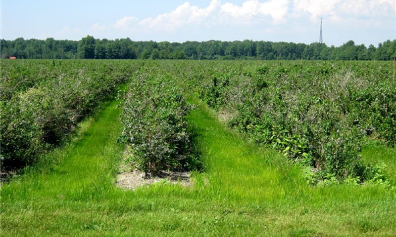
Figure 36. Blueberry farm
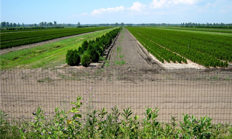
Figure 37. Ornamental nursery
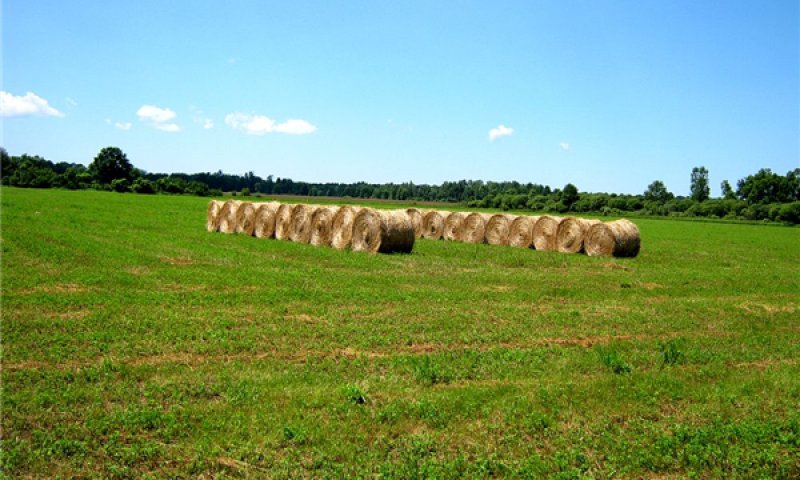
Figure 38. Hayfield in state game area
Blueberries are among the most important crops in this ecological site. This and adjacent wet sandy sites support some of the nation’s largest supply of blueberries. Although commonly in the form of cultivars, this is one of the few essentially native crops, being that all are derived from Vaccinium corymbosum. Large operations require chemical control of introduced insect pests that do not otherwise threaten the viability of wild populations (Demchak and Rudisill, 2006). Despite the natural occurrence of native blueberries on these low nutrient sites, for optimal production, blueberry farmers increase the levels of available nitrogen and calcium in the form of salts, which maintain the optimal low pH, levels (4.5 to 5.1). Nitrogen is supplied as ammonium sulfate, and calcium is supplied with calcium sulfate (gypsum). When necessary, pH is adjusted upward with lime (calcium carbonate) and downward with sulfur (Hayden, 2001). Sites are often mulched to help maintain low pH. Recommended water tables for blueberry production are 36 to 56 cm (14 to 24 inches), which is within normal range for somewhat poorly drained sites (Hayden, 2001). However, ditching intended for adjacent poorly drained soils results in water tables being deeper than reference conditions. Deeper seasonal water tables allow for larger rooting volumes, which helps maintain stronger plants for production. With or without drainage ditches, the natural variability in the water table and low available water holding capacity of the sandy textures requires that the blueberry crop is irrigated. Other practices represented by this community phase are ornamental nurseries, hayfields, and pastures. Although not elaborated here, these agricultural practices involve the establishment of different species, alternative patterns of drainage and irrigation, and different nutrient management regimes. In general, they may require higher applications of lime to raise the soil pH as compared to blueberry cultivation.
Forest understory. Production blueberry fields typically have ample herbaceous ground covers. The composition of the ground vegetation differs in important ways from the reference condition due to frequent disturbance, and more importantly, the heavy inputs of nitrogen fertilizers. As a result, cosmopolitan weed species such as yellow nutsedge can proliferate. Other weeds such as the non-native sheep sorrel are characteristic of disturbed sites such as these that are acidic.
Transition T1A
State 1 to 2
The reference state transitions to the agricultural state with the clearing of woody vegetation and the establishment of crop plants. Depending on crop species, the site would require appropriate amounts of drainage and irrigation. Crops may also require the application of pesticides and fertilizers according to desired market specifications (e.g. “organic” or otherwise).
Restoration pathway R2A
State 2 to 1
Control non-native invasive species and reestablish native plant species characteristic of the forested reference state. If applicable, cease nutrient enrichment (to allow excess calcium and nitrogen to be slowly flushed from the system or incorporated into biomass) or restore hydrology by blocking drainage ditches. If the site has been limed heavily, application of sulfur should be considered depending on restoration objectives.
Additional community tables
Table 8. Community 1.1 forest overstory composition
| Common name | Symbol | Scientific name | Nativity | Height (ft) | Canopy cover (%) | Diameter (in) | Basal area (square ft/acre) |
|---|---|---|---|---|---|---|---|
|
Tree
|
|||||||
| red maple | ACRUR | Acer rubrum var. rubrum | Native | 32.8–93 | 25–95 | 9.3–23.3 | – |
| northern red oak | QURU | Quercus rubra | Native | 49.2–114.8 | 0–70 | 7.6–44.9 | – |
| blackgum | NYSY | Nyssa sylvatica | Native | 32.8–65.6 | 0–70 | 10 | – |
| American beech | FAGR | Fagus grandifolia | Native | 32.8–98.4 | 0–60 | 13.4 | – |
| red maple | ACRUR | Acer rubrum var. rubrum | Native | 24.6–41 | 0–45 | – | – |
| black oak | QUVE | Quercus velutina | Native | 55.8–95.1 | 0–45 | 17.4 | – |
| American beech | FAGR | Fagus grandifolia | Native | 16.4–38.3 | 0–40 | – | – |
| tuliptree | LITU | Liriodendron tulipifera | Native | 32.8–65.6 | 0–35 | 12.8–38.8 | – |
| eastern hemlock | TSCA | Tsuga canadensis | Native | 6.6–95.1 | 0–30 | 13.9–18.5 | – |
| eastern white pine | PIST | Pinus strobus | Native | – | 0–30 | – | – |
| sassafras | SAAL5 | Sassafras albidum | Native | 36.1–55.8 | 0–20 | – | – |
| northern red oak | QURU | Quercus rubra | Native | 16.4–38.3 | 0–10 | – | – |
| paper birch | BEPA | Betula papyrifera | Native | 52.5–91.9 | 0–10 | 9.8 | – |
| white oak | QUAL | Quercus alba | Native | – | 0–10 | – | – |
| tuliptree | LITU | Liriodendron tulipifera | Native | 16.4–49.2 | 0–10 | – | – |
| pin oak | QUPA2 | Quercus palustris | Native | – | 0–5 | 20.3 | – |
| American hornbeam | CACA18 | Carpinus caroliniana | Native | 16.4–36.1 | 0–5 | – | – |
| bigtooth aspen | POGR4 | Populus grandidentata | Native | – | 0–5 | – | – |
| black cherry | PRSE2 | Prunus serotina | Native | 16.4–36.1 | 0–5 | – | – |
| blackgum | NYSY | Nyssa sylvatica | Native | 16.4–49.2 | 0–5 | – | – |
| American elm | ULAM | Ulmus americana | Native | 16.4–36.1 | 0–2 | – | – |
|
Vine/Liana
|
|||||||
| summer grape | VIAE | Vitis aestivalis | Native | 36.1–75.5 | 0–0.1 | – | – |
Table 9. Community 1.1 forest understory composition
| Common name | Symbol | Scientific name | Nativity | Height (ft) | Canopy cover (%) | |
|---|---|---|---|---|---|---|
|
Grass/grass-like (Graminoids)
|
||||||
| sedge | CAREX | Carex | Native | 0–0.3 | 0–5 | |
| fringed sedge | CACR6 | Carex crinita | Native | 0.3–1.6 | 0–2 | |
| greater bladder sedge | CAIN12 | Carex intumescens | Native | 0–1.6 | 0–2 | |
| weak stellate sedge | CASE6 | Carex seorsa | Native | 0–0.3 | 0–1 | |
| drooping woodland sedge | CAAR3 | Carex arctata | Native | 0–0.3 | 0–0.1 | |
| Swan's sedge | CASW | Carex swanii | Native | 0–0.3 | 0–0.1 | |
| sweet woodreed | CIAR2 | Cinna arundinacea | Native | 0.3–1.6 | 0–0.1 | |
|
Forb/Herb
|
||||||
| Canada mayflower | MACA4 | Maianthemum canadense | Native | 0–0.3 | 0.2–10 | |
| partridgeberry | MIRE | Mitchella repens | Native | 0–0.3 | 0.1–10 | |
| starflower | TRBO2 | Trientalis borealis | Native | 0–0.3 | 0–2 | |
| threeleaf goldthread | COTR2 | Coptis trifolia | Native | 0–0.3 | 0–2 | |
| wild sarsaparilla | ARNU2 | Aralia nudicaulis | Native | 0.3–1.6 | 0–1 | |
| Indian cucumber | MEVI | Medeola virginiana | Native | 0–0.3 | 0–1 | |
| moccasin flower | CYAC3 | Cypripedium acaule | Native | – | 0–0.1 | |
| bunchberry dogwood | COCA13 | Cornus canadensis | Native | 0–0.3 | 0–0.1 | |
| wrinkleleaf goldenrod | SORU2 | Solidago rugosa | Native | 0.3–1.6 | 0–0.1 | |
| dwarf ginseng | PATR2 | Panax trifolius | Native | 0–0.3 | 0–0.1 | |
| crippled cranefly | TIDI | Tipularia discolor | Native | 0–0.3 | 0–0.1 | |
| small white violet | VIMA2 | Viola macloskeyi | Native | 0–0.3 | 0–0.1 | |
| blue skullcap | SCLA2 | Scutellaria lateriflora | Native | 0.3–1.6 | 0–0.1 | |
| spotted water hemlock | CIMA2 | Cicuta maculata | Native | 0.3–1.6 | 0–0.1 | |
| aster | SYMPH4 | Symphyotrichum | Native | 0.3–1.6 | 0–0.1 | |
| violet | VIOLA | Viola | Native | 0–0.3 | 0–0.1 | |
| smallspike false nettle | BOCY | Boehmeria cylindrica | Native | 0.3–1.6 | 0–0.1 | |
|
Fern/fern ally
|
||||||
| western brackenfern | PTAQL | Pteridium aquilinum var. latiusculum | Native | 0.3–1.6 | 0.1–20 | |
| spinulose woodfern | DRCA11 | Dryopteris carthusiana | Native | 0.3–1.6 | 0–0.5 | |
|
Shrub/Subshrub
|
||||||
| bristly dewberry | RUHI | Rubus hispidus | Native | 0–0.3 | 0–15 | |
| highbush blueberry | VACO | Vaccinium corymbosum | Native | 1.6–3.3 | 0–10 | |
| highbush blueberry | VACO | Vaccinium corymbosum | Native | 0.3–1.6 | 0–5 | |
| eastern teaberry | GAPR2 | Gaultheria procumbens | Native | 0–0.3 | 0.1–5 | |
| northern spicebush | LIBE3 | Lindera benzoin | Native | 1.6–3.3 | 0–2 | |
| northern spicebush | LIBE3 | Lindera benzoin | Native | 0.3–1.6 | 0–2 | |
| common winterberry | ILVE | Ilex verticillata | Native | 1.6–6.6 | 0–2 | |
| mapleleaf viburnum | VIAC | Viburnum acerifolium | Native | 0–1.6 | 0–2 | |
| mapleleaf viburnum | VIAC | Viburnum acerifolium | Native | 1.6–3.3 | 0–1 | |
| common winterberry | ILVE | Ilex verticillata | Native | 0–1.6 | 0–1 | |
| lowbush blueberry | VAAN | Vaccinium angustifolium | Native | 0–0.3 | 0–0.2 | |
| purple chokeberry | ARPR2 | Aronia ×prunifolia | Native | 0–1.6 | 0–0.2 | |
| common buttonbush | CEOC2 | Cephalanthus occidentalis | Native | 0–1.6 | 0–0.1 | |
|
Tree
|
||||||
| American beech | FAGR | Fagus grandifolia | Native | 1.6–16.4 | 15–40 | |
| red maple | ACRUR | Acer rubrum var. rubrum | Native | 1.6–16.4 | 0–15 | |
| American hornbeam | CACA18 | Carpinus caroliniana | Native | 1.6–16.4 | 0–10 | |
| eastern hemlock | TSCA | Tsuga canadensis | Native | 3.3–16.4 | 0–10 | |
| black cherry | PRSE2 | Prunus serotina | Native | 1.6–16.4 | 0–10 | |
| black cherry | PRSE2 | Prunus serotina | Native | 0.3–1.6 | 0–5 | |
| white oak | QUAL | Quercus alba | Native | 0–1.6 | 0–5 | |
| American witchhazel | HAVI4 | Hamamelis virginiana | Native | 1.6–16.4 | 0–5 | |
| American beech | FAGR | Fagus grandifolia | Native | 0–1.6 | 0.5–2 | |
| sassafras | SAAL5 | Sassafras albidum | Native | 1.6–3.3 | 0–2 | |
| common serviceberry | AMAR3 | Amelanchier arborea | Native | 0–1.6 | 0–2 | |
| northern red oak | QURU | Quercus rubra | Native | 6.6–16.4 | 0–2 | |
| northern red oak | QURU | Quercus rubra | Native | 0–1.6 | 0.5–1 | |
| common serviceberry | AMAR3 | Amelanchier arborea | Native | 1.6–16.4 | 0–1 | |
| American hornbeam | CACA18 | Carpinus caroliniana | Native | 0–1.6 | 0–1 | |
| red maple | ACRUR | Acer rubrum var. rubrum | Native | 0–1.6 | 0.1–1 | |
| American witchhazel | HAVI4 | Hamamelis virginiana | Native | 0.3–1.6 | 0–1 | |
| tuliptree | LITU | Liriodendron tulipifera | Native | 0–0.3 | 0–1 | |
| blackgum | NYSY | Nyssa sylvatica | Native | 1.6–6.6 | 0–0.5 | |
| blackgum | NYSY | Nyssa sylvatica | Native | 0–0.3 | 0.1–0.5 | |
| eastern white pine | PIST | Pinus strobus | Native | 0–1.6 | 0–0.5 | |
| sassafras | SAAL5 | Sassafras albidum | Native | 0–1.6 | 0–0.5 | |
| swamp white oak | QUBI | Quercus bicolor | Native | 0–1.6 | 0–0.2 | |
| tuliptree | LITU | Liriodendron tulipifera | Native | 1.6–6.6 | 0–0.1 | |
| flowering dogwood | COFL2 | Cornus florida | Native | 0–0.3 | 0–0.1 | |
| green ash | FRPE | Fraxinus pennsylvanica | Native | 0–1.6 | 0–0.1 | |
| American elm | ULAM | Ulmus americana | Native | 0.3–1.6 | 0–0.1 | |
| pin oak | QUPA2 | Quercus palustris | Native | 0–1.6 | 0–0.1 | |
|
Vine/Liana
|
||||||
| roundleaf greenbrier | SMRO | Smilax rotundifolia | Native | 0–1.6 | 0.5–35 | |
| roundleaf greenbrier | SMRO | Smilax rotundifolia | Native | 1.6–16.4 | 0–2 | |
| summer grape | VIAE | Vitis aestivalis | Native | 0–1.6 | 0–0.2 | |
| Virginia creeper | PAQU2 | Parthenocissus quinquefolia | Native | 0–1.6 | 0–0.1 | |
|
Nonvascular
|
||||||
| Bryophyte (moss, liverwort, hornwort) | 2BRY | Bryophyte (moss, liverwort, hornwort) | Native | 0–0.3 | 0–2 | |
| sphagnum | SPHAG2 | Sphagnum | Native | 0–0.3 | 0–1 | |
| polytrichum moss | POLYT5 | Polytrichum | Native | 0–0.3 | 0–0.5 | |
Table 10. Community 1.2 forest overstory composition
| Common name | Symbol | Scientific name | Nativity | Height (ft) | Canopy cover (%) | Diameter (in) | Basal area (square ft/acre) |
|---|---|---|---|---|---|---|---|
|
Tree
|
|||||||
| eastern hemlock | TSCA | Tsuga canadensis | Native | – | – | – | – |
| American beech | FAGR | Fagus grandifolia | Native | – | – | – | – |
Table 11. Community 1.2 forest understory composition
| Common name | Symbol | Scientific name | Nativity | Height (ft) | Canopy cover (%) | |
|---|---|---|---|---|---|---|
|
Forb/Herb
|
||||||
| Indian cucumber | MEVI | Medeola virginiana | Native | – | – | |
| starflower | TRBO2 | Trientalis borealis | Native | – | – | |
Table 12. Community 1.3 forest overstory composition
| Common name | Symbol | Scientific name | Nativity | Height (ft) | Canopy cover (%) | Diameter (in) | Basal area (square ft/acre) |
|---|---|---|---|---|---|---|---|
|
Tree
|
|||||||
| sassafras | SAAL5 | Sassafras albidum | Native | – | 0–100 | – | – |
| bigtooth aspen | POGR4 | Populus grandidentata | Native | – | 0–100 | – | – |
Table 13. Community 1.3 forest understory composition
| Common name | Symbol | Scientific name | Nativity | Height (ft) | Canopy cover (%) | |
|---|---|---|---|---|---|---|
|
Fern/fern ally
|
||||||
| western brackenfern | PTAQL | Pteridium aquilinum var. latiusculum | Native | – | 0–100 | |
|
Shrub/Subshrub
|
||||||
| lowbush blueberry | VAAN | Vaccinium angustifolium | Native | – | 0–100 | |
Table 14. Community 1.4 forest understory composition
| Common name | Symbol | Scientific name | Nativity | Height (ft) | Canopy cover (%) | |
|---|---|---|---|---|---|---|
|
Grass/grass-like (Graminoids)
|
||||||
| little bluestem | SCSC | Schizachyrium scoparium | Native | – | – | |
| whiteroot rush | JUBR | Juncus brachycarpus | Native | – | – | |
| big bluestem | ANGE | Andropogon gerardii | Native | – | – | |
| bog rush | JUBI | Juncus biflorus | Native | – | – | |
| Georgia bulrush | SCGE2 | Scirpus georgianus | Native | – | – | |
| redtop | AGGI2 | Agrostis gigantea | Introduced | – | – | |
| grassleaf rush | JUMA4 | Juncus marginatus | Native | – | – | |
| rufous bulrush | SCPE4 | Scirpus pendulus | Native | – | – | |
| yellowfruit sedge | CAAN6 | Carex annectens | Native | – | – | |
| broom sedge | CASC11 | Carex scoparia | Native | – | – | |
| poverty oatgrass | DASP2 | Danthonia spicata | Native | – | – | |
| tapered rosette grass | DIACA | Dichanthelium acuminatum var. acuminatum | Native | – | – | |
| rough panicgrass | DILE4 | Dichanthelium leucothrix | Native | – | – | |
| reed canarygrass | PHAR3 | Phalaris arundinacea | Unknown | – | – | |
|
Forb/Herb
|
||||||
| roundhead lespedeza | LECA8 | Lespedeza capitata | Native | – | – | |
| purple milkwort | POSA3 | Polygala sanguinea | Native | – | – | |
| hairy white oldfield aster | SYPI2 | Symphyotrichum pilosum | Native | – | – | |
| rice button aster | SYDU2 | Symphyotrichum dumosum | Native | – | – | |
| flowering spurge | EUCO10 | Euphorbia corollata | Native | – | – | |
| annual ragweed | AMAR2 | Ambrosia artemisiifolia | Native | – | – | |
| handsome Harry | RHVI | Rhexia virginica | Native | – | – | |
| Missouri ironweed | VEMI2 | Vernonia missurica | Native | – | – | |
| white colicroot | ALFA2 | Aletris farinosa | Native | – | – | |
| Maryland meadowbeauty | RHMA | Rhexia mariana | Native | – | – | |
| hairy beardtongue | PEHI | Penstemon hirsutus | Native | – | – | |
| common selfheal | PRVU | Prunella vulgaris | Unknown | – | – | |
| parasol whitetop | DOUM2 | Doellingeria umbellata | Native | – | – | |
|
Fern/fern ally
|
||||||
| western brackenfern | PTAQL | Pteridium aquilinum var. latiusculum | Native | – | – | |
|
Shrub/Subshrub
|
||||||
| steeplebush | SPTO2 | Spiraea tomentosa | Native | – | – | |
| prairie willow | SAHU2 | Salix humilis | Native | – | – | |
| northern dewberry | RUFL | Rubus flagellaris | Native | – | – | |
| bristly dewberry | RUHI | Rubus hispidus | Native | – | – | |
|
Vine/Liana
|
||||||
| roundleaf greenbrier | SMRO | Smilax rotundifolia | Native | – | – | |
Table 15. Community 1.5 forest overstory composition
| Common name | Symbol | Scientific name | Nativity | Height (ft) | Canopy cover (%) | Diameter (in) | Basal area (square ft/acre) |
|---|---|---|---|---|---|---|---|
|
Tree
|
|||||||
| white oak | QUAL | Quercus alba | Native | – | 1–60 | – | – |
| eastern white pine | PIST | Pinus strobus | Native | – | 1–60 | – | – |
| black oak | QUVE | Quercus velutina | Native | – | 0–60 | – | – |
Table 16. Community 1.5 forest understory composition
| Common name | Symbol | Scientific name | Nativity | Height (ft) | Canopy cover (%) | |
|---|---|---|---|---|---|---|
|
Grass/grass-like (Graminoids)
|
||||||
| little bluestem | SCSC | Schizachyrium scoparium | Native | – | – | |
|
Fern/fern ally
|
||||||
| western brackenfern | PTAQL | Pteridium aquilinum var. latiusculum | Native | – | – | |
Table 17. Community 2.1 forest understory composition
| Common name | Symbol | Scientific name | Nativity | Height (ft) | Canopy cover (%) | |
|---|---|---|---|---|---|---|
|
Grass/grass-like (Graminoids)
|
||||||
| yellow nutsedge | CYES | Cyperus esculentus | Native | – | 0–25 | |
| bristlegrass | SETAR | Setaria | Introduced | – | – | |
| crabgrass | DIGIT2 | Digitaria | Introduced | – | – | |
| fall panicgrass | PADI | Panicum dichotomiflorum | Native | – | – | |
|
Forb/Herb
|
||||||
| common sheep sorrel | RUAC3 | Rumex acetosella | Introduced | – | 0–25 | |
| white clover | TRRE3 | Trifolium repens | Introduced | – | – | |
| alfalfa | MESA | Medicago sativa | Introduced | – | – | |
|
Shrub/Subshrub
|
||||||
| highbush blueberry | VACO | Vaccinium corymbosum | Native | 1.6–6.6 | 25–50 | |
Interpretations
Animal community
The following wildlife species discussion emphasizes species of economic (game or fur trapping) or conservation concern that have suitable habitat within one or more community phases within the site concept or are ecologically significant to the structure of community phases. The major references used to determine habitat suitability are NatureServe (2013), Michigan Natural Features Inventory (2013), Indianapolis Department of Transportation (2004), Harding, (1997), Chartier, et al.(2011), Brewer, et al. (1991), Ehrlich, et al. (1988), and National Park Service (2013). Vertebrate nomenclature is consistent with NatureServe (2013).
Mammals
Large Herbivores
The largest herbivore in the region is white-tailed deer (Odocoileus virginianus), a browser that occupies a wide range of cover phases in all but the most inundated habitats. Agricultural conversion and forest fragmentation, both of which are favorable to deer forage, and the extirpation of most natural predators have resulted in excess populations of deer across the entire area. Excess deer browse limits the continued recruitment of hemlock into the overstory and severely reduces the diversity of forbs in the understory (Rooney, 2001).
Larger grazing species such as elk or wapiti (Cervus elaphus canadensis) have historically occupied more open habitats in the region, but elk was extirpated from the region by the late 1800s.
Large Predators
Formerly, gray wolf (Canis lupus), American black bear (Ursus americanus), and cougar (Puma concolor), were among the top predators occupying all community phases. By the late 1800s, these species were extirpated from the area through excess hunting and habitat conversion. Bobcat (Lynx rufus) and fisher (Pekania pennanti) ranked among the medium-sized predators until they too were extirpated by the late 1800s. However, bear and bobcats may yet occur at the northern end of this ecological site concept, in Muskegon and Newaygo Counties, Michigan, adjacent to where they can still be hunted legally.
At present, the only native carnivore capable of preying on deer is the coyote (Canis latrans), which occupies all community phases. Medium-sized mammalian predators include gray fox (Urocyon cinereoargenteus) and red fox (Vulpes vulpes), both of which occupy wide range of community phases; however, gray fox prefers more forested phases.
Small Mammals
Small predators that occur across the span of community phases include striped skunk (Mephitis mephitis) and long-tailed weasel (Mustela frenata). Both forested and open phases of this ecological site provide suitable habitats for eastern cottontail (Sylvilagus floridanus) and various deermice and voles (Cricetidae) and shrews (Soricidae). Among these of conservation concern is the woodland vole (Microtus pinetorum), which has the potential to occur in any of the forested phases where ponding does not occur.
Among the small arboreal mammals, eastern fox squirrel (Sciurus niger) and eastern gray squirrel (Sciurus carolinensis) are among the more conspicuous, being diurnal. Both squirrels are adaptable to dryer portions of the ecological site concept in community phases that contain nut-bearing trees such as beech and oak. They also require cavities in trees or snags for hibernation and initial nesting. Fox squirrels favor more open and early successional forest, whereas the gray squirrels tend to be more common in more heavily forested areas.
Among the various bat species that may pass through or occupy community phases of this ecological site, the Indiana Myotis (Myotis sodalis) and tricolored bat (Perimyotis subflavus) are of conservation concern. These species roost in summer in cavities and under bark, thus requiring community phases with at least mature trees. They also favor forest edge adjacent to savanna or water bodies. Indiana myotis hibernates off site in Kentucky and Indiana caves, whereas tricolored bat may be only of local concern to this ecological site concept, since it is seldom more than 48 km (30 miles) from local hibernacula such as a cave in Berrien County, Michigan (the only cave in the area) (Michigan Natural Features Inventory, 2013).
Birds
Wild turkey (Meleagris gallopavo) is a large omnivorous bird that occupies a range of non-ponded community phases within this ecological site concept. After becoming extirpated from Michigan due to overhunting, wild turkey was successfully reestablished across the entire region. Allegan County was the initial location in Michigan where turkeys became reestablished in 1954 (Brewer, et al., 1991). Winter survivorship is maximized by availability of nut trees such as beech or oak. Suitable turkey habitat can thus be found in most forested community phases in as much as most community phases have beech or oak trees.
Ruffed grouse (Bonasa umbellus) occurs in the dryer end of this ecological site concept in a range of early successional forest community phases, but has a particular affinity for young aspen clones.
Passenger pigeon (Ectopistes migratorius) and blue jay (Cyanocitta cristata) are historically important components of the avifauna responsible for the long distant dispersal of nut trees (beech and oaks) that occur in forested phases of this ecological site concept (Webb, 1986; Johnson and Webb III, 1989). The passenger pigeon is now extinct.
Woodpeckers such as pileated woodpecker (Dryocopus pileatus) and red-bellied woodpecker (Melanerpes carolinus) are important creators of tree and snag cavities, in which they and many other animal taxa depend for nesting. As such, their frequency would be expected to increase with stand age and associated tree mortality. Typically encountered song bird species in the forested phases include: eastern wood-pewee (Contopus virens), acadian flycatcher (Empidonax virescens), yellow-throated vireo (Vireo flavifrons), red-eyed vireo (Vireo olivaceus), black-capped chickadee (Poecile atricapillus), tufted titmouse (Baeolophus bicolor), veery (Catharus fuscescens), wood thrush (Hylocichla mustelina), American robin (Turdus migratorius), ovenbird (Seiurus aurocapilla), black-and-white warbler (Mniotilta varia), hooded warbler (Setophaga citrina), American redstart (Setophaga ruticilla), cerulean warbler (Setophaga cerulea), yellow warbler (Setophaga petechia), scarlet tanager (Piranga olivacea), rose-breasted grosbeak (Pheucticus ludovicianus) (eBird, 2013).
Large tracts of late successional forested phases are favorable to northern goshawk (Accipiter gentilis), red-shouldered hawk (Buteo lineatus), cerulean warbler (Setophaga cerulea), prothonotary warbler (Protonotaria citrea), and hooded warbler (Setophaga citrina) forage and nesting sites. In particular, goshawk and red-shouldered hawk require snags or larger trees for nesting. Prothonotary warbler requires tree or snag cavities for nesting. Management for small forest interior songbirds species such as cerulean and hooded warblers, must consider their vulnerability to brown-headed cowbird (Molothrus ater), a brood parasite that becomes more common near forest edges. Tall emergent canopy white pine, particularly near water, is favorable to bald eagle (Haliaeetus leucocephalus) nesting.
Reptiles
Common snakes such as ribbon and garter (Thamnophis spp.) prey upon soft invertebrates and amphibian among all cover types (community phases) on land and occasionally in the water. Blue racer (Coluber constrictor foxii) and midland ratsnake (Pantherophis spiloides, of the “black ratsnake” species complex) are the largest snakes, preying upon small mammals and birds. The snakes with the greatest conservation concern are the midland ratsnake and the eastern massasauga (Sistrurus catenatus catenatus). Ratsnakes are partially arboreal and terrestrial and would likely occupy forested areas in the dryer portions of the landscape, particularly where there is a suitable amount of down woody debris. Massaugas, the region’s only significantly venomous species, occupies a mixture of cover types, but frequently associates with open upland phases during cooler periods. Massaugas also require the high water tables that characterize this site concept for their subterranean hibernacula, in order to avoid freezing over the winter.
Eastern box turtle (Terrapene carolina carolina), strictly terrestrial, finds suitable habitat among a mixture of cover types in non-ponded phases, but is most frequent near water sources. Box turtles also require some degree of down woody debris for protective cover, as would be expected in later successional phases. In addition to their preferred forage habitats, most turtles also prefer bare terrestrial microsites in sand (or other suitably friable soils) in order to bury a clutch of eggs.
Amphibians
The seasonally ponded areas associated with this ecological site provide potentially important fish-free pools for the development of amphibian larvae. Amphibians most frequently encountered in wooded community phases are wood frogs (Lithobates sylvaticus) and gray treefrogs (Hyla versicolor & H. chrysoscelis). This ecological site is a potentially significant larval recruitment site for marbled salamander (Ambystoma opacum). The adult marbled salamanders, normally stays hidden below ground in a range of forest types where they forage for invertebrates. However, unlike other related “mole” salamanders, these species reproduce in the fall rather than the spring. They lay their eggs in forest depressions that become inundated by fall rains (Harding, 1997). The eggs or larvae overwinter in the pools, where they later have a size advantage to prey upon the larvae of spring-breeding amphibian larvae. However, their fall breeding habit leaves them vulnerable, as shallow pools tend to freeze solid over winter in ecological sites occurring northward or inland away from the moderating influence of Lake Michigan.
Invertebrates
Ants can be significant seed dispersers and insect predators. Alleghany mound ants (Formica exsectoides) are among the more prominent and aggressive species making large mounds in a range of sandy ecological sites in forest edge or openings. Considerable ant induced plant mortality can occur in proximity of ant mounds, whereby only Carex pensylvanica is allowed to survive directly on the mounds.
There is much uncertainty regarding invertebrates of conservation interest, so only species that show particular dependence on this or similar ecological sites are mentioned. Regal fern borer (Papaipema speciosissima) is a moth that specializes on royal and cinnamon ferns (Osmundaceae), which are frequent in forested phases of this ecological site. Pine katydid (Scudderia fasciata) specializes in hemlock and pine, which can be common in forested phases of this ecological site.
Non-native invasive species
Hemlock woolly adelgid (Adelges tsugae) is currently devastating hemlock in the Southern Appalachians (Hessl and Pederson, 2013). Should this serious pest spread northwestward, it would potentially alter the reference state by permanently eliminating hemlock as an important canopy component.
The scale insect, Cryptococcus fagisuga, is a vector of two different fungi responsible for beech bark disease, is a serious threat to the continued existence of beech, and has begun to spread into sites relatively close to this ecological site (O'Brien, et al., 2001).
Domesticated Livestock
This ecological site is not important in domesticated livestock production in this region. Understory forage opportunities are likely sparse and low in nutrients without addition of fertilizers or non-native invasive nitrogen-fixers like clovers.
Hydrological functions
Hydrology is a definitive feature of this ecological site. Changes in water table occur normally on a weekly to monthly basis. Given that this ecological site is essentially an ecotone between wetlands and uplands, particularly wet summers or a series of dry years would potentially result in dramatic shifts in species composition. Most areas, however, have a pit and mound microtopography, which allows the coexistence of wetland and upland taxa spanning these normal variations in climate.
Generally speaking, predominantly broadleaf-forested states function to accelerate potential evapotranspiration and maintain a lower water table than under herbaceous vegetated or conifer dominated phases. Therefore, on the wettest sites, there may be a delay in reforestation if ponding duration increases beyond the physiological limits of the dominant tree species.
Recreational uses
Recreational opportunities are mainly hunting, hiking, botanizing, and bird watching. Ponding creates issues with camping. Abundant mosquitoes may compromise user experience during the warmer seasons.
Wood products
Red Maple (Acer rubrum)
Red maple is managed through a variety of silvicultural systems, including clearcutting, and regenerates by stump sprouting, but sometimes suppressed with herbicide and fire where oak is desired.
Wood is used for furniture and cabinetry. It is a moderate density firewood (dry specific gravity: 0.54).
Northern Red Oak (Quercus rubra)
Northern red oak is managed by group selection and shelterwood systems, and typically requires presence of advance regeneration.
Wood is generally marketed with other related red oaks, and is used in flooring, furniture, cabinetry, etc. It is a high-density firewood (dry specific gravity: 0.63).
Black Oak (Quercus velutina)
Black oak is managed by group selection and shelterwood harvest.
Wood is grouped with other related red oaks, and is used in flooring, furniture, and cabinetry. It is a high-density firewood (dry specific gravity: 0.61).
American Beech (Fagus grandifolia)
American beech is managed primarily by single tree selection systems.
Wood is very dense and is used in flooring, tool handles, and crates. It is a high-density firewood (dry specific gravity: 0.64).
Black Gum (Nyssa sylvatica)
Although not frequently managed for, black gum can be clearcut or selectively harvested. It can stump sprout, but is usually present in new stand as advance regeneration.
Wood is used in flooring, tool handles, pallets and crates, but rarely of merchantable size. It is a moderate density firewood (dry specific gravity: 0.50).
Sassafras (Sassafras albidum)
Sassafras is not typically managed for wood products, due to its small size. It can be managed by clearcut and aggressively regenerates by root suckers.
Wood is used in fence posts, pallets and crates, but is rarely of merchantable size for larger products. It is moderate density firewood (dry specific gravity: 0.46).
Eastern White Pine (Pinus strobus)
Eastern white pine is frequently grown in plantations, but can regenerate naturally under various harvest methods like shelter wood and single tree or group selection.
Wood is used for general construction (dimensional lumber), poles, pulp and paper products and was formerly used for tall masts in ship building. It is a low-density firewood (dry specific gravity: 0.35).
White Oak (Quercus alba)
White oak is managed by group selection or shelterwood harvest systems.
Wood is grouped with other related white oaks. It is used in furniture and uniquely suitable (above all other woods) for its use in wine barrels and other applications were water resistance is required, such as boat building. It is a high-density firewood (dry specific gravity: 0.68).
Tuliptree (Liriodendron tulipifera)
Tuliptree is managed by a variety of silvicultural systems, including clearcutting, seed-tree cutting, and shelterwood.
Wood is used in widely ranging applications: furniture, framing, and veneer. It is sold commercially as yellow-poplar. It is a low-density firewood (dry specific gravity: 0.42).
Black Cherry (Prunus serotina)
Black cherry is managed most typically with selection harvests, but can be clearcut to release advance regeneration.
Wood is highly valued for cabinetry and fine furniture. It is moderate density firewood (dry specific gravity: 0.50).
Eastern Hemlock (Tsuga canadensis)
Eastern hemlock is managed by single tree or group selection. Historically, larger stands established with white pine after fire prepared the seedbed. Otherwise, it naturally regenerates under shade of other species, especially on rotting logs in mature forests.
Wood is used primarily as pulp, but formerly used for roofing, boxes, and crates. Eastern hemlock is seldom cut due to its value for wildlife winter cover. It is low-density firewood (dry specific gravity: 0.40).
Bigtooth Aspen (Populus grandidentata)
Bigtooth aspen is managed by clearcutting and aggressively regenerates by root suckers.
Wood, along with other aspen species (sometimes called “popple”), is used primarily for pulp and paper products and particle board. It is a low-density firewood (dry specific gravity: 0.39).
Sources include Miles & Smith (2009), Burns & Honkala (1990), and Andy Henriksen expert knowledge.
Other products
Wild blueberries may be sought in most forested cover phases.
Table 18. Representative site productivity
| Common name | Symbol | Site index low | Site index high | CMAI low | CMAI high | Age of CMAI | Site index curve code | Site index curve basis | Citation |
|---|---|---|---|---|---|---|---|---|---|
| eastern white pine | PIST | 64 | 64 | 133 | 133 | – | – | – | |
| black oak | QUVE | 70 | 71 | 52 | 53 | – | – | – | |
| northern red oak | QURU | 67 | 67 | 49 | 49 | – | – | – | |
| white oak | QUAL | 58 | 61 | 41 | 44 | – | – | – | |
| red maple | ACRU | 70 | 70 | 25 | 25 | – | – | – |
Supporting information
Inventory data references
The type locations were 20 by 20 m plots, in which occular estimates of cover by species by stratum were conducted.
The low intensity plots consisted of occular estimates within roughtly 10 m viewshed and for only three standard strata of delimited by 0.5 and 5 meters.
The site index plot consisted of a 3-4 trees measured per plot. In addition, ECS-5 plots of the appropriate soil, species, and county were used.
Type locality
| Location 1: Newaygo County, MI | |
|---|---|
| Latitude | 43° 18′ 17″ |
| Longitude | 85° 55′ 43″ |
| Location 2: LaPorte County, IN | |
| Latitude | 41° 43′ 39″ |
| Longitude | 86° 48′ 36″ |
Other references
In the NatureServe Systems classification (NatureServe, 2011), this site concept would be grouped either with the wetland “North-Central Interior Wet Flatwoods” system or the upland “Laurentian-Acadian Pine-Hemlock-Hardwood” system.
The National Vegetation Classification System (NatureServe, 2011) classifies the adjacent wetlands as “Quercus palustris - Quercus bicolor - Acer rubrum Flatwoods Forest” association, whereas the dryer uplands would likely classify as “Quercus rubra - Quercus alba - (Quercus velutina, Acer rubrum) / Viburnum acerifolium Forest” or the “Tsuga canadensis - Fagus grandifolia - (Acer saccharum) Great Lakes Forest”.
The Michigan Natural Features Inventory (MNFI, 2011) groups the adjacent wetland sites with the broadly defined “Southern Hardwood Swamp” or “Hardwood-Conifer Swamp” and the upland sites with “Northern Dry-Mesic Forest” for the red oak-red maple type or “Northern Mesic Forest” for the beech-hemlock type. The “Wet-mesic Flatwoods” is narrowly defined to only address non-sandy flatwoods in southeastern Michigan and may not apply here. The “Mesic Sand Prairie” and “Oak-Pine Barrens” community corresponds to the open phases. “Oak-Pine Barrens” generally implies upland sites whereas “Mesic Sand Prairie” more clearly focusses on the high water tables. The sand prairie concepts do not make a distinction between high and low pH status.
Other classification systems do not provide a clear community concept for wetland-upland transitional zones. According to the Indiana natural community types (Namestnik & Board, 2010; Jacquart, et al., 2002), the adjacent upland sites approach the broadly defined “Dry upland forest” concept. However, the adjacent wetland sites are equivalent to "Boreal Flatwoods, "which emphasizes a minor amount of paper birch responsible for the "boreal" modifier in the name. Other taxa are not distinctly northern, except relative to their ranges in Indiana. The site concept is also related to the "Sand Flatwoods" further south in the Kankakee region. They equate “wet-mesic sand prairie” with somewhat poorly drained sites.
This site concept is roughly equivalent to Huron-Manistee National Forest ELTP 62 and to some extent ELTP 63 (Cleland, et al., 1994).
According to the Kotar system (Burger & Kotar, 2003), this ecological site concept would be the southern equivalent to the PArVCo type of Northern Lower Michigan. PArVCo stands for "Pinus strobus-Acer rubrum/Vaccinium-Cornus canadensis,” which is the least fertile, wet-mesic types in the Kotar site concepts.
Acknowledgments
The following individuals made substantive comments regarding the development of this ESD: David Clausnitzer, NRCS; Andy Henriksen, NRCS; Roger Hedge, Indiana Natural Heritage Program; Daniel Zay, NRCS.
Literature Cited
Albert, D. A. et al., 1995. Vegetation circa 1800 of Michigan. Michigan's native landscape as interpreted from the General Land Office Surveys 1816-1856 (digital map), Lansing: Michigan Natural Features Inventory.
Barnes, B. V. and Wagner, W. H., 2004. Michigan trees: a guide to the trees of the Great Lakes region. Ann Arbor (Michigan): University of Michigan Press.
Brewer, R., McPeek, G. A. & Adams Jr., R. J., 1991. The atlas of breeding birds of Michigan. East Lansing, Michigan: Michigan State University Press.
Burger, T. L. and Kotar, J., 2003. A Guide to Forest Communities and Habitat Types of Michigan. Madison, Wisconsin: Department of Forest Ecology and Management, University of Wisconsin.
Burns, R. M. and Honkala , B. H., 1990. Silvics of North America: 1. Conifers; 2. Hardwoods. Agriculture Handbook 654. U.S. Department of Agriculture, Forest Service, Washington, DC. vol.2, 877 pp.
Carey, J. H., 1993. Fire Effects Information System: Tsuga canadensis. Accessed August 23, 2013. http://www.fs.fed.us/database/feis/.
Carey, J. H., 1994. Fire Effects Information System: Populus grandidentata. Accessed August 23, 2013. http://www.fs.fed.us/database/feis/
Chartier, A. T., Baldy, J. J. & Brenneman, J. M., 2011. The Second Michigan Breeding Bird Atlas. Accessed December 2013. http://www.mibirdatlas.org/MichiganBreedingBirdAtlasII.aspx.
.
Cleland, D. T. et al., 1994. Field guide: Ecological classification and inventory system of the Huron-Manistee National Forests, s.l.: USDA Forest Service, North Central Forest Experiment Station.
Demchak, K. and Rudisill, A., 2006. Chapter 7: Blueberries. In: The mid-Atlantic berry guide for commercial growers. University Park (Pennsylvania): Penn State College of Agricultural Sciences, Agricultural Research and Cooperative Extension, pp. 115-169.
eBird, 2013. An online database of bird distribution and abundance. Accessed December 2013. http://www.ebird.org.
Ehrlich, P. R., Dobkin, D. S. and Wheye, D., 1988. Birder's handbook. s.l.:Simon and Schuster.
Givnish, T. J., 2002. Adaptive significance of evergreen vs. deciduous leaves: solving the triple paradox. Silva Fennica, Volume 36, pp. 703--743.
Harding, J. H., 1997. Amphibians and reptiles of the Great Lakes region. Ann Arbor, Michigan: University of Michigan Press.
Hayden, R. A., 2001. Fertilizing blueberries, West Lafayette: Dept. of Horticulture, Purdue University, Cooperative Extension Service.
Hessl, A. and Pederson, N., 2013. Hemlock Legacy Project (HeLP) A paleoecological requiem for eastern hemlock. Progress in Physical Geography, 37(1), pp. 114--129.
Indiana Department of Transportation, 2004. Appendix G - Wetland, Habitat and Trophic Response Guilds for Vertebrates in Indiana. In: Draft Environmental Impact Statement: US 31 Improvement Project Plymouth to South Bend. Indianapolis, Indiana.
Jacquart, E., Homoya, M. and Casebere, L., 2002. Natural Communities of Indiana (Working Draft), Indianapolis: Indiana Department of Natural Resources, Division of Nature Preserves.
Johnson, W. C. and Webb III, T., 1989. The role of blue jays (Cyanocitta cristata L.) in the postglacial dispersal of fagaceous trees in eastern North America. Journal of Biogeography, Volume 16, pp. 561--571.
Kartesz, J. T., 2011. Density Gradient Map Samples Produced From BONAP's Floristic Synthesis. Accessed May 10, 2011. http://bonap.org/diversity/diversity/diversity.html.
Kost, M. A. et al., 2010. Natural Communities of Michigan: Classification and Description, Lansing, MI: Michigan Natural Features Inventory.
Malloch, D. W., Pirozynski, K. A. and Raven, P. H., 1980. Ecological and evolutionary significance of mycorrhizal symbioses in vascular plants (a review). Proceedings of the National Academy of Sciences, Volume 77, pp. 2113--2118.
Miles, P. D. and Smith, W. B., 2009. Specific gravity and other properties of wood and bark for 156 tree species found in North America. Res. Note NRS-38. Newtown Square, PA: U.S. Department of Agriculture, Forest Service, Northern Research Station. 35 pp.
Michigan Natural Features Inventory, 2013. Michigan Natural Features Inventory Rare Species Explorer. Accessed December 2013. http://mnfi.anr.msu.edu/explorer/search.cfm.
Namestnik, S. and Board, K., 2010. The Vascular Flora of Sebert Property, Laporte County, Indiana. The Michigan Botanist, Volume 49, pp. 1-40.
National Park Service, 2013. NPSpecies - The National Park Service biodiversity database: Indiana Dunes National Lakeshore. Accessed December 2013.
https://irma.nps.gov/NPSpecies/Reports/Shared/Species%20Full%20List%20with%20Details/INDU
NatureServe, 2011. An online encyclopedia of life [web application].. NatureServe, Arlington, VA. www.natureserve.org/explorer
Neumann, D. D. & Dickmann, D. I., 2001. Surface burning in a mature stand of Pinus resinosa and Pinus strobus in Michigan: effects on understory vegetation. International Journal of Wildland Fire, Volume 10, pp. 91-101.
Noss, R. F., 2013. Physical Factors: Rock, Soil, Landform, Water, and Wind. In: Forgotten Grasslands of the South. Washington(District of Columbia): Island Press, pp. 117--180.
Read, D. J., 1991. Mycorrhizas in ecosystems. Experientia, Volume 47, pp. 376-391.
Reznicek, A. A., 1994. The disjunct coastal plain flora in the Great Lakes region. Biological Conservation, 68(3), pp. 203-215.
Rooney, T. P., 2001. Deer impacts on forest ecosystems: a North American perspective. Forestry, Volume 74, pp. 201--208.
Russell, F. L., Zippin, D. B. and Fowler, N. L., 2001. Effects of white-tailed deer (Odocoileus virginianus) on plants, plant populations and communities: a review. The American Midland Naturalist, 146(1), pp. 1-26.
Sorrie, B. A. and Weakley, A. S., 2001. Coastal plain vascular plant endemics: phytogeographic patterns. Castanea, Volume 66, pp. 50-82.
Swink, F. and Wilhelm, G., 1994. Plants of the Chicago Region. Indianapolis(Indiana): Indiana Academy of Science.
Tirmenstein, D. A., 1991. Fire Effects Information System: Acer rubrum. Accessed August 23, 2013. http://www.fs.fed.us/database/feis/
U.S. Department of the Interior, Geological Survey, 2008. LANDFIRE: LANDFIRE 1.1.0 Vegetation Dynamics Models. Accessed August 28, 2012 http://landfire.cr.usgs.gov/viewer/.
U.S. Department of the Interior, Geological Survey, 2011. LANDFIRE: LANDFIRE 1.1.0 Existing Vegetation Type layer. http://landfire.cr.usgs.gov/viewer/
Webb, S. L., 1986. Potential role of passenger pigeons and other vertebrates in the rapid Holocene migrations of nut trees. Quaternary Research, Volume 26, pp. 367--375.
Contributors
Gregory J. Schmidt
Approval
Nels Barrett, 1/16/2024
Rangeland health reference sheet
Interpreting Indicators of Rangeland Health is a qualitative assessment protocol used to determine ecosystem condition based on benchmark characteristics described in the Reference Sheet. A suite of 17 (or more) indicators are typically considered in an assessment. The ecological site(s) representative of an assessment location must be known prior to applying the protocol and must be verified based on soils and climate. Current plant community cannot be used to identify the ecological site.
| Author(s)/participant(s) | |
|---|---|
| Contact for lead author | |
| Date | 01/16/2024 |
| Approved by | Nels Barrett |
| Approval date | |
| Composition (Indicators 10 and 12) based on | Annual Production |
Indicators
-
Number and extent of rills:
-
Presence of water flow patterns:
-
Number and height of erosional pedestals or terracettes:
-
Bare ground from Ecological Site Description or other studies (rock, litter, lichen, moss, plant canopy are not bare ground):
-
Number of gullies and erosion associated with gullies:
-
Extent of wind scoured, blowouts and/or depositional areas:
-
Amount of litter movement (describe size and distance expected to travel):
-
Soil surface (top few mm) resistance to erosion (stability values are averages - most sites will show a range of values):
-
Soil surface structure and SOM content (include type of structure and A-horizon color and thickness):
-
Effect of community phase composition (relative proportion of different functional groups) and spatial distribution on infiltration and runoff:
-
Presence and thickness of compaction layer (usually none; describe soil profile features which may be mistaken for compaction on this site):
-
Functional/Structural Groups (list in order of descending dominance by above-ground annual-production or live foliar cover using symbols: >>, >, = to indicate much greater than, greater than, and equal to):
Dominant:
Sub-dominant:
Other:
Additional:
-
Amount of plant mortality and decadence (include which functional groups are expected to show mortality or decadence):
-
Average percent litter cover (%) and depth ( in):
-
Expected annual annual-production (this is TOTAL above-ground annual-production, not just forage annual-production):
-
Potential invasive (including noxious) species (native and non-native). List species which BOTH characterize degraded states and have the potential to become a dominant or co-dominant species on the ecological site if their future establishment and growth is not actively controlled by management interventions. Species that become dominant for only one to several years (e.g., short-term response to drought or wildfire) are not invasive plants. Note that unlike other indicators, we are describing what is NOT expected in the reference state for the ecological site:
-
Perennial plant reproductive capability:
Print Options
Sections
Font
Other
The Ecosystem Dynamics Interpretive Tool is an information system framework developed by the USDA-ARS Jornada Experimental Range, USDA Natural Resources Conservation Service, and New Mexico State University.
Click on box and path labels to scroll to the respective text.