Natural Resources
Conservation Service
Ecological site R106XY077NE
Shallow Limy
Last updated: 6/09/2025
Accessed: 03/23/2026
General information
Approved. An approved ecological site description has undergone quality control and quality assurance review. It contains a working state and transition model, enough information to identify the ecological site, and full documentation for all ecosystem states contained in the state and transition model.
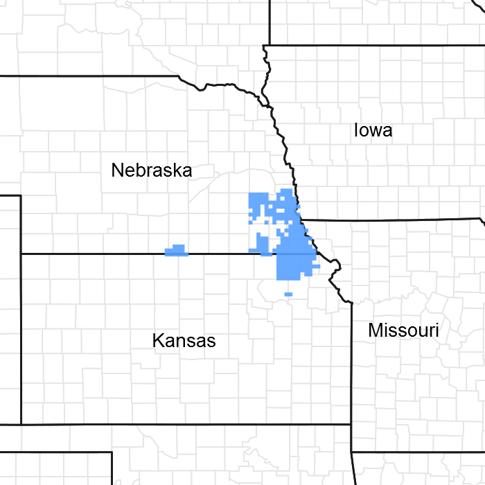
Figure 1. Mapped extent
Areas shown in blue indicate the maximum mapped extent of this ecological site. Other ecological sites likely occur within the highlighted areas. It is also possible for this ecological site to occur outside of highlighted areas if detailed soil survey has not been completed or recently updated.
MLRA notes
Major Land Resource Area (MLRA): 106X–Nebraska and Kansas Loess-Drift Hills
Named the “Nebraska and Kansas Loess-Drift Hills,” Major Land Resource Area (MLRA) 106 is divided almost evenly between southeastern Nebraska (52%), and northeastern Kansas, (48%). The approximately seven-million-acre landscape covers all or parts of thirty counties between the two states. The northern border is located on the north end of Saunders County, Nebraska, and the MLRA extends into Douglas County, Kansas in the south. The Nebraska cities of Beatrice and Lincoln are the major population centers in the north, while Topeka and Lawrence in Kansas are the primary cities in the south. The Platte, Little Nemaha, and the North Fork of the Big Nemaha Rivers flow through the Nebraska side of the MLRA, while the Black Vermillion, the Soldier, and the Delaware Rivers are the major waterways on the Kansas side. The Big Blue River runs through both states, while the Salt Creek hydrologic system located near Lincoln, Nebraska provides habitat for the only known population of the Federally listed endangered Salt Creek Tiger Beetle.
This dissected glacial drift plain primarily consists of broad, smooth ridgetops, and slopes ranging from nearly level to steep. The elevation in MLRA 106 decreases from west to east, and ranges from nearly 1,650 feet to less than 790 feet above sea level. Stream valleys in this landscape are narrow and bordered by steep hills, with 10 to 20 feet of local relief. The river valleys are broader and may drop up to over 160 feet below the adjacent hilltops. The uplands are primarily comprised of glacial drift underlying a mantle of loess, while alluvial deposits are found in the stream and river valleys. Limestone and shale quarries are also located in MLRA 106. The predominant soil orders in this MLRA are mesic, udic, Mollisols, Alfisols, and Entisols. Loams and clays are the primary soil textures in this landscape.
Sixty-two percent of the land in this MLRA has been broken out of native prairie and farmed, while only 23 percent of the grasslands remain. Livestock grazing, primarily by cattle, is the main industry on these remnants. Corn, wheat, soybeans, and grain sorghum are the primary commodity crops, but a significant number of acres are also planted to alfalfa for harvest as hay. With annual precipitation averaging from 40 inches in the southeast, to 28 inches in the northwest, irrigation for crop production is not a critical factor in most years.
The historical matrix vegetation type is Tallgrass Prairie, and big and little bluestem, switchgrass, Indiangrass, sideoats, and blue grama make up the bulk of the warm season species. Historically, western wheatgrass was the dominant cool season grass but today the dominant cool season grasses are introduced grasses, smooth brome in the north and tall fescue in the south. Large and small patch vegetative communities are found primarily along the riparian zones, and on both upland and lowland saline sites. Woodlands make up about six percent of MLRA 106, consisting primarily of green ash, oak, hackberry, boxelder, and maple trees.
Wildlife flourishes in this combination of crop and grassland environments. In a landscape historically occupied by bison herds, white-tailed deer are now the most abundant wild ungulates. A variety of smaller species, including coyote, raccoon, opossum, porcupines, muskrat, beaver, squirrel, and mink thrive in the region. Native grassland bird populations are limited by the lack of contiguous native prairie and the fragmented habitat created by the farmland. The rivers, streams, and lakes harbor excellent fisheries, and migrating and local waterfowl use the wetland complexes. These complexes provide ideal habitat for wading and shore bird species as well.
This landscape serves as a backdrop for a disturbance driven ecosystem, evolving under the influences of herbivory, fire, and variable climate. Historically, these processes created a heterogeneous mosaic of plant communities and structure heights across the region. Any given site in this landscape experienced fire every three to four years. Fires were caused by lightning strikes and also were set by Native Americans, who used fire for warfare, signaling, and to refresh the native grasses. The Indigenous inhabitants understood the value of fire as a tool and that the highly palatable growth following a fire provided excellent forage for their horses and attracted grazing game animals such as bison and elk.
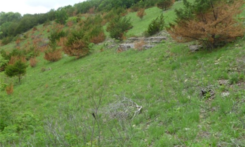
Land use patterns by post European settlers have fragmented the native grasslands through conversion to cropland, transportation corridors, and other developments. This has significantly altered the natural fire regime allowing encroachment by native and introduced shrubs and trees into the native prairie remnants throughout the MLRA. Aggressive fire suppression policies have exacerbated this process to the point that shrub and tree encroachment is a major ecological threat in the majority of both native and reseeded grasslands. Introduction of eastern red cedar as a windbreak species further facilitates invasion by this species. While eastern red cedar is native to the landscape, the historic population in MLRA 106 was limited to isolated pockets in rugged river drainageways that were protected from fire. Widespread plantings of windbreaks with eastern red cedar as a primary component have provided a seed source for the aggressive woody plant. The ensuing encroachment into the native grasslands degrades the native wildlife habit and causes significant forage loss for domestic livestock. Since it is not a root sprouter, eastern red cedar is very susceptible to fire when under six feet tall. Management with prescribed fire is exceedingly effective if applied before this stage. Larger eastern red cedars can also be controlled with fire, but successful application requires the use of specifically designed ignition and holding techniques.
Classification relationships
►USDA-NRCS (2022)◄
Land Resource Region – M, Central Feed Grains and Livestock Region
Major Land Resource Area (MLRA) – 106
►Fenneman (1916) Physiographic Regions ◄
Division – Interior Plains
Province – Central Lowland
Section – Dissected Till Plains
►USDA-USFS (2007) Ecoregions◄
Domain – Humid Temperate
Division – Prairie
Province – Prairie Parkland (Temperate)
Section – Central Dissected Till Plains (251C)
►EPA Ecoregions (Omernik 1997)◄
I – Great Plains (9)
II – Temperate Prairies (9.2)
III – Western Corn Belt Plains (9.2.3)
IV – Loess and Glacial Drift Hills (47i)
►Associated Counties◄
Nebraska: Butler, Cass, Gage, Jefferson, Johnson, Lancaster, Nemaha, Otoe, Pawnee, Richardson, Saline, Saunders, Seward
Kansas: Atchison, Brown, Doniphan, Douglas, Franklin, Jackson, Jefferson, Johnson, Leavenworth, Marshall, Nemaha, Osage, Pottawatomie, Shawnee, Wabaunsee, Washington, Wyandotte
Ecological site concept
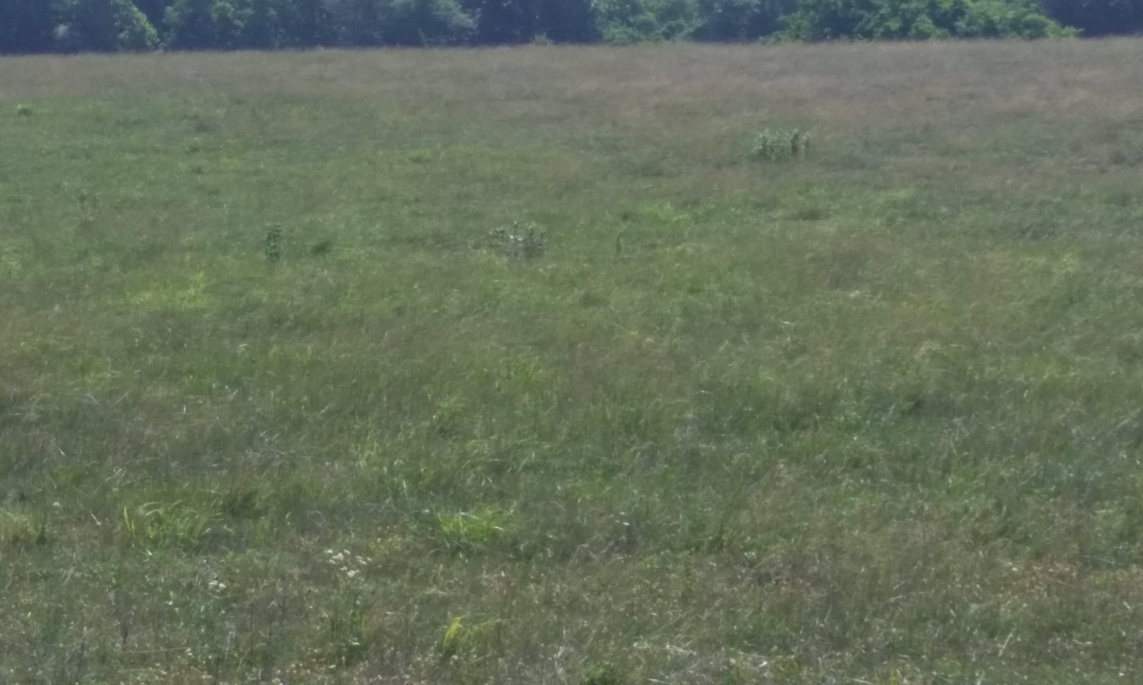
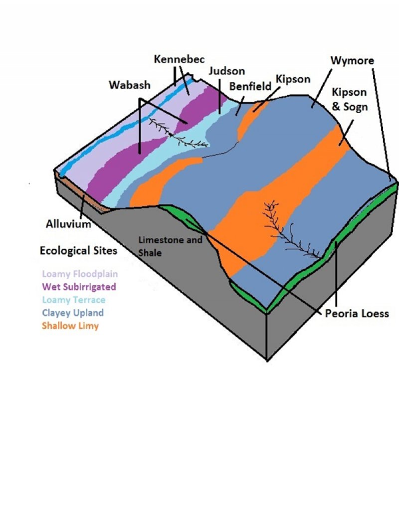
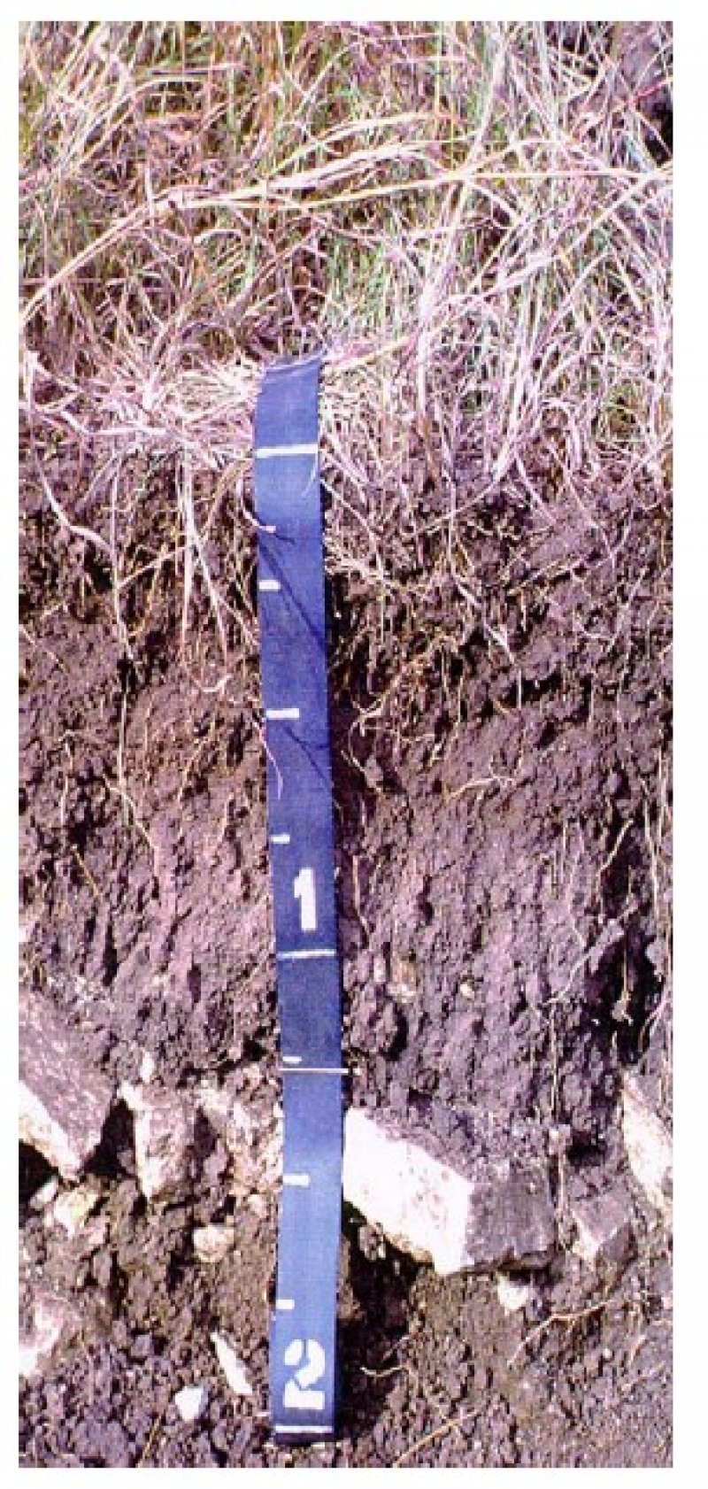
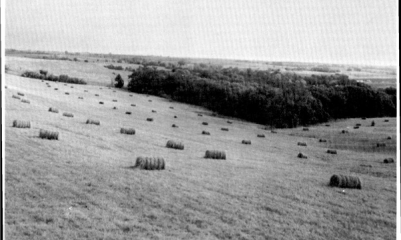
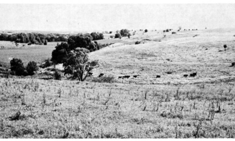
The Shallow Limy ecological site is located on nearly level to sloping upland landscapes and does not receive additional moisture from runoff or overflow. The site supplies runoff water to those sites lower in the landscape. Slopes typically range from 3 to 20 percent but may be as steep as 70 percent. The soils associated with the Shallow Limy ecological site are shallow to very shallow to bedrock. Surface textures are primarily silty clay loam and silt loam. These somewhat excessively drained soils formed in residuum weathered from calcareous silty shales and limestone. The vegetation of the Reference Community is mixed grass prairie. The primary grasses include big bluestem, little bluestem, and sideoats grama. Secondary grasses include switchgrass, Indiangrass, and blue grama. Forbs are common and diverse. Vegetative production is lower on the Shallow Limy ecological site than that of associated upland sites due to the proximity of bedrock to the soil surface. This site is more intact than many other upland sites within the MLRA as it is better suited to grazing than to farming due to the shallowness of the site.
Associated sites
| R106XY074NE |
Clayey Upland The Clayey Upland ecological site is often found adjacent to the Shallow Limy site. |
|---|---|
| R106XY075NE |
Loamy Upland The Loamy Upland ecological site is often located adjacent to the Shallow Limy site. |
Similar sites
| R106XY074NE |
Clayey Upland The Clayey Upland ecological site is an upland site that is often found adjacent to the Shallow Limy ecological site. Clayey Upland sites are moderately deep to very deep and are not calcareous near the surface while Shallow Limy sites are calcareous at or near the surface and bedrock is within 20 inches of the surface. |
|---|---|
| R106XY076NE |
Limy Upland The Limy Upland ecological site is an upland site that is often found adjacent to the Shallow Limy ecological site. While both sites are calcareous at or near the surface, Limy Upland sites are very deep while bedrock is within 20 inches of the surface on Shallow Limy sites. |
| R106XY075NE |
Loamy Upland The Loamy Upland ecological site is an upland site that is often found adjacent to the Shallow Limy ecological site. Loamy Upland sites are deep to very deep and are not calcareous near the surface while Shallow Limy sites are calcareous at or near the surface and bedrock is within 20 inches of the surface. |
Table 1. Dominant plant species
| Tree |
Not specified |
|---|---|
| Shrub |
Not specified |
| Herbaceous |
(1) Andropogon gerardii |

Click on box and path labels to scroll to the respective text.
| T1A | - | Heavy grazing or haying with inadequate growing season recovery periods. |
|---|---|---|
| T1B | - | Woody encroachment and no fire or woody species management. |
| T2A | - | Woody encroachment and no fire or woody species management. |
| R3A | - | Prescribed burning, wildfire, timber harvest, and brush management. |
| R3B | - | Prescribed burning, wildfire, timber harvest, and brush management. |
State 1 submodel, plant communities
| 1.1A | - | Continuous season long grazing or rotational grazing with inadequate growing season recovery time. |
|---|---|---|
| 1.1B | - | Prolonged absence (>5 years) of herbivory and fire. |
| 1.2A | - | Prescribed grazing during the cool season portion of the growing season. |
| 1.2B | - | Continued season long grazing or rotational grazing or haying with inadequate, growing season recovery periods. |
| 1.2C | - | Prolonged absence (>5 years) of herbivory and fire. |
| 1.3A | - | Prescribed grazing with high intensity grazing during the early and late portions of the growing season. |
| 1.3B | - | Prolonged absence (>5 years) of herbivory and fire. |
| 1.4A | - | Reintroduction of herbivory and fire. |
| 1.4B | - | Reintroduction of herbivory and fire. |
| 1.4C | - | Reintroduction of herbivory and fire. |