Natural Resources
Conservation Service
Ecological site R107XB023IA
Natric Floodplain Prairie
Last updated: 5/21/2020
Accessed: 02/13/2026
General information
Provisional. A provisional ecological site description has undergone quality control and quality assurance review. It contains a working state and transition model and enough information to identify the ecological site.
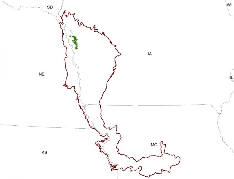
Figure 1. Mapped extent
Areas shown in blue indicate the maximum mapped extent of this ecological site. Other ecological sites likely occur within the highlighted areas. It is also possible for this ecological site to occur outside of highlighted areas if detailed soil survey has not been completed or recently updated.
MLRA notes
Major Land Resource Area (MLRA): 107X–Iowa and Missouri Deep Loess Hills
The Iowa and Missouri Deep Loess Hills (MLRA 107B) includes the Missouri Alluvial Plain, Loess Hills, Southern Iowa Drift Plain, and Central Dissected Till Plains landform regions (Prior 1991; Nigh and Schroeder 2002). It spans four states (Iowa, 53 percent; Missouri, 32 percent; Nebraska, 12 percent; and Kansas 3 percent), encompassing over 14,000 square miles (Figure 1). The elevation ranges from approximately 1,565 feet above sea level (ASL) on the highest ridges to about 600 feet ASL along the Missouri River near Glasgow in central Missouri. Local relief varies from 10 to 20 feet in the major river floodplains, to 50 to 100 feet in the dissected uplands, and loess bluffs of 200 to 300 feet along the Missouri River. Loess deposits cover most of the area, with deposits reaching a thickness of 65 to 200 feet in the Loess Hills and grading to about 20 feet in the eastern extent of the region. Pre-Illinoian till, deposited more than 500,000 years ago, lies beneath the loess and has experienced extensive erosion and dissection. Pennsylvanian and Cretaceous bedrock, comprised of shale, mudstones, and sandstones, lie beneath the glacial material (USDA-NRCS 2006).
The vegetation in the MLRA has undergone drastic changes over time. Spruce forests dominated the landscape 30,000 to 21,500 years ago. As the last glacial maximum peaked 21,500 to 16,000 years ago, they were replaced with open tundras and parklands. The end of the Pleistocene Epoch saw a warming climate that initially prompted the return of spruce forests, but as the warming continued, spruce trees were replaced by deciduous trees (Baker et al. 1990). Not until approximately 9,000 years ago did the vegetation transition to prairies as climatic conditions continued to warm and subsequently dry. Between 4,000 and 3,000 years ago, oak savannas began intermingling within the prairie landscape, while the more wooded and forested areas maintained a foothold in sheltered areas. This prairie-forest transition ecosystem formed the dominant landscapes until the arrival of European settlers (Baker et al. 1992).
Classification relationships
Major Land Resource Area (MLRA): Iowa and Missouri Deep Loess Hills (107B) (USDA-NRCS 2006)
USFS Subregions: Central Dissected Till Plains Section (251C); Missouri River Alluvial Plain (251Cg) (Cleland et al. 2007)
U.S. EPA Level IV Ecoregion: Missouri Alluvial Plain (47d) (USEPA 2013)
Biophysical Setting (LANDFIRE 2009): Western Great Plains Depressional Wetland Systems (3914950)
Ecological Systems (National Vegetation Classification System, Nature Serve 2015): Western Great Plains Saline Depression Wetland (CES303.669)
Nebraska Game and Parks Commission (Steinauer and Rolfsmeier 2010): Eastern Saline Meadow
Plant Associations (National Vegetation Classification System, Nature Serve 2015): Distichilis spicata – Hordeum jubatum – (Poa arida, Iva annua) Wet Meadow (CEGL002031)
Ecological site concept
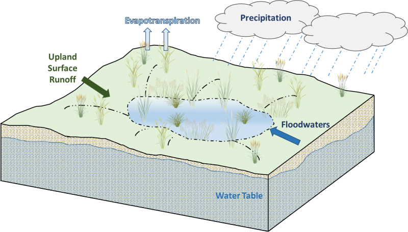
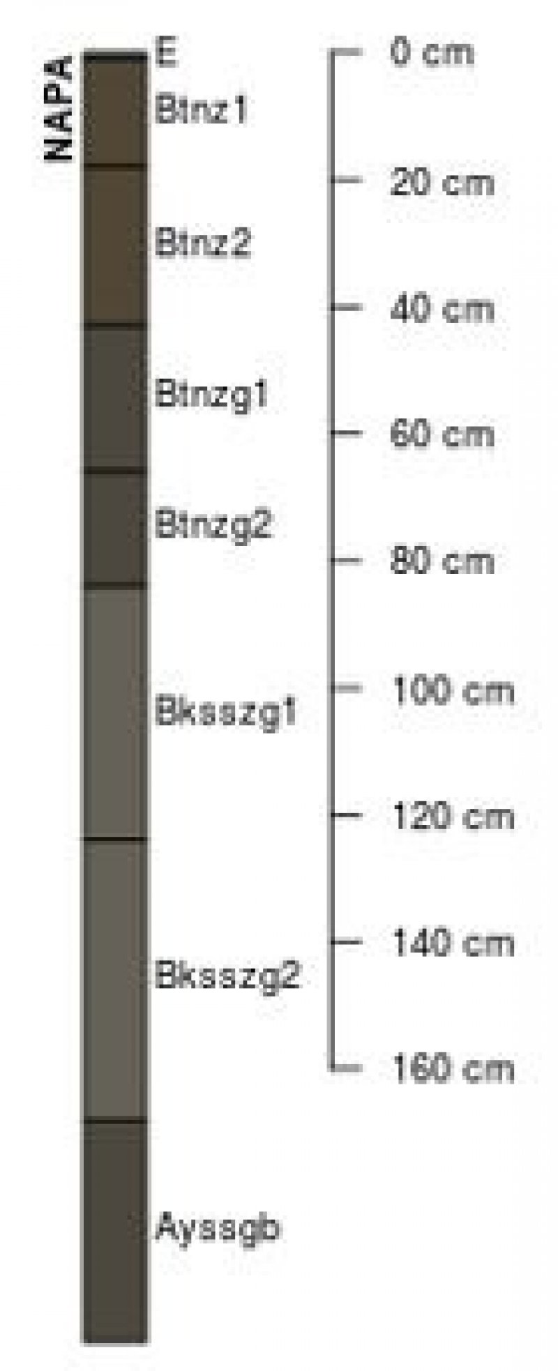
Natric Floodplain Prairies are located within the green areas on the map (Figure 1). They occur on floodplains in shallow depressions. Soils are Mollisols and Vertisols that are poorly-drained and very deep. These soils formed from clayey alluvium that are slightly to moderately affected by soluble salts, which accumulated from seeps associated with the underlying Dakota Sandstone bedrock (Steinauer and Rolfsmeier 2010). As a result, the associated vegetation is typically dominated by salt-tolerant species.
The historic pre-European settlement vegetation on this site was dominated by graminoids and annual herbs adapted to conditions of varying salinity. Species diversity occurs on a gradient with diversity increasing as salinity decreases. Saltgrass (Distichlis spicata (L.) Greene) and foxtail barley (Hordeum jubatum L.) are the dominant and diagnostic species for the site. Prairie junegrass (Koeleria macrantha (Ledeb.) Schult.), blue grama (Bouteloua gracilis (Willd. ex Kunth) Lag. ex Griffiths), western wheatgrass (Pascopyrum smithii (Rydb.) Á. Löve), and prairie cordgrass (Spartina pectinata Bosc ex Link) are other common grass associates. Few herbaceous species can be found within this site. Those present include Pursh seepweed (Suaeda calceoliformis (Hook.) Moq.), annual marsh elder (Iva annua L.), and red swampfire (Salicornia rubra A. Nelson) (Steinauer and Rolfsmeier 2010; NatureServe 2015). Historically, fluctuating high water tables and seasonal flooding were the primary disturbance factors of this ecological site (LANDFIRE 2009; Steinauer and Rolfsmeier 2010; NatureServe 2015).
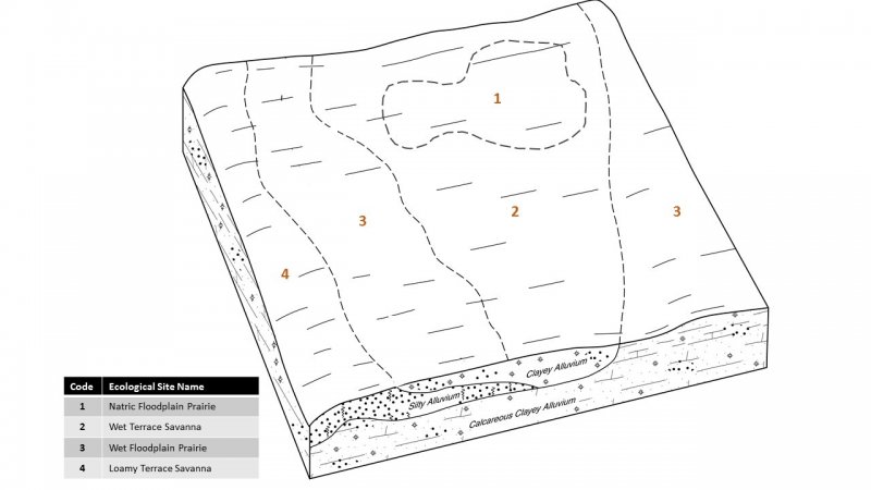
Associated sites
| R107XB021MO |
Wet Terrace Savanna Alluvial soils that are somewhat poorly to poorly-drained including Blackoar, Blencoe, Bremer, Burcham, Hornick, Luton, and Nevin |
|---|---|
| R107XB020MO |
Loamy Terrace Savanna Moderately well-drained soils on terraces including Ankeny, Anthon, Cott, Cotter, Keg, Norborne, Salix, and Wiota |
| R107XB019MO |
Wet Floodplain Prairie Poorly-drained alluvial soils on floodplains far from the stream channel including Ackmore, Aquents, Bremer, Calco, Colo, Cooper, Fluvaquents, Fluvaquents-sandy, Fluvaquents-silty, Forney, Grantcenter, Holly Springs, Kezan, Lakeport, Larpenteur, Lawson, Mt. Sterling, Nishna, Orthents, Solomon, Tieville, Uturin, Vesser, Wabash, Woodbury, and Zook |
Similar sites
| R107XB019MO |
Wet Floodplain Prairie Wet Floodplain Prairies have somewhat poorly to poorly-drained soils but are not affected by salts/gypsum |
|---|---|
| R107XB025IA |
Loamy Floodplain Prairie Loamy Floodplain Prairies have moderately well-drained soils and are not affected by salt/gypsum |
| R107XB018MO |
Ponded Floodplain Marsh Ponded Floodplain Marshes experience flooding and ponded, but soils are not affected by salts/gypsum |
Table 1. Dominant plant species
| Tree |
Not specified |
|---|---|
| Shrub |
Not specified |
| Herbaceous |
(1) Distichlis spicata |
Click on box and path labels to scroll to the respective text.
