Natural Resources
Conservation Service
Ecological site R116AY017MO
Dolomite Exposed Cliff
Last updated: 9/24/2020
Accessed: 11/23/2024
General information
Provisional. A provisional ecological site description has undergone quality control and quality assurance review. It contains a working state and transition model and enough information to identify the ecological site.

Figure 1. Mapped extent
Areas shown in blue indicate the maximum mapped extent of this ecological site. Other ecological sites likely occur within the highlighted areas. It is also possible for this ecological site to occur outside of highlighted areas if detailed soil survey has not been completed or recently updated.
MLRA notes
Major Land Resource Area (MLRA): 116A–Ozark Highland
The Ozark Highland constitutes the Salem Plateau of the Ozark Uplift. Elevation ranges from about 300 feet on the southeast edge of the Ozark escarpment, to about 1,600 feet in the west, adjacent to the Burlington Escarpment of the Springfield Plateau. The underlying bedrock is mainly horizontally bedded Ordovician-aged dolomites and sandstones that dip gently away from the uplift apex in southeast Missouri. Cambrian dolomites are exposed on deeply dissected hillslopes. In some places, Pennsylvanian and Mississipian sediments overlie the plateau. Relief varies, from the gently rolling central plateau areas to deeply dissected hillslopes associated with drainageways such as the Buffalo, Current, Eleven Point and White Rivers.
Classification relationships
Terrestrial Natural Community Type in Missouri (Nelson, 2010):
The reference state for this ecological site is most similar to a Dry Limestone/Dolomite Cliff.
National Vegetation Classification System Vegetation Association (NatureServe, 2010):
The reference state for this ecological site is most similar to Limestone - Dolostone Midwest Dry Cliff Sparse Vegetation (CEGL002291).
Geographic relationship to the Missouri Ecological Classification System (Nigh & Schroeder, 2002):
This ecological site occurs across the Ozark Highlands Section.
Ecological site concept
NOTE: This is a “provisional” Ecological Site Description (ESD) that is under development. It contains basic ecological information that can be used for conservation planning, application and land management. After additional information is collected, analyzed and reviewed, this ESD will be refined and published as “Approved”.
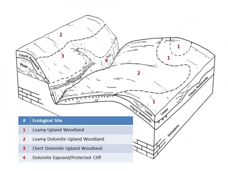
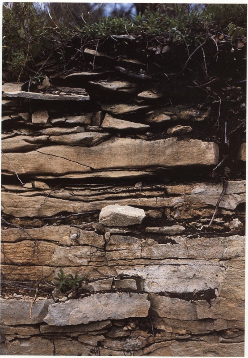
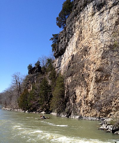
Dolomite Exposed Cliffs occur along deeply dissected river valleys throughout the Ozark Highland. They occupy southerly and westerly aspects, and are mapped in complex with the Dolomite Protected Cliff ecological site. Soils are very shallow to limestone or dolomite. The reference plant community consists of scattered small trees, shrubs, grasses, forbs, and ferns, occupying cracks and ledges in the cliff face.
Associated sites
| F116AY044MO |
Chert Dolomite Upland Woodland Chert Dolomite Upland Woodlands are adjacent and upslope. |
|---|---|
| F116AY048MO |
Chert Dolomite Exposed Backslope Woodland Chert Dolomite Exposed Backslope Woodlands are adjacent. |
| R116AY020MO |
Shallow Dolomite Upland Glade/Woodland Shallow Dolomite Upland Glade/Woodlands are adjacent. |
Similar sites
| R116AY014MO |
Dolomite Protected Cliff Dolomite Protected Cliffs are mapped in complex with the Dolomite Exposed Cliff ecological sites. |
|---|
Table 1. Dominant plant species
| Tree |
(1) Juniperus virginiana |
|---|---|
| Shrub |
(1) Celastrus scandens |
| Herbaceous |
(1) Bouteloua curtipendula |
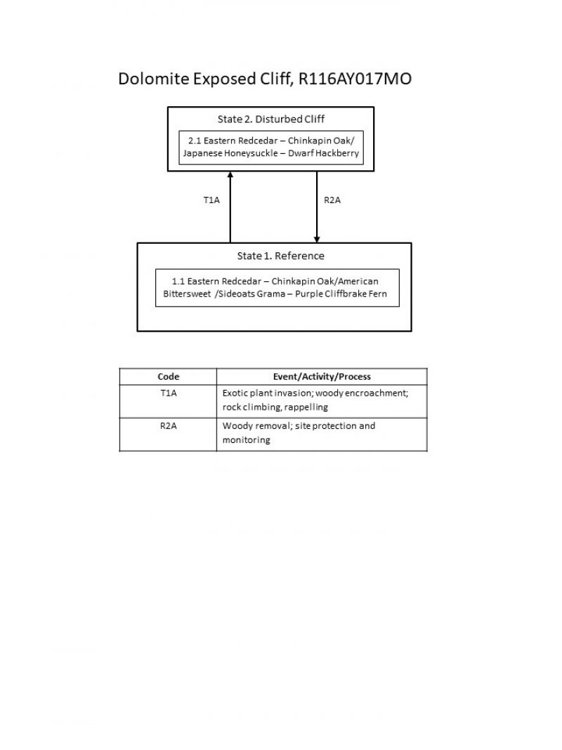
Click on box and path labels to scroll to the respective text.


