Natural Resources
Conservation Service
Ecological site F125XY002WV
Interbedded Sedimentary Colluvium
Last updated: 9/27/2024
Accessed: 02/26/2026
General information
Provisional. A provisional ecological site description has undergone quality control and quality assurance review. It contains a working state and transition model and enough information to identify the ecological site.

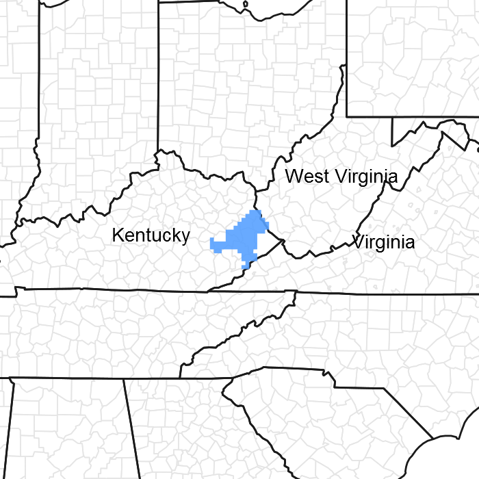
Figure 1. Mapped extent
Areas shown in blue indicate the maximum mapped extent of this ecological site. Other ecological sites likely occur within the highlighted areas. It is also possible for this ecological site to occur outside of highlighted areas if detailed soil survey has not been completed or recently updated.
MLRA notes
Major Land Resource Area (MLRA): 125X–Cumberland Plateau and Mountains
This area is in Kentucky (43 percent), Tennessee (25 percent), West Virginia (20 percent), Virginia (9 percent), and Alabama (3 percent). It makes up about 20,330 square miles (52,685 square kilometers). The towns of Logan, Madison, Welch, and Williamson, West Virginia, and Norton and Wise, Virginia, are in the northeastern part of this area. The towns of Middlesboro, Williamsburg, Corbin, London, Hazard, and Pikeville, Kentucky, and La Follette and Crossville, Tennessee, are in the area. Chattanooga, Tennessee, and Huntsville, Alabama, are just outside the southeast and southwest corners, respectively.
Interstates 24, 64/77, 75, and 40/75 cross this area. The Cumberland Gap National Historic Park is in the part of this area along the Virginia and Kentucky border. The Daniel Boone and Jefferson National Forests occur in this area. Numerous State forests and parks are throughout the area (USDA-NRCS, 2006).
Ecological site concept
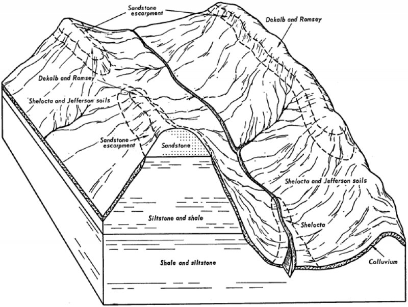
Soils included in this PES occur primarily in uplands (upper slopes of mountains, plateaus, side slopes, etc.)and formed in residuum or colluvium of mixed geology including acid sandstone, shale, siltstone, and quartzite. Outcrops of bedrock are common.
This PES is chiefly in forest, dominated by a mix of tulip poplar, upland oaks, Virginia and shortleaf pine. Mountain laurel is common in the shrub layer. Eastern hemlock may be an important tree, since it is now threatened by the hemlock woolly adelgid. Red maple, redbud and sassafras commonly occur as regeneration. Dichanthelium boscii and the violets are commonly noted understory species.
There may be potential habitat in this PES for the golden-winged warbler, listed as a high conservation concern and prioritized by NRCS, among other agencies and organizations. https://www.sciencebase.gov/catalog/item/55e36f1fe4b05561fa208207 accessed 1/3/2017
Associated sites
| F125XY001WV |
Sandstone Residuum |
|---|---|
| F125XY003WV |
Interbedded Sedimentary Uplands |
| F125XY004WV |
Floodplain Alluvium |
| F125XY005WV |
Low Stream Terrace Alluvium |
Similar sites
| F125XY001WV |
Sandstone Residuum |
|---|
Table 1. Dominant plant species
| Tree |
(1) Liriodendron tulipifera |
|---|---|
| Shrub |
(1) Kalmia latifolia |
| Herbaceous |
(1) Dichanthelium boscii |
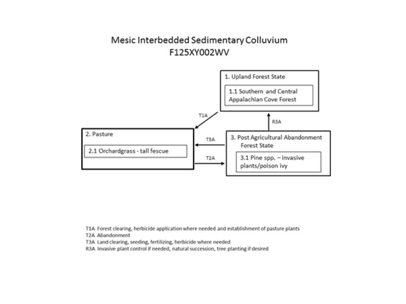
Click on box and path labels to scroll to the respective text.

