Natural Resources
Conservation Service
Ecological site F125XY004WV
Floodplain Alluvium
Last updated: 9/27/2024
Accessed: 02/26/2026
General information
Provisional. A provisional ecological site description has undergone quality control and quality assurance review. It contains a working state and transition model and enough information to identify the ecological site.
MLRA notes
Major Land Resource Area (MLRA): 125X–Cumberland Plateau and Mountains
This area is in Kentucky (43 percent), Tennessee (25 percent), West Virginia (20 percent), Virginia (9 percent), and Alabama (3 percent). It makes up about 20,330 square miles (52,685 square kilometers). The towns of Logan, Madison, Welch, and Williamson, West Virginia, and Norton and Wise, Virginia, are in the northeastern part of this area. The towns of Middlesboro, Williamsburg, Corbin, London, Hazard, and Pikeville, Kentucky, and La Follette and Crossville, Tennessee, are in the area. Chattanooga, Tennessee, and Huntsville, Alabama, are just outside the southeast and southwest corners, respectively.
Interstates 24, 64/77, 75, and 40/75 cross this area. The Cumberland Gap National Historic Park is in the part of this area along the Virginia and Kentucky border. The Daniel Boone and Jefferson National Forests occur in this area. Numerous State forests and parks are throughout the area (USDA-NRCS, 2006).
Ecological site concept
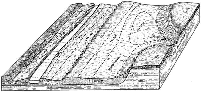
Soils typical of this site are on or near flood plains. Slopes range from 0 to 10 percent. These soils formed from limestone, sandstone and shale, or quartzite. Near the type location the mean annual temperature ranges from 53 to 59.4 degrees F., and mean annual precipitation ranges from 40 to 53.9 inches.
This site occurs entirely in the mesic temperature regime. Historic vegetation is unclear but most likely consisted of water-tolerant tree species and patches of canebrake. Much of this site has been cleared for agriculture or developed.
Associated sites
| F125XY001WV |
Sandstone Residuum |
|---|---|
| F125XY002WV |
Interbedded Sedimentary Colluvium |
| F125XY003WV |
Interbedded Sedimentary Uplands |
| F125XY005WV |
Low Stream Terrace Alluvium |
Table 1. Dominant plant species
| Tree |
(1) Liriodendron tulipifera |
|---|---|
| Shrub |
Not specified |
| Herbaceous |
Not specified |
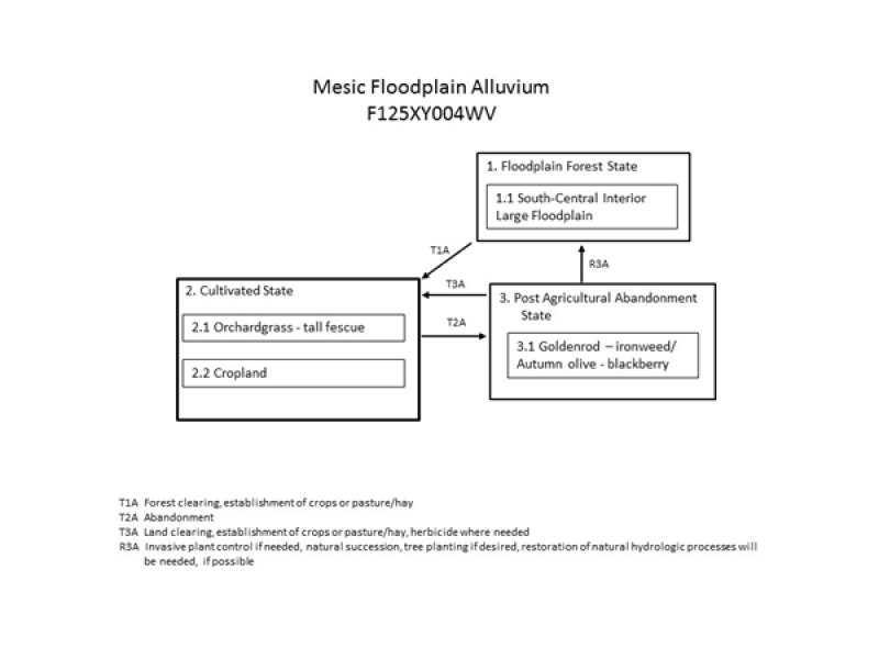
Click on box and path labels to scroll to the respective text.

