Ecological dynamics
The information in this ecological site description (ESD), including the state-and-transition model (STM), was developed using archeological and historical data, professional experience, and scientific studies. The information is representative of a complex set of plant communities. Not all scenarios or plants are included. Key indicator plants, animals, and ecological processes are described to inform land management decisions.
Introduction – Southern Arkansas, western Louisiana, and eastern Texas have been deemed the Pineywoods because of the vast expanse of pine trees. The region represents the western edge of the southern coniferous belt. Historically, the area was covered by pines with mixed hardwoods, sparse shrubs, and a diverse understory of grasses and forbs. Fire played a significant role in reducing the woody competition that generally out-competes the herbaceous understory layer. Fire suppression and land conversion have reduced the amount of historical communities in existence today.
Background – Prior to settlement by the Europeans, the reference state for the Loamy Uplands was a Shortleaf Pine/Red Oak (Pinus echinata/Quercus falcata) Woodland. Remnants of this presumed historic plant community still exist where natural conditions are replicated through conservation management techniques. Evidence of the reference state is found in accounts of early historic explorers to the area, historic forest and biological survey teams, as well as recent ecological studies in the last 30 years. The age of this woodland community varies, and has a diverse understory of grasses and forbs.
Settlement Management – As human settlement increased throughout the area, so did the increase in logging and grazing by domestic livestock. The logging became so extensive that by the 1930’s most of the region had been cut-over. Replanting trees to historic communities was not common and early foresters began planting loblolly pine (Pinus taeda) for its quick growth. As more people colonized they began suppressing fire, which allowed dense thickets of shrubs to replace the herbaceous understory.
Current Management and State – Today much of the remnant forest is gone, replaced by pine plantations, crops, and pastures. The areas that were not converted have been fire-suppressed so long that loblolly pine and fire intolerant hardwoods populate the overstory structure. Currently, U.S. Forest Service properties are the best place to view the remnant sites. Some private individuals have begun restoring communities through selective tree planting and retention of communities that remain. Other restoration efforts include mimicking natural-disturbance regimes through gap-phase regeneration on plantation sites.
Fire Regimes – Fire was a natural and important disturbance throughout the Western Gulf Plain. Fire occurred naturally from lightning strikes and by Native Americans for game movement. The reference community developed with a frequency of fire every 3 to 5 years. Fires usually occurred in early spring, removing senescent vegetation, recycling nutrients and minerals, and spurring new plant growth. Late summer fires occurred as well, but with a different community effect. Summer fires burned hotter and with more intensity, greatly suppressing the shrub canopy layer. The summer fires also shifted the ecological site transitional state by decreasing grass densities and increasing forb densities. The topography, fuel loads, and other conditions caused patchy burns throughout the region resulting in mosaic patterns of plant communities and a heterogeneous landscape.
Disturbance Regimes – Extreme weather events occur occasionally throughout the region. Tornados uproot trees and open canopies in the spring months. In the late summer and early fall, hurricanes or tropical depressions often make landfall, dumping excessive amounts of rain and toppling trees with high winds. Another cause of large canopy openings is the effects of the southern pine beetle (Dendroctonus frontalis). Starting in the late 1950’s, beetle outbreaks have occurred every 6 to 9 years (although a major attack has not occurred in some time), usually when the trees are stressed due to multiple environmental factors.
Plant Community Interactions – The deep loamy soils provide an excellent growing medium with very little restrictions. No special plant adaptions are necessary to persist in these soils, as compared to plants adapted to overly saturated (wetlands) or overly droughty (deep sands) conditions. Because of the high desirability for plants to grow on the ecological site, great competition exists between plants as they try and occupy space, rapidly taking advantage of sunlight. High amounts of biomass are produced and, left unchecked through management or natural frequencies of fire, the understory is quickly occupied by shrubs and understory saplings. Little bare ground exists in natural conditions and high amounts of litter accumulate. The sites typically support a basal area of trees from 80 to 120 square feet result in 65 to 85 percent canopy cover. Mature stands of pines will attain heights over 100 feet. The sites are characterized by high productivity of all plant types.
State 1
Woodland
There are two communities in the Woodland State: Shortleaf Pine/Red Oak Woodland Community (1.1) and the Fire-primed Understory Community (1.2). State 1 has a moderate overstory cover (65 to 85 percent) of primarily shortleaf pine and red oak. The understory is heavily vegetated with grasses, forbs, and shrubs. In large part to the overall productivity of the site, high levels of biomass exist and very little bare ground. Plants grow quickly and search to colonize every useable space.
Natural disturbances of fires, lightning strikes, hurricanes (wind throw), ice events (rare), and beetle infestations aid in maintaining the uneven-age structure. Understory saplings are constantly growing and trying to occupy space, but the natural canopy spacing is kept intact by periodic fires ranging from 3 to 5 years. Representative basal areas range from 80 to 120 square feet per acre. The basal area and canopy cover generally increase at a parallel rate.
Community 1.1
Shortleaf Pine/Red Oak Woodland
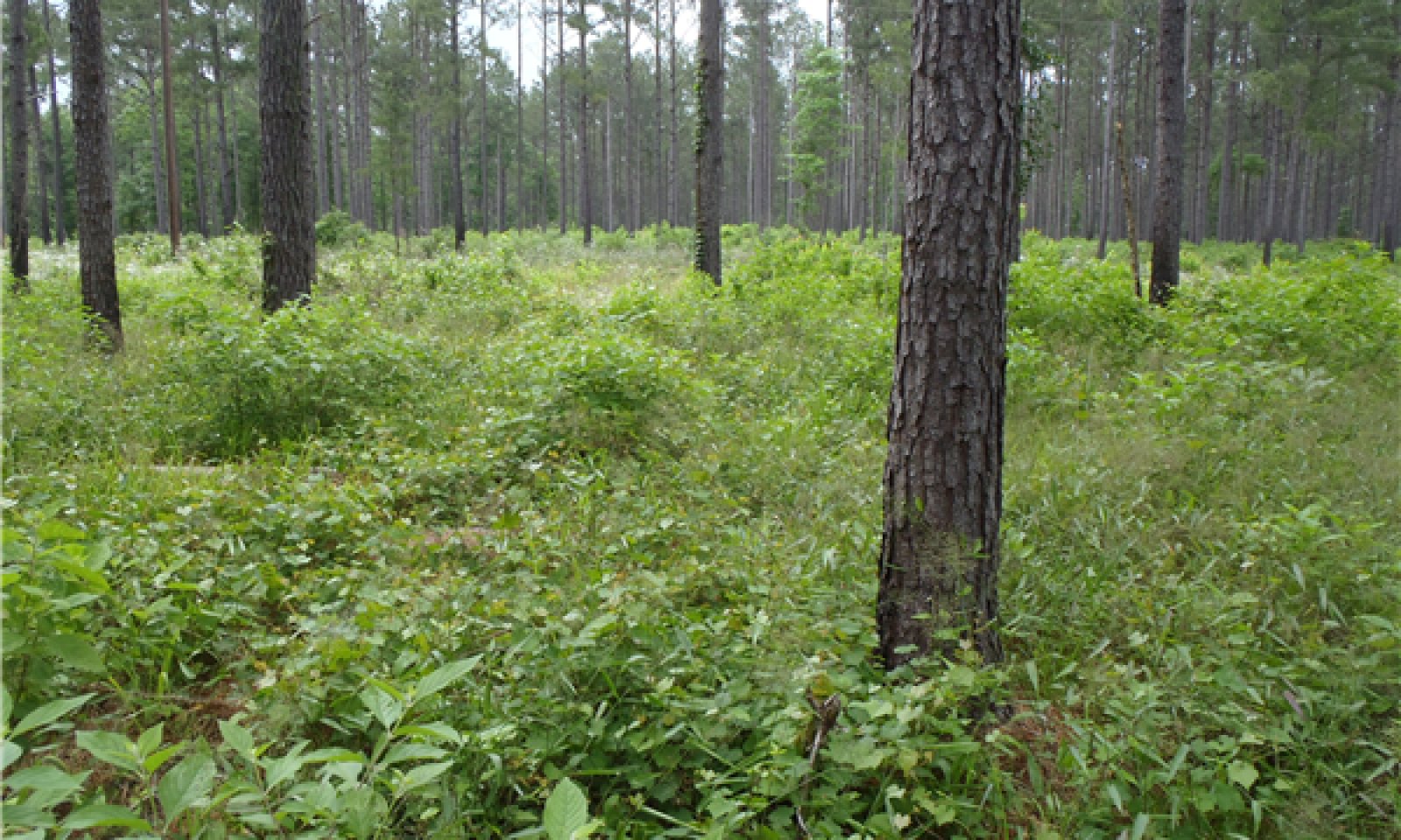
The Shortleaf Pine/Red Oak Woodland (1.1) is the first community in State 1. Litter accumulation is moderate and understory vegetation is naturally dense. The overstory canopy is dominated by shortleaf pine and red oaks, and are usually in higher densities (total basal area) than the adjacently surrounding upland sites. The overstory canopy can also be interspersed with post oak (Quercus stellata), blackjack oak (Quercus marilandica), white oak (Quercus alba), and black hickory (Carya texana). The sites can be dominated by shortleaf pines, 100 percent canopy cover, but range as low as 60 percent with the oak and hickories comprising the rest of the overstory. Given time to mature, the sites produce tall, straight overstory pines which can reach heights above 100 feet.
This community is characterized by a dense ground layer with relatively no bare ground (less than 5 percent). Needleleaf rosette grass (Dichanthelium aciculare) is a highly abundant grass throughout the herbaceous understory. Other grasses seen, though not as dominant are longleaf woodoats (Chasmanthium sessiliflorum), variable panicgrass (Dichanthelium commutatum), and little bluestem (Schizachyrium scoparium). Forbs occupying the site include flowering spurge (Euphorbia corollata), hairy small-leaf ticktrefoil (Desmodium ciliare), and downy milkpea (Galactia volubilis). The shrub layer of the community is very conspicuous, containing numerous American beautyberry (Callicarpa americana) and yaupon (Ilex vomitoria).
Table 6. Ground cover
| Tree foliar cover |
0-20%
|
| Shrub/vine/liana foliar cover |
5-25%
|
| Grass/grasslike foliar cover |
50-75%
|
| Forb foliar cover |
5-25%
|
| Non-vascular plants |
0%
|
| Biological crusts |
0%
|
| Litter |
15-50%
|
| Surface fragments >0.25" and <=3" |
0%
|
| Surface fragments >3" |
0%
|
| Bedrock |
0%
|
| Water |
0%
|
| Bare ground |
0-5%
|
Table 7. Canopy structure (% cover)
| Height Above Ground (ft) |
Tree |
Shrub/Vine |
Grass/
Grasslike |
Forb |
| <0.5 |
3-15% |
5-50% |
5-50% |
1-20% |
| >0.5 <= 1 |
1-15% |
5-40% |
25-50% |
3-10% |
| >1 <= 2 |
1-15% |
10-40% |
25-75% |
3-5% |
| >2 <= 4.5 |
1-10% |
3-25% |
5-50% |
1-3% |
| >4.5 <= 13 |
1-15% |
1-10% |
– |
– |
| >13 <= 40 |
3-70% |
– |
– |
– |
| >40 <= 80 |
40-70% |
– |
– |
– |
| >80 <= 120 |
10-70% |
– |
– |
– |
| >120 |
– |
– |
– |
– |
Community 1.2
Fire-primed Understory
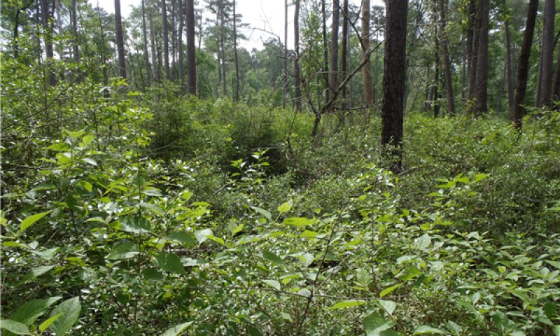
The Fire-primed Understory (1.2) phase has an increased accumulation of previous years’ growth of grasses, forbs, and shrubs, increasing the fuel load for fire. The shrub layer is on the verge of occupying the entire understory. Litter has built up, bare ground has lessened, and last year’s vegetative growth may still be seen on the ground layer. Under natural conditions, only fire tolerant saplings will grow into the overstory of State 1.
Pathway 1.1A
Community 1.1 to 1.2
Shortleaf Pine/Red Oak Woodland
The driver for the community shift is time since the last fire. As post-fire time increases, so does the foliar cover by shrub species. As the grasses and forbs age, their senesced leaves increase fine fuel levels.
Pathway 1.2A
Community 1.2 to 1.1
Shortleaf Pine/Red Oak Woodland
The driver for the community shift is fire. As fire burns through the understory, it encourages a diverse herbaceous layer while suppressing shrubs and tree seedlings.
State 2
Mixed Mid-story
One community exists in the Mixed Mid-story (2) State: the Mixed Mid-story Community (2.1). This community represents a transitioning state between the historical climax community (State 1) and the steady-state of the Mixed Forest (State 3). Without fire or management, the understory is quickly overtaken by shrubs and saplings which shade out grasses and forbs. The site begins to lose diversity amongst vegetative types.
Community 2.1
Mixed Mid-story
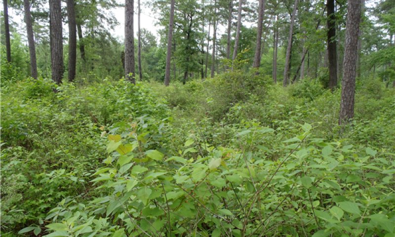
Encroachment by fire intolerant species like sweetgum (Liquidambar stryacifula), red maple (Acer rubrum), and loblolly pine begin to grow in the mid-story. Added foliar cover by the shrubs and saplings reduce the light penetration to the lower growing herbaceous species. The shading reduces the diversity of the environment. Both factors combine to allow only the most dominant species to propagate. Longleaf woodoats, yaupon, and American beautyberry quickly become the most dominant understory vegetation.
Tree seedlings have grown higher and are beginning to escape the effects of fire and will become part of the overstory given more time with lack of management. The species present in the reference community will still be found, only in lesser amounts because the canopy cover is creating a better environment for fire-intolerant and shade-loving species.
Table 8. Ground cover
| Tree foliar cover |
5-20%
|
| Shrub/vine/liana foliar cover |
20-45%
|
| Grass/grasslike foliar cover |
5-25%
|
| Forb foliar cover |
0-5%
|
| Non-vascular plants |
0%
|
| Biological crusts |
0%
|
| Litter |
35-75%
|
| Surface fragments >0.25" and <=3" |
0%
|
| Surface fragments >3" |
0%
|
| Bedrock |
0%
|
| Water |
0%
|
| Bare ground |
0-3%
|
Table 9. Canopy structure (% cover)
| Height Above Ground (ft) |
Tree |
Shrub/Vine |
Grass/
Grasslike |
Forb |
| <0.5 |
1-5% |
3-35% |
1-5% |
1-5% |
| >0.5 <= 1 |
1-15% |
3-50% |
3-25% |
1-20% |
| >1 <= 2 |
1-15% |
3-50% |
3-10% |
1-15% |
| >2 <= 4.5 |
3-10% |
10-50% |
0-5% |
0-5% |
| >4.5 <= 13 |
5-50% |
20-75% |
– |
– |
| >13 <= 40 |
15-70% |
5-15% |
– |
– |
| >40 <= 80 |
40-70% |
– |
– |
– |
| >80 <= 120 |
10-70% |
– |
– |
– |
| >120 |
– |
– |
– |
– |
State 3
Mixed Forest
There are two communities in the Mixed Forest State: the Mixed Forest Community (3.1) and the No Overstory Community (3.2). The Mixed Forest community represents a steady-state for the Loamy Uplands. Without fire or management, the site begins to lose the vegetative indicators that make the ecological site unique. The plant communities will stay constant without disturbance or intervention.
Community 3.1
Dense Mixed Forest
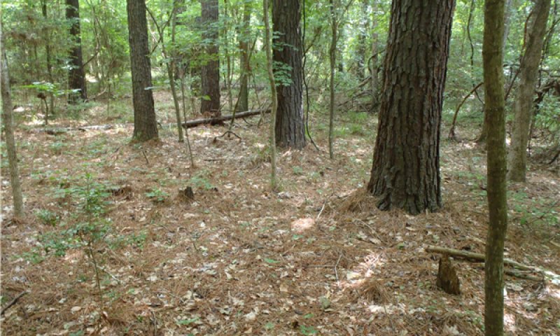
The Dense Mixed Forest Community has crossed a threshold in which normal environmental events cannot transition the community back to the reference state (State 1). The crossing of this threshold represents a closure in the overstory canopy, which limits the productivity of the ground layer. The canopy closure is filled in by any sapling that could gain a foothold in an earlier state. Water oak (Quercus nigra), willow oak (Quercus phellows), red maple, and sweetgum are especially common invaders into the community. The limited ground layer does not provide enough fuel to harbor a burn with the intensity found in State 1. Hardwood litter usually covers the ground, also retarding fire in this state.
The understory plant layer only contains remnants of the reference community and possibly no reference community indicator species. Sparse amounts of shade tolerant species, like longleaf woodoats, poison ivy, and greenbriers (Smilax sp.) may be the only ground-layer species. Some shrubs may still persist, but not as dense as found in States 1 or 2. Because the site lacks the diversity of the reference state, the wildlife diversity will be limited to generalist species, species that require a closed canopy, and those species seeking refuge.
This ecological state requires management to restore the reference community. Selective timber harvest to reduce the basal area is the first step to allow the understory to return. More frequent than natural prescribed burns (1 to 3 years) will help suppress the hardwood regeneration, but only after understory fuel levels are adequate. Intense summer fires may also be required. The suppression of unwanted overstory seedlings will allow the reference plant community to establish.
Table 10. Ground cover
| Tree foliar cover |
0-15%
|
| Shrub/vine/liana foliar cover |
5-20%
|
| Grass/grasslike foliar cover |
0-10%
|
| Forb foliar cover |
0-5%
|
| Non-vascular plants |
0%
|
| Biological crusts |
0%
|
| Litter |
50-90%
|
| Surface fragments >0.25" and <=3" |
0%
|
| Surface fragments >3" |
0%
|
| Bedrock |
0%
|
| Water |
0%
|
| Bare ground |
0-5%
|
Table 11. Canopy structure (% cover)
| Height Above Ground (ft) |
Tree |
Shrub/Vine |
Grass/
Grasslike |
Forb |
| <0.5 |
0-5% |
5-15% |
0-10% |
0-10% |
| >0.5 <= 1 |
0-5% |
5-10% |
0-5% |
0-5% |
| >1 <= 2 |
0-5% |
5-10% |
0-5% |
0-5% |
| >2 <= 4.5 |
10-20% |
5-15% |
0-3% |
0-3% |
| >4.5 <= 13 |
10-35% |
0-5% |
– |
– |
| >13 <= 40 |
50-85% |
0-5% |
– |
– |
| >40 <= 80 |
65-95% |
– |
– |
– |
| >80 <= 120 |
10-85% |
– |
– |
– |
| >120 |
– |
– |
– |
– |
Community 3.2
No Overstory
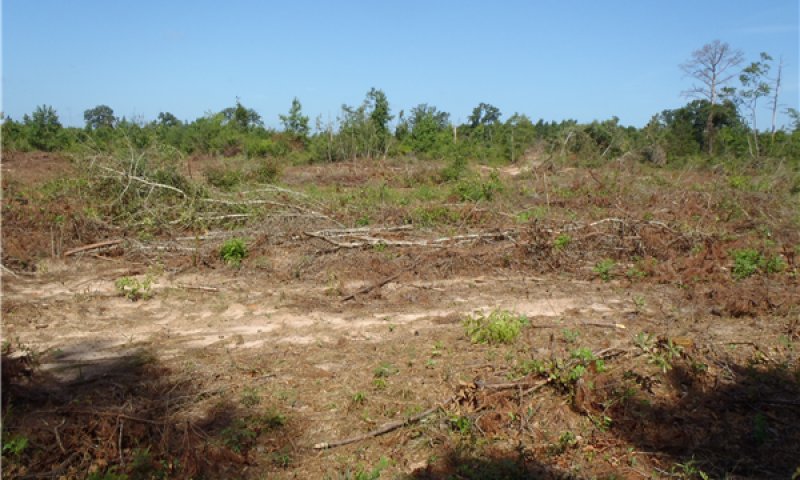
The No Overstory Community (3.2) is a result of natural environmental disturbances or clearcutting the overstory trees. The plant communities from State 1 may return initially, but if the natural disturbance of fire or overstory stand management do not occur, the site will transition into a Mixed Forest Community (3.1)
Pathway 3.1A
Community 3.1 to 3.2
The driver for the shift is a natural disaster or clearcut situation. Examples of natural disasters include hurricane, wind throw, tornadoes, severe ice storms, or severe fires. Following timber harvest by clearcut, little of the reference state vegetation remains. Primary vegetative succession occurs post clearcut.
Pathway 3.2A
Community 3.2 to 3.1
The driver for the community shift is time and lack of fire. Shrubs and tree saplings will not be suppressed without return fire intervals.
State 4
Plantation
The Plantation State is a result of conversion activities. The landowner has maximized silviculture production by planting a monoculture of tree species.
Community 4.1
Pine/Hardwood Plantation
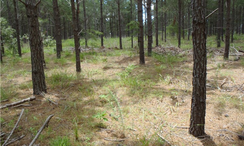
In the immediate years following the initial tree planting, the understory community will resemble the reference state (State 1). During this early growth period, the landowner will typically remove unwanted hardwoods and mow the herbaceous plants to reduce competition with the planted pine trees. As the overstory canopy closes, less understory management is required due to sunlight restrictions at the ground layer.
State 5
Pasture and Cropland
The Pasture and Cropland State is a result of conversion activities. The landowner has maximized agriculture production by planting a monoculture of introduced grass species or agricultural row crops.
Community 5.1
Planted Pasture and Row Crop
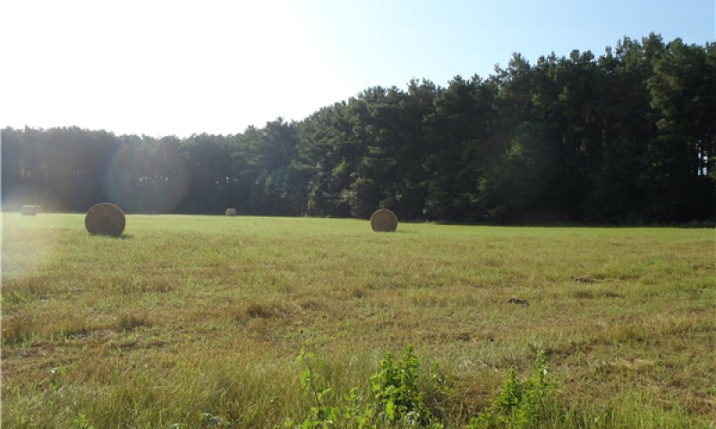
Typical introduced pasture grass species include bahiagrass (Paspalum notatum) and different varieties of bermudagrass (Cynodon dactylon). The grasses are grown for livestock production through direct grazing or baling hay for later use. Agricultural row crops are grown for food and fiber production. Many farmers use herbicides to reduce unwanted plant competition which yields a plant community unrepresentative of State 1 or subsequent vegetative states.
Transition T1A
State 1 to 2
The transition from State 1 to State 2 is a result of time and long periods (greater than 5 years) of no fire and/or forest management practices. Without fire to suppress tree seedlings, biomass and diversity is lost from the grass and forb layers of the system.
Transition T1B
State 1 to 4
The transition is due to the land manager maximizing silviculture potential. Merchantable timber is harvested by clearcut, then the site is prepared and planted to a monoculture of trees.
Transition T1C
State 1 to 5
The transition is due to the land manager maximizing agricultural production. Merchantable timber is harvested by clearcut, then the site is prepared and planted to either an improved grass or row crops.
Restoration pathway R2A
State 2 to 1
The driver for restoration is fire and understory shrub and tree suppression. Enough fuel is still left in this community to carry a fire through the site. More frequent burns (1 to 2 years) may be required to suppress the woody vegetation. Timber stand improvement practices should be used on undesirables and some species may have escaped the effective fire height and will have to be selectively cut down to return to the reference state.
Transition T2A
State 2 to 3
The transition from a Mixed Mid-story (State 2) to the Mixed Forest (State 3) is a result of time and long periods (greater than 20 years) of no fire and/or no forest management. Without fire to suppress fire intolerant trees, they become part of the overstory canopy. The overstory is so saturated that the understory herbaceous layer is almost non-existent. As the overstory canopy closes, the under and mid-story are occupied only by shade tolerant species.
Transition T2B
State 2 to 4
The transition is due to the land manager maximizing silviculture potential. Merchantable timber is harvested by clearcut, then the site is prepared and planted to a monoculture of trees.
Transition T2C
State 2 to 5
The transition is due to the land manager maximizing agricultural production. Merchantable timber is harvested by clearcut, then the site is prepared and planted to either an improved grass or row crops.
Restoration pathway R3A
State 3 to 1
Restoration of this community to the reference state begins with a selective timber harvest. Removing unwanted trees opens up the canopy, allowing sunlight penetration to the ground. Years of overstory growth have limited the fuel necessary to have an effective fire. Time will be needed to encourage understory growth. Once the herbaceous layer has established, more frequent than natural burns (1 to 3 years) may be required to suppress the woody vegetation.
Transition T3A
State 3 to 4
The transition is due to the land manager maximizing silviculture potential. Merchantable timber is harvested by clearcut, then the site is prepared and planted to a monoculture of pine trees.
Transition T3B
State 3 to 5
The transition is due to the land manager maximizing agricultural production. Merchantable timber is harvested by clearcut, then the site is prepared and planted to either an improved grass or row crops.
Restoration pathway R4A
State 4 to 1
This restoration pathway can be accomplished in different ways depending on goals. One option is to create canopy openings by reducing the number of overstory trees. Then, restore the resulting canopy gaps with species from the reference state’s (State 1) understory. Restoring the understory may include planting shortleaf pine and oak species found in the reference state. This method keeps the woodland structure intact and slowly changes the species composition.
Transition T4A
State 4 to 3
This community transition is caused by neglecting the plantation understory. Without fire, mowing, or herbicides, unwanted understory saplings can begin to grow into the overstory.
Transition T4B
State 4 to 5
The transition is due to the land manager maximizing agricultural production. Merchantable timber is harvested by clearcut, then the site is prepared and planted to either an improved grass or row crops.
Restoration pathway R5A
State 5 to 1
This restoration path can be accomplished by planting a mix of oak and pine species to their natural frequencies (see State 1 – Overstory Composition table), trying to attain a 65 to 85 percent mature overstory canopy. Management will be required to control unwanted species by burning, mowing, and/or herbicides. Controlling introduced pasture grasses is difficult, with complete control likely not attainable. The herbaceous understory will take time to develop, but this process can be expedited if adapted plant material seed is available.
Transition T5A
State 5 to 4
The transition is due to the land manager maximizing silviculture production. The site is prepared and planted to a monoculture of trees.
