Ecological dynamics
The information in this ecological site description (ESD), including the state-and-transition model (STM), was developed using archeological and historical data, professional experience, and scientific studies. The information is representative of a complex set of plant communities. Not all scenarios or plants are included. Key indicator plants, animals, and ecological processes are described to inform land management decisions.
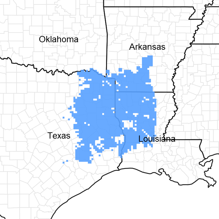
Introduction – Southern Arkansas, western Louisiana, and eastern Texas have been deemed the Pineywoods because of the vast expanse of pine trees. The region represents the western edge of the southern coniferous belt. Historically, the area was covered by pines with mixed hardwoods, sparse shrubs, and a diverse understory of grasses and forbs. Fire played a significant role in reducing the woody competition that generally out-competes the herbaceous understory layer. Fire suppression and land conversion have reduced the amount of historical communities in existence today.
Background – The Terrace sites are possibly the most anthropogenically disturbed areas in the region. Terrace sites are close to water sources, but elevated from floodwaters, and have deep productive soils. For centuries, Native Americans, and settlers alike, used the sites for farming. Despite all the changes, the historic plant community for the Terraces is believed to be a White Oak/Loblolly Pine (Quercus alba/Pinus taeda) Forest. Remnants of this presumed historic plant community still exist where the historic conditions are still in place. Evidence of the reference state is found in accounts of early historic explorers to the area, historic forest and biological survey teams, as well as recent ecological studies in the last 30 years.
Settlement Management – Differing from other ecological sites, human settlement on the Terraces occurred well before the arrival of Europeans. Historians believe the Caddo settled as early as AD 800. Their culture revolved around farming and cleared the overstory to make the areas more suitable. The Caddo used the timber found onsite in framing their dwellings and covered the frame with long grasses. The remaining deep, loamy-textured soils were excellent sites to farm crops, such as corn, beans, and squash.
The first Europeans discovered the area in 1542, but did not begin colonizing until the early 1700s. The early settlers would have probably kept the Terrace sites open and continued, and expanded, the same farming practices learned from the Caddo. The early colonizers from Alabama, Georgia, and Tennessee would have seen great value in the white oaks, even more so than the pines. White oaks were used for roofing boards, shakes, shingles, and staves. The early colonizers would have also preferred white oaks because they require less energy to split than some of the other native overstory trees.
Current Management and State – Today much of the remnant forest is gone, replaced by pine plantations, crops, and pastures. The areas that were not converted have been fire-suppressed so long that loblolly pine and fire intolerant hardwoods populate the overstory structure. Other forestry practices such as high-grading and diameter-limit cutting has also heavily contributed to an overall loss of remnant forest. The nature of white oaks also adds to the disappearance of historical sites. White oak, like other oaks, is dependent on advanced regeneration needing a seed source. Many seed sources have been cut out long ago and the notoriety of having bumper seed crops every four to ten years only complicates the problem. White oak is a comparatively slow-growing tree that can easily be out-competed by other species. The acorns are the preferred by livestock and wildlife, again, making regeneration difficult.
Fire Regimes – Fire was a natural and important disturbance throughout the Western Gulf Plain. Fire occurred naturally from lightning strikes and was started by Native Americans for game movement. The historic community developed with a frequency of fire every 10 to 20 years. Fires usually occurred in early spring, removing senescent vegetation, recycling nutrients and minerals, and spurring new plant growth. Late summer fires occurred as well, but with a different community effect. Summer fires burned hotter and with more intensity, greatly suppressing the shrub canopy layer. The summer fires also decreased grass densities and increased forb densities. The topography, fuel loads, and other conditions caused patchy burns throughout the region resulting in mosaic patterns of plant communities and a heterogeneous landscape.
Disturbance Regimes – Extreme weather events occur occasionally throughout the region. Tornados uproot trees and open canopies in the spring months. In the late summer and early fall, hurricanes or tropical depressions often make landfall, dumping excessive amounts of rain and toppling trees with high winds. Another cause of large canopy openings is the effects of the southern pine beetle (Dendroctonus frontalis). Since the Forest Service has been recording in the late 1950’s, beetle outbreaks have occurred every 6 to 9 years (although a major attack has not occurred in some time), usually when the trees are stressed because of multiple environmental factors.
Plant Community Interactions – The length of fire intervals and position on the landscape create a moderate overstory-canopy cover (70 to 90 percent). The canopy cover is higher than the associated upland sandy sites with frequent fire, but lower than the bottomland/drain sites with infrequent fire. The understory consists of small shrubs and saplings with a mixed layer of grasses and forbs. American beautyberry (Callicarpa americana), longleaf woodoats (Chasmanthium sessiflorum), and partridgeberry (Mitchella repens) are especially common in the understory. Yaupon (Ilex vomitoria) and possumhaw (Ilex decidua) are especially common shrubs in the mid-story (less than 13 feet).
State and Transition Diagram -
The following diagram suggests some pathways the vegetative communities may take. Other states may exist that are not shown on the diagram. The information is intended to show what might happen through different circumstances; it does not mean that this would happen the same way in every instance. Changes to the community within a state move back-and-forth easily, but as thresholds are crossed the site changes from state to state. Meaning, changes have progressed to the point where some form of energy is necessary to return the site to the previous state.
State 1
Forest
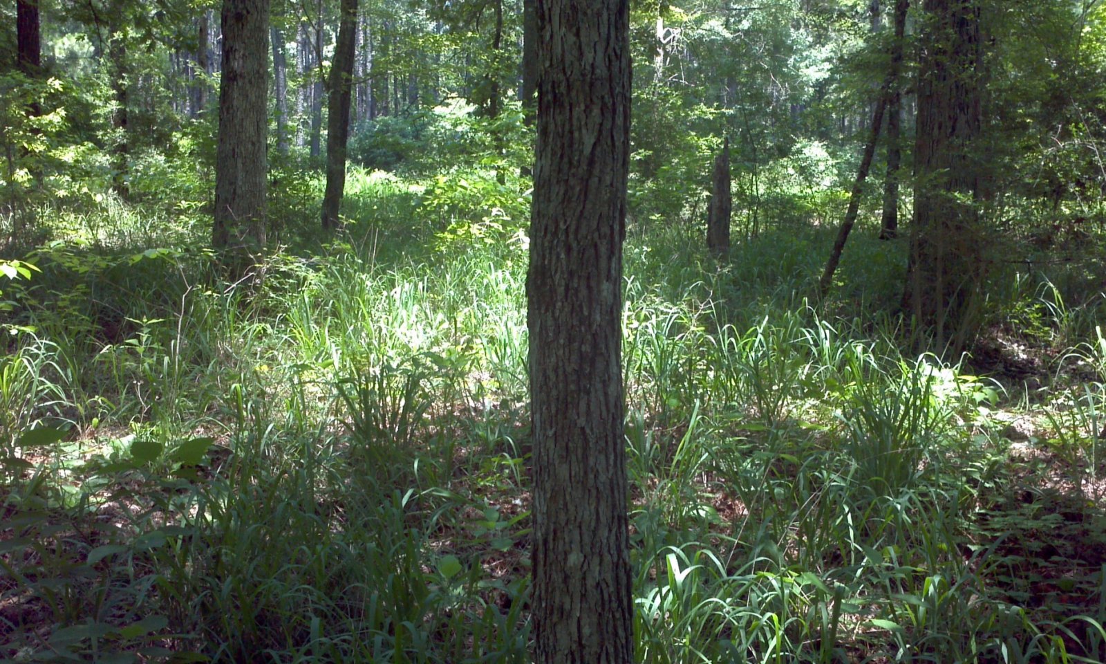
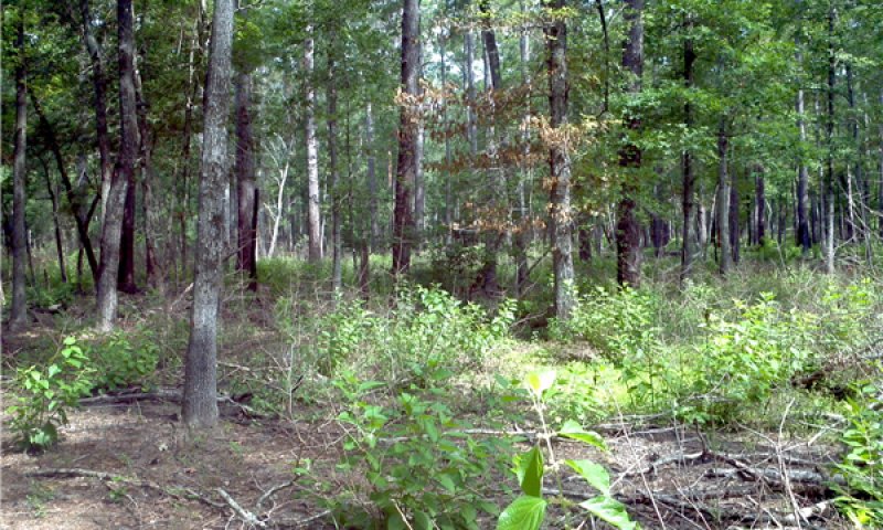
Two community phases exist in the Forest State (1): White Oak/Loblolly Pine Forest Community (1.1) and the Shrub-dominated Community (1.2). State 1 has a moderate overstory cover (70 to 90 percent) of primarily mixed hardwood and pine species with white oak and loblolly pine being the most dominant. The landscape position of the Terraces cause an intermixed plant community to form. Terraces are regularly a transition between uplands and bottomland. Therefore, species occurring on both uplands and bottomlands exist on terraces. Also, micro-lows commonly develop on the flattest parts of the terrace supporting a slightly wetter plant community.
Natural disturbances of fires, lightning strikes, hurricanes (wind throw), ice events (rare), and beetle infestations maintain the uneven-age structure. The natural canopy spacing is kept intact by fires ranging from 10 to 20 years. Representative basal areas range from 70 to 100 square feet per acre. As the basal area of the site increases, canopy cover generally increases as well. Growth competition can be seen in the outer rings on trees in locations where the basal area exceeds 100 square feet per acre. With more trees occupying one site, the competition for light, water, and nutrients will cause the tree rings to be less thick (for example, ten rings per inch in a competitive environment compared to six rings per inch on a lower basal area site).
Community 1.1
White Oak/Loblolly Pine Forest
Terrace sites are highly variable in their overstory composition. While white oak and loblolly pine are the dominant species, the overstory frequently has southern red oak, (Quercus falcata), sweetgum (Liquidambar styraciflua), and shortleaf pine (Pinus echinata) intermingled. Longleaf pine (Pinus palustris) may occur in the southern portions of the region. White oaks and/or loblolly pine may make up 75 percent of the overstory at any given time. The other hardwood and pine species make up the rest of the overstory.
Shrubs are an important component in the ecological site. American beautyberry, yaupon, and possumhaw are dominant. Sassafras (Sassafras albidum), parsley hawthorn (Crataegus marshalii), and farkleberry (Vaccinium arboreum) are common, but seen in lesser densities. The shrub-layer height and densities fluctuate with time since the last fire. Fire prunes their growth back and allows the understory grasses and forbs to stay diverse and abundant. The shrub layer is the main driver between communities 1.1 and 1.2. As the shrubs begin to grow above 4.5 feet and become more dense, the community moves along the pathway from 1.1 to 1.2.
The infrequency of fire causes an accumulation of litter throughout the sites and bare ground is uncommon. The most dominant gramanoids are longleaf woodoats, slender woodoats (Chasmanthium laxum), and cypress swamp sedge (Carex joorii). The micro-lows are often colonized by broomsedge bluestem (Andropogon virginicus). Partridgeberry and Carolina elephanstfoot (Elephantopus carolinianus) are highly associated to the site.
Table 6. Ground cover
| Tree foliar cover |
0-10%
|
| Shrub/vine/liana foliar cover |
10-40%
|
| Grass/grasslike foliar cover |
25-65%
|
| Forb foliar cover |
5-20%
|
| Non-vascular plants |
0%
|
| Biological crusts |
0%
|
| Litter |
5-35%
|
| Surface fragments >0.25" and <=3" |
0%
|
| Surface fragments >3" |
0%
|
| Bedrock |
0%
|
| Water |
0%
|
| Bare ground |
0-10%
|
Table 7. Canopy structure (% cover)
| Height Above Ground (ft) |
Tree |
Shrub/Vine |
Grass/
Grasslike |
Forb |
| <0.5 |
0-5% |
3-15% |
5-40% |
3-10% |
| >0.5 <= 1 |
0-5% |
5-15% |
5-20% |
3-10% |
| >1 <= 2 |
0-5% |
10-20% |
5-50% |
0-20% |
| >2 <= 4.5 |
0-5% |
3-35% |
0-25% |
0-3% |
| >4.5 <= 13 |
0-5% |
– |
0-25% |
– |
| >13 <= 40 |
5-20% |
– |
– |
– |
| >40 <= 80 |
10-50% |
– |
– |
– |
| >80 <= 120 |
65-75% |
– |
– |
– |
| >120 |
– |
– |
– |
– |
Community 1.2
Shrub-dominated
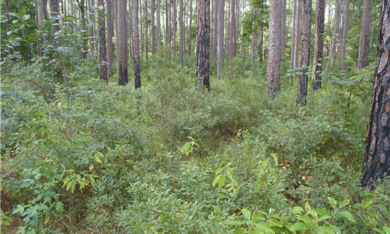
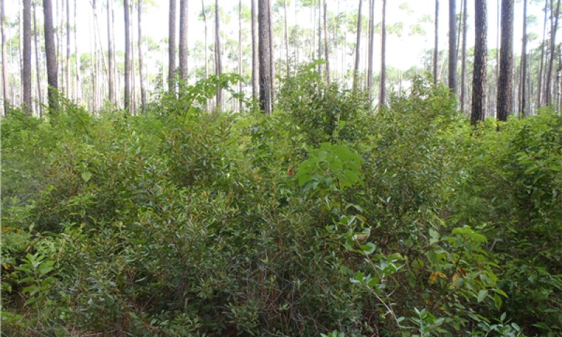
Phase 1.1 is the most representative community. Litter accumulation is minimal and understory vegetation is occupied with grasses, forbs, and shrubs. Phase 1.2 has an increased abundance of shrubs and standing litter from grasses and forbs. The fuel load for fire is at peak in Phase 1.2. Without fire to reduce competition, Phase 1.2 will transition into State 2.
Pathway 1.1A
Community 1.1 to 1.2
White Oak/Loblolly Pine Forest
The driver for the community shift is time since the last fire. As post-fire time increases, so does the foliar cover by shrub species. The foliar cover increases immediately after fire, but the shrub layer begins to affect the other vegetation 8 to 12 years post fire. As the perennial grasses and forbs age, their senesced leaves increase fine fuel levels.
Pathway 1.2A
Community 1.2 to 1.1
White Oak/Loblolly Pine Forest
The driver for the community shift is fire. As fire burns through the understory, it encourages a diverse herbaceous layer while suppressing shrubs and tree seedlings. In areas where fire is difficult, timber stand improvement such as mechanical and chemical controls can act as a surrogate.
State 2
Mixed Forest
The understory has developed into a dense mid-story layer (4.5 to 13 feet) and crossed a threshold in which historic environmental events (i.e., fire) cannot transition the community back to the reference state (State 1). The mid-story canopy has become so thick, it greatly limits the productivity of the grass/forb-ground layer. The limited ground layer does not provide the same fine fuel to harbor a burn with the same effects as found in State 1.
Community 2.1
Mixed Forest
Yaupon and wax myrtle (Morella cerifera) are especially dominant in the mid-story and are major indicators of State 2. Reduction in pine recruitment begins as hardwood species like sweetgum, red maple (Acer rubrum), and water oak (Quercus nigra) dominate. When their heights grow above 13 feet, their fire tolerance is increased and burning is also not as effective because of lack of fine fuels. If the site is allowed to develop without interruption, the pine component will be greatly reduced, if not lost, as the hardwood species are able to out compete. At this point, the threshold to State 3 has been crossed. The species present in the reference community will still be found, only in lesser amounts because the canopy cover is creating a more suitable environment for fire-intolerant and shade-loving species.
Table 8. Ground cover
| Tree foliar cover |
25-95%
|
| Shrub/vine/liana foliar cover |
35-85%
|
| Grass/grasslike foliar cover |
5-25%
|
| Forb foliar cover |
0-10%
|
| Non-vascular plants |
0%
|
| Biological crusts |
0%
|
| Litter |
25-75%
|
| Surface fragments >0.25" and <=3" |
0%
|
| Surface fragments >3" |
0%
|
| Bedrock |
0%
|
| Water |
0%
|
| Bare ground |
0-3%
|
State 3
Hardwood Forest
A long-term lack of fire has now caused the plant community to cross two major thresholds from State 1, resulting in a very-closed canopy state. Fire intolerant hardwoods dominate the overstory. The overstory composition will be dominated by red oak, water oak, sweetgum, and hickory (Carya sp.).
Community 3.1
Hardwood Forest
The understory plant layer only contains remnants of longleaf woodoats and possibly a few forb species. The shrub layer has changed in composition substantially with species of deerberry (Vaccinium stamineum), southern arrowwood (Viburnum dentatum), hophornbeam (Ostrya virginiana), American hornbeam (Carpinus caroliniana), and yaupon occurring. The shrub densities are less than State 1 and 2 because of the closing of the overstory canopy and restriction of light to the ground.
Similar to State 2, this ecological state requires management to restore the reference community. Selective timber harvest to remove unwanted hardwood species is the first step to allow the understory to return. Frequent prescribed burns (3 to 5 years) will help suppress the hardwood regeneration. Intense summer fires may also be required. The suppression of overstory seedlings will allow grasses, forbs, and shrubs to reestablish. The other restoration option is to clearcut the entire area and prepare the site to be replanted with white oak and loblolly in desired frequencies.
Table 9. Ground cover
| Tree foliar cover |
50-95%
|
| Shrub/vine/liana foliar cover |
25-50%
|
| Grass/grasslike foliar cover |
0-5%
|
| Forb foliar cover |
0-3%
|
| Non-vascular plants |
0%
|
| Biological crusts |
0%
|
| Litter |
50-100%
|
| Surface fragments >0.25" and <=3" |
0%
|
| Surface fragments >3" |
0%
|
| Bedrock |
0%
|
| Water |
0%
|
| Bare ground |
0-5%
|
Community 3.2
No Overstory
The No Overstory Community is the result of natural disaster or clearcutting. After the initial event, the understory will resemble State 1. But, if fire and/or management do not return, the overstory species will develop back into a Hardwood Forest community.
Pathway 3.1A
Community 3.1 to 3.2
The driver for the shift is a natural disaster or clearcut situation. Examples of natural disasters include hurricane, wind throw, severe ice storms, or severe fires. Following timber harvest by clearcut, little of the reference state vegetation remains. Primary vegetative succession occurs post clearcut.
Pathway 3.2A
Community 3.2 to 3.1
The drivers for the community shift are time and lack of fire. Shrubs and tree saplings will not be suppressed without return fire intervals or herbicides.
State 4
Plantation
The Plantation State is a result of conversion activities. The landowner has maximized silviculture production by planting a monoculture of tree species.
Community 4.1
Pine/Hardwood Plantation
In the immediate years following the initial plantation tree planting, the understory community will resemble State 1. During this early growth period, the landowner will typically remove unwanted hardwoods and herbaceous plants to reduce competition with the planted pine trees. As the overstory canopy closes, less understory management is required due to sunlight restrictions to the ground layer.
State 5
Pasture and Cropland
The Pasture and Cropland State is a result of conversion activities. The landowner has maximized agriculture production by planting a monoculture of introduced grass species or agricultural row crops.
Community 5.1
Planted Pasture and Row Crop
Typical introduced pasture grass species include bahiagrass (Paspalum notatum) and different varieties of bermudagrass (Cynodon dactylon). The grasses are grown for livestock production through direct grazing or baling hay for later use. Agricultural row crops are grown for food and fiber production. Many farmers use herbicides to reduce unwanted plant competition which yields a plant community unrepresentative of State 1 or subsequent vegetative states.
Transition T1A
State 1 to 2
The transition from State 1 to State 2 is a result of time and long periods (greater than 20 years) of no fire. Without fire to suppress shrubs and tree seedlings, biomass, and diversity is lost from the grass and forb layers of the system. The transition is also characterized by tree sapling’s bud zones escaping the height at which fire effectively suppresses shade-tolerant, fire-intolerant species. High-grading of timber will also cause a shift.
Transition T1B
State 1 to 4
The transition is because of the land manager maximizing silviculture potential. Merchantable timber is harvested by clearcut, then the site is prepared and planted to a monoculture of trees.
Transition T1C
State 1 to 5
The transition is because of the land manager converting to agricultural production. Merchantable timber is harvested by clearcut, then the site is prepared and planted to either a planted grass for grazing livestock or row crops for food and fiber.
Restoration pathway R2A
State 2 to 1
The driver for restoration is fire. Enough fuel is still left in this community to carry a fire through the site with intensity to kill young saplings. More frequent burns (3 to 5 years) may be required, initially, to suppress the woody vegetation. Some tree species may have escaped the effective fire height and will have to be selectively cut down to return to State 1. Herbicides can assist in deterring some hardwoods/unwanted species from growing. Care must be taken that non-target plants are not affected by the chemicals.
Transition T2A
State 2 to 3
The transition from a State 2 to State 3 is a result of time and long periods (greater than 20 years) of no fire. Without fire to maintain the open spacing, the overstory becomes densely populated. The overstory is so saturated that the understory herbaceous layer is almost non-existent because of a lack of sunlight. As the overstory canopy closes, the established mid-story lessens in density. This begins to occur at overstory canopies greater than 90 percent. High-grading of timber will also cause a shift.
Transition T2B
State 2 to 4
The transition is because of the land manager maximizing silviculture potential. Merchantable timber is harvested by clearcut, then the site is prepared and planted to a monoculture of trees.
Transition T2C
State 2 to 5
The transition is because of the land manager converting to agricultural production. Merchantable timber is harvested by clearcut, then the site is prepared and planted to either a planted grass for grazing livestock or row crops for food and fiber.
Restoration pathway R3A
State 3 to 1
Among all restoration pathways, this path is the most energy intensive. Restoration of this community to State 1 begins with a selective timber harvest. Removing unwanted trees (shade and fire intolerant) opens up the canopy, allowing sunlight penetration to the ground. Years of overstory growth have limited the fuel necessary to have an effective fire. Time will be needed to encourage an understory and, if possible, mowing the understory may help. Once the herbaceous layer has established, frequent burns (3 to 5 years) may be required to suppress the woody vegetation. If no white oak or loblolly pine seed source is available on nearby ecological sites, planting will be needed.
Transition T3A
State 3 to 4
The transition is because of the land manager maximizing silviculture potential. Merchantable timber is harvested by clearcut, prepared, and planted to a monoculture of trees.
Transition T3B
State 3 to 5
The transition is because of the land manager maximizing agricultural production. Merchantable timber is harvested by clearcut, then the site is prepared and planted to either an improved grass or row crops.
Restoration pathway R4A
State 4 to 1
This restoration pathway can be accomplished in different ways depending on goals. One option is to create canopy openings by reducing the number of overstory trees. Then, restore the resulting canopy gaps with species from State 1's understory. Restoring the understory may include replanting trees. This method keeps the woodland structure intact and slowly changes the species composition.
Another restoration method is to selectively harvest and remove brush (via mechanical or chemical means) followed by re-planting loblolly pine and oak species (using reduced planting rates.) The herbaceous understory will take time to develop, but this process can be expedited if adapted plant material is available. Fire is the best option to maintain desired canopy cover for enhancement of the understory, and reduce undesirable woody species. Initially, fire frequencies of 3 to 5 years during both growing and cool seasons may be desired in order to maintain an open canopy and reduce undesirable plant competition. If fire is not a viable option, management of woody encroachment can be controlled by mowing or the use of herbicides.
Transition T4A
State 4 to 3
This community transition is caused by neglecting the plantation understory. Without mowing or herbicides, the brush canopy becomes a dense thicket.
Restoration pathway R5A
State 5 to 1
This restoration path can be accomplished by planting a mix of loblolly pine and white oak species to their natural frequencies (see State 1 Overstory Composition table), trying to attain a 60 to 80 percent mature overstory canopy. Management will be required to control unwanted species by burning, mowing, and/or herbicides. Controlling introduced pasture grasses is difficult, with complete control likely not attainable. The herbaceous understory will take time to develop, but this process can be expedited if adapted plant material seed is available.
Transition T5A
State 5 to 4
The transition is because of the land manager maximizing silviculture potential. Merchantable timber is harvested by clearcut, prepared, and planted to a monoculture of trees.
