Natural Resources
Conservation Service
Ecological site PX137X00X080
Dry Sandy Backslope Woodland
Last updated: 5/13/2025
Accessed: 02/11/2026
General information
Provisional. A provisional ecological site description has undergone quality control and quality assurance review. It contains a working state and transition model and enough information to identify the ecological site.
Figure 1. Mapped extent
Areas shown in blue indicate the maximum mapped extent of this ecological site. Other ecological sites likely occur within the highlighted areas. It is also possible for this ecological site to occur outside of highlighted areas if detailed soil survey has not been completed or recently updated.
MLRA notes
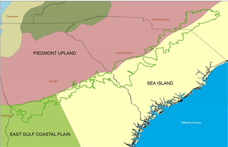
Major Land Resource Area (MLRA): 137X–Carolina and Georgia Sand Hills
MLRA 137 covers approximately 8,665 square miles (22,450 square kilometers) in the states of South Carolina (44 percent), Georgia (34 percent), and North Carolina (21 percent).
The Sand Hills region occurs below the "fall line", which delineates the older crystalline rocks of the Southern Piedmont (MLRA 136) from the younger sediments of the Southern Coastal Plain (MLRA 133A). The term "fall line" came about because the rivers of the Piedmont cut downward through hard bedrock to meet the lower Coastal Plain sediments. The elevational change is evident in the waterfalls and rapids that occur along this transitional line.
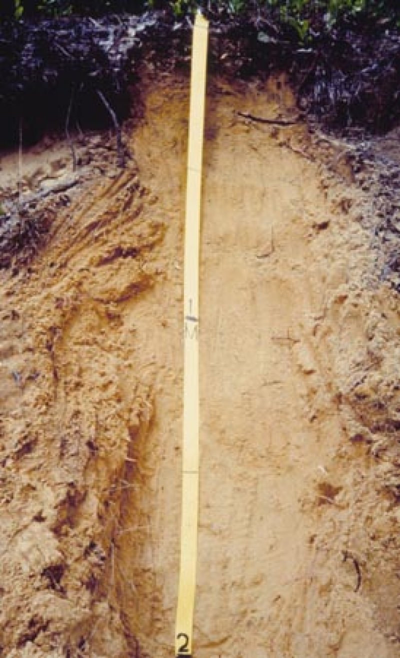
This region is composed of mainly of unconsolidated sediments deposited during the Cretaceous period. Overlying these sediments is the late Miocene to early Pliocene Pinehurst Formation. The Pinehurst Formation is of windblown or eolian origin. Soils in this formation are the subject of this ecological site. Deposits of kaolin and high-silica sands are found across the area and are often mined.
Classification relationships
ATTENTION: This ecological site meets the requirements for PROVISIONAL. A provisional ecological site is established after ecological site concepts are developed and an initial state-and-transition model is drafted. A provisional ecological site typically will include literature reviews, land use history information, legacy data, and must include some soils data, ocular estimates for canopy and/or species composition by weight, and some line-point intercept information. A provisional ecological site provides the conceptual framework of soil-site correlation for the development of the ESD. For more information about this ecological site, please contact your local NRCS office.
Ecological site concept
The concept for this ecological site is similar to that for F137XY001GA (Dry sandy Upland Woodland). The map unit components to be correlated to this ES occur on steeper slopes than F137XY001GA (representative slopes > 6 percent). The Ecological Site concept was developed and includes deep, sandy map units (Alaga, Alpin, Candor, Lakeland, and Wakulla) based on preliminary analyses of existing data pertaining to sandy uplands of MLRA 137. This ES concept is distinct because of its native condition (i.e. reference site vegetation), component soils, successional patterns, and wildlife habitat. Reference site vegetation of this ES is edaphically supported by deep, coated sands lacking evidence of a seasonal high water table. Candor and Wakulla soils were not considered when initial draft concepts were established for F137XY001GA. However, upon field observation and discussions with regional staff, it was agreed to include them. Therefore, these series are included in the Dry Sandy Backslope ES. Dominant reference site vegetation includes longleaf pine (Pinus palustris), wiregrass (Aristida stricta and Aristida beyrichiana), turkey oak (Quercus laevis), and an herb layer. Historically, fire was integral to the evolution and maintenance of the native condition in this region.
Proposed field investigations are designed to test the association of our initial Dry Sandy Backslope Woodland ES with soil series and specific soil properties.
Table 1. Dominant plant species
| Tree |
(1) Pinus palustris |
|---|---|
| Shrub |
Not specified |
| Herbaceous |
(1) Aristida stricta |
Legacy ID
F137XY080SC
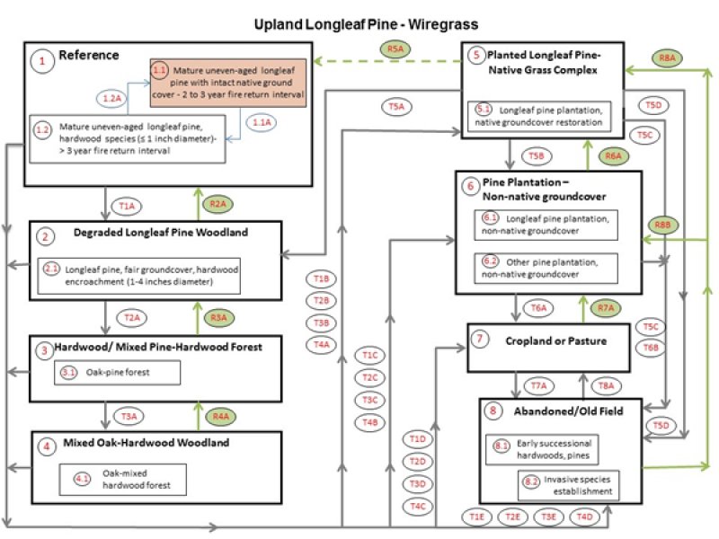
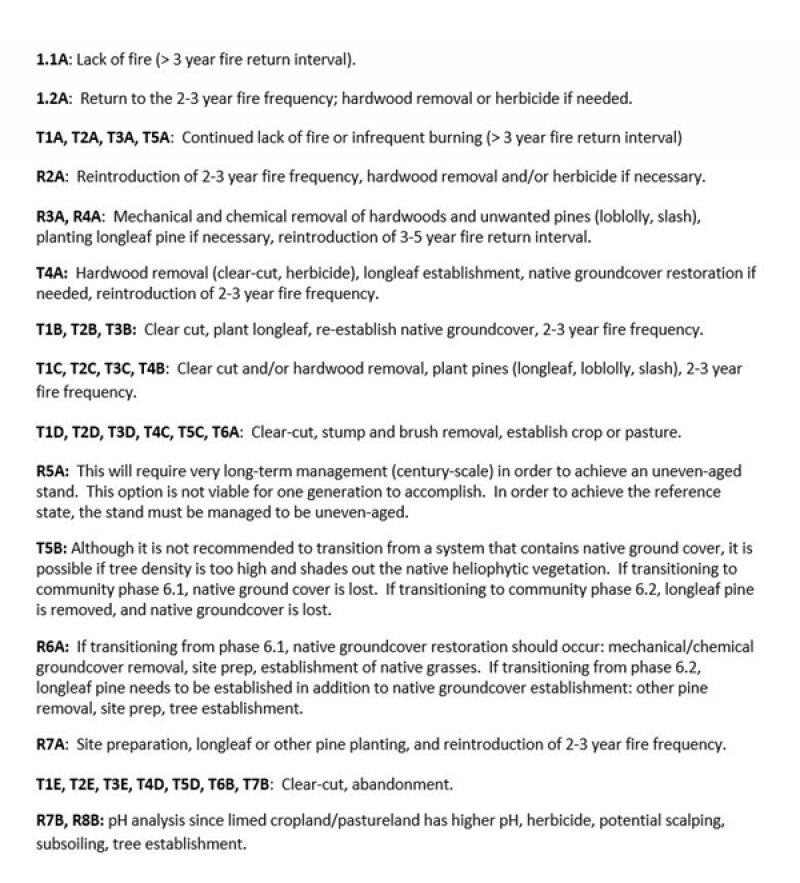
Click on box and path labels to scroll to the respective text.


