Clayplain
Scenario model
Current ecosystem state
Select a state

Management practices/drivers
Select a transition or restoration pathway
-
Transition T1A
Natural Vegetation Clearing, Site Preparation, Planting of Crops
More details -
Transition T1B
Natural Vegetation Clearing, Site Preparation, Introduction of Native and Non-Native Pasture Grasses and Legumes
More details - Transition T2A More details
-
Restoration pathway R2A
Site Preparation, Reintroduce Tree Saplings and Native Species to Area
More details -
Transition T3B
Long-term Post-Agricultural Succession
More details -
Transition T3A
Removal of Grasses, Introduction of Crops
More details -
Restoration pathway R3A
Site Preparation, Reintroduce Tree Saplings and Native Species to Area
More details -
Transition T4A
Time, Natural Succession
More details -
No transition or restoration pathway between the selected states has been described
Target ecosystem state
Select a state
Description
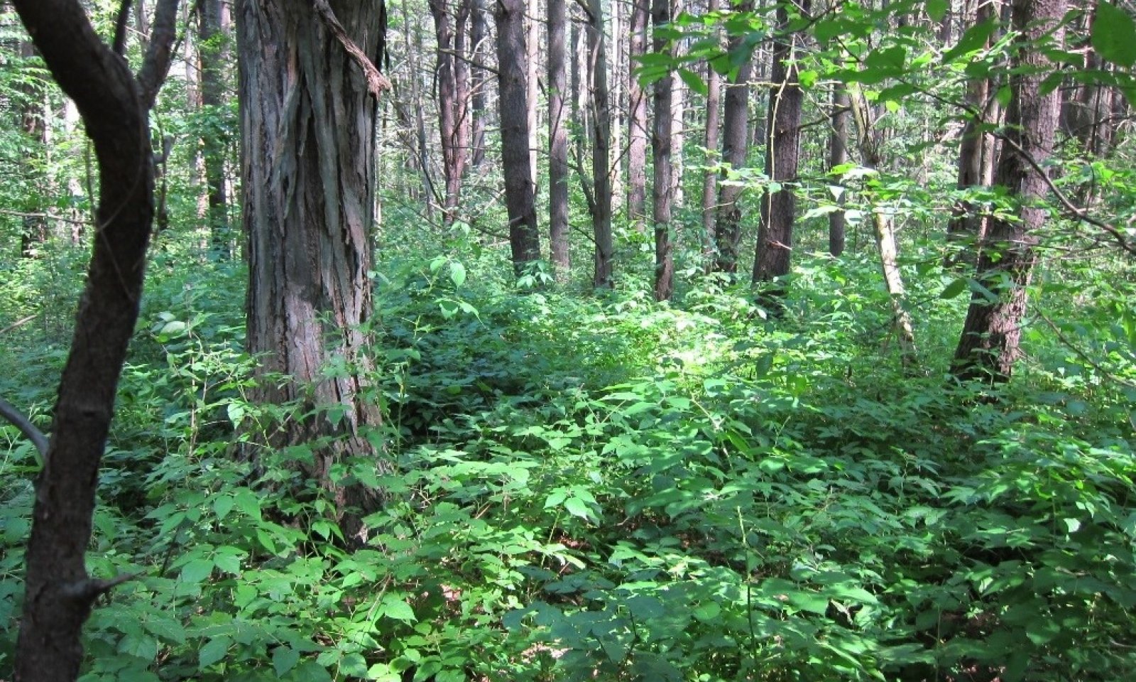
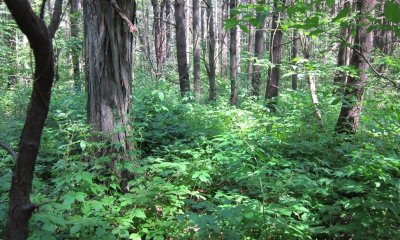
This state represents the reference mesic clayplain forest. The tree canopy is generally closed to partially open. Shrub and herb layers are of variable cover. These were once expansive forests within the Champlain Valley prior to European settlement and have since been subjected to intensive land use conversion and disturbances.
Submodel
Description
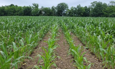
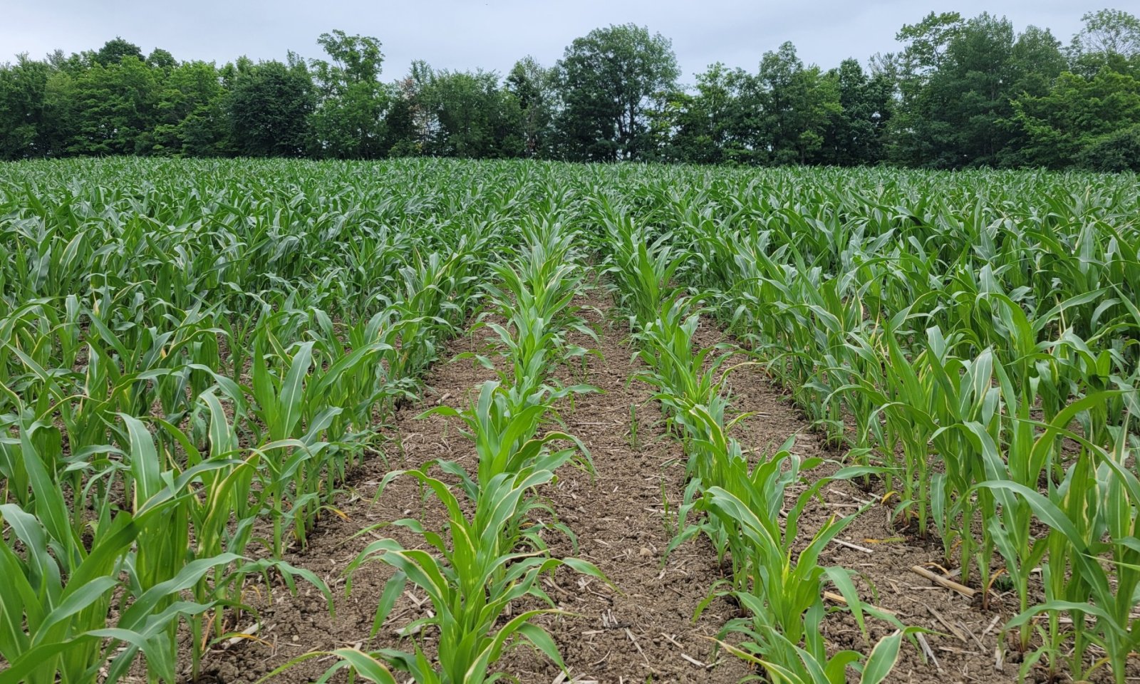
This state represents a once forested area now cleared for cropland. This will typically only occur on gentler slopes (less than15 percent) due to potential for water erosion. Corn is the dominant agricultural row crop on this site.
Submodel
Description
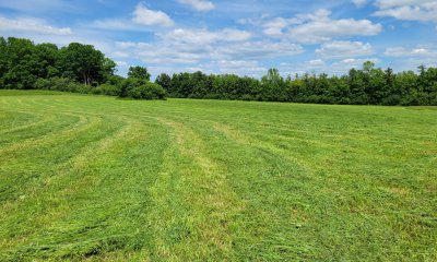
This state represents a once forested area now cleared and managed as pasture or hay fields. This will typically only occur on gentler slopes (less than15 percent) due to potential for water erosion. Pasture vegetation can consist of grasses, legumes, other forbs, shrubs or a mixture. Many of these forages are introduced, having originally come from areas in other states or continents. Overgrazed pastures can lead to soil compaction and numerous bare spots, which may then become focal points of accelerated erosion and colonization sites of undesirable plants or weeds.
Submodel
Description
This state represents an altered state that is undergoing restoration to reflect the mesic clayplain forest in composition and structure but also reflects the past land use. This may include a variety of phases that may or may not be successful.
Submodel
Mechanism
Converted forested communities have often undergone the clearing of native vegetation and site preparation before conversion to agricultural fields is complete. Due to the complex microtopography of the native site, land smoothing and / or leveling may be required, as well as undergoing practices such as tilling for the field to be ready to plant. Planting of desired crops can be done by hand or machine at desired spacing and intervals.
Mechanism
Converted forested communities have often undergone the clearing of native vegetation and site preparation before conversion to a managed grassland state is complete. Due to the complex microtopography of the native site, land smoothing and / or leveling may be required. Planting of desired mixtures of grasses and / or legumes can be done by hand or machine at desired densities.
Mechanism
Cropland can be converted to managed grasslands following the removal of the crop and the planting of desired mixtures of grasses and / or legumes at the desired density. Short term abandonment of crop fields may also give rise to ruderal shrublands and undesirable grasses and forbs that, if managed correctly, can be converted into a persistently managed grassland.
Mechanism
Conversion from an agricultural state to a restored function state may require the removal of the crop and the reintroduction of tree saplings and other native species to the area. Measures may need to be taken to prevent excessive soil erosion and failure of establishment due to browse.
Relevant conservation practices
| Practice | External resources |
|---|---|
|
Tree/Shrub Site Preparation |
|
|
Tree/Shrub Establishment |
Mechanism
Long-term abandonment of converted land may result in fallow fields that will allow for the growth and establishment of native and non-native species that over time can reflect an early- to mid-successional forest of the reference state. The presence of non-native species will often diminish the ecological value of the restored forest, but through proper management and care may reflect the reference condition over time.
Relevant conservation practices
| Practice | External resources |
|---|---|
|
Tree/Shrub Establishment |
|
|
Upland Wildlife Habitat Management |
|
|
Native Plant Community Restoration and Management |
|
|
Herbaceous Weed Control |
Mechanism
Managed grassland can be converted to agricultural fields following the removal of the grasses / legumes (typically achieved by tilling) and planting the desired crop at the desired spacing and intervals.
Mechanism
Conversion from a managed grassland state to a restored function state may require the cessation of management and the reintroduction of tree saplings and other native species to the area. Measures may need to be taken to prevent excessive soil erosion and failure of establishment due to browse. Passive restoration management may result in a condition similar to an old-field white pine forest, whereas active restoration management may result in more diverse species composition.
Relevant conservation practices
| Practice | External resources |
|---|---|
|
Tree/Shrub Site Preparation |
|
|
Tree/Shrub Establishment |
Model keys
Briefcase
Add ecological sites and Major Land Resource Areas to your briefcase by clicking on the briefcase (![]() ) icon wherever it occurs. Drag and drop items to reorder. Cookies are used to store briefcase items between browsing sessions. Because of this, the number of items that can be added to your briefcase is limited, and briefcase items added on one device and browser cannot be accessed from another device or browser. Users who do not wish to place cookies on their devices should not use the briefcase tool. Briefcase cookies serve no other purpose than described here and are deleted whenever browsing history is cleared.
) icon wherever it occurs. Drag and drop items to reorder. Cookies are used to store briefcase items between browsing sessions. Because of this, the number of items that can be added to your briefcase is limited, and briefcase items added on one device and browser cannot be accessed from another device or browser. Users who do not wish to place cookies on their devices should not use the briefcase tool. Briefcase cookies serve no other purpose than described here and are deleted whenever browsing history is cleared.
Ecological sites
Major Land Resource Areas
The Ecosystem Dynamics Interpretive Tool is an information system framework developed by the USDA-ARS Jornada Experimental Range, USDA Natural Resources Conservation Service, and New Mexico State University.