Natural Resources
Conservation Service
Ecological site RX143X00Y903
Subalpine Slope
Last updated: 2/03/2025
Accessed: 02/27/2026
General information
Provisional. A provisional ecological site description has undergone quality control and quality assurance review. It contains a working state and transition model and enough information to identify the ecological site.
MLRA notes
Major Land Resource Area (MLRA): 143X–Northeastern Mountains
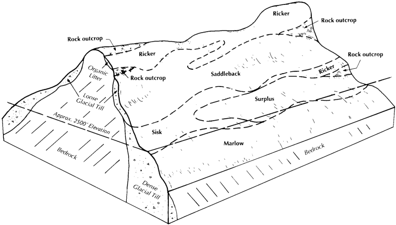
MLRA 143, known as the Northeastern Mountains, covers approximately 23 million acres of mountains, hills, and valleys in northern Maine, New Hampshire, Vermont, New York, and Massachusetts. The area is sparsely populated, with less than five percent of the land area developed for agriculture, residential, and urban development. About 90 percent of the area is forested, most of which is actively managed for timber. Elevations are mostly between 1,000 to 4,000 feet, with a few isolated peaks more than 5,000 feet above sea level. The present day mountains are but remnants of a much larger ancient range that has been eroding for approximately 500 million years. Bedrock consists of mostly very old metamorphic rock (gneiss, schist, slate, marble, quartzite, etc.) with younger intrusions of igneous rock (e.g. granite and granodiorite) from the Triassic and Cretaceous periods. MLRA 143 differs somewhat geologically from its neighboring MLRAs (142, 144A, 144B, 145, and 146), which have greater amounts of nutrient-rich sedimentary rock. Compared to MLRA 143, they are all lower in elevation, with longer growing seasons large areas that were once submerged by the ocean following glaciation.
The characteristic landforms and soils of northern New England were derived from the massive continental ice sheet that engulfed the region during North America’s most recent glaciation. Mighty glaciers, embedded with sediment and rock fragments, scoured bedrock and compacted mineral beds in a steady march south and east toward the Atlantic Ocean. The softer sedimentary rocks were pulverized into fine silts and clays under the immense weight of ice a mile thick, while the more resistant igneous and metamorphic rocks were sculpted into steep mountains and hills or plucked and dragged along the base of the glacier. With a warming climate, the ice retreated northward, depositing a thin layer of unsorted glacial till sediment atop the newly-exposed bedrock and compacted mineral beds. Deeper mounds of unsorted till formed small hills, kames, moraines and drumlins. Enormous chunks of ice detached as the glacier retreated, melting slowly in place and forming many kettle lakes and basins where water and fine sediments collect. Raging torrents of glacial meltwater dissected much of the barren landscape, entraining coarse and fine sediments, carving river valleys, and leaving well-sorted deposits of mostly sand and gravel along the watercourse. By 10,000 years ago the ice sheet had fully receded from MLRA 143. Silty floodplains developed along perennial rivers, many of which occupy the same channels that once gushed with sediment-rich glacial meltwater. Over time, wet basins accumulated fine sediment, some dried out, and still others became acidified by organic matter inputs from colonizing vegetation.
In terms of climate, MLRA 143 is distinguished from neighboring MLRAs by a shorter growing season and the occurrence of cryic soil temperature regimes at high elevations. The majority of MLRA 143 averages 32 to 44 inches of precipitation annually with a five to six month growing season and frigid winter temperatures. However, the higher elevations may receive up to double the annual precipitation of the lower elevations, and have a three to four month growing season with extremely cold winters. As the northernmost MLRA in the region with the coldest temperatures and shortest growing season, the Northeastern Mountains have less overall tree diversity, fewer pine and oak trees, and more abundant spruce and fir trees than neighboring MLRAs.
Classification relationships
This site occurs in Ecological Site Group 9 (Alpine/Subalpine) of MLRA 143 (The Northeastern Mountains), in the Northeastern Forage and Forest Region (Land Resource Region R).
The Northeastern Forage and Forest LRR includes all of Maine, New Hampshire, Vermont, Rhode Island, and Connecticut, as well as large portions of Massachusetts, New York, New Jersey, Pennsylvania, and Ohio. Its southern boundary marks the extent of the Wisconsin ice sheet, which engulfed the entire LRR as recently as 10,000 to 15,000 years ago. Erosional and depositional processes associated with glaciation created many of the topographic patterns that distinguish MLRAs within the Northeastern region. Harder granitic and metamorphic bedrock to the north were more resistant to glacial erosion, resulting in the relatively nutrient poor mountains of MLRA 143; whereas nutrient-rich sedimentary bedrock of MLRAs 139, 140, and 146 resulted in relatively flat, fertile landscapes ideal for cultivation. Other areas were depressed below sea-level by the sheer mass of the glacier, resulting in pockets of marine sediments which distinguish MLRAs 142, 144A, 144B, and 145.
Precipitation is sufficient to support productive forestland throughout the Northeastern region. Still, a latitudinal temperature gradient from mesic to frigid soil temperatures results in a general transition from central hardwoods and pine in the southern MLRAs to northern hardwoods and spruce-fir forests farther north (no true boreal forests exist in the region). Elevations are generally low throughout the Northeastern region, with the exception of MLRA 143 which has many high mountain ecosystems with cryic temperature regimes and alpine vegetation above the tree line.
Ecological site concept
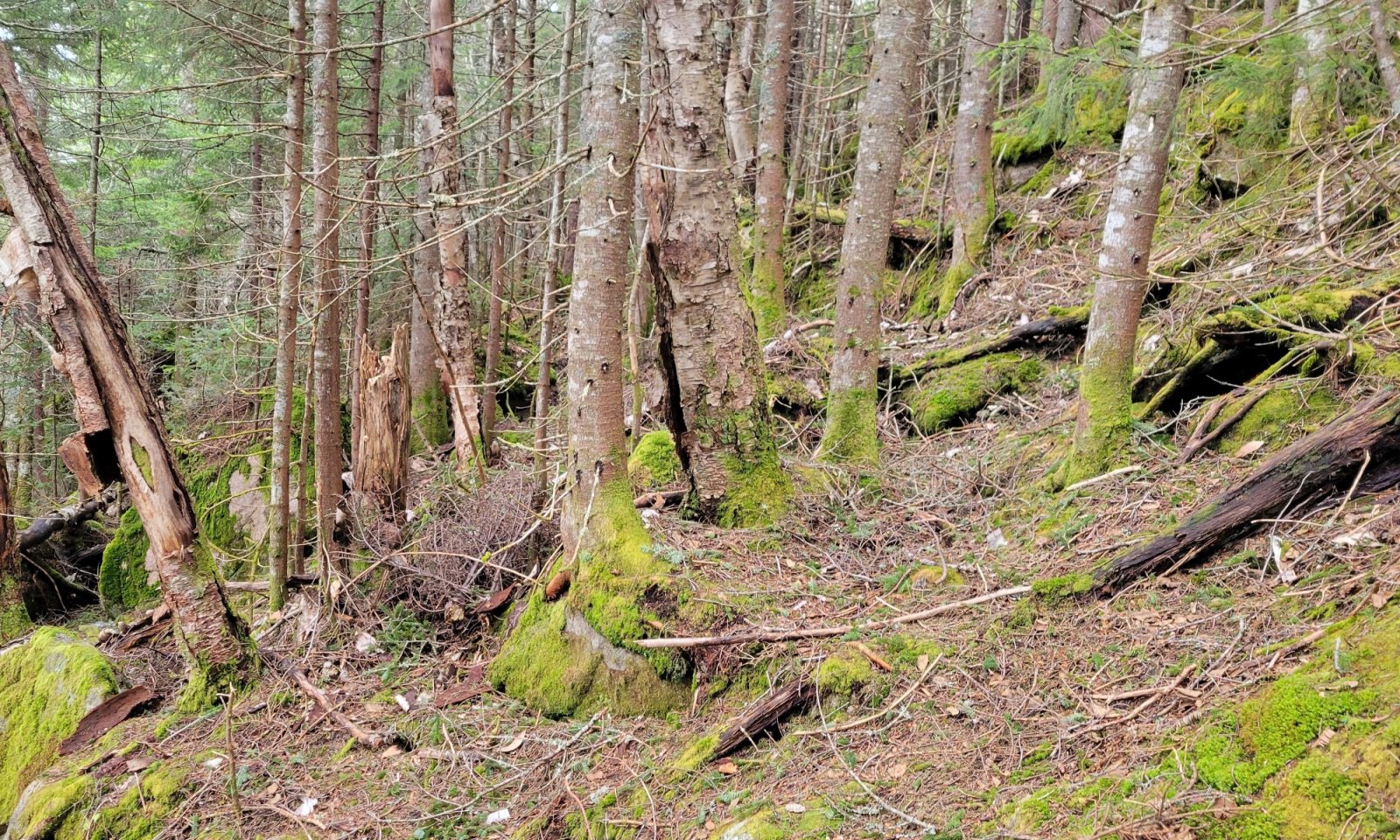
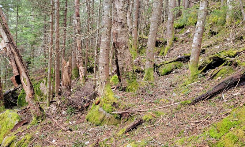
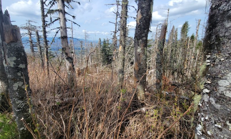
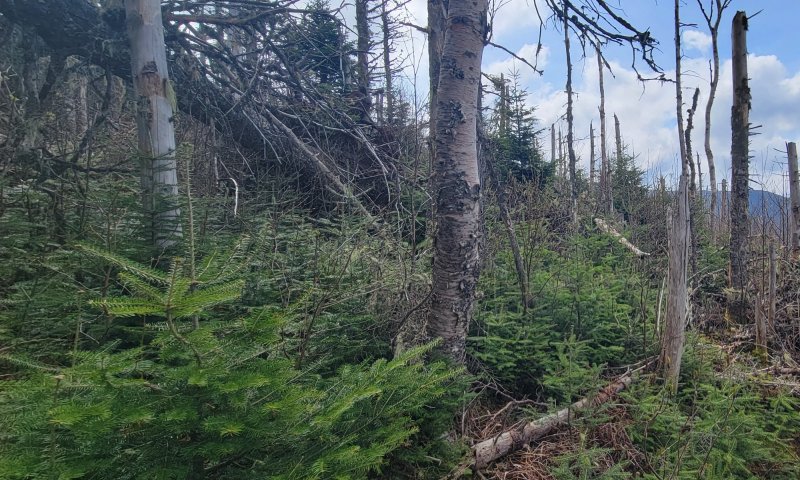
This site occurs on high mountain slopes at elevations between 2500 and 4000 feet (762 and 1219 meters) below tree line and is the first community evident of the cryic soil temperature regime. A broad range of soils are included in this provisional site concept since the primary factors driving vegetation dynamics have to do with the localized climate along the high elevations of the site. Soils may be organic or mineral, shallow to deep, with or without rock fragments in the profile. All soils are well- to excessively-drained, and pH is typically between 3.4 and 6.0.
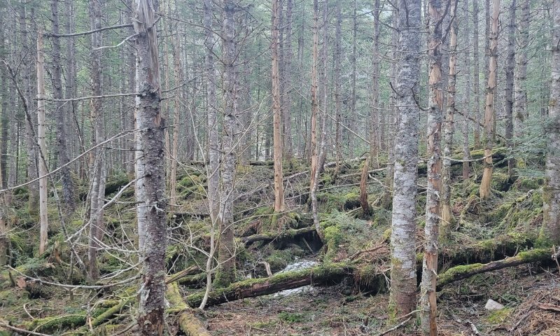
This site is dominated by balsam fir, with black spruce, red spruce, and heartleaf paper birch common. It is resistant to disturbance, but may be susceptible to occasional tree removal by fire, logging, insects, disease, or blowdowns. Downslope movement of soils may also act as an ecological driver when soils are super saturated in steep areas. Other ecological processes which may shift the dominant species includes snow and ice loading, as well as rare fires. Following tree removal, a brief herbaceous phase may be followed by an early successional softwood or heartleaf paper birch phase before eventually returning to softwood dominance.
Associated sites
| RX143X00Y902 |
Alpine Ridge Krummholz These sites tend to occur immediately upslope of this site and is a indicator of the tree line, often seen as stunted black spruce or balsam fir trees (less than 6.5 feet [2 meters] in height).The gradient between the two is correlated to elevation rather than soil properties. |
|---|
Similar sites
| RX143X00Y902 |
Alpine Ridge Krummholz These sites are dominated by stunted balsam fir and black spruce (less than 6.5 feet [2 meters]), whereas this site is dominated by taller balsam fir, red or black spruce, and heartleaf paper birch (up to 80 feet [24 meters]), in the community. |
|---|---|
| F143XY503ME |
Loamy Flat These sites are dominated by red spruce and balsam fir found on wetter, poorly to somewhat poorly drained loamy soils at lower elevations. They occur on deep till flats rather than the steep mountain slopes of this site. A densely compacted layer can be found 10 to 30 inches below the surface that perches water in the upper soil layers. |
| F143XY703ME |
Shallow And Moderately Deep Humic Till These sites are dominated by red spruce and balsam fir found on well drained, bedrock controlled, loamy to sandy loam soils at lower elevations. They will have an accumulation of organic matter at the surface and can be found on upper backslopes and shoulders of hills or mountains below 2,500 feet in elevation. |
Table 1. Dominant plant species
| Tree |
(1) Abies balsamea |
|---|---|
| Shrub |
(1) Sorbus |
| Herbaceous |
(1) Cornus canadensis |
Legacy ID
F143XY903ME


Click on box and path labels to scroll to the respective text.
Ecosystem states
| T1A | - | Soil Degradation / Erosion |
|---|---|---|
| R2A | - | Habitat protection, Seedbank Establishment |
State 1 submodel, plant communities
Communities 1, 5 and 2 (additional pathways)
| 1.1A | - | Canopy Disturbance |
|---|---|---|
| 1.2A | - | Spruce Removal |
| 1.2B | - | Canopy Disturbance |
| 1.3A | - | Conifer Regeneration |
| 1.3B | - | Canopy Disturbance / Intense Soil Disturbance/ Hardwood Establishment |
| 1.4A | - | Time / Self or Selective Thinning / Fir Dominance |
| 1.4B | - | Time / Self or Selective Thinning / Spruce & Fir Dominance |
| 1.5A | - | Time / Soil Stabilization / Absence of Disturbance / Conifer Regeneration |
| 1.5B | - | Time / Soil Stabilization / Absence of Disturbance / Conifer Regeneration |
| 1.5C | - | Canopy Disturbance |