Tidal Salt High Marsh mesic very frequently flooded
Scenario model
Current ecosystem state
Select a state
Management practices/drivers
Select a transition or restoration pathway
- Transition T1A More details
- Transition T1B More details
- Restoration pathway R2A More details
- Transition T2A More details
- Restoration pathway R3A More details
- Transition T3A More details
-
No transition or restoration pathway between the selected states has been described
Target ecosystem state
Select a state
State 1
Reference


Description
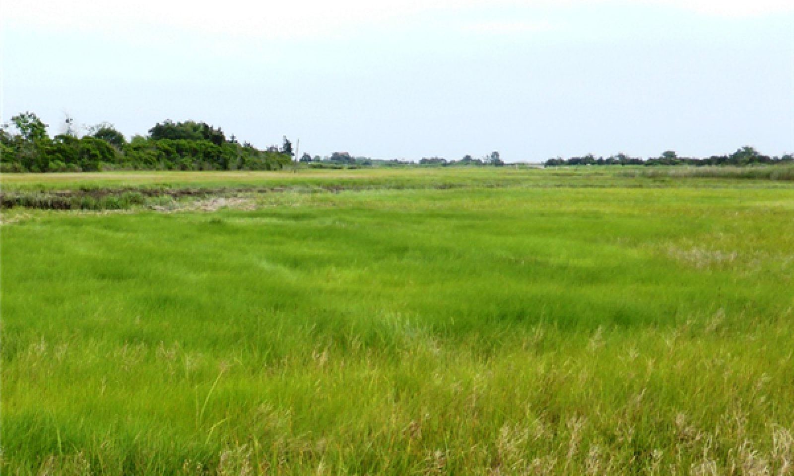
The reference state is a typical tidal salt high marsh of the northeastern United States, characterized as a complex mosaic dominated by (1.1) “salt meadows” of pure and or mixed graminoids: Spartina patens (saltmeadow cordgrass) and Distichlis spicata (saltgrass) and Juncus gerardii (saltmeadow rush). Areas of high marsh with less frequent flooding, at higher elevations and landward reaches, support (1.2) “upper salt meadows and/or shrublands” composed predominantly of Juncus gerardii and Iva frutescens ssp. oraria. (Jesuit’s bark or maritime marsh-elder). The high marsh is further interrupted by (1.3) patches of floristically distinct “pannes”: typified by a sequence of three types, listed in order of increased, but temporary, ponding: (i) shallow forb panne variant typically dominated by Triglochin maritima (seaside arrow-grass), (ii) stunted Spartina alterniflora (smooth cordgrass) – Salicornia depressa (common glasswort or Virginia glasswort) panne variant, and (iii) an unvegetated salt panne variant. Another occasional high marsh feature is (1.4) permanently flooded pools of Ruppia maritima (widgeongrass or beaked ditchgrass).
Note that some transitions away from the reference site lead to different states and still other more severe transitions occur that transform the typical salt high marsh reference condition into completely different ecological sites. A brief synopsis of these external transitions and ecological sites are located near the end of the previous section on ecological dynamics.
Submodel
State 2
Hydrologically-altered Marsh


Description
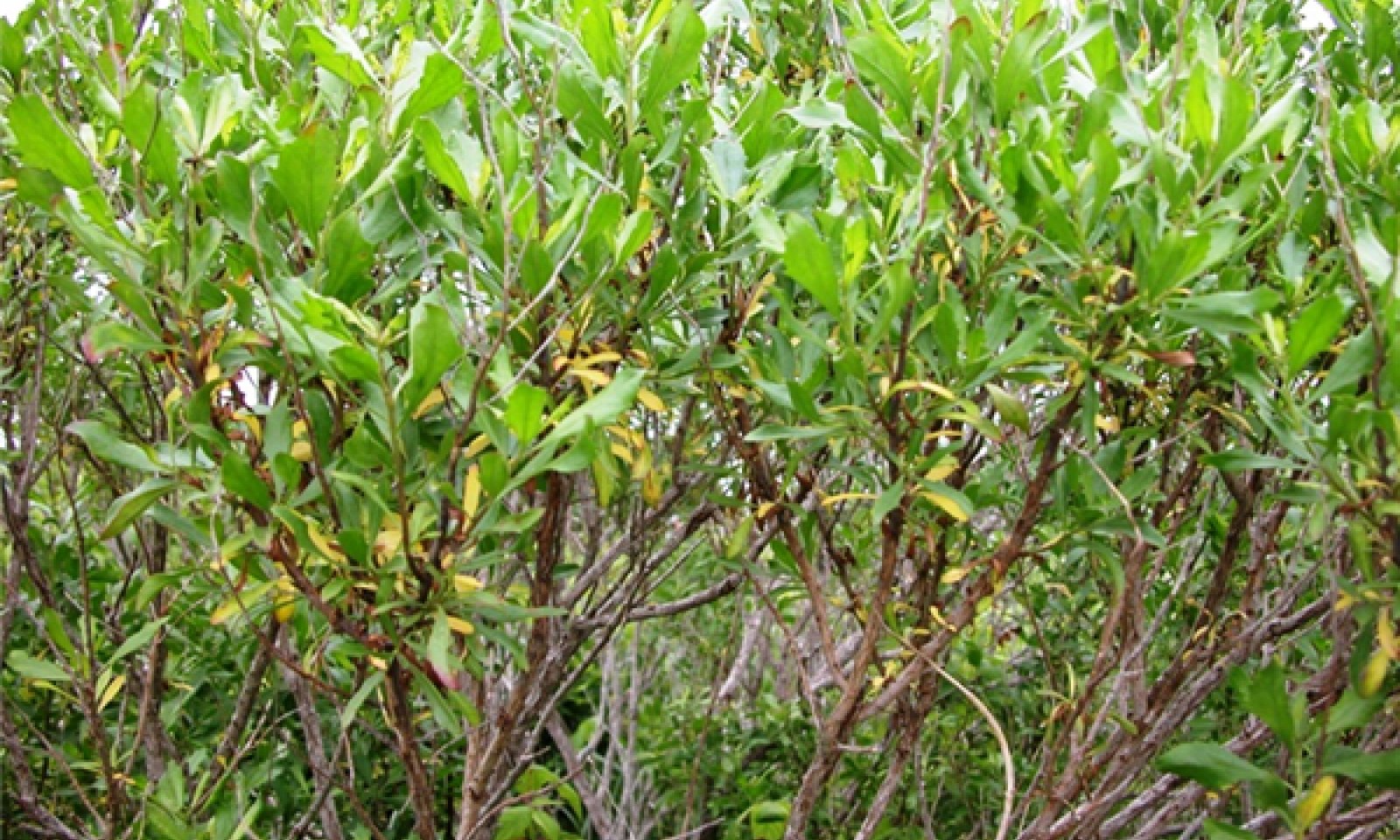
Human disturbances in salt marshes such as ditching and ditching legacy, accelerated sea-level rise, and open water marsh management (OMWM) have altered hydrologic conditions in many ways which in turn affect the vegetation. Hydrologically-altered habitat includes both, drier and wetter scenarios. In the drier situation occur local levees and ditch margins of (2.1) Iva frutescens (maritime marsh-elder). In the wetter situations occur either flooded drainage ditch banks of (2.2) Spartina alterniflora (smooth cordgrass), and or excavated OMWM pools (2.3) Ruppia maritima (beaked ditch-grass) and marine algae, or various degrees of waterlogging in un-drained pannes with (2.4) Distichilis spicata (salt grass)- Salicornia spp. (glassworts) - Spartina alterniflora (smooth cordgrass) or un-vegetated.
Submodel
Description
Marsh surface modifications and engineered structures, e.g., filled causeways, constricted bridges, undersized and improperly emplaced culverts, cause tidal restrictions (Roman, 2012; Tiner, 2013). Tidal restrictions reduce tidal flooding, lower salinity, and may lower the water table, changing the character of the salt marsh which prompts a state change in the vegetation. The type of replacement vegetation depends upon the nature of the restriction and the local drainage pattern. Open restrictions, such as culverts, are common and have less impact then closed restrictions that prohibit tidal exchange entirely (Crain et al., 2009).
Submodel
Mechanism
Physical alterations to marsh hydrology by cut and fill, ditching, open water marsh management can add or subtract tidal flooding, affecting shifts and changes among salt plant communities. Replacement plant communities are variable and include Iva frutenscens (maritime marsh elder) ditch levees/margins, Spartina alterniflora (smooth cordgrass) ditch banks, and excavated pools with Ruppia (beaked ditch-grass) and marine algae.
Mechanism
Engineered structures, such as culverts, tide gates, etc., that restrict the tidal flooding of the marsh will ultimately change the vegetation to a brackish to freshwater state, often supporting the invasive Phragmites (common reed). In extreme cases, the site may be rendered unvegetated.
Mechanism
Restoration of salt high marsh requires correcting the hydrological modifications at issue, such as selective filling of ditches or excavations and or compensating for the elevation changes that lead to waterlogging. To address waterlogging concerns, Runnelling (shallow ditches) is still considered an experimental treatment in these situations.
Mechanism
Engineered structures, such as culverts, tide gates, etc., which restrict the tidal flooding of the marsh will ultimately change the vegetation to a brackish to freshwater state, often supporting the invasive Phragmites (common reed). In extreme cases, the site may be rendered unvegetated.
Mechanism
Restoration involves removing or fixing the tidal restrictions (e.g., culvert size, location, invert, etc.) and reintroducing tidal flooding. Regulating the tides or compensating for surface elevation loss from subsidence using fill or engineering can facilitate the conversion back to salt high marsh. If elevation grades are lower salt low marsh restoration is possible.
Relevant conservation practices
| Practice | External resources |
|---|---|
|
Wetland Wildlife Habitat Management |
|
|
Wetland Restoration |
|
|
Wetland Enhancement |
Mechanism
Removing or fixing the tidal restrictions (e.g., culvert size, location, invert, etc.) with engineering or land management and renewing the ditches to facilitate drainage. Although the resulting marsh may be hydrologically-altering, the return of salt marsh plants may be considered a partial restoration.
Model keys
Briefcase
Add ecological sites and Major Land Resource Areas to your briefcase by clicking on the briefcase (![]() ) icon wherever it occurs. Drag and drop items to reorder. Cookies are used to store briefcase items between browsing sessions. Because of this, the number of items that can be added to your briefcase is limited, and briefcase items added on one device and browser cannot be accessed from another device or browser. Users who do not wish to place cookies on their devices should not use the briefcase tool. Briefcase cookies serve no other purpose than described here and are deleted whenever browsing history is cleared.
) icon wherever it occurs. Drag and drop items to reorder. Cookies are used to store briefcase items between browsing sessions. Because of this, the number of items that can be added to your briefcase is limited, and briefcase items added on one device and browser cannot be accessed from another device or browser. Users who do not wish to place cookies on their devices should not use the briefcase tool. Briefcase cookies serve no other purpose than described here and are deleted whenever browsing history is cleared.
Ecological sites
Major Land Resource Areas
The Ecosystem Dynamics Interpretive Tool is an information system framework developed by the USDA-ARS Jornada Experimental Range, USDA Natural Resources Conservation Service, and New Mexico State University.


