Natural Resources
Conservation Service
Ecological site VX160X01X007
Isothermic Ustic Naturalized Grassland (Kikuyugrass)
Last updated: 4/17/2025
Accessed: 04/10/2026
General information
Provisional. A provisional ecological site description has undergone quality control and quality assurance review. It contains a working state and transition model and enough information to identify the ecological site.
MLRA notes
Major Land Resource Area (MLRA): 160X–Subhumid and Humid Intermediate and High Mountain Slopes
This MLRA occurs in the State of Hawaii on the Big Island of Hawaii and extent on Maui. Elevation ranges from 1000 to 9000 feet (305 to 2745 meters). Slopes are moderate to steep. Topography is sloping to hilly, and cinder cones are common. Lava flows are basaltic or andesitic aa or pahoehoe lava. Aa may form outcrops at higher elevations, but most of the area is covered with material weathered from deep volcanic ash. Areas of volcanic sand and gravel alluvium exist. Average annual precipitation ranges from 20 to 75 inches (510 to 1905 millimeters). Most of the rainfall occurs during kona storms from November through March. In some areas afternoon fog accumulation at higher elevations adds significant moisture to the soil by fog drip and ameliorates evapotranspiration. Average annual air temperatures range from 50 to 71 degrees F (10 to 22 degrees C), with little seasonal variation. The dominant soil order is Andisols with an isothermic or isomesic soil temperature regime and ustic or udic soil moisture regime. Native vegetation consists of forests and rangelands that can include medium to tall statured forests, savannas, and grasslands.
Classification relationships
This ecological site occurs within Major Land Resource Area (MLRA) 160 - MLRA 160XY – Subhumid and Humid Intermediate and High Mountain Slopes.
Ecological site concept
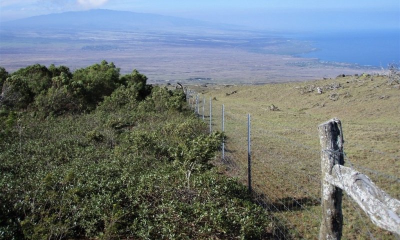
This ecological site occurs on the Island of Maui on the west- and south-facing slopes of Haleakala, where it is accessible from the Haleakala Highway and Kula Highway south of the towns of Makawao and Pukalani. Most of the area is on lands owned by the State of Hawaii, the Division of Hawaiian Homelands, and private owners that include large ranches. It also occurs on southwest-facing slopes of Kohala, mauka and makai of the Waimea-Hawi Road (Rte. 250), and on the west-facing slopes of Mauna Kea south of Waimea along the upper highway (Rte. 190) including the area known as Mana. Large parts of it are on private lands managed for livestock grazing. The State of Hawaii and State Division of Hawaiian Homelands own large areas, and some parts are on the US Army Pohakuloa Training Area. Small, restored examples of native forest are found on the island of Hawaii on State and private lands in Kohala along the Waimea-Hawi highway, and at the Auwahi dryland forest restoration project on the southwestern slopes of Haleakala on the island of Maui.
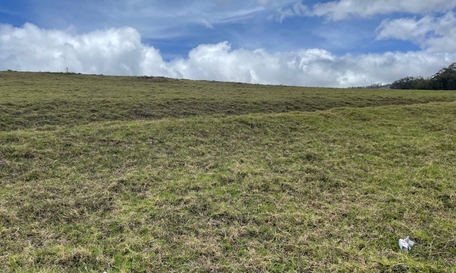
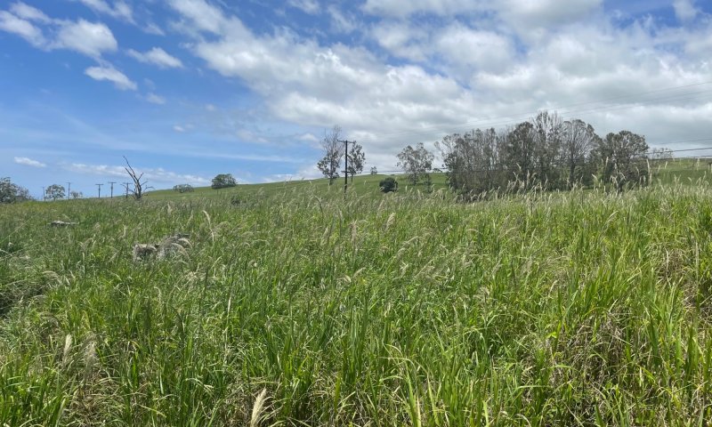
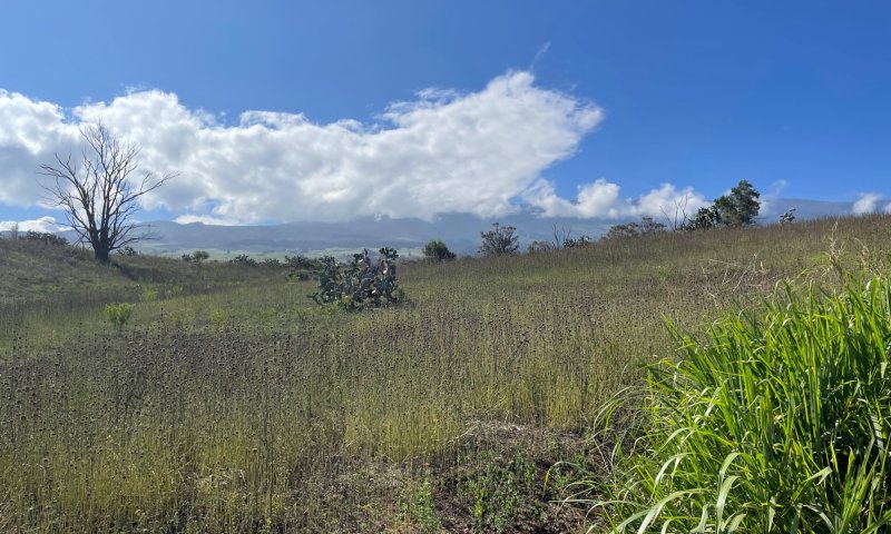
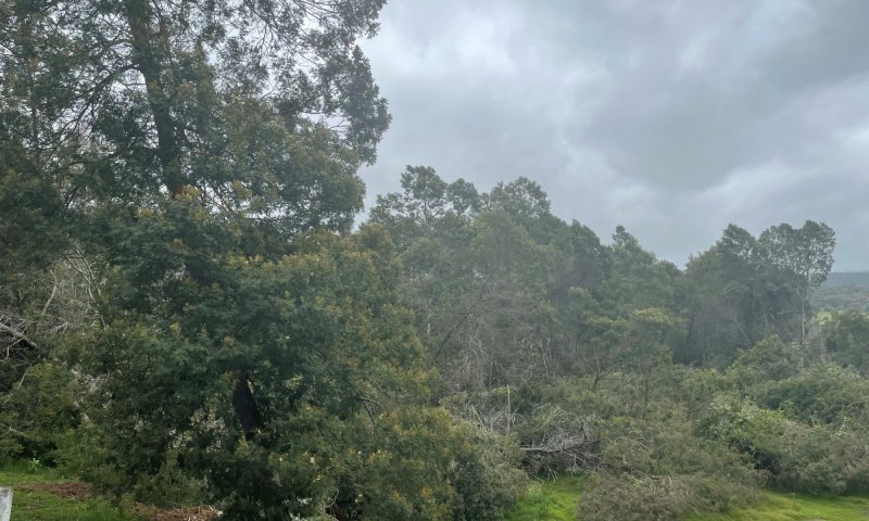
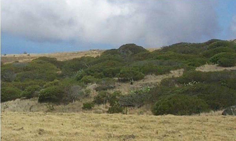
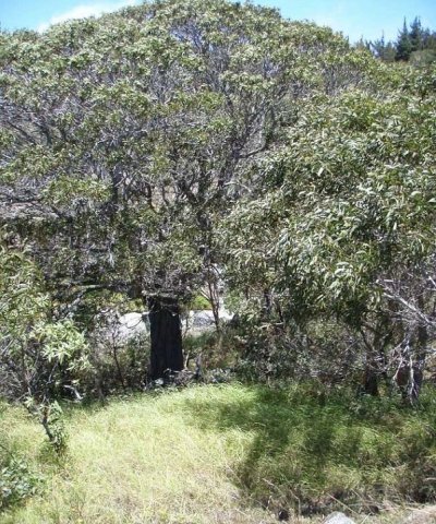
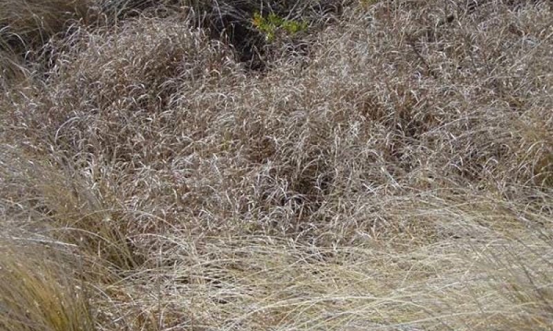
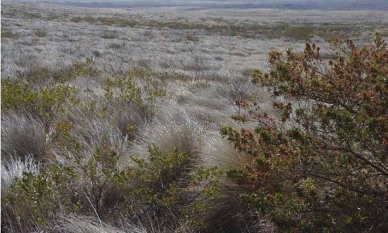
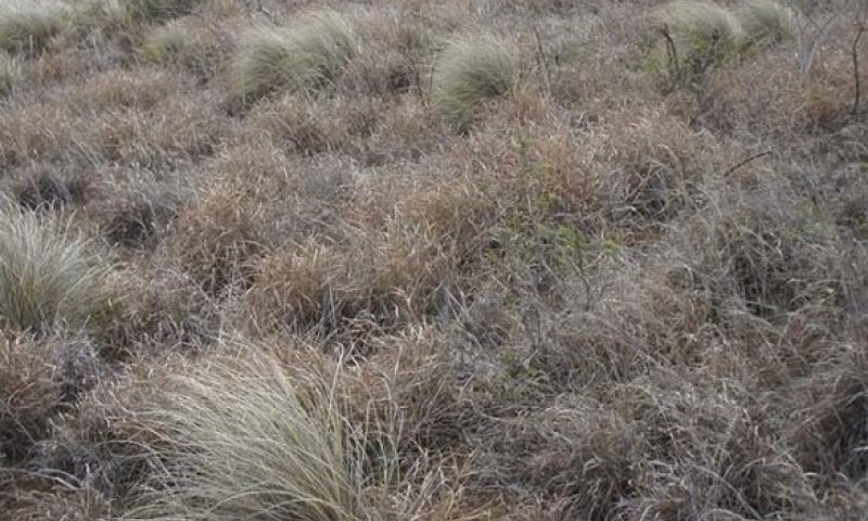
The central concept of the Isothermic Ustic Naturalized Grassland is of well drained, shallow to very deep soils formed in deposits of volcanic ash. This site is primarily found where elevations range from 2000 to 4500 feet, and annual precipitation range between 20 to 40 inches. Annual air temperatures and rainfall are associated with warm (isothermic), seasonally dry (ustic) soil conditions. Soils at the northern extremes of the ecological site on both islands transition to moist (udic) soil conditions. The original vegetation was dry tropical forest with very high native species diversity; only remnants remain of this native forest. Most of the area is now naturalized grassland dominated by introduced species, mainly kikuyugrass (Cenchrus clandestinus) with minor amounts of leguminous forbs and vines.
Associated sites
| VX167X01X001 |
Oxidic Dissected Lowland The Oxidic Dissected Lowland adjoins this ecological site on the north aspect of Haleakala. It is at generally lower elevations with higher rainfall, warmer temperatures, and much more weathered soil orders than this ecological site. The dominant forage species in the Oxidic Dissected Lowland is guineagrass rather the kikuyugrass. It probably supported a native forest of tall ohia with tree ferns in the past rather than the dry forest of this ecological site. |
|---|---|
| VX157X01X008 |
Rocky Isothermic Naturalized Grassland The Rocky Isothermic Naturalized Grassland adjoins this ecological site on the lower western aspect of Haleakala on Maui. It occurs at lower, drier, and warmer elevations than this ecological site on similar volcanic ash soils. It has introduced vegetation dominated by kiawe and guinea grass and supported a sparser, lower-stature, more shrub-dominated native vegetation in the past, compared with this ecological site. Buffelgrass is also common in this ecological site where the two sites meet. |
| VX164X01X500 |
Volcanic Ash Forest The Volcanic Ash Forest adjoins this ecological site on the upper slopes of the southwest aspect of Kohala on Hawaii. It occurs at higher, cooler, moister elevations on similar volcanic ash parent materials to those on this ecological site and supports medium stature rain forest rather than dry forest species. There was probably a very diverse transitional dry-moist forest type where these two ecological sites merged; this zone is now a grassland of introduced species. |
| VX160X01X501 |
Ustic Fog Drip Forest The Ustic Fog Drip Forest adjoins this ecological site on the southwest aspect of Mauna Kea. It occurs at higher, moister, cooler elevations than this ecological site. The native species lists are different, but the two ecological sites share kikuyugrass as the dominant forage species over most of their areas. The Ustic Fog Drip Forest has some cool-season (C3) grass species not found in this ecological site. |
| VX160X01X502 |
Isomesic-Cool Isothermic Forest The Isomesic Cool Isothermic Forest adjoins this ecological site on the western aspects of Haleakala and Mauna Kea. The Isomesic Cool Isothermic Forest occurs at mostly higher, moister, cooler elevations than this ecological site. The Isomesic Cool Isothermic Forest is dominated by tall koa trees rather than the dry forest species, including koaia, of this ecological site. Where the sites meet, koa and koaia may intermix and possibly even hybridize, as evidenced by seed pods with intermediate characteristics of the two species. |
| VX157X01X003 |
Rocky Volcanic Ash Savanna The Rocky Volcanic Ash Savanna adjoins this ecological site on the lower western aspect of Haleakala on Maui and the lower southwestern slopes of Kohala and western slopes of Mauna Kea on Hawaii. It occurs at lower, drier, and warmer elevations than this ecological site on similar volcanic ash parent materials. It has introduced vegetation dominated by kiawe and buffelgrass and supported a sparser, lower-stature, more shrub-dominated native vegetation in the past, compared with this ecological site. Buffelgrass is also common in this ecological site where the two sites meet. |
Similar sites
| VX161B01X500 |
Ustic Isothermic Forest The Ustic Isothermic Forest occurs on Hawaii at similar elevations, climate, and on similar soils to this ecological site. Both sites support remnants of a notably diverse dry native forest type, and both are now primarily naturalized grasslands dominated by kikuyugrass and, on Hawaii, crimson fountaingrass. |
|---|
Table 1. Dominant plant species
| Tree |
Not specified |
|---|---|
| Shrub |
Not specified |
| Herbaceous |
(1) Pennisetum clandestinum |
Legacy ID
R160XY007HI

Click on box and path labels to scroll to the respective text.
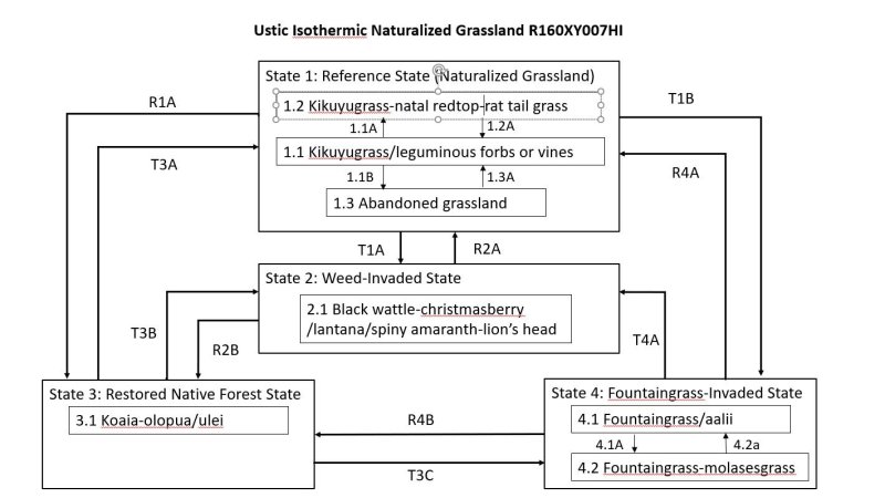
Ecosystem states
| T1A | - | State 1 Reference will transition gradually to State 2 Weed-Invaded by invasion of competitive tree and shrub species, particularly black wattle, lantana, and christmasberry. The rate of conversion will depend on proximity of weed seed sources and the degree of overgrazing that creates bare soil and reduces the competitiveness of kikuyugrass. |
|---|---|---|
| R1A | - | State 1 Reference may be restored to a facsimile of the original native forest. The site must be securely fenced to exclude all domestic and feral ungulates; protection from fire is also useful. Managed grazing outside the restoration site to control dense growth of grasses can reduce fire threat. Within the enclosure, introduced plants must be cut down, girdled, or killed with weed control measures. Replanting of native species then proceeds along with continuous weed monitoring and control. Supplemental water is usually needed until native plants are well established. |
| T1B | - | State 1 Reference can transition to State 4 Fountaingrass-Invaded when competitiveness of kikuyugrass is reduced by overgrazing, allowing less-desirable fountaingrass (Cenchrus setaceus) to invade and establish. Eventually fountaingrass will carry a fire through the site, eliminating all other species with the possible exception of aalii (Dodonaea viscosa). |
| R2A | - | Restoration of State 2 Weed-Invaded to State 1 Reference requires brush control followed by weed control. Re-establishment of desired forage grasses is likely to be needed. |
| R2B | - | State 2 Weed-Invaded may be restored to a facsimile of native forest by constructing a fence designed to keep out ungulates (including deer, pigs, goats, and cattle), removal of all ungulates, establishment of fire protection, brush control, intensive and long term weed control, all followed by replanting of native species. |
| T3A | - | This transition from State 3 Restored Native Forest to State 1 Naturalized Grassland is not recommended given the rarity of locations containing native plant species. It would occur quickly and easily by allowing ungulates and/or fire to access a site surrounded by State 1. |
| T3B | - | State 3 Restored Native Forest gradually transitions to State 2 Weed-Invaded due to lack of native plant regeneration resulting from weed competition and ungulate browsing coupled with destruction of existing native plants by ungulates. The transition is rapid when fire carried by introduced grass species destroys other vegetation. |
| T3C | - | State 3 Restored Native Forest transitions to State 4 Fountaingrass-Invaded if fountaingrass (Cenchrus setaceus) invades the site. Competition from fountaingrass would impede growth and reproduction of native species; eventually fountaingrass will carry a fire through the site, eliminating all other species with the possible exception of aalii (Dodonaea viscosa). |
| R4A | - | We are unaware of this restoration having been performed. Fountaingrass might be heavily grazed and then killed with probably two applications of herbicide, with follow-up control of seedling emergence from the fountaingrass seed bank and introduction of a competitive desired grass species. Careful grazing, protection from fire, and continuous control of seedling fountaingrass from nearby areas may result in success. |
| R4B | - | Grazing, mowing, or weed-whacking of fountaingrass followed by applications of herbicide to kill existing fountaingrass plants and follow-up herbicide to kill fountaingrass recruited from the site seedbank or nearby areas would be necessary. Dead fountaingrass plants and litter should be left in place to protect the soil from erosion. Planting of native plants could then proceed along with protection from ungulates and fire. |
State 1 submodel, plant communities
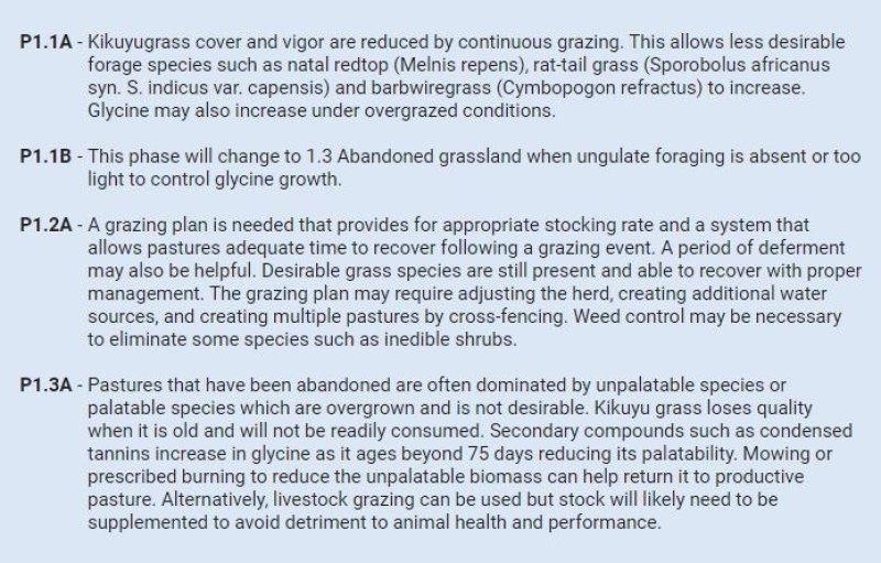
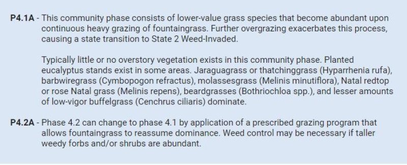
| P1.1A | - | Kikuyugrass cover and vigor are reduced by continuous grazing. This allows less desirable forage species such as natal redtop (Melnis repens), rat-tail grass (Sporobolus africanus syn. S. indicus var. capensis) and barbwiregrass (Cymbopogon refractus) to increase. Glycine may also increase under overgrazed conditions. |
|---|---|---|
| P1.1B | - | This phase will change to 1.3 Abandoned grassland when ungulate foraging is absent or too light to control glycine growth. |
| P1.2A | - | A grazing plan is needed that provides for appropriate stocking rate and a system that allows pastures adequate time to recover following a grazing event. A period of deferment may also be helpful. Desirable grass species are still present and able to recover with proper management. The grazing plan may require adjusting the herd, creating additional water sources, and creating multiple pastures by cross-fencing. Weed control may be necessary to eliminate some species such as inedible shrubs. |
| P1.3A | - | Pastures that have been abandoned are often dominated by unpalatable species or palatable species which are overgrown and is not desirable. Kikuyu grass loses quality when it is old and will not be readily consumed. Secondary compounds such as condensed tannins increase in glycine as it ages beyond 75 days reducing its palatability. Mowing or prescribed burning to reduce the unpalatable biomass can help return it to productive pasture. Alternatively, livestock grazing can be used but stock will likely need to be supplemented to avoid detriment to animal health and performance. |
State 2 submodel, plant communities
State 3 submodel, plant communities
State 4 submodel, plant communities
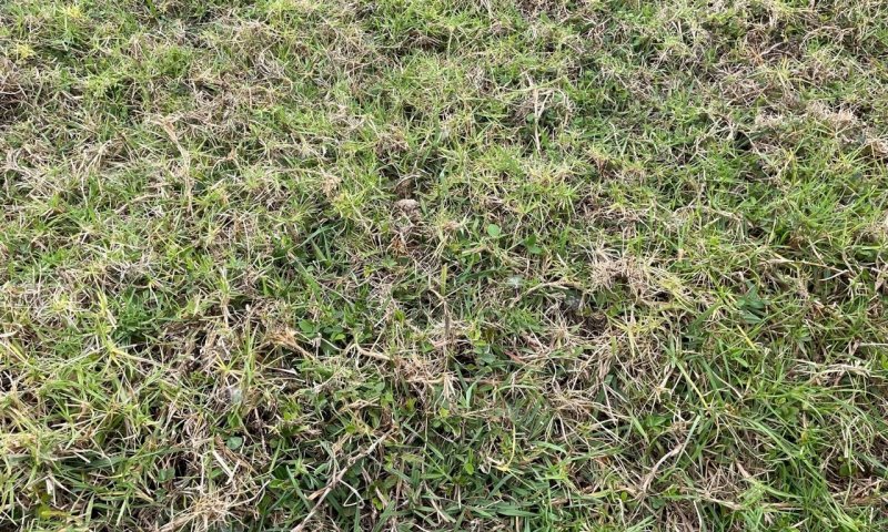
| P4.1A | - | This community phase consists of lower-value grass species that become abundant upon continuous heavy grazing of fountaingrass. Further overgrazing exacerbates this process, causing a state transition to State 2 Weed-Invaded. Typically little or no overstory vegetation exists in this community phase. Planted eucalyptus stands exist in some areas. Jaraguagrass or thatchinggrass (Hyparrhenia rufa), barbwiregrass (Cymbopogon refractus), molassesgrass (Melinis minutiflora), Natal redtop or rose Natal grass (Melinis repens), beardgrasses (Bothriochloa spp.), and lesser amounts of low-vigor buffelgrass (Cenchrus ciliaris) dominate. |
|---|---|---|
| P4.2A | - | Phase 4.2 can change to phase 4.1 by application of a prescribed grazing program that allows fountaingrass to reassume dominance. Weed control may be necessary if taller weedy forbs and/or shrubs are abundant. |