Maritime Forest Sandy Coastal Plain
Scenario model
Current ecosystem state
Select a state
Management practices/drivers
Select a transition or restoration pathway
-
Transition T1A
Ditching
More details -
Restoration pathway R2A
Return to reference state site hydrology
More details -
No transition or restoration pathway between the selected states has been described
Target ecosystem state
Select a state
Description
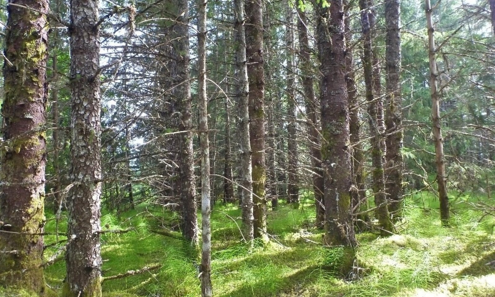
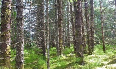
The reference state supports three community phases. The reference community phase is represented by an open needleleaf forest. The presence of these and related communities are dictated temporally and spatially by ponding on the alluvial outwash plains. All community phases in this report are characterized using the Alaska Vegetation Classification System (Viereck et al. 1992).
Submodel
Description
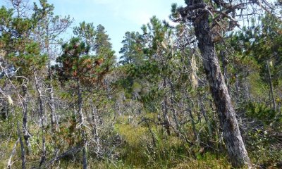
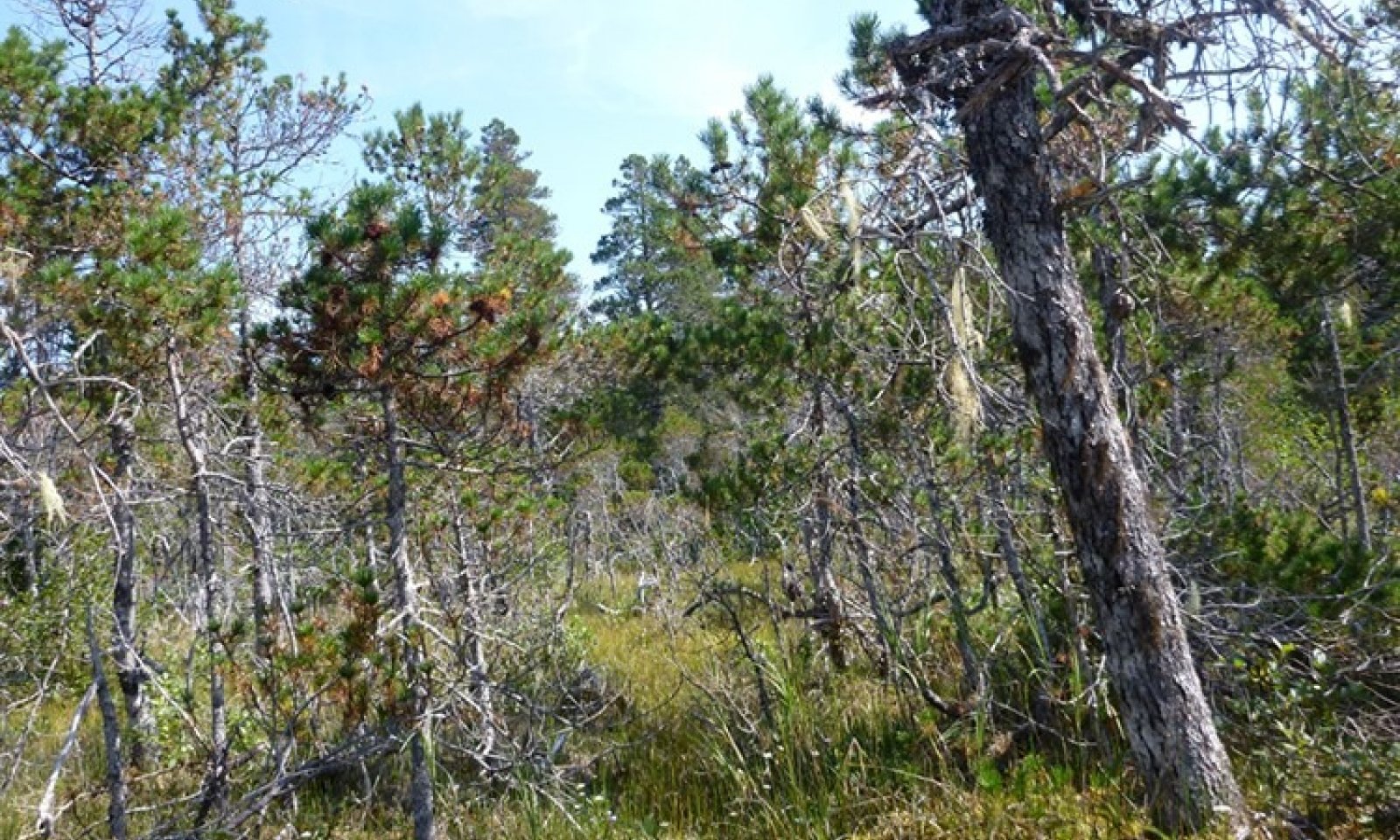
This alternative state is associated with historical and active anthropogenic ditching. This practice is used for development in the Gustavus area, and results in substantial changes to the hydrological processes. Ditching rapidly lowers the water table, increases drainage and runoff potential, and reduces the frequency and duration of ponding. Ditching associated with this ecological site results in a rapid transition to different plant communities from that normally found in the reference state. The ditching state commonly includes resilient individuals and species extant from the reference state.
Whether the alternative state can naturally transition back to the reference state remains unknown. If the overstory is not cleared for development, community phase 2.1 may transition back to the reference state and exhibit similar vegetative communities as those in community phase 1.1.
Submodel
Mechanism
This transition is caused by anthropogenic ditching. Areas surrounding the ditches have a lower water table and associated hydrological processes that support plant assemblages and soil characteristics distinctly different from those of the reference state. The plant community consists largely of extant hydrophilic species that are water-tolerant and various trees and shrubs with greater overall production. Over time, these areas become less susceptible to flooding and ponding after rainfall and snowmelt due to the hydrological effects of ditching. As a result of ditching and isostatic rebound, this transition is rapid as compared to natural succession and it is dependent on land management decisions.
Mechanism
The restorative pathway to the reference state may occur in areas where anthropogenic efforts are implemented. Dikes and ditch plugs commonly are used, and they can potentially restore historic reference state hydrologic processes. Once these techniques are properly implemented, it is hypothesized that the community can transition to the reference state. Further research and in situ documentation is required to fully understand this transition.
Model keys
Briefcase
Add ecological sites and Major Land Resource Areas to your briefcase by clicking on the briefcase (![]() ) icon wherever it occurs. Drag and drop items to reorder. Cookies are used to store briefcase items between browsing sessions. Because of this, the number of items that can be added to your briefcase is limited, and briefcase items added on one device and browser cannot be accessed from another device or browser. Users who do not wish to place cookies on their devices should not use the briefcase tool. Briefcase cookies serve no other purpose than described here and are deleted whenever browsing history is cleared.
) icon wherever it occurs. Drag and drop items to reorder. Cookies are used to store briefcase items between browsing sessions. Because of this, the number of items that can be added to your briefcase is limited, and briefcase items added on one device and browser cannot be accessed from another device or browser. Users who do not wish to place cookies on their devices should not use the briefcase tool. Briefcase cookies serve no other purpose than described here and are deleted whenever browsing history is cleared.
Ecological sites
Major Land Resource Areas
The Ecosystem Dynamics Interpretive Tool is an information system framework developed by the USDA-ARS Jornada Experimental Range, USDA Natural Resources Conservation Service, and New Mexico State University.