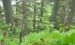
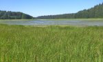
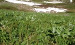
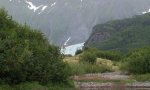
Major Land Resource Area 220X
Alexander Archipelago-Gulf of Alaska Coast
Accessed: 04/03/2026
Next steps
-
1
Select an ecological site
Select an ecological site using the list, keys, photos, briefcase, or quick search option located on this page. -
2
Explore the ecological site description
Next, learn more about the selected ecological site and its characteristic dynamics by browsing the ecological site description and exploring alternative state and transition model formats.
Ecological site list
-
i
Key Characteristics
- Parent material not alluvium and landform not associated with flood plain.
- Not as above. Parent material typically colluvium and/or residuum.
- Soil parent material is not calcareous.
- Not as above.
- Well- to moderately-well drained soils. Soils do not have a persistent water table at any depth during the growing season.
- Occurs at the lowest band of subalpine vegetation. Trees more productive compared to es 350. Krummholz and alpine species less common.
-
i
Key Characteristics
- Parent material not alluvium and landform not associated with flood plain.
- Not as above. Parent material typically colluvium and/or residuum.
- Soil parent material is calcareous.
-
i
Key Characteristics
- Parent material not alluvium and landform not associated with flood plain.
- Soils are primarily organic material over bedrock.
- Wet soils, histic.
-
i
Key Characteristics
- Parent material not alluvium and landform not associated with flood plain.
- Not as above. Parent material typically colluvium and/or residuum.
- Soil parent material is not calcareous.
- Not as above.
- Wetter soils then above.
-
i
Key Characteristics
- Parent material not alluvium and landform not associated with flood plain.
- Soils are primarily organic material over bedrock.
- Dry soils, folistic.
-
i
Key Characteristics
- Parent material not alluvium and landform not associated with flood plain.
- Not as above. Parent material typically colluvium and/or residuum.
- Soil parent material is not calcareous.
- Not as above.
- Well- to moderately-well drained soils. Soils do not have a persistent water table at any depth during the growing season.
- Occurs at the highest band of subalpine vegetation. Trees less productive compared to es 200. Krummholz and alpine species more common.
-
i
Key Characteristics
- Hydrologic-driven (water influenced) communities
- Inland hydrology controlled
- Riparian, or channel driven, hydrology: ES Group 1: Floodplains and drainageways
- Active floodplains
- Higher floodplain or floodplain step, above channel, forest dominated
-
i
Key Characteristics
- Not hydrologically driven (nor water influenced) communities
- Tree, or forested, driven sites
- Higher Elevation and slope driven sites: ES Group 5 - Forested Slopes and Mountains
- Non-organic soils
- Coarser textured soils (sands and gravels)
- Alluvial soils and alluvium driven sites
-
i
Key Characteristics
- Not hydrologically driven (nor water influenced) communities
- Tree, or forested, driven sites
- Lower elevation hills and flat sites: ES Group 4 - Forested flats and hills
- Deep to very deep soils
- Alluvial or outwash materials
- Glacial outwash and till deposits
-
i
Key Characteristics
- Not hydrologically driven (nor water influenced) communities
- Tree, or forested, driven sites
- Higher Elevation and slope driven sites: ES Group 5 - Forested Slopes and Mountains
- Non-organic soils
- Finer textured, loamy soils
- High elevation slopes
-
i
Key Characteristics
- Hydrologic-driven (water influenced) communities
- Inland hydrology controlled
- Open, non-channel, hydrology
- ES Group 3 - Wooded Wetlands
- nearly level to gentle slopes. Common on outwash delta, outwash plains, and till plains.
- Fine-textured soils (coarse-loamy, fine-loamy particle size class)
-
i
Key Characteristics
- Not hydrologically driven (nor water influenced) communities
- Tree, or forested, driven sites
- Higher Elevation and slope driven sites: ES Group 5 - Forested Slopes and Mountains
- Shallow organic soils
-
i
Key Characteristics
- Not hydrologically driven (nor water influenced) communities
- Tree, or forested, driven sites
- Lower elevation hills and flat sites: ES Group 4 - Forested flats and hills
- Shallow soils
-
i
Key Characteristics
- Not hydrologically driven (nor water influenced) communities
- Tree, or forested, driven sites
- Higher Elevation and slope driven sites: ES Group 5 - Forested Slopes and Mountains
- Non-organic soils
- Coarser textured soils (sands and gravels)
- Gravelly slopes
-
i
Key Characteristics
- Not hydrologically driven (nor water influenced) communities
- Tree, or forested, driven sites
- Higher Elevation and slope driven sites: ES Group 5 - Forested Slopes and Mountains
- Non-organic soils
- Finer textured, loamy soils
- Mid to low elevation slopes
- Steeper, non-aspect affected slopes
-
i
Key Characteristics
- Hydrologic-driven (water influenced) communities
- Inland hydrology controlled
- Open, non-channel, hydrology
- ES Group 3 - Wooded Wetlands
- Steeper slopes then above. Footslopes and backslopes of hills and mountains.
-
i
Key Characteristics
- Hydrologic-driven (water influenced) communities
- Inland hydrology controlled
- Open, non-channel, hydrology
- ES Group 3 - Wooded Wetlands
- nearly level to gentle slopes. Common on outwash delta, outwash plains, and till plains.
- Coarse-textured soils (sandy and sandy-skeletal particle size class)
-
i
Key Characteristics
- Not hydrologically driven (nor water influenced) communities
- Tree, or forested, driven sites
- Lower elevation hills and flat sites: ES Group 4 - Forested flats and hills
- Deep to very deep soils
- Alluvial or outwash materials
- Alluvium on stream terraces
-
i
Key Characteristics
- Not hydrologically driven (nor water influenced) communities
- Tree, or forested, driven sites
- Lower elevation hills and flat sites: ES Group 4 - Forested flats and hills
- Deep to very deep soils
- Eolian or wind deposited materials
-
i
Key Characteristics
- Not hydrologically driven (nor water influenced) communities
- Tree, or forested, driven sites
- Higher Elevation and slope driven sites: ES Group 5 - Forested Slopes and Mountains
- Non-organic soils
- Finer textured, loamy soils
- Mid to low elevation slopes
- Warmer, south aspect slopes
-
i
Key Characteristics
- Hydrologic-driven (water influenced) communities
- Coastal hydrology controlled: ES Group Coastal/Estuaries
- Marine and fluvial marine deposits
- Silty and clayey marine deposits with flooding and potential ponding
-
i
Key Characteristics
- Parent material not alluvium and landform not associated with flood plain.
- Not as above. Parent material typically colluvium and/or residuum.
- Soil parent material is not calcareous.
- Site associated with avalanche chutes or soil creep. Alder is typically common and dominant.
- Avalanche chutes.
-
i
Key Characteristics
- Parent material not alluvium and landform not associated with flood plain.
- Not as above. Parent material typically colluvium and/or residuum.
- Soil parent material is not calcareous.
- Site associated with avalanche chutes or soil creep. Alder is typically common and dominant.
- Site associated with soil creep. Soils commonly have buried, mixed, and/or broken soil horizons. Soils with thick A-horizons are common.
-
i
Key Characteristics
- Parent material is alluvium. Site associated with flood plains.
- drier soils then above.
-
i
Key Characteristics
- Parent material is alluvium. Site associated with flood plains.
- persistent water table throughout the growing season.
-
i
Key Characteristics
- Hydrologic-driven (water influenced) communities
- Coastal hydrology controlled: ES Group Coastal/Estuaries
- Marine and fluvial marine deposits
- Sandy deposits and eolian sands
- no water table above 30 inches
-
i
Key Characteristics
- Hydrologic-driven (water influenced) communities
- Coastal hydrology controlled: ES Group Coastal/Estuaries
- Marine and fluvial marine deposits
- Sandy deposits and eolian sands
- Water table above 30 inches
-
i
Key Characteristics
- Hydrologic-driven (water influenced) communities
- Inland hydrology controlled
- Riparian, or channel driven, hydrology: ES Group 1: Floodplains and drainageways
- Drainageways
- Lower sloping drainageways along coastal plains and outwash
-
i
Key Characteristics
- Hydrologic-driven (water influenced) communities
- Inland hydrology controlled
- Riparian, or channel driven, hydrology: ES Group 1: Floodplains and drainageways
- Active floodplains
- Lower floodplain along channel, shrub dominated
-
i
Key Characteristics
- Hydrologic-driven (water influenced) communities
- Inland hydrology controlled
- Open, non-channel, hydrology
- ES Group 2 - Open Wetlands
- Depressions
- Thick organic horizons (Histosols), commonly associated with muskegs.
-
i
Key Characteristics
- Hydrologic-driven (water influenced) communities
- Inland hydrology controlled
- Open, non-channel, hydrology
- ES Group 2 - Open Wetlands
- Glacial valley floors
-
i
Key Characteristics
- Not hydrologically driven (nor water influenced) communities
- Shrub and scrub driven upland or neutral sites: ES Group 6 - Upland Scrub
- Steep active slopes (Avalanche driven communities)
-
i
Key Characteristics
- Hydrologic-driven (water influenced) communities
- Inland hydrology controlled
- Riparian, or channel driven, hydrology: ES Group 1: Floodplains and drainageways
- Drainageways
- Steeper sloping drainageways on mountain slopes and hills
-
i
Key Characteristics
- Not hydrologically driven (nor water influenced) communities
- Shrub and scrub driven upland or neutral sites: ES Group 6 - Upland Scrub
- Steep, stable or less active slopes, shallow soils
-
i
Key Characteristics
- Hydrologic-driven (water influenced) communities
- Coastal hydrology controlled: ES Group Coastal/Estuaries
- Alluvium parent material
-
i
Key Characteristics
- Hydrologic-driven (water influenced) communities
- Inland hydrology controlled
- Open, non-channel, hydrology
- ES Group 2 - Open Wetlands
- Depressions
- Comparatively thinner organic horizons (Inceptisols and Entisols).


Ecological site map
Basemap
Find me
Find point
Full screen
Zoom in to display soil survey map units for an area of interest, and zoom out to display MLRAs. Select a map unit polygon to view ecological sites correlated to that map unit. View a brief description of an ecological site by clicking on its name in the map popup. Soil survey correlations may not be accurate, and ecological site classification of a location should always be verified in the field. Each selection may require the transfer of several hundred KB of data.
Ecological site keys
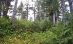
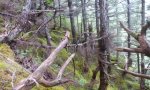
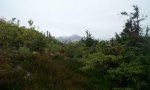
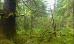
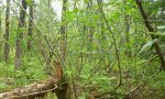
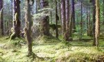
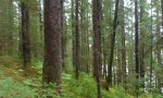
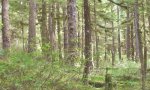
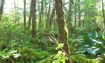
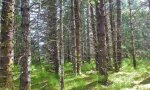
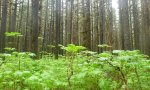
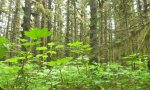
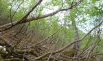
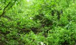
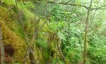
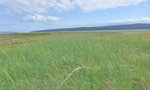
Ecological site photos
Print Options
Sections
Font
Other
Briefcase
Add ecological sites and Major Land Resource Areas to your briefcase by clicking on the briefcase (![]() ) icon wherever it occurs. Drag and drop items to reorder. Cookies are used to store briefcase items between browsing sessions. Because of this, the number of items that can be added to your briefcase is limited, and briefcase items added on one device and browser cannot be accessed from another device or browser. Users who do not wish to place cookies on their devices should not use the briefcase tool. Briefcase cookies serve no other purpose than described here and are deleted whenever browsing history is cleared.
) icon wherever it occurs. Drag and drop items to reorder. Cookies are used to store briefcase items between browsing sessions. Because of this, the number of items that can be added to your briefcase is limited, and briefcase items added on one device and browser cannot be accessed from another device or browser. Users who do not wish to place cookies on their devices should not use the briefcase tool. Briefcase cookies serve no other purpose than described here and are deleted whenever browsing history is cleared.
Ecological sites
Major Land Resource Areas
The Ecosystem Dynamics Interpretive Tool is an information system framework developed by the USDA-ARS Jornada Experimental Range, USDA Natural Resources Conservation Service, and New Mexico State University.