Natural Resources
Conservation Service
Ecological site R220XY443AK
Maritime Scrub Loamy Steep Slopes
Last updated: 6/05/2025
Accessed: 04/05/2026
General information
Provisional. A provisional ecological site description has undergone quality control and quality assurance review. It contains a working state and transition model and enough information to identify the ecological site.
MLRA notes
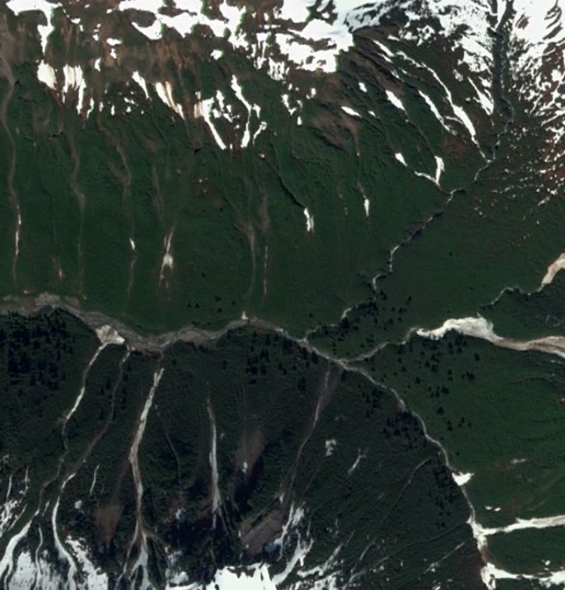
Major Land Resource Area (MLRA): 220X–Alexander Archipelago-Gulf of Alaska Coast
The Alexander Archipelago-Gulf of Alaska Coast area consists of a narrow arc of islands and lower elevation coastal mountains in the Southern Alaska Region. This area spans from the Alexander Archipelago in southeastern Alaska, north and west along the coast of the Gulf of Alaska and Prince William Sound, and further west to the southern tip of the Kenai Peninsula and the northeastern islands of the Kodiak Archipelago. The area makes up about 27,435 square miles (USDA 2006). The terrain primarily consists of low to moderate relief mountains that are deeply incised. Throughout the area glaciers, rivers, and streams have cut deep, narrow to broad valleys. The broader valleys have nearly level to strongly sloping flood plains and stream terraces. Alluvial and colluvial fans and short footslopes are common in the valleys along the base of the mountains. Rocky headlands, sea cliffs, estuaries, and beaches are common along the coast.
During the late Pleistocene epoch, the entire area was covered with glacial ice. The numerous fjords of the Alexander Archipelago and Prince William Sound were formed chiefly as a result of glacial scouring and deepening of preglacial river valleys. Most glacial deposits have been eroded away or buried by mountain colluvium and alluvium, which cover about 90 percent of the present landscape. The remaining glacial and glaciofluvial deposits are generally restricted to coastal areas. During the Holocene epoch, volcanic activity within and adjacent to this area deposited a layer of volcanic ash of varying thickness on much of the landscape in the southeastern and northwestern parts of the area. Paleozoic, Mesozoic, and Lower Tertiary stratified sedimentary rocks and Cretaceous and Tertiary intrusive rocks underlie much of the area and are exposed on steep mountain
slopes and ridges (USDA 2006).
The dominant soil orders in this MLRA are Spodosols, Histosols, and Entisols. Soils in the area typically have a cryic soil temperature regime, an udic moisture regime, and have mixed minerology. Spodosols are common on mountains and hills having been formed in gravelly or cobbly colluvium, glacial till, and varying amounts of silty volcanic ash. These Spodosols commonly range from shallow to deep, are well to somewhat poorly drained, and typically classify as Humicryods or Haplocryods. Histosols that are poorly to very poorly drained occur on footslopes, discharge slopes, and valley floors. These wet histosols commonly classify as Cryosaprists, Cryohemists, and Cryofibrists. Histosols that are well drained occur on steep mountainsides. These dry Histosols commonly classify as Cryofolists. Entisols are common on flood plains, stream terraces, and outwash plains having been formed in silty, sandy, and gravelly to cobbly alluvium. These Entisols are generally deep, range from well to somewhat poorly drained, and commonly classify as Cryaquents and Cryofluvents. Miscellaneous (nonsoil) areas make up about 23 percent of this MLRA. The most common miscellaneous areas are chutes, rock outcrop, rubble land, beaches, riverwash, and water.
This area represents the Northern extent of the Pacific temperate rainforest and is characterized by productive stands of conifers. Western hemlock and Sitka spruce are the dominant trees on mountains and hills at lower elevations. Due to warmer temperatures, western red cedar and Alaska cedar are more prevalent in the southern portion of this area. Black cottonwood and mixed forest types occur on flood plains. Areas of peat and other sites that are too wet for forest growth support sedge-grass meadows and low scrub. As elevation increases, mountain hemlock becomes the dominant tree in forested stands, which marks the transition to subalpine vegetation. The subalpine life zone typically occurs at elevations between 1500 to 3000 feet (Boggs et al. 2010, Carstensen 2007, Martin et al. 1995). Other common subalpine plant communities include tall alder scrub and bluejoint-forb meadows. Alpine vegetation occurs at even higher elevations, which marks the transition to the Southern Alaska Coastal Mountains Area (MLRA 222).
This area includes the Municipality of Juneau, Alaska's capital, and a number of smaller coastal towns and villages. Federally administered lands within this MLRA include Admiralty Island National Monument and part of Misty Fjords National Monument, Tongass National Forest, Chugach National Forest, and Glacier Bay, Wrangell-St. Elias, and Kenai Fjords National Parks and Preserves. The southern terminus of the Trans-Alaska Pipeline is in Valdez.
Ecological site concept
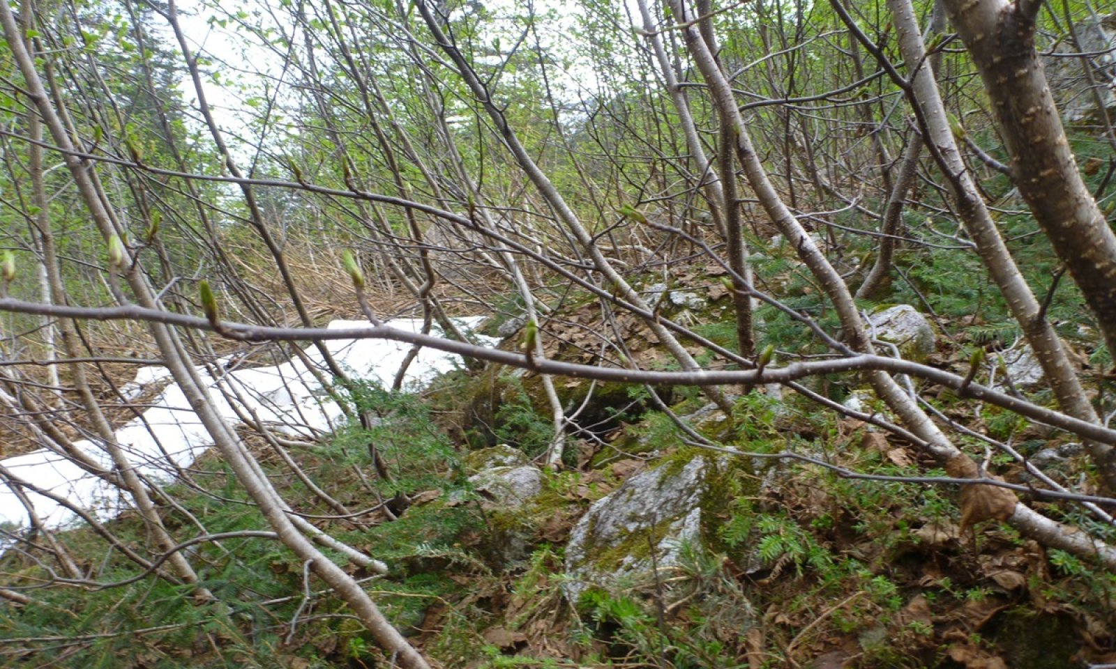
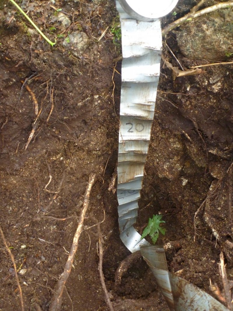
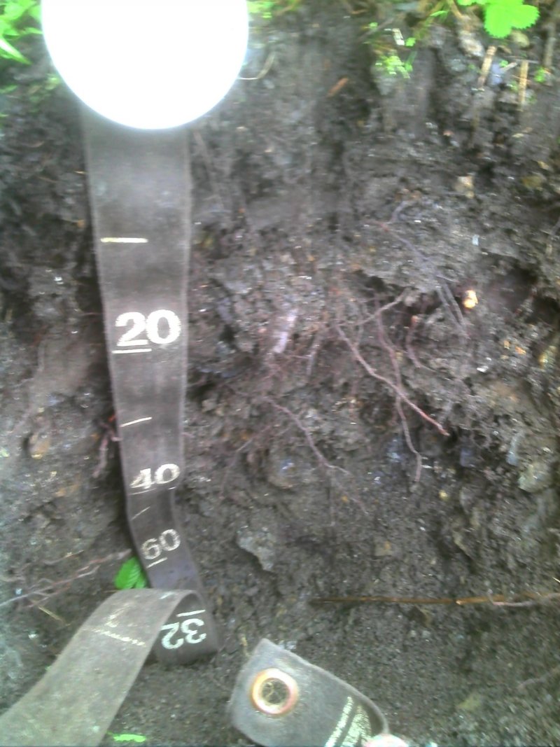
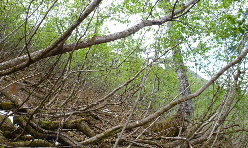
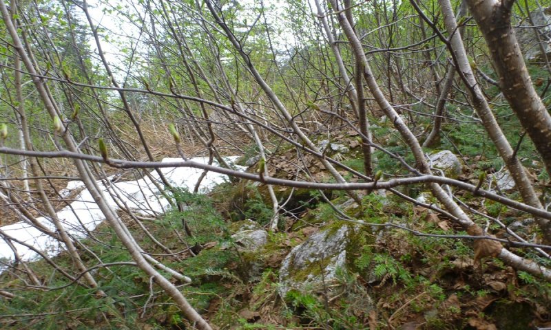
This site occurs in avalanche chutes characterized by linear/concave features of steep mountain slopes. Avalanche chutes typically occur on the center third of mountain flanks on slopes ranging from 40-100%. The soils of this site are very cobbly sandy loams that formed in colluvium. Rock fragments may or may not be present on the soil surface, but typically compose about 80% of the soil volume below the surface. Bedrock is sometimes present at depths of 20 inches or greater.
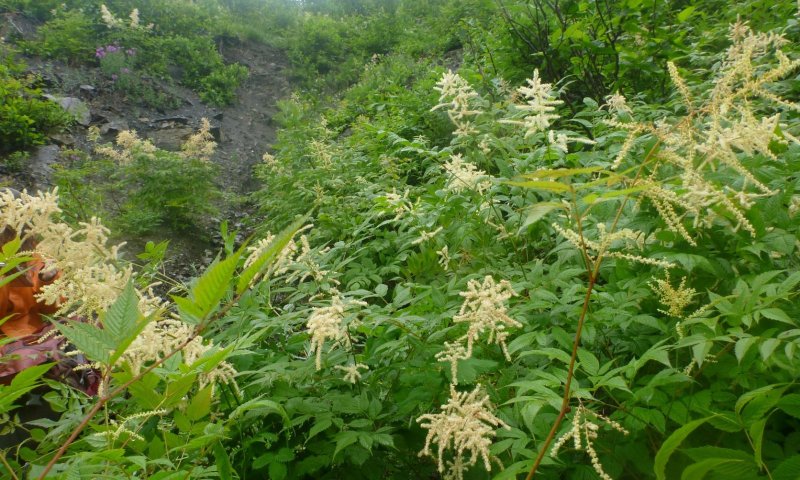
This site supports two distinctive plant communities driven by avalanche activity. The most common community phase is an open tall scrub community dominated by Sitka alder, and the other is an early seral mesic forb herbaceous community that establishes following an avalanche. Trees may establish in this site given sufficient time without avalanches.
Associated sites
| R220XY446AK |
Maritime Scrub Loamy Escarpments Ecological site R220XY446AK supports a similar plant community but occurs on escarpments on steep, shallow to moderately-deep soils. |
|---|
Similar sites
| R220XY446AK |
Maritime Scrub Loamy Escarpments Site R220XY446AK occurs on steep mountain slopes dominated by alder, but lacks avalanches as a disturbance driver. |
|---|---|
| R220XY465AK |
Maritime Scrub Loamy Slopes Site R220XY465AK is also dominated by alder, but occurs on mountain slopes with less than 50% slope, and lacking avalanches as a disturbance driver. |
Table 1. Dominant plant species
| Tree |
Not specified |
|---|---|
| Shrub |
(1) Alnus viridis ssp. sinuata |
| Herbaceous |
(1) Athyrium filix-femina |
Click on box and path labels to scroll to the respective text.
Ecosystem states
State 1 submodel, plant communities
| 1.1a | - | Avalanche removes woody vegetation |
|---|---|---|
| 1.2a | - | Time without avalanche results in colonization and increased shrub cover |