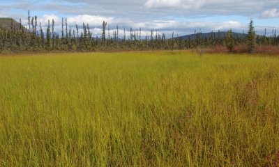
The reference state has two associated plant communities largely controlled by the influences of ponding and a water table. Community 1.1 typically occurs in the center of the depression, while community 1.2 typically occurs on the edges of the depression. When compared to the depression edge, the center of the depression has wetter soils that pond more frequently and have more abundant graminoid cover.
Submodel
1.1. water sedge / water horsetail - purple marshlocks
Add ecological sites and Major Land Resource Areas to your briefcase by clicking on the briefcase () icon wherever it occurs. Drag and drop items to reorder. Cookies are used to store briefcase items between browsing sessions. Because of this, the number of items that can be added to your briefcase is limited, and briefcase items added on one device and browser cannot be accessed from another device or browser. Users who do not wish to place cookies on their devices should not use the briefcase tool. Briefcase cookies serve no other purpose than described here and are deleted whenever browsing history is cleared.
The Ecosystem Dynamics Interpretive Tool is an information system framework developed by the USDA-ARS Jornada Experimental Range, USDA Natural Resources Conservation Service, and New Mexico State University.