Major Land Resource Area 231X
Interior Alaska Highlands
Accessed: 04/03/2026
Description
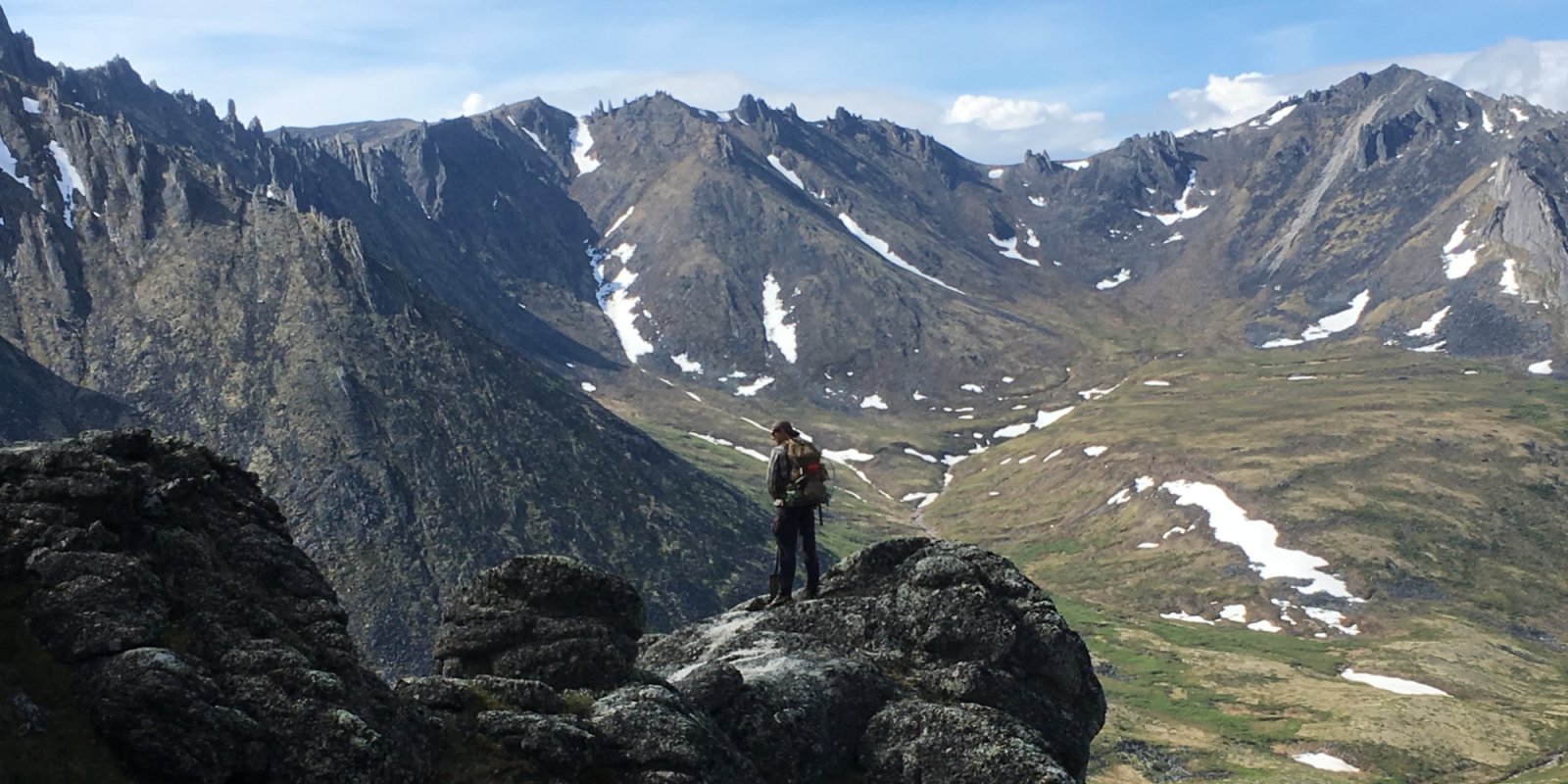
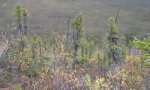
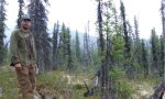
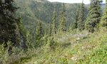
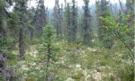
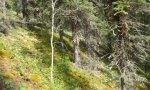
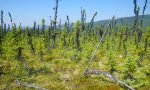
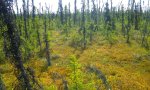
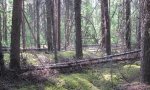
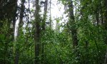
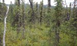
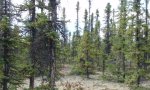
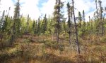
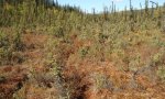
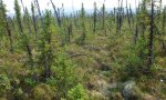
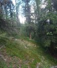
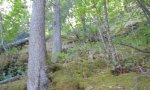
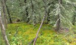
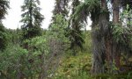
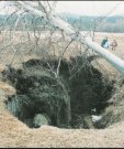
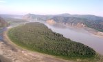
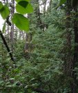
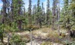
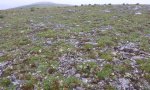
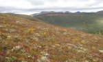
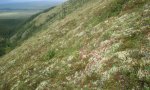
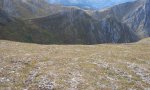
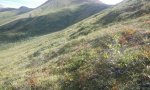
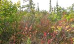
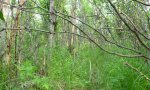
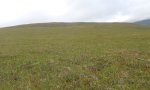
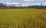
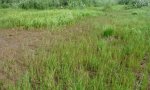
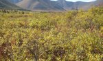
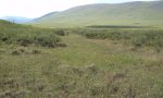
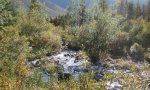
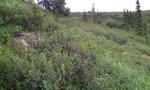
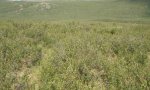
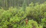
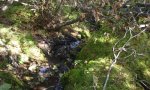
The Interior Alaska Uplands (MLRA 231X) is in the Interior Region of Alaska and includes the extensive hills, mountains, and valleys between the Tanana River to the south and the Brooks Range to the north. These hills and mountains surround the Yukon Flats Lowlands (MLRA 232X). MLRA 231X makes up about 69,175 square miles. The hills and mountains of the area tend to be moderately steep to steep resulting in high-relief slopes. The mountains are generally rounded at lower elevations and sharp-ridged at higher elevations. Elevation ranges from about 400 feet in the west, along the boundary with the Interior Alaska Lowlands (MLRA 229X), to 6,583 feet at the summit of Mt. Harper, in the southeast. Major tributaries include large sections of the Yukon, Koyukuk, Kanuti, Charley, Coleen, and Chatanika Rivers. This area is traversed by several major roads, including the Taylor Highway in the east and the Steese, Elliott, and Dalton Highways north of Fairbanks. The area is mostly undeveloped wild land that is sparsely populated. The largest community along the road system is Fairbanks with smaller communities like Alatna, Allakaket, Chicken, Eagle, Eagle Village, Hughes, and Rampart occurring along the previously mentioned rivers and highways. The vast majority of this MLRA was unglaciated during the Pleistocene epoch with the exceptions being the highest mountains and where glaciers extended into the area from the Brooks Range. For the most part, glacial moraines and drift are limited to the upper elevations of the highest mountains. Most of the landscape is mantled with bedrock colluvium originating from the underlying bedrock. Valley bottoms are filled with Holocene fluvial deposits and colluvium from the adjacent mountain slopes. Silty loess, which originated from unvegetated flood plains in and adjacent to this area, covers much of the surface. On hill and mountain slopes proximal to major river valleys (e.g., Tanana and Yukon Rivers), the loess is many feet thick. As elevation and distance from major river valleys increases, loess thickness decreases significantly. Bedrock is commonly exposed on the highest ridges. This area is in the zone of discontinuous permafrost. Permafrost commonly is close to the surface in areas of the finer textured sediments throughout the MLRA. Isolated masses of ground ice occur in thick deposits of loess on terraces and the lower side slopes of hills. Solifluction lobes, frost boils, and circles and stripes are periglacial features common on mountain slopes in this area. Pingos, thermokarst pits and mounds, ice-wedge polygons, and earth hummocks are periglacial features common on terraces, lower slopes of hills and mountains, and in upland valleys in the area. The dominant soil orders in this area are Gelisols, Inceptisols, Spodosols, and Entisols. The soils in the area have a subgelic or cryic soil temperature regime, an aquic or udic soil moisture regime, and mixed mineralogy. Gelisols are common on north facing slopes, south facing footslopes, valley bottoms, and stream terraces. Gelisols are typically shallow or moderately deep to permafrost (10 to 40 inches) and are poorly or very poorly drained. Wildfires can disturb the insulating organic material at the surface, lowering the permafrost layer, eliminating perched water tables from Gelisols, and thus changing the soil classification. Inceptisols and Spodosols commonly form on south facing hill and mountain slopes. Entisols are common on flood plains and high elevation mountain slopes. Miscellaneous (non-soil) areas make up about 2 percent of this MLRA. The most common miscellaneous areas are rock outcrop and rubble land. In many valleys placer mine tailings are common. Short, warm summers and long, cold winters characterize the subarctic continental climate of the area. The mean annual temperature of the area ranges from 22 to 27 degrees F. The mean annual temperature of the southern half of the area is approximately 3 degrees warmer compared to the northern half (PRISM 2018). The warmest months span June through August with mean monthly temperatures ranging from 50 to 56 degrees F. The coldest months span November through February with mean monthly temperatures ranging from -5 to 3 degrees F. When compared to the high-elevation alpine and subalpine life zones, the lower elevation boreal life zone tends to be 2-3 degrees F colder during the coldest months and 1-2 degrees F warmer during the warmest months (PRISM 2018). The freeze-free period at the lower elevations averages about 60 to 100 days, and the temperature usually remains above freezing from June through mid-September. Precipitation is limited across this area, with the average annual precipitation ranging from 12 to 19 inches. The southern half of the areas receives approximately 2.5 inches more annual precipitation then the northern half (PRISM 2018). The lower elevation boreal life zone receives approximately 2.5 inches less annual precipitation than the high-elevation alpine and subalpine life zones (PRISM 2018). Approximately 3/5th of the annual precipitation occurs during the months of June through September with thunderstorms being common. The average annual snowfall ranges from about 45 to 100 inches. The ground is consistently covered with snow from November through March. Most of this area is forested below an elevation of about 2500 feet. Dominant tree species on slopes are white spruce and black spruce. Black spruce stands are most common on north-facing slopes, stream terraces, and other sites with poor drainage and permafrost. White spruce stands are most common on warm slopes with dry soils. At lower elevations, lightning-caused wildfires are common, often burning many thousands of acres during a single fire. Following wildfires, forbs, grasses, willow, ericaceous shrubs, paper birch, and quacking aspen communities are common until they are eventually replaced by stands of spruce. Tall willow and alder scrub is extensive on low flood plains. White spruce and balsam poplar are common on high flood plains. With increasing elevation, the forests and woodlands give way to subalpine communities dominated by krummholz spruce, shrub birch, willow, and ericaceous shrubs. At even higher elevations, alpine communities prevail which are characterized by diverse forbs, dwarf ericaceous shrubs, and eightpetal mountain-avens. Many of these high elevation communities have a considerable amount of lichen cover and bare ground. Vegetation Life Zones This area supports three life zones defined by the physiological limits of plant communities along an elevational gradient: boreal, subalpine, and alpine. The boreal life zone is the elevational band where forest communities dominate. Not all areas in the boreal life zone are forest communities, however, particularly in places with too wet or dry soil to support tree growth (e.g., bogs or river bluffs). Above the boreal band of elevation, subalpine and alpine vegetation dominate. The subalpine zone is typically a narrow transitional band between the boreal and the alpine life zones, and is characterized by sparse, stunted trees. In the subalpine, certain types of birch and willow shrub species grow at ≥ 1 m in height (commonly Betula glandulosa and Salix pulchra). In the alpine, trees no longer occur, and all shrubs are dwarf or lay prostrate on the ground. In this area, the boreal life zone occurs below 2500 feet elevation on average. The transition between boreal and alpine vegetation can occur within a range of elevations, and is highly dependent on slope, aspect, and shading from adjacent mountains. Within each life zone, there are plant assemblages that are typically associated with cold slopes and warms slopes. Cold slopes and warm slopes are created by the combination of the steepness of the slope, the aspect, and shading from surrounding ridges and mountains. Warm slope positions typically occur on southeast to west facing slopes that are moderate to very steep (>10% slope) and are not shaded by the surrounding landscape. Cold slopes typically occur on northwest to east facing slopes, occur in shaded slope positions, or occur in low-lying areas that are cold air sinks. Examples of shaded positions include head slopes, low relief backslopes of hills, and the base of hills and mountains shaded by adjacent mountain peaks. Warm boreal slope soils have a cryic soil temperature regime and lack permafrost. In this area, white spruce forests are an indicator of warm boreal slopes. Cold boreal slope soils typically have a gelic soil temperature regime and commonly have permafrost. In this area, black spruce forests and woodlands are an indicator of cold boreal slopes. The boreal life zone can occur at higher elevations on warm slopes, and lower elevations on cold slopes.
Key publications
Next steps
-
1
Select an ecological site
Select an ecological site using the list, keys, photos, briefcase, or quick search option located on this page. -
2
Explore the ecological site description
Next, learn more about the selected ecological site and its characteristic dynamics by browsing the ecological site description and exploring alternative state and transition model formats.
Ecological site list
-
i
Key Characteristics
- Ecological sites of the boreal life zone
- This site occurs on sloping landforms like hills, plains, and mountains.
- This site occurs on cold slopes which are northwest to east facing slopes, occur in shaded slope positions, and/or occur in low-lying areas that are cold air sinks
- Alkaline/Calcareous soils.
- forested wetlands.
- Soils typically have > 20 cm of organic matter, have minimal gravel content, and have permafrost.
-
i
Key Characteristics
- Ecological sites of the boreal life zone
- This site occurs on sloping landforms like hills, plains, and mountains.
- This site occurs on cold slopes which are northwest to east facing slopes, occur in shaded slope positions, and/or occur in low-lying areas that are cold air sinks
- Alkaline/Calcareous soils.
- forested wetlands.
- Gravelly soils that lack permafrost.
-
i
Key Characteristics
- Ecological sites of the boreal life zone
- This site occurs on sloping landforms like hills, plains, and mountains.
- This site occurs on warm slopes which are southeast to west facing slopes that are moderate to very steep (>10% slope) and are not shaded by the surrounding landscape.
- Alkaline/calcareous soils.
- Not as above.
-
i
Key Characteristics
- Ecological sites of the boreal life zone
- This site occurs on sloping landforms like hills, plains, and mountains.
- This site occurs on cold slopes which are northwest to east facing slopes, occur in shaded slope positions, and/or occur in low-lying areas that are cold air sinks
- Alkaline/Calcareous soils.
- non-wetland soils.
-
i
Key Characteristics
- Ecological sites of the boreal life zone
- This site occurs on sloping landforms like hills, plains, and mountains.
- This site occurs on warm slopes which are southeast to west facing slopes that are moderate to very steep (>10% slope) and are not shaded by the surrounding landscape.
- Not as above, acidic parent material.
- Very steep slopes. Slope is typically >50%.
- Not as erosive.
-
i
Key Characteristics
- Ecological sites of the boreal life zone
- This site occurs on sloping landforms like hills, plains, and mountains.
- This site occurs on cold slopes which are northwest to east facing slopes, occur in shaded slope positions, and/or occur in low-lying areas that are cold air sinks
- Not as above, acidic parent material.
- Less steep slopes.
- Wetland soils. These include soils that pond, have a water table at very shallow to shallow depth for long durations of time (0 to 20 inches), and/or are classified as very poorly to poorly drianed.
- Not as above, supports woodlands and forests.
- Summits, shoulders, and backslopes.
- loamy soils with permafrost. Assumes no recent fires.
-
i
Key Characteristics
- Ecological sites of the boreal life zone
- This site occurs on sloping landforms like hills, plains, and mountains.
- This site occurs on cold slopes which are northwest to east facing slopes, occur in shaded slope positions, and/or occur in low-lying areas that are cold air sinks
- Not as above, acidic parent material.
- Less steep slopes.
- Wetland soils. These include soils that pond, have a water table at very shallow to shallow depth for long durations of time (0 to 20 inches), and/or are classified as very poorly to poorly drianed.
- Not as above, supports woodlands and forests.
- Footslope and Toeslope with peaty, frozen soils.
-
i
Key Characteristics
- Ecological sites of the boreal life zone
- The site occurs on drainageway, flood-plain steps, or stream terraces
- The site occurs on flood-plain steps. Flooding happens at least one time in one hundred years.
- Small order streams proximal to the mountains like Beaver Creek and Chatanika River. Soils generally have gravelly horizons
- flood-plain steps
- Occasional to rare flooding, forested communities when not recently burned.
- high flood plain; occasional to rare flooding. Comparatively drier soils with more productive stands of trees.
-
i
Key Characteristics
- Ecological sites of the boreal life zone
- The site occurs on drainageway, flood-plain steps, or stream terraces
- The site occurs on flood-plain steps. Flooding happens at least one time in one hundred years.
- Small order streams proximal to the mountains like Beaver Creek and Chatanika River. Soils generally have gravelly horizons
- flood-plain steps
- Occasional to rare flooding, forested communities when not recently burned.
- high flood-plain step. rare flooding. Comparitively wetter soils and less productive stands of trees.
-
i
Key Characteristics
- Ecological sites of the boreal life zone
- This site occurs on sloping landforms like hills, plains, and mountains.
- This site occurs on cold slopes which are northwest to east facing slopes, occur in shaded slope positions, and/or occur in low-lying areas that are cold air sinks
- Not as above, acidic parent material.
- Less steep slopes.
- Wetland soils. These include soils that pond, have a water table at very shallow to shallow depth for long durations of time (0 to 20 inches), and/or are classified as very poorly to poorly drianed.
- Not as above, supports woodlands and forests.
- Summits, shoulders, and backslopes.
- gravelly soils with permafrost. Assumes no recent fires.
-
i
Key Characteristics
- Ecological sites of the boreal life zone
- This site occurs on sloping landforms like hills, plains, and mountains.
- This site occurs on cold slopes which are northwest to east facing slopes, occur in shaded slope positions, and/or occur in low-lying areas that are cold air sinks
- Not as above, acidic parent material.
- Less steep slopes.
- Not as above, non-wetland soils.
- Gravelly soils at very shallow to shallow depth.
-
i
Key Characteristics
- Ecological sites of the boreal life zone
- This site occurs on sloping landforms like hills, plains, and mountains.
- This site occurs on cold slopes which are northwest to east facing slopes, occur in shaded slope positions, and/or occur in low-lying areas that are cold air sinks
- Not as above, acidic parent material.
- Steep, north facing slopes. Slope is typically > 35%
- Thick organic matter and permafrost.
-
i
Key Characteristics
- Ecological sites of the boreal life zone
- The site occurs on drainageway, flood-plain steps, or stream terraces
- This site occurs on stream terraces. No flooding in one hundred years.
- Wetland soils. These include soils that pond, have a water table at very shallow to shallow depth for long durations of time (0 to 20 inches), and/or are classified as very poorly to poorly drianed.
- terrace tread and thermokarst pits
- Soils with >40 cm of organic material, prone to thermokarst.
-
i
Key Characteristics
- Ecological sites of the boreal life zone
- The site occurs on drainageway, flood-plain steps, or stream terraces
- This site occurs on stream terraces. No flooding in one hundred years.
- Wetland soils. These include soils that pond, have a water table at very shallow to shallow depth for long durations of time (0 to 20 inches), and/or are classified as very poorly to poorly drianed.
- terrace tread and thermokarst pits
- Soils with <40 cm of organic material, not as prone to thermokarst.
-
i
Key Characteristics
- Ecological sites of the boreal life zone
- This site occurs on sloping landforms like hills, plains, and mountains.
- This site occurs on warm slopes which are southeast to west facing slopes that are moderate to very steep (>10% slope) and are not shaded by the surrounding landscape.
- Not as above, acidic parent material.
- Less steep slopes
- Soils with < 20 inches of silt over gravelly soils or paralithic bedrock.
- 0-10 inches of silty soil over gravelly soil or paralithic bedrock.
-
i
Key Characteristics
- Ecological sites of the boreal life zone
- This site occurs on sloping landforms like hills, plains, and mountains.
- This site occurs on cold slopes which are northwest to east facing slopes, occur in shaded slope positions, and/or occur in low-lying areas that are cold air sinks
- Not as above, acidic parent material.
- Steep, north facing slopes. Slope is typically > 35%
- Dry soils. Potentially restricted to North facing slopes adjacent to the Yukon River.
-
i
Key Characteristics
- Ecological sites of the boreal life zone
- This site occurs on sloping landforms like hills, plains, and mountains.
- This site occurs on warm slopes which are southeast to west facing slopes that are moderate to very steep (>10% slope) and are not shaded by the surrounding landscape.
- Not as above, acidic parent material.
- Less steep slopes
- Soils with < 20 inches of silt over gravelly soils or paralithic bedrock.
- 10-20 inches of silt over gravelly soils or paralithic bedrock.
-
i
Key Characteristics
- All other landforms.
- Wetland soils. These include soils that pond, have a water table at very shallow to shallow depths for long durations of time (0 to 20 inches), and/or are classified as very poorly to poorly drained.
- Sloping landforms.
- Occurs in protected positions like headslopes that accumulate snow, reduce wind, and reduce the harsh climate in the subalpine life zone. This site supports high elevations stands of trees.
-
i
Key Characteristics
- Ecological sites of the boreal life zone
- This site occurs on sloping landforms like hills, plains, and mountains.
- This site occurs on warm slopes which are southeast to west facing slopes that are moderate to very steep (>10% slope) and are not shaded by the surrounding landscape.
- Not as above, acidic parent material.
- Less steep slopes
- Soils with >20 inches of silt over gravelly soil or paralithic bedrock
- Drier soils.
- More than 40 inches of silt over gravelly soils or paralithic bedrock.
-
i
Key Characteristics
- Ecological sites of the boreal life zone
- This site occurs on sloping landforms like hills, plains, and mountains.
- This site occurs on warm slopes which are southeast to west facing slopes that are moderate to very steep (>10% slope) and are not shaded by the surrounding landscape.
- Not as above, acidic parent material.
- Less steep slopes
- Soils with >20 inches of silt over gravelly soil or paralithic bedrock
- Somewhat poorly to moderately well drained soils, soils prone to thermokarst, commonly on lower third of slope.
-
i
Key Characteristics
- Ecological sites of the boreal life zone
- This site occurs on sloping landforms like hills, plains, and mountains.
- This site occurs on warm slopes which are southeast to west facing slopes that are moderate to very steep (>10% slope) and are not shaded by the surrounding landscape.
- Not as above, acidic parent material.
- Less steep slopes
- Soils with >20 inches of silt over gravelly soil or paralithic bedrock
- Drier soils.
- 20-40 inches of silt over gravelly soil or paralithic bedrock.
-
i
Key Characteristics
- Ecological sites of the boreal life zone
- The site occurs on drainageway, flood-plain steps, or stream terraces
- The site occurs on flood-plain steps. Flooding happens at least one time in one hundred years.
- Large order streams distal from the mountains. Soils commonly lack thick bands of gravels in the soil profile. Permafrost common in the high flood plain. Potentially restricted to the Yukon River.
- flood-plain steps
- frequent to occasional flooding
- Middle flood plain; occasional flooding, commonly supports stands of balsam poplar.
-
i
Key Characteristics
- Ecological sites of the boreal life zone
- This site occurs on sloping landforms like hills, plains, and mountains.
- This site occurs on cold slopes which are northwest to east facing slopes, occur in shaded slope positions, and/or occur in low-lying areas that are cold air sinks
- Not as above, acidic parent material.
- Less steep slopes.
- Not as above, non-wetland soils.
- Deep loess cap over paralithic bedrock or gravelly soils
-
i
Key Characteristics
- Ecological sites of the boreal life zone
- The site occurs on drainageway, flood-plain steps, or stream terraces
- The site occurs drainageways.
- Nearly level to gentle sloping drainageways.
- Silty and wet soils that are prone to having permafrost.
-
i
Key Characteristics
- Ecological sites of the boreal life zone
- The site occurs on drainageway, flood-plain steps, or stream terraces
- The site occurs on flood-plain steps. Flooding happens at least one time in one hundred years.
- Large order streams distal from the mountains. Soils commonly lack thick bands of gravels in the soil profile. Permafrost common in the high flood plain. Potentially restricted to the Yukon River.
- flood-plain steps
- Rare Flooding. The high flood plain commonly supports stands of white spruce.
-
i
Key Characteristics
- Ecological sites of the boreal life zone
- The site occurs on drainageway, flood-plain steps, or stream terraces
- This site occurs on stream terraces. No flooding in one hundred years.
- Not as above, non-wetland soils. Thick gravels at very shallow to shallow depth.
-
i
Key Characteristics
- All other landforms.
- Not as above, non-wetland soils.
- Not as above.
-
i
Key Characteristics
- All other landforms.
- Wetland soils. These include soils that pond, have a water table at very shallow to shallow depths for long durations of time (0 to 20 inches), and/or are classified as very poorly to poorly drained.
- Not as above.
- Calcareous soils.
- Soils with >20 cm of organic matter and permafrost at depth.
-
i
Key Characteristics
- All other landforms.
- Not as above, non-wetland soils.
- Calcareous soils.
- Cold slopes.
-
i
Key Characteristics
- All other landforms.
- Not as above, non-wetland soils.
- Calcareous soils.
- Warm slopes.
-
i
Key Characteristics
- All other landforms.
- Wetland soils. These include soils that pond, have a water table at very shallow to shallow depths for long durations of time (0 to 20 inches), and/or are classified as very poorly to poorly drained.
- Not as above.
- Calcareous soils.
- Thinner organic cap, soils do not have permafrost. Extremely gravelly soils.
-
i
Key Characteristics
- Ecological sites of the boreal life zone
- This site occurs on sloping landforms like hills, plains, and mountains.
- This site occurs on warm slopes which are southeast to west facing slopes that are moderate to very steep (>10% slope) and are not shaded by the surrounding landscape.
- Alkaline/calcareous soils.
- Very steep, erosive slopes.
- Ecological sites of the boreal life zone
- This site occurs on sloping landforms like hills, plains, and mountains.
- This site occurs on warm slopes which are southeast to west facing slopes that are moderate to very steep (>10% slope) and are not shaded by the surrounding landscape.
- Not as above, acidic parent material.
- Very steep slopes. Slope is typically >50%.
- erosive slopes.
-
i
Key Characteristics
- All other landforms.
- Wetland soils. These include soils that pond, have a water table at very shallow to shallow depths for long durations of time (0 to 20 inches), and/or are classified as very poorly to poorly drained.
- Not as above.
- Not as above.
- Soils very gravelly with no permafrost. Commonly associated with large solifluction lobes.
-
i
Key Characteristics
- All other landforms.
- Wetland soils. These include soils that pond, have a water table at very shallow to shallow depths for long durations of time (0 to 20 inches), and/or are classified as very poorly to poorly drained.
- Not as above.
- Not as above.
- Soils associated with permafrost.
- silty soils commonly associated with turf hummocks on rounded mountains.
-
i
Key Characteristics
- Ecological sites of the boreal life zone
- This site occurs on sloping landforms like hills, plains, and mountains.
- This site occurs on cold slopes which are northwest to east facing slopes, occur in shaded slope positions, and/or occur in low-lying areas that are cold air sinks
- Not as above, acidic parent material.
- Less steep slopes.
- Wetland soils. These include soils that pond, have a water table at very shallow to shallow depth for long durations of time (0 to 20 inches), and/or are classified as very poorly to poorly drianed.
- broad slopes, commonly summits. Supports mixed shrub-sedge tussock bog.
-
i
Key Characteristics
- All other landforms.
- Wetland soils. These include soils that pond, have a water table at very shallow to shallow depths for long durations of time (0 to 20 inches), and/or are classified as very poorly to poorly drained.
- Sloping landforms.
- Not as above, exposed positions.
- Backslopes with a thick layer of saturated organic material (≥ 20 cm) over permafrost.
-
i
Key Characteristics
- Ecological sites of the boreal life zone
- The site occurs on drainageway, flood-plain steps, or stream terraces
- The site occurs on flood-plain steps. Flooding happens at least one time in one hundred years.
- Small order streams proximal to the mountains like Beaver Creek and Chatanika River. Soils generally have gravelly horizons
- flood-plain steps
- Low floodplain; frequent flooding, shrubby communities.
-
i
Key Characteristics
- All other landforms.
- Wetland soils. These include soils that pond, have a water table at very shallow to shallow depths for long durations of time (0 to 20 inches), and/or are classified as very poorly to poorly drained.
- Not as above.
- Not as above.
- Soils associated with permafrost.
- gravelly soils commonly associated with non-sorted circles and stripes on all mountains.
-
i
Key Characteristics
- Ecological sites of the boreal life zone
- The site occurs on drainageway, flood-plain steps, or stream terraces
- This site occurs on stream terraces. No flooding in one hundred years.
- Wetland soils. These include soils that pond, have a water table at very shallow to shallow depth for long durations of time (0 to 20 inches), and/or are classified as very poorly to poorly drianed.
- abandoned channels
-
i
Key Characteristics
- Ecological sites of the boreal life zone
- The site occurs on drainageway, flood-plain steps, or stream terraces
- The site occurs on flood-plain steps. Flooding happens at least one time in one hundred years.
- Large order streams distal from the mountains. Soils commonly lack thick bands of gravels in the soil profile. Permafrost common in the high flood plain. Potentially restricted to the Yukon River.
- Depressions
- Ecological sites of the boreal life zone
- The site occurs on drainageway, flood-plain steps, or stream terraces
- The site occurs on flood-plain steps. Flooding happens at least one time in one hundred years.
- Small order streams proximal to the mountains like Beaver Creek and Chatanika River. Soils generally have gravelly horizons
- Depressions.
-
i
Key Characteristics
- All other landforms.
- Not as above, non-wetland soils.
- Oxyaquic soils. Commonly associated with swales on backslopes.
-
i
Key Characteristics
- All other landforms.
- Wetland soils. These include soils that pond, have a water table at very shallow to shallow depths for long durations of time (0 to 20 inches), and/or are classified as very poorly to poorly drained.
- Depressions with ≥ 40 cm of saturated organic material.
- All other landforms.
- Wetland soils. These include soils that pond, have a water table at very shallow to shallow depths for long durations of time (0 to 20 inches), and/or are classified as very poorly to poorly drained.
- Depressions with ≥ 40 cm of saturated organic material.
-
i
Key Characteristics
- Streams and drainageways.
- Streams and drainageways.
-
i
Key Characteristics
- All other landforms.
- Not as above, non-wetland soils.
- Well drained soils.
-
i
Key Characteristics
- All other landforms.
- Wetland soils. These include soils that pond, have a water table at very shallow to shallow depths for long durations of time (0 to 20 inches), and/or are classified as very poorly to poorly drained.
- Sloping landforms.
- Not as above, exposed positions.
- Footslopes and toeslopes with extensive turf hummocks and thick layer of saturated organic material (≥20 cm) over permafrost.
-
i
Key Characteristics
- Ecological sites of the boreal life zone
- The site occurs on drainageway, flood-plain steps, or stream terraces
- The site occurs drainageways.
- Nearly level to gentle sloping drainageways.
- Gravelly and wet soils that do not typically have permafrost.
-
-
i
Key Characteristics
- Ecological sites of the boreal life zone
- The site occurs on drainageway, flood-plain steps, or stream terraces
- The site occurs on flood-plain steps. Flooding happens at least one time in one hundred years.
- Large order streams distal from the mountains. Soils commonly lack thick bands of gravels in the soil profile. Permafrost common in the high flood plain. Potentially restricted to the Yukon River.
- flood-plain steps
- frequent to occasional flooding
- low flood plain; frequent flooding, shrubby communities.

Ecological site map
Basemap
Find me
Find point
Full screen
Zoom in to display soil survey map units for an area of interest, and zoom out to display MLRAs. Select a map unit polygon to view ecological sites correlated to that map unit. View a brief description of an ecological site by clicking on its name in the map popup. Soil survey correlations may not be accurate, and ecological site classification of a location should always be verified in the field. Each selection may require the transfer of several hundred KB of data.
Ecological site keys
Ecological site photos
Print Options
Sections
Font
Other
Briefcase
Add ecological sites and Major Land Resource Areas to your briefcase by clicking on the briefcase (![]() ) icon wherever it occurs. Drag and drop items to reorder. Cookies are used to store briefcase items between browsing sessions. Because of this, the number of items that can be added to your briefcase is limited, and briefcase items added on one device and browser cannot be accessed from another device or browser. Users who do not wish to place cookies on their devices should not use the briefcase tool. Briefcase cookies serve no other purpose than described here and are deleted whenever browsing history is cleared.
) icon wherever it occurs. Drag and drop items to reorder. Cookies are used to store briefcase items between browsing sessions. Because of this, the number of items that can be added to your briefcase is limited, and briefcase items added on one device and browser cannot be accessed from another device or browser. Users who do not wish to place cookies on their devices should not use the briefcase tool. Briefcase cookies serve no other purpose than described here and are deleted whenever browsing history is cleared.
Ecological sites
Major Land Resource Areas
The Ecosystem Dynamics Interpretive Tool is an information system framework developed by the USDA-ARS Jornada Experimental Range, USDA Natural Resources Conservation Service, and New Mexico State University.