Ecological dynamics
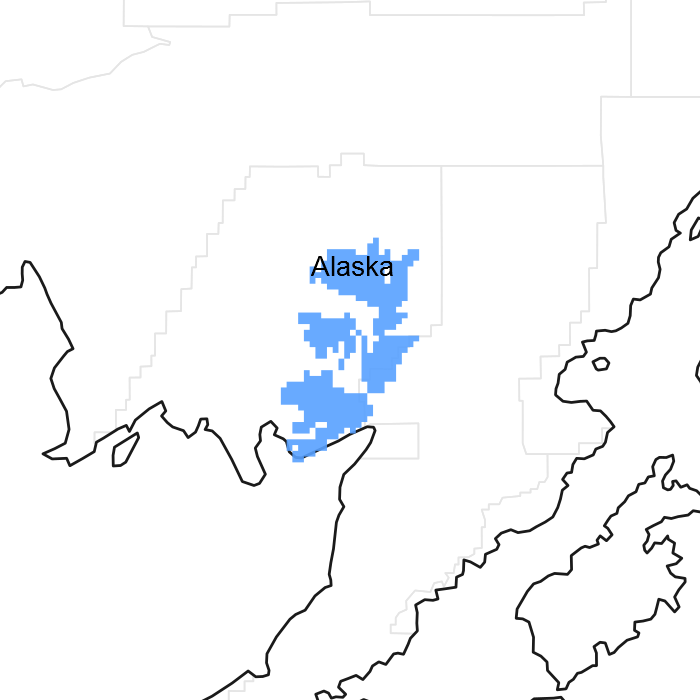
This maritime ecological site is on steep, short (less than 10 feet) risers of eolian terraces on upland plains and hills in western Alaska. Elevation typically ranges from 10 to 960 feet above sea level, and slopes are 6 to 40 percent. This site is on all aspects; therefore, aspect does not appear to influence the plant community dynamics.
This site is correlated to D36-Western maritime scrub eolian terraces. This soil has a cryic temperature regime and a udic moisture regime. The saturated hydraulic conductivity is moderately low to a depth of 40 inches. The upper layer is extremely acid to strongly acid (pH 3.9 to 5.5), and it has an organic matter content of 15 to 33 percent. The annual precipitation is 21 to 49 inches, and the annual frost-free period is 80 to 140 days. The parent material is coarse-loamy cryoturbate over coarse-loamy eolian deposits.
The reference community phase is typified by low and dwarf scrubland that has pockets of graminoids and forbs. As compared to other maritime ecological sites on upland hills and plains, this site is unique because it is on short, steep slopes. The other ecological sites are in depressions, on earth hummocks, and along lake margins. These sites are associated with different soils and have different disturbance regimes from those of this site. These differences and the dissimilarities in reference states and community phases make the use of unique ecological sites necessary.
Erosion from animal movement or nearby frost heave that is exacerbated by wind, rain, or landslides is the hypothesized disturbance regime for this ecological site. This disturbance regime results in two distinct community phases. The steep, short slopes may be subject to erosion if the plant cover is removed. Slight or moderate browsing of the reference community phase has been observed, which suggests that animal movement may not have to be severe to facilitate a change in the plant community. After the vegetation is removed, wind, rain, or landslides may increase the impact of the disturbance. Further research and onsite investigation are needed to determine the full impact of erosion.
State 1
Reference State
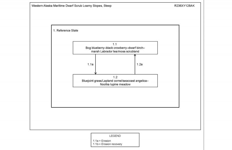
The reference state supports two community phases, which are grouped by the structure and dominance of the vegetation (e.g., shrubs, graminoids, and forbs) and by their ecological function and stability. The presence of these two communities is dictated temporally by erosion. The reference community phase is characterized by dense scrubland consisting of low and dwarf shrubs. No alternate states have been observed.
Community 1.1
Bog blueberry-black crowberry-dwarf birch-marsh Labrador tea/moss scrubland
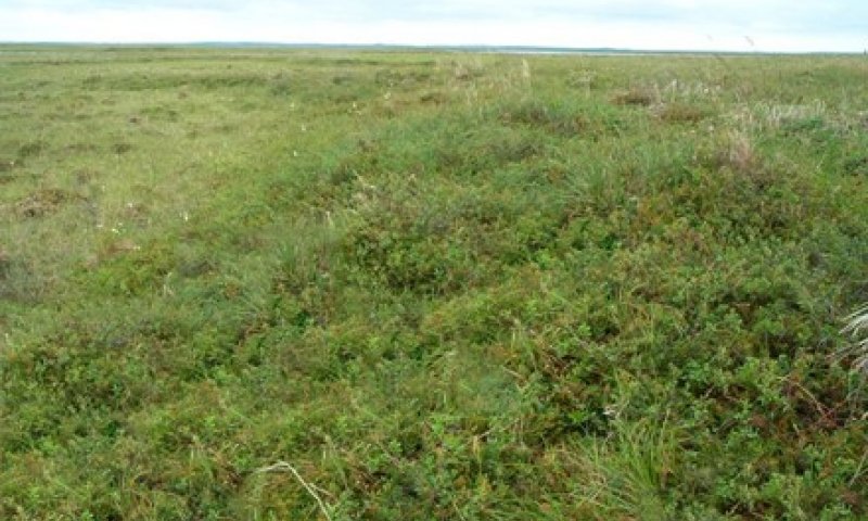
Figure 3. Community 1.1
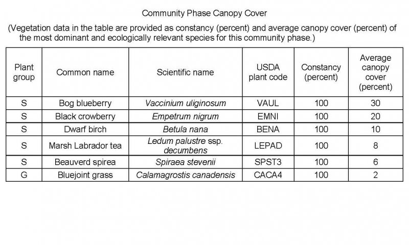
Figure 4. Constancy and canopy cover of plants in community 1.1.
The reference community phase is characterized by a dense scrubland of low and dwarf shrubs. Typically, this community consists of bog blueberry (Vaccinium uliginosum), black crowberry (Empetrum nigrum), dwarf birch (Betula nana), marsh Labrador tea (Ledum palustre ssp. decumbens), spirea (Spiraea stevenii), and bluejoint grass (Calamagrostis canadensis). Other extant species may include fireweed (Chamerion angustifolium), twinflower (Linnaea borealis), arctic starflower (Trientalis europaea), low and dwarf willows (Salix spp.), and clubmosses (Lycopodium spp.). Individual white spruce (Picea glauca) and Kenai birch (Betula papyrifera var. kenaica) trees from adjacent areas may become colonized, but a sustainable population likely cannot establish. The ground cover generally consists of mosses (about 40 percent cover), lichens (about 10 percent), herbaceous litter (about 55 percent), and woody litter (about 3 percent). About 1 percent is bare soil.
Community 1.2
Bluejoint grass/Lapland cornel/seacoast angelica-Nootka lupine meadow
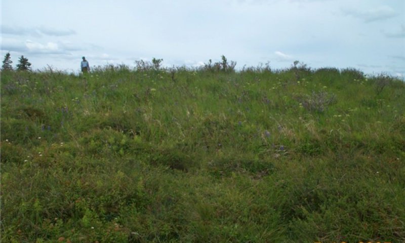
Figure 5. Typical area of community 1.2.
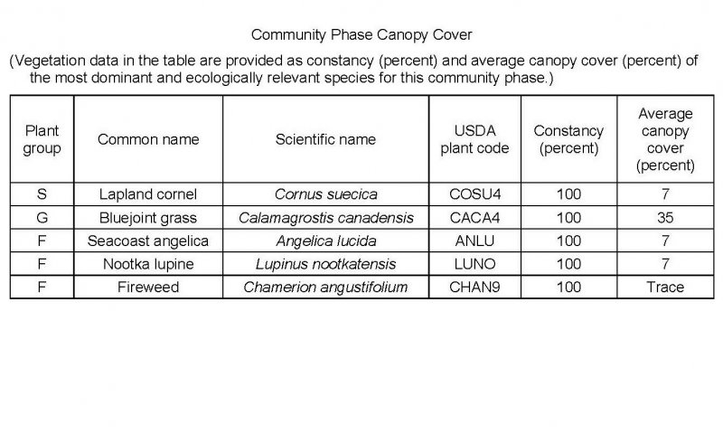
Figure 6. Constancy and canopy cover of plants in community 1.2.
This early erosional community phase is characterized by grassland that has forbs and some shrubs dispersed throughout. Typically, this community consists of bluejoint grass (Calamagrostis canadensis), Lapland cornel (Cornus suecica), seacoast angelica (Angelica lucida), and Nootka lupine (Lupinus nootkatensis). Other species may include tealeaf willow (Salix pulchra), arctic raspberry (Rubus arcticus), woolly geranium (Geranium erianthum), beachhead iris (Iris setosa), and fireweed (Chamerion angustifolium). The ground cover is dominantly herbaceous litter (about 95 percent total mean cover). Other species are mosses (about 5 percent) and woody litter (about 2 percent).
Note: The vegetation and soils for this community were sampled at one location. Due to the limited data available, personal field observations were used to aid in describing the plant community.
Pathway 1.1a
Community 1.1 to 1.2
Bog blueberry-black crowberry-dwarf birch-marsh Labrador tea/moss scrubland
Bluejoint grass/Lapland cornel/seacoast angelica-Nootka lupine meadow
Erosion.
This site may be subject to erosion by wind, rain, and landslides as a result of the loss of plant cover from browsing, animal movement, or nearby frost heave. Post-disturbance, unvegetated areas generally will be populated by fast-growing, pioneer species of graminoids and forbs. This transition is expected to begin immediately after major erosion.
Pathway 1.2a
Community 1.2 to 1.1
Bluejoint grass/Lapland cornel/seacoast angelica-Nootka lupine meadow
Bog blueberry-black crowberry-dwarf birch-marsh Labrador tea/moss scrubland
Natural succession: Normal time and growth without disruptive erosion.
As this community develops, the landform likely will stabilize and organic matter from senescent pioneers will accumulate. Low and dwarf shrubs that can compete for light and space and withstand the abiotic conditions on the exposed, steep slopes likely will colonize and reproduce. The period needed for this transition is unknown. It likely depends at least partially on the rates of colonization, growth, and reproduction of shrubs.


