Major Land Resource Area 239X
Northern Bering Sea Islands
Accessed: 02/16/2026
Description
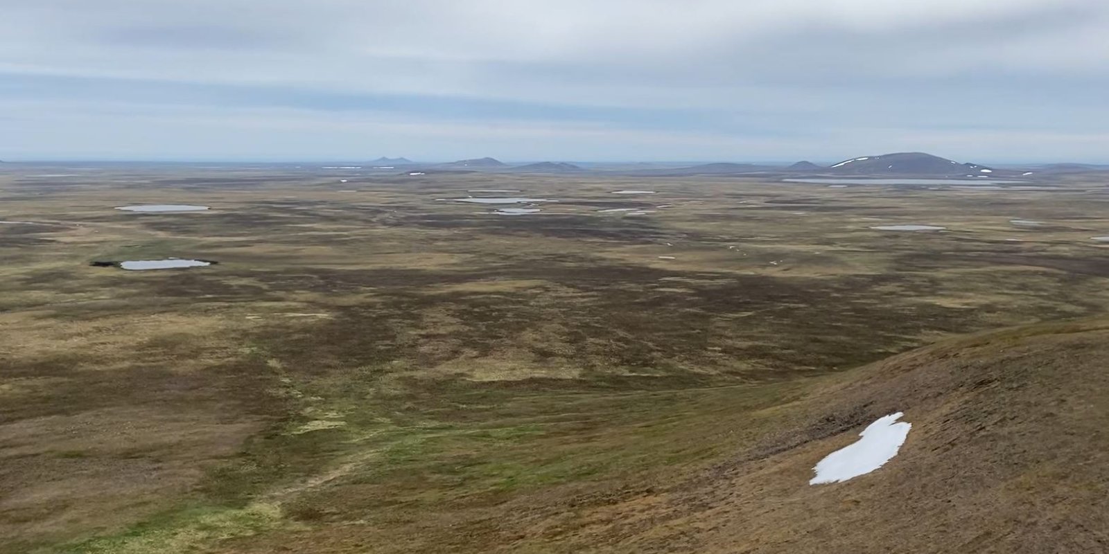
The Northern Bering Sea Islands (MLRA 239X) occurs in Western Alaska and includes Saint Lawrence (1,792 square miles), Nunivak (1,632 square miles), and Saint Matthew (137 square miles) Islands and several smaller adjacent islands all of which are surrounded by the Bering Sea. This MLRA makes up 3,705 square miles. The terrain primarily consists of nearly level to rolling plains and highlands with mostly gentle slopes. Coastal lowlands dotted with numerous small- and medium-size lakes make up a significant part of St. Lawrence Island. Steep, low-relief volcanic cones, vents, and lava flows are common throughout Nunivak Island and less common on St. Lawrence and St. Matthew Islands. Narrow, discontinuous sea cliffs, sand dunes, and sand sheets are along many stretches of the coast. Elevation ranges from sea level along the coast to 2,207 feet at the summit of Atuk Mountain, on St. Lawrence Island. The area is mostly undeveloped wild land that is sparsely populated. Residents use this remote area primarily for subsistence hunting, fishing, and gathering. Reindeer and/or muskox herding provides meat and other products to residents on Nunivak Island and St. Lawrence Islands. The largest communities on the islands are Diomede, Gambell, Mekoryuk, and Savoonga. Geology and Soils Across the islands, most of the landscape is mantled with late Tertiary and Quaternary alluvial, marine, and eolian deposits (surficial deposits). While a small portion of the northwest coast of St. Lawrence Island was glaciated (Patton et al. 2011), the vast majority of the MLRA was unglaciated during the Pleistocene Epoch. St. Lawrence Island is the most geologically complex of the islands in this area. The St. Lawrence Island coastal plain is dotted with numerous small- and medium-size lakes with a mosaic primarily composed of surficial deposits and volcanic and sedimentary rock, including coal beds and limestone. The highlands on this island are primarily composed of Cretaceous granitic bedrock except for Atuk Mountain which is composed of young volcanic bedrock from the Quaternary to late Tertiary. Nunivak and St. Matthew Islands are made up almost exclusively of early and late Tertiary and Quaternary volcanic rocks. These islands are in the zone of discontinuous permafrost. Frozen soils are common across the vast extents of rolling plains and gentle sloping highlands. In these areas, the layer of permafrost is generally thin or moderately thick and occurs primarily in fine textured deposits. Permafrost generally does not occur on flood plains, in coarse textured sediments on the slopes of volcanic cones and other highlands, along the coast, or near lakes and other bodies of water. Common periglacial features include solifluction lobes, frost boils, and palsen (USDA 1986, USDA 2022). The majority of soils are acidic, and the dominant soil order is Gelisols. Except for some non-acidic uplands on St. Lawrence Island, the vast majority of soil substrate across the MLRA is acidic (pH <5.5) (CAVM Team 2023). The Gelisols are shallow or moderately deep to permafrost (10 to 40 inches) and are typically very poorly to poorly drained. Common Gelisol suborders are Histels, Orthels, and Turbels. The Histels have thick accumulations of surface organic material and primarily occur in very wet coastal plain depressions and low-gradient drainageways. The Orthels and Turbels have comparably thinner surface organic material and primarily occur on the coastal lowlands and other areas with gentle slopes. The MLRA also has small areas of Andisols, Entisols, Inceptisols, and Mollisols. Andisols and Inceptisols primarily occur on volcanic cones and other slopes with coarse textured, acidic soils. Mollisols occur on areas with limestone on St. Lawrence Island (USDA 2022). Entisols primarily occur on flood plains and estuaries. Miscellaneous (non-soil) areas make up about 10 percent of the area and are primarily water, lava flows, rubble composed of volcanic rock, and beach sediments. Climate The presence of sea ice in the Bering Sea strongly influences the climate across the islands in this area. Sea ice in the Bering Sea historically forms in early December, increases in thickness until late April, and breaks apart in June (Zuesler 1941). When sea ice is absent, the Bering Sea and North Pacific Ocean moderate diurnal and monthly temperatures resulting in a maritime climate. As se ice forms around the islands, temperatures decrease significantly with the area shifting to a continental climate. Vegetation Tidal flats and estuaries support sedge dominant communities, while drier beach dune communities support American dunegrass and seacoast angelica communities (USDA 1986). The costal lowlands and nearly level to rolling plains have a mosaic of sedge and moss dominant wetlands and various tundra. The tundra often has dwarf shrubs like crowberry; tussock forming and non-tussock forming sedges; and a variety of forbs, lichen, and mosses. Very wet drainages and the shores of lakes support wet sedge meadows. Drier soils on flood plains commonly support low to tall willow scrub with dense grasses and forbs in the understory. Shallow soils with coarse textured rocks common on volcanic cones, mountain slopes, and ridges commonly support alpine dwarf scrub dominated by ericaceous shrubs, Dryas, and dwarf willows. These communities commonly have a considerable amount of lichen and bare ground. Bedrock exposures and barrens with lichens and scattered shrubs and herbs in pockets of fine earth dominate the highest elevations, ridges, and other windblown sites.
Key publications
Next steps
-
1
Select an ecological site
Select an ecological site using the list, keys, photos, briefcase, or quick search option located on this page. -
2
Explore the ecological site description
Next, learn more about the selected ecological site and its characteristic dynamics by browsing the ecological site description and exploring alternative state and transition model formats.


