Natural Resources
Conservation Service
Ecological site R239XY063AK
Arctic Dwarf Scrub Loamy Frozen Slopes
Last updated: 6/03/2025
Accessed: 04/02/2026
General information
Provisional. A provisional ecological site description has undergone quality control and quality assurance review. It contains a working state and transition model and enough information to identify the ecological site.
MLRA notes
Major Land Resource Area (MLRA): 239X–Northern Bering Sea Islands
The Northern Bering Sea Islands (MLRA 239X) occurs in Western Alaska and includes Saint Lawrence (1,792 square miles), Nunivak (1,632 square miles), and Saint Matthew (137 square miles) Islands and several smaller adjacent islands all of which are surrounded by the Bering Sea. This MLRA makes up 3,705 square miles. The terrain primarily consists of nearly level to rolling plains and highlands with mostly gentle slopes. Coastal lowlands dotted with numerous small- and medium-size lakes make up a significant part of St. Lawrence Island. Steep, low-relief volcanic cones, vents, and lava flows are common throughout Nunivak Island and less common on St. Lawrence and St. Matthew Islands. Narrow, discontinuous sea cliffs, sand dunes, and sand sheets are along many stretches of the coast. Elevation ranges from sea level along the coast to 2,207 feet at the summit of Atuk Mountain, on St. Lawrence Island. The area is mostly undeveloped wild land that is sparsely populated. Residents use this remote area primarily for subsistence hunting, fishing, and gathering. Reindeer and/or muskox herding provides meat and other products to residents on Nunivak Island and St. Lawrence Islands. The largest communities on the islands are Diomede, Gambell, Mekoryuk, and Savoonga.
Geology and Soils
Across the islands, most of the landscape is mantled with late Tertiary and Quaternary alluvial, marine, and eolian surficial deposits. While a small portion of the northwest coast of St. Lawrence Island was glaciated (Patton et al. 2011), the vast majority of the MLRA was unglaciated during the Pleistocene Epoch. St. Lawrence Island is the most geologically complex of the islands in this area. The St. Lawrence Island coastal plain is dotted with numerous small- and medium-size lakes with a mosaic primarily composed of surficial deposits and volcanic and sedimentary rock, including coal beds and limestone. The highlands on this island are primarily composed of Cretaceous granitic bedrock except for Atuk Mountain which is composed of young volcanic bedrock from the Quaternary to late Tertiary. Nunivak and St. Matthew Islands are made up almost exclusively of early and late Tertiary and Quaternary volcanic rocks.
These islands are in the zone of discontinuous permafrost. Frozen soils are common across the vast extents of rolling plains and gentle sloping highlands. In these areas, the layer of permafrost is generally thin or moderately thick and occurs primarily in fine textured deposits. Permafrost generally does not occur on flood plains, in coarse textured sediments on the slopes of volcanic cones and other highlands, along the coast, or near lakes and other bodies of water. Common periglacial features include solifluction lobes, frost boils, and palsen (Swanson et al. 1986, USDA 2022).
The majority of soils are acidic, and the dominant soil order is Gelisols. Except for some non-acidic uplands on St. Lawrence Island, the vast majority of soil substrate across the MLRA is acidic (pH less than 5.5) (CAVM Team 2023). The Gelisols are shallow or moderately deep to permafrost (10 to 40 inches) and are typically very poorly to poorly drained. Common Gelisol suborders are Histels, Orthels, and Turbels. The Histels have thick accumulations of surface organic material and primarily occur in very wet coastal plain depressions and low-gradient drainageways. The Orthels and Turbels have comparably thinner surface organic material and primarily occur on the coastal lowlands and other areas with gentle slopes. The MLRA also has small areas of Andisols, Entisols, Inceptisols, and Mollisols. Andisols and Inceptisols primarily occur on volcanic cones and other slopes with coarse textured, acidic soils. Mollisols occur on areas with limestone on St. Lawrence Island (USDA 2022). Entisols primarily occur on flood plains and estuaries. Miscellaneous (non-soil) areas make up about 10 percent of the area and are primarily water, lava flows, rubble composed of volcanic rock, and beach sediments.
Climate
The presence of sea ice in the Bering Sea strongly influences the climate across the islands in this area. Sea ice in the Bering Sea historically forms in early December, increases in thickness until late April, and breaks apart in June (Zuesler 1941). When sea ice is absent, the Bering Sea and North Pacific Ocean moderate diurnal and monthly temperatures resulting in a maritime climate. As sea ice forms around the islands, temperatures decrease significantly with the area shifting to a continental climate.
Vegetation
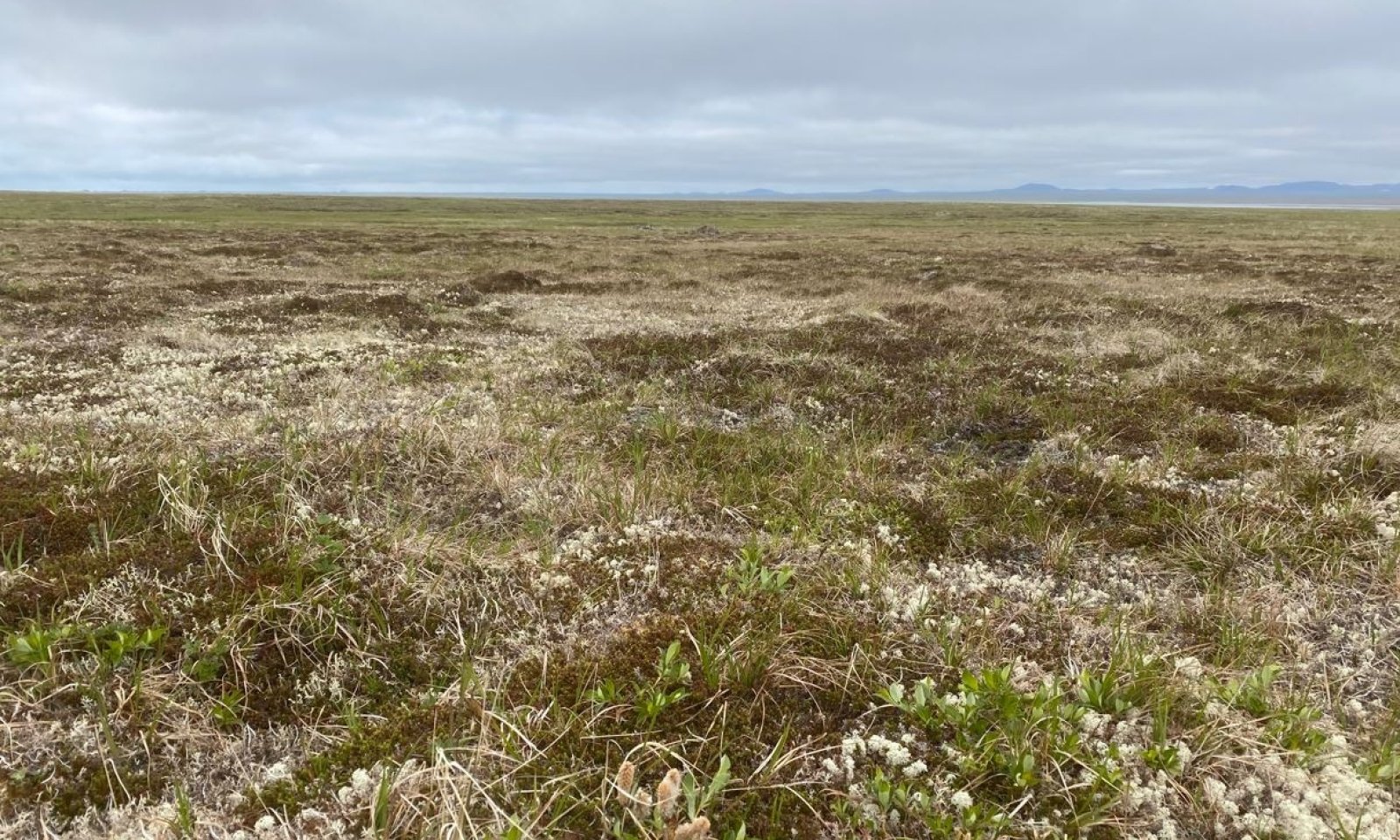
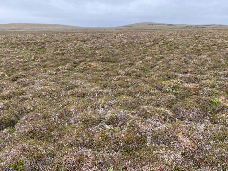
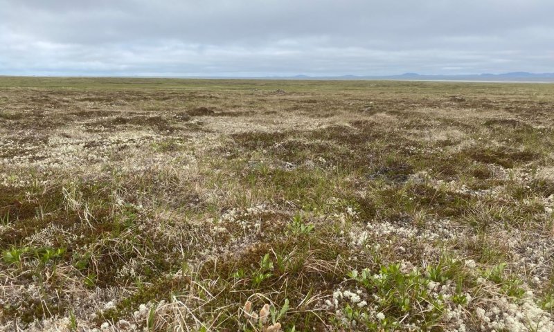
Tidal flats and estuaries support sedge dominant communities, while drier beach dune communities support American dunegrass and seacoast angelica communities (Swanson et al. 1986). The coastal lowlands and nearly level to rolling plains have a mosaic of sedge and moss dominant wetlands and various tundra. The tundra often has dwarf shrubs like crowberry; tussock forming and non-tussock forming sedges; and a variety of forbs, lichen, and mosses. Very wet drainages and the shores of lakes support wet sedge meadows. Drier soils on flood plains commonly support low to tall willow scrub with dense grasses and forbs in the understory. Shallow soils with coarse textured rocks common on volcanic cones, mountain slopes, and ridges commonly support alpine dwarf scrub dominated by ericaceous shrubs, Dryas, and dwarf willows. These communities commonly have a considerable amount of lichen and bare ground. Bedrock exposures and barrens with lichens and scattered shrubs and herbs in pockets of fine earth dominate the highest elevations, ridges, and other windblown sites.
Introduced ungulates
Introduced herds of reindeer and muskox provide a rich history of land use across the Northern Bering Sea Islands MLRA. Of the many islands in this MLRA, Nunivak was the only island historically grazed by ungulates. Inhabited by caribou until the late 1800’s, the caribou on Nunivak Island were extirpated with the introduction of rifles (Griffin 2001).
Reindeer were introduced to St. Lawrence Island as early as 1901 (Jackson 1902), Nunivak Island in 1920, and St. Matthew Island in 1944 (Swanson and Barker 1991). Muskox were introduced to Nunivak Island in 1930 (ADFG 2024). Nunivak Island currently has managed herds of reindeer and muskox, St. Lawrence Island currently has managed herds of reindeer, and St. Matthew Island currently has no herds of reindeer. Some small islands in this MLRA are believed to have no history of natural or introduced ungulate herds (e.g. Pinnace Islands, Hall Island, and Punuk Islands).
LRU notes
There are two distinct bioclimates in this MLRA resulting in slight differences in vegetation. St. Lawrence Island is more than 200 miles North of Nunivak and St. Matthew Islands. As a result, St. Lawrence Island is significantly colder. Mean annual air temperatures on Nunivak and St. Matthew Islands typically range from 30 to 34 degrees Fahrenheit and are between 24 to 28 degrees Fahrenheit on St. Lawrence Islands (PRISM 2018). More southerly islands in this area fall into the Circumpolar Arctic Vegetation Mapping (CAVM) subzone E and more northerly islands fall into CAVM subzone D (CAVM 2022). Moist and dry tundra common to the near level to rolling plains across the islands are thought to support plant communities with similar species but have different plant community structures. Subzone E supports low shrub communities and subzone D erect dwarf shrub communities (CAVM 2022). At this time, these differences in community structure are recognized but unique ecological sites for each CAVM bioclimate subzone were not developed.
This area supports two life zones defined by the physiological limits of plant communities along an elevational gradient: arctic and alpine. In this MLRA, the arctic life zone occurs below 500 feet elevation on average (Swanson et al. 1986) and is the elevational band where lowland vegetation dominates. For this MLRA, certain vascular plant species are common in the lowlands and much less common in the alpine (i.e. Salix pulchra, Salix fuscescens, Betula nana, Ledum palustre ssp. decumbens, and Calamagrostis canadensis). Above the arctic band of elevation, alpine vegetation dominates. For this MLRA, certain vascular plant and lichen species are common in the alpine and much less common in the lowlands (i.e. Dryas octopetala ssp. octopetala, Diapensia lapponica var. obovata, Anthoxanthum monticola ssp. alpinum, Oxytropis nigrescens, Alectoria ochroleuca, and Flavocetraria nivalis). The lowlands also have much higher potential for lichen biomass yields compared to the alpine (Swanson et al. 1986). The transition between arctic and alpine vegetation can occur within a range of elevations, and is highly dependent on latitude, slope, aspect, and shading from adjacent mountains.
Classification relationships
Landfire BPS – 6816902 - Alaska Arctic Dwarf – Shrubland – Infrequent Fire (Landfire 2009)
Crowberry Tundra (Viereck et al. 1992)
Lichen-Sedge (Tundra) (Swanson et al. 1986)
Ecological site concept
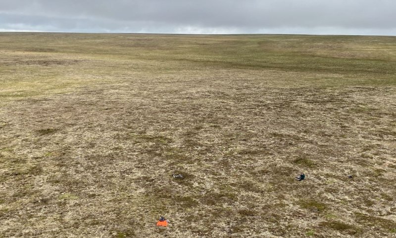
This arctic ecological site occurs on broad and gentle slopes with wet and silty soils that have permafrost. Slopes occur on broad loess covered hills and plains and the backslopes of low mountains. Associated soils do not pond or flood, have a high-water table at very shallow depth throughout much of the growing season, and are considered poorly drained. A typical soil profile has 6 to 14 inches of peat over a thick layer of silty loess.
The presence of introduced ungulate herds on Nunivak, St Lawrence, and St. Matthews Islands, in some places for over a century, plays an integral role in shaping vegetation across this MLRA. Islands in this MLRA without a history of introduced reindeer and muskox herds are associated with reference state vegetation, while islands with introduced herds are associated with grazing state vegetation.
Two plant communities have been documented within the grazing state for this ecological site and are based on the degree of ungulate use. The potential natural vegetation for the grazing state is characterized as crowberry tundra (Viereck et al. 1992). Common and dominant species include crowberry, water sedge, small awned sedge, Bigelow’s sedge, and various preferred lichen range species (i.e. reindeer lichen and Cetraria lichen). The vegetative strata that characterize this community are dwarf shrubs (less than 8 inches height), medium graminoids (between 4 and 24 inches height), and foliose and fruticose lichen.
Associated sites
| R239XY032AK |
Arctic Scrub Silty Frozen Slopes Wet Occurs on gentle slopes of hills and plains and in broad depressions. Ecological site 32 often occurs downslope of ecological site 63 in comparatively wetter landform positions. |
|---|---|
| R239XY052AK |
Arctic Sedge Loamy Frozen Slopes Occurs on nearly level slopes at lower elevations. Soils pond frequently and have comparatively wetter soils. |
| R239XY058AK |
Arctic Grass Loamy Slopes Occurs on gentle slopes of hills and plains. Ecological site 58 occurs on adjacent slopes with comparatively drier soils. |
Similar sites
| R239XY032AK |
Arctic Scrub Silty Frozen Slopes Wet When compared to ecological site 63, ecological site 32 has much less crowberry and lichen cover and biomass and much more willow and dwarf birch. |
|---|---|
| R239XY043AK |
Alpine Dwarf Scrub Silty Slopes Both ecological sites 43 and 63 support crowberry tundra. Ecological site 43 occurs in the alpine typically at elevations above 1000 feet (Swanson et al. 1986), while ecological site 63 occurs at lower elevations. These differences in life zone result in different kinds and amounts of vegetation. |
Table 1. Dominant plant species
| Tree |
Not specified |
|---|---|
| Shrub |
(1) Empetrum nigrum |
| Herbaceous |
(1) Carex bigelowii |
Click on box and path labels to scroll to the respective text.
Ecosystem states
| T1 | - | Human introduction of reindeer and/or muskox to islands. |
|---|---|---|
| R1 | - | Long periods of time after extirpation of human introduced ungulates. |
State 1 submodel, plant communities
State 2 submodel, plant communities
| 2.1a | - | Continuous grazing by reindeer and/or muskox |
|---|---|---|
| 2.2a | - | Time without continuous grazing by reindeer and/or muskox |