
Ecological site group R017XY907CAESG
Aridic Alkali Desert
Last updated: 06/03/2024
Accessed: 04/11/2026
Ecological site group description
Key Characteristics
- Basin Landform
- MAP <10"
- pH ≥ 8.4
- Landform Not As Above
- Not As Above
- Site Is Not Sub-Irrigated
- MAP < 10"
- pH ≥ 8.4
Provisional. A provisional ecological site description has undergone quality control and quality assurance review. It contains a working state and transition model and enough information to identify the ecological site.
Physiography
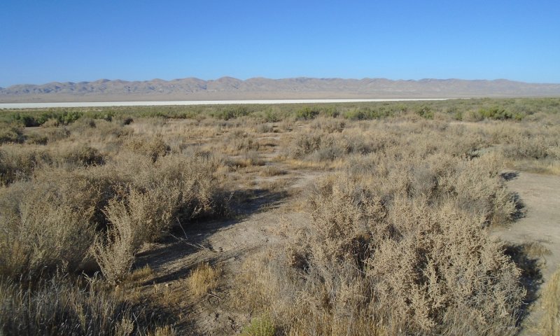
These sites are at the lowest positions on the landscape on basins or distal fans, where they receive supplemental water from runoff or subsurface flow.
Climate
The average annual precipitation is 5 to 12 inches (125 to 305 millimeters) in the San Joaquin Valley. The Tulare Basin, at the southern end of this MLRA, typically receives less than 6 inches (150 millimeters) of rainfall per year. These sites receive less than 10 inches in an average year.
Summers are long, hot, and dry, and winters are cool and rainy. Most of the rainfall occurs as low- or moderate intensity, Pacific frontal storms from October to May. The average annual temperature is 59 to 67 degrees F (15 to 20 degrees C), decreasing from south to north. The freeze-free period averages 325 days and ranges from 280 to 365 days, decreasing in length with elevation and from south to north.
Soil features
This site has a heavy alkali soil (pH >8.0) weathered from shale, often with high salinity.
Soils commonly associated with this site have a clay loam or finer texture and a sodic designation. Mineral crusts and natric horizons are also common in the soils associated with this group of sites. Some series that have been mapped at these sites are, Buttonwillow, Pulvadaro, Houser, and Chicote
Vegetation dynamics
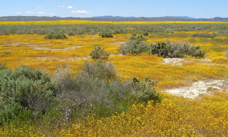
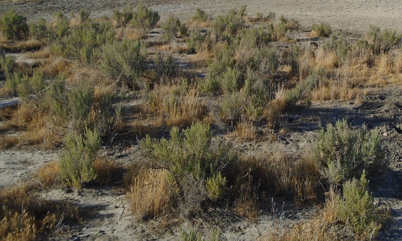
The dominant vegetation across this ESG are Spinescale (Atriplex spinifera) and iodinebush (Allenrolfia occidentalis), which are adapted to the harsh conditions of the site. During the spring if sufficient levels of moisture are available a variety of annual forbs will grow for short periods the rest of the year there is >25% bare ground.
This site is at a very low position on the landscape where it receives supplemental water from upslope runoff which delivers a variety of water-soluble minerals to these basin positions. The minerals are then concentrated at the soil surface through the process of evaporation. These concentrated salts at the soil surface may form crusts which prevent infiltration until the crust dissolves. The iodinebush community requires more water than the spinescale community and very subtle changes in local topography may be significant to which vegetation is dominant.
Under pre-settlement conditions these sites were stable for very long periods of time and likely changed structure or composition very little even in response to fire or drought. Historically these sites were heavily grazed by sheep which forced many sites across a threshold. (Twisselmann, 1956) possibly promoting invasion by Russian thistle (Salsola iberica).
Regional irrigation projects have led to agricultural conversion of much of this site within MLRA 17, but the soil properties require intensive management to be productive.
References/Citations:
Mikhiel, G. S., Meyer, S. E., & Pendleton, R. L. 1992. Variation in germination response to temperature and salinity in shrubby Atriplex species. Journal of Arid Environments, 22(1), 39-49.
Rowlands, Peter. 2003. California Wildlife Habitat Relations System: Alkali Desert Scrub. Accessed at: Wildlife Habitats - California Wildlife Habitat Relationships System. [2023, December 12].
The Central Valley Historic Mapping Project. 2003. California State University, Chico Department of Geography and Planning and Geographic Information Center. http://www.waterboards.ca.gov/waterrights/water_issues/programs/bay_delta/docs/cmnt081712/sldmwa/csuc.
Twisselmann, E. C. 1956. Flora of the Temblor Range. University of San Francisco. The Wasmann Journal of Biology Vol. 14, No. 2.
Major Land Resource Area
MLRA 017X
Sacramento and San Joaquin Valleys
Subclasses
- R017XE102CA–FINE LOAMY SALINE
- R017XF031CA–FINE LOAMY FLAT
- R017XF069CA–Loamy Saline-Alkali 9-12" P.Z.
- R017XF073CA–LOAMY SALINE-ALKALI SUBIRRIGATED
- R017XF074CA–LOAMY SALINE-ALKALI WETLAND
- R017XG005CA–CLAYEY SALINE-ALKALI
- R017XG045CA–LOAMY SALINE ALKALI
- R017XG046CA–LOAMY SALINE-ALKALI BOTTOMLANDS
- R017XG048CA–SALINE
- R017XY907CA–Aridic Alkali Desert
Stage
Provisional
Contributors
Photo Credits: Ryan O'Dell BLM
Click on box and path labels to scroll to the respective text.
Ecosystem states
| T1 | - | Grazing and Invasion |
|---|---|---|
| T2 | - | Human Alteration |
| R1 | - | Weed management |
| T2 | - | This transition is caused by significant human alterations that force this ecological site over a threshold and change the function and structure of this site in extensive ways. |
| R2 | - | Restoration and Weed Management |
| R3 | - | Restoration without weed management |
State 1 submodel, plant communities
| 1.1a | - | Increased soil saturation. |
|---|---|---|
| 1.2a | - | Decreased soil saturation |