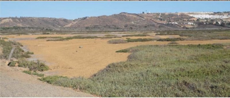
Ecological site group R019XG901CA
Tidal Flat
Last updated: 07/05/2023
Accessed: 02/21/2026
Ecological site group description
Key Characteristics
None specified
Provisional. A provisional ecological site description has undergone quality control and quality assurance review. It contains a working state and transition model and enough information to identify the ecological site.
Physiography
This ESG is found on tidal flats near the coastline, with slopes from 0-1% and elevations at -10 ft below sea level to approximately 30 ft.
Climate
The climate for this MLRA includes an average annual precipitation that covers a diverse landscape of valleys and mountains and can range anywhere from 8 to 53 inches (215 to 1,354 millimeters), increasing with elevation. Most of the rainfall occurs as low- or moderate-intensity, Pacific frontal storms during winter. Rain can turn to snow at the higher elevations. A little snow may fall in winter, but it does not last. Summers are dry, but fog provides some moisture along the coast. The average annual temperature is 38 to 67 degrees F (3 to 19 degrees C). The freeze-free period averages 310 days in the valleys, 245 days in the mountains, and ranges from 125 to 365 days along the coast. It decreases in length with elevation. The longest freeze-free period occurs at the lower elevations along the western edge of the area.
Soil features
Soils for these tidal flats are variable, but all will be saline and wet, with a water table at or near the surface most of the year. They are poorly drained soils that experience frequent flooding, and vary between frequently ponded to no ponding. The soils textures and pH will vary depending on parent material and source waters with most being alkaline, and others being acidic.
.
Representative soils may include Aquents and Sulfic fluvaquents
Vegetation dynamics
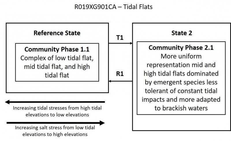
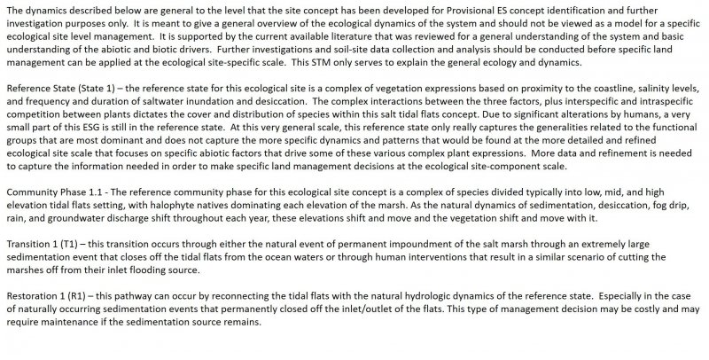
This tidal salt flats ESG represent the myriad of seasonal wetlands that are characteristic of the Mediterranean climate coastal environment of MLRA 19 in Southern California. They are subject to intermittent flooding due to tidal or freshwater influence and remain unvegetated due to salt concentration, with soil salinities often exceeding 100-200 ppt. They are extremely dynamic features, experiencing large fluctuations in salinity and inundation. They were widespread historically and are present in many Southern California estuaries today, providing an array of ecosystem functions for resident and migratory wildlife. However, due to the extent of urbanization in this ESG, many of these tidal flats no longer exist and have become fragmented and significantly altered. Little is known about their formative processes, historical and contemporary distribution, and ecosystem functions and services of salt flats in the region relative to other estuarine habitat types.
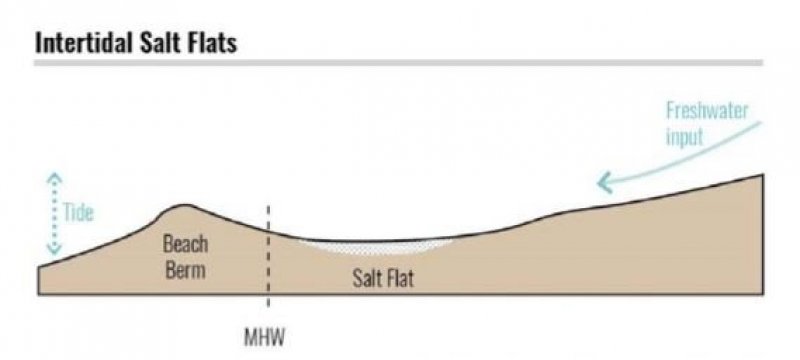
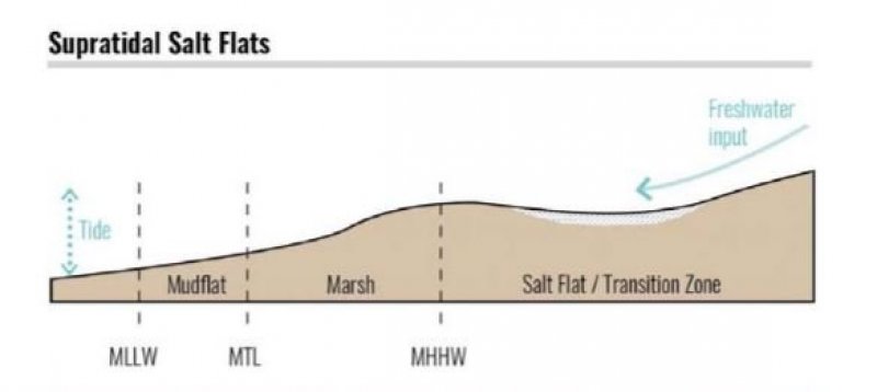
These tidal salt flats indicate some degree of disconnectivity from regular tidal inundation that would allow for desiccation, either due to elevation (e.g., above Mean Higher High Water where inundation is infrequent) or a physical barrier such as sand dunes or inlet closure. As a result, salt flat conditions and dynamics (including shape and landscape position, inundation regime, soil and water salinity, sediment dynamics) are variable from year to year and feature to feature.
Salt flats were historically present in approximately one-quarter of Southern California 104 estuarine systems. They were found across the Bight, from Goleta Slough to the Tijuana River estuary, and covered more than 3,000 acres in total (~10% of total estuarine habitat area excluding subtidal open water Salt flat size, shape, landscape position, and ecological context varied across systems, with salt flats ranging in size from less than one acre to well over 1,000 acres (flanking either side of the San Gabriel River as it entered what is now Los Angeles Harbor). Other than the Los Angeles Harbor area, the largest salt flats (between 150 and 1,000 acres) were found in northern San Diego County (Batiquitos, San Elijo, Buena Vista, and Agua Hedionda lagoons, ranging from 160 to 475 acres), at Goleta (~200 acres), and Mugu Lagoon (largest salt flat ~180 acres; 250 acres total). Other notable salt flat complexes were found at Ballona (135 ac) and Seal Beach (135 ac).
Beller, E. 2018. Appendix 7: Salt Flats in Southern California Coastal Wetlands of the Wetlands on the Edge: The Future of Southern California's Wetlands Regional Strategy, San Francisco Estuary Institute.
Major Land Resource Area
MLRA 019X
Southern California Coastal Plains and Mountains
Subclasses
Correlated Map Unit Components
23482491, 22665598, 22666488, 22670412
Stage
Provisional
Contributors
Curtis Talbot
Click on box and path labels to scroll to the respective text.
