Description
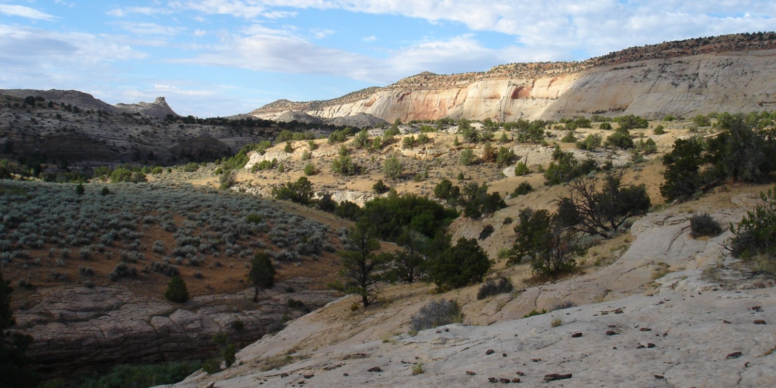
MLRA 35 covers approximately 60 percent of the Colorado Plateau Province. It generally consists of flat-lying to gently tilted Mesozoic and Paleozoic sedimentary formations that have been uplifted, allowing the Colorado River and its tributaries to cut deep canyons through the formations’ layers. The major landforms include gently sloping to strongly sloping plains, volcanic plugs, steep scarps, and deeply incised canyons. The Colorado Plateau demonstrates the power of wind and water to erode soil and rock over time. Not only are deeply incised canyons evidence of erosion, but also isolated mesas and buttes testify to the enormous amount of material removed by the Colorado River and its tributaries. MLRA 35 is bounded to the south by the Mogollon Rim and associated volcanic landforms of the Mogollon Transition area (MLRA 39). The Mogollon Rim is a long, erosional escarpment stretching diagonally across Arizona and into New Mexico. It marks the boundary where the horizontal stratigraphy of the Colorado Plateau falls into the faulted and broken landscape of the Mogollon Transition. Volcanic landforms, such as the San Francisco Peaks and White Mountains, are in MLRA 39 while horizontal sedimentary formations, such as the Kaibab and Chinle Formations, are in MLRA 35. Part of the western boundary of MLRA 35 is shared with MLRA 30, the Mohave Basin and Range. A principal difference is the change from flat-lying sedimentary beds of the Colorado Plateau region to faulted, block mountains and valleys of the Basin and Range Province. The boundary with MLRA 30 lies at the base of the Grand Wash Cliffs and the Music Mountains to the south, the entrance to the Grand Canyon in the central area, and the base of the Shivwits Plateau in the north. It is marked by the lower alluvial Hualapai Valley and has a drier climate with thermic temperatures. In contrast, MLRA 35 lacks thermic temperatures except within the Grand Canyon. The northwest boundary is shared with the southern part of MLRA 47, which is dominated by fault-bounded, lava-capped plateaus, such as the Markagunt and Paunsaugunt, with the exception of the Table Cliffs Plateau, which is limestone capped. The underlying sedimentary strata in MLRA 47 are the same geologic units as the Colorado Plateau but elevations are mostly higher and temperatures cooler. The eastern boundary of 35 is shared with MLRA 42B, the Southern Rio Grande Rift. The boundary of MLRAs 35 and 42B lies near the base of various ridges that roughly parallel the rift. MLRA 42B has Quaternary and Tertiary geology associated with the rifting and filling of large tectonic basins along the Rio Grande Valley. MLRA 35 is in Arizona (56 percent), Utah (22 percent), New Mexico (21 percent), and Colorado (1 percent). It makes up about 71,735 square miles (185,885 square kilometers) and 46 million acres.
Key publications
Geographic subunits
Land Resource Unit 1. The Central Colorado Plateau LRU can be considered the heart of MLRA 35. It is dominated by Mesozoic sedimentary geology, mostly sandstone and shale. It begins to the north with the canyons and plateaus surrounding the confluence of the Green and Colorado Rivers in Utah and extends south to the Little Colorado River Basin in Arizona. It includes the sand sheet of the Green River Desert; the mesas and benches of the Blue Hills; the structural anticlines, monoclines, and structural benches of the Circle Cliffs; a large laccolith thrust through a shallow syncline called the Henry Mountains; the Kaiparowits Plateau with its cretaceous sandstones overlying escarpments of soft marine shales; The Chinle Valley, a broad basin; the Grand Staircase with its series of cliffs and structural benches; Black Mesa Navajo Mountain, a series of broad mesas with one large laccolith; and the Paria and Kaibeto Plateaus. The soils are continually stripped of their cover and, due to uplift forces most positions, are erosional in nature. The overwhelmingly shallow soils are predominantly an exudium, continually being uplifted, weathered from rock, and transported regionally from the MLRA.
Land Resource Unit 2. The western Colorado Plateau LRU is strongly characterized by its limestone and dolomite cap, known as the Kaibab formation. Physiographically, this subdivision is affected by the combination of regional uplift and the deeply incised Colorado River at the Grand Canyon. The Grand Canyon is surrounded by adjacent plateaus: the Kaibab Plateau on the North Rim, the Arizona Strip with the Shivwits Plateau to the northwest, and the Coconino Plateau on the South Rim. Marble Canyon is a narrow northerly extension of the Grand Canyon. The Coconino Transition represents a northwesterly extension of the Mogollon Rim that is more protected from monsoonal moisture. The Coconino Transition is largely Redwall Limestone and has isolated volcanic and granitic soils.
Land Resource Unit 3. The Northwest New Mexico Highlands LRU is primarily non-marine sedimentary hills and mountains that have been affected by regional uplift of the Colorado Plateau. Physiographically, it represents higher elevations than the Central Colorado Plateau subdivision to the west and lower elevations than the volcanic mountains of MLRA 39 to the south. The highlands include Nacimiento sediments derived from Cenozoic relict lakebeds; the Chuska Mountains, a mountain ridge of upturned sedimentary beds and sandstone; the Defiance Plateau with its uplifted sedimentary beds of Permian sandstone and Triassic shale; the Zuni Mountains, an area of tilted ridges of mountains and various structurally contorted sedimentary formations; Bidahochi sediments with broadly scattered low mesas and hills; and a diverse collection of small basins, mountains, and valleys. Parent material is nonmarine sediments and mixed sedimentary rock in the southeast. The highlands have shallow soils and rock outcrops on structural benches and mesas.
Land Resource Unit 4. The San Juan Basin LRU is almost exclusively marine shale sediments, including Menefee Shale and Lewis Shale. Physiographically, it represents lower elevations than the New Mexico Highlands at the Chuska Mountains to the west, the Nacimiento Mountains to the east, and Mount Taylor and the Zuni Mountains to the south. This subdivision includes the San Juan River corridor, the Bisti Lowlands with the Chaco River Valley and surrounding shale basin, and Chaco Mesa with its extension of Menefee Shale. This subdivision has shallow soils and, near the Chaco River and major rivers to the north, deeper alluvial soils. The expanse is affected by regional uplift of the Colorado Plateau.
Next steps
-
1
Select an ecological site group
Select an ecological site group using the list, keys, photos, briefcase, or quick search option located on this page. -
2
Explore the ecological site group description
Next, learn more about the selected ecological site group and its characteristic dynamics by browsing the ecological site group description and exploring alternative state and transition model formats.
Ecological site group list
-
i
Key Characteristics
- Grand Staircase-Kaiparowits
- Bottoms and Flats
- Extra water is from perennial or intermittent streamflow
-
i
Key Characteristics
- Grand Staircase-Kaiparowits
- Bottoms and Flats
- Extra water is from run-in or local water table
-
i
Key Characteristics
- Grand Staircase-Kaiparowits
- Outcrops and Slopes
- Soils are shallow to bedrock
-
i
Key Characteristics
- Grand Staircase-Kaiparowits
- Saline Hills and Badlands
- Soil parent material is dominantly gypsiferous
-
i
Key Characteristics
- Grand Staircase-Kaiparowits
- Saline Hills and Badlands
- Soil parent material is dominated by salts other than gypsum
-
i
Key Characteristics
- Grand Staircase-Kaiparowits
- Saline Uplands and Flats
- Soils are sandy loams
-
i
Key Characteristics
- Grand Staircase-Kaiparowits
- Saline Uplands and Flats
- Soils are loams to clays
-
i
Key Characteristics
- Grand Staircase-Kaiparowits
- Shallow Soil Shrublands and Woodlands
- Soil parent material is volcanic cinders
-
ProvisionalDX035X01AESG10Grand Staircase-Shallow Soils Shrub & Woodlands-Not Volcanic PM-Sandy Soilsi
Key Characteristics
- Grand Staircase-Kaiparowits
- Shallow Soil Shrublands and Woodlands
- Soil parent material is not volcanic cinders
- Soils are sandy
-
ProvisionalDX035X01AESG11Grand Staircase-Shallow Soils Shrub & Woodlands-Not Volcanic PM-Sandy Loam Soilsi
Key Characteristics
- Grand Staircase-Kaiparowits
- Shallow Soil Shrublands and Woodlands
- Soil parent material is not volcanic cinders
- Soils are sandy loams
-
ProvisionalDX035X01AESG12Grand Staircase-Shallow Soils Shrub & Woodlands-Not Volcanic PM-Loam to Clay Soilsi
Key Characteristics
- Grand Staircase-Kaiparowits
- Shallow Soil Shrublands and Woodlands
- Soil parent material is not volcanic cinders
- Soils are loams to clays
-
i
Key Characteristics
- Grand Staircase-Kaiparowits
- Sandy Grasslands and Shrublands
- Soils are sands
-
i
Key Characteristics
- Grand Staircase-Kaiparowits
- Sandy Grasslands and Shrublands
- Soils are sandy loams
-
i
Key Characteristics
- Grand Staircase-Kaiparowits
- Loam Soils Shrublands
- Soils are gravelly
-
i
Key Characteristics
- Grand Staircase-Kaiparowits
- Loam Soils Shrublands
- Soils are generally free of rock fragments
-
i
Key Characteristics
- Grand Staircase-Kaiparowits
- Deep Rocky Soils
- Low elevation MAST>54 degrees F
-
i
Key Characteristics
- Grand Staircase-Kaiparowits
- Deep Rocky Soils
- Mid elevation MAST<54 degrees F
-
i
Key Characteristics
- Circle Cliffs
- Bottoms and Flats
- Extra water is from perennial or intermittent streamflow
-
i
Key Characteristics
- Circle Cliffs
- Bottoms and Flats
- Extra water is from run-in or local water table
- Soils are sodic
-
i
Key Characteristics
- Circle Cliffs
- Bottoms and Flats
- Extra water is from run-in or local water table
- Soils are not sodic
-
i
Key Characteristics
- Circle Cliffs
- Outcrops and Slopes
- Soils are shallow
-
i
Key Characteristics
- Circle Cliffs
- Outcrops and Slopes
- Soils are moderately deep or deeper
-
i
Key Characteristics
- Circle Cliffs
- Saline Hills and Badlands
- Soil parent material is dominantly gypsiferous
-
i
Key Characteristics
- Circle Cliffs
- Saline Hills and Badlands
- Soil parent material is dominated by salts other than gypsum
-
i
Key Characteristics
- Circle Cliffs
- Saline Uplands and Flats
- Soils are shallow
-
ProvisionalDX035X01BESG09Circle Cliffs - Saline Uplands and Flats - moderately deep and deeper soilsi
Key Characteristics
- Circle Cliffs
- Saline Uplands and Flats
- Soils are moderately deep or deeper
-
i
Key Characteristics
- Circle Cliffs
- Shallow Shrublands and Woodlands
- Low elevation, MAST > 54 degrees F.
-
i
Key Characteristics
- Circle Cliffs
- Shallow Shrublands and Woodlands
- Mid-elevation, MAST < 54 degrees F.
-
i
Key Characteristics
- Circle Cliffs
- Sandy Grasslands and Shrublands
- Low elevation, MAST > 54 degrees F.
-
ProvisionalDX035X01BESG13Circle Cliffs - Sandy Grasslands and Shrublands - mid-elevation, aridic grasslandsi
Key Characteristics
- Circle Cliffs
- Sandy Grasslands and Shrublands
- Mid-elevation, MAST <54 degrees F.
- aridic grasslands and shrublands on sandsheets, dunes, and structural benches
-
i
Key Characteristics
- Circle Cliffs
- Sandy Grasslands and Shrublands
- Mid-elevation, MAST <54 degrees F.
- Ustic shrublands and woodlands on hills, mountains, and high benches
-
i
Key Characteristics
- Circle Cliffs
- Loamy Shrublands
-
i
Key Characteristics
- Circle Cliffs
- Deep Rocky Soils
- Low elevation, MAST > 54 degrees F.
-
i
Key Characteristics
- Circle Cliffs
- Deep Rocky Soils
- Mid-elevation, MAST < 54 degrees F.
-
i
Key Characteristics
- Mesa and Benches
- Bottoms and Flats
- Extra water is from perennial or intermittent streamflow
-
i
Key Characteristics
- Mesa and Benches
- Bottoms and Flats
- Extra water is from run-in or local water table
-
i
Key Characteristics
- Mesa and Benches
- Outcrops and Slopes
-
i
Key Characteristics
- Mesa and Benches
- Saline Hills and Badlands
- Soil parent material is dominantly gypsiferous
-
i
Key Characteristics
- Mesa and Benches
- Saline Hills and Badlands
- Soil parent material is dominated by salts other than gypsum
-
i
Key Characteristics
- Mesa and Benches
- Saline Uplands and Flats
- Soils are loams to clays
-
i
Key Characteristics
- Mesa and Benches
- Saline Uplands and Flats
- Soils are sandy loams
-
i
Key Characteristics
- Mesa and Benches
- Shallow Shrublands and Woodlands
- Soils are sandy loams
-
i
Key Characteristics
- Mesa and Benches
- Shallow Shrublands and Woodlands
- Soils are loams to clays
-
i
Key Characteristics
- Mesa and Benches
- Sandy Grasslands and Shrublands
- Soils are sands
-
i
Key Characteristics
- Mesa and Benches
- Sandy Grasslands and Shrublands
- Soils are sandy loams
-
i
Key Characteristics
- Mesa and Benches
- Deep Rocky Soils
- Low elevation, MAST > 54 degrees F.
-
i
Key Characteristics
- Mesa and Benches
- Deep Rocky Soils
- Mid-elevation, MAST < 54 degrees F.
-
i
Key Characteristics
- Henry Mountains
- Bottoms & Flats
-
i
Key Characteristics
- Henry Mountains
- Saline Hills & Badlands
-
i
Key Characteristics
- Henry Mountains
- Saline Uplands & Flats
-
i
Key Characteristics
- Henry Mountains
- Shallow Shrublands & Woodlands
- Soils are sandy loams
-
i
Key Characteristics
- Henry Mountains
- Shallow Shrublands & Woodlands
- Soils are loams to clays
-
i
Key Characteristics
- Henry Mountains
- Sandy Grasslands and Shrublands
-
i
Key Characteristics
- Henry Mountains
- Deep Rocky Soils
- Low elevation MAST>54 degrees F
-
i
Key Characteristics
- Henry Mountains
- Deep Rocky Soils
- Mid elevation MAST<54 degrees F
-
i
Key Characteristics
- Green River Desert
- Bottoms and Flats
- Extra water is from perennial or intermittent streamflow
-
i
Key Characteristics
- Green River Desert
- Bottoms and Flats
- Extra water is from run-in or local water table
-
i
Key Characteristics
- Green River Desert
- Outcrops and Slopes
-
i
Key Characteristics
- Green River Desert
- Saline Hills and Badlands
-
i
Key Characteristics
- Green River Desert
- Shallow Shrublands and Woodlands
- Low Elevation MAST > 54 degrees F.
-
i
Key Characteristics
- Green River Desert
- Shallow Shrublands and Woodlands
- Mid-elevation MAST < 54 degrees F.
-
i
Key Characteristics
- Green River Desert
- Sandy Grasslands and Shrublands
- Soils are Sands
-
i
Key Characteristics
- Green River Desert
- Sandy Grasslands and Shrublands
- Soils are Sandy Loams
-
i
Key Characteristics
- Green River Desert
- Deep Rocky Soils
- Low Elevation MAST > 54 degrees F.
-
i
Key Characteristics
- Green River Desert
- Deep Rocky Soils
- Mid-Elevation MAST < 54 degrees F.
-
i
Key Characteristics
- Canyonlands
- Bottoms and Flats
- Extra water is from perennial or intermittent streamflow
-
i
Key Characteristics
- Canyonlands
- Bottoms and Flats
- Extra water is from run-in or local water table
- Soils are sodic
-
i
Key Characteristics
- Canyonlands
- Bottoms and Flats
- Extra water is from run-in or local water table
- Soils are not sodic
-
i
Key Characteristics
- Canyonlands
- Outcrops and Slopes
- Soils are shallow
-
i
Key Characteristics
- Canyonlands
- Outcrops and Slopes
- Soils are moderately deep or deeper
-
i
Key Characteristics
- Canyonlands
- Saline Hills and Badlands
- Soil parent material is dominantely gypsiferous
-
i
Key Characteristics
- Canyonlands
- Saline Hills and Badlands
- Soil parent material is dominated by salts other than gypsum
-
i
Key Characteristics
- Canyonlands
- Saline Uplands and Flats
- Soils are shallow
-
ProvisionalDX035X01FESG09Canyonlands - Saline Uplands and Flats - moderately deep and deeper soilsi
Key Characteristics
- Canyonlands
- Saline Uplands and Flats
- Soils are moderately deep or deeper
-
i
Key Characteristics
- Canyonlands
- Shallow Shrublands and Woodlands
- Low elevation MAST > 54 degrees F.
-
i
Key Characteristics
- Canyonlands
- Shallow Shrublands and Woodlands
- Mid-elevation MAST < 54 degrees F.
-
i
Key Characteristics
- Canyonlands
- Sandy Grasslands and Shrublands
- Low Elevation MAST > 54 degrees F.
-
i
Key Characteristics
- Canyonlands
- Sandy Grasslands and Shrublands
- Mid-elevation MAST < 54 degrees F.
-
i
Key Characteristics
- Canyonlands
- Loamy Soils Shrublands
-
i
Key Characteristics
- Canyonlands
- Deep Rocky Soils
- Low elevation MAST > 54 degrees F.
-
i
Key Characteristics
- Canyonlands
- Deep Rocky Soils
- Mid-elevation MAST < 54 degrees F.
-
i
Key Characteristics
- Chinle Valley
- Sodic
- Bottoms
-
i
Key Characteristics
- Chinle Valley
- Sodic
- Uplands
- Stream terraces
-
i
Key Characteristics
- Chinle Valley
- Sodic
- Uplands
- Structural benches, fan remnants
-
i
Key Characteristics
- Chinle Valley
- Saline
- Bottoms
- [Criteria]
-
ProvisionalDX035X01GESG05Chinle Valley Saline Uplands Level to Rolling Moderately Deep to Very Deepi
Key Characteristics
- Chinle Valley
- Saline
- Uplands
- Level to rolling
- Moderately deep to very deep
-
i
Key Characteristics
- Chinle Valley
- Saline
- Uplands
- Level to rolling
- Shallow
-
i
Key Characteristics
- Chinle Valley
- Saline
- Uplands
- Escarpments
-
i
Key Characteristics
- Chinle Valley
- Gypsum
-
i
Key Characteristics
- Chinle Valley
- Limy
-
i
Key Characteristics
- Chinle Valley
- Sandy
- Bottoms
- Perennial streamflow
-
i
Key Characteristics
- Chinle Valley
- Sandy
- Bottoms
- Annual streamflow
-
i
Key Characteristics
- Chinle Valley
- Sandy
- Uplands
-
i
Key Characteristics
- Chinle Valley
- Loamy
- Washes and bottoms
-
i
Key Characteristics
- Chinle Valley
- Loamy
- Upland
- Shallow
- Hills, escarpments, cliffs
-
i
Key Characteristics
- Chinle Valley
- Loamy
- Upland
- Shallow
- Benches, mesas
-
ProvisionalDX035X01GESG16Chinle Valley Loamy Moderately Deep to Very Deep Hills, Escarpments, and Steep Slopesi
Key Characteristics
- Chinle Valley
- Loamy
- Upland
- Moderately deep to very deep
- Hills, escarpments, steep slopes
-
ProvisionalDX035X01GESG17Chinle Valley Loamy Moderately Deep to Very Deep Benches, Mesas, and Terracesi
Key Characteristics
- Chinle Valley
- Loamy
- Upland
- Moderately deep to very deep
- Benches, mesas, terraces
-
i
Key Characteristics
- Chinle Valley
- Shale or clayey
- Washes and Swales
-
i
Key Characteristics
- Chinle Valley
- Shale or clayey
- Upland
- Moderately deep to very deep
-
i
Key Characteristics
- Chinle Valley
- Shale or clayey
- Upland
- Moderately deep to very deep
-
i
Key Characteristics
- Chinle Valley
- Sandstone or sandy loam
- Shallow
- MAST > 54 degrees F
-
i
Key Characteristics
- Chinle Valley
- Sandstone or sandy loam
- Shallow
- MAST < 54 degrees F
-
ProvisionalDX035X01GESG23Chinle Valley Sandstone Moderately Deep to Very Deep, MAST > 54 degrees Fi
Key Characteristics
- Chinle Valley
- Sandstone or sandy loam
- Moderately deep to very deep
- MAST > 54 degrees F
-
ProvisionalDX035X01GESG24Chinle Valley Sandstone Moderately Deep to Very Deep, MAST < 54 degrees Fi
Key Characteristics
- Chinle Valley
- Sandstone or sandy loam
- Moderately deep to very deep
- MAST < 54 degrees F
-
i
Key Characteristics
- Black Mesa Navajo Mountain
- Saline/Sodic soils
-
i
Key Characteristics
- Black Mesa Navajo Mountain
- Sandy soils
- Sandy washes
-
i
Key Characteristics
- Black Mesa Navajo Mountain
- Sandy soils
- Sandy uplands
-
i
Key Characteristics
- Black Mesa Navajo Mountain
- Loamy soils
- Loamy bottoms
-
i
Key Characteristics
- Black Mesa Navajo Mountain
- Loamy soils
- Loamy uplands
-
i
Key Characteristics
- Black Mesa Navajo Mountain
- Loamy soils
- Loamy hills and escarpments
-
i
Key Characteristics
- Black Mesa Navajo Mountain
- Clayey soils
- Clayey washes
-
i
Key Characteristics
- Black Mesa Navajo Mountain
- Clayey soils
- Clayey uplands
-
i
Key Characteristics
- Black Mesa Navajo Mountain
- Sandy loam soils
- Shallow sandy loam soils
- Shallow sandy loam soils, warm
-
i
Key Characteristics
- Black Mesa Navajo Mountain
- Sandy loam soils
- Shallow sandy loam soils
-
i
Key Characteristics
- Black Mesa Navajo Mountain
- Sandy loam soils
- Sandy loam uplands
- Sandy loam uplands, warm
-
i
Key Characteristics
- Black Mesa Navajo Mountain
- Sandy loam soils
- Sandy loam uplands
-
i
Key Characteristics
- Black Mesa Navajo Mountain
- Sandy loam soils
- Sandy loam Pinyon/Juniper
-
i
Key Characteristics
- Little Colorado River Basin
- Salt affected soils
- Receive extra water from run-in moisture
-
i
Key Characteristics
- Little Colorado River Basin
- Salt affected soils
- Soils do not receive extra water from run-in moisture
- Shallow
-
ProvisionalDX035X01IESG03Little Colorado River Basin-salt affected soils- moderately deep or deeperi
Key Characteristics
- Little Colorado River Basin
- Salt affected soils
- Soils do not receive extra water from run-in moisture
- Moderately deep or deeper
-
i
Key Characteristics
- Little Colorado River Basin
- Gypsum
-
i
Key Characteristics
- Little Colorado River Basin
- Limy
-
i
Key Characteristics
- Little Colorado River Basin
- Sandy
- Receive extra run-in or stream flow
-
i
Key Characteristics
- Little Colorado River Basin
- Sandy
- Do not receive extra moisture from run-in
-
i
Key Characteristics
- Little Colorado River Basin
- Loamy
- Receive extra run-in moisture
-
i
Key Characteristics
- Little Colorado River Basin
- Loamy
- Does not receive extra run-in moisture
- Shallow
- On hills, escarpments, slopes and cliffs
-
i
Key Characteristics
- Little Colorado River Basin
- Loamy
- Does not receive extra run-in moisture
- Shallow
- On benches, terraces and mesas
-
i
Key Characteristics
- Little Colorado River Basin
- Loamy
- Does not receive extra run-in moisture
- Moderately deep or deeper
- Slopes are less than 15% and upper part of soil has less than 35% rock fragments
-
i
Key Characteristics
- Little Colorado River Basin
- Loamy
- Does not receive extra run-in moisture
- Moderately deep or deeper
- Slopes are greater than 15% and the upper part of the soil has more than 35% rock fragments
-
i
Key Characteristics
- Little Colorado River Basin
- Shale or Clayey
- Receive extra water from run-in moisture
-
i
Key Characteristics
- Little Colorado River Basin
- Shale or Clayey
- Does not receive extra water from run-in moisture
- Generally shallow soils on hills, benches and slopes
- landforms are dominantly shale
-
i
Key Characteristics
- Little Colorado River Basin
- Shale or Clayey
- Does not receive extra water from run-in moisture
- Generally shallow soils on hills, benches and slopes
- landforms are basalt capped or shallow to cinders
-
i
Key Characteristics
- Little Colorado River Basin
- Shale or Clayey
- Does not receive extra water from run-in moisture
- moderately deep and deeper soils on fan remnants and plains
-
ProvisionalDX035X01IESG17Little Colorado River Basin-sandstone or sandy loam, shallow soils, low elevationi
Key Characteristics
- Little Colorado River Basin
- Sandstone or sandy loam
- Shallow soils
- Low elevation, MAST >54 degrees F
-
ProvisionalDX035X01IESG18Little Colorado River Basin-sandstone or sandy loam, shallow soils, mid-elevationi
Key Characteristics
- Little Colorado River Basin
- Sandstone or sandy loam
- Shallow soils
- Mid elevation, MAST< 54 degrees F
-
i
Key Characteristics
- Little Colorado River Basin
- Sandstone or sandy loam
- Moderately deep and deeper soils
- Low elevation, MAST >54 degrees F
-
i
Key Characteristics
- Little Colorado River Basin
- Sandstone or sandy loam
- Moderately deep and deeper soils
- Mid elevation, MAST< 54 degrees F
-
i
Key Characteristics
- Paria and Kaibito Plateaus
- Saline
- Bottoms and streambanks
-
i
Key Characteristics
- Paria and Kaibito Plateaus
- Saline
- Upland
-
i
Key Characteristics
- Paria and Kaibito Plateaus
- Gypsum
-
i
Key Characteristics
- Paria and Kaibito Plateaus
- Limy
-
i
Key Characteristics
- Paria and Kaibito Plateaus
- Sandy
- Washes and bottoms
-
i
Key Characteristics
- Paria and Kaibito Plateaus
- Sandy
- Uplands
- Shallow
-
i
Key Characteristics
- Paria and Kaibito Plateaus
- Sandy
- Uplands
- Moderately deep to very deep
-
i
Key Characteristics
- Paria and Kaibito Plateaus
- Loamy
- Washes and bottoms
-
i
Key Characteristics
- Paria and Kaibito Plateaus
- Loamy
- Uplands
- Shallow
- Hille, slopes, cliffs
-
i
Key Characteristics
- Paria and Kaibito Plateaus
- Loamy
- Uplands
- Shallow
- Benches, terraces, mesas
-
i
Key Characteristics
- Paria and Kaibito Plateaus
- Loamy
- Uplands
- Moderately deep to very deep
- Hills, escarpments, mesas
-
ProvisionalDX035X01JESG12Paria and Kaibito Plateaus Loamy Moderately Deep to Very Deep Benches, Terraces, and Mesasi
Key Characteristics
- Paria and Kaibito Plateaus
- Loamy
- Uplands
- Moderately deep to very deep
- Benches, terraces, mesas
-
i
Key Characteristics
- Paria and Kaibito Plateaus
- Shale or clayey
- [Criteria]
-
i
Key Characteristics
- Paria and Kaibito Plateaus
- Sandstone or sandy loam
- Shallow
- MAST > 54 degrees F
-
i
Key Characteristics
- Paria and Kaibito Plateaus
- Sandstone or sandy loam
- Shallow
- MAST < 54 degrees F
-
ProvisionalDX035X01JESG16Paria and Kaibito Plateaus Moderately Deep to Very Deep Sandy Loam, MAST > 54 degrees Fi
Key Characteristics
- Paria and Kaibito Plateaus
- Sandstone or sandy loam
- Moderately deep to very deep
- MAST > 54 degrees F
-
ProvisionalDX035X01JESG17Paria and Kaibito Plateaus Moderately Deep to Very Deep Sandy Loam, MAST < 54 degrees Fi
Key Characteristics
- Paria and Kaibito Plateaus
- Sandstone or sandy loam
- Moderately deep to very deep
- MAST < 54 degrees F
-
ProvisionalDX035X02AESG01North Slope of the Mogollon Rim - Ustic Aridic - Limestone or Loamy Bottomsi
Key Characteristics
- North Slope of the Mogollon Rim (A)
- Site parent material is limestone or dolomite, or soil is loamy.
- Site soils are ustic aridic or within a 10-14" precipitation zone.
- Site is and/or located in a wash.
-
ProvisionalDX035X02AESG02North Slope of the Mogollon Rim - Ustic Aridic - Limestone or Loamy Uplandi
Key Characteristics
- North Slope of the Mogollon Rim (A)
- Site parent material is limestone or dolomite, or soil is loamy.
- Site soils are ustic aridic or within a 10-14" precipitation zone.
- Site is and/or located in an upland with slopes <15%.
-
ProvisionalDX035X02AESG03North Slope of the Mogollon Rim - Ustic Aridic - Limestone or Loamy Cliffsi
Key Characteristics
- North Slope of the Mogollon Rim (A)
- Site parent material is limestone or dolomite, or soil is loamy.
- Site soils are ustic aridic or within a 10-14" precipitation zone.
- Site is and/or located on a cliff with slopes >50%.
-
ProvisionalDX035X02AESG06North Slope of the Mogollon Rim - Aridic Ustic - Limestone or Loamy Uplandi
Key Characteristics
- North Slope of the Mogollon Rim (A)
- Site parent material is limestone or dolomite, or soil is loamy.
- Site soils are typic aridic or within a 6-10" precipitation zone.
- Site is and/or located in an upland with slopes <15%.
-
ProvisionalDX035X02AESG07North Slope of the Mogollon Rim - Ustic Aridic - Sandstone or Sandy Loam Uplandi
Key Characteristics
- North Slope of the Mogollon Rim (A)
- Site parent material is sandstone or soil is a sandy loam.
- Site soils are ustic aridic or within a 10-14" precipitation zone.
- Site is and/or located in an upland with slopes <15%.
-
ProvisionalDX035X02AESG08North Slope of the Mogollon Rim - Aridic Ustic - Sandstone or Sandy Loam Upland.i
Key Characteristics
- North Slope of the Mogollon Rim (A)
- Site parent material is sandstone or soil is a sandy loam.
- Site soils are aridic ustic or within a 14-18" precipitation zone.
- Site is and/or located in an upland with slopes <15%.
-
i
Key Characteristics
- North Slope of the Mogollon Rim (A)
- Soil is basalt, shale, or clayey.
- Site soils are ustic aridic or within a 10-14" precipitation zone.
- Site is and/or located in a wash.
-
i
Key Characteristics
- North Slope of the Mogollon Rim (A)
- Soil is basalt, shale, or clayey.
- Site soils are ustic aridic or within a 10-14" precipitation zone.
- Site is and/or located in an upland with slopes <15%.
-
i
Key Characteristics
- Coconino Plateau (B)
- Site parent material is limestone or dolomite, or soil is loamy.
- Site soils are ustic aridic or within a 10-14" precipitation zone.
- Site is and/or located in a wash.
-
i
Key Characteristics
- Coconino Plateau (B)
- Site parent material is limestone or dolomite, or soil is loamy.
- Site soils are ustic aridic or within a 10-14" precipitation zone.
- Site is and/or located in an upland with slopes <15%.
-
i
Key Characteristics
- Coconino Plateau (B)
- Site parent material is limestone or dolomite, or soil is loamy.
- Site soils are ustic aridic or within a 10-14" precipitation zone.
- Site is and/or located on a cliff with slopes >50%.
-
i
Key Characteristics
- Coconino Plateau (B)
- Site parent material is limestone or dolomite, or soil is loamy.
- Site soils are aridic ustic or within a 14-18" precipitation zone.
- Site is and/or located in an upland with slopes <15%.
-
i
Key Characteristics
- Coconino Plateau (B)
- Soil at site is sandy.
- Site is and/or located in an upland with slopes <15%.
-
i
Key Characteristics
- Coconino Plateau (B)
- Soil at site is Clayey.
- Site soils are ustic aridic or within a 10-14" precipitation zone.
- Site is and/or located in a wash.
-
i
Key Characteristics
- Coconino Plateau (B)
- Soil at site is Clayey.
- Site soils are ustic aridic or within a 10-14" precipitation zone.
- Site is and/or located in an upland with slopes <15%.
-
i
Key Characteristics
- Coconino Plateau (B)
- Soil at site is Clayey.
- Site soils are aridic ustic or within a 14-18" precipitation zone.
- Site is and/or located in an upland with slopes <15%.
-
i
Key Characteristics
- Coconino Plateau (B)
- Site parent material is volcanic.
- Site is and/or located on a hill with slopes >15%.
-
i
Key Characteristics
- Coconino Plateau (B)
- Site parent material is sandstone or soil is a sandy loam.
- Site is and/or located in an upland with slopes <15%.
-
i
Key Characteristics
- Coconino Transition (C)
- Site parent material is limestone or dolomite, or soil is loamy.
- Site soils are ustic aridic or within a 10-14" precipitation zone.
- Site is and/or located in a wash.
-
i
Key Characteristics
- Coconino Transition (C)
- Site parent material is limestone or dolomite, or soil is loamy.
- Site soils are ustic aridic or within a 10-14" precipitation zone.
- Site is and/or located in an upland with slopes <15%.
-
i
Key Characteristics
- Coconino Transition (C)
- Site parent material is limestone or dolomite, or soil is loamy.
- Site soils are ustic aridic or within a 10-14" precipitation zone.
- Site is and/or located on a hill with slopes >15%.
-
i
Key Characteristics
- Coconino Transition (C)
- Site parent material is limestone or dolomite, or soil is loamy.
- Site soils are aridic ustic or within a 13-17" precipitation zone.
- Site is and/or located in an upland with slopes <15%.
-
i
Key Characteristics
- Coconino Transition (C)
- Site parent material is limestone or dolomite, or soil is loamy.
- Site soils are aridic ustic or within a 13-17" precipitation zone.
- Site is and/or located on a hill with slopes >15%.
-
i
Key Characteristics
- Coconino Transition (C)
- Site parent material is limestone or dolomite, or soil is loamy.
- Site soils are aridic ustic or within a 13-17" precipitation zone.
- Site is and/or located on a cliff with slopes >50%.
-
i
Key Characteristics
- Coconino Transition (C)
- Site parent material is limestone or dolomite, or soil is loamy.
- Site soils are aridic ustic or within a 14-18" precipitation zone.
- Site is and/or located in a wash.
-
i
Key Characteristics
- Coconino Transition (C)
- Site parent material is limestone or dolomite, or soil is loamy.
- Site soils are aridic ustic or within a 14-18" precipitation zone.
- Site is and/or located in an upland with slopes <15%.
-
i
Key Characteristics
- Coconino Transition (C)
- Site parent material is limestone or dolomite, or soil is loamy.
- Site soils are aridic ustic or within a 14-18" precipitation zone.
- Site is and/or located on a hill with slopes >15%.
-
i
Key Characteristics
- Coconino Transition (C)
- Site parent material is limestone or dolomite, or soil is loamy.
- Site soils are aridic ustic or within a 14-18" precipitation zone.
- Site is and/or located on a cliff with slopes >50%.
-
i
Key Characteristics
- Coconino Transition (C)
- Soil at site is sandy.
- Site soils are ustic aridic or within a 10-14" precipitation zone.
- Site is and/or located in an upland with slopes <15%.
-
i
Key Characteristics
- Coconino Transition (C)
- Soil at site is sandy.
- Site soils are aridic ustic or within a 14-18" precipitation zone.
- Site is and/or located in an upland with slopes <15%.
-
i
Key Characteristics
- Coconino Transition (C)
- Soil at site is basalt or clayey.
- Site soils are ustic aridic or within a 10-14" precipitation zone.
- Site is and/or located in a wash.
-
i
Key Characteristics
- Coconino Transition (C)
- Soil at site is basalt or clayey.
- Site soils are ustic aridic or within a 10-14" precipitation zone.
- Site is and/or located in an upland with slopes <15%.
-
i
Key Characteristics
- Coconino Transition (C)
- Soil at site is basalt or clayey.
- Site soils are ustic aridic or within a 10-14" precipitation zone.
- Site is and/or located on a hill with slopes >15%.
-
i
Key Characteristics
- Coconino Transition (C)
- Soil at site is basalt or clayey.
- Site soils are aridic ustic or within a 14-18" precipitation zone.
- Site is and/or located in an upland with slopes <15%.
-
i
Key Characteristics
- Grand Canyon (D)
- Site parent material is limestone or dolomite, or soil is loamy.
- Site soils are typic aridic or within a 6-10" precipitation zone.
- Site is and/or located in an upland with slopes <15%.
-
i
Key Characteristics
- Grand Canyon (D)
- Site parent material is limestone or dolomite, or soil is loamy.
- Site soils are ustic aridic or within a 10-14" precipitation zone.
- Site is and/or located in an upland with slopes <15%.
-
i
Key Characteristics
- Grand Canyon (D)
- Site parent material is limestone or dolomite, or soil is loamy.
- Site soils are ustic aridic or within a 10-14" precipitation zone.
- Site is and/or located on a hill with slopes >15%.
-
i
Key Characteristics
- Grand Canyon (D)
- Site parent material is limestone or dolomite, or soil is loamy.
- Site soils are aridic ustic or within a 13-17" precipitation zone.
- Site is and/or located in an upland with slopes <15%.
-
i
Key Characteristics
- Grand Canyon (D)
- Site parent material is limestone or dolomite, or soil is loamy.
- Site soils are aridic ustic or within a 13-17" precipitation zone.
- Site is and/or located on a hill with slopes >15%.
-
i
Key Characteristics
- Grand Canyon (D)
- Site parent material is limestone or dolomite, or soil is loamy.
- Site soils are aridic ustic or within a 13-17" precipitation zone.
- Site is and/or located in an upland with slopes <15%.
-
i
Key Characteristics
- Grand Canyon (D)
- Site parent material is limestone or dolomite, or soil is loamy.
- Site soils are within a 17-25" precipitation zone.
- Site is and/or located in an upland with slopes <15%.
-
i
Key Characteristics
- Grand Canyon (D)
- Site parent material is volcanic or clayey.
- Site soils are ustic aridic or within a 10-14" precipitation zone.
- Site is and/or located in a wash.
-
i
Key Characteristics
- Grand Canyon (D)
- Site parent material is volcanic or clayey.
- Site soils are ustic aridic or within a 10-14" precipitation zone.
- Site is and/or located in an upland with slopes <15%.
-
i
Key Characteristics
- Grand Canyon (D)
- Site parent material is volcanic or clayey.
- Site soils are ustic aridic or within a 10-14" precipitation zone.
- Site is and/or located on a hill with slopes >15%.
-
i
Key Characteristics
- Grand Canyon (D)
- Site parent material is volcanic or clayey.
- [Criteria]
- Site is and/or located in an upland with slopes <15%.
-
i
Key Characteristics
- Grand Canyon (D)
- Site parent material is sandstone or soil is a sandy loam.
- Site soils are typic aridic or within a 6-10" precipitation zone.
- Site is and/or located in an upland with slopes <15%.
-
i
Key Characteristics
- Grand Canyon (D)
- Site parent material is sandstone or soil is a sandy loam.
- Site soils are typic aridic or within a 6-10" precipitation zone.
- Site is and/or located on a hill with slopes >15%.
-
i
Key Characteristics
- Grand Canyon (D)
- Site parent material is sandstone or soil is a sandy loam.
- Site soils are ustic aridic or within a 10-14" precipitation zone.
- Site is and/or located in an upland with slopes <15%.
-
i
Key Characteristics
- Grand Canyon (D)
- Site parent material is sandstone or soil is a sandy loam.
- Site soils are aridic ustic or within a 13-17" precipitation zone.
- Site is and/or located in an upland with slopes <15%.
-
i
Key Characteristics
- Grand Canyon (D)
- Sandy
- Ustic Aridic
- Sandy bottoms ustic aridic
-
i
Key Characteristics
- Grand Canyon (D)
- Sandy
- Typic Aridic
- typic aridic sandy bottoms
-
i
Key Characteristics
- Grand Canyon (D)
- Site parent material is volcanic or clayey.
- site is typic aridic or precipitation is within 6 to 10 inch range
- site is volcanic or clayey, typic aridic, and slopes exceed 15%
-
i
Key Characteristics
- Grand Canyon (D)
- Gypsum
- Gypsum Hills, Slopes ≥ 15%
- Gypsum Hills, slopes ≥ 15%, typic aridic
-
i
Key Characteristics
- Grand Canyon (D)
- Site parent material is limestone or dolomite, or soil is loamy.
- Site soils are typic aridic or within a 6-10" precipitation zone.
- Slopes exceed 15%
-
i
Key Characteristics
- Grand Canyon (D)
- Limy
- uplands slopes ≤ 15%
- typic aridic limy uplands
-
i
Key Characteristics
- Grand Canyon (D)
- Limy
- Hillslopes ≥ 15% typic aridic
- [Criteria]
-
i
Key Characteristics
- Grand Canyon (D)
- Gypsum
- Gypsum Uplands, Slopes ≤ 15%
- Gypsum Uplands, slopes ≤ 15%, typic aridic
-
i
Key Characteristics
- Grand Canyon (D)
- Site parent material is volcanic or clayey.
- site is typic aridic or precipitation is within 6 to 10 inch range
- Upland, slopes are ≤ 15%
-
i
Key Characteristics
- Arizona Strip (E)
- Site soils are gypsiferous
- Soils are typic aridic, or precipitation is within the range of 7 to 11 inches.
- Site is and/or located in an upland with slopes <15%.
-
i
Key Characteristics
- Arizona Strip (E)
- Site soils are gypsiferous
- Soils are typic aridic, or precipitation is within the range of 7 to 11 inches.
- Site is and/or located in an upland with slopes >15%.
-
i
Key Characteristics
- Arizona Strip (E)
- Site soils are gypsiferous
- Soils are ustic aridic, or precipitation is within the range of 10 to 14 inches.
- Site is and/or located in an upland with slopes <15%.
-
i
Key Characteristics
- Arizona Strip (E)
- Site soils are gypsiferous
- Soils are ustic aridic, or precipitation is within the range of 10 to 14 inches.
- Site is and/or located in an upland with slopes >15%.
-
i
Key Characteristics
- Arizona Strip (E)
- Site is sandy.
- Soils are typic aridic, or precipitation is within the range of 6 to 10 inches.
- Site is and/or located in an upland with slopes <15%.
-
i
Key Characteristics
- Arizona Strip (E)
- Site is sandy.
- Soils are Ustic Aridic, or precipitation is within a range of 10 to 14 inches
- Site is and/or located in an upland with slopes <15%.
-
i
Key Characteristics
- Arizona Strip (E)
- Site parent material is sandstone or sandy loam.
- Soil are typic aridic, or precipitation is within the range of 7 to 11 inches.
- Site is and/or located in an upland with slopes <15%.
-
i
Key Characteristics
- Arizona Strip (E)
- Site parent material is sandstone or sandy loam.
- Soils are ustic aridic, or precipitation is within the range of 10 to 14 inches.
- Site is and/or located in an upland with slopes <15%.
-
i
Key Characteristics
- Arizona Strip (E)
- Site parent material is basalt or clayey
- Soils are typic aridic, or precipitation is within the range of 7 to 11 inches.
- Site is and/or located in a wash.
-
i
Key Characteristics
- Arizona Strip (E)
- Site parent material is basalt or clayey
- Soils are typic aridic, or precipitation is within the range of 7 to 11 inches.
- Site is and/or located in an upland with slopes <15%.
-
i
Key Characteristics
- Arizona Strip (E)
- Site parent material is basalt or clayey
- Soils are ustic aridic or precipitation is within the range of 10 to 14 inches.
- Site is and/or located in an upland with slopes <15%.
-
i
Key Characteristics
- Arizona Strip (E)
- Blackbrush (coleogyne ramosissima) is present on site
- Parent material is basalt.
-
i
Key Characteristics
- Arizona Strip (E)
- Site parent material is basalt or clayey
- Soils are ustic aridic, or precipitation is within the range of 13 to 17 inches.
- Site is and/or located in an upland with slopes <15%.
-
i
Key Characteristics
- Arizona Strip (E)
- Site parent material is basalt or clayey
- Soils are ustic aridic, or precipitation is within the range of 13 to 17 inches.
- Site is and/or located in an upland with slopes >15%.
-
i
Key Characteristics
- Arizona Strip (E)
- Site parent material is limestone or loamy.
- Soils are typic aridic, or precipitation is within the range of 7 to 11 inches.
- Site is and/or located in an upland with slopes <15%.
-
i
Key Characteristics
- Arizona Strip (E)
- Site parent material is limestone or loamy.
- Soils are typic aridic, or precipitation is within the range of 7 to 11 inches.
- Site is and/or located in an upland with slopes >15%.
-
i
Key Characteristics
- Arizona Strip (E)
- Site parent material is limestone or loamy.
- Soils are ustic aridic, or precipitation is within the range of 10 to 14 inches.
- Site is and/or located in a wash.
-
i
Key Characteristics
- Arizona Strip (E)
- Site parent material is limestone or loamy.
- Soils are ustic aridic, or precipitation is within the range of 10 to 14 inches.
- Site is and/or located in an upland with slopes <15%.
-
i
Key Characteristics
- Arizona Strip (E)
- Site parent material is limestone or loamy.
- Soils are ustic aridic, or precipitation is within the range of 10 to 14 inches.
- Site is and/or located in an upland with slopes >15%.
-
i
Key Characteristics
- Arizona Strip (E)
- Site parent material is limestone or loamy.
- Soils are aridic ustic, or precipitation is within the range of 13 to 17 inches.
- Site is and/or located in an upland with slopes <15%.
-
i
Key Characteristics
- Arizona Strip (E)
- Site parent material is limestone or loamy.
- Soils are aridic ustic, or precipitation is within the range of 13 to 17 inches.
- Site is and/or located in an upland with slopes >15%.
-
i
Key Characteristics
- Arizona Strip (E)
- Blackbrush (coleogyne ramosissima) is present on site
- Parent Material is not basalt.
-
i
Key Characteristics
- Arizona Strip (E)
- Site parent material is sandstone or sandy loam.
- moisture is aridic ustic or precipitation is 13 to 17 inches annually
- upland, slopes are ≤ 15%
-
i
Key Characteristics
- Kaibab Plateau (F)
- Site soils are gypsiferous.
- Soils are ustic aridic or precipitation is within the range of 10 to 14 inches.
- Site is and/or located in an upland with slopes >15%.
-
i
Key Characteristics
- Kaibab Plateau (F)
- Site parent material is shale or clayey.
- Soils are ustic aridic, or precipitation is within the range of 10 to 14 inches.
- Site is and/or located in an upland with slopes <15%.
-
i
Key Characteristics
- Kaibab Plateau (F)
- Site parent material is limestone or loamy.
- Soils are ustic aridic, or precipitation is within the range of 10 to 14 inches.
- Site is and/or located in a wash.
-
i
Key Characteristics
- Kaibab Plateau (F)
- Site parent material is limestone or loamy.
- Soils are ustic aridic, or precipitation is within the range of 10 to 14 inches.
- Site is and/or located in an upland with slopes <15%.
-
i
Key Characteristics
- Kaibab Plateau (F)
- Site parent material is limestone or loamy.
- Soils are ustic aridic, or precipitation is within the range of 10 to 14 inches.
- Site is and/or located in an upland with slopes >15%.
-
i
Key Characteristics
- Kaibab Plateau (F)
- Site parent material is limestone or loamy.
- Soils are aridic ustic, or precipitation is within the range of 13 to 17 inches.
- Site is and/or located in an upland with slopes <15%.
-
i
Key Characteristics
- Kaibab Plateau (F)
- Site parent material is limestone or loamy.
- Soils are aridic ustic, or precipitation is within the range of 13 to 17 inches.
- Site is and/or located in an upland with slopes >15%.
-
i
Key Characteristics
- Kaibab Plateau (F)
- Site parent material is limestone or loamy.
- Soils are typic ustic, or precipitation is within the range of 17 to 25 inches.
- Site is and/or located in an upland with slopes <15%.
-
i
Key Characteristics
- Kaibab Plateau (F)
- Site parent material is limestone or loamy.
- Soils are ustic udic, or precipitation is within the range of 25 to 33 inches.
- Site is and/or located in an upland with slopes <15%.
-
i
Key Characteristics
- Marble Canyon (G)
- Soil at site is colluvial.
- Site soils are typic aridic or within a 6-10" precipitation zone.
- Site is and/or located in an upland with slopes <15%.
-
i
Key Characteristics
- Marble Canyon (G)
- Soil at site is saline.
- Site soils are typic aridic or within a 6-10" precipitation zone.
- Site is and/or located in an upland with slopes <15%.
-
i
Key Characteristics
- Marble Canyon (G)
- site is gypsic
- site soils are typic aridic or within 6 to 10 inch precipitation range
- site slopes are upland, slopes ≤ 15%
-
i
Key Characteristics
- Marble Canyon (G)
- site is gypsic
- site soils are typic aridic or within 6 to 10 inch precipitation range
- site slopes are hills, slopes are ≥ 15%
-
i
Key Characteristics
- Marble Canyon (G)
- Soil at site is sandy.
- Site soils are typic aridic or within a 6-10" precipitation zone.
- Site is and/or located in an upland with slopes <15%.
-
i
Key Characteristics
- Marble Canyon (G)
- Soil at site is sandy.
- Site soils are within a 7-11" precipitation zone.
- Site is and/or located in an upland with slopes <15%.
-
i
Key Characteristics
- Marble Canyon (G)
- Soil at site is sedimentary or loamy.
- Site soils are typic aridic or within a 6-10" precipitation zone.
- Site is and/or located in an upland with slopes <15%.
-
i
Key Characteristics
- Marble Canyon (G)
- Soil at site is sedimentary or loamy.
- Site soils are typic aridic or within a 6-10" precipitation zone.
- Site is and/or located on a hill with slopes >15%.
-
i
Key Characteristics
- Marble Canyon (G)
- Soil at site is sedimentary or loamy.
- Site soils are within a 7-11" precipitation zone.
- Site is and/or located in an upland with slopes <15%.
-
i
Key Characteristics
- Marble Canyon (G)
- shale
- soils are in the typic aridic or within the 6 to 10 inch annual precipitation range
- upland, slopes are ≤ 15%
-
i
Key Characteristics
- Marble Canyon (G)
- shale
- soils are in the typic aridic or within the 6 to 10 inch annual precipitation range
- bottoms
-
i
Key Characteristics
- Marble Canyon (G)
- Site parent material is sandstone or soil is a sandy loam.
- Site soils are typic aridic or within a 6-10" precipitation zone.
- Site is and/or located in an upland with slopes <15%.
-
i
Key Characteristics
- Marble Canyon (G)
- Site parent material is sandstone or soil is a sandy loam.
- Site soils are within a 7-11" precipitation zone.
- Site is and/or located in an upland with slopes <15%.
-
i
Key Characteristics
- Acoma Valley, Tres Hermanos, and Sierra Lucero
- Soils limy
-
i
Key Characteristics
- Acoma Valley, Tres Hermanos, and Sierra Lucero
- Soils not limy
- Soils sandy
-
i
Key Characteristics
- Acoma Valley, Tres Hermanos, and Sierra Lucero
- Soils not limy
- Soils not sandy
- Parent Material is Sedimentary or soil is loamy
-
i
Key Characteristics
- Acoma Valley, Tres Hermanos, and Sierra Lucero
- Soils not limy
- Soils not sandy
- Parent Material is Shale or soil is Clayey
-
i
Key Characteristics
- Acoma Valley, Tres Hermanos, and Sierra Lucero
- Soils not limy
- Soils not sandy
- Parent Material is Sandstone or soil is Sandy Loam
-
i
Key Characteristics
- Chuska Mountains
- Soils sodic
-
i
Key Characteristics
- Chuska Mountains
- Soils not sodic
- Soils saline
-
i
Key Characteristics
- Chuska Mountains
- Soils not sodic
- Soils not saline
- Soils limy
-
i
Key Characteristics
- Chuska Mountains
- Soils not sodic
- Soils not saline
- Soils not limy
- Soils silty
-
i
Key Characteristics
- Chuska Mountains
- Soils not sodic
- Soils not saline
- Soils not limy
- Soils not silty
- Soils sandy
-
i
Key Characteristics
- Chuska Mountains
- Soils not sodic
- Soils not saline
- Soils not limy
- Soils not silty
- Soils not sandy
- Parent Material is Sedimentary or soil is Loamy
-
i
Key Characteristics
- Chuska Mountains
- Soils not sodic
- Soils not saline
- Soils not limy
- Soils not silty
- Soils not sandy
- Parent Material is Shale or soil is Clayey
-
i
Key Characteristics
- Chuska Mountains
- Soils not sodic
- Soils not saline
- Soils not limy
- Soils not silty
- Soils not sandy
- Parent Material is Sandstone or soil is Sandy Loam
-
i
Key Characteristics
- Defiance Plateau
- Soils sodic
-
i
Key Characteristics
- Defiance Plateau
- Soils not sodic
- Soils saline
-
i
Key Characteristics
- Defiance Plateau
- Soils not sodic
- Soils not saline
- Soils limy
-
i
Key Characteristics
- Defiance Plateau
- Soils not sodic
- Soils not saline
- Soils not limy
- Soils silty
-
i
Key Characteristics
- Defiance Plateau
- Soils not sodic
- Soils not saline
- Soils not limy
- Soils not silty
- Soils sandy
-
i
Key Characteristics
- Defiance Plateau
- Soils not sodic
- Soils not saline
- Soils not limy
- Soils not silty
- Soils not sandy
- Parent Material is Sedimentary or soil is Loamy
-
i
Key Characteristics
- Defiance Plateau
- Soils not sodic
- Soils not saline
- Soils not limy
- Soils not silty
- Soils not sandy
- Parent Material is Shale or soil is Clayey
-
i
Key Characteristics
- Defiance Plateau
- Soils not sodic
- Soils not saline
- Soils not limy
- Soils not silty
- Soils not sandy
- Parent Material is Sandstone or soil is Sandy Loam
-
i
Key Characteristics
- Lake Bidahochi Sediments
- Soils sodic
-
i
Key Characteristics
- Lake Bidahochi Sediments
- Soils not sodic
- Soils saline
-
i
Key Characteristics
- Lake Bidahochi Sediments
- Soils not sodic
- Soils not saline
- Soils sandy
-
i
Key Characteristics
- Lake Bidahochi Sediments
- Soils not sodic
- Soils not saline
- Soils not sandy
- Parent Material is Sedimentary, or soil is Loamy
-
i
Key Characteristics
- Lake Bidahochi Sediments
- Soils not sodic
- Soils not saline
- Soils not sandy
- Parent Material is Shale or Volcanic, or soil is Clayey
-
i
Key Characteristics
- Lake Bidahochi Sediments
- Soils not sodic
- Soils not saline
- Soils not sandy
- Parent Material is Sandstone, or soil is Sandy Loam
-
i
Key Characteristics
- Nacimiento Sediments
- Soils sodic
-
i
Key Characteristics
- Nacimiento Sediments
- Soils not sodic
- Soils limy
-
i
Key Characteristics
- Nacimiento Sediments
- Soils not sodic
- Soils not limy
- Soils sandy
-
i
Key Characteristics
- Nacimiento Sediments
- Soils not sodic
- Soils not limy
- Soils not sandy
- Parent Material is Sedimentary or soil is Loamy
-
i
Key Characteristics
- Nacimiento Sediments
- Soils not sodic
- Soils not limy
- Soils not sandy
- Parent Material is Shale or soil is Clayey
-
i
Key Characteristics
- Nacimiento Sediments
- Soils not sodic
- Soils not limy
- Soils not sandy
- Parent Material is Sandstone or soil is Sandy Loam
-
i
Key Characteristics
- Puerco, Zuni, and Carrizo Basins
- Parent Material is Sedimentary or soil is Loamy
-
i
Key Characteristics
- Puerco, Zuni, and Carrizo Basins
- Parent Material is Shale or soil is Clayey
-
i
Key Characteristics
- Puerco, Zuni, and Carrizo Basins
- Parent Material is Sandstone or soil is Sandy Loam
-
i
Key Characteristics
- Zuni Mountains
- Parent Material is Sedimentary or soil is Loamy
-
i
Key Characteristics
- Zuni Mountains
- Parent Material is Shale or soil is Clayey
-
i
Key Characteristics
- Zuni Mountains
- Parent Material is Sandstone or soil is Sandy Loam
-
i
Key Characteristics
- San Juan River Corridor. This LRU subset consists of landforms which drain directly into the San Juan River. Elevations are mostly under 1900 meters. Stratigraphy is varied, ranging from the Mancos to the Nacimiento formations. This LRU subset is distinct from the rest of 35.4 in that it provides irrigation water. Thus, upland landforms which contribute significant water are included.
- Site occurs on landforms that are concave in one or more dimensions, and receive extra moisture from runoff, throughflow, or discharge in the landscape.
-
i
Key Characteristics
- San Juan River Corridor. This LRU subset consists of landforms which drain directly into the San Juan River. Elevations are mostly under 1900 meters. Stratigraphy is varied, ranging from the Mancos to the Nacimiento formations. This LRU subset is distinct from the rest of 35.4 in that it provides irrigation water. Thus, upland landforms which contribute significant water are included.
- Sites that occur on "upland", water-shedding landforms. Elevated terraces are included in this group.
- Soils are < 50 cm to lithic or paralithic contact (root-restrictive bedrock).
-
i
Key Characteristics
- San Juan River Corridor. This LRU subset consists of landforms which drain directly into the San Juan River. Elevations are mostly under 1900 meters. Stratigraphy is varied, ranging from the Mancos to the Nacimiento formations. This LRU subset is distinct from the rest of 35.4 in that it provides irrigation water. Thus, upland landforms which contribute significant water are included.
- Sites that occur on "upland", water-shedding landforms. Elevated terraces are included in this group.
- Soils are > 50 cm to lithic or paralithic contact (root-restrictive bedrock).
- Sites that have saline and/or sodic soils. In these cases soils regularly have an EC > 4.0 and/or SAR > 10 or ESP > 15.
-
i
Key Characteristics
- San Juan River Corridor. This LRU subset consists of landforms which drain directly into the San Juan River. Elevations are mostly under 1900 meters. Stratigraphy is varied, ranging from the Mancos to the Nacimiento formations. This LRU subset is distinct from the rest of 35.4 in that it provides irrigation water. Thus, upland landforms which contribute significant water are included.
- Sites that occur on "upland", water-shedding landforms. Elevated terraces are included in this group.
- Soils are > 50 cm to lithic or paralithic contact (root-restrictive bedrock).
- Soils lack both significant salinity and sodicity.
- Soils have a combination of free carbonates and calcareous rock fragments at the surface. Strong or violent response to dilute HCl and ≥ 5% calcareous fragments.
-
i
Key Characteristics
- San Juan River Corridor. This LRU subset consists of landforms which drain directly into the San Juan River. Elevations are mostly under 1900 meters. Stratigraphy is varied, ranging from the Mancos to the Nacimiento formations. This LRU subset is distinct from the rest of 35.4 in that it provides irrigation water. Thus, upland landforms which contribute significant water are included.
- Sites that occur on "upland", water-shedding landforms. Elevated terraces are included in this group.
- Soils are > 50 cm to lithic or paralithic contact (root-restrictive bedrock).
- Soils lack both significant salinity and sodicity.
- Soils lack one or both f the following at the surface: Strong or violent response to dilute HCl or ≥ 5% calcareous fragments.
- Sites with soils that have particle size classes of sandy, coarse loamy, or coarser.
-
i
Key Characteristics
- San Juan River Corridor. This LRU subset consists of landforms which drain directly into the San Juan River. Elevations are mostly under 1900 meters. Stratigraphy is varied, ranging from the Mancos to the Nacimiento formations. This LRU subset is distinct from the rest of 35.4 in that it provides irrigation water. Thus, upland landforms which contribute significant water are included.
- Sites that occur on "upland", water-shedding landforms. Elevated terraces are included in this group.
- Soils are > 50 cm to lithic or paralithic contact (root-restrictive bedrock).
- Soils lack both significant salinity and sodicity.
- Soils lack one or both f the following at the surface: Strong or violent response to dilute HCl or ≥ 5% calcareous fragments.
- Sites with soils that have particle size classes of loamy or fine loamy.
-
i
Key Characteristics
- San Juan River Corridor. This LRU subset consists of landforms which drain directly into the San Juan River. Elevations are mostly under 1900 meters. Stratigraphy is varied, ranging from the Mancos to the Nacimiento formations. This LRU subset is distinct from the rest of 35.4 in that it provides irrigation water. Thus, upland landforms which contribute significant water are included.
- Sites that occur on "upland", water-shedding landforms. Elevated terraces are included in this group.
- Soils are > 50 cm to lithic or paralithic contact (root-restrictive bedrock).
- Soils lack both significant salinity and sodicity.
- Soils lack one or both f the following at the surface: Strong or violent response to dilute HCl or ≥ 5% calcareous fragments.
- Sites with soils that have particle size classes of fine or very fine.
-
i
Key Characteristics
- Bisti Lowlands. This LRU subset is composed of Cretaceous materials, and is generally below 1900 m in elevation. The Bisti Lowanads subset is further distinguished from Chaco Mesa in that the former receives less monsoonal moisture, harbors less warm-season grass, and experiences low amounts of blowing sands.
- Sites that occur on "upland", water-shedding landforms. Elevated terraces are included in this group.
- Soils are > 50 cm to lithic or paralithic contact (root-restrictive bedrock).
- Sites that have saline and/or sodic soils. In these cases soils regularly have an EC > 4.0 and/or SAR > 10 or ESP > 15.
-
i
Key Characteristics
- Bisti Lowlands. This LRU subset is composed of Cretaceous materials, and is generally below 1900 m in elevation. The Bisti Lowanads subset is further distinguished from Chaco Mesa in that the former receives less monsoonal moisture, harbors less warm-season grass, and experiences low amounts of blowing sands.
- Sites that occur on "upland", water-shedding landforms. Elevated terraces are included in this group.
- Soils are > 50 cm to lithic or paralithic contact (root-restrictive bedrock).
- Soils lack both significant salinity and sodicity.
- Soils have a combination of free carbonates and calcareous rock fragments at the surface. Strong or violent response to dilute HCl and ≥ 5% calcareous fragments.
-
i
Key Characteristics
- Bisti Lowlands. This LRU subset is composed of Cretaceous materials, and is generally below 1900 m in elevation. The Bisti Lowanads subset is further distinguished from Chaco Mesa in that the former receives less monsoonal moisture, harbors less warm-season grass, and experiences low amounts of blowing sands.
- Sites that occur on "upland", water-shedding landforms. Elevated terraces are included in this group.
- Soils are > 50 cm to lithic or paralithic contact (root-restrictive bedrock).
- Soils lack both significant salinity and sodicity.
- Soils lack one or both f the following at the surface: Strong or violent response to dilute HCl or ≥ 5% calcareous fragments.
- Sites with soils that have particle size classes of sandy, coarse loamy, or coarser.
-
i
Key Characteristics
- Bisti Lowlands. This LRU subset is composed of Cretaceous materials, and is generally below 1900 m in elevation. The Bisti Lowanads subset is further distinguished from Chaco Mesa in that the former receives less monsoonal moisture, harbors less warm-season grass, and experiences low amounts of blowing sands.
- Sites that occur on "upland", water-shedding landforms. Elevated terraces are included in this group.
- Soils are > 50 cm to lithic or paralithic contact (root-restrictive bedrock).
- Soils lack both significant salinity and sodicity.
- Soils lack one or both f the following at the surface: Strong or violent response to dilute HCl or ≥ 5% calcareous fragments.
- Sites with soils that have particle size classes of clayey, fine, or very fine.
-
i
Key Characteristics
- Bisti Lowlands. This LRU subset is composed of Cretaceous materials, and is generally below 1900 m in elevation. The Bisti Lowanads subset is further distinguished from Chaco Mesa in that the former receives less monsoonal moisture, harbors less warm-season grass, and experiences low amounts of blowing sands.
- Sites that occur on "upland", water-shedding landforms. Elevated terraces are included in this group.
- Soils are > 50 cm to lithic or paralithic contact (root-restrictive bedrock).
- Soils lack both significant salinity and sodicity.
- Soils lack one or both f the following at the surface: Strong or violent response to dilute HCl or ≥ 5% calcareous fragments.
- Sites with soils that have particle size classes of loamy or fine loamy.
-
i
Key Characteristics
- Bisti Lowlands. This LRU subset is composed of Cretaceous materials, and is generally below 1900 m in elevation. The Bisti Lowanads subset is further distinguished from Chaco Mesa in that the former receives less monsoonal moisture, harbors less warm-season grass, and experiences low amounts of blowing sands.
- Site occurs on landforms that are concave in one or more dimensions, and receive extra moisture from runoff, throughflow, or discharge in the landscape.
-
i
Key Characteristics
- Bisti Lowlands. This LRU subset is composed of Cretaceous materials, and is generally below 1900 m in elevation. The Bisti Lowanads subset is further distinguished from Chaco Mesa in that the former receives less monsoonal moisture, harbors less warm-season grass, and experiences low amounts of blowing sands.
- Sites that occur on "upland", water-shedding landforms. Elevated terraces are included in this group.
- Soils are < 50 cm to lithic or paralithic contact (root-restrictive bedrock).
-
i
Key Characteristics
- Chaco Mesa. This LRU subset is composed of Cretaceous materials, is generally above 1900 m in elevation, and does not drain directly into the San Juan River. The Chaco Mesa subset is further distinguished from the Bisti Lowlands in that the former receives more monsoonal moisture, harbors more warm-season grasses, and experiences a considerable amount of blowing sands.
- Site occurs on landforms that are concave in one or more dimensions, and receive extra moisture from runoff, throughflow, or discharge in the landscape.
-
i
Key Characteristics
- Chaco Mesa. This LRU subset is composed of Cretaceous materials, is generally above 1900 m in elevation, and does not drain directly into the San Juan River. The Chaco Mesa subset is further distinguished from the Bisti Lowlands in that the former receives more monsoonal moisture, harbors more warm-season grasses, and experiences a considerable amount of blowing sands.
- Sites that occur on "upland", water-shedding landforms. Elevated terraces are included in this group.
- Soils are < 50 cm to lithic or paralithic contact (root-restrictive bedrock).
-
i
Key Characteristics
- Chaco Mesa. This LRU subset is composed of Cretaceous materials, is generally above 1900 m in elevation, and does not drain directly into the San Juan River. The Chaco Mesa subset is further distinguished from the Bisti Lowlands in that the former receives more monsoonal moisture, harbors more warm-season grasses, and experiences a considerable amount of blowing sands.
- Sites that occur on "upland", water-shedding landforms. Elevated terraces are included in this group.
- Soils are > 50 cm to lithic or paralithic contact (root-restrictive bedrock).
- Sites that have saline and/or sodic soils. In these cases soils regularly have an EC > 4.0 and/or SAR > 10 or ESP > 15.
-
i
Key Characteristics
- Chaco Mesa. This LRU subset is composed of Cretaceous materials, is generally above 1900 m in elevation, and does not drain directly into the San Juan River. The Chaco Mesa subset is further distinguished from the Bisti Lowlands in that the former receives more monsoonal moisture, harbors more warm-season grasses, and experiences a considerable amount of blowing sands.
- Sites that occur on "upland", water-shedding landforms. Elevated terraces are included in this group.
- Soils are > 50 cm to lithic or paralithic contact (root-restrictive bedrock).
- Soils lack both significant salinity and sodicity.
- Soils lack one or both f the following at the surface: Strong or violent response to dilute HCl or ≥ 5% calcareous fragments.
- Sites with soils that have particle size classes of of sandy, coarse loamy, or coarser.
-
i
Key Characteristics
- Chaco Mesa. This LRU subset is composed of Cretaceous materials, is generally above 1900 m in elevation, and does not drain directly into the San Juan River. The Chaco Mesa subset is further distinguished from the Bisti Lowlands in that the former receives more monsoonal moisture, harbors more warm-season grasses, and experiences a considerable amount of blowing sands.
- Sites that occur on "upland", water-shedding landforms. Elevated terraces are included in this group.
- Soils are > 50 cm to lithic or paralithic contact (root-restrictive bedrock).
- Soils lack both significant salinity and sodicity.
- Soils lack one or both f the following at the surface: Strong or violent response to dilute HCl or ≥ 5% calcareous fragments.
- Sites with soils that have particle size classes of loamy or fine loamy.
-
i
Key Characteristics
- Chaco Mesa. This LRU subset is composed of Cretaceous materials, is generally above 1900 m in elevation, and does not drain directly into the San Juan River. The Chaco Mesa subset is further distinguished from the Bisti Lowlands in that the former receives more monsoonal moisture, harbors more warm-season grasses, and experiences a considerable amount of blowing sands.
- Sites that occur on "upland", water-shedding landforms. Elevated terraces are included in this group.
- Soils are > 50 cm to lithic or paralithic contact (root-restrictive bedrock).
- Soils lack both significant salinity and sodicity.
- Soils lack one or both f the following at the surface: Strong or violent response to dilute HCl or ≥ 5% calcareous fragments.
- Sites with soils that have particle size classes of clayey, fine, or very fine.
-
i
Key Characteristics
- Canon Seboyeta. This LRU subset drains eastward toward the Acoma Valley, and is confined to Cretaceous sedimentary parent materials. It is bounded to the west by the Mt. Taylor Volcanic field, to the north by a watershed divide, and to the east and south by a break between Cretaceous and Jurassic strata.
- Site occurs on landforms that are concave in one or more dimensions, and receive extra moisture from runoff, throughflow, or discharge in the landscape.
-
i
Key Characteristics
- Canon Seboyeta. This LRU subset drains eastward toward the Acoma Valley, and is confined to Cretaceous sedimentary parent materials. It is bounded to the west by the Mt. Taylor Volcanic field, to the north by a watershed divide, and to the east and south by a break between Cretaceous and Jurassic strata.
- Sites that occur on "upland", water-shedding landforms. Elevated terraces are included in this group.
- Sites that have saline and/or sodic soils. In these cases soils regularly have an EC > 4.0 and/or SAR > 10 or ESP > 15.
-
i
Key Characteristics
- Canon Seboyeta. This LRU subset drains eastward toward the Acoma Valley, and is confined to Cretaceous sedimentary parent materials. It is bounded to the west by the Mt. Taylor Volcanic field, to the north by a watershed divide, and to the east and south by a break between Cretaceous and Jurassic strata.
- Sites that occur on "upland", water-shedding landforms. Elevated terraces are included in this group.
- Soils lack both significant salinity and sodicity.
- Sites with soils that have particle size classes of loamy, fine loamy, or coarser.
-
i
Key Characteristics
- Canon Seboyeta. This LRU subset drains eastward toward the Acoma Valley, and is confined to Cretaceous sedimentary parent materials. It is bounded to the west by the Mt. Taylor Volcanic field, to the north by a watershed divide, and to the east and south by a break between Cretaceous and Jurassic strata.
- Sites that occur on "upland", water-shedding landforms. Elevated terraces are included in this group.
- Soils lack both significant salinity and sodicity.
- Sites with soils that have particle size classes of clayey, fine, or very fine.
-
i
Key Characteristics
- Additional water
- Ephemeral water
- Subsurface EC <4
- Sand <50% or clay >25% for surface and subsurface
-
i
Key Characteristics
- Uplands
- <75% bedrock outcrop
- Surface SAR <8
- Gypsum <5% and <10% subsurface
- Subsurface EC <8 and surface EC <4
- EC <1.5 surface and <2 subsurface
- Slope >35% & >40% surface rock
-
i
Key Characteristics
- Uplands
- <75% bedrock outcrop
- Surface SAR <8
- Gypsum <5% and <10% subsurface
- Subsurface EC <8 and surface EC <4
- EC <1.5 surface and <2 subsurface
- Slope <35% or <40% surface rock
- Depth >55cm
- Rock <30% surface and <30% subsurface
- Clay >30% surface or >35% subsurface
-
i
Key Characteristics
- Uplands
- <75% bedrock outcrop
- Surface SAR <8
- Gypsum <5% and <10% subsurface
- Subsurface EC <8 and surface EC <4
- EC <1.5 surface and <2 subsurface
- Slope <35% or <40% surface rock
- Depth >55cm
- Rock >30% surface or >30% subsurface
-
i
Key Characteristics
- Uplands
- <75% bedrock outcrop
- Surface SAR <8
- Gypsum <5% and <10% subsurface
- Subsurface EC <8 and surface EC <4
- EC <1.5 surface and <2 subsurface
- Slope <35% or <40% surface rock
- Depth >55cm
- Rock <30% surface and <30% subsurface
- Clay <30% surface and <35% subsurface
- Sand <75% or texture is sandy loam or finer in surface & subsurface
- Clay >20% or texture is finer than sandy loam in surface
-
i
Key Characteristics
- Uplands
- <75% bedrock outcrop
- Surface SAR <8
- Gypsum >5% surface or >10% subsurface
-
i
Key Characteristics
- Uplands
- <75% bedrock outcrop
- Surface SAR <8
- Gypsum <5% and <10% subsurface
- Subsurface EC <8 and surface EC <4
- EC <1.5 surface and <2 subsurface
- Slope <35% or <40% surface rock
- Depth >55cm
- Rock <30% surface and <30% subsurface
- Clay <30% surface and <35% subsurface
- Sand <75% or texture is sandy loam or finer in surface & subsurface
- Clay <20% or texture is sandy loam or sandier in surface
-
i
Key Characteristics
- Uplands
- >75% bedrock outcrop
-
i
Key Characteristics
- Additional water
- Perennial water
-
i
Key Characteristics
- Additional water
- Ephemeral water
- Subsurface EC >4
-
i
Key Characteristics
- Uplands
- <75% bedrock outcrop
- Surface SAR >8
- Uplands
- <75% bedrock outcrop
- Surface SAR <8
- Gypsum <5% and <10% subsurface
- Subsurface EC >8 or surface EC >4
-
i
Key Characteristics
- Uplands
- <75% bedrock outcrop
- Surface SAR <8
- Gypsum <5% and <10% subsurface
- Subsurface EC <8 and surface EC <4
- EC >1.5 surface or >2 subsurface
-
i
Key Characteristics
- Additional water
- Ephemeral water
- Subsurface EC <4
- Sand >50% & clay <25% for surface and subsurface
-
i
Key Characteristics
- Uplands
- <75% bedrock outcrop
- Surface SAR <8
- Gypsum <5% and <10% subsurface
- Subsurface EC <8 and surface EC <4
- EC <1.5 surface and <2 subsurface
- Slope <35% or <40% surface rock
- Depth >55cm
- Rock <30% surface and <30% subsurface
- Clay <30% surface and <35% subsurface
- Sand >75% or texture is loamy sand or sandier in surface & subsurface
-
i
Key Characteristics
- Uplands
- <75% bedrock outcrop
- Surface SAR <8
- Gypsum <5% and <10% subsurface
- Subsurface EC <8 and surface EC <4
- EC <1.5 surface and <2 subsurface
- Slope <35% or <40% surface rock
- Depth: 30-55cm
-
i
Key Characteristics
- Uplands
- <75% bedrock outcrop
- Surface SAR <8
- Gypsum <5% and <10% subsurface
- Subsurface EC <8 and surface EC <4
- EC <1.5 surface and <2 subsurface
- Slope <35% or <40% surface rock
- Depth <30cm
Ecological site group keys
Ecological site group photos
Print Options
Sections
Font
Other
Briefcase
Add ecological site groups and Major Land Resource Areas to your briefcase by clicking on the briefcase () icon wherever it occurs. Drag and drop items to reorder. Cookies are used to store briefcase items between browsing sessions. Because of this, the number of items that can be added to your briefcase is limited, and briefcase items added on one device and browser cannot be accessed from another device or browser. Users who do not wish to place cookies on their devices should not use the briefcase tool. Briefcase cookies serve no other purpose than described here and are deleted whenever browsing history is cleared.
Ecological site groups
Major Land Resource Areas
The Ecosystem Dynamics Interpretive Tool is an information system framework developed by the USDA-ARS Jornada Experimental Range, USDA Natural Resources Conservation Service, and New Mexico State University.