Ecological site group EX043AESG08
Warm-Frigid, Udic, Loamy, Hill and Mountain Slopes (Western Redcedar/Moist Herb) Thuja plicata / Clintonia uniflora
Last updated: 05/02/2025
Accessed: 04/03/2026
Ecological site group description
Key Characteristics
None specified
Provisional. A provisional ecological site description has undergone quality control and quality assurance review. It contains a working state and transition model and enough information to identify the ecological site.
Physiography
Physiographic Features
This ecological site occurs mainly on forested backslopes and ridges of mountains and hills. Parent materials are till derived from mixed origins, outwash, lacustrine material and residuum and colluvium derived from igneous (granitic) and metamorphic rock mantled by volcanic ash and loess.
Landscapes: Mountains, Foothills
Landforms: Mountain slopes, Hill slopes, Terraces
Elevation:
Total range = 515 to 1815 m
(1,690 to 5,955 feet)
Central tendency = 1005 to 1330 m
(3,295 to 4,360 feet)
Slope (percent):
Total range = 0 to 90 percent
Central tendency = 25 to 55 percent
Water Table Depth: (98% of components have water table > 200cm)
30 cm to >200 cm
(12 to >80 inches)
Flooding:
Frequency: None
Duration: None
Ponding:
Frequency: None
Duration: None
Aspect: 340-140-290 Overall
110-140-205 Central tendency
Climate
Climatic Features
During the spring and summer, a circulation of air around a high-pressure center brings a prevailing westerly and northwesterly flow of comparatively dry, cool and stable air into the region. As the air moves inland, it becomes warmer and drier which results in a dry season beginning in the late spring and reaching a peak in mid-summer. In the fall and winter, a circulation of air around two pressure centers over the ocean brings a prevailing southwesterly and westerly flow of air into the Pacific Northwest. This air from over the ocean is moist and near the temperature of the water. Condensation occurs as the air moves inland over the cooler land and rises along the windward slopes of the mountains or highlands. This results in a wet season beginning in October, reaching a peak in winter, then gradually decreasing in the spring.
The elevation within the LRU varies from approximately 1,900 feet in the lower river valleys to over 6,000 feet in the higher terrain. The annual precipitation increases from 28 inches in the valleys to over 52 inches over the higher mountains. Winter season snowfall varies from 30 to 50 inches. Both rainfall and snowfall increase in the higher elevations. Snow can be expected after the first of November and to remain on the ground from the first of December until March or April.
In January, the average maximum temperature is near 31° F and the minimum temperature is 18° F. Minimum temperatures from -10° to -20°F are recorded almost every winter and temperatures ranging to -30° F have been recorded. In July, the average maximum temperature is 85° to 90° and the minimum temperature 45° to 50° F. Maximum temperatures reach 100° F on a few afternoons each summer and temperatures between 105° to 110° F have been recorded. Temperatures in the mountains decrease three to five degrees Fahrenheit with each 1,000 feet increase in elevation. The average date of the last freezing temperatures can be expected by mid-May and before mid-October in the warmer areas.
(Compiled from WRCC: Climate of Washington and available station data)
Frost-free period (days):
Total range = 75 to 130 days
Central tendency = 95 to 105 days
Mean annual precipitation (cm):
Total range = 415 to 1860 mm
(16 to 73 inches)
Central tendency = 775 to 1210 mm
(30 to 48 inches)
MAAT (C)
Total range = 1.5 to 9.2
(35 to 49 F)
Central tendency = 4.4 to 6.3
(40 to 43 F)
Climate stations: none
Soil features
Representative Soil Features
This ecological site is associated with several soil components. The soil components can be grouped into three soil suborders. These are the Udalfs, Udepts, and Vitrands. These soils have developed in various thicknesses of Mazama tephra deposits (often highly mixed with loess) over a number of other parent materials. These parent materials are dominantly: glacial till, outwash and material weathered from granite, gneiss or schist.. The tephra layers are important for forest productivity. Where present in sufficient thickness they can: retain large amounts of water compared to other parent materials, increase cation exchange capacity and have high availability of organically bound plant nutrients.
Parent Materials:
Kind: Tephra (volcanic ash)
Origin: mixed
Kind: Till, Outwash, Lacustrine
Origin: mixed
Kind: residuum and colluvium
Origin: Granite, Metasedimentary, other metamorphic rock
Surface Texture: (<2mm fraction)
(1) Ashy Silt Loam
Surface Fragments
Vegetation dynamics
Ecological Dynamics of the Site
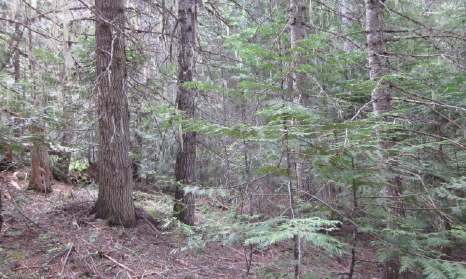
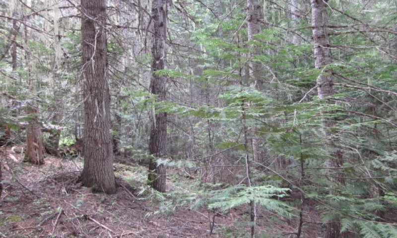
This ecological site is the largest of the western redcedar series. It’s highly diverse in tree species, shrub and forb composition. Forest composition is dependent of fire severity, occurrence, and tree species seed source after fire. Western white pine used to dominate stands after stand replacing fires before the white pine blister rust. Now, western larch, Douglas-fir, lodgepole, and ponderosa pine (dry exposures) have replaced it. Grand fir and western red cedar also get established but sit in understory underneath the other species until release from canopy openings. In early stands after fire Quaking aspen, paper birch, and black cottonwood will be present only to be overtopped in later years. Shrub competition can be severe after fire with many shrub species dominating the site. Red stem ceanothus or snowbrush ceanothus (drier areas) could dominate sites with severe burns. Mixed severity fires create a patchy mosaic of all tree species being present. Reference condition will have fire exclusion or fire intervals of over 150 years which produce an all-aged western red cedar – grand fir forest. Relic western larch, Douglas-fir, and ponderosa pine may be present.
Major Land Resource Area
MLRA 043A
Northern Rocky Mountains
Subclasses
- F043AY526WA–Warm-Frigid, Udic, Loamy Foothills/Mountainsides, ashy surface (western redcedar, moist herb) Thuja plicata / Clintonia uniflora
- F043AY527WA–Warm-Frigid, Udic, Loamy Foothills/Valleys, high water table (western redcedar, moist herb) Thuja plicata / Clintonia uniflora
- F043AY528WA–Warm-Frigid, Udic, Loamy Foothills/Mountainsides, low AWC subsoils (western redcedar, moist herb) Thuja plicata / Clintonia uniflora
Stage
Provisional


Click on box and path labels to scroll to the respective text.