Ecological site group EX043AESG11
Warm-Mesic, Xeric, Unglaciated, Loamy Slopes (Ponderosa Pine Warm Dry Grass)
Last updated: 05/02/2025
Accessed: 04/03/2026
Ecological site group description
Key Characteristics
None specified
Provisional. A provisional ecological site description has undergone quality control and quality assurance review. It contains a working state and transition model and enough information to identify the ecological site.
Physiography
Major land resource area (MLRA): 043A-Northern Rocky Mountains
Modal LRU – 43A07 Eastern Columbia Plateau Embayments
This LRU is composed predominantly of low to mid elevation foothills, structural benches, and valleys. The soils tend to be loamy xerolls, and xeralfs with mixed ash surfaces. Basalt and older sediment deposits are the dominant parent materials. Soil climate is a mesic to frigid temperature regime and xeric to udic moisture regime with average annual precipitation around 780 mm (31 inches).
Others where occurring – 43A08 – Clearwater Canyons
43A09 - Western Bitterroot Foothills
Ecological Site Concept:
The data below describes the physiographic, climatic and other parameters for the Ponderosa Pine/Dry Grass ESG as a whole. This vegetation alliance is widespread so a central tendency for each parameter is also described. See Appendix A for a finer division of the alliance based on selected soil features.
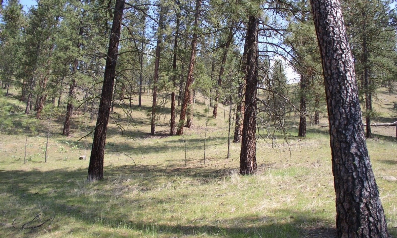
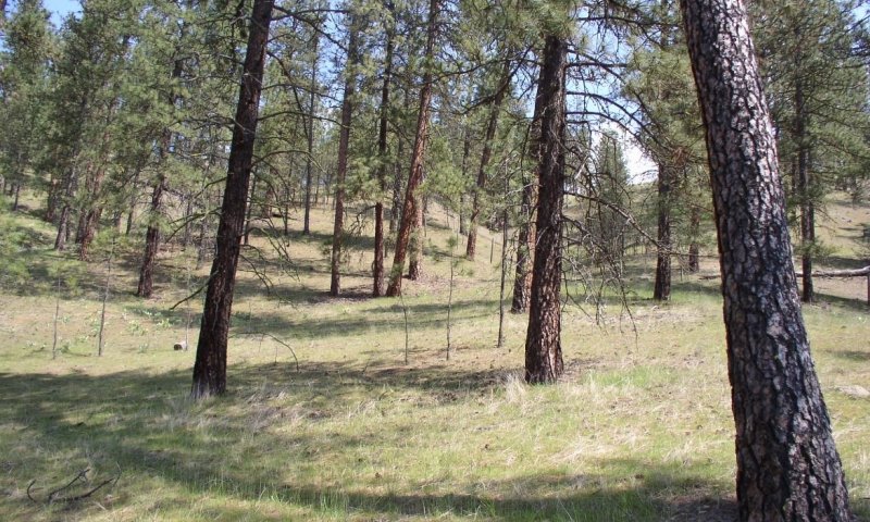
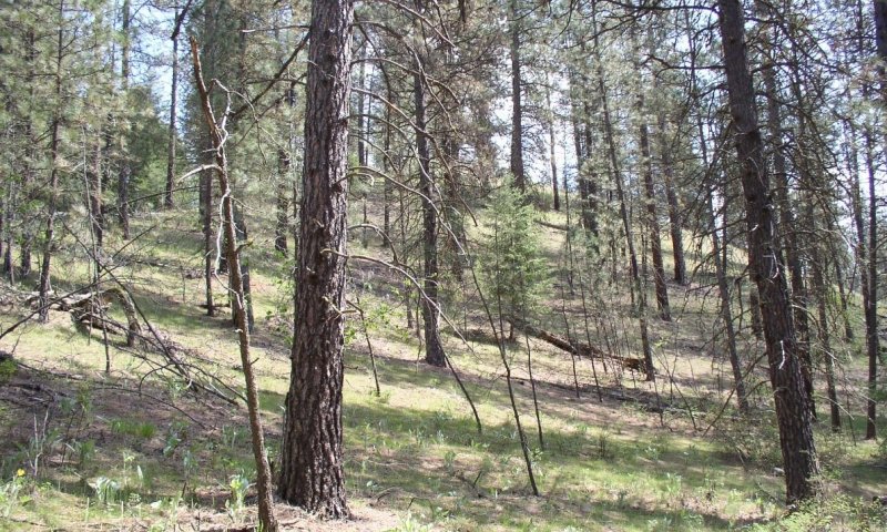
This ES group is distinguished by an overstory of Ponderosa pine. Understory is grass dominated. Grass species are dominantly bluebunch wheatgrass and Idaho fescue. Forbs include arrowleaf balsamroot, sticky geranium, yarrow and lupine.. It occurs on foothills, canyon sides, and terraces. This ES group fits into the National Vegetation Standard’s Ponderosa Pine / Herbaceous Understory Central Rocky Mt. Forest & Woodland Alliance and Washington State’s Natural Heritage Program’s Northern Rocky Mountain Ponderosa Pine Woodland and Savanna.
Physiographic Features
This ecological site occurs mainly on forested backslopes of hills and canyons, and summits and treads of structural benches or terraces. Parent materials are residuum and colluvium from basalt, quartzite or granite, alluvium, and loess. Most soils have volcanic ash mixed into the surface horizon.
Landscapes: Canyonlands, Valleys
Landforms: Canyon walls, hills, terraces
Elevation:
Total range = 390 to 1070 m
(1,280 to 3,510 feet)
Central tendency = 645 to 815 m
(2,115 to 2,675 feet)
Slope (percent):
Total range = 0 to 80 percent
Central tendency = 12 to 40 percent
Water Table Depth:
>200 cm
(>80 inches)
Flooding:
Frequency: None
Duration: None
Ponding:
Frequency: None
Duration: None
Aspect: 105-200-250 (central tendency)
Climate
Climatic Features
The climate of this portion of the MLRA is controlled by a combination of large-scale and small-scale factors. The large-scale factors here include latitude, relative position on the North American continent, prevailing hemispheric wind patterns, and extensive mountain barriers. Small-scale or local factors include the topographic setting and position (valley, slope, or ridge location), as well as orientation or aspect, and vegetative cover. Elevation may cover various scales. Broadly, the climate is transitional between a northern Pacific coastal type and a continental type. The Pacific influence is noted particularly by the late autumn and winter maximum in cloudiness and precipitation; also in the relatively moderate average winter temperatures, compared with areas east of the Rocky Mountains. Summer is characteristically sunny and dry, though July and August are the only distinct summer months. July and August are thus also the peak fire-danger months. Annual precipitation (rain and melted snow) averages as little as 10 inches at the lowest canyon floors; over 100 inches at the highest elevations. Wettest months are normally November, December, and January. Close to 60 percent of the annual total occurs during the period November through March. A slight, secondary peak in precipitation normally appears in May and June, followed by a sharp decrease in July. Snowfall accounts for more than 50 percent of the total precipitation at elevations above 4,800 ft. Snow cover usually persists in the mid elevation valleys from early December through the end of March. High-elevation snowpack reaches a depth of 5 ft (1.5 m) or more in March and April and may linger into June. The main season of lightning (or thunderstorm) activity extends from late May through August. Storms occur on an average of 3 or 4 days each in June, July, and August. Monthly mean temperatures in populated valley locations range from 24 F (-4 C) in January to 65 F (18 C) in July; these are midpoint values between the average daily maximum and minimum temperatures. The annual mean is 43 F (6 C). A large diurnal range occurs in summer. Extreme temperatures have been as high as 103" to 105" F (about 40" C) and as low as -36" F (-38" C). Temperature inversions are commonplace, particularly on the clear summer and early autumn nights. The frost-free season, defined as the period with minimum temperatures staying above 32" F (0" C), varies widely with elevation and topographic position. The season is generally longer at lower elevation locations and on slope positions in the "thermal belt" around 3,500 ft. The season is shorter in positions affected by cold air drainage and slopes above the “thermal belt” at elevations >5,500 ft. Relative humidity is usually high throughout the day in late autumn and winter, averaging 70 to 80 percent or higher in midafternoon. In July and August, afternoon values average near 35 percent in the mid elevation valleys and 45 percent at 5,500 ft. Summer nighttime humidity in these valleys typically recovers to over 90 or 95 percent by dawn. On the slopes above the temperature inversion, at the same time, humidity may average only 50 to 60 percent. Winds have a prevailing (most frequent) direction from the southwest during all or most of the year. Local terrain effects modify the larger-scale wind that occurs in the adjacent free atmosphere. A nighttime drainage effect is common. Sunshine duration is at a minimum in December, when it may average only 20 percent of the maximum possible. July has close to 80 percent of the maximum possible.
(from Finklin, A. 1983. Climate of Priest River Experimental Forest, Northern Idaho.GTR-INT-159)
Frost-free period (days):
Total range = 90 to 145 days
Central tendency = 110 to 125 days
Mean annual precipitation (cm):
Total range = 435 to 930 mm
(17 to 37 inches)
Central tendency = 590 to 725 mm
(23 to 29 inches)
MAAT (C)
Total range = 6.4 to 10.5
(43 to 51 F)
Central tendency = 7.9 to 9.0
(46 to 48 F)
Climate stations: Dworshak Dam, Dworshak Fish Hatchery, Orofino, Orofino Telemark
Soil features
Representative Soil Features
This ecological site is associated with several soil components. Most components can be grouped into six soil subgroups. These are Lithic Ultic Argixerolls, Ultic Argixerolls, Ultic Haploxerolls, Typic Argixerolls, and Ultic Haploxeralfs. These soils are often influenced by Mazama tephra deposits (usually highly mixed with loess) over other parent materials. These parent materials are dominantly: basalt, granite, quartzite or alluvium. The mixed tephra and loess layers are important for forest productivity. Where present in sufficient thickness they can retain large amounts of water compared to other parent materials, increase cation exchange capacity and have high availability of organically bound plant nutrients.
Parent Materials:
Kind: Tephra (volcanic ash)
Origin: mixed
Kind: residuum and colluvium
Origin: basalt, granite, quartzite
Kind: Alluvium
Surface Texture:
(1) Gravelly-Silt Loam
(2) Gravelly-Loam
Surface Fragments
Vegetation dynamics
Ecological Dynamics of the Site
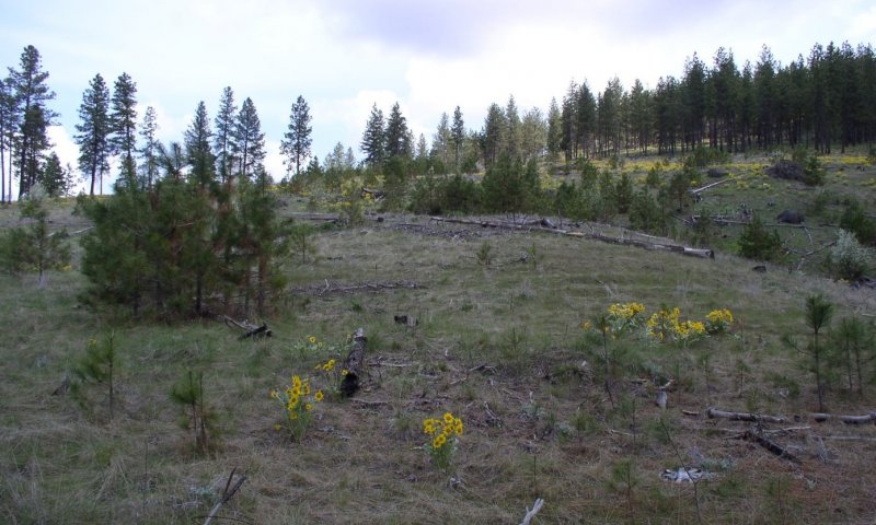
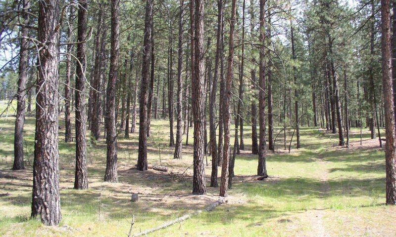
This reference site is located on very warm dry slopes with ponderosa pine the only tree species with an understory of mainly bluebunch wheatgrass, Idaho Fescue, and some needle and thread grass. Tree stocking is low with large open grown ponderosa pine and small amounts of sapling/pole size pine in understory. Frequent ground fires every 10-15 years kept pine regeneration low and perpetuated this condition with a dominant grass understory. With fire exclusion a mosaic of pine cohorts underneath the large pine survive and a patchy woodland develops. In addition, some woodland shrubs may establish and an occasional Douglas-fir may be present. Stands in this altered state are subject to beetle kill and mistletoe infestation. Soils are mainly sandy loams or loamy sands. The main habitat types included in this ecological site are Ponderosa pine/blunchwheat grass and Ponderosa pine/Idaho fescue.. The bluebunch wheatgrass sites occur on the warmer drier slopes and the Idaho fescue sites occur on the lower slopes and more level terrain. Both habitat types have similar ecological processes as described above. The fescue sites will have more pine stand density due to a little more moisture and topographic position.
Major Land Resource Area
MLRA 043A
Northern Rocky Mountains
Subclasses
Stage
Provisional
Contributors
Gary Kuhn

Click on box and path labels to scroll to the respective text.