Ecological site group EX043AESG13
Warm-Frigid, Xeric, Unglaciated, Loamy Mountains, Hills and Canyons (Douglas-Fir Warm Dry Shrub) Douglas fir / mallow ninebark - common snowberry
Last updated: 05/02/2025
Accessed: 04/03/2026
Ecological site group description
Key Characteristics
None specified
Provisional. A provisional ecological site description has undergone quality control and quality assurance review. It contains a working state and transition model and enough information to identify the ecological site.
Physiography
Major Land Resource Area: 43A Northern Rocky Mountains
Modal LRU – 43A09 - Western Bitterroot Foothills
This LRU is composed predominantly of low and mid elevation foothills and mid elevation mountain slopes, ridges and valley walls The soils of the LRU tend to be loamy Andisols, Xerolls, and Alfisols with thick or mixed ash surfaces. Loess and colluvium and residuum from metasedimentary, granitic or other metamorphic rock are the dominant parent materials. Soil climate is mesic or frigid temperature regime and xeric or udic moisture regime with average annual precipitation around 895 mm (35 inches).
Others where occurring – 43A07 - Eastern Columbia Plateau Embayments
43A08 - Clearwater Canyons
43A11 - Bitterroot Metasedimentary Zone
Ecological Site Group Concept:
The data below describes the physiographic, climatic and other parameters for the Douglas-fir/warm, dry shrub ES group. This vegetation alliance is widespread so a central tendency for each parameter is also described. See Appendix A for a finer division of the alliance based on selected soil features.
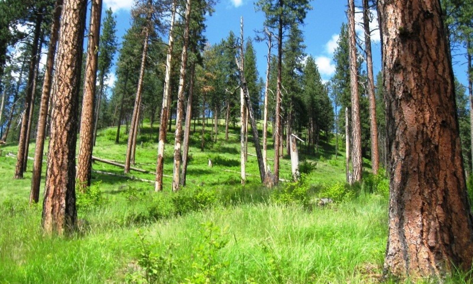
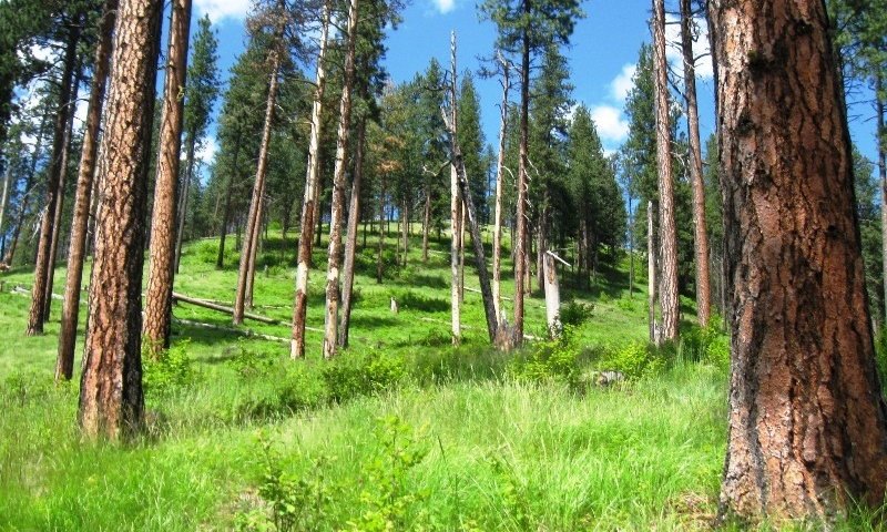
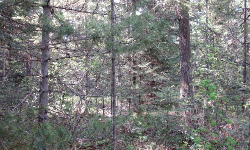
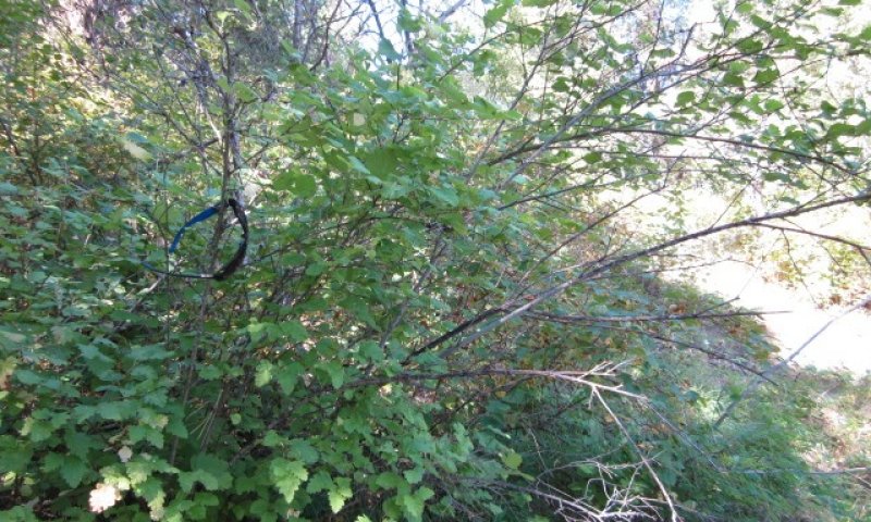
This ESG in distinguished by an overstory of ponderosa pine and Douglas-fir and an understory shrub component of ninebark, oceanspray, and snowberry. It occurs on foothills, mountainsides, and canyon walls. Pre-European frequent low intensity fire created open ponderosa stands with grass/herbaceous understory, mainly pinegrass. With fire suppression and management use stands currently have high density with multiple overstories of ponderosa pine and Douglas-fir. With infrequent fire shrubs will dominate the understory. This ESD fits into the National Vegetation Standard’s Central Rocky Mt. Ponderosa Pine – Douglas-fir Dry shrub alliance and Washington State’s Natural Heritage Program’s Northern Rocky Mt. Dry Mesic Montane Mixed Conifer Forest.
Physiographic Features
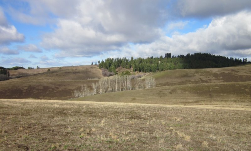
This ecological site group occurs mainly on low to mid elevation slopes of unglaciated mountains, foothills and canyons. It is found predominantly on sideslopes and ridges. The parent material is volcanic ash or mixed volcanic ash and loess over residuum and colluvium from mainly metasedimentary, granitic or other metamorphic rock.
Landscapes: Mountains, Foothills, Valleys, Plateaus, Canyonlands
Landform: Mountain slope, Hill slope, Canyon wall, Structural bench
Elevation:
Total range = 480 to 1445 m
(1,575 to 4,740 feet)
Central tendency = 845 to 1085 m
(2,770 to 3,560 feet)
Slope (percent):
Total range = 0 to 90 percent
Central tendency = 25 to 50 percent
Water Table Depth:
20 cm to >200 cm
(8 to >80 inches)
Flooding:
Frequency:
None
Duration:
None
Ponding:
Frequency:
None
Duration:
None
Aspect:
55-200-35
Central tendency - 115-200-245
Climate
Climatic Features
The climate of this portion of the MLRA is controlled by a combination of large-scale and small-scale factors. The large-scale factors include latitude, relative position on the North American continent, prevailing hemispheric wind patterns, and extensive mountain barriers. Small-scale or local factors include the topographic setting and position (valley, slope, or ridge location), as well as orientation or aspect, and vegetative cover. Broadly, the climate is transitional between a northern Pacific coastal type and a continental type. The Pacific influence is noted particularly by the late autumn and winter maximum in cloudiness and precipitation and in the relatively moderate average winter temperatures, compared with areas east of the Rocky Mountains. Summer is characteristically sunny and dry, though July and August are the only distinct summer months. July and August are thus also the peak fire-danger months. Annual precipitation (rain and melted snow) averages as little as 10 inches at the lowest canyon floors; over 100 inches at the highest elevations. Wettest months are normally November, December, and January. Close to 60 percent of the annual total occurs during the period November through March. A slight, secondary peak in precipitation normally appears in May and June, followed by a sharp decrease in July. Snowfall accounts for more than 50 percent of the total precipitation at elevations above 4,800 ft. Snow cover usually persists in the mid elevation valleys from early December through the end of March. High-elevation snowpack reaches a depth of 5 ft or more in March and April and may linger into June. The main season of lightning (or thunderstorm) activity extends from late May through August. Storms occur on an average of 3 or 4 days each in June, July, and August. Monthly mean temperatures in populated valley locations range from 24 F (-4 C) in January to 65 F (18 C) in July; these are midpoint values between the average daily maximum and minimum temperatures. The annual mean is 43 F (6 C). A large diurnal range occurs in summer. Extreme temperatures have been as high as 103" to 105" F (about 40" C) and as low as -36" F (-38" C). Temperature inversions are commonplace, particularly on the clear summer and early autumn nights. The frost-free season, defined as the period with minimum temperatures staying above 32" F (0" C), varies widely with elevation and topographic position. The season is generally longer at lower elevation locations and on slope positions in the "thermal belt" around 3,500 ft. The season is shorter in positions affected by cold air drainage and slopes above the “thermal belt” at elevations >5,500 ft. Relative humidity is usually high throughout the day in late autumn and winter, averaging 70 to 80 percent or higher in midafternoon. In July and August, afternoon values average near 35 percent in the mid elevation valleys and 45 percent at 5,500 ft. Summer nighttime humidity in these valleys typically recovers to over 90 or 95 percent by dawn. On the slopes above the temperature inversion, at the same time, humidity may average only 50 to 60 percent. Winds have a prevailing (most frequent) direction from the southwest during all or most of the year. Local terrain effects modify the larger-scale wind that occurs in the adjacent free atmosphere. A nighttime drainage effect is common. Sunshine duration is at a minimum in December, when it may average only 20 percent of the maximum possible. July has close to 80 percent of the maximum possible.
(from Finklin, A. 1983. Climate of Priest River Experimental Forest, Northern Idaho.GTR-INT-159)
Frost-free period (days):
Total range = 75 to 140 days
Central tendency = 100 to 115 days
Mean annual precipitation (cm):
Total range = 470 to 1345 mm
(19 to 53 inches)
Central tendency = 800 to 1020 mm
(31 to 40 inches)
MAAT (C)
Total range = 5.1 to 9.5
(41 to 49 F)
Central tendency = 6.8 to 7.9
(44 to 46 F)
Climate Stations: Fraser, Kamiah, Plummer 3 WSW, Wallace Woodland Park, Wallace
Soil features
Representative Soil Features
This ecological site group is associated with several soil components. The soil components can be grouped into four soil Great Groups: Argixerolls, Dystrudepts, Haploxerepts, Haploxerolls, and Vitrixerands. Most of these soils have developed in Mazama tephra deposits and loess over residuum and colluvium from basalt, granitic or metasedimentary rock. The tephra layers are important for forest productivity in that they retain large amounts of water compared to other parent materials, have high cation exchange capacity and high availability of organically bound plant nutrients. Minor amounts of soil are formed in alluvial deposits. The soils range from shallow (lithic bedrock) to very deep. Many of these soils have dense till layers at a depth of 20 to 40 inches and have a low available water holding capacity and slow to very slow permeability in the till layers. The soils are mostly moderately well drained to well-drained. Surface textures include ashy fine sandy loam, gravelly ashy sandy loam, stony and/or very stony ashy sandy loam. See appendix A for a discussion of different subdivisions of the Douglas-fir/shrub alliance based on differences in soils features.
Parent Materials:
Kind: Tephra (volcanic ash), loess
Origin: mixed
Kind: residuum and colluvium
Origin: Basalt, Granite, Metasedimentary rock
Surface Texture:
(1) Ashy Silt loam
(2) Gravelly Ashy Silt loam
(3) Silt loam
Subsurface Texture Group: Loamy
Surface Fragments
Vegetation dynamics
Ecological Dynamics of the Site
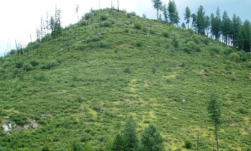
The reference state occurred before European settlement when frequent low intensity fires created open stands of large ponderosa pine with a grass dominated understory of pinegrass. Patches of Douglas-fir regeneration will be present. On the lower foothills this ecological site occurs on north and east slopes. On upper mountainous terrain it will occur on southern and western aspects. Sites escaping frequent fire will have a patchy mosaic of older large trees with patches of regeneration, pole stands of ponderosa pine and Douglas-fir, and a mixture of shrubs, grasses and forbs. Bark beetle and root disease mortality will create snags and woody debris. Severe stand replacing fires can result in ceanothus shrub fields dominating for several years until natural regeneration of pine and Douglas-fir reclaim the site. In other less severe burned areas, grass and sedge species will dominate along with sprouting shrubs like ninebark, oceanspray, and snowberry.
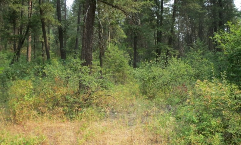
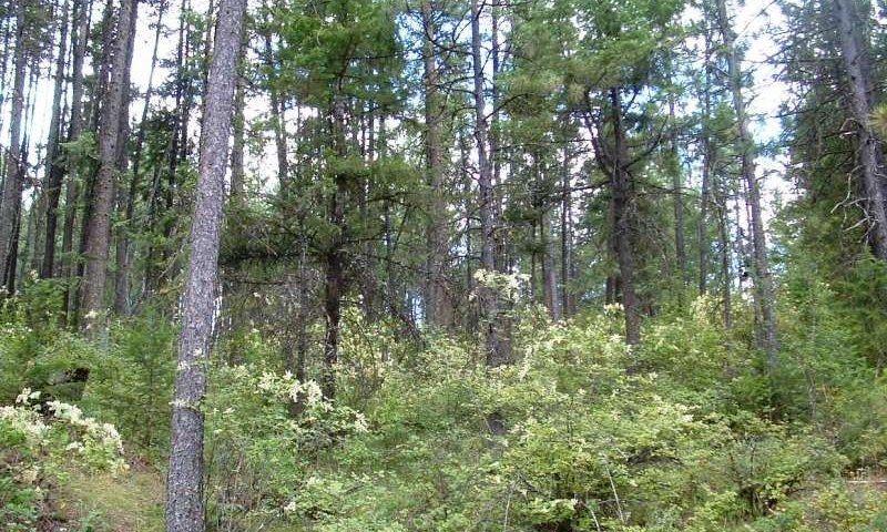
Lack of fire or fire exclusion crosses a threshold and the site goes to another state. State 2 results in homogenous multi-storied stands of ponderosa pine and Douglas-fir with dense understories of regeneration and/or shrubs. Snags and wood debris are lacking. These stands are highly susceptible to stand replacing fires. Much of the acreage of this ecological site is in this condition. Timber stand improvement and fuel removal treatments along with prescribed fire can restore this site to a more open patchy landscape more resistant to severe fire.
In Alternative State 3 severe fire has damaged soil nutrient capacity with shrub fields of ceanothus species dominating the site for 50+ years. This condition more commonly occurring on south and west facing slopes. Restoration activities must be scrutinized on a site by site basis.
In Alternative State 4 some of the lower landscape portions of this ecological site have been converted to introduced grass pastures or annual cropland. Restoring this site to the reference state takes major inputs in site preparation, tree planting, vegetation control, fuels management and other silvicultural treatments.
Major Land Resource Area
MLRA 043A
Northern Rocky Mountains
Subclasses
- F043AY540ID–Sandy Mountain Slopes 19-24" PZ Frigid Western Bitterroot Foothills
- F043AY541ID–Fragipan Foothills 19-24" PZ Frigid Eastern Columbia Plateau Embayments
- F043AY542ID–Skeletal Mountain Slopes 19-24" PZ Frigid Clearwater Mountains
- F043AY543ID–Ashy over loamy-skeletal Hills and Mountains 19-24" PZ Frigid Bitterroot Metasedimentary Zone
- F043AY544ID–Vitrandic Metasedimentary Hills and Mountains 19-24" PZ Frigid Western Bitterroot Foothills
- F043AY545ID–Ashy Basalt Hills and Canyons 19-24" PZ Frigid Clearwater Canyons
- F043AY546ID–Ashy Canyons and Mountains 19-24" PZ Frigid Western Bitterroot Foothills
Stage
Provisional
Contributors
Gary Kuhn


Click on box and path labels to scroll to the respective text.