Ecological site group EX043AESG15
Frigid, Udic, Unglaciated, Loamy, Foothills and Mountains (Western Hemlock/Moist Forbes) Western Hemlock/Queencup beadliliy - Wild ginger
Last updated: 05/02/2025
Accessed: 04/03/2026
Ecological site group description
Key Characteristics
None specified
Provisional. A provisional ecological site description has undergone quality control and quality assurance review. It contains a working state and transition model and enough information to identify the ecological site.
Physiography
Major Land Resource Area: 43A Northern Rocky Mountains
Modal LRU: 43A11 - Bitterroot Metasedimentary Zone
This LRU is composed predominantly of mid to high elevation slopes of mountains and valley walls. The soils tend to be loamy andisols, and inceptisols with ashy surfaces., residuum or colluvium from metasedimentary rock are the dominant parent materials. Soil climate is a frigid or cryic temperature regime and udic moisture regime with average annual precipitation around 1100 mm (43 inches).
Other LRU where occurring: 43A09 - Western Bitterroot Foothills
Ecological Site Group Concept:
The data below describes the physiographic, climatic and other parameters for the Frigid, Udic, Unglaciated, Loamy, Foothills and Mountains (Western Hemlock/Moist Forbes) ES group as a whole. This vegetation alliance is widespread so a central tendency for each parameter is also described.
This ecological site is the most productive in terms of forest production and biodiversity. It can be highly dynamic in forest succession depending on seed source, degree of disturbance, and shrub completion. Western larch has taken over the role of early successor since the western white pine blister rust epidemic. A whole range of tree species can be found through forest succession. Eventually, without major disturbance stands of Douglas-fir, larch, grand fir and white pine are overtaken by western hemlock and western redcedar. These cedar-hemlock stands will perpetuate until a major stand replacing fire occurs.
Physiographic Features
Landscapes: Mountains, Foothills, Valleys
Landform: Mountain slopes, Hill slopes, Escarpments, Floodplains, Stream Terraces, Structural Benches, Valley Sides, Ridges
Elevation
Total range: 510 – 1,660m
(1,675 to 5,445 feet)
Central tendency: 940-1230m
(3,0850 to 4,035 feet)
Slope (percent):
Total range: 0-90
Central tendency: 25-50
Water Table Depth:
10 to >80 inches (median = > 80 inches)
Flooding:
Frequency: None
Duration: None
Ponding:
Depth (inches): 0
Frequency: none
Duration: None
Aspect:
Range: 02-360-150
Central tendency: 290-360-70
Climate
Climatic Features
During the spring and summer, a circulation of air around a high-pressure center brings a prevailing westerly and northwesterly flow of comparatively dry, cool and stable air into the region. As the air moves inland, it becomes warmer and drier which results in a dry season beginning in the late spring and reaching a peak in mid-summer. In the fall and winter, a circulation of air around two pressure centers over the ocean brings a prevailing southwesterly and westerly flow of air into the Pacific Northwest. This air from over the ocean is moist and near the temperature of the water. Condensation occurs as the air moves inland over the cooler land and rises along the windward slopes of the mountains or highlands. This results in a wet season beginning in October, reaching a peak in winter, then gradually decreasing in the spring.
Temperature
The pattern of average annual temperatures indicates the effect both of latitude and altitude. In general, it can be said that monthly means are 32° F or lower at stations above 5,000 feet from November through March; between 4,000 and 5,000 feet, November through February; 3,000 to 4,000 feet, December through February; and 2,000 to 3,000 feet, only one or two months. The diurnal range of temperature is, of course, most extreme in high valleys and in the semiarid plains. The magnitude of diurnal range varies with the season, being lowest in winter when cloudiness is much more prevalent, and greatest in the warmer part of the year. In summer, periods of extreme heat extending beyond a week are quite rare, and the same can be said of periods of extremely low temperatures in winter. In both cases the normal progress of weather systems across the region usually results in a change at rather frequent intervals.
Precipitation
To a large extent the source of moisture for precipitation regionally is the Pacific Ocean. In summer there are some exceptions to this when moisture-laden air is brought in from the south at high levels to produce thunderstorm activity. Seasonal distribution of precipitation shows a very marked pattern of winter maximum and midsummer minimum.
Snowfall
Snowfall distribution is affected both by availability of moisture and by elevation. Annual snowfall totals have reached nearly 500 inches. The major mountain ranges accumulate a deep snow cover during the winter months, and the release of water from the melting snowpack in late spring is a primary source of instream flows.
(from WRCC: Climate of Idaho)
Mean Annual precipitation
Total Range: 495-1610 mm
(19 to 63 inches)
Central tendency: 910-1190 mm
(36 to 47 inches)
MAAT
Total Range 4.2-8.7 C
(40 to 48 F)
Central tendency: 5.9-7.0 C
(43 to 45 F)
Frost free period (days)
Total range: 75-130
Central tendency: 95-110
Climate Stations: : Avery RS, Bayview, Calder, Clarkia RS, Enaville, Fernwood, Kellog, Kingston RS, Mullan, Prichard, Wallace
Soil features
Representative Soil Features
This ecological site group is associated with several soil components. The soil components can be grouped into ten most common soil great groups: Dystrudepts, Endoaquepts, Eutrudepts, Fragiudalfs, Glossudalfs, Hapludalfs, and Udivitrands. Soils in this ecologic site are very deep to moderately deep with available water holding capacities mostly equal to or greater than 3.1 inches (in 40 inches). Most of these soils have developed in colluvium and residuum from various rock types that has strong influence from Mazama tephra. The soils are mostly well-drained or moderately well drained. Surface textures are dominantly ashy silt loam, or ashy loam.
Soil series occurring in this ES group:
Bouldercreek, Honeyjones, Hobo, Hugus, Threebear, Huckle, Jacot, Pearsoncreek, Nakarna, Flewsie, Hubub, Boulderjud, Keeler, Township, Garveson, Disalto, Rubson, Brodeer, Dorb, Bigtalk, Rettig, Secunda, Scand, Lakestarr, Elkberry, Jaypeak, Vay, Aldermand, Grangemont, Kingspeak, Glaciercreek, Chesley, and Kauder.
Parent Materials:
Kind: Volcanic ash, alluvium, Residuum, and Colluvium
Origin: Granite, Metamorphics, and Metasedimentary rock
Surface Texture: (<2mm fraction)
(1) Ashy Silt Loam
(2) Gravelly Ashy Silt Loam
(3) Medial Silt Loam
Fragment content surface horizons (% by Volume): Minimum: 0 Maximum: 34 Median: 5
Surface Fragment content
Vegetation dynamics
Ecological Dynamics of the Site
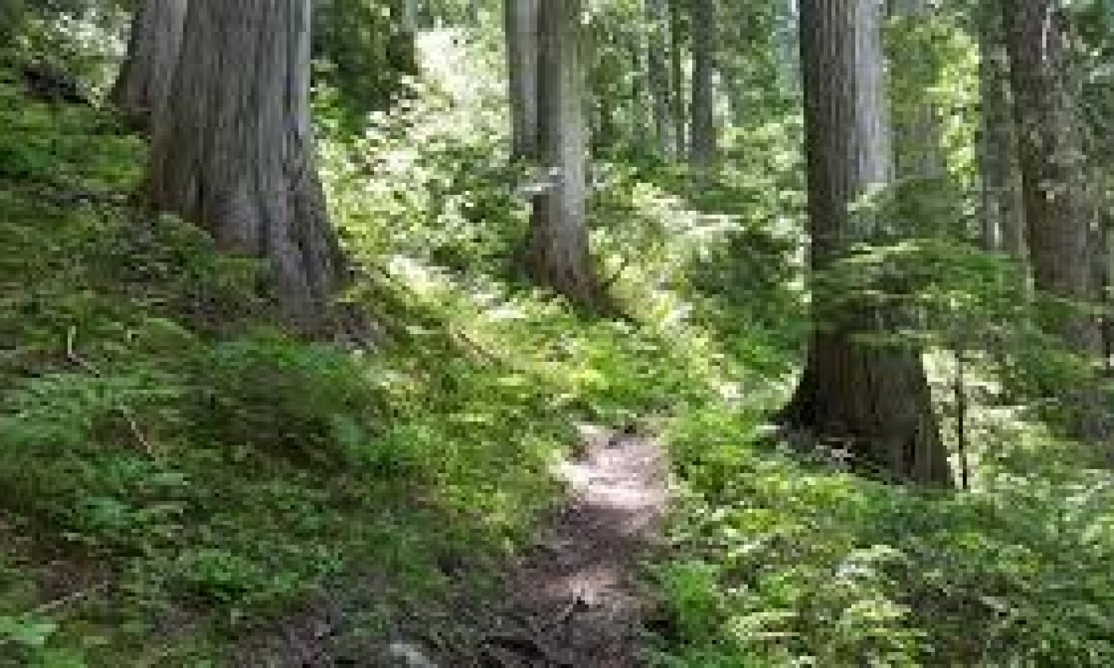
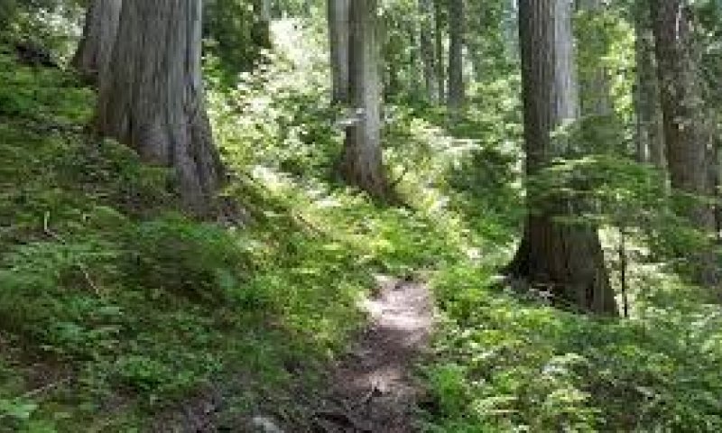
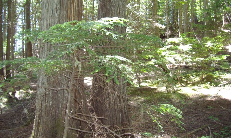
This site occurs most commonly on north slopes, cool benches, and dissected drainages. The depth of volcanic ash in the soil along with high precipitation makes this site highly productive. It is recognized by USFS Forest Habitat Types of Northern Idaho as the Western hemlock / Queenscup beadlily and Western hemlock / Wild Ginger habitat types. The WH/beadlilly habitat type is the most prolific and occurs on all aspects. The wild ginger type occurs on moister landscapes, usually on toe slopes or drainage areas. The cooler portions of this site occur at higher elevation lack western redcedar and have rusty menziesia as key shrub indicator.
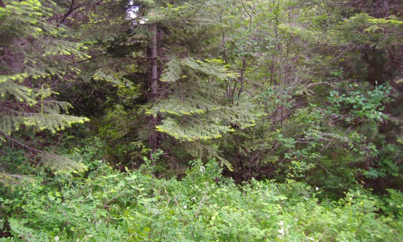
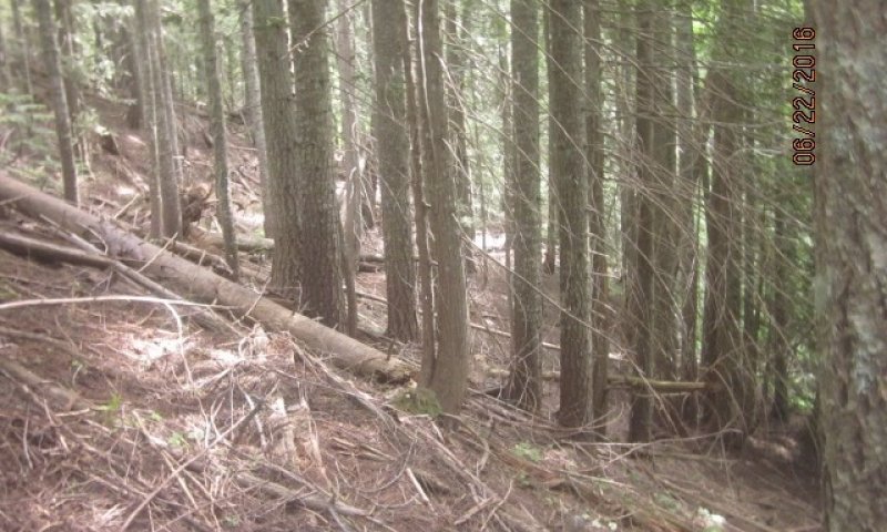
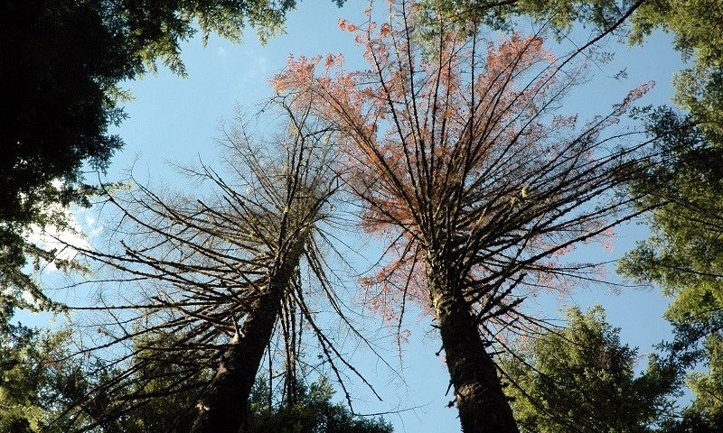
This site has the highest ecological dynamics depending on type and degree of disturbance, and tree species seed source. Western hemlock and western redcedar will eventually dominate the overstory without major fire disturbance. Grand fir, Douglas-fir, western white pine, and western larch could be present in varying amounts. Understory reproduction and 2nd level overstory will be dominated by western hemlock and western redcedar due to their high degree of shade tolerance. There will be a large component of downed wood caused by windthrow, seral species die-out, and insect and disease mortality. Paper birch is a key deciduous tree species in this hemlock-cedar ecological site. It can be a prominent understory component in early to mature stands and eventually dies out in the late climax forest.
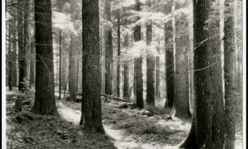
Fire frequency in these stands occurs in long intervals of 150+ years. Due to the large volume of wood, stand replacing fires were the norm leaving the site naturally reforested by western white pine. After the white pine blister rust epidemic western larch, Douglas-fir, and in drier areas ponderosa pine gets established depending on seed source and competing shrub species. Grand fir, western hemlock, and western redcedar will also reestablish on the site through time. Lodgepole pine can be present and prevalent on sites after fire.
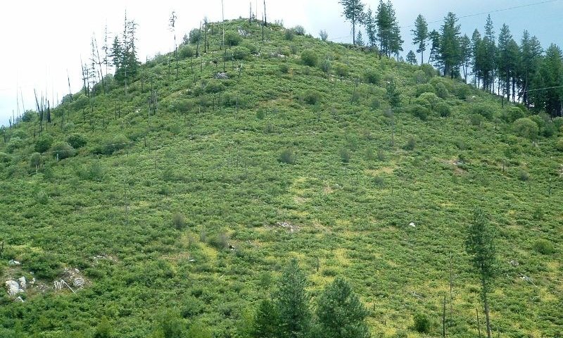
Ceanothus, alder species, and Douglas maple can reestablish quickly on these burnt sites slowing down natural reforestation. Reoccurring severe fires causing soil degradation can keep the site in a shrub dominated condition for long periods. Western larch is not as hardy as western white pine in competing with the brush species through natural regeneration. Larch needs to immediately establish on bare soil without much competition. The loss of the dominant white pine component again has caused a higher occurrence of Douglas-fir, grand fir, western hemlock, and western redcedar in developing stands.
The understory vegetation can be very rich in areas receiving enough sunlight. Key species include Queenscup beadlily, hooker fairybells, starry Solomon seal, wintergreen, huckleberry spp., and sword fern.
Major Land Resource Area
MLRA 043A
Northern Rocky Mountains
Subclasses
- F043AY556ID–Fragipan Foothills 30-45" PZ Frigid Eastern Columbia Plateau Embayments
- F043AY557ID–Ashy Till Mountains and Valleys 30-45" PZ Frigid Bitterroot Metasedimentary Zone
- F043AY558ID–Ashy Metasedimentary Hills and Mountains 30-45" PZ Frigid Bitterroot Metasedimentary Zone
- F043AY559ID–Ashy Mountains and Valleys 30-45" PZ Frigid Western Bitterroot Foothills
- F043AY560ID–Vitrandic Mountains and Valleys 30-45" PZ Frigid Western Bitterroot Foothills
Stage
Provisional
Contributors
Gary Kuhn

Click on box and path labels to scroll to the respective text.