
Ecological site group EX043AESG16
Warm-Frigid, Dry-Udic Unglaciated, Loamy, Hills, Mountains and Canyons (Grand Fir Moist Herb) Grand Fir / Bride's Bonnet
Last updated: 05/02/2025
Accessed: 04/03/2026
Ecological site group description
Key Characteristics
None specified
Provisional. A provisional ecological site description has undergone quality control and quality assurance review. It contains a working state and transition model and enough information to identify the ecological site.
Physiography
Major land resource area (MLRA): 043A-Northern Rocky Mountains
Modal LRU – 43A11 Bitterroot Metasedimentary Zone
This LRU is composed predominantly of mid elevation foothills and valley walls and mid to high elevation mountain slopes. The soils tend to be loamy andisols, and inceptisols with distinct ash surfaces. Colluvium and residuum from metasedimentary rock are the dominant parent materials. Soil climate is a frigid or cryic temperature regime and udic moisture regime with average annual precipitation around 1100 mm (43 inches).
Others where occurring – 43A07 – Eastern Columbia Plateau Embayments
43A09 - Western Bitterroot Foothills
43A10 - Clearwater Mountains
Ecological Site Concept:
The data below describes the physiographic, climatic and other parameters for the Grand Fir Moist Herb ES Group as a whole. This vegetation alliance is widespread so a central tendency for each parameter is also described. See Appendix A for a finer division of the alliance based on selected soil features.
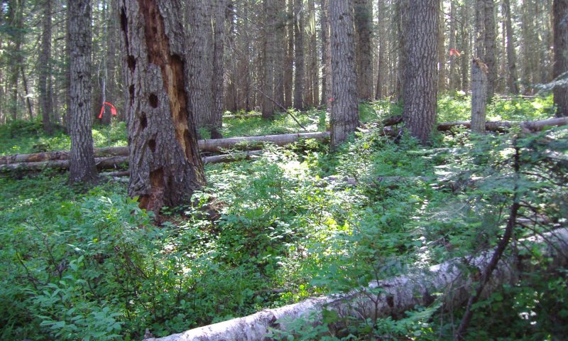
This ES group is distinguished by an overstory of grand fir and Douglas-fir. Understory shrubs can include Acer glabrum, Linnaea borealis, Menziesia ferruginea, Physocarpus malvaceus, Spiraea betulifolia, Symphoricarpos occidentalis, and Vaccinium membranaceum. Herbaceous layers may be graminoid- or forb-dominated and may include Bromus vulgaris, Calamagrostis rubescens, Carex geyeri, Clintonia uniflora, Coptis occidentalis, Cornus canadensis, Linnaea borealis, and Trautvetteria caroliniensis.. It occurs on foothills, mountainsides, and canyon walls. This ES group fits into the National Vegetation Standard’s Grand Fir - Douglas-fir Central Rocky Mountain Forest & Woodland Alliance and Washington State’s Natural Heritage Program’s Northern Rocky Mt. Mesic Montane Mixed Conifer Forest.
Physiographic Features
This ecological site occurs mainly on forested backslopes of mountains, hills and canyon walls. Parent materials are mostly residuum and colluvium derived from igneous (granitic and basaltic), metamorphic, or metasedimentary rock thinly mantled by volcanic ash and loess. Some soils are formed in sediment deposits mantled by mixed loess and volcanic ash.
Landscapes: Mountains, Foothills, Canyonlands, Plateaus
Landforms: Mountain slope, Hill slope, Canyon wall, Structural bench
Elevation:
Total range = 575 to 1580 m
(1,885 to 5,180 feet)
Central tendency = 950 to 1200 m
(3,115 to 3,935 feet)
Slope (percent):
Total range = 0 to 85 percent
Central tendency = 20 to 45 percent
Water Table Depth:
12 to >80 inches (median >80 inches)
Flooding:
Frequency: None
Duration: None
Ponding:
Frequency: None
Duration: None
Aspect: Total range: 55-205-350
Central tendency: 135-205-270
Climate
Climatic Features
The climate of this portion of the MLRA is controlled by a combination of large-scale and small-scale factors. The large-scale factors include latitude, relative position on the North American continent, prevailing hemispheric wind patterns, and extensive mountain barriers. Small-scale or local factors include the topographic setting and position (valley, slope, or ridge location), as well as orientation or aspect, and vegetative cover. Broadly, the climate is transitional between a northern Pacific coastal type and a continental type. The Pacific influence is noted particularly by the late autumn and winter maximum in cloudiness and precipitation and in the relatively moderate average winter temperatures, compared with areas east of the Rocky Mountains. Summer is characteristically sunny and dry, though July and August are the only distinct summer months. July and August are thus also the peak fire-danger months. Annual precipitation (rain and melted snow) averages as little as 10 inches at the lowest canyon floors; over 100 inches at the highest elevations. Wettest months are normally November, December, and January. Close to 60 percent of the annual total occurs during the period November through March. A slight, secondary peak in precipitation normally appears in May and June, followed by a sharp decrease in July. Snowfall accounts for more than 50 percent of the total precipitation at elevations above 4,800 ft. Snow cover usually persists in the mid elevation valleys from early December through the end of March. High-elevation snowpack reaches a depth of 5 ft or more in March and April and may linger into June. The main season of lightning (or thunderstorm) activity extends from late May through August. Storms occur on an average of 3 or 4 days each in June, July, and August. Monthly mean temperatures in populated valley locations range from 24 F (-4 C) in January to 65 F (18 C) in July; these are midpoint values between the average daily maximum and minimum temperatures. The annual mean is 43 F (6 C). A large diurnal range occurs in summer. Extreme temperatures have been as high as 103" to 105" F (about 40" C) and as low as -36" F (-38" C). Temperature inversions are commonplace, particularly on the clear summer and early autumn nights. The frost-free season, defined as the period with minimum temperatures staying above 32" F (0" C), varies widely with elevation and topographic position. The season is generally longer at lower elevation locations and on slope positions in the "thermal belt" around 3,500 ft. The season is shorter in positions affected by cold air drainage and slopes above the “thermal belt” at elevations >5,500 ft. Relative humidity is usually high throughout the day in late autumn and winter, averaging 70 to 80 percent or higher in midafternoon. In July and August, afternoon values average near 35 percent in the mid elevation valleys and 45 percent at 5,500 ft. Summer nighttime humidity in these valleys typically recovers to over 90 or 95 percent by dawn. On the slopes above the temperature inversion, at the same time, humidity may average only 50 to 60 percent. Winds have a prevailing (most frequent) direction from the southwest during all or most of the year. Local terrain effects modify the larger-scale wind that occurs in the adjacent free atmosphere. A nighttime drainage effect is common. Sunshine duration is at a minimum in December, when it may average only 20 percent of the maximum possible. July has close to 80 percent of the maximum possible.
(from Finklin, A. 1983. Climate of Priest River Experimental Forest, Northern Idaho.GTR-INT-159)
Frost-free period (days):
Total range = 85 to 135 days
Central tendency = 100 to 120 days
Mean annual precipitation (cm):
Total range = 510 to 1315 mm
(20 to 52 inches)
Central tendency = 710 to 950 mm
(28 to 37 inches)
MAAT (C)
Total range = 2.8 to 9.1
(37 to 48 F)
Central tendency = 5.2 to 6.8
(41 to 44 F)
Climate stations: Bungalow RS, Clarke Mtn Lookout, Clarkia RS, Kellogg 1 W, Mt Coeur D’Alene LO, Murray, Pritchard 4 N, St Maries 2, Silverton
Soil features
Representative Soil Features
This ecological site is associated with several soil components. The soil components can be grouped into seven soil subgroups. These are: Alfic Udivitrands, Andic Dystrudepts, Andic Haploxerepts, Typic Udivitrands, Typic Vitrixerands, and Vitrandic Dystrudepts. These soils have developed in Mazama tephra deposits (often highly mixed with loess) over several other parent materials. These parent materials are dominantly: residuum and colluvium derived from igneous (granitic and basaltic), metamorphic, or metasedimentary rock and sediments of varying age. The tephra layers are important for forest productivity. Where present in sufficient thickness they can: retain large amounts of water compared to other parent materials, increase cation exchange capacity and have high availability of organically bound plant nutrients.
Parent Materials:
Kind: Tephra (volcanic ash)
Origin: mixed
Kind: loess, Tertiary or recent alluvium
Origin: mixed
Kind: residuum and colluvium
Origin: Granite basalt, Metasedimentary, other metamorphic rock,
Surface Texture: (<2mm fraction)
(1) Ashy Silt Loam
(2) Gravelly Ashy Silt Loam
(3) Ashy Loam
Surface Fragments
Vegetation dynamics
Ecological Dynamics of the Site
This grand fir site is on the moister end of the grand fir series and can have many tree species occurring depending on disturbance and seed source. Douglas-fir is the main seral species and will occur in mature stands with grand fir with fire exclusion. Engelmann spruce can also be present in fire excluded mature stands. With stand replacing or mixed severity disturbance Douglas-fir, western larch, ponderosa pine, western white pine, and lodgepole pine can occur in mixed stands. Quaking aspen, paper birch, and black cottonwood can be present in early to mid-seral stands.
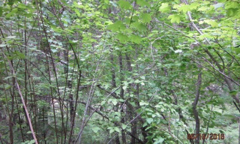
Key understory species include Douglas maple, ninebark, oceanspray, serviceberry, snowberry, twinflower, honeysuckle, Oregon grape, rose, thimbleberry, pachistima, Scouler willow, spirea, pinegrass, brides bonnet, pathfinder, sweetroot, starry solomonplume, western princes pine, and white hawkweed.
Root rot and beetle kill will occur in the mature grand fir – Douglas fir stands. Western white pine once would have been more prevalent in the seral to mature stands, however, blister rust has made it a minor component of current stands. Low intensity frequent fires will favor more open western larch, Douglas-fir, and ponderosa pine stands. Mixed severity fires will create a mosaic of mixed stands of all tree species. Severe fires may create ceanothus brush fields with tree regeneration slow to reclaim the site.
Major Land Resource Area
MLRA 043A
Northern Rocky Mountains
Subclasses
- F043AY561ID–Fragipan Foothills 30-45" PZ Frigid Eastern Columbia Plateau Embayments
- F043AY562ID–Skeletal Mountains 30-45" PZ Frigid Clearwater Mountains
- F043AY563ID–Ashy Metasedimentary Mountains 30-45" PZ Frigid Bitterroot Metasedimentary Zone
- F043AY564ID–Vitrandic Metasedimentary Hills and Mountains 30-45" PZ Frigid Western Bitterroot Foothills
- F043AY565ID–Ashy Basalt Hills and Canyons 30-45" PZ Frigid Eastern Columbia Plateau Embayments
- F043AY566ID–Dry Ashy Hills and Mountains 30-45" PZ Frigid Clearwater Mountains
- F043AY567ID–Vitrandic Hills and Mountains 30-45" PZ Frigid Western Bitterroot Foothills
Stage
Provisional


Click on box and path labels to scroll to the respective text.