
Ecological site group EX043AESG17
Warm-Frigid, Udic, Unglaciated, Loamy, Foothills and Mountains (Western redcedar, moist herb) Western Redcedar / Bride's Bonnet
Last updated: 05/02/2025
Accessed: 04/03/2026
Ecological site group description
Key Characteristics
None specified
Provisional. A provisional ecological site description has undergone quality control and quality assurance review. It contains a working state and transition model and enough information to identify the ecological site.
Physiography
Major land resource area (MLRA): 043A-Northern Rocky Mountains
Modal LRU – 43A09 - Western Bitterroot Foothills
This LRU is composed predominantly of low to mid elevation foothills, mid elevation mountain slopes and valley walls, and low elevation canyons. The soils tend to be loamy andisols, inceptisols, and alfisols with distinct or mixed ash surfaces. residuum and colluvium from metasedimentary, granitic or metamorphic rock are the dominant parent materials. Soil climate is a frigid or mesic temperature regime and xeric or udic moisture regime with average annual precipitation around 895 mm (35 inches).
Others where occurring – 43A10 - Clearwater Mountains
43A07 - Eastern Columbia Plateau Embayments
Ecological Site Concept:
The data below describes the physiographic, climatic and other parameters for the Western Redcedar, Moist Herb ES group as a whole as it occurs in MLRA 43A. This vegetation alliance is widespread so a central tendency for each parameter is also described. See Appendix A for a finer division of the alliance based on selected soil features.
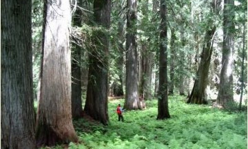
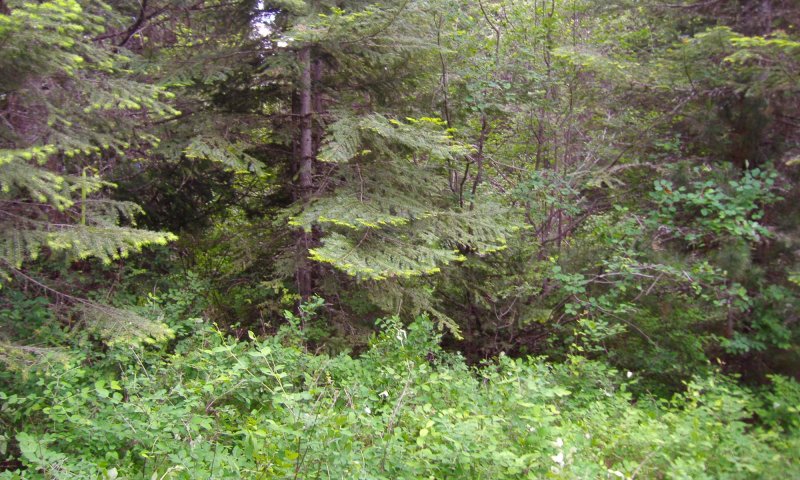
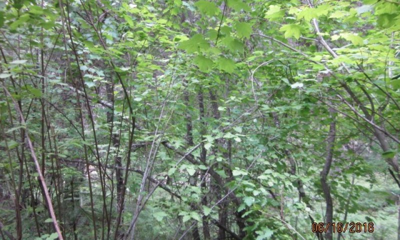
This ES group is distinguished by an overstory of western redcedar, grand fir and Douglas-fir and a diverse understory of shrubs such as woods rose and Utah honeysuckle; and herbs such as bride’s bonnet, Idaho goldthread and starry false solomon’s seal. It occurs on foothills, mountainsides, and ridges. This ES group fits into the National Vegetation Standard’s Tsuga heterophylla - Thuja plicata Cool-Mesic Central Rocky Mountain Forest & Woodland Alliance and Washington State’s Natural Heritage Program’s Northern Rocky Mountain Mesic Montane Mixed Conifer Forest.
Physiographic Features
This ecological site occurs mainly on forested backslopes and ridges of mountains and hills. Parent materials are alluvium (both recent and Tertiary), and residuum and colluvium derived from igneous (granitic and basaltic), metasedimentary and other metamorphic rock mantled by volcanic ash and loess.
Landscapes: Mountains, Foothills
Landforms: Mountain slopes, Hill slopes, Stream Terraces
Elevation:
Total range = 540 to 1585 m
(1,770 to 5,200 feet)
Central tendency = 930 to 1195 m
(3,050 to 3,920 feet)
Slope (percent):
Total range = 0 to 85 percent
Central tendency = 20 to 45 percent
Water Table Depth: (90% of components have water table > 80 inches)
When present water tables are at 12-45 inches (RV values); median = 20 inches
Flooding:
Frequency: None
Duration: None
Ponding:
Frequency: None
Duration: None
Aspect: 55-205-350 Overall
135-205-270 Central tendency
Climate
Climatic Features
The climate of this portion of the MLRA is controlled by a combination of large-scale and small-scale factors. The large-scale factors include latitude, relative position on the North American continent, prevailing hemispheric wind patterns, and extensive mountain barriers. Small-scale or local factors include the topographic setting and position (valley, slope, or ridge location), as well as orientation or aspect, and vegetative cover. Broadly, the climate is transitional between a northern Pacific coastal type and a continental type. The Pacific influence is noted particularly by the late autumn and winter maximum in cloudiness and precipitation and in the relatively moderate average winter temperatures, compared with areas east of the Rocky Mountains. Summer is characteristically sunny and dry, though July and August are the only distinct summer months. July and August are thus also the peak fire-danger months. Annual precipitation (rain and melted snow) averages as little as 10 inches at the lowest canyon floors; over 100 inches at the highest elevations. Wettest months are normally November, December, and January. Close to 60 percent of the annual total occurs during the period November through March. A slight, secondary peak in precipitation normally appears in May and June, followed by a sharp decrease in July. Snowfall accounts for more than 50 percent of the total precipitation at elevations above 4,800 ft. Snow cover usually persists in the mid elevation valleys from early December through the end of March. High-elevation snowpack reaches a depth of 5 ft or more in March and April and may linger into June. The main season of lightning (or thunderstorm) activity extends from late May through August. Storms occur on an average of 3 or 4 days each in June, July, and August. Monthly mean temperatures in populated valley locations range from 24 F (-4 C) in January to 65 F (18 C) in July; these are midpoint values between the average daily maximum and minimum temperatures. The annual mean is 43 F (6 C). A large diurnal range occurs in summer. Extreme temperatures have been as high as 103" to 105" F (about 40" C) and as low as -36" F (-38" C). Temperature inversions are commonplace, particularly on the clear summer and early autumn nights. The frost-free season, defined as the period with minimum temperatures staying above 32" F (0" C), varies widely with elevation and topographic position. The season is generally longer at lower elevation locations and on slope positions in the "thermal belt" around 3,500 ft. The season is shorter in positions affected by cold air drainage and slopes above the “thermal belt” at elevations >5,500 ft. Relative humidity is usually high throughout the day in late autumn and winter, averaging 70 to 80 percent or higher in midafternoon. In July and August, afternoon values average near 35 percent in the mid elevation valleys and 45 percent at 5,500 ft. Summer nighttime humidity in these valleys typically recovers to over 90 or 95 percent by dawn. On the slopes above the temperature inversion, at the same time, humidity may average only 50 to 60 percent. Winds have a prevailing (most frequent) direction from the southwest during all or most of the year. Local terrain effects modify the larger-scale wind that occurs in the adjacent free atmosphere. A nighttime drainage effect is common. Sunshine duration is at a minimum in December, when it may average only 20 percent of the maximum possible. July has close to 80 percent of the maximum possible.
(from Finklin, A. 1983. Climate of Priest River Experimental Forest, Northern Idaho.GTR-INT-159)
Frost-free period (days):
Total range = 40 to 140 days
Central tendency = 100 to 120 days
Mean annual precipitation:
Total range = 570 to 1545 mm
(22 to 61 inches)
Central tendency = 935 to 1180 mm
(37 to 46 inches)
MAAT (C)
Total range = 4.8 to 9.1
(42 to 50 F)
Central tendency = 6.9 to 8.1
(44 to 47 F)
Climate stations: Avery RS, Baldy Mountain LO, Bayview, Boehls Cabin, Bovill 1 N, Bungalow RS, Burke 2 ENE, Calder,Canyon RS, Canyon Clearwater R St, Cayuse Creek, Elk River 1 S, Elmira, Enaville, Fernwood, Fish Lake, Fortynine Meadows, Headquarters, Kelly Creek RS, Musselshell RS, Oxford Ranger Station, Pierce, Round Meadow, Saint Maries, Saint Maries 1 W, Saint Maries 3, Saint Maries River
Soil features
Representative Soil Features
This ecological site is associated with several soil components. The soil components can be grouped into several soil Great Groups. These are Udivitrands, Hapludalfs, Glossudalfs, Fraglossudalfs, Fragiudalfs, Eutrudepts, and Dystrudepts. These soils have developed in various thicknesses of Mazama tephra deposits (sometimes highly mixed with loess) over a number of other parent materials. These parent materials are dominantly: material weathered from granite, gneiss, schist, basalt, or metasedimentary rock or alluvium of different ages. The tephra layers are important for forest productivity. Where present in sufficient thickness they can: retain large amounts of water compared to other parent materials, increase cation exchange capacity and have high availability of organically bound plant nutrients.
Parent Materials:
Kind: Tephra (volcanic ash)
Origin: mixed
Kind: Alluvium, Lacustrine
Origin: mixed
Kind: residuum and colluvium
Origin: Granite, Metasedimentary, other metamorphic rock
Surface Texture:
(1) Ashy Silt Loam
(2) Ashy Loam
(3) Medial Silt Loam
Surface Fragments
Vegetation dynamics
Ecological Dynamics of the Site
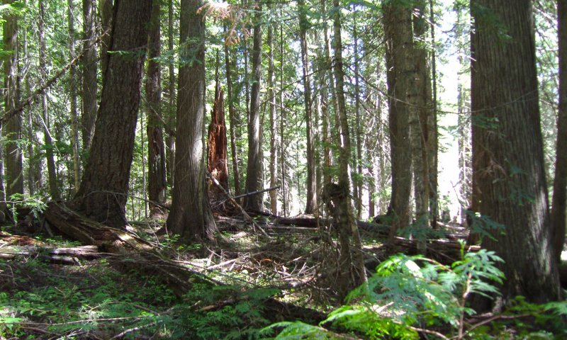
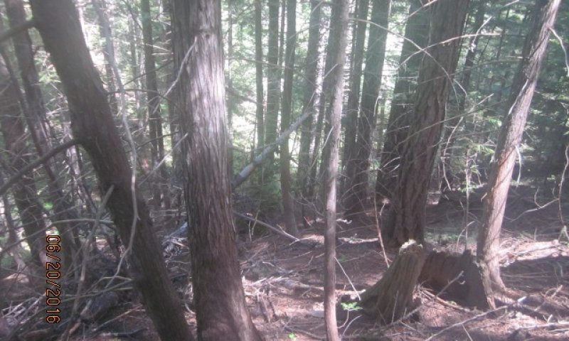
This ecological site is the largest of the western redcedar series. It’s highly diverse in tree species, shrub and forb composition. Forest composition is dependent of fire severity, occurrence, and tree species seed source after fire. Western white pine used to dominate stands after stand replacing fires before the white pine blister rust. Now, western larch, Douglas-fir, lodgepole, and ponderosa pine (dry exposures) have replaced it. Grand fir and western red cedar also get established but sit in understory underneath the other species until release from canopy openings. In early stands after fire Quaking aspen, paper birch, and black cottonwood will be present only to be overtopped in later years. Shrub competition can be severe after fire with many shrub species dominating the site. Red stem ceanothus or snowbrush ceanothus (drier areas) could dominate sites with severe burns. Mixed severity fires create a patchy mosaic of all tree species being present. Reference condition will have fire exclusion or fire intervals of over 150 years which produce an all-aged western red cedar – grand fir forest. Relic western larch, Douglas-fir, and ponderosa pine may be present.
Major Land Resource Area
MLRA 043A
Northern Rocky Mountains
Subclasses
- F043AY568ID–Ashy Fragipan Hills 30-45" PZ Frigid Eastern Columbia Plateau Embayments
- F043AY569ID–Vitrandic Fragipan Hills 30-45" PZ Frigid Western Bitterroot Foothills
- F043AY570ID–Ashy Metasedimentary Hills and Mountains 30-45" PZ Frigid Western Bitterroot Foothills
- F043AY571ID–Vitrandic Metasedimentary Hills and Mountains 30-45" PZ Frigid Western Bitterroot Foothills
- F043AY572ID–Ashy Basalt Hills and Canyons 30-45" PZ Frigid Eastern Columbia Plateau Embayments
- F043AY573ID–Vitrandic Basalt Hills and Canyons 30-45" PZ Frigid Eastern Columbia Plateau Embayments
- F043AY574ID–Ashy Hills and Mountains 30-45" PZ Frigid Western Bitterroot Foothills
- F043AY575ID–Vitrandic Hills and Mountains 30-45" PZ Frigid Western Bitterroot Foothills
- F043AY576ID–Poorly Drained Vitrandic Foothills 30-45" PZ Frigid Western Bitterroot Foothills
Stage
Provisional
Contributors
Gary Kuhn

Click on box and path labels to scroll to the respective text.