
Ecological site group EX043AESG18
Warm-Cryic, Moist-Udic, Loamy Mountain Slopes (Subalpine Fir-Mountain Hemlock/ Moist Herb) Subalpine Fir-Mountain Hemlock/ Bride's Bonnett
Last updated: 05/02/2025
Accessed: 04/03/2026
Ecological site group description
Key Characteristics
None specified
Provisional. A provisional ecological site description has undergone quality control and quality assurance review. It contains a working state and transition model and enough information to identify the ecological site.
Physiography
Major Land Resource Area: 43A Northern Rocky Mountains and Foothills
Modal LRU – 43A10 - Clearwater Mountains
This LRU is composed predominantly of mid and high elevation valley walls, mountain slopes and ridges. The soils tend to be loamy andisols and inceptisols with ashy surfaces. Till, residuum and colluvium from metamorphics, and granitics are the dominant parent materials. Soil climate is a cryic or frigid temperature regime and udic moisture regime with average annual precipitation around 1300 mm (51 inches). While not exposed to continental glaciation, features associated with montane glaciation (cirques, trough valleys etc.) do exist at higher elevations.
Others where occurring – 43A11 - Bitterroot Metasedimentary Zone
Ecological Site Concept:
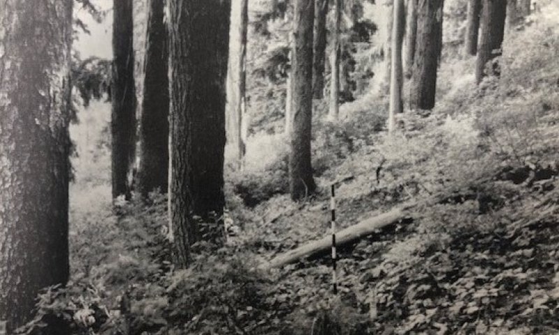
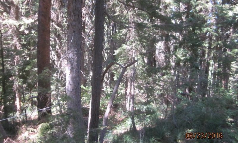
This ESD in distinguished by an overstory of subalpine fir or mountain hemlock and a diverse understory. Shrubs include rustyleaf menzesia, sitka alder, blue huckleberry, big huckleberry, twinflower and grouse whortleberry. Forbs include Piper’s anemone, queencup beadlily, wild ginger, mountain arnica, Idaho goldthread, rattlesnake plantain, western meadowrue, coolwort foamflower and round leaved violet. This ESD fits into the National Vegetation Classification’s Subalpine Fir - Engelmann Spruce Rocky Mountain Moist Forest Alliance and Washington State Natural Heritage Program’s Rocky Mountain Subalpine Mesic-Wet Spruce-Fir Forest.
Physiographic Features
This ecological site group occurs mainly on high elevation slopes and ridges of mountains. It is found predominantly on side slopes and summits. It can also be found at lower elevations where cold air drainage has created frost pockets in valleys and basins of foothills. The parent material is volcanic ash or mixed volcanic ash and loess over till, alluvium, residuum and colluvium from mainly metamorphic, metasedimentary or granitic rock.
Landscapes: Mountains, Foothills, Uplands
Landform: Mountain slope, Hillslopes, ridges, stream terraces, floodplains, structural benches
Elevation:
Total range = 1090 to 2010 m
(3,575 to 6,590 feet)
Central tendency = 1435 to 1665 m
(4,705 to 5,460 feet)
Slope (percent):
Total range = 0 to 85 percent
Central tendency = 25 to 50 percent
Water Table Depth: 24 to >80 inches (median = >80 inches)
Flooding:
Frequency: none
Duration: none
Ponding:
Frequency: none
Duration: none
Aspect:
Full range: 230-10-175
Central tendency: 285-10-75
Climate
Climatic Features
During the spring and summer, a circulation of air around a high-pressure center brings a prevailing westerly and northwesterly flow of comparatively dry, cool and stable air into the region. As the air moves inland, it becomes warmer and drier which results in a dry season beginning in the late spring and reaching a peak in mid-summer. In the fall and winter, a circulation of air around two pressure centers over the ocean brings a prevailing southwesterly and westerly flow of air into the Pacific Northwest. This air from over the ocean is moist and near the temperature of the water. Condensation occurs as the air moves inland over the cooler land and rises along the windward slopes of the mountains or highlands. This results in a wet season beginning in October, reaching a peak in winter, then gradually decreasing in the spring.
Temperature
The pattern of average annual temperatures indicates the effect both of latitude and altitude. In general, it can be said that monthly means are 32° F or lower at stations above 5,000 feet from November through March; between 4,000 and 5,000 feet, November through February; 3,000 to 4,000 feet, December through February; and 2,000 to 3,000 feet, only one or two months. The diurnal range of temperature is, of course, most extreme in high valleys and in the semiarid plains. The magnitude of diurnal range varies with the season, being lowest in winter when cloudiness is much more prevalent, and greatest in the warmer part of the year. In summer, periods of extreme heat extending beyond a week are quite rare, and the same can be said of periods of extremely low temperatures in winter. In both cases the normal progress of weather systems across the region usually results in a change at rather frequent intervals.
Precipitation
To a large extent the source of moisture for precipitation regionally is the Pacific Ocean. In summer there are some exceptions to this when moisture-laden air is brought in from the south at high levels to produce thunderstorm activity. Seasonal distribution of precipitation shows a very marked pattern of winter maximum and midsummer minimum.
Snowfall
Snowfall distribution is affected both by availability of moisture and by elevation. Annual snowfall totals have reached nearly 500 inches. The major mountain ranges accumulate a deep snow cover during the winter months, and the release of water from the melting snowpack in late spring is a primary source of instream flows.
(from WRCC: Climate of Idaho)
Frost-free period (days):
Total range = 35 to 125 days
Central tendency = 60 to 85 days
Mean annual precipitation (cm):
Total range = 880 to 1920 mm
(35 to 75 inches)
Central tendency = 1270 to 1525 mm
(50 to 60 inches)
MAAT (C)
Total range = 2.6 to 7.6
(37 to 46 F)
Central tendency = 4.5 to 5.7
(40 to 42 F)
Climate Stations: none
Soil features
Climatic Features
During the spring and summer, a circulation of air around a high-pressure center brings a prevailing westerly and northwesterly flow of comparatively dry, cool and stable air into the region. As the air moves inland, it becomes warmer and drier which results in a dry season beginning in the late spring and reaching a peak in mid-summer. In the fall and winter, a circulation of air around two pressure centers over the ocean brings a prevailing southwesterly and westerly flow of air into the Pacific Northwest. This air from over the ocean is moist and near the temperature of the water. Condensation occurs as the air moves inland over the cooler land and rises along the windward slopes of the mountains or highlands. This results in a wet season beginning in October, reaching a peak in winter, then gradually decreasing in the spring.
Temperature
The pattern of average annual temperatures indicates the effect both of latitude and altitude. In general, it can be said that monthly means are 32° F or lower at stations above 5,000 feet from November through March; between 4,000 and 5,000 feet, November through February; 3,000 to 4,000 feet, December through February; and 2,000 to 3,000 feet, only one or two months. The diurnal range of temperature is, of course, most extreme in high valleys and in the semiarid plains. The magnitude of diurnal range varies with the season, being lowest in winter when cloudiness is much more prevalent, and greatest in the warmer part of the year. In summer, periods of extreme heat extending beyond a week are quite rare, and the same can be said of periods of extremely low temperatures in winter. In both cases the normal progress of weather systems across the region usually results in a change at rather frequent intervals.
Precipitation
To a large extent the source of moisture for precipitation regionally is the Pacific Ocean. In summer there are some exceptions to this when moisture-laden air is brought in from the south at high levels to produce thunderstorm activity. Seasonal distribution of precipitation shows a very marked pattern of winter maximum and midsummer minimum.
Snowfall
Snowfall distribution is affected both by availability of moisture and by elevation. Annual snowfall totals have reached nearly 500 inches. The major mountain ranges accumulate a deep snow cover during the winter months, and the release of water from the melting snowpack in late spring is a primary source of instream flows.
(from WRCC: Climate of Idaho)
Frost-free period (days):
Total range = 35 to 125 days
Central tendency = 60 to 85 days
Mean annual precipitation (cm):
Total range = 880 to 1920 mm
(35 to 75 inches)
Central tendency = 1270 to 1525 mm
(50 to 60 inches)
MAAT (C)
Total range = 2.6 to 7.6
(37 to 46 F)
Central tendency = 4.5 to 5.7
(40 to 42 F)
Climate Stations: none
Vegetation dynamics
Ecological Dynamics of the Site
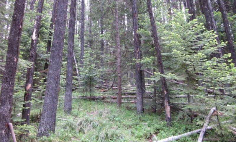
Forests in this ESG have substantial herbaceous and shrub cover, and often have a closed canopy. Climax stands are dominated by subalpine fir and mountain hemlock. Large spruces persist for centuries in old-growth stands. A variety of species, including climax species and spruce, occur in early succession. Seral lodgepole pine can dominate in several habitat types, but it dies out 120 to 160 years after stand establishment (Cooper and others 1991). Western larch is common on sites with good drainage. Douglas-fir, grand fir, and western white pine occur on moderate sites, but rarely dominate. Whitebark pine intergrades with lodgepole pine at high elevations.
Most stands regenerate readily after fire. Species composition varies because of variation in drainage, moisture and temperature regimes, seed source, and fire history. Patchy, mixed-severity burns further complicate structural development and species composition. Where severe fires were less than about 160 years apart in presettlement times, lodgepole pine may dominate seral stands. Lodgepole pine may also codominate with Engelmann spruce, or may occur in combination with other seral species and climax species. Cold temperatures, wet soils, and luxuriant undergrowth favor early dominance by Engelmann spruce and climax species, especially if long fire-free intervals have excluded lodgepole pine. Stands that were drier before fire follow this pathway if water tables rise appreciably after canopy removal. (from Smith and Fischer, 1997, pp. 75-78)
Major Land Resource Area
MLRA 043A
Northern Rocky Mountains
Subclasses
Stage
Provisional
Contributors
Gary Kuhn
Click on box and path labels to scroll to the respective text.