
Ecological site group EX043AESG19
Cryic, Moist-Udic, Loamy Mountain Slopes (Subalpine Fir-Mountain Hemlock/ Cool Shrub- Beargrass) Subalpine Fir-Mountain Hemlock/rustyleaf menzesia
Last updated: 05/02/2025
Accessed: 04/03/2026
Ecological site group description
Key Characteristics
None specified
Provisional. A provisional ecological site description has undergone quality control and quality assurance review. It contains a working state and transition model and enough information to identify the ecological site.
Physiography
Major Land Resource Area: 43A Northern Rocky Mountains and Foothills
Modal LRU – 43A10 - Clearwater Mountains
This LRU is composed predominantly of mid and high elevation valley walls, mountain slopes and ridges. The soils tend to be loamy andisols and inceptisols with ashy surfaces. Till, residuum and colluvium from metamorphics, and granitics are the dominant parent materials. Soil climate is a cryic or frigid temperature regime and udic moisture regime with average annual precipitation around 1300 mm (51 inches). While not exposed to continental glaciation, features associated with montane glaciation (cirques, trough valleys etc.) do exist at higher elevations.
Others where occurring – 43A11 - Bitterroot Metasedimentary Zone
Ecological Site Concept:
This ESD in distinguished by an overstory of subalpine fir or mountain hemlock and an understory shrub component of menzesia and huckleberry. On some exposures shrubs are absent and beargrass dominates the understory. It occurs on upper slopes of mountainsides, and ridges. This ESD fits into the National Vegetation Classification’s Subalpine Fir - Engelmann Spruce Rocky Mountain Moist Forest Alliance and Washington State Natural Heritage Program’s Rocky Mountain Subalpine Mesic-Wet Spruce-Fir Forest.
Physiographic Features
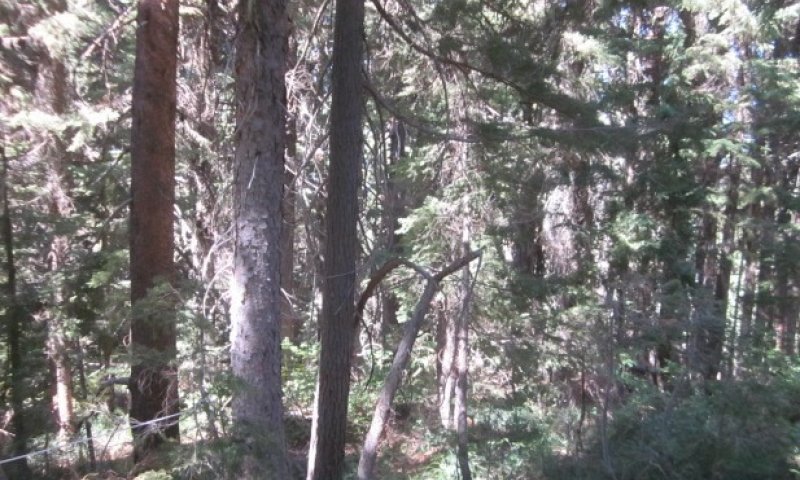
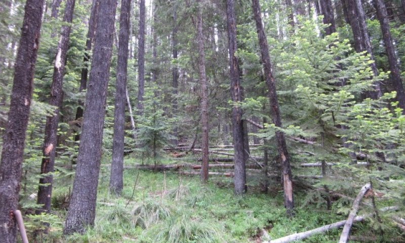
This ecological site group occurs mainly on high elevation slopes and ridges of mountains. It is found predominantly on side slopes and summits. The parent material is volcanic ash or mixed volcanic ash and loess over till, residuum and colluvium from mainly metamorphic, metasedimentary or granitic rock.
Landscapes: Mountains
Landform: Mountain slope, ridges, cirque floors, glacial-valley walls
Elevation:
Total range = 1200 to 2195 m
(3,950 to 7,200 feet)
Central tendency = 1570 to 1820 m
(5,150 to 5,970 feet)
Slope (percent):
Total range = 0 to 85 percent
Central tendency = 30 to 50 percent
Water Table Depth: >80 inches
Flooding:
Frequency: none
Duration: none
Ponding:
Frequency: none
Duration: none
Aspect:
Full range: 50-210-355
Climate
Climatic Features
During the spring and summer, a circulation of air around a high-pressure center brings a prevailing westerly and northwesterly flow of comparatively dry, cool and stable air into the region. As the air moves inland, it becomes warmer and drier which results in a dry season beginning in the late spring and reaching a peak in mid-summer. In the fall and winter, a circulation of air around two pressure centers over the ocean brings a prevailing southwesterly and westerly flow of air into the Pacific Northwest. This air from over the ocean is moist and near the temperature of the water. Condensation occurs as the air moves inland over the cooler land and rises along the windward slopes of the mountains or highlands. This results in a wet season beginning in October, reaching a peak in winter, then gradually decreasing in the spring.
Temperature
The pattern of average annual temperatures indicates the effect both of latitude and altitude. In general, it can be said that monthly means are 32° F or lower at stations above 5,000 feet from November through March; between 4,000 and 5,000 feet, November through February; 3,000 to 4,000 feet, December through February; and 2,000 to 3,000 feet, only one or two months. The diurnal range of temperature is, of course, most extreme in high valleys and in the semiarid plains. The magnitude of diurnal range varies with the season, being lowest in winter when cloudiness is much more prevalent, and greatest in the warmer part of the year. In summer, periods of extreme heat extending beyond a week are quite rare, and the same can be said of periods of extremely low temperatures in winter. In both cases the normal progress of weather systems across the region usually results in a change at rather frequent intervals.
Precipitation
To a large extent the source of moisture for precipitation regionally is the Pacific Ocean. In summer there are some exceptions to this when moisture-laden air is brought in from the south at high levels to produce thunderstorm activity. Seasonal distribution of precipitation shows a very marked pattern of winter maximum and midsummer minimum.
Snowfall
Snowfall distribution is affected both by availability of moisture and by elevation. Annual snowfall totals have reached nearly 500 inches. The major mountain ranges accumulate a deep snow cover during the winter months, and the release of water from the melting snowpack in late spring is a primary source of instream flows.
(from WRCC: Climate of Idaho)
Frost-free period (days):
Total range = 35 to 110 days
Central tendency = 45 to 70 days
Mean annual precipitation (cm):
Total range = 835 to 2140 mm
(33 to 84 inches)
Central tendency = 1325 to 1650 mm
(52 to 65 inches)
MAAT (C)
Total range = 1.9 to 6.8
(35 to 44 F)
Central tendency = 3.7 to 4.9
(39 to 41 F)
Climate Stations: none
Soil features
Representative Soil Features
This ecological site group is associated with several soil components (e.g. Andic Cryochrepts, Entic Cryandepts, McCay, Redraven, Typic Haplocryands, Rubycreek, Daveggio, Katka, Fico, Vay, Roman, Dystric Cryochrepts, Vaywood, Kintla, and Divers). These soils are: Andic Dystrocryepts, Andic Haplocryepts, Typic Fulvicryands, Typic Haplocryands, Typic Vitricryands, Vitrandic Dystrocryepts, and Vitric Haplocryands . Most of these soils have developed in Mazama tephra deposits over till, residuum and colluvium from granitic, metasedimentary or metamorphic rock. These tephra (ash) layers are important for forest productivity in that they retain large amounts of water compared to other parent materials, have high cation exchange capacity and high availability of organically bound plant nutrients. The soils range from moderately deep to very deep. Some of these soils have dense till layers at a depth of 40 to 60 inches. These soils have a low available water holding capacity and slow to very slow permeability in the till layers. The soils are mostly moderately well drained to well-drained.
Parent Materials:
Kind: Tephra (volcanic ash)
Origin: mixed
Kind: till, residuum, colluvium
Origin: Granite, Metamorphic, Metasedimentary rock
Surface Texture:
(1) Medial Silt Loam
(2) Gravelly Medial Silt Loam
(3) Sandy Loam
Surface Fragment coverage: None to 3 percent
Fragment content surface horizons (% by Volume): Minimum: 0 Maximum: 30 Median: 10
Surface Fragment content
Vegetation dynamics
Ecological Dynamics of the Site
The four main US Forest Service habitat types (HT) incorporated into this ecological site all are located high elevation mountain slopes and ridges. They can occur at lower elevations as ecotypes of their higher elevation sites due to cold air drainage and/or frosty conditions. The ABLA/MEFE (Subalpine fir/rustyleaf menzesia) and TSME/MEFE (Mountain hemlock/rustyleaf menzesia) HTs are moister than ABLA/XETE (ABLA/beargrass) or TSME/XETE (Mountain hemlock/beargrass) and capable of having more Engelmann spruce in the overstory and understory. In the ABLA/XETE and TSME/XETE HTs, subalpine fir will have higher presence in the overstory and understory with fire exclusion. Some stands are in early to mid-seral condition with Douglas-fir (PSME), western larch (LAOC), and lodgepole pine (PICO) as the main overstory component. Subalpine fir (ABLA), Mountain hemlock (TSME) and/or Engelmann spruce (PIEN) can be present in the understory. Historically western white pine (PIMO3) played an important role as a seral species.
Major Land Resource Area
MLRA 043A
Northern Rocky Mountains
Subclasses
Stage
Provisional
Contributors
Gary Kuhn
Click on box and path labels to scroll to the respective text.