
Natural Resources
Conservation Service
Ecological site R009XY504OR
Moderately Sloping Plateau Riparian Complex
Last updated: 4/21/2025
Accessed: 02/13/2026
General information
Provisional. A provisional ecological site description has undergone quality control and quality assurance review. It contains a working state and transition model and enough information to identify the ecological site.
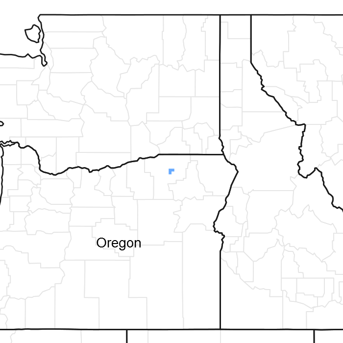
Figure 1. Mapped extent
Areas shown in blue indicate the maximum mapped extent of this ecological site. Other ecological sites likely occur within the highlighted areas. It is also possible for this ecological site to occur outside of highlighted areas if detailed soil survey has not been completed or recently updated.
MLRA notes
Major Land Resource Area (MLRA): 009X–Palouse and Nez Perce Prairies
Palouse and Nez Perce Prairies.
The majority of this MLRA lies within the Walla Walla Plateau Section of the Columbia Plateaus Province of the Intermountain Plateaus. A portion of this MLRA in the southeastern area is in the Blue Mountain Section of the Colombia Plateau Province. This MLRA is characterized by an undulating, highly-dissected basalt plateau. Streams are deeply cut into the plateau, with elevations for major stream bottoms of approximately 650 feet (198 meters) while plain elevation ranges from 2,000 to 4,000 feet (610 to 1220 meters). The average annual precipitation typically ranges from 13 to 28 inches (300 to 710 mm), but may be as high as 43 inches (1,090 mm) in the south. Precipitation is evenly distributed between fall, winter, and spring, with winter precipitation typically occurring as snow. Summers are typically dry. The average annual temperature ranges from 47 to 57 degrees F (8 to 12 degrees C), but can be as low as 40 degrees F (5 degrees C) at higher elevations in the south. The freeze-free period averages 165 days, and ranges from 100 to 230 days.
Ecological site concept
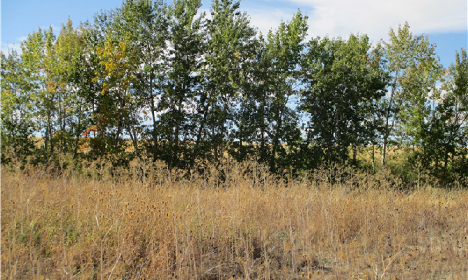
This riparian complex occurs on Strahler 2nd and 3th order or streams in moderately sloping (4 to 10 percent) and narrow floodplains on broad alluvial terraces and fans. Stream gradients range from 2 to 5 percent, and are moderately entrenched. These streams have intermittent to perennial flow. Perennial flow originates from spring discharge. Drainage area ranges from 2,000 and 4,000 acres. Situated at the edge of the Columbia Plateau, loess material is common on the upland soils. These drainageways typically have low sinuosity. This is in part due to natural features, and in part due to stream alterations for cultivation for local agriculture. These streams have Rosgen B3, B4 or B3a and B4a morphology. Black cottonwood (Populus balsamifera ssp. trichocarpa), black hawthorn (Crataegus douglasii), and common snowberry are dominant. Willows (Salix sp.) and other wetland species are intermittently present along the stream banks. Soils have developed in recent alluvium from basalt.
Associated sites
| R009XY015OR |
Clayey 14-17 PZ This ecological site occurs on hills. Soils are moderately deep, and vegetation is Idaho fescue and bluebunch wheatgrass. |
|---|---|
| R009XY029OR |
South 14-17 PZ This site occurs in basin floors. Soils are very deep and developed in loess material over ancient alluvium. |
Similar sites
| R009XY502OR |
Low Slope Alluvial Mountain Valley Riparian Complex This ecological site is associated with larger streams, at higher elevations, with channel gradients less than 2 percent. |
|---|---|
| R009XY503OR |
Moderately Sloping Narrow Alluvial Valley Riparian Complex This ecological site occurs on second and third order streams with channel gradients between 2 and 4 percent. |
| R009XY501OR |
Low Slope Alluvial Valley Riparian Complex This ecological site is associated with larger streams with channel gradients less than 2 percent. |
| R009XY505OR |
Moderately Sloping Confined Intermittent Riparian Complex This ecological site occurs on first and second order streams in dissected lava plateaus. Flow is intermittent. Slopes range from 5 to 15 percent. |
Table 1. Dominant plant species
| Tree |
(1) Populus balsamifera subsp. trichocarpa |
|---|---|
| Shrub |
(1) Philadelphus lewisii |
| Herbaceous |
(1) Leymus cinereus |
Physiographic features
This ecological site occurs on floodplains and stream terraces. Valley slopes range from 1 to 5 percent, and elevations range from 1,200 to 1,900 feet (365-579 m).
There are 4 community components associated with this site.
CC1 Floodplain, frequently flooded
Water table between 10 to 35 inches, with frequent, brief flooding.
CC2 Floodplain, Occasionally flooded
Water table between 10 and 40 inches, with occasional, very brief flooding.
CC3 Floodplain step, very rare flooding
Water table below 60 inches.
CC4 Floodplain step, very rare flooding
water table below 60 inches.
Table 2. Representative physiographic features
| Landforms |
(1)
Flood plain
(2) Stream terrace |
|---|---|
| Flooding duration | Brief (2 to 7 days) |
| Flooding frequency | Rare to frequent |
| Ponding frequency | None |
| Elevation | 1,200 – 1,900 ft |
| Slope | 1 – 5% |
| Water table depth |
Not specified |
| Aspect | Aspect is not a significant factor |
Climatic features
This ecological has a xeric temperature regime, with moist winters and dry summers. Precipitation occurs as rain in the fall and spring, and snow in winter. There is very little rain in the summer months. Mean annual precipitation ranges from 15 to 23 inches (381 to 584 millimeters). Mean annual air temperature ranges from 50 to 55 degrees F (10 to 12.7 degrees C). The frost-free period ranges from 100 to 195 days, and the freeze-free period ranges from 151 to 184 days.
Data for the Frost-Free table and the Monthly Precipitation and Temperature distribution table are from the Pendleton Climate Station. Mean annual and temperature precipitation ranges in the narrative are from PRISM data.
Table 3. Representative climatic features
| Frost-free period (average) | 122 days |
|---|---|
| Freeze-free period (average) | 154 days |
| Precipitation total (average) | 17 in |
Figure 2. Monthly precipitation range
Figure 3. Monthly average minimum and maximum temperature
Figure 4. Annual precipitation pattern
Figure 5. Annual average temperature pattern
Climate stations used
-
(1) PENDLETON BR EXP STN [USC00356540], Pendleton, OR
Influencing water features
This site occurs on floodplains and terraces, with frequent to very rare flooding.
The blue line in the cross section diagram represents bank full flow, the red line represents the level of flow at 1.5 times the bank full depth, and the dotted red line represents low bank height.
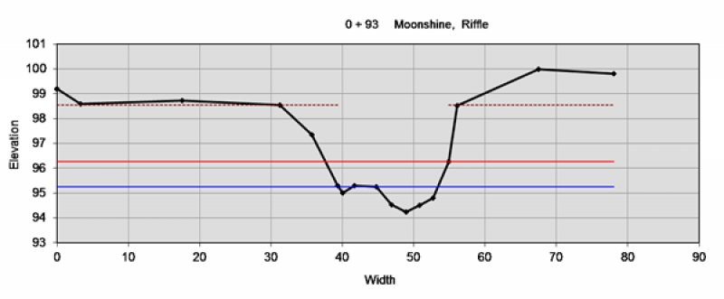
Figure 6. MS XS1
Soil features
There are several soils associated with this ecological site. They are associated with different fluvial surfaces, and vary in wetness, development, and texture. These soils are all very deep, and formed in alluvium predominantly derived from basalt parent material. The soil moisture regime is xeric and the soil temperature regime is mesic.
CC1 Floodplain, frequently flooded
The Joseph soils are associated with this landform. They occur on floodplains and are on seasonally exposed gravel bars along active channel margins. They are subject to frequent flooding. These soils are very deep, moderately well or somewhat poorly drained, and formed in alluvium from basalt.
These soils are classified as Sandy-skeletal, mixed, mesic Oxyaquic Xerofluvents. Surface rock cover < 3 inches (gravels) typically have 55 percent cover, and rock fragments > 3 inches (cobbles) typically have 26 percent cover. Subsurface rock fragments < 3 inches range from 50 to 65 percent, and > 3 inch fragments range from 5 to 31 percent by volume.
CC2 Floodplain, occasionally flooded
The Olallie soils occur on floodplains, are somewhat poorly drained and rarely flooded (1 to 5% chance of flooding in any given year) (Natural Resources Conservation Service 1993). There is moderate soil development with thick A horizon.
The Olallie soils are classified as Loamy-skeletal, mixed, superactive, mesic Cumulic Endoaquolls. Surface rock cover < 3 inches ranges from 0 to 3 percent, and rock fragments > 3 inches are typically absent. Subsurface rock fragments < 3 inches range from 5 to 55 percent, and > 3 inch fragments range from 0 to 5 percent by volume.
CC3 Floodplain step, very rarely flooded
The Bridgewater soils are associated with this fluvial surface. They are well drained and situated on very rarely flooded floodplain steps (Floods less than one time in 100 years but more than one time in 500 years) (Natural Resources Conservation Service 1993).
These soils are classified as Loamy-skeletal, mixed, superactive, mesic, Cumulic Haploxerolls. Surface rock cover < 3 inches ranges from 0 to 35 percent, and rock fragments > 3 inches ranges from 0 to 25 percent. Subsurface rock fragments < 3 inches range from 15 to 50 percent, and > 3 inch fragments range from 5 to 35 percent by volume.
CC4 Floodplain step, very rarely flooded
The Patit Creek soils are associated with this fluvial surface. They are well drained and developed on very rarely flooded floodplain steps.
The Patit Creek soils are classified as Coarse-loamy, mixed, superactive, mesic, Cumulic Haploxerolls. Surface rock cover < 3 inches ranges from 0 to 10 percent, and rock fragments > 3 inches range from 0 to 2 percent. Subsurface rock fragments < 3 inches range from 0 to 65 percent, and > 3 inch fragments range from 0 to 15 percent by volume.
Table 4. Representative soil features
| Parent material |
(1)
Alluvium
–
basalt
|
|---|---|
| Surface texture |
(1) Extremely cobbly loamy sand (2) Loam (3) Silt loam |
| Drainage class | Somewhat poorly drained to well drained |
| Soil depth | 60 in |
| Surface fragment cover <=3" | 55% |
| Surface fragment cover >3" | 26% |
| Subsurface fragment volume <=3" (Depth not specified) |
65% |
| Subsurface fragment volume >3" (Depth not specified) |
35% |
Ecological dynamics
Scale and stream classification system:
Lotic ecological sites describe portions of valley section with similar reaches, defined by slope, valley width, Strahler stream order, and similar associated fluvial landforms and associated vegetation. They are tied to the scale of the NRCS soil survey. The Umatilla County Soil Survey for this area was mapped at Order 3, with map unit size ranging from 1.6 to 16 hectares (Soil Survey Division Staff 1993). The closest equivalent scale for stream classification is the valley segment, which ranges from 0.1 to 10,000 hectares (Montgomery and Buffington 1993). Soil surveys may have different map units for a valley section based on slope classes and changes in composition of soil components, which often correspond to changes in stream classification. Lotic ecological sites incorporate Rosgen stream classification (Rosgen 1994) to identify the channel morphology and the stream succession scenarios. Stream succession scenarios are used to develop state-and-transition models based on morphological changes of stream channels over time.
Site concept:
This riparian complex occurs on Strahler 2nd and 3th order or streams in moderately sloping (4 to 10 percent), narrow floodplains on broad alluvial terraces and fans. Stream gradients range from 2 to 5 percent, and are moderately entrenched. These streams have intermittent or perennial flow. Perennial flow originates from spring discharge. Drainage area ranges from 2,000 and 4,000 acres. Situated at the edge of the Columbia Plateau, loess material is common adjacent upland soils. These drainageways typically have low sinuosity, in part due to natural features, and in part due to stream alterations for local agriculture. The streams have Rosgen B3, B4 or B3a and B4a morphology. Black cottonwood, black hawthorn, and common snowberry are dominant. Willows and other wetland species are intermittently present along the stream banks. Soils have developed in recent alluvium from basalt.
There are three community components laterally associated with this ecological site. Starting from the stream, they are the floodplain-frequently flooded and floodplain-rarely flooded components. The floodplain-frequently flooded (CC1) component occurs in a narrow intermittent strip along the active channel. The rarely flooded, floodplain component (CC2) occurs above the 50-year floodplain. Black cottonwood, black hawthorn, and other shrubs are present. The original floodplain components may become abandoned in the altered entrenched states. The floodplain becomes abandoned when the channel is cut deeper and becomes larger, which lowers the water table and reduces flooding frequency onto the floodplain. Species dependent on a shallow water table or flooding, such as willow and black cottonwood, may become decadent and decline over time. The upper terrace component (CC3) is dominated by grasses and black hawthorn. This area is often highly-disturbed by active or past cultivation. It may have extensive cover by grasses or black hawthorn, or weeds such as poison hemlock (Conium maculatum) and Fuller’s teasel (Dipsacus fullonum).
Disturbance Factors:
This ecological site is developed based on the lower drainage of Moonshine Creek, Coonskin Creek, Mission Creek, and Cottonwood Creek. These streams are tributaries of the Umatilla River in northeast Oregon and are within the boundaries of the Confederated Tribes of the Umatilla Indian Reservation (CTUIR). The treaty between the US government and the CTUIR, was signed in 1855 which designated the reservation and began the settlement of tribal people in this area. The valleys were farmed and horses grazed the hillslopes. Additional incentives for land allotments drew more Indian and non-Indian settlers. Land use intensified, and cattle and sheep grazing increased (CTUIR 2014). Highest stocking rates occurred during 1880s to the 1920s. The tribes possessed 20,000 horses, and 3,000 cattle by 1890, and non-Indian settles and travelers brought several thousand additional cattle (BIA and CTUIR 2007). Intensive grazing caused a decline in vegetative cover on the steep hillslopes from foraging and hoof trampling (BIA and CTUIR 2007). Erosion from the upper watershed and stream bank erosion, contributes sediment to the lower sections of these streams.
This ecological site bisects gently-sloping plateaus which are currently tilled for wheat and other crops. Between 1940 and 1960, land use changed, and pastures utilized for livestock grazing were converted to cropland (Williams, Hartman et al. 2011). Smaller streams on the Colombia Plateau were largely eliminated. These streams were channelized or altered during this period to concentrate surface water, increase production area, and facilitate access for tillage and harvest equipment (Williams, Hartman et al. 2011). Manipulation of the channels has resulted in highly controlled, straightened, ditch-like drainageways. The natural sinuosity has been reduced or eliminated, and channels have incised as a result of steeper stream gradients and increased stream velocity. In addition, the removal of riparian vegetation contributes to the instability of the easily-erodible, silt upland soils, and stream alluvium. Active floodplains are confined to a narrow band within the incised channel. Abandoned floodplains may exist three to four feet above the active incised channel. In some areas, the abandoned floodplains support riparian vegetation, and in other areas they have been developed into buffer strips or are actively cultivated. Historic farming practices on the silty loess soils have been associated with high rates of erosion from rill, sheet, and gully formation from surface water runoff. Wind erosion is also a concern. Disturbance from tillage leaves very little plant residue on the surface and the resulting bare, loose soils are highly susceptible to erosion. Average soil loss was estimated to be 10.9 tons per acre per year in the wetter parts of this region between 1939 and 1972 (Williams, Wuest et al. 2014). Minimum or no tillage systems, buffer strips, and other conservation practices can reduce erosion and delivery of sediments to the stream system.
Beavers may have been present in these streams prior to 1840, but these streams do not currently provide ideal conditions for beaver habitat. The fur trade was a major industry in Oregon in the early 1800s, and beavers were avidly exploited for their thick, smooth pelts. From 1820 to 1830 the Hudson Bay Company initiated a practice of exterminating beavers from areas south and east of the Columbia River, to eliminate competition. This purposefully, detrimental practice, along with other trapping, caused a severe decline in beaver populations by 1825 and a near extinction of this species by 1900 (Harrison 2009). Since the 1900s there has been a gradual increase in beaver populations. Although these streams do not have the deep waterways ideal for beaver movement, beavers may have created dams in areas with sufficient perennial spring flow. Beaver dams create ponds, which slow water flow and raise surface flow. Beaver ponds also raise water tables and cause more frequent flooding onto floodplains. A higher water table and increased flooding can change plant species composition to wetland obligate species, and will also increase growth rates and abundance of existing riparian vegetation. The Northwest Fisheries Science Center has added structural integrity to existing beaver dams on land managed by the Bureau of Land Management to improve habitat for steelhead. Initial results have shown an increase in density and survival rates of young steelhead (Pollock, Jordan et al. , Pollock, Beechie et al. 2007).
Invasive weeds are a concern for this ecological site. Fuller's teasel, poison hemlock, quackgrass (Elymus repens), and tall oatgrass (Arrhenatherum elatius) can dominate buffer zones on abandoned floodplains. Reed canarygrass (Phalaris arundinacea) is a native species to riverine systems in Idaho, Montana, and Wyoming. In Oregon, this species is believed to be a European cultivar, which was developed for high growth rates (Tu 2004). This species usually becomes weedy or invasive in some habitats, and it excludes desirable vegetation in time (USDA NRCS Plant Materials Center 2002). Other non-native species are bull thistle (Cirsium vulgare), common viper's bugloss (Echium vulgare), gypsyflower (Cynoglossum officinale), orchardgrass (Dactylis glomerata), and common St. Johnswort (Hypericum perforatum).
Hydrologic factors:
This ecological site incorporates the longitudinal, lateral, and to some extent the vertical connectivity of the stream. Longitudinally the stream includes variation of two to five, percent channel gradients and associated channel morphologies that represent B or A type channels. This ecological site includes reaches that are highly modified by human alterations. These altered reaches now resemble ditches, with 90 degree turns and an absence of riparian vegetation. Other areas are less disturbed and have riparian vegetation along the stream and abandoned floodplains. The abandoned floodplains are 70 to 100 feet wide, with the active floodplain 20 to 30 feet wide.
Unaltered reference conditions are not present in this project area, but based on valley slopes and historical literature, B type channel morphology was likely present prior to modern influences. B type channels have 2 to 4 percent channel gradients and are naturally moderately-entrenched, with entrenchment ratios between 1.4 and 2.2, and have moderate sinuosity (>1.2). B type channels are often in colluvial valleys or narrow moderately-sloping alluvial valleys (Rosgen 1994). Present sinuosity measurements range from 1.05 to 1.18, and entrenchment ratio is 1.4. to 1.6. This indicates a straightened, borderline entrenched channel, which does not classify clearly into a Rosgen stream type. It borders on an A or G type channel, but is more likely attributed to the altered conditions of a B type channel. Ba type channels have the channel morphology of a B type channel, but have greater than 4 percent channel gradients which are characteristic of A type channels.
G and F type channels are often temporary or occur in short sections along the stream. G type channels occur as stream headcuts or downcuts into sediments, which create a deep, narrow channel. F type channels typically develop as bank erosion widens the narrow G type channel. At this site, the F type channel will develop into an entrenched B type channel.
Climate change
Climate records for the Northwest United States show that average annual temperature has increased 1.5 degree F in the last 100 years, and it is predicted to increase by 3 to 10 degrees F in the next century (EPA 2013). Precipitation predictions are less clear, but warmer temperatures are expected to cause more winter precipitation to come as rain instead of snow, and cause the reduced snowpack to melt 20 to 40 days earlier in spring (EPA 2013). The snowpack is currently the primary water source for late spring and summer flows in these streams. A greater proportion of rain and earlier snow melt could increase flood severity and frequency in winter and spring, and reduce flow in summer and fall. The Meacham Creek USGS station has already shown a significant increase in flow during March (Chang and Jones 2010), likely due to earlier snow melt from warmer temperatures.
State and transition model
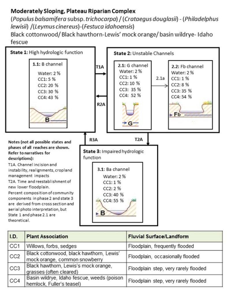
Figure 7. R009XY504OR STM
More interactive model formats are also available.
View Interactive Models
More interactive model formats are also available.
View Interactive Models
Click on state and transition labels to scroll to the respective text
Ecosystem states
State 1 submodel, plant communities
State 2 submodel, plant communities
State 3 submodel, plant communities
State 1
Reference
The historic or unaltered condition for this ecological site is based on current conditions and expected stream development in the associated alluvial valley type and valley slope (1 to 7 percent). It is presumed that historic channels had greater meander, stable stream banks, high riparian cover, were less incised, and were hydrologically connected to the floodplains. Most of this ecological site has been disturbed by cultivation for crops, physical stream alterations, the introduction of non-native species and other disturbances, so it is difficult to find data to describe this state and its phases.
Community 1.1
B Channel
The B channel phase is defined by moderate entrenchment, moderate width to depth ratios, and moderate sinuosity. This B type channel system has a limited active floodplain, and rarely accesses the higher floodplain during large flood events. The floodplain community (CC1) is dependent upon shallow ground water, and frequent flooding. It is limited to a narrow strip along the channel. Community component 2, historically had a shallower water table, and may have been occasionally flooded, rather than rarely flooded under its present incised condition. It occurs on a step above the frequently flooded community, and transitions to the upland communities (CC3 and CC4). Community component 3 (CC3) typically occurs in the upper drainage area near the base of the dissected lava plateaus, and historically was a mixed shrubland dominated by black hawthorn. Community component 4 (CC4) typically occurs lower in the watershed and is influenced by the silty loess parent materials. Historically, this component may have been dominated by basin wildrye, Idaho fescue, and other native grasses. The upland communities are very rarely flooded, but capillary draw, and subsurface flow create moist soil conditions, compared to the higher alluvial terraces and fans. Plant Community Components I.D., Plant Association Fluvial Surface/Landform, Composition (%) W, Water, Water, Active channel, 2 % CC1, Willows, forbs, sedges, Floodplain, frequently flooded, 5 % CC2, Black cottonwood, black hawthorn, Lewis’ mock orange, common snowberry, Floodplain, rarely flooded, 20 % CC3, Black hawthorn, mixed shrubs, Floodplain step, very rarely flooded, 30 % CC4, Basin wildrye, Idaho fescue, native grasses Floodplain step, very rarely flooded, 43 %
State 2
Unstable Channels
This state is defined by unstable, incised, transitional G and F type channels. As channel incision occurs the water table is lowered and flow is contained within the channel, reducing over bank flooding. G type channels are narrow and deep, with reduced sinuosity. The unstable banks of the G type channel erode rapidly into a wider and shallower entrenched F type channel.
Community 2.1
G Channel
This channel is unstable, deep and narrow, with reduced sinuosity. Stream banks are unstable and erode rapidly. The community components are similar as described in state 1, but the disconnected floodplain community (CC2) begins to decline, and species composition transitions to more upland species typical in CC3. CC1 may be missing in severely eroded reaches. Plant Community Components I.D., Plant Association Fluvial Surface/Landform, Composition (%) W, Water, Water, Active channel, 2 % CC1, Willows, forbs, sedges, Floodplain, frequently flooded, 1 % CC2, Black cottonwood, black hawthorn, Lewis’ mock orange, common snowberry, Floodplain, rarely flooded, 10 % CC3, Black hawthorn, mixed shrubs, Floodplain step, very rarely flooded, 35 % CC4, Basin wildrye, Idaho fescue, native grasses Floodplain step, very rarely flooded, 52 %
Community 2.2
F Channel
The F type channel is a wide, incised channel with nearly vertical eroding banks. Flow is contained within the large channel, and the original floodplain is hydrologically disconnected from 50-year flood events. The floodplain community (CC2) declines, and becomes abandoned. Composition of CC1 remains low due to bank instability. The floodplain step communities (CC3 and CC4) increase. The composition of the community components are theoretical. Plant Community Components I.D., Plant Association Fluvial Surface/Landform, Composition (%) W, Water, Water, Active channel, 2 % CC1, Willows, forbs, sedges, Floodplain, frequently flooded, 1 % CC2, Black cottonwood, black hawthorn, Lewis’ mock orange, common snowberry, Floodplain, rarely flooded, 8 % CC3, Black hawthorn, mixed shrubs, Floodplain step, very rarely flooded, 35 % CC4, Basin wildrye, Idaho fescue, native grasses Floodplain step, very rarely flooded, 54 %
Pathway 2.1A
Community 2.1 to 2.2
This pathway occurs with time and lateral bank erosion, which creates a wider and shallower channel (F type channel).
State 3
Impaired Hydrologic Function
This state develops as new, limited floodplains develop along the deeply entrenched channel. The new floodplains are at a lower elevation than the original floodplain, and are more confined. The majority of this ecological site currently exists in this state. This state may have B or Ba type channel morphology, depending upon slope and entrenchment ratios.
Community 3.1
Ba Channel

Figure 8. R009XY504OR area
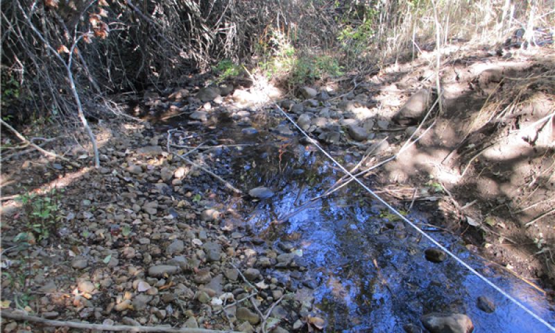
Figure 9. Channel
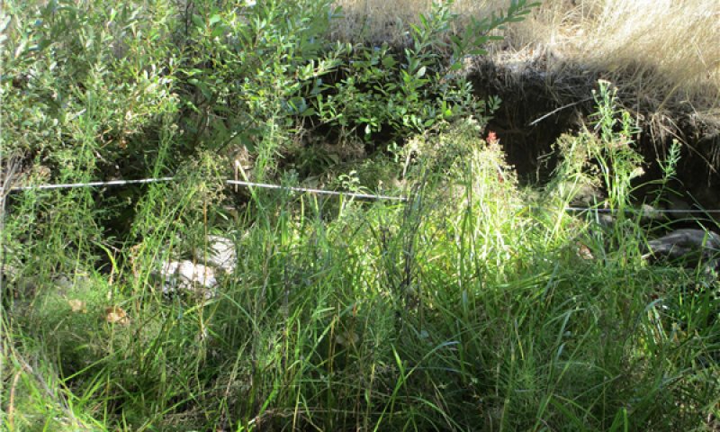
Figure 10. CC1
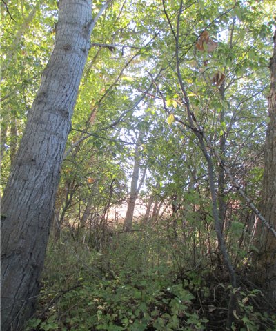
Figure 11. CC2
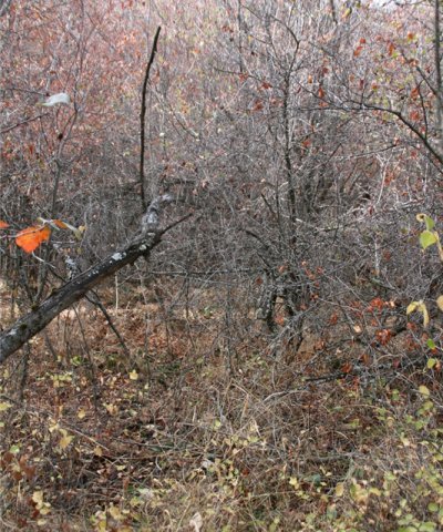
Figure 12. CC3
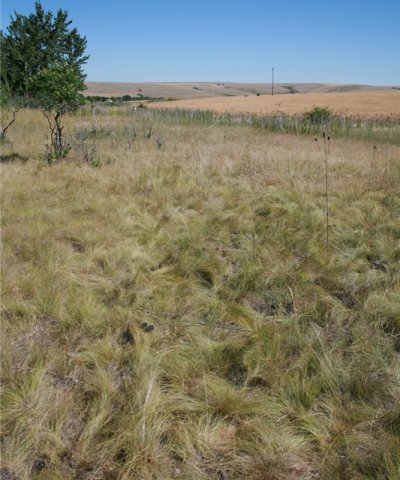
Figure 13. CC4
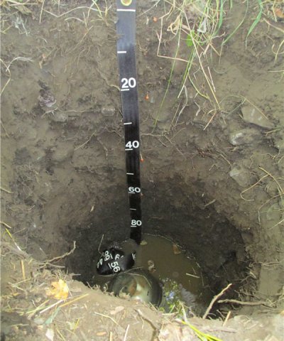
Figure 14. CC2 soil
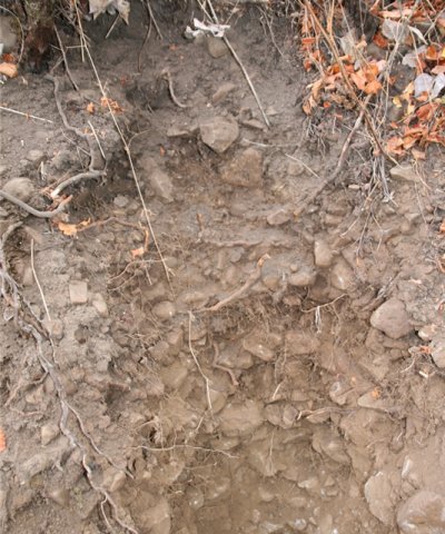
Figure 15. CC3 soil
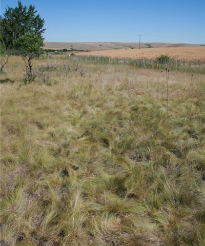
Figure 16. CC4 soil
This phase is similar to the 1.1 B Channel, but it has become deeply incised with reduced stream meander. The water table is lower across the floodplain, and overbank flow onto the floodplain is rare. The floodplain community (CC1) remains limited to a narrow strip along the channel. Community component 2, on the historically active floodplain, now has rare flooding. The upper terraces have a lower water table, and invasive weeds may be abundant. Plant Community Components I.D., Plant Association Fluvial Surface/Landform, Composition (%) W, Water, Water, Active channel, 2 % CC1, Willows, forbs, sedges, Floodplain, frequently flooded, 1 % CC2, Black cottonwood, black hawthorn, Lewis’ mock orange, common snowberry, Floodplain, rarely flooded, 2 % CC3, Black hawthorn, mixed shrubs, Floodplain step, very rarely flooded, 40 % CC4, Basin wildrye, Idaho fescue, native grasses Floodplain step, very rarely flooded, 55 % Description of Community Components CC1, Floodplains, Frequently Flooded Community component 1 occurs on frequently flooded floodplains which are within the active channel at high flows and become exposed gravels and cobbles during low flow. This community is confined to a thin band, which intermittently occurs parallel to the active channel. Since it is within the active channel during high flows, this area is subject to frequent scouring and depositional events, making it difficult for longer lived species to establish. The vegetation is dominated by annual and short-lived perennial species, with an overstory of black cottonwood, that may be rooted in this community or on the higher floodplain. Species documented include brome (Bromus sp.), rushes (Juncus spp.), timothy (Phleum pretense), bluegrass (Poa sp.), and panicled bulrush (Scirpus microcarpus). Arroyo willow (Salix lasiolepis) and other willow species establish in areas with relative stability and absence of grazing. Limited vegetation data was collected for this community component, so the species list is limited, and expected to be much more diverse. CC2, Floodplain, Occasionally Flooded This community historically occurred on active floodplains, but due to channel incision is presently rarely flooded. The water table typically remains within the upper 100 centimeters throughout the year due the presence of subsurface seeps or proximity to perennial springs. Black cottonwood is a facultative species (FAC), meaning it may occur equally in wetland or upland habitats. Black cottonwood produces a high volume of seed every spring, but seeds are only viable for a few weeks. Once the seeds become wet they begin to germinate, and need a good substrate in order to survive. Seedling survival is best on mineral soil that remains moist near the surface for at least a month. If the water table and soil moisture drop to deeper layers and the young roots cannot access the water, they will succumb to drought. Short seed viability and specific moisture requirements for germination mean that in order for regeneration to occur, seed production and flood events need to occur in the same time frame. Seedlings develop best in open sunlight, and seldom regenerate under existing black cottonwood forest or other vegetative cover. Regeneration from seed typically occurs in pulses with large flood events. After damage from flood events, black cottonwood can resprout from buried stems or develop root succors after stem damage. Twigs broken by flood events can re-sprout if buried in moist sediments with leaves still attached (Steinberg 2001). This is more common in areas with moist summers. Mature cottonwood need to have roots in a perennial water table, but since roots may penetrate to depths of seven meters they can persist on higher floodplains and terraces. Willow species also produce seeds yearly that are only viable for a short period of time and require moist substrates for germination and seedling survival. Willows can withstand long periods of inundation, and their flexible stems enable them to flex with water flows. If stems are damaged they can resprout from the roots or lower stem. Some species of willow, for example narrowleaf willow (Salix exigua), can form dense clonal colonies from sprouting of root shoots. Broken branches and root pieces can resprout if lightly buried in fresh flood deposits (Uchytil 1989, Anderson 2006). Non-native or horticultural trees documented include apple (Malus sp.), black locust (Robinia psuedoacacia), and boxelder (Acer negundo). Black hawthorn (Crateagus douglasii) is common in the open or in the understory of black cottonwood. It can form dense, nearly impenetrable thickets, with a sparse herbaceous layer. Common snowberry and Woods’ rose (Rosa woodsii) may be present in the thickets. Black hawthorn was more abundant on plots with a deeply incised channel. The seeds of black hawthorn require scarification prior to germination. Information is lacking for regeneration requirements of black hawthorn, but fruits are most likely partially digested by birds, bear, deer, and other small mammals and dispersed in their feces. Other shrubs that may be present with low cover include common snowberry (Symphoricarpos albus), redosier dogwood (Cornus sericea), rose (Rosa sp.), chokecherry (Prunus virginiana), Lewis’ mock orange (Philadelphus lewisii), and blue elderberry (Sambucus nigra ssp. cerulea). Grasses were typically sparse, but native, but invasive, reed canarygrass (Phalaris arundinacea) was abundant on one plot. Native forbs include miner’s lettuce (Claytonia perfoliata), leather flower (Clematis sp.), blue eyed Mary (Collinsia sp.), bedstraw (Galium sp.), and coastal manroot (Marrah oreganus). Non-native forbs dominate and include lesser burdock (Arctium minus), Canada thistle (Cirsium arvensis), gypsyflower, Queen Anne’s lace (Daucus carota), Scotch cottonthistle (Onopordum acanthium), curly dock (Rumex crispus), common dandelion (Taraxacum officianale), and moth mullein (Verbascum blatteria). CC3, Floodplain step, very rarely flooded This community component occurs on valley bottoms with very rare flooding. It is difficult to find areas representative of natural undisturbed conditions, since it is often cleared and grazed. The presence of relict species indicates that this community may have once been dominated by black hawthorn, Lewis’ mock orange, and western chokecherry. Rocky Mountain maple (Acer glabrum), smooth sumac (Rhus glabra), and common snowberry (Symphoricarpos albus) are also present. Grasses include wildrye (Leymus sp.), witchgrass (Panicum capillare), tall oatgrass (Arrhenatherum elatius), rattlesnake brome (Bromus briziformis), soft brome (Bromus hordeaceus), compact brome (Bromus madritensis), poverty brome (Bromus sterilis), and medusahead (Taeniantherum caput-medusae). The only native forb documented is common yarrow (Achillea millefolium). Non-native forbs include garden cornflower (Centaurea cyanus), bindweed (Convolvulus sp.), Fuller's teasel (Dipsacus fullonum) common St. Johnswort, plantain (Plantago sp.), and moth mullein (Verbascum blatteria). CC4, Floodplain step, very rarely flooded. This community component occurs on valley bottoms on broad plateaus influenced by loess material and has few rock fragments. This site is subject to very rare flooding. Historic vegetation on these stream terraces may have been dominated by basin wildrye (Leymus cinereus), Idaho fescue (Festuca idahoensis), and/or bluebunch wheatgrass (Pseudoroegneria spicata). Basin wildrye is sporadically present with low cover, and Idaho fescue was dominant in one plot where was planted. The Loamy Bottoms ecological site (R010XY005OR) describes an upland ecological site with a similar ecological niche as this upper floodplain. Basin wildrye commonly grows in bottomland and depression soils with additional moisture, but does not persist under saturated conditions (CTUIR 2003). When disturbed by grazing or cultivation, quackgrass, poison hemlock, and Fuller's teasel can become dominant. The dominance of these and other non-native species can reduce forage, wildlife habitat, and plant diversity. Native grasses documented include Idaho fescue, basin wildrye, blue wildrye (Elymus glaucus), and wildrye (Leymus sp.). Non-native grasses include tall oatgrass, soft brome, poverty brome, cheatgrass (Bromus tectorum), orchardgrass, bulbous bluegrass (Poa bulbosa), and North Africa grass (Ventenata dubia). Native forbs include common yarrow, blue eyed Mary (Collinsia parviflora), willowherb (Epilobium sp.), bedstraw, lupine (Lupinus sp.), tarweed (Madia sp.), and vetch (Vicia sp.). Non-native forbs include lesser burdock, field bindweed (Convolvulus arvensis), gypsyflower, Queen Anne’s lace, common viper’s bugloss, common St. Johnswort, prickly lettuce (Lactuca serriola), and Scotch cottonthistle. Shrub cover is sparse, but may have been cleared in some areas. Native shrubs include smooth sumac (Rhus glabra) and blue elderberry. Non-native shrubs include sweetbriar rose (Rosa rubiginosa) and common lilac (Syringa vulgaris).
Figure 17. Annual production by plant type (representative values) or group (midpoint values)
Transition T1A
State 1 to 2
The most common trigger for this transition is manipulation of the stream channel for farming. Grazing by cattle and feral horses reduces riparian vegetation and physical trampling from their hooves may cause bank erosion. Manipulation of the stream channel typically reduces sinuosity, and increases velocity and scour potential. Sometimes these streams are completely relocated into areas without a natural stream channel, and the redirected streams form unnatural gullies. Natural streams may also resemble a gully, due to the straight, incised channel morphology. As meander decreases and the stream downcuts with the increased velocity, a G type channel develops.
Restoration pathway R2A
State 2 to 1
Restoration from State 2 to State 1 requires site-specific stream surveying in order to determine the best restoration approach. Restoration may not be feasible due to easily erodible loess soils, and a high degree of channel alterations. Stream restoration projects in similar conditions are not common. Restoration efforts should attempt to increase stream channel meander and stream bed elevation, with a focus on restoring riparian vegetation and preserving the erodible soils. Willow check dams may help raise the channel bed. Efforts should be made to control noxious weeds and increase the cover by native species.
Transition T2A
State 2 to 3
This transition occurs as the channel develops more sinuosity and creates a new floodplain, with an entrenched Ba channel type. Ba type channels have similar morphology as a B type channel, but have lower sinuosity, are more deeply entrenched, and have steeper channel gradients.
Restoration pathway R3A
State 3 to 1
Restoration from State 3 to State 1 is similar to restoration 2A. It requires site-specific stream surveying in order to determine the best restoration approach.
Additional community tables
Table 5. Community 3.1 plant community composition
| Group | Common name | Symbol | Scientific name | Annual production (lb/acre) | Foliar cover (%) | |
|---|---|---|---|---|---|---|
|
Tree
|
||||||
| 1 | Trees | 0–550 | ||||
| black cottonwood | POBAT | Populus balsamifera ssp. trichocarpa | 0–550 | 0–30 | ||
| 2 | Trees | 15–900 | ||||
| black cottonwood | POBAT | Populus balsamifera ssp. trichocarpa | 15–900 | 35–80 | ||
| black locust | ROPS | Robinia pseudoacacia | 0–15 | 0–1 | ||
| boxelder | ACNE2 | Acer negundo | 0–15 | 0–1 | ||
| apple | MALUS | Malus | 0–15 | 0–1 | ||
|
Shrub/Vine
|
||||||
| 1 | Shrubs | 15–300 | ||||
| arroyo willow | SALA6 | Salix lasiolepis | 15–300 | 2–12 | ||
| 2 | Shrubs | 120–430 | ||||
| black hawthorn | CRDO2 | Crataegus douglasii | 15–120 | 3–40 | ||
| blue elderberry | SANIC5 | Sambucus nigra ssp. cerulea | 0–110 | 0–8 | ||
| common snowberry | SYAL | Symphoricarpos albus | 20–75 | 10–35 | ||
| Lewis' mock orange | PHLE4 | Philadelphus lewisii | 10–50 | 2–12 | ||
| chokecherry | PRVI | Prunus virginiana | 5–50 | 1–6 | ||
| Woods' rose | ROWO | Rosa woodsii | 0–15 | 0–2 | ||
| redosier dogwood | COSE16 | Cornus sericea | 0–5 | 0–1 | ||
| willow | SALIX | Salix | 0–5 | 0–1 | ||
| 3 | Shrubs | 75–185 | ||||
| black hawthorn | CRDO2 | Crataegus douglasii | 10–65 | 2–15 | ||
| Lewis' mock orange | PHLE4 | Philadelphus lewisii | 0–50 | 0–12 | ||
| smooth sumac | RHGL | Rhus glabra | 0–50 | 0–8 | ||
| Rocky Mountain maple | ACGL | Acer glabrum | 0–15 | 0–3 | ||
| common snowberry | SYAL | Symphoricarpos albus | 0–5 | 0–1 | ||
| 4 | Shrubs | 0–55 | ||||
| common lilac | SYVU | Syringa vulgaris | 0–30 | 0–6 | ||
| sweetbriar rose | RORU82 | Rosa rubiginosa | 0–15 | 0–2 | ||
| blue elderberry | SANIC5 | Sambucus nigra ssp. cerulea | 0–5 | 0–1 | ||
| smooth sumac | RHGL | Rhus glabra | 0–5 | 0–1 | ||
|
Grass/Grasslike
|
||||||
| 1 | Grass and grasslike | 2–40 | ||||
| panicled bulrush | SCMI2 | Scirpus microcarpus | 0–30 | 0–10 | ||
| rush | JUNCU | Juncus | 0–5 | 0–2 | ||
| bluegrass | POA | Poa | 0–5 | 0–2 | ||
| timothy | PHPR3 | Phleum pratense | 0–5 | 0–1 | ||
| brome | BROMU | Bromus | 0–1 | 0–1 | ||
| 2 | Grass and grasslike | 30–380 | ||||
| reed canarygrass | PHAR3 | Phalaris arundinacea | 6–330 | 5–55 | ||
| wildrye | ELYMU | Elymus | 15–70 | 5–15 | ||
| panicled bulrush | SCMI2 | Scirpus microcarpus | 0–5 | 0–1 | ||
| bluegrass | POA | Poa | 0–1 | 0–1 | ||
| bentgrass | AGROS2 | Agrostis | 0–1 | 0–1 | ||
| orchardgrass | DAGL | Dactylis glomerata | 0–1 | 0–1 | ||
| 3 | Grass and grasslike | 350–1600 | ||||
| wildrye | LEYMU | Leymus | 65–1200 | 6–30 | ||
| tall oatgrass | AREL3 | Arrhenatherum elatius | 0–200 | 0–25 | ||
| soft brome | BRHO2 | Bromus hordeaceus | 0–40 | 0–5 | ||
| rattlesnake brome | BRBR5 | Bromus briziformis | 2–20 | 1–3 | ||
| poverty brome | BRST2 | Bromus sterilis | 0–1 | 0–1 | ||
| witchgrass | PACA6 | Panicum capillare | 0–1 | 0–1 | ||
| medusahead | TACA8 | Taeniatherum caput-medusae | 0–1 | 0–1 | ||
| 4 | Grass and grasslike | 850–4500 | ||||
| wildrye | LEYMU | Leymus | 0–3891 | 0–25 | ||
| quackgrass | ELRE4 | Elymus repens | 0–980 | 0–15 | ||
| Idaho fescue | FEID | Festuca idahoensis | 0–375 | 0–70 | ||
| tall oatgrass | AREL3 | Arrhenatherum elatius | 0–280 | 0–35 | ||
| poverty brome | BRST2 | Bromus sterilis | 0–75 | 0–15 | ||
| blue wildrye | ELGL | Elymus glaucus | 0–65 | 0–8 | ||
| cheatgrass | BRTE | Bromus tectorum | 0–60 | 0–8 | ||
| basin wildrye | LECI4 | Leymus cinereus | 0–35 | 0–1 | ||
| bulbous bluegrass | POBU | Poa bulbosa | 0–12 | 0–2 | ||
| North Africa grass | VEDU | Ventenata dubia | 0–10 | 0–5 | ||
| orchardgrass | DAGL | Dactylis glomerata | 0–8 | 0–2 | ||
| soft brome | BRHO2 | Bromus hordeaceus | 0–5 | 0–1 | ||
|
Forb
|
||||||
| 1 | Forbs | 15–50 | ||||
| field horsetail | EQAR | Equisetum arvense | 15–30 | 11–20 | ||
| Canadian horseweed | COCA5 | Conyza canadensis | 0–20 | 0–5 | ||
| 2 | Forbs | 25–230 | ||||
| Queen Anne's lace | DACA6 | Daucus carota | 5–150 | 1–15 | ||
| lesser burdock | ARMI2 | Arctium minus | 0–25 | 0–5 | ||
| Canada thistle | CIAR4 | Cirsium arvense | 0–25 | 0–5 | ||
| coastal manroot | MAOR3 | Marah oreganus | 0–25 | 0–5 | ||
| gypsyflower | CYOF | Cynoglossum officinale | 0–15 | 0–3 | ||
| bedstraw | GALIU | Galium | 0–3 | 0–2 | ||
| western white clematis | CLLI2 | Clematis ligusticifolia | 0–1 | 0–1 | ||
| miner's lettuce | CLPE | Claytonia perfoliata | 0–1 | 0–1 | ||
| blue eyed Mary | COLLI | Collinsia | 0–1 | 0–1 | ||
| Scotch cottonthistle | ONAC | Onopordum acanthium | 0–1 | 0–1 | ||
| curly dock | RUCR | Rumex crispus | 0–1 | 0–1 | ||
| common dandelion | TAOF | Taraxacum officinale | 0–1 | 0–1 | ||
| moth mullein | VEBL | Verbascum blattaria | 0–1 | 0–1 | ||
| 3 | Forbs | 10–50 | ||||
| bindweed | CONVO | Convolvulus | 0–35 | 0–6 | ||
| Fuller's teasel | DIFU2 | Dipsacus fullonum | 0–10 | 0–1 | ||
| plantain | PLANT | Plantago | 0–5 | 0–2 | ||
| moth mullein | VEBL | Verbascum blattaria | 0–1 | 0–1 | ||
| common St. Johnswort | HYPE | Hypericum perforatum | 0–1 | 0–1 | ||
| common yarrow | ACMI2 | Achillea millefolium | 0–1 | 0–1 | ||
| garden cornflower | CECY2 | Centaurea cyanus | 0–1 | 0–1 | ||
| 4 | Forbs | 129–310 | ||||
| poison hemlock | COMA2 | Conium maculatum | 60–150 | 5–12 | ||
| Queen Anne's lace | DACA6 | Daucus carota | 10–70 | 1–3 | ||
| Fuller's teasel | DIFU2 | Dipsacus fullonum | 10–50 | 1–5 | ||
| tarweed | MADIA | Madia | 0–10 | 0–3 | ||
| gypsyflower | CYOF | Cynoglossum officinale | 0–8 | 0–3 | ||
| willowherb | EPILO | Epilobium | 0–5 | 0–2 | ||
| bedstraw | GALIU | Galium | 0–5 | 0–2 | ||
| vetch | VICIA | Vicia | 0–2 | 0–1 | ||
| field bindweed | COAR4 | Convolvulus arvensis | 0–2 | 0–1 | ||
| common viper's bugloss | ECVU | Echium vulgare | 0–1 | 0–1 | ||
| maiden blue eyed Mary | COPA3 | Collinsia parviflora | 0–1 | 0–1 | ||
| Scotch cottonthistle | ONAC | Onopordum acanthium | 0–1 | 0–1 | ||
| common St. Johnswort | HYPE | Hypericum perforatum | 0–1 | 0–1 | ||
| prickly lettuce | LASE | Lactuca serriola | 0–1 | 0–1 | ||
| lupine | LUPIN | Lupinus | 0–1 | 0–1 | ||
| common yarrow | ACMI2 | Achillea millefolium | 0–1 | 0–1 | ||
| lesser burdock | ARMI2 | Arctium minus | 0–1 | 0–1 | ||
|
Moss
|
||||||
| 1 | Moss | 0–1 | ||||
| 2 | Moss | 0–3 | ||||
| 3 | Moss | 0–1 | ||||
| 4 | Moss | 0–1 | ||||
Interpretations
Animal community
This ecological site provides valuable, structurally-diverse habitat for a variety of aquatic and upland animals. Bear, beaver, deer, birds, and small mammals find shelter within the riparian forests along these streams. The surrounding plateau is often cultivated, which offers limited cover and forage. The leaves and young stems of cottonwood and willows provide browse for deer, elk, and livestock. The leaf litter of these tree species and willows which falls into the stream is eaten by caddisfly larvae (Going 2008) and other macroinvertebrates.
Black hawthorn thickets provide shelter, thermal cover, and hiding places for small and large animals. The berries are eaten by birds, bear, deer, and small mammals. Livestock will graze the foliage, but it is considered poor-quality browse (Habeck 1991). Common snowberry is an important browse for wildlife, domestic sheep and cattle. It also provides cover and food for a variety of bird species and small mammals (McWilliams 2000). Woods’ rose provides forage, and the fruit is consumed by a variety of large and small mammals and birds.
Other products
Grass seeds provided a significant amount of food in some areas. The seeds can be harvested and utilized like wild rice. Some species that have been documented for this purpose include wildry (Leymus sp.), needlegrass (Achnatherum sp.), fescue (Festuca sp.), barley (Hordeum sp.), blue wildrye (Elymus glaucus), bromes (Bromus sp.), and wild oats (Avena sp.) (Anderson 2006).
Young green leaves were an important source of vitamins and minerals. Some plants documented as used for this purpose include, sweet cicely (Osmorhiza sp.), angelica (Angelica sp.), common cow parsnip (Heracleum maximum), wild onions (Allium sp.), clovers (Trifolium sp.), stinging nettle (Urtica Dioica), violets (Viola sp.), vetch (Vicia sp.), horsetail (Equisetum sp.), spring beauty (Claytonia sp.), and thistles (Cirsium sp.).
Many shrubs and forbs provide edible fruits, such as wild strawberry (Fragaria sp.), wild raspberry and blackberry (Rubus sp.), serviceberry (Almelanchier sp.), wild rose (Rosa sp.), western chokecherry (Prunus virginiana), blue elderberry (Sambucus nigra), gooseberries and currents (Ribes sp.) (Anderson 2006). Black hawthorn berries are also edible, and the flowering tops and berries are used to make a tincture used as a heart tonic (Moore 1993). Most of these fruits can be eaten raw, or they are used to make pies, jellies, and jams.
Historically, shrubs used for basketry were carefully managed to promote long unbranched stems. Common shrubs used for basketry include willows (Salix sp.), dogwoods (Cornus sp.), and maples (Acer sp.) (Anderson 2006).
Young shoots of cottonwood (Populus sp.) and maple were used to make cordage. Snowberry (Symphoricarpos sp.), gooseberries, willow, alder (Alnus sp.), and mock orange (Philadelphus lewisii), were pruned to collect material to make arrows (Anderson 2006).
There are many medicinal or ritual uses for plants that occur on this site. For example, cottonwood leave buds can be used to make tinctures or salves, and are also used as a topical anti-inflammatory and antimicrobial medicine (Moore 1993). Willow bark, shoots, and twigs can be used as a fever reducer, pain-killer, and anti-inflammatory. The chemical compound salacin was isolated from willow and eventually used to develop Aspirin (Chatfield 1997).
Supporting information
Inventory data references
Vegetation data includes ocular cover, and production estimates, and double weight sampling methods. Herbaceous production was collected in 4.8 sq. ft. circular hoops. Shrubland production was estimated by counting weight units in four (21' X 21') plots. Soil were described at the center of selected vegetation plots, and channel cross-section measurements were taken when possible to intersect soil and vegetation plots.
Cross section and vegetation notes only
CS_XS2a
CS_XS2b
CS_XS2c
MN_XS1b
MS_XS1b
MS_XS1c
MS_XS1d
MS_XS1e
MS_XS1f
Community component 1
MS_XS1_CC1
Community component 2
CS_XS2c_CC2
MN_XS1_CC1
MN_XS3_CC1
MS_XS1_CC2_410 Type location
Community component 3
MN_XS1_CC2_014 Type location
MN_XS1c_CC3
Community component 4
MN_XS2_CC3_015 Type location soils
MS_XS1_CC3
MS_XS1e_CC3_005 Type location vegetation
Type locality
| Location 1: Umatilla County, OR | |
|---|---|
| UTM zone | N |
| UTM northing | 5057840 |
| UTM easting | 377933 |
| General legal description | The type location is on Moonshine Creek, approx. 1200’ downstream from Cayuse Road, in Umatilla County, Oregon. |
Other references
Anderson, M. (2006). "Salix exigua In: Fire Effects Information System." 2015, from http://www.fs.fed.us/database/feis/plants/shrub/salexi/all.html.
BIA and CTUIR (2007). Environmental Assessment Draft. A program to manage rangeland and pasture resouce on the Umatilla Indian Reservation, Umatilla County, Oregon. Pendleton, OR, US. Department of the Interior.
Center, U. N. P. M. (2002). "Plant Fact Sheet, reed canarygrass, Phalaris arundinaceae L.". from http://www.plants.usda.gov/factsheet/pdf/fs_phar3.pdf.
Chang, H. and J. Jones (2010). Climate change and freshwater resources in Oregon. Chapter 3, Oregon Climate Assessment Report. K. D. Dello and P. W. Mot. , Corvallis, OR, Oregon Climate Change Research Institute.
Chatfield, K. (1997). Medicine from the Mountains, Medicinal Plants of the Sierra Nevada
South Lake Tahoe, CA, Range of Light Publications.
Confederated Tribes of the Umatilla Indian Reservation (2003). Patawa and Tutuilla Creek hydrologic assessment and restoration recommendations. Pendleton, OR.
Confederated Tribes of the Umatilla Indian Reservation (2014). Meacham Creek river mile 6.0 to 8.5 floodplain restoration and in-stream enhancement project and completion report. Bothell, Washington, Tetra Tech, Inc.
Going, B. M., Dudley, Tom L. (2008). "Invasive riparian plant litter alters aquatic insect growth." Biological Invasions 10(7): 10.
Habeck, R. J. (1991). "Crataegus douglasii. In: Fire Effects Information System." 2015, from http://www.fs.fed.us/database/feis/plants/shrub/cradou/all.html.
Harrison, J. (2009). "Beavers." Retrieved March 18th, 2015, from nwcouncil.org/history/Beavers.
Jeffrey P. Repp, et al. (2011). Lotic riparian complex ecological site descriptions guidelines for development. P. West National Technology Support Center, Oregon: 123.
McWilliams, J. (2000). "Symphoricarpos albus. In: Fire Effects Information System." 2015, from http://www.fs.fed.us/database/feis/plants/shrub/symalb/all.html.
Montgomery, D. R. and J. M. Buffington (1993). Channel classification, prediction of channel response, and assessment of channel condition. Seattle, WA 98195, University of Washington: 110.
Moore, M. (1993). Medicinal Plants of the Pacific West. Santa Fe, New Mexico Red Crane Books.
Natural Resources Conservation Service (1993). "National soil survey handbook." 430-VI. 2015, from http://www.soils.usda.gov/wps/portal/nrcs/detail/soils/ref/?cid=nrcs142p2_054242.
Pollock, M., et al. "Working with beaver to restore salmon habitat." Retrieved March 18th, 2015, from http://www.nwfsc.noaa.gov/research/divisions/fe/wpg/beaver-assist-stld.cfm.
Pollock, M. M., et al. (2007). "Geomorphic changes upstream of beaver dams in Bridge Creek, an incised stream channel in the interior Columbia River basin, eastern Oregon." Earth Surface Processes and Landforms, Wiley Interscience 32: 1174-1185.
Rosgen, D. L. (1994). "A classification of natural rivers." 22.
Soil Survey Division Staff (1993). Soil survey manual, Soil Conservation Service, USDA.
Steinberg, P. D. (2001). "Populus balsamifera subsp. trichocarpa. In: Fire Effects Information System." 2015, from http://www.fs.fed.us/database/feis/plants/tree/alnrho/all.html.
Tu, M. (2004). Reed canarygrass (Phalaris arundinacea L.), control and management in the Pacific Northwest. T. N. Conservancy. Oregon.
U.S. Environmental Protection Agency (2013). "Climate impacts in the Pacific Northwest." from http://www.epa.gov/climatechange/impacts-adaptation/northwest.html.
Uchytil, R. J. (1989). "Salix lasiolepis. In: Fire Effects Information System." 2015, from http://www.fs.fed.us/database/feis/plants/tree/sallas/all.html.
Williams, J. D., et al. (2011). "Plant Community Development in a Dryland CREP in Northeastern Oregon
" American Journal of Plant Sciences 2: 8.
Williams, J. D., et al. (2014). "Soil and water conservation in the Pacific Northwest through no-tillage and intensified crop rotations." Journal of Water and Soil Conservation NOV/DEC 2014—VOL. 69(No. 6): 9.
Contributors
Marchel Munnecke
Approval
Kirt Walstad, 4/21/2025
Acknowledgments
This project was completed by a contract between the Confederated Tribes of the Umatilla Indian Reservation and Pyramid Botanical Consultants. Marchel Munnecke was the lead for Pyramid Botanical Consultants. Carolyn Wiarda, of Terra West Soils, collected soil data, created mapunits, and entered soil data into NASIS for this project. Dave Trochell, retired NRCS soil scientist, collected soil data and provided guidance on soil map unit design. Todd Kramer, from Pacific Watershed Associates, conducted stream measurements and created cross section profiles for this report. CTUIR provided several personnel to assist with data collection.
Rangeland health reference sheet
Interpreting Indicators of Rangeland Health is a qualitative assessment protocol used to determine ecosystem condition based on benchmark characteristics described in the Reference Sheet. A suite of 17 (or more) indicators are typically considered in an assessment. The ecological site(s) representative of an assessment location must be known prior to applying the protocol and must be verified based on soils and climate. Current plant community cannot be used to identify the ecological site.
| Author(s)/participant(s) | |
|---|---|
| Contact for lead author | |
| Date | 04/22/2025 |
| Approved by | Kirt Walstad |
| Approval date | |
| Composition (Indicators 10 and 12) based on | Annual Production |
Indicators
-
Number and extent of rills:
-
Presence of water flow patterns:
-
Number and height of erosional pedestals or terracettes:
-
Bare ground from Ecological Site Description or other studies (rock, litter, lichen, moss, plant canopy are not bare ground):
-
Number of gullies and erosion associated with gullies:
-
Extent of wind scoured, blowouts and/or depositional areas:
-
Amount of litter movement (describe size and distance expected to travel):
-
Soil surface (top few mm) resistance to erosion (stability values are averages - most sites will show a range of values):
-
Soil surface structure and SOM content (include type of structure and A-horizon color and thickness):
-
Effect of community phase composition (relative proportion of different functional groups) and spatial distribution on infiltration and runoff:
-
Presence and thickness of compaction layer (usually none; describe soil profile features which may be mistaken for compaction on this site):
-
Functional/Structural Groups (list in order of descending dominance by above-ground annual-production or live foliar cover using symbols: >>, >, = to indicate much greater than, greater than, and equal to):
Dominant:
Sub-dominant:
Other:
Additional:
-
Amount of plant mortality and decadence (include which functional groups are expected to show mortality or decadence):
-
Average percent litter cover (%) and depth ( in):
-
Expected annual annual-production (this is TOTAL above-ground annual-production, not just forage annual-production):
-
Potential invasive (including noxious) species (native and non-native). List species which BOTH characterize degraded states and have the potential to become a dominant or co-dominant species on the ecological site if their future establishment and growth is not actively controlled by management interventions. Species that become dominant for only one to several years (e.g., short-term response to drought or wildfire) are not invasive plants. Note that unlike other indicators, we are describing what is NOT expected in the reference state for the ecological site:
-
Perennial plant reproductive capability:
Print Options
Sections
Font
Other
The Ecosystem Dynamics Interpretive Tool is an information system framework developed by the USDA-ARS Jornada Experimental Range, USDA Natural Resources Conservation Service, and New Mexico State University.
Click on box and path labels to scroll to the respective text.