Natural Resources
Conservation Service
Ecological site R024XY017NV
SANDY 8-10 P.Z.
Last updated: 3/07/2025
Accessed: 03/18/2025
General information
Provisional. A provisional ecological site description has undergone quality control and quality assurance review. It contains a working state and transition model and enough information to identify the ecological site.
MLRA notes
Major Land Resource Area (MLRA): 024X–Humboldt Basin and Range Area
Major land resource area (MLRA) 24, the Humboldt Area, covers an area of approximately 8,115,200 acres (12,680 sq. mi.). It is found in the Great Basin Section of the Basin and Range Province of the Intermontane Plateaus. Elevations range from 3,950 to 5,900 feet (1,205 to 1,800 meters) in most of the area, some mountain peaks are more than 8,850 feet (2,700 meters).
A series of widely spaced north-south trending mountain ranges are separated by broad valleys filled with alluvium washed in from adjacent mountain ranges. Most valleys are drained by tributaries to the Humboldt River. However, playas occur in lower elevation valleys with closed drainage systems. Isolated ranges are dissected, uplifted fault-block mountains. Geology is comprised of Mesozoic and Paleozoic volcanic rock and marine and continental sediments. Occasional young andesite and basalt flows (6 to 17 million years old) occur at the margins of the mountains. Dominant soil orders include Aridisols, Entisols, Inceptisols and Mollisols. Soils of the area are generally characterized by a mesic soil temperature regime, an aridic soil moisture regime and mixed geology. They are generally well drained, loamy and very deep.
Approximately 75 percent of MLRA 24 is federally owned, the remainder is primarily used for farming, ranching and mining. Irrigated land makes up about 3 percent of the area; the majority of irrigation water is from surface water sources, such as the Humboldt River and Rye Patch Reservoir. Annual precipitation ranges from 6 to 12 inches (15 to 30 cm) for most of the area, but can be as much as 40 inches (101 cm) in the mountain ranges. The majority of annual precipitation occurs as snow in the winter. Rainfall occurs as high-intensity, convective thunderstorms in the spring and fall.
Ecological site concept
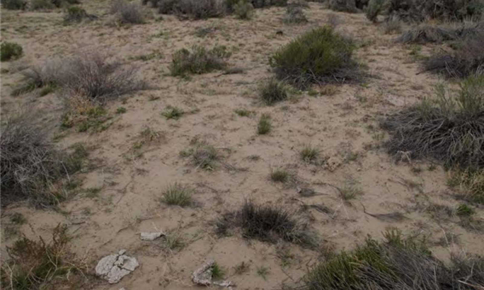
This ecological site is on sand sheets and sand dunes. Soils associated with this site are very deep, well drained to somewhat excessively drained, and formed in alluvium or eolian deposits derived from mixed parent material. The soil profile is characterized by an ochric epipedon and greater than 50 percent sand in the particle size control section and less than 20 percent clay. Surface textures are usually loamy fine sand or loamy very fine sand.
Important abiotic factors associated with this site sandy surface texture that favors dominance by needle and thread grass and Indian ricegrass and as well as coarse textured subsoil.
Components will be field checked and full consideration will be given to combining 024XY017NV, 024XY018OR and 024XY058NV.
Associated sites
| R024XY001NV |
DUNES 6-10 P.Z. This site is on thick sand sheets on middle and lower piedmont slopes. Soils associated with this site are very deep, somewhat excessively drained and formed in eolian and lacustrine sands derived from mixed rocks, with influence from volcanic ash. |
|---|---|
| R024XY002NV |
LOAMY 5-8 P.Z. This site includes limited effective moisture, salt-affected soils, and low precipitation. |
| R024XY014NV |
COARSE SILTY 4-8 P.Z. This site occurs on fan piedmonts. Soils associated with this site are very deep, well drained and formed in alluvium derived from mixed rocks, loess and volcanic ash. The soil profile is characterized by an ochric epipedon. |
| R024XY020NV |
DROUGHTY LOAM 8-10 P.Z. Soils are very deep, well drained and formed in a thin layer of loess and alluvium. The plant community is characterized by the mixing of shadscale (ATCO), and black greasewood (SAVE4). |
| R024XY055NV |
SANDY 5-8 P.Z. Soils have a thick layer of overblown or alluvial sand. These soils have rapid infiltration and percolation rates, very low available water capacity and are somewhat excessively drained with very low runoff. Spiny hopsage (GRSP) and Indian ricegrass (ACHY) |
Similar sites
| R024XY001NV |
DUNES 6-10 P.Z. Occurs on sandhill or dune landform; Indian ricegrass (ACHY) dominant grass; Needle and thread (HECO26) not codominant. |
|---|---|
| R024XY058NV |
SANDY LOAM 8-10 P.Z. Indian ricegrass (ACHY)- Needle and thread (HECO26) codominant; not on dune landform |
| R024XY055NV |
SANDY 5-8 P.Z. Less productive site on Sand sheets; Spiny hopsage (GRSP) dominant shrub, big sagebrush (ARTR2) absent. |
Table 1. Dominant plant species
| Tree |
Not specified |
|---|---|
| Shrub |
(1) Artemisia tridentata |
| Herbaceous |
(1) Achnatherum hymenoides |
Physiographic features
This site is on sand sheets and sand dunes. Slopes range from 0 to 30 percent, but slope gradients of 2 to 8 percent are typical. Elevations are 4,000 to 6,000 feet (1,219 to 1,829m).
Table 2. Representative physiographic features
| Landforms |
(1)
Sand sheet
(2) Dune (3) Fan skirt |
|---|---|
| Runoff class | Very low to very high |
| Flooding frequency | None |
| Ponding frequency | None |
| Elevation | 1,219 – 1,829 m |
| Slope | 2 – 8% |
| Water table depth | 183 cm |
| Aspect | Aspect is not a significant factor |
Climatic features
The climate associated with this site is semiarid, characterized by cool, moist winters and hot, dry summers. Over 70 percent of the precipitation occurs from November through May. Average annual precipitation across the range in which this site occurs is 9.4 inches (24cm). The average growing season ranges from 90 to 120 days.
Mean precipitation by month: Jan 1.0; Feb 0.89; Mar 0.92; Apr 1.04; May 1.09; Jun 0.85; Jul 0.25; Aug 0.26; Sept 0.43; Oct 0.78; Nov 0.88; Dec 0.96.
Table 3. Representative climatic features
| Frost-free period (characteristic range) | 75-77 days |
|---|---|
| Freeze-free period (characteristic range) | 103-107 days |
| Precipitation total (characteristic range) | 229-254 mm |
| Frost-free period (actual range) | 75-77 days |
| Freeze-free period (actual range) | 102-108 days |
| Precipitation total (actual range) | 203-254 mm |
| Frost-free period (average) | 76 days |
| Freeze-free period (average) | 105 days |
| Precipitation total (average) | 229 mm |
Figure 1. Monthly precipitation range
Figure 2. Monthly minimum temperature range
Figure 3. Monthly maximum temperature range
Figure 4. Monthly average minimum and maximum temperature
Figure 5. Annual precipitation pattern
Figure 6. Annual average temperature pattern
Climate stations used
-
(1) WINNEMUCCA MUNI AP [USW00024128], Winnemucca, NV
-
(2) OROVADA 3 W [USC00265818], Orovada, NV
Influencing water features
Influencing water features are not associated with this site.
Soil features
The soils associated with this site are very deep, well to somewhat excessively drained, and formed in alluvium or eolian deposits derived from mixed rock sources. These soils are characterized by an ochric epipedon, minimal soil development, and generally not affected by excess salts or sodium. The particle size control section typically contains greater than 50 percent sand and less than 20 percent clay. Available water capacity is moderate. The soil temperature regime is mesic, and the soil moisture regime is aridic bordering on xeric. If unprotected by plant cover, these soils are highly susceptible to wind erosion.
The representative soil series correlated to this site is Davey, classified as Sandy, mixed, mesic Xeric Haplocambids.
Other soil series associated with this site include: Enko, Orovada, Rad, Bliss, Hunewill, Hussell, oupico, Botom, Connel and Zorravista.
Where this ecological site is correlated to shallow soils, such as Jackpot or Kleck, areas will be field checked and correlated to a more appropriate ecological site.
Table 4. Representative soil features
| Parent material |
(1)
Alluvium
(2) Eolian deposits |
|---|---|
| Surface texture |
(1) Loamy sand (2) Fine sandy loam (3) Loamy fine sand |
| Family particle size |
(1) Sandy |
| Drainage class | Well drained to somewhat excessively drained |
| Permeability class | Moderately rapid to very rapid |
| Soil depth | 198 – 213 cm |
| Surface fragment cover <=3" | 0% |
| Surface fragment cover >3" | 0% |
| Available water capacity (0-101.6cm) |
6.86 – 12.7 cm |
| Calcium carbonate equivalent (0-101.6cm) |
0 – 10% |
| Electrical conductivity (0-101.6cm) |
0 – 16 mmhos/cm |
| Sodium adsorption ratio (0-101.6cm) |
0 – 5 |
| Soil reaction (1:1 water) (0-101.6cm) |
6.6 – 9 |
| Subsurface fragment volume <=3" (Depth not specified) |
0 – 5% |
| Subsurface fragment volume >3" (Depth not specified) |
0% |
Ecological dynamics
The plant communities of this site are dynamic in response to changing weather patterns and disturbance regimes. The reference plant community is dominated by Indian ricegrass, Wyoming big sagebrush and basin big sagebrush. Black greasewood, fourwing saltbush and spiny hopsage are associated shrub species. Needleandthread and basin wildrye are other important species. This site inherently has low resistance to invasion by non-natives and low resilience following invasion by non-natives. In Great Basin ecosystems, inherent resilience typically increases with elevation due to higher levels of water, nutrients and annual biomass production. Wyoming sagebrush ecosystems are least resistant to cheatgrass invasion due to the combination of low resilience to disturbances such as fire and low resistance to cheatgrass invasion (Chambers et al. 2012). Management activities should be prioritized based on the relative resilience and resistance of a specific ecological site.
This ecological site is characterized by coarse-textured soils formed from alluvium or eolian deposits. In arid and semi-arid systems, coarse-textured soils lose less moisture to evaporation than fine-textured soils and thus have higher water availability (Lane et al 1998). This principle known as the inverse-texture hypothesis, predicts that plant communities on coarse-textured soils should have higher above-ground net primary productivity than communities on fine-textured soils. Infiltration is rapid on coarse-textured soil reducing the potential for runoff during typical precipitation events. Almost all the precipitation that falls upon this site is available for plant use. Deep-rooted plants are particularly suited to this site as they can take advantage of the rapid infiltration and deep percolation of water normal to coarse textured soils. These soils warm distinctly earlier in the spring than do heavier textured soils. Plant growth is thus initiated earlier than on most adjacent sites.
Sandy soils are highly susceptible to wind erosion. Reduced soil stability decreases both resilience and resistance of this site. Low resistance allows for invasion by annual non-native species. Reduction in perennial plant cover or changes in plant community composition and structure increases the risk of active soil movement. Management of the site should insure sufficient perennial plant cover to protect the site from soil surface movement.
Big sagebrush root systems are well developed, with both lateral roots and tap roots. Tap roots can penetrate as far as six feet (Howard 1999). Research suggests that the taproots of sagebrush plants absorb moisture from the deeper soil horizons and transport it to the lateral roots in the drier upper soil horizons (Richards and Caldwell 1987). Hydraulic lift by deep-rooted species can result in greater competitive ability for limited resources, than root distribution would suggest.
Big sagebrush species of this site regenerates solely from seed and do not sprout or layer. It generally flowers and sets seed in late summer and fall. Most seed shatters within a week of maturation and travels less than 100 feet from the parent plant. Germination occurs the following spring, cold stratification and light improves germination (Howard 1999). Sagebrush seedlings require sufficient soil moisture to germinate and survive. Mature shrubs, perennial bunchgrasses and litter can create microhabitats with favorable germination conditions.
As ecological condition declines and where management results in abusive grazing use by livestock or feral horses, needleandthread and Indian ricegrass decrease as Sandberg's bluegrass and bottlebrush squirreltail increase and become the dominant understory vegetation. With further site deterioration, cheatgrass and annual mustards replace perennial grasses and dominate the understory as big sagebrush, rabbitbrush, and horsebrush increase and become the dominant overstory vegetation. Cheatgrass, halogeton, and Russian thistle are species likely to invade this site.
Fire Ecology:
Sagebrush steppe communities have historically been subjected to fires at varying intervals (25 to 70+ years). Fire severity in big sagebrush communities is described as variable depending on weather, fuels, and topography. Fire is the principal means of renewal for decadent stands of big sagebrush. Basin big sagebrush and Wyoming big sagebrush are readily killed when aboveground plant parts are charred by fire. Prolific seed production from nearby unburned plants coupled with high germination and survival rates is required to ensure establishment following fire. The VAM fungal populations upon which Wyoming big sagebrush depends on for healthy growth are harmed by fire, and may take several years after fire to recover.
In many big sagebrush communities, changes in fire occurrence have occurred along with fire suppression, livestock grazing and off-road vehicle (OHV) use. Invasion of cheatgrass, mustards and other annual non-natives decreases site resilience, increases the risk of stand-replacing fire, and decreases the potential for sagebrush and Indian ricegrass reestablishment. Soil movement associated with fire and other activities such as OHV use or brush treatment has been observed. Twelve years after stand replacing fires near Winnemucca, NV reestablishment of sagebrush stands has not occurred. Repeated fire within a 10 to 20 year timeframe has the potential to convert this site to an annual non-native plant community. Seeding of this site following fire has not proven effective and rehabilitation methods are not known due to active soil movement following fire (M. Zielinski, personal communication, 2010)
Indian ricegrass can be killed by fire, depending on severity and season of burn. Indian ricegrass has been found to reestablish on burned sites through seed dispersed from adjacent unburned areas, thus the presence of surviving, seed producing plants is necessary for reestablishment of Indian ricegrass (Young 1983). Grazing management following fire to promote seed production and establishment of seedlings is essential in re-establishing this species.
Spiny hopsage is considered to be somewhat fire tolerant and often survives fires that kill sagebrush. Mature spiny hopsage generally sprout after being burned. Spiny hopsage is reported to be least susceptible to fire during summer dormancy. Spiny hopsage, a minor component in the reference community, has increased on burned areas due to the ability to resprout.
Needleandthread grass is top-killed by fire. It may be killed if the aboveground stems are completely consumed. Needleandthread grass is classified as slightly to severely damaged by fire. Needleandthread grass sprouts from the caudex following fire, if heat has not been sufficient to kill underground parts. Recovery usually takes 2 to 10 years.
Basin wildrye is top-killed by fire. Older basin wildrye plants with large proportions of dead material within the perennial crown can be expected to show higher mortality due to fire than younger plants having little debris. Basin wildrye is generally tolerant of fire but may be damaged by early season fire combined with dry soil conditions.
State and transition model

Figure 7. Sandy 8-10 STM Diagram

Figure 8. Sandy 8-10 STM Legend
More interactive model formats are also available.
View Interactive Models
More interactive model formats are also available.
View Interactive Models
Click on state and transition labels to scroll to the respective text
State 1 submodel, plant communities
State 2 submodel, plant communities
State 3 submodel, plant communities
State 4 submodel, plant communities
State 1
Reference State
The reference state is representative of the natural range of variability under pristine conditions. The reference state has three general community phases; a perennial grass dominant phase, a shrub-grass dominant phase and a shrub dominant phase. State dynamics are maintained by interactions between climatic patterns and disturbance regimes. Negative feedbacks enhance ecosystem resilience and contribute to the stability of the state. These include the presence of all structural and functional groups, low fine fuel loads, and retention of organic matter and nutrients. Plant community phase changes are primarily driven by fire, periodic drought and/or insect or disease attack.
Community 1.1
Reference Plant Community 1.1
The visual aspect of the reference plant community is an open canopy of perennial bunchgrasses and soft woody shrubs. Dominant species include big sagebrush (Wyoming big sagebrush and basin big sagebrush), Indian ricegrass and needleandthread. Spiny hopsage and basin wildrye are important associated species. Potential vegetative composition is about 60 percent grasses, 10 percent forbs and 30 percent shrubs. Approximate ground cover (basal and crown) is 20 to 30 percent.
Figure 9. Annual production by plant type (representative values) or group (midpoint values)
Table 5. Annual production by plant type
| Plant type | Low (kg/hectare) |
Representative value (kg/hectare) |
High (kg/hectare) |
|---|---|---|---|
| Grass/Grasslike | 336 | 471 | 605 |
| Shrub/Vine | 168 | 235 | 303 |
| Forb | 56 | 78 | 101 |
| Total | 560 | 784 | 1009 |
Community 1.2
Plant community 1.2
This plant community phase is characteristic of a post-disturbance, early seral community phase. This community is dominated by Indian ricegrass, needleandthread, and basin wildrye; big sagebrush decreases after fire and perennial bunchgrasses initially increase. Spiny hopsage and ephedra may resprout after fire. Big sagebrush is present in trace amounts or in unburned islands. Fast moving, low intensity wildfire results in the incomplete removal of sagebrush allowing for direct reestablishment and a faster recovery. This plant community phase is at risk of invasion by non-native species. Non-natives are able to take advantage of increased availability of critical resources following disturbance.
Community 1.3
Plant community 1.3
This plant community phase is characterized by a decadent overstory of basin and Wyoming big sagebrush, along with spiny hopsage and other shrubs. Perennial grasses are declining from drought, competition from over-mature shrub overstory, and/or inadequate rest and recovery from defoliation. In the absence of disturbance, sagebrush communities become monotypic stands of late successional plants. This results in reduced quantity and diversity of plant species, reduced sagebrush vigor and seed production. Over-mature sagebrush plants are very competitive for water, light, and nutrients, preventing recruitment and establishment of other vegetation and increasing the amount of bare ground. This plant community is at risk of invasion by non-native species. Non-natives can easily invade plant communities where structural and functional groups are reduced. Increased bare ground is an indicator of site susceptibility to accelerated wind erosion.
Pathway 1.1A
Community 1.1 to 1.2
Fire, insect and/or disease attack
Pathway 1.1B
Community 1.1 to 1.3
Prolonged drought, inadequate rest and recovery from defoliation and the absence or fire or other natural disturbance
Pathway 1.2A
Community 1.2 to 1.1
Absence of disturbance and natural regeneration over time. Ten years or greater is required for big sagebrush to reach pre-fire conditions (Howard 1999).
Pathway 1.3A
Community 1.3 to 1.1
Adequate rest and recovery from defoliation, Aroga moth infestation of sagebrush, fast moving, low intensity fire, and/or release from drought allow for the perennial grasses to increase over time.
Pathway 1.3B
Community 1.3 to 1.2
Fire or other natural disturbance reduces shrub cover and invigorates the perennial bunchgrass community.
State 2
Current Potential
This state is characterized by the presence of non-native invasive species in the understory. This state is similar to the Reference State (1) and has the same three general community phases. Ecological function has not changed, however, the resiliency of the state has been reduced by the presence of invasive weeds. Prescribed grazing and infrequent fire maintains state dynamics. These non-natives are highly flammable and can promote wildfire where fires historically have been infrequent. Negative feedbacks enhance ecosystem resilience and contribute to the stability of the state. These include the presence of all structural and functional groups, low fine fuel loads and retention of organic matter and nutrients. Positive feedbacks decrease ecosystem resilience and stability of the state. These include non-natives high seed output, persistent seed bank, rapid growth rate, ability to cross pollinate and adaptations for seed dispersal.
Community 2.1
Community Phase 2.1
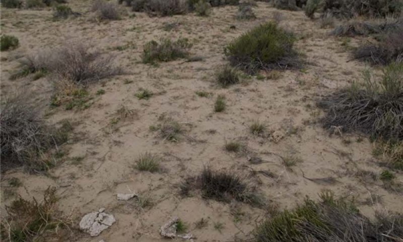
Figure 10. Sandy 8-10 Phase 2.1 T. Stringham June 2010

Figure 11. Plant community 2.1a
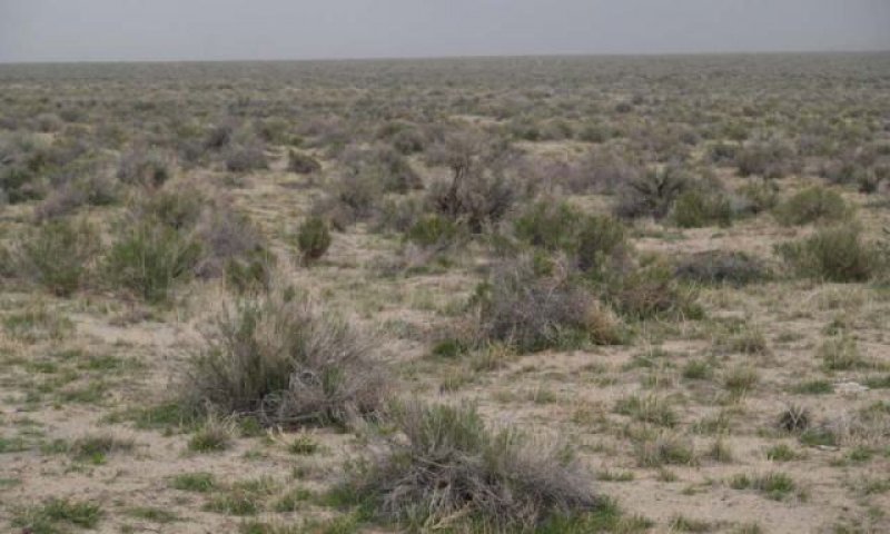
Figure 12. Plant community 2.1b
This community is compositionally similar to 1.1 Plant Community with a trace of non-native annual weeds, primarily cheatgrass and mustards. Ecological processes (soil hydrology properties, nutrient cycling and productivity) have not changed. Ecological resilience has been reduced by the presence of non-native annual species and this community may respond differently following a disturbance, when compared to non-invaded plant communities.
Community 2.2
Plant community 2.2
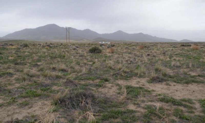
Figure 13. Sandy 8-10 Community Phase 2.2 NV777 MU410 Bliss Soil T. Stringham
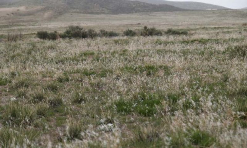
Figure 14. Sandy 8-10 Community Phase 2.2 NV777 MU410 Bliss Soil T. Stringham
This plant community phase is characteristic of a post-disturbance, early seral plant community phase. Perennial bunchgrasses, especially Indian ricegrass and needleandthread, respond positively to fire and now dominate the site. Trace amounts of shrubs may be present. Fast moving, low intensity wildfires result in the incomplete removal of sagebrush allowing for direct reestablishment and faster recovery. Spiny hopsage and ephedra may resprout. Non-native annual species, like cheatgrass and annual mustards, are present in the understory. Bare ground may increase. With inadequate rest and recovery from defoliation, this community is at risk of crossing a threshold to State 3, 3.2 Plant Community.
Community 2.3
Plant community (at-risk) 2.3
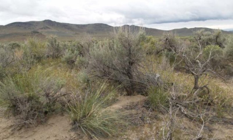
Figure 15. Plant community 2.3
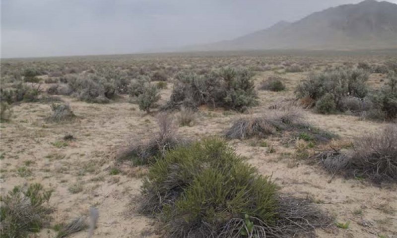
Figure 16. Sandy 8-10 Phase 2.3 T. Stringham June 2010
The at-risk plant community of state 2 is characterized by the over-dominance of sagebrush and other shrubs. In response to inadequate rest and recovery from defoliation, perennial grasses decline and the shrub overstory becomes dominant. Annual non-native species are stable or increasing within the understory. Bare ground is increasing. Resistance of the plant community to wind erosion and further weed invasion is reduced. With further disturbance, such as fire and continued inadequate rest and recovery from defoliation this plant community will likely cross a threshold to State 3 or 4.
Pathway 2.1A
Community 2.1 to 2.2
Fire, insect and/or disease attack.
Pathway 2.1B
Community 2.1 to 2.3
Prolonged drought, inadequate rest and recovery from defoliation and absence of fire or other natural disturbance.
Pathway 2.2A
Community 2.2 to 2.1
Time allows for re-establishment of sagebrush after fire. This may take a very long time for the shrubs to re-establish (20 years or greater is required for sagebrush to achieve pre-fire conditions), depending on seed source and movement of the surface soils (i.e. burying of seed).
Pathway 2.3A
Community 2.3 to 2.1
Fast moving, low intensity fire, insect attack, release from drought and/or adequate rest and recovery from defoliation reduces shrub overstory and releases bunchgrass understory.
Pathway 2.3B
Community 2.3 to 2.2
Stand replacing disturbance (fire and/or Aroga moth infestation of sagebrush) promotes perennial bunchgrass response.
State 3
Shrub State
This state has two general community phases: a shrub phase with an annual non-native understory and a non-native annual dominated phase. This state has crossed a biotic threshold and site processes (soil hydrology, nutrient cycling, and energy capture) are being controlled by the shrub component of the plant community. Perennial bunchgrasses may or may not be present in trace amounts. The herbaceous understory is dominated by annual non-native species such as cheatgrass and mustards. Resiliency has declined and further degradation from fire facilitates a cheatgrass and sprouting shrub plant community. The fire return interval has shortened due to the dominance of cheatgrass in the understory and is a driver in site dynamics. Sagebrush may be eliminated by continued fire. Spiny hopsage and ephedra may resprout if grazing is controlled and drought does not occur following fire. Negative feedbacks enhance ecosystem resilience and contribute to stability of this state. These include the persistent seedbank and competitive ability of cheatgrass.
Community 3.1
Plant community 3.1
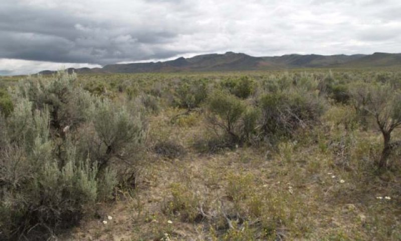
Figure 17. Plant community 3.1a
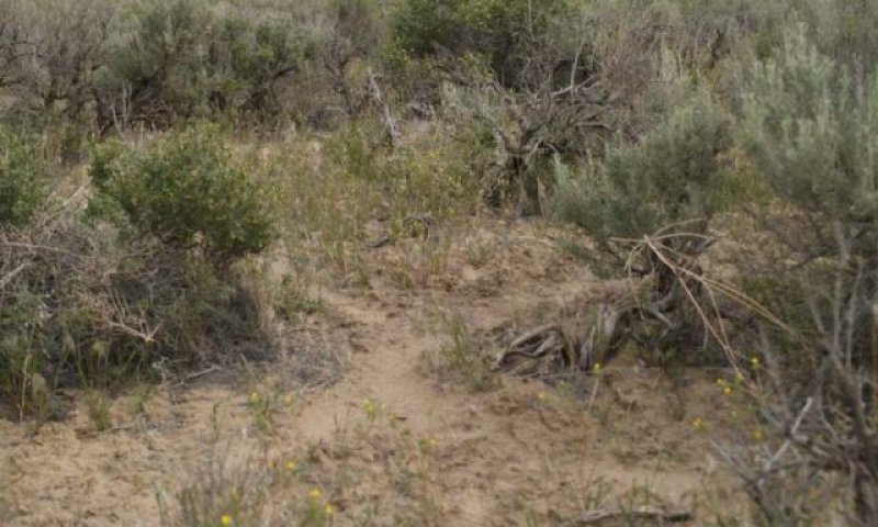
Figure 18. Plant community 3.1b
Sagebrush and various native shrubs associated with this site dominate the overstory. Cheatgrass, mustards and other non-native annual species dominate the understory. The native perennial bunchgrass component is significantly reduced. Native species exhibit reduced vigor and reproductive capacity due to competition from non-native species and shrub overstory. Prolonged drought may result in overall reduction of the plant community. This plant community is at risk of increased fire because of the increased fuel load provided by non-natives.
Community 3.2
Plant community 3.2
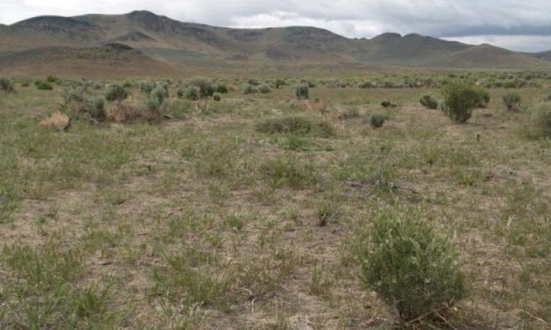
Figure 19. Plant community 3.2a
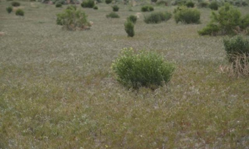
Figure 20. Plant community 3.2b
This plant community phase is dominated by non-natives. After fire, spiny hopsage, ephedra and rabbitbrush may sprout from the root crown. Sagebrush present in trace amounts, if at all. Annual species dominate the understory and control ecological processes (soil hydrology, nutrient cycling, energy capture). This plant community is at risk of reoccurring fire, due to continuous fuel bed provided by non-native annuals.
Pathway 3.1A
Community 3.1 to 3.2
Fire, insect and/or disease attack
Pathway 3.2A
Community 3.2 to 3.1
Absence of disturbance (fire return interval >20 years) and natural regeneration over time (if a seed source is present for sagebrush)
State 4
Annual State
This state has crossed both a biotic and abiotic threshold. Annual invasive weeds, primarily cheatgrass and mustard, dominate the plant community. Sprouting shrubs may be present in trace amounts; sagebrush is missing. Ecological processes are controlled by the annual weed community during the spring growing season and by the physical process of wind movement of soil after the annual plant cover has senesced. In extremely degraded sites wind erosion of soil may progress to dune formation or flattening (depending on landscape position) and near elimination of the annual plant community.
Community 4.1
Plant community 4.1
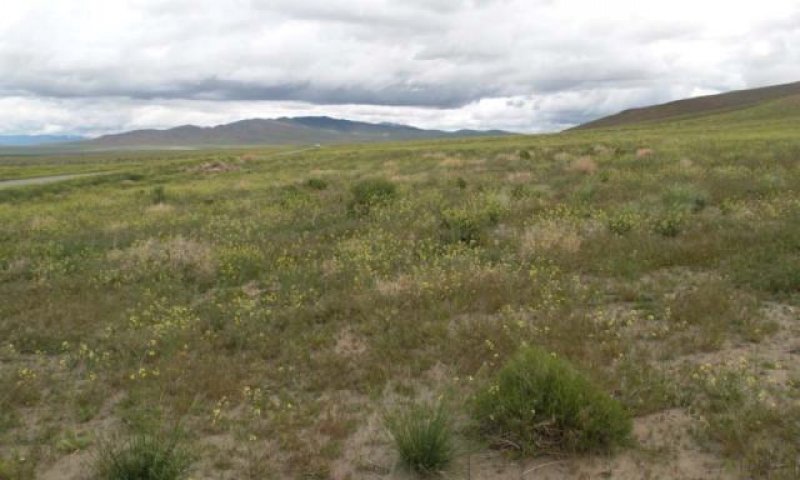
Figure 21. Sandy 8-10 Community Phase 4.1 NV777 MU250 Davey Soil T. Stringham June 2010
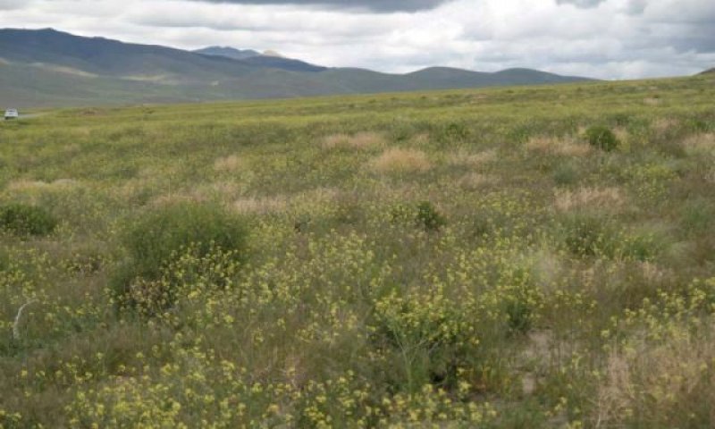
Figure 22. Sandy 8-10 Community Phase 4.1 NV777 MU250 Davey Soil T. Stringham June 2010
Annual species, primarily mustards and cheatgrass, dominate this community phase. Canopy cover and litter cover, during average and above-average precipitation years, is typically greater than 50%. Litter cover provides safe sites for the germination of cheatgass. Average soil stability values range from 1 to 3, which indicates low resistance to erosion. Trace amounts of perennial grasses or sprouting shrubs may be present. Annual production, dominated by cheatgrass and mustard, ranges from 1000-1300 lbs/ac in an average precipitation year. Fire occurs frequent enough in this state to eliminate the reestablishment of sagebrush or dominance of sprouting shrubs. Extensive soil movement also precludes the natural reestablishment of shrub and herbaceous species. Restoration practices include stabilization of soil, control of non-natives, and seeding of native species during a high-rainfall period.
Community 4.2
Plant community (At-Risk) 4.2
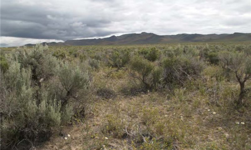
Figure 23. Sandy 8-10 Community Phase 4.1 NV777 MU409 Davey Soil T. Stringham June 2010
Sagebrush and/or sprouting shrubs dominate the overstory. Cheatgrass, annual mustards and other non-native annual species dominate the understory. This phase is very at risk of fire and conversion to an annual dominated site. Fire occurs frequent enough in this state to eliminate the reestablishment of sagebrush or dominance of sprouting shrubs. Extensive soil movement also precludes the natural reestablishment of shrub and herbaceous species. Restoration practices include stabilization of soil, control of non-natives, and seeding of native species during a high-rainfall period.
Pathway 4.1a
Community 4.1 to 4.2
Time and lack of disturbance allows for regeneration of sagebrush. This pathway is unlikely due to the competitive advantages of cheatgrass over sagebrush seedlings.
Pathway 4.2a
Community 4.2 to 4.1
Fire
Transition T1A
State 1 to 2
Trigger: Introduction of non-native annual species. Slow variables: Changes in the kinds of animals and their grazing patterns, drought and/or changes in fire history that altered recruitment rates of native species. Threshold: Reduction in deep-rooted herbaceous understory reduces productivity, changes nutrient cycling and soil stability. Non-native invasive species cannot be easily removed from the system and have the potential to significantly alter disturbance regimes from their historic range of variation.
Transition T2A
State 2 to 3
Trigger: Inadequate rest and recovery from winter and spring defoliation and/or prolonged drought. Slow variables: long term decrease in grass density and reduced native species (shrub and grass) recruitment rates. Increased reproduction of non-native species. Threshold: loss of deep-rooted perennial bunchgrasses changes nutrient cycling and nutrient redistribution; thus reducing soil organic matter.
Transition T2B
State 2 to 4
Trigger: Multiple stand replacing fires eliminates sagebrush and severely damages spiny hopsage. Typically occurs in the hot season. Slow variables: Increased reproduction and cover of non-native invasive annuals. Threshold: Loss of deep-rooted perennial bunchgrasses reduces infiltration and increases runoff; this leads to reduced soil organic matter and soil moisture. The natural fire regime is also modified (changes in intensity, size and spatial variability of fires).
Transition T3A
State 3 to 4
Trigger: Multiple fires within a 10 to 20 year timeframe Slow Variables: Increased reproduction, cover and density of non-native annuals Threshold: Modified fire regime (changes in frequency, intensity, size and spatial variability of fire). Changes in plant community composition and spatial variability of vegetation (loss of perennial bunchgrasses and sagebrush).
Additional community tables
Table 6. Community 1.1 plant community composition
| Group | Common name | Symbol | Scientific name | Annual production (kg/hectare) | Foliar cover (%) | |
|---|---|---|---|---|---|---|
|
Grass/Grasslike
|
||||||
| 1 | Primary Perennial Grasses | 392–628 | ||||
| Indian ricegrass | ACHY | Achnatherum hymenoides | 235–314 | – | ||
| needle and thread | HECO26 | Hesperostipa comata | 118–235 | – | ||
| basin wildrye | LECI4 | Leymus cinereus | 39–78 | – | ||
| 2 | Secondary Perennial Grasses | 16–78 | ||||
| squirreltail | ELEL5 | Elymus elymoides | 4–24 | – | ||
| thickspike wheatgrass | ELLAL | Elymus lanceolatus ssp. lanceolatus | 4–24 | – | ||
| Sandberg bluegrass | POSE | Poa secunda | 4–24 | – | ||
|
Forb
|
||||||
| 3 | Perennial Forbs | 13–54 | ||||
| buckwheat | ERIOG | Eriogonum | 4–16 | – | ||
| starlily | LEUCO | Leucocrinum | 4–16 | – | ||
| lupine | LUPIN | Lupinus | 4–16 | – | ||
| evening primrose | OENOT | Oenothera | 4–16 | – | ||
| globemallow | SPHAE | Sphaeralcea | 4–16 | – | ||
|
Shrub/Vine
|
||||||
| 4 | Primary Shrubs | 182–269 | ||||
| basin big sagebrush | ARTRT | Artemisia tridentata ssp. tridentata | 84–118 | – | ||
| Wyoming big sagebrush | ARTRW8 | Artemisia tridentata ssp. wyomingensis | 84–118 | – | ||
| spiny hopsage | GRSP | Grayia spinosa | 13–34 | – | ||
| 5 | Secondary Shrubs | 13–67 | ||||
| fourwing saltbush | ATCA2 | Atriplex canescens | 8–16 | – | ||
| shadscale saltbush | ATCO | Atriplex confertifolia | 8–16 | – | ||
| yellow rabbitbrush | CHVI8 | Chrysothamnus viscidiflorus | 8–16 | – | ||
| Nevada jointfir | EPNE | Ephedra nevadensis | 8–16 | – | ||
| winterfat | KRLA2 | Krascheninnikovia lanata | 8–16 | – | ||
Interpretations
Animal community
Livestock Interpretations:
This site is suitable for livestock grazing. Basin big sagebrush may serve as emergency food during severe winter weather, but it is not usually sought out by livestock. Livestock browse Wyoming big sagebrush, but may use it only lightly when palatable herbaceous species are available. Spiny hopsage provides a palatable and nutritious food source for livestock, particularly during late winter through spring. Domestic sheep browse the succulent new growth of spiny hopsage in late winter and early spring.
Indian ricegrass is highly palatable to all classes of livestock in both green and cured condition. It supplies a source of green feed before most other native grasses have produced much new growth. Heavy spring grazing has been found to sharply reduce the vigor of Indian ricegrass and decrease the stand (Cook and Child 1971). In eastern Idaho, productivity of Indian ricegrass was at least 10 times greater in undisturbed plots than in heavily grazed ones (Pearson 1976). Cook and Child (1971) found significant reduction in plant cover after 7 years of rest from heavy (90%) and moderate (60%) spring use. The seed crop may be reduced where grazing is heavy (Bich et al. 1995). Tolerance to grazing increases after May thus spring deferment may be necessary for stand enhancement (Pearson 1964; Cook and Child 1971), however utilization of less than 60% is recommended.
Needleandthread provides highly palatable forage, especially in the spring before fruits have developed. Needlegrasses are grazed in the fall only if the fruits are softened by rain. The early growth and abundant production of basin wildrye make it a valuable source of forage for livestock. It is important forage for cattle and is readily grazed by cattle and horses in early spring and fall. Though coarse-textured during the winter, basin wildrye may be utilized more frequently by livestock and wildlife when snow has covered low shrubs and other grasses.
Stocking rates vary over time depending upon season of use, climate variations, site, and previous and current management goals. A safe starting stocking rate is an estimated stocking rate that is fine tuned by the client by adaptive management through the year and from year to year.
Wildlife Interpretations:
Basin big sagebrush is the least palatable of all the subspecies of big sagebrush. Basin big sagebrush is browsed by mule deer from fall to early spring, but is not preferred. Wyoming big sagebrush is preferred browse for wild ungulates. Pronghorn usually browse Wyoming big sagebrush heavily. Spiny hopsage provides a palatable and nutritious food source for big game animals. Spiny hopsage is used as forage to at least some extent by domestic goats, deer, pronghorn, and rabbits. Indian ricegrass is eaten by pronghorn in moderate amounts whenever available. A number of heteromyid rodents inhabiting desert rangelands show preference for seed of Indian ricegrass. Indian ricegrass is an important component of jackrabbit diets in spring and summer. In Nevada, Indian ricegrass may even dominate jackrabbit diets during the spring through early summer months. Indian ricegrass seed provides food for many species of birds. Doves, for example, eat large amounts of shattered Indian ricegrass seed lying on the ground. Needleandthread is moderately important spring forage for mule deer, but use declines considerably as more preferred forages become available. Basin wildrye provides winter forage for mule deer, though use is often low compared to other native grasses. Basin wildrye provides summer forage for black-tailed jackrabbits. Because basin wildrye remains green throughout early summer, it remains available for small mammal forage for longer time than other grasses.
Hydrological functions
Runoff is very low. Permeability is slow to moderately rapid. Hydrologic soil groups are B and C. Rills and flow patterns are none. Pedestals are rare to none. Perennial herbaceous plants (especially deep-rooted bunchgrasses [i.e., Indian ricegrass]) slow runoff and increase infiltration. Shrub canopy and associated litter break raindrop impact and provide opportunity for snow catch and accumulation on site.
Recreational uses
Aesthetic value is derived from the diverse floral and faunal composition and the colorful flowering of wild flowers and shrubs during the spring and early summer. This site offers rewarding opportunities to photographers and for nature study. This site has potential for upland bird and big game hunting.
Other products
Some Native American peoples used the bark of big sagebrush to make rope and baskets. Native Americans made tea from big sagebrush leaves. They used the tea as a tonic, an antiseptic, for treating colds, diarrhea, and sore eyes and as a rinse to ward off ticks. Big sagebrush seeds were eaten raw or made into meal. Some Native American peoples traditionally ground parched seeds of spiny hopsage to make pinole flour. Indian ricegrass was traditionally eaten by some Native Americans. The Paiutes used seed as a reserve food source. Basin wildrye was used as bedding for various Native American ceremonies, providing a cool place for dancers to stand.
Other information
Basin big sagebrush shows high potential for range restoration and soil stabilization. Basin big sagebrush grows rapidly and spreads readily from seed. Wyoming big sagebrush is used for stabilizing slopes and gullies and for restoring degraded wildlife habitat, rangelands, mine spoils and other disturbed sites. It is particularly recommended on dry upland sites where other shrubs are difficult to establish. Spiny hopsage has moderate potential for erosion control and low to high potential for long-term revegetation projects. It can improve forage, control wind erosion, and increase soil stability on gentle to moderate slopes. Spiny hopsage is suitable for highway plantings on dry sites in Nevada. Needleandthread grass is useful for stabilizing eroded or degraded sites. Basin wildrye is useful in mine reclamation, fire rehabilitation and stabilizing disturbed areas. Its usefulness in range seeding, however, may be limited by initially weak stand establishment.
Supporting information
Inventory data references
NASIS soil component data.
Type locality
| Location 1: Humboldt County, NV | |
|---|---|
| Township/Range/Section | T36N R38E S29 |
| UTM zone | N |
| UTM northing | 4535328 |
| UTM easting | 438930 |
| Latitude | 40° 58′ 0″ |
| Longitude | 117° 43′ 32″ |
| General legal description | NW¼SW¼ Southwest corner of the intersection between Hanson Road and Wesco Road, Winnemucca, Humboldt County, Nevada. This site also occurs in Elko, Eureka, Lander, and Pershing Counties, Nevada. |
Other references
Bich, B.S., J.L. Butler, and C.A. Schmidt. 1995. Effects of differential livestock use of key plant species and rodent populations within selected Oryzopsis hymenoides/Hilaria jamesii communities in Glen Canyon National Recreation Area. The Southwestern Naturalist 40(3):281-287.
Blauer, A.C., A.P. Plummer, E.D. McArthur, R. Stevens, and B.C. Giunta. 1976. Characteristics and hybridization of important Intermountain shrubs. II. Chenopod family. Res. Pap. INT-177. Ogden, UT. U.S. Department of Agriculture, Forest Service, Intermountain Forest and Range Experiment Station. 42 p.
Bunting, S.C., B.M. Kilgore, and C.L. Bushey. 1987. Guidelines for prescribed burning sagebrush-grass rangelands in the northern Great Basin. Gen. Tech. Rep. INT-231. Ogden, UT. U.S. Department of Agriculture, Forest Service, Intermountain Research Station. 33 p.
Chambers, J., R. Miller and J. Grace. 2012. The importance of resilience and resistance to the restoration of sagebrush rangelands. SageSTEP News 18:4-6.
Cook, C.W. and R.D. Child. 1971. Recovery of desert plants in various states of vigor. Journal of Range Management 24(5):339-343.
Daubenmire, R. 1970. Steppe vegetation of Washington. Technical Bulletin 62. Pullman, WA: Washington State University, College of Agriculture, Washington Agricultural Experiment Station. 131 p.
Goodrich, S., E.D. McArthur, and A.H. Winward. 1985. A new combination and a new variety in Artemisia tridentata. The Great Basin Naturalist 45(1):99-104.
Howard, Janet L. 1999. Artemisia tridentata subsp. wyomingensis. In: Fire Effects Information System, [Online]. U.S. Department of Agriculture, Forest Service, Rocky Mountain Research Station, Fire Sciences Laboratory (Producer). Available: http://www.fs.fed.us/database/feis/
Humphrey, L.D. 1984. Patterns and mechanisms of plant succession after fire on Artemisia-grass sites in southeastern Idaho. Vegetatio 57:91-101.
Hurley, C. A., Wicklow-Howard, M. 1986. The occurence of vesicular-arbuscular mycorrhizae associated with Artemisia tridentata var. wyomingenesis within burned areas of the Idaho. Journal of the Idaho Academy of Science. 22(1).
Johnson, J.R. and G.F. Payne. 1968. Sagebrush reinvasion as affected by some environmental influences. Journal of Range Management 21:209-213.
Lane, D.R., D.P. Coffin and W.K. Lauenroth. 1998. Effects of soil texture and precipitation on above ground net primary productivity and vegetation structure across the central grassland region of the United States. Journal of Vegetation Science. 9:239-250.
Pearson, L.C. 1964. Effect of harvest date on recovery of range grasses and shrubs. Agronomy Journal 56:80-82.
Pearson, L.C. 1976. Primary production in grazed and ungrazed desert communities of eastern Idaho. Ecology 46(3):278-285.
Richards, J.H. and M.M. Caldwell. 1987. Hydraulic lift: substantial nocturnal water transport between soil layers by Artemisia tridentata roots. Oecologia. 73:486-489.
Rickard, W.H. and M.C. McShane. 1984. Demise of spiny hopsage shrubs following summer wildfire: an authentic record. Northwest Science 58(4):282-285.
Sapsis, D.B. and J.B. Kauffman. 1991. Fuel consumption and fire behavior associated with prescribed fires in sagebrush ecosystems. Northwest Science 65(4):173-179.
Shaw, N.L. 1992. Germination and seedling establishment of spiny hopsage (Grayia spinosa [Hook.] Moq.). Corvallis, OR: Oregon State University. 174 p. Dissertation.
Shumar, M.L. and J.E. Anderson. 1986. Gradient analysis of vegetation dominated by two subspecies of big sagebrush. Journal of Range Management 39(2):156-159.
Wasser, C.H. 1982. Ecology and culture of selected species useful in revegetating disturbed lands in the West. FWS/OBS-82/56. Washington, DC: U.S. Department of the Interior, Fish and Wildlife Service. 347 p.
Webb, R.H. and S.S. Stielstra. 1979. Sheep grazing effects on Mojave Desert vegetation and soils. Environmental Management 3(6):517-529.
Young, R.P. 1983. Fire as a vegetation management tool in rangelands of the Intermountain Region. In: Monsen, S.B. and N. Shaw (compilers). Managing Intermountain rangelands--improvement of range and wildlife habitats: Proceedings; 1981 September 15-17; Twin Falls, ID; 1982 June 22-24; Elko, NV. Gen. Tech. Rep. INT-157. Ogden, UT: U.S. Department of Agriculture, Forest Service, Intermountain Forest and Range Experiment Station: 18-31.
Contributors
CP/GKB
TK Stringham
Approval
Kendra Moseley, 3/07/2025
Rangeland health reference sheet
Interpreting Indicators of Rangeland Health is a qualitative assessment protocol used to determine ecosystem condition based on benchmark characteristics described in the Reference Sheet. A suite of 17 (or more) indicators are typically considered in an assessment. The ecological site(s) representative of an assessment location must be known prior to applying the protocol and must be verified based on soils and climate. Current plant community cannot be used to identify the ecological site.
| Author(s)/participant(s) | Patti Novak-Echenique |
|---|---|
| Contact for lead author | State Rangeland Management Specialist |
| Date | 09/10/2009 |
| Approved by | Kendra Moseley |
| Approval date | |
| Composition (Indicators 10 and 12) based on | Annual Production |
Indicators
-
Number and extent of rills:
None -
Presence of water flow patterns:
None -
Number and height of erosional pedestals or terracettes:
Pedestals are none or rare in areas that are wind scoured. -
Bare ground from Ecological Site Description or other studies (rock, litter, lichen, moss, plant canopy are not bare ground):
Bare Ground up to 50-60% -
Number of gullies and erosion associated with gullies:
None -
Extent of wind scoured, blowouts and/or depositional areas:
Soils derived from aeolian material may develop wind scoured and depositional areas around bases of shrubs. -
Amount of litter movement (describe size and distance expected to travel):
Fine litter (foliage from grasses and annual & perennial forbs) expected to move distance of slope length during intense summer convection storms or rapid snowmelt events. Persistent litter (large woody material) will remain in place except during large rainfall events. -
Soil surface (top few mm) resistance to erosion (stability values are averages - most sites will show a range of values):
Soil stability values average from 1 to 2 with no canopy cover and 2 to 5 with canopy cover. -
Soil surface structure and SOM content (include type of structure and A-horizon color and thickness):
Structure of soil surface is typically weak medium platy structure. Soil surface colors are pale browns or grays and soils are typified by ochric epipedon. Organic matter of the surface 2 to 3 inches is typically less than to 1.5 percent. -
Effect of community phase composition (relative proportion of different functional groups) and spatial distribution on infiltration and runoff:
Perennial herbaceous plants (especially deep-rooted bunchgrasses [i.e., needleand thread, Indian ricegrass]) slow runoff and increase infiltration. Shrub canopy and associated litter break raindrop impact and provide opportunity for snow catch and accumulation on site. -
Presence and thickness of compaction layer (usually none; describe soil profile features which may be mistaken for compaction on this site):
Compacted layers are none. -
Functional/Structural Groups (list in order of descending dominance by above-ground annual-production or live foliar cover using symbols: >>, >, = to indicate much greater than, greater than, and equal to):
Dominant:
Reference Plant Community: Deep-rooted, cool season, perennial bunchgrasses (i.e., Indian ricegrass, needleandthread)Sub-dominant:
tall shrubs (big sagebrush) > associated shrubs > perennial forbs > shallow-rooted, cool season, perennial bunchgrasses > annual forbsOther:
Additional:
-
Amount of plant mortality and decadence (include which functional groups are expected to show mortality or decadence):
Dead branches within individual shrubs common and standing dead shrub canopy material may be as much as 25% of total woody canopy; mature bunchgrasses may have dead centers. -
Average percent litter cover (%) and depth ( in):
Under canopy and between plant interspaces (10-20%) and depth (± ¼-inch) -
Expected annual annual-production (this is TOTAL above-ground annual-production, not just forage annual-production):
For normal or average growing season (February thru April [May]) ±700 lbs/ac. Favorable years 900 lbs/ac and unfavorable years 500 lbs/ac. -
Potential invasive (including noxious) species (native and non-native). List species which BOTH characterize degraded states and have the potential to become a dominant or co-dominant species on the ecological site if their future establishment and growth is not actively controlled by management interventions. Species that become dominant for only one to several years (e.g., short-term response to drought or wildfire) are not invasive plants. Note that unlike other indicators, we are describing what is NOT expected in the reference state for the ecological site:
Potential invaders include halogeton, Russian thistle, annual mustards, and cheatgrass. -
Perennial plant reproductive capability:
All functional groups should reproduce in average and above average growing season years. Little growth or reproduction occurs in severe drought years.
Print Options
Sections
Font
Other
The Ecosystem Dynamics Interpretive Tool is an information system framework developed by the USDA-ARS Jornada Experimental Range, USDA Natural Resources Conservation Service, and New Mexico State University.
Click on box and path labels to scroll to the respective text.