Natural Resources
Conservation Service
Ecological site R030XB076NV
SHALLOW GRAVELLY SLOPE 6-8 P.Z.
Last updated: 2/26/2025
Accessed: 03/25/2026
General information
Provisional. A provisional ecological site description has undergone quality control and quality assurance review. It contains a working state and transition model and enough information to identify the ecological site.
MLRA notes
Major Land Resource Area (MLRA): 030X–Mojave Basin and Range
The Mojave Desert Major Land Resource Area (MLRA 30) is found in southern California, southern Nevada, the extreme southwest corner of Utah and northwestern Arizona within the Basin and Range Province of the Intermontane Plateaus. The Mojave Desert is a transitional area between hot deserts and cold deserts where close proximity of these desert types exert enough influence on each other to distinguish these desert types from the hot and cold deserts beyond the Mojave. Kottek et. al 2006 defines hot deserts as areas where mean annual air temperatures are above 64 F (18 C) and cold deserts as areas where mean annual air temperatures are below 64 F (18 C). Steep elevation gradients within the Mojave create islands of low elevation hot desert areas surrounded by islands of high elevation cold desert areas.
The Mojave Desert receives less than 10 inches of mean annual precipitation. Mojave Desert low elevation areas are often hyper-arid while high elevation cold deserts are often semi-arid with the majority of the Mojave being an arid climate. Hyper-arid areas receive less than 4 inches of mean annual precipitation and semi-arid areas receive more than 8 inches of precipitation (Salem 1989). The western Mojave receives very little precipitation during the summer months while the eastern Mojave experiences some summer monsoonal activity.
In summary, the Mojave is a land of extremes. Elevation gradients contribute to extremely hot and dry summers and cold moist winters where temperature highs and lows can fluctuate greatly between day and night, from day to day and from winter to summer. Precipitation falls more consistently at higher elevations while lower elevations can experience long intervals without any precipitation. Lower elevations also experience a low frequency of precipitation events so that the majority of annual precipitation may come in only a couple precipitation events during the whole year. Hot desert areas influence cold desert areas by increasing the extreme highs and shortening the length of below freezing events. Cold desert areas influence hot desert areas by increasing the extreme lows and increasing the length of below freezing events. Average precipitation and temperature values contribute little understanding to the extremes which govern wildland plant communities across the Mojave.
Arid Eastern Mojave Land Resource Unit (XB)
LRU notes
The Mojave Desert is currently divided into 4 Land Resource Units (LRUs). This ecological site is within the Arid Eastern Mojave LRU where precipitation is bi-modal, occurring during the winter months and summer months. The Arid Eastern Mojave LRU is designated by the 'XB' symbol within the ecological site ID. This LRU is found across the eastern half of California, much of the mid-elevations of Nevada, the southernmost portions of western Utah, and the mid-elevations of northwestern Arizona. This LRU is essentially equivalent to the Eastern Mojave Basins and Eastern Mojave Low Ranges and Arid Footslopes of EPA Level IV Ecoregions
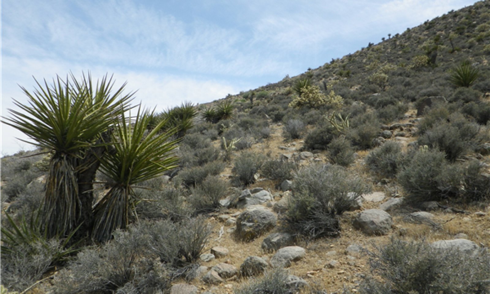
Elevations range from 1650 to 4000 feet and precipitation is between 4 to 8 inches per year. This LRU is distinguished from the Arid Western Mojave (XA) by the summer precipitation, falling between July and September, which tends to support more warm season plant species. The 'XB' LRU is generally east of the Mojave River and the 117 W meridian (Hereford et. al 2004). Vegetation includes creosote bush, burrobush, Nevada jointfir, ratany, Mojave yucca, Joshua tree, cacti, big galleta grass and several other warm season grasses. At the upper portions of the LRU, plant production and diversity are greater and blackbrush is a common dominant shrub.
Classification relationships
EPA Ecoregions level III - Predominantly Mojave Basin and Range with some areas in Central Basin and Range.
EPA Ecoregions level IV - Amargosa Desert, Arid Valleys and Canyonlands, Death Valley/Mojave Central Trough, Eastern Mojave Basins, Eastern Mojave Low Ranges and Arid Footslopes, Eastern Mojave Mountain Woodland and Shrubland, Tonopah Basin, Tonopah Sagebrush Foothills
United States National Vegetation Classification -
Class - 3 Xeromorphic Woodland, Scrub & Herb Vegetation Class
Subclass - 3.B Cool Semi-Desert Scrub & Grassland Subclass
Formation - 3.B.1 Cool Semi-Desert Scrub & Grassland Formation
Division - 3.B.1.Ne Western North American Cool Semi-Desert Scrub & Grassland Division
Macrogroup - 3.B.1.Ne.1 Chrysothamnus viscidiflorus - Coleogyne ramosissima / Achnatherum hymenoides Great Basin & Intermountain Dry Shrubland & Grassland Macrogroup
Group - 3.B.1.Ne.1.a Yucca brevifolia - Eriogonum fasciculatum - Ephedra fasciculata Mixed Desert Scrub Group
Alliance - 3.B.1.Ne.1.a Coleogyne ramosissima Mojave Desert Shrubland Alliance
(Schulz 2014)
Ecological site concept
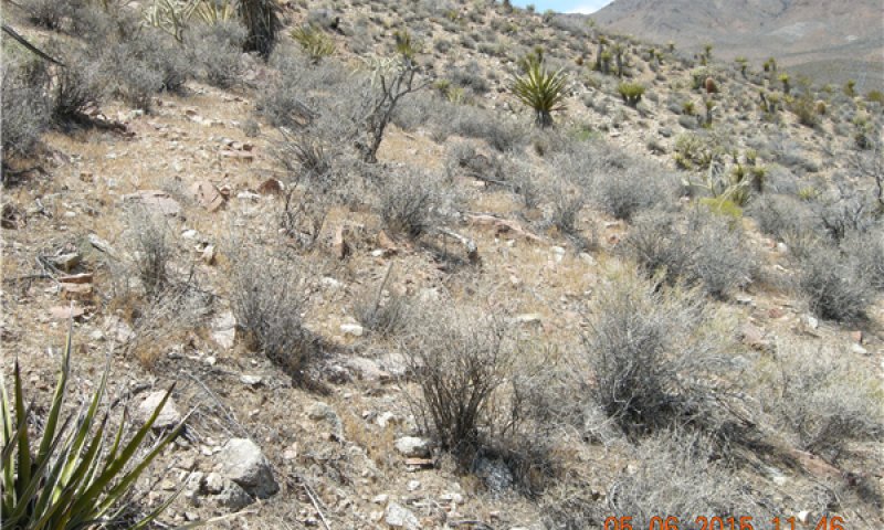
This ecological site occurs on hills and mountains on all aspects above 3800 feet but can occur as low as 3000 feet on northerly aspects. Mean annual air temperatures are relatively cooler than the majority of the Mojave Desert due to the close proximity of high elevation sky islands. Soils are formed in colluvium and residuum derived from igneous and plutonic metamorphosed material such as basalt, rhyolite, granodiorite and gneiss. Soils are typically shallow but deep soils may have an argillic horizon which act as an aquatard creating hydrologically similar characteristics. These soils do not have a calcic or petrocalcic horizon.
This is a group concept and provisional STM that also covers the following ecological sites: R029XY178CA, R029XY179CA, R029XY180CA, R030XA095NV, R030XB057NV, , R030XB060NV, R030XB166CA, R030XB010NV, R030XB062NV
Associated sites
| R030XB072NV |
STONY SLOPE 5-7 P.Z. R030XB072NV is found soils derived from colluvium and residuum from rhyolite and basalt where rock outcropings produce fragments larger than 10 inches, which cover more than 20% of the soil surface. |
|---|---|
| R030XB073NV |
VOLCANIC SLOPE 5-7 P.Z. R030XB073NV is on warmer slopes with higher evapotranspiration rates which usually occur at elevations below 3800 ft (1150 m). Soils are similar between the two ecological sites but R030XB073NV contains a greater mix of plant species found in warmer climates with very little chance of black brush recovery from any disturbance and no monospecific stands of blackbrush in any community phase of this ecological site. |
| R030XB100NV |
GRAVELLY CLAYPAN 5-7 P.Z. This site occurs on alluvial fans having a concave shape and with a calcic or petrocalcic horizon present or soil has a calcareous reaction class in the top 25 cm of the soil profile and generally below 3800 ft (1150 m). |
| R029XY010NV |
LOAMY SLOPE 8-10 P.Z. R029XY010NV has a mesic soil temperature regime and a xeric-aridic moisture regime with a mean annual precipitation higher than 8 inches. |
| R029XY077NV |
SHALLOW GRAVELLY LOAM 8-10 P.Z. R029XY077NV has a mesic soil temperature regime and a xeric-aridic moisture regime with a mean annual precipitation higher than 8 inches. |
| R030XB140CA |
Shallow Hill 4-6" P.Z. R030XB140CA is found on warmer, drier slopes generally less than 3800 feet in elevation and likely on south aspects in map units where the R030XB076NV can be found. Mean annual precipitation for the R030XB140CA is roughly between 4-6 inches or effective precipitation is less than -800 mm. |
| R030XB151CA |
Shallow Gravelly Loam 5-7" P.Z. R030XB151CA is found on soils derived from colluvium and residuum from granodiorite where rock outcrops produce fragments larger than 10 inches, which cover more than 20% of the soil surface. |
| R030XB028NV |
VALLEY WASH R030XB028NV is a wash which drains soils below 3800 ft in elevation. |
| R030XB029NV |
SHALLOW GRAVELLY LOAM 5-7 P.Z. R030XB029NV is found on adjacent erosional fan remnants in the upper fan piedmont. |
| R030XB068NV |
LIMESTONE HILL 5-7 P.Z. R030XB068NV shallow soils formed in residuum and colluvium from limestone and dolomite where fragments larger than 10 inches cover more than 15% of the soil surface. |
| R030XB102NV |
GRAVELLY LOAM 5-7 P.Z. This site occurs on alluvial fans with a calcic or petrocalcic horizon present in the top 25 cm of the soil profile. |
| R030XB172CA |
Warm Gravelly Shallow Hills R030XB172CA is found on warmer slopes, generally below 3800 ft where mafic igneous rock outcrops produce fragments over 10 inches which cover more than 15% of the soil surface. |
| R029XY009NV |
UPLAND WASH R029XY009NV has a mesic soil temperature regime and a xeric-aridic moisture regime with a mean annual precipitation higher than 8 inches. |
| R030XB164CA |
Steep South Slopes R030XB164CA is found on warmer steep slopes, generally less than 4000 ft elevation, with slopes generally greater than 30% slope. Surface fragments larger than 3/4 inch cover more than 80% of the soil surface. Volcanic rock outcrops, including plutonic rock types, are common in and around this ecological site. Soil temperatures for this site are likely hyperthermic even at higher elevations due to aspect, larger heat storage due to larger fragments and higher solar radiation due to slope. |
| R030XA044NV |
LOAMY HILL 5-7 P.Z. R030XA044NV is an ecological more likely to be common in MLRA 29 where annual average minimum temperatures are less than 5 degrees C. This site occurs in Plant Hardiness Zone 7b and cooler. |
| R030XA061NV |
LOAMY 5-7 P.Z. R030XA061NV is an ecological more likely to be common in MLRA 29 where annual average minimum temperatures are less than 5 degrees C. This site occurs in Plant Hardiness Zone 7b and cooler. |
| R030XB009CA |
Loamy Cool Aridic Fans 6-8 R030XB009CA is found on adjacent buried fan remnants, non-buried fan remnants, fan aprons, or other landforms which are not an erosional fan remnant and where washes do not deeply dissect the landscape. R030XB009CA soils are derived from alluvium from mixed sources, usually from volcanic and/or metamorphic rock types but not alluvium from limestone. |
| R030XB030NV |
SHALLOW LIMESTONE SLOPE 5-7 P.Z. R030XB030NV has shallow soils which developed in colluvium and residuum derived from limestone or dolomite where fragments larger than 10 inches cover less than 15% of the soil surface. A calcic or petrocalcic horizon is likely to be present. |
| R030XB039NV |
LIMY FAN 5-7 P.Z. R030XB039NV is found on warmer, drier adjacent buried fan remnants, non-buried fan remnants, fan aprons, or other landforms which are not an erosional fan remnant and where washes do not deeply dissect the landscape. Mean annual precipitation for this site is between 6-8 inches however effective precipitation for R030XB039NV is less than -800 mm. R030XB039NV soils are derived from alluvium of volcanic or limestone origins where soils either have a calcareous reaction class or a calcic or petrocalcic horizon. |
| R030XB047NV |
ALLUVIAL PLAIN R030XB047NV occurs within the playa landscape on lake plain or alluvial flat landforms where there is rare to no ponding and having sodic soils where the electrical conductivity is generally below 4 deciSiemens/meter and sodium adsorption ratio greater than 13. |
| R030XB052NV |
RUBBLY OUTWASH R030XB052NV is an inset fan, generally above 3800 feet which drains cool thermic soils where the average sum of July, August and September precipitation does not exceed more than 2.5 inches. |
| R030XB056NV |
SHALLOW GRANITIC SLOPE 5-7 P.Z. R030XB056NV soils form in colluvium and residuum derived from igneous and plutonic metamorphosed material where the material is intrusive, felsic and where fragments greater than 3 inches in width cover more than 15% of the soil surface. |
| R030XB070NV |
VOLCANIC HILL 5-7 P.Z. R030XB070NV soils form in colluvium and residuum derived from igneous and plutonic metamorphosed material where the material is extrusive, felsic and where fragments greater than 3 inches in width cover more than 15% of the soil surface. |
| R030XB108NV |
GRAVELLY INSET FAN 7-9 P.Z. This site occurs on alluvial fans having a concave shape and with a calcic or petrocalcic horizon present or soil has a calcareous reaction class in the top 25 cm of the soil profile and generally above 3800 ft (1150 m). |
| R030XB139CA |
Shallow Dry Hill 4-6 P.Z. R030XB139CA is the hyper-thermic or more arid equivalent to R030XB076NV and R030XB073NV. High gravel cover is likely to contribute to the development of a weak vesicular horizon and a hydrophobic soil surface. R030XB139CA is most likely to occur on steep south facing slopes within the 3000-4000 elevational range for the R030XB076NV ecological site, where large surface fragments, fragments greater than 3/4, cover less than 80% of the area and cobble, stone and boulder cover is less than 15%. |
| R030XC047CA |
Bi-Modal Semi-Arid Order 3 Ephemeral Wash R030XC047CA is an order 2-3 ephemeral stream, generally above 4000 feet, which drains bi-modal xeric-aridic soils with a thermic soil temperature regime where the sum of July, August and September precipitation exceeds 2.5 inches. |
| R030XC235CA |
Limestone Fan Remnants (Provisional) R030XC235CA occurs on alluvial fans composed of alluvium from limestone or volcanic sources where soils are moderately deep or deeper and the sum of July, August and September precipitation exceeds 2.5 inches. |
| R030XC236CA |
Lithic Slopes R030XC236CA occurs on nearby slopes of volcanic origins where the soils are very shallow to deep with surface fragments larger than 3 inches covering more than 15% of the soil surface. The sum of July, August and September precipitation exceeds 2.5 inches. |
| R030XB187CA |
Rarely Flooded Warm Thermic Ephemeral System R030XB187CA is a small wash with headwaters generally above 3800 meters elevation. Although this wash is small, water flow during flash flood events is strong enough to create various patterns of flooding disturbance. Soils in and around this wash generally have no argillic or calcic horizons creating a very deep sandy wash. |
| R030XC011NV |
GRAVELLY INSET FAN 7-9 P.Z. R030XC011NV is found on cooler inset fans and small ephemeral streams where flooding disturbance does not destroy calcic horizons within the soil profile nor long lived plant species such as blackbrush. The soil moisture regime is xeric-aridic and the sum of July, August and September precipitation exceeds 2.5 inches. |
| R030XC238CA |
Bi-Modal Semi-Desert Deep Fans 8-10 inches R030XC238CA occurs on alluvial fans derived predominantly from granitic sources. If alluvium is not from granitic sources, there is no diagnostic horizon present. |
| R030XB005NV |
Arid Active Alluvial Fans R030XB005NV is found on adjacent alluvial fans with a mean annual precipitation between 4-6 inches and where the effective precipitation is less than -800 mm. |
| F029XY065NV |
PIMO-JUOS/ARTRW8 F029XY065NV has a mesic soil temperature regime and a xeric-aridic moisture regime with a mean annual precipitation higher than 8 inches. |
| F030XC250NV |
Singleleaf Pinyon Pine Forestland F030XC250NV has a mesic soil temperature regime and a xeric-aridic moisture regime with a mean annual precipitation higher than 8 inches. |
Similar sites
| R030XB029NV |
SHALLOW GRAVELLY LOAM 5-7 P.Z. R030XB029NV is found on adjacent erosional fan remnants in the upper fan piedmont. |
|---|---|
| R029XY179CA |
SHALLOW GRANITIC SLOPE 5-8 P.Z. Conceptually the same ecological site. |
| R030XB071NV |
VOLCANIC SLOPE 7-9 P.Z. Conceptually the same ecological site. |
| R030XB166CA |
Dissected Pediment, Cool Conceptually the same ecological site. |
| R030XB189CA |
Shallow Cool Hills Conceptually the same ecological site. |
| R030XB193CA |
Very Shallow To Moderately Deep Gravelly Slopes Conceptually the same ecological site. |
| R030XB213CA |
Moderately Deep Gravelly Mountain Slopes Conceptually the same ecological site. |
| R029XY180CA |
SHALLOW GRAVELLY SLOPE 5-8" P.Z. Conceptually the same ecological site. |
| R030XA095NV |
SHALLOW GRAVELLY SLOPE 5-7 P.Z. Conceptually the same ecological site. |
| R030XB057NV |
SHALLOW GRANITIC LOAM 5-7 P.Z. Conceptually the same ecological site. |
| R030XB070NV |
VOLCANIC HILL 5-7 P.Z. Conceptually the same ecological site. |
| R030XC236CA |
Lithic Slopes R030XC236CA occurs on nearby slopes of volcanic origins where the soils are very shallow to deep with surface fragments larger than 3 inches covering more than 15% of the soil surface. The sum of July, August and September precipitation exceeds 2.5 inches. |
| R030XB151CA |
Shallow Gravelly Loam 5-7" P.Z. R030XB151CA is found on soils derived from colluvium and residuum from granodiorite where rock outcrops produce fragments larger than 10 inches, which cover more than 20% of the soil surface. |
| R030XB073NV |
VOLCANIC SLOPE 5-7 P.Z. R030XB073NV is on warmer slopes with higher evapotranspiration rates which usually occur at elevations below 3800 ft (1150 m). Soils are similar between the two ecological sites but R030XB073NV contains a greater mix of plant species found in warmer climates with very little chance of black brush recovery from any disturbance and no monospecific stands of blackbrush in any community phase of this ecological site. |
| R030XB072NV |
STONY SLOPE 5-7 P.Z. R030XB072NV is found on similar soils near rock outcrops where surface fragments larger than 10 inches cover more than 20% of the soil surface. |
| R030XC170CA |
Bouldery Slopes R030XC170CA occurs on slopes with soils derived from colluvium and/or residuum from granitic sources or gneiss where rock outcrops produce stones and boulders which cover more than 15% of the surface area. |
| R030XC189CA |
Bi-Modal Semi-Arid Shallow Cool Hills R030XC189CA occurs on slopes with soils derived from colluvium and/or residuum from granitic sources or gneiss stones and boulders cover less than 15% of the surface area. |
| R030XC234CA |
Fine-Loamy Very Deep Slopes R030XC234CA occurs on slopes with very deep soils derived from colluvium and/or residuum from volcanic sources. Soils have an argillic horizon and cobbles and stones cover less than 15% of the soil surface. |
| R030XB030NV |
SHALLOW LIMESTONE SLOPE 5-7 P.Z. R030XB030NV has shallow soils which developed in colluvium and residuum derived from limestone or dolomite where fragments larger than 10 inches cover less than 15% of the soil surface. A calcic or petrocalcic horizon is likely to be present. |
| R030XB056NV |
SHALLOW GRANITIC SLOPE 5-7 P.Z. R030XB056NV soils form in colluvium and residuum derived from igneous and plutonic metamorphosed material where the material is intrusive, felsic and where fragments greater than 3 inches in width cover more than 15% of the soil surface. |
| R029XY178CA |
SHALLOW CLAY LOAM 5-8 P.Z. Conceptually the same ecological site. |
Table 1. Dominant plant species
| Tree |
Not specified |
|---|---|
| Shrub |
(1) Coleogyne ramosissima |
| Herbaceous |
(1) Pleuraphis rigida |


Click on box and path labels to scroll to the respective text.