Natural Resources
Conservation Service
Ecological site R030XC232CA
Petrocalcic Fan Remnants
Last updated: 3/10/2025
Accessed: 04/07/2026
General information
Provisional. A provisional ecological site description has undergone quality control and quality assurance review. It contains a working state and transition model and enough information to identify the ecological site.
MLRA notes
Major Land Resource Area (MLRA): 030X–Mojave Basin and Range
MLRA Description:
Major Land Resource Area (MLRA) 30, Mojave Desert, is found in southern California, southern Nevada, the extreme southwest corner of Utah and northwestern Arizona within the Basin and Range Province of the Intermontane Plateaus. The climate of the area is hot and dry with mostly hyperthermic and thermic soil temperature regimes. However, at higher elevations of this MLRA, generally above 5,000 feet, soil temperature regimes can be mesic, cryic and frigid. The most arid regimes of this MLRA can receive less than 4 inches (100 mm) Elevations range from below sea level to over 12,000 feet (3650 meters) in the higher mountain areas found within the MLRA. Due to the extreme elevational range found within this MLRA, land resource units (LRUs) were designated to group the MLRA into similar land units.
LRU Description:
The Bi-Modal Semi-Arid (XC) Land Resource Unit (LRU), represents a semi-arid zone as defined by the United Nations Food and Agriculture Organization and is a semi-arid region distinguished by other semi-arid regions of the Mojave by the amounts of summer precipitation it receives. Semi-arid regions in the western Mojave can experience hot and very dry summers whereas regions within the XC LRU can receive more than 2.5 inches (63.5 mm) of rain during the months of July, August and September. The Bi-Modal Semi-Arid LRU is found primarily in eastern Mojave such as in Nevada at the higher elevations, in California in the New York, Providence, Castle and Clark Mountain Ranges as well as the Cerbat and Virgin Mountains of Arizona. Elevations range from approximately 4000 to 12,000 feet (1500 to 3650 meters) and precipitation ranges 8 to 18 inches (200 – 450 mm) per year in the form of rain. Snow is not uncommon in this LRU with the chance of receiving 3 to 48 inches of snow per year.
Due to the relatively high volume of summer rainfall, soil moisture regimes may have been designated as ustic-aridic, however emerging soil moisture data suggests the xeric-aridic soil moisture regime may be more appropriate and is likely to dominate this LRU. Soils within this LRU also have a cool thermic or cooler soil temperature regime. The combination of cooler temperatures [mean annual air temperatures lower than 62 degrees F (17 degrees C)] with summer monsoonal rains help to create a unique climate within the Mojave Desert which may be more similar to the Southern Nevada Basin and Range (MLRA). Vegetation at the lower elevations of this LRU includes blackbrush, Joshua tree, juniper, pinyon pine, and mountain big sagebrush. At the higher elevations, vegetation includes oaks, Mojave sagebrush, Ponderosa pine, white fir, limber pine and the Great Basin bristlecone pine.
Ecological site concept
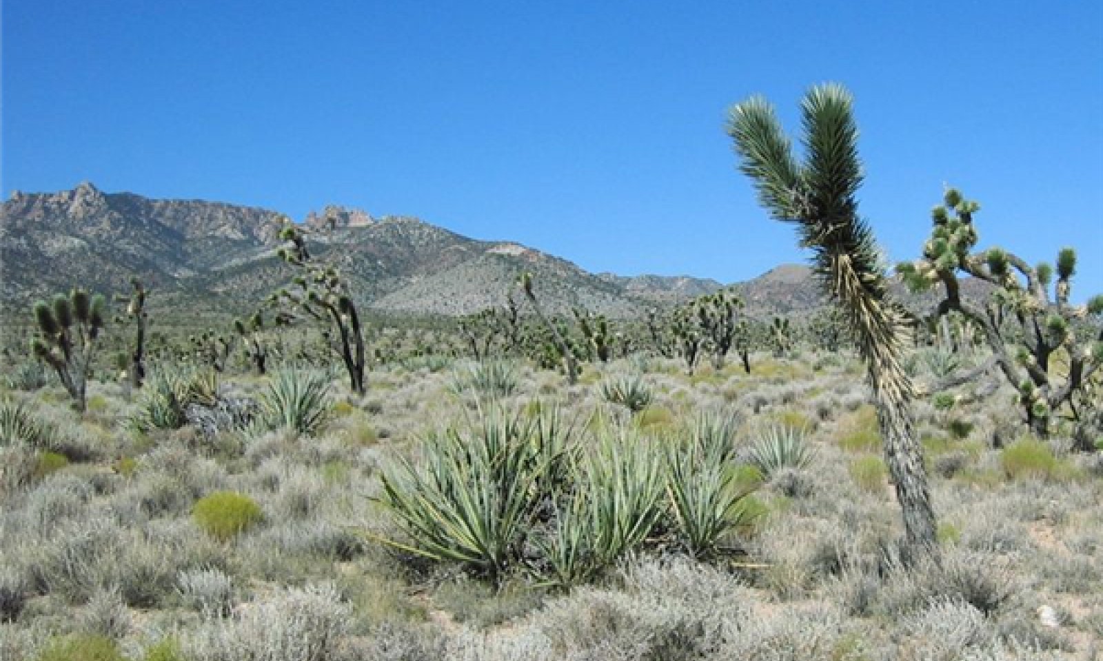
This ecological site is found on eroded alluvial fan remnants in the east Mojave Desert at elevations of 4300 to 5200 feet where the soil moisture regime is typic aridic bordering on ustic. Soils are calcic and shallow to moderately deep to a petrocalcic horizon. The plant community is co-dominated by winterfat and black grama (Bouteloua eriopoda). Big galleta (Pleuraphis rigida) is an important species. Jaeger''s Joshua Tree (Yucca brevifolia Engelm. var. jaegeriana) provides a sparse but uniform overstory canopy. Utah juniper (Juniperus osteosperma) occurs at higher elevation ranges.
This site is part of provisional concept R030XC034NV.
Associated sites
| R030XY219CA |
Ustic Ephemeral Drainageway Order 3 This site is found on adjacent large drainageways. |
|---|
Similar sites
| R030XB102NV |
GRAVELLY LOAM 5-7 P.Z. This ecological site is found at lower elevations, and does not have black grama. |
|---|---|
| R030XB080NV |
STONY LOAM 5-7 P.Z. This ecological site is found at lower elevations, it has higher production and does not have black grama. |
| R030XB089NV |
STONY LOAM 7-9 P.Z. This ecological site occurs on hills and mountains at lower elevations. It has much higher production, and does not have black grama. |
| R030XB069NV |
BASALTIC HILL 5-7 P.Z. This ecological site is found at lower elevations on basaltic parent material. White bursage is a dominant species. |
| R030XB085NV |
BASALTIC NORTH SLOPE 7-9 P.Z. This ecological site has basalt parent material, has higher production and a different composition of perennial grasses. |
| R030XB053NV |
SHALLOW HILL 5-7 P. Z. This ecological site is found at lower elevations on shallow soils. White bursage is a dominant species and black grama is not present. |
| R030XB091NV |
MOUNTAIN RIDGE This ecological site occurs on mountain ridges, and has lower production. |
Table 1. Dominant plant species
| Tree |
(1) Yucca brevifolia var. jaegeriana |
|---|---|
| Shrub |
(1) Krascheninnikovia lanata |
| Herbaceous |
(1) Bouteloua eriopoda |
Physiographic features
This ecological site occurs on summits, shoulders and backslopes of eroded alluvial fan remnants. It occurs at elevations of 4150 to 5050 feet on slopes of 2 to 15 percent. Slopes of 4 to 8 percent are typical. Runoff class ranges from low to high.
Table 2. Representative physiographic features
| Landforms |
(1)
Fan remnant
(2) Ballena |
|---|---|
| Flooding frequency | None |
| Ponding frequency | None |
| Elevation | 4,150 – 5,050 ft |
| Slope | 2 – 15% |
| Aspect | Aspect is not a significant factor |
Climatic features
The climate of this ecological site is characterized by hot temperatures, aridity, and a bimodal precipitation pattern. Precipitation falls as rain, with 40 percent falling in summer between July and October, and 49 percent falling in winter between November and March. The mean annual precipitation ranges from 7 to 9 inches and mean annual air temperature ranges from 55 to 63 degrees F. The frost free period is 201 to 240 days, and the freeze free period is 243 to 273 days.
Maximum and minimum monthly climate data for this ESD were generated by the Climate Summarizer
(http://www.nm.nrcs.usda.gov/technical/handbooks/nrph/Climate_Summarizer.xls) using data
from the following climate stations:
45890, Mountain Pass, CA (Period of record = 1955 to 2005) [1]
26739, Searchlight, NV (Period of record = 1914 to 2006) [1]
The data from multiple weather stations were combined to most accurately reflect the climatic conditions of this ecological site. These weather stations occur at the mid-elevation range of this ecological site.
Table 3. Representative climatic features
| Frost-free period (average) | 258 days |
|---|---|
| Freeze-free period (average) | 220 days |
| Precipitation total (average) | 8 in |
Figure 1. Monthly precipitation range
Figure 2. Monthly average minimum and maximum temperature
Figure 3. Annual precipitation pattern
Figure 4. Annual average temperature pattern
Influencing water features
Soil features
The soils associated with this ecological site formed in alluvium from limestone sources. Soils are shallow to moderately deep to a petrocalcic horizon. Surface textures are sandy and fine sandy loam and subsurface textures are sandy loam, fine sandy loam, cemented sand, cemented gravelly sand and cemented very gravelly fine sandy loam. Surface rock fragments less than 3 inches in diameter range from 17 to 65 percent, and larger fragments range from 0 to 1 percent. Subsurface fragments less than 3 inches in diameter range from 0 to 2 percent and larger fragments range from 13 to 25 percent for a depth from 0 to 39 inches. Soils have a thermic temperature regime and a typic aridic bordering on ustic soil moisture regime. The soils correlated with this site are classified as Calcic Petrocalcids. The soil series that have been correlated with this site include Sagamore and Stonekey.
The Sagamore series consists of very shallow and shallow, somewhat excessively drained soils that formed in alluvium from limestone. Surface textures are typically coarse loams with gravelly sandy loams and moderately cemented sand and moderately cemented very gravelly loamy sand beneath. Surface rock fragments ranges from 65 to 70 percent and are comprised of 41 to 65 percent gravel, 0 to 20 percent cobbles, 0 to 4 percent stones, and 0 to 2 percent boulders. A calcic horizon occurs at depths of 3 to 17 cm (1 to 7 inches) and a petrocalcic horizon occurs at depths of 25 to 36 cm (10 to 14 in). The Sagamore soils are on ballenas and fan remnants with slopes ranging from 2 to 30 percent. These soils are Loamy, carbonatic, thermic, shallow Calcic Petrocalcids.
The Stonekey series consists of moderately deep, well drained soils that formed in alluvium from dominantly limestone sources. Surface textures are coarse loams with sandy loams, gravelly sandy loams and weakly cemented loamy sands beneath. Surface rock fragments range from 30 to 70 percent, and are comprised of 15 to 70 percent gravel, 0 to 2 percent cobbles and 5 to 15 percent strongly cemented, gravel-sized calcium carbonate nodules. A calcic horizon occurs at depths of 5 to 50 centimeters (2 to 19 inches), and a petrocalcic horizon occurs at depths of 50 to 100 centimeters (19 to 39 inches. Stonekey soils are on fan remnants with slopes ranging from 2 to 15 percent. These soils are Coarse-loamy, carbonatic, thermic Calcic Petrocalcids.
This ecological site is correlated with the following map units and soil components in the Mojave National Preserve Soil Survey: (Mapunit number; Mapunit name; Component; phase; component percent)
4305; Stonekey-Sagamore complex, 2 to 8 percent slopes; Sagamore; 30; Stonekey; 55; Stonekey; moderately sloping; 6
4306; Stonekey-Rosshorse complex, 2 to 8 percent slopes; Sagamore; 5
4300; Sagamore-Stonekey complex, 4 to 30 percent slopes; Stonekey; 30
404; Lecyr-Ustidur complex, 8 to 30 percent slopes; Ustalfic Petrocalcids; 2
Table 4. Representative soil features
| Parent material |
(1)
Alluvium
–
limestone
|
|---|---|
| Surface texture |
(1) Gravelly sandy loam (2) Gravelly fine sandy loam |
| Family particle size |
(1) Loamy |
| Drainage class | Well drained to somewhat excessively drained |
| Permeability class | Moderately rapid |
| Soil depth | 10 – 39 in |
| Surface fragment cover <=3" | 17 – 65% |
| Surface fragment cover >3" | 1% |
| Available water capacity (0-40in) |
1 – 2.9 in |
| Calcium carbonate equivalent (0-40in) |
10 – 35% |
| Electrical conductivity (0-40in) |
2 mmhos/cm |
| Sodium adsorption ratio (0-40in) |
4 |
| Soil reaction (1:1 water) (0-40in) |
7.4 – 9 |
| Subsurface fragment volume <=3" (Depth not specified) |
2% |
| Subsurface fragment volume >3" (Depth not specified) |
13 – 25% |
Ecological dynamics
Abiotic factors
These mid-elevation eroded alluvial fan remnants located near the base of mountain fronts are composed of well-drained shallow to moderately deep soils with a petrocalcic horizon. The soils are slightly to moderately alkaline with an ustic aridic soil moisture regime. Due to the proximity of desert monsoons and orographic precipitation these mid-elevation alluvial fans receive more summer precipitation and annual precipitation than other similar landforms with similar soils. Winterfat is the dominant species of the reference plant community. This species has relatively high water requirements, and is most abundant and vigorous on soils receiving additional run-on from the nearby mountain slopes (Woodmansee and Potter 1971). Winterfat requires good soil drainage, and is most commonly found on slightly to moderately alkaline soils (Woodmansee, 1971). Black grama is also a dominant species at this site and grows well in areas with an ustic aridic soil moisture regime. Black grama is rarely found on soils with a typic aridic soil moisture regime. The ustic aridic soil moisture regime receives more summer precipitation than is typical of the aridic soil moisture regime.
Disturbance dynamics
The disturbances impacting this plant community are invasion by non-native annual species, livestock grazing, and fire.
Naturalization of non-native annual species such as red brome (Bromus rubens), cheatgrass (Bromus tectorum), and redstem storks bill (Erodium cicutarium) with European exploration and settlement from the 1860s through the 1900s (e.g. Brooks and Chambers 2011) caused a transition from the reference state, which contained only native species, to a state that included non-native species (State 2). Fire in the reference plant community was very rare. Winterfat communities are thought to have evolved without fire, due to a lack of fine fuels (Carey 1995, Hild and Wester 1995, Provencher et al. 2007). Invasion by non-native annual grasses may have increased the flammability of the invaded state by providing higher levels of fine fuels (e.g. Brown and Minnich 1986, Brooks et al. 2004, Brooks and Chambers 2011). After fire, these communities appear to be more susceptible to invasion by exotic grasses, which may lead to a grass-fire cycle (D'Antonio and Vitousek 1992). Winterfat is typically killed by moderate to severe intensity fire (Carey 1995), but may resprout after light fire (Havstad and James 2010). Winterfat re-establishment is greatly suppressed by the presence of abundant annual grasses (Hild et al. 2007), and recurrent fire prevents winterfat recovery, and causes a transition to a degraded state (State 3). Winterfat recovery may also be suppressed in the presence of abundant native perennial grasses, which typically recover well after fire (Woodmansee, 1971). Black grama typically demonstrates rapid recovery after fire (Potter and Krenetsky 1967, Allred and Snyder 2008), although the rate of recovery will depend on the climatic conditions, with recovery slower if fire occurs during drought when perennial grasses are dormant, or if drought occurs after fire. Black grama had recovered to 51% of pre-fire patch size five years after fire, and was projected to fully recover within 12 years in a Chihuahuan Desert grassland (Parmenter 2008).
Ranching was established in the eastern Mojave desert in approximately 1875 (Nystrom 2003). Grazing occurred unregulated in the area until the passage of the Taylor Grazing Act in 1934, which divided public land into allotments that were regulated by the Bureau of Land Management (BLM), and among other things, called for fenced ranges and multiple developed water sources (http://www.blm.gov/wy/st/en/field_offices/Casper/range/taylor.1.html). The Federal Land Policy and Management Policy Act of 1976 (FLPMA) brought further regulations, including 10-year grazing permits. In 1994 the California Desert Protection Act created the Mojave National Preserve, and the National Park Service took over management of grazing allotments in much of the eastern Mojave Desert where this site occurs. All of the area occupied by this ecological site within the Mojave National Preserve was retired from grazing in 2000 (Lanfair Valley and Kessler Spring Allotments) (Kim 2004).
Heavy cattle grazing in the arid west has been shown to have numerous negative effects on vegetative communities, including decrease cryptogram crust cover, decrease seedling survival, decrease total biomass, decrease perennial grass and shrub cover, and decrease litter cover (Jones 2000). In addition, soils and hydrology may be impacted, with reduced infiltration, increased runoff and erosion (e.g. Rauzi and Hanson 1966 1973, Jones 2000), and soil compaction (e.g. Rauzi and Hanson 1966, Abdel-Magid et al. 1987). Grazing in winterfat dominated communities has been demonstrated to increase soil compaction, lower soil aggregate stability, increase bare ground cover and decrease winterfat, biological crust, and liver cover (Rasmussen and Brotherson 1986, Matney 2010). Grazing may cause shifts in species composition from more palatable to less palatable species, and to species more tolerant of mechanical disturbance, or with a shorter life-cycle (Rasmussen and Brotherson 1986). Black grama may decline with heavy grazing (e.g. Yao et al. 2006, Allred and Snyder 2008, Havstad and James 2010), and especially with grazing during drought or during the summer growing season. Black grama cover may increase rapidly with protection from grazing, inhibiting or reducing winterfat recovery (Potter and Krenetsky 1967, Woodmansee and Potter 1971).
All tabular data listed for a specific community phase within this ecological site description represent a summary of one or more field data collection plots taken in modal communities within the community phase. Although such data are valuable in understanding the phase (kinds and amounts of ground and surface materials, canopy characteristics, community phase overstory and understory species, production and composition, and growth), they do not represent the absolute range of characteristics or an exhaustive listing of all species that may occur in that phase over the geographic range of the ecological site.
State and transition model

Figure 5. R030XB232CA
More interactive model formats are also available.
View Interactive Models
More interactive model formats are also available.
View Interactive Models
Click on state and transition labels to scroll to the respective text
State 1 submodel, plant communities
State 2 submodel, plant communities
State 3 submodel, plant communities
State 1
Reference (Provisional)
This state represents the natural range of variability for this ecological site, pre-European settlement. This state no longer exists due to the naturalization of non-native species in the Mojave Desert. Data for this State does not exist. This state had only native species, no livestock grazing, and fire was not a part of the natural disturbance cycle. Fluctuations in annual productivity would have occurred with climatic variability.
Community 1.1
Reference plant community
The reference plant community was dominated by winterfat and black grama. Jaeger’s Joshua tree provided a sparse but uniform overstory cover. Utah juniper (Juniperus osteosperma) was present at higher elevations of this ecological site, but is considered transitional in this site. Secondary perennial grasses including big galleta, desert needlegrass (Achnatherum speciosum), and bush muhly (Muhlenbergia porteri) contributed significant annual production. Secondary shrubs were present at low abundance.
State 2
Non-native species present
This is the current potential state for this ecological site. It is similar in composition to the historical plant community, but non-native species are present, and livestock grazing and severe, large fire introduce new ecological dynamics.
Community 2.1
Current reference community

Figure 6. Community Phase 2.1
This plant community is dominated by winterfat, which provides at least 25% of annual production. Black grama is the dominant perennial grass, at 16 to 20% annual production, and big galleta, Indian ricegrass (Achnatherum hymenoides) and bush muhly (Muhlenbergia porterii) are important secondary perennial grasses. A diverse assemblage of secondary shrubs is present, and Nevada ephedra (Ephedra nevadensis), banana yucca (Yucca baccata), littleleaf ratany (Krameria erecta, and waterjacket (Lycium cooperi) are typical. Native perennial forbs including desert globemallow (Sphaeralcea ambigua), desert trumpet (Eriogonum inflatum), and whitestem paperflower (Psilostrophe cooperi) contribute a small proportion of annual production. The invasive annual grass red brome, and the non-native redstem storks bill are present but contribute only trace annual production. Ungrazed current reference community data are not available, as this unique ecological site is limited in geographic extent, no known portions of which were kept free of grazing. The community phase data presented below has been free of grazing for approximately 11 years, and represent the best ecological condition that could be located. Winterfat and perennial grass production and cover were probably higher prior to grazing, and species evenness lower. Increasers (non-palatable and seral species) such as snakeweed (Gutierrezia microcephala), desert globemallow and desert trumpet would have been less abundant.
Figure 7. Annual production by plant type (representative values) or group (midpoint values)
Table 5. Annual production by plant type
| Plant type | Low (lb/acre) |
Representative value (lb/acre) |
High (lb/acre) |
|---|---|---|---|
| Shrub/Vine | 350 | 400 | 450 |
| Grass/Grasslike | 200 | 275 | 350 |
| Forb | 20 | 25 | 30 |
| Tree | 15 | 25 | 30 |
| Total | 585 | 725 | 860 |
Table 6. Ground cover
| Tree foliar cover | 0-1% |
|---|---|
| Shrub/vine/liana foliar cover | 25% |
| Grass/grasslike foliar cover | 23-25% |
| Forb foliar cover | 2-7% |
| Non-vascular plants | 0% |
| Biological crusts | 0% |
| Litter | 0-1% |
| Surface fragments >0.25" and <=3" | 31-55% |
| Surface fragments >3" | 0-2% |
| Bedrock | 0% |
| Water | 0% |
| Bare ground | 12-31% |
Table 7. Canopy structure (% cover)
| Height Above Ground (ft) | Tree | Shrub/Vine | Grass/ Grasslike |
Forb |
|---|---|---|---|---|
| <0.5 | – | – | 4-5% | 2-2% |
| >0.5 <= 1 | – | 1-2% | 0-6% | 0-1% |
| >1 <= 2 | – | 11-16% | 16-18% | 1-8% |
| >2 <= 4.5 | – | 6-7% | 0-1% | – |
| >4.5 <= 13 | 1-2% | – | – | – |
| >13 <= 40 | – | – | – | – |
| >40 <= 80 | – | – | – | – |
| >80 <= 120 | – | – | – | – |
| >120 | – | – | – | – |
Community 2.2
Black grama - Jaegers Joshua Tree
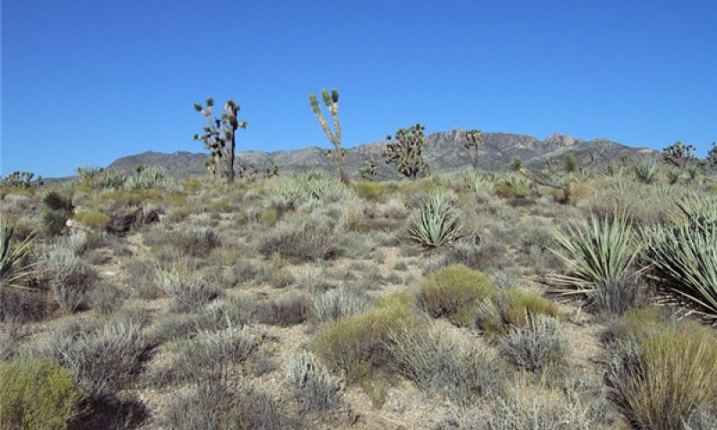
Figure 8. Community Phase 2.2
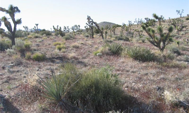
Figure 9. Community Phase 2.2 High red brome
The community phase data presented in the tables and described in the narrative below represent a typical example of community composition with 11 years recovery from heavy grazing use. Depending on which stage of recovery, and climatic conditions after recovery, different community compositions are likely. Although both winterfat and black grama are negatively impacted by heavy grazing, black grama often recovers more quickly than winterfat, sometimes limiting winterfat recovery (Potter and Krenetsky 1967, Woodmansee and Potter 1971). This community phase is characterized by dominance by black grama, with at least 30% annual production. Winterfat contributes less than 15% of annual production. Community evenness increases as non-palatable and seral species become more abundant. Increasers such as snakeweed, Nevada ephedra, banana yucca, desert almond (Prunus fasciculata), Mexican bladdersage (Salazaria mexicana), fluffgrass (Dasyochloa pulchella), desert globemallow, and desert trumpet contribute more than 50% of annual production. Non-native annual species contribute 1% or more of annual production with adequate winter precipitation. Ecological resilience is relatively high in this plant community. Total plant cover is not impacted, and negative effects on soils are minor. However, increased annual cover makes this community more susceptible to burning, and sustained overgrazing will cause increases in bare ground with decline in plant cover, and soil compaction may occur with trampling. Increased bare ground with compacted soil is likely to have reduced infiltration rates, greater run-off, and a risk of erosion. Gullying and plant pedestalling may develop, and should be considered signs that the community is at risk of transitioning to a degraded state.
Figure 10. Annual production by plant type (representative values) or group (midpoint values)
Table 8. Annual production by plant type
| Plant type | Low (lb/acre) |
Representative value (lb/acre) |
High (lb/acre) |
|---|---|---|---|
| Shrub/Vine | 250 | 300 | 350 |
| Grass/Grasslike | 200 | 250 | 300 |
| Forb | 20 | 50 | 80 |
| Tree | 15 | 20 | 30 |
| Total | 485 | 620 | 760 |
Table 9. Ground cover
| Tree foliar cover | 1-2% |
|---|---|
| Shrub/vine/liana foliar cover | 17-30% |
| Grass/grasslike foliar cover | 25-35% |
| Forb foliar cover | 1-5% |
| Non-vascular plants | 0% |
| Biological crusts | 0% |
| Litter | 3-6% |
| Surface fragments >0.25" and <=3" | 42-67% |
| Surface fragments >3" | 0-10% |
| Bedrock | 0% |
| Water | 0% |
| Bare ground | 3-45% |
Table 10. Canopy structure (% cover)
| Height Above Ground (ft) | Tree | Shrub/Vine | Grass/ Grasslike |
Forb |
|---|---|---|---|---|
| <0.5 | – | – | 3-6% | 4-5% |
| >0.5 <= 1 | – | 4-4% | 2-3% | – |
| >1 <= 2 | – | 5-14% | 26-31% | 1-2% |
| >2 <= 4.5 | – | 7-8% | 0-1% | – |
| >4.5 <= 13 | 1-2% | – | – | – |
| >13 <= 40 | – | – | – | – |
| >40 <= 80 | – | – | – | – |
| >80 <= 120 | – | – | – | – |
| >120 | – | – | – | – |
Community 2.3
Fire Recovery (Provisional)
This community phase develops with moderate to severe fire. Winterfat is killed, and faster recovering perennial grass species dominate. Perennial forbs increase in importance. Secondary shrubs increase in importance. These include species capable of resprouting after fire, such as banana yucca, fourwing saltbush, waterjacket, Nevada jointfir, desert almond and Mexican bladdersage, and species capable of rapidly recolonizing after disturbance, such as burrobush (Hymenoclea salsola), rayless goldenhead (Acamptopappus sphaerocephalus), snakeweed, and Parish’s goldeneye (Viguiera parishii). This community phase is at risk of transitioning to a degraded state with recurrent fire, grazing during early fire recovery, or grazing during drought.
Pathway 2.1a
Community 2.1 to 2.2
Occurs with grazing.
Pathway 2.1b
Community 2.1 to 2.3
Occurs with moderate to severe fire.
Pathway 2.2a
Community 2.2 to 2.1
Occurs with rest from grazing and the absence of additional disturbance including severe drought. The time necessary for recovery is unknown.
Pathway 2.2b
Community 2.2 to 2.3
Occurs with moderate to severe fire.
Pathway 2.3a
Community 2.3 to 2.1
Occurs with time, with no additional disturbance including grazing and severe drought. The time necessary for recovery is unknown.
State 3
Degraded (Provisional)
This state develops with recurrent fire, or sustained overgrazing, especially overgrazing combined with severe drought or during early fire recovery.
Community 3.1
Severely degraded
Annual species such as red brome dominate this community phase. Perennial forbs including desert globemallow, desert trumpet, and rose heath (Chaetopappa ericoides) are abundant. Short-lived shrubs such as snakeweed, burrobush, and rayless goldenhead colonize with time.
Transition 1
State 1 to 2
This transition occurred with naturalization of non-native annual species such as red brome (Bromus rubens), cheatgrass (Bromus tectorum), and redstem storks bill (Erodium cicutarium) with European exploration and settlement from the 1860s through the 1900s (e.g. Brooks and Chambers 2011). The ubiquitous presence of non-native annuals means that removing them entirely is essentially impossible.
Transition 1
State 1 to 2
This transition occurred with naturalization of non-native annual species such as red brome (Bromus rubens), cheatgrass (Bromus tectorum), and redstem storks bill (Erodium cicutarium) with European exploration and settlement from the 1860s through the 1900s (e.g. Brooks and Chambers 2011). The ubiquitous presence of non-native annuals means that removing them entirely and returning to the reference state is essentially impossible.
Transition 2
State 2 to 3
Occurs with repeated severe fire or with continued overgrazing, especially during drought or after fire.
Restoration pathway 2
State 3 to 2
This pathway occurs with revegetation (outplanting and/or seeding) of native shrub and grass species into burned areas with herbicide application to treat annual grasses.
Additional community tables
Table 11. Community 2.1 plant community composition
| Group | Common name | Symbol | Scientific name | Annual production (lb/acre) | Foliar cover (%) | |
|---|---|---|---|---|---|---|
|
Shrub/Vine
|
||||||
| 1 | Shrubs | 350–450 | ||||
| winterfat | KRLA2 | Krascheninnikovia lanata | 200–300 | 6–10 | ||
| threadleaf snakeweed | GUMI | Gutierrezia microcephala | 30–85 | 3–6 | ||
| littleleaf ratany | KRER | Krameria erecta | 15–80 | 1–2 | ||
| Nevada jointfir | EPNE | Ephedra nevadensis | 15–25 | 1–3 | ||
| water jacket | LYAN | Lycium andersonii | 3–25 | 1–2 | ||
| banana yucca | YUBA | Yucca baccata | 1–15 | 2–5 | ||
| Engelmann's hedgehog cactus | ECEN | Echinocereus engelmannii | 0–3 | 0–1 | ||
| beavertail pricklypear | OPBA2 | Opuntia basilaris | 0–1 | 0–1 | ||
|
Grass/Grasslike
|
||||||
| 2 | Native perennial grasses | 200–350 | ||||
| big galleta | PLRI3 | Pleuraphis rigida | 50–160 | 6–13 | ||
| black grama | BOER4 | Bouteloua eriopoda | 115–150 | 14–17 | ||
| desert needlegrass | ACSP12 | Achnatherum speciosum | 4–50 | 1–2 | ||
| bush muhly | MUPO2 | Muhlenbergia porteri | 6–15 | 1–3 | ||
| Indian ricegrass | ACHY | Achnatherum hymenoides | 3–9 | 0–1 | ||
| low woollygrass | DAPU7 | Dasyochloa pulchella | 0–1 | 0–1 | ||
| purple threeawn | ARPU9 | Aristida purpurea | 0–1 | 0–1 | ||
| 6 | Non-native annual grasses | 0–5 | ||||
| red brome | BRRU2 | Bromus rubens | 0–5 | 1–5 | ||
|
Forb
|
||||||
| 3 | Native perennial forbs | 20–30 | ||||
| whitestem paperflower | PSCO2 | Psilostrophe cooperi | 3–17 | 0–1 | ||
| desert marigold | BAMU | Baileya multiradiata | 0–10 | 0–1 | ||
| desert trumpet | ERIN4 | Eriogonum inflatum | 3–9 | 1–3 | ||
| desert globemallow | SPAM2 | Sphaeralcea ambigua | 2–9 | 0–1 | ||
| 5 | Native annual forbs | 0–2 | ||||
| cryptantha | CRYPT | Cryptantha | 0–1 | 0–1 | ||
| desert Indianwheat | PLOV | Plantago ovata | 0–1 | 0–1 | ||
| 7 | Non-native annual forbs | 0–1 | ||||
| redstem stork's bill | ERCI6 | Erodium cicutarium | 0–1 | 1–3 | ||
|
Tree
|
||||||
| 4 | Trees | 15–30 | ||||
| Jaeger's Joshua tree | YUBRJ | Yucca brevifolia var. jaegeriana | 15–30 | 1–2 | ||
Table 12. Community 2.2 plant community composition
| Group | Common name | Symbol | Scientific name | Annual production (lb/acre) | Foliar cover (%) | |
|---|---|---|---|---|---|---|
|
Shrub/Vine
|
||||||
| 1 | Shrubs | 250–350 | ||||
| winterfat | KRLA2 | Krascheninnikovia lanata | 50–80 | 6–9 | ||
| threadleaf snakeweed | GUMI | Gutierrezia microcephala | 50–70 | 5–7 | ||
| Nevada jointfir | EPNE | Ephedra nevadensis | 40–60 | 3–5 | ||
| littleleaf ratany | KRER | Krameria erecta | 5–40 | 1–3 | ||
| Mexican bladdersage | SAME | Salazaria mexicana | 0–35 | 0–4 | ||
| water jacket | LYAN | Lycium andersonii | 5–30 | 1–3 | ||
| banana yucca | YUBA | Yucca baccata | 10–20 | 2–4 | ||
| desert almond | PRFA | Prunus fasciculata | 0–20 | 0–1 | ||
| Parish's goldeneye | VIPA14 | Viguiera parishii | 0–15 | 0–1 | ||
| burrobrush | HYSA | Hymenoclea salsola | 0–5 | 0–1 | ||
| rayless goldenhead | ACSP | Acamptopappus sphaerocephalus | 0–5 | 0–1 | ||
| fourwing saltbush | ATCA2 | Atriplex canescens | 0–5 | 0–1 | ||
| Engelmann's hedgehog cactus | ECEN | Echinocereus engelmannii | 0–1 | 0–1 | ||
|
Grass/Grasslike
|
||||||
| 2 | Perennial grasses | 200–300 | ||||
| black grama | BOER4 | Bouteloua eriopoda | 190–225 | 16–20 | ||
| big galleta | PLRI3 | Pleuraphis rigida | 40–60 | 7–13 | ||
| Indian ricegrass | ACHY | Achnatherum hymenoides | 3–12 | 0–1 | ||
| bush muhly | MUPO2 | Muhlenbergia porteri | 2–5 | 0–1 | ||
| desert needlegrass | ACSP12 | Achnatherum speciosum | 0–3 | 0–2 | ||
| low woollygrass | DAPU7 | Dasyochloa pulchella | 0–1 | 0–1 | ||
| 6 | Non-native annual grasses | 4–10 | ||||
| red brome | BRRU2 | Bromus rubens | 4–10 | 1–5 | ||
|
Forb
|
||||||
| 3 | Native perennial forbs | 20–60 | ||||
| desert trumpet | ERIN4 | Eriogonum inflatum | 5–60 | 0–1 | ||
| desert globemallow | SPAM2 | Sphaeralcea ambigua | 7–20 | 0–2 | ||
| desert marigold | BAMU | Baileya multiradiata | 0–20 | 0–1 | ||
| rose heath | CHER2 | Chaetopappa ericoides | 0–20 | 0–1 | ||
| whitestem paperflower | PSCO2 | Psilostrophe cooperi | 2–4 | 0–1 | ||
| 5 | Native annual forbs | 0–1 | ||||
| cryptantha | CRYPT | Cryptantha | 0–1 | 0–1 | ||
| desert Indianwheat | PLOV | Plantago ovata | 0–1 | 0–1 | ||
| 7 | Non-native annual forbs | 1–10 | ||||
| redstem stork's bill | ERCI6 | Erodium cicutarium | 1–10 | 0–2 | ||
|
Tree
|
||||||
| 4 | Trees | 15–30 | ||||
| Jaeger's Joshua tree | YUBRJ | Yucca brevifolia var. jaegeriana | 15–30 | 1–2 | ||
Interpretations
Animal community
Winterfat provides highly valuable winter forage for native browsers and domestic wildlife (e.g. Carey 1995, Matney 2010). Big galleta is a valuable forage plant for livestock, and is especially palatable after summer rains (Williams 2003). Declines in big galleta were observed with grazing in burned Utah blackbrush communities (Hughes 2002), and in intact creosote bush communities in Arizona (Hughes 1982). Declines in both communities occurred regardless of grazing management system, and are likely due to heavy utilization during periods of drought (Hughes 1982). Black grama is considered excellent forage for livestock and wildlife (Simonin 2000). Black grama is tolerant of light grazing, but is generally a decreaser under grazing, and is especially susceptible to damage during summer grazing (Simonin 2000). Vegetative growth is suppressed with trampling, which can reduce black grama cover and vigor (Simonin 2000).
Recreational uses
This site is used for hiking and aesthetic enjoyment. This site is of interest to botanists as the plant assemblage is unusual in California (Sawyer et al. 2009) and in the Mojave National Preserve.
Supporting information
Inventory data references
High intensity sampling (Caudle et al. 2013) was used to describe this ecological site. Site characteristics such as aspect, slope, elevation and UTMS were recorded for each plot, along with complete species inventory by ocular percent cover. The line-point intercept method was used to measure foliar cover, groundcover, and vegetation structure. At either 300 or 100 points along a 600- or 400-foot step transect, ground cover and intercepted plant species were recorded by height. The first hit method (Herrick et al. 2009) was used to generate the foliar cover values entered in the community phase composition tables. Annual production was estimated using the double-weight sampling method outlined in the National Range and Pasture Handbook and in Sampling Vegetation Attributes (NRCS 2003 and Interagency Technical Reference 1999 pgs. 102 - 115). For herbaceous vegetation, ten 9.6 square foot circular sub-plots were evenly distributed along a 200 foot transect. For woody and larger herbaceous species production was estimated in four 21’X21’ square plots along the same transect. Weight units were collected for each species encountered in the production plots. The number of weight units for each species is then estimated for all plots.
Community Phase 2.1
11CA795118 (Type location)
11CA795141
Community Phase 2.2
11CA795021
2011CA795044
11CA795143
11CA795215 (Photographs and notes only)
Type locality
| Location 1: San Bernardino County, CA | |
|---|---|
| Township/Range/Section | T14N R16E S35 |
| UTM zone | N |
| UTM northing | 3901625 |
| UTM easting | 660981 |
| General legal description | In Mojave National Preserve, approximately 2.7 miles on Ivanpah-Lanfair Road from the New York Mountain Road intersection, then approximately 1 mile at 273 degrees on an unnamed road. |
Other references
Abdel-Magid, A. H., M. J. Tritica, and R. H. Hart. 1987. Soil and vegetation response to simulated trampling. Journal of Range Management 40:303-306.
Allred, B. W. and K. A. Snyder. 2008. Ecophysiological responses of Chihuahuan desert grasses to fire. Journal of Arid Environments 72:1989-1996.
Brooks, M. L. and J. C. Chambers. 2011. Resistance to invasion and resilience to fire in desert shrublands of North America. Rangeland Ecological Management 64:431-438.
Brooks, M. L., C. M. D''Antonio, D. M. Richardson, J. B. Grace, J. E. Keeley, J. M. DiTomaso, R. J. Hobbs, M. Pellant, and D. Pyke. 2004. Effects of invasive alien plants on fire regimes. Bioscience 54:677-689.
Brown, D. E. and R. A. Minnich. 1986. Fire and Changes in Creosote Bush Scrub of the Western Sonoran Desert, California. American Midland Naturalist 116:411-422.
Carey, J. H. 1995. Krascheninnikovia lanata. Fire Effects Information System, [Online]. U.S. Department of Agriculture, Forest Service, Rocky Mountain Research Station, Fire Sciences Laboratory.
Caudle, D., H. Sanchez, J. DiBenedetto, C. Talbot, and M. Karl. 2013. Interagency ecological site handbook for rangelands. USDA-NRCS, USDA-FS, DOI-BLM.
D'Antonio, C. M. and P. M. Vitousek. 1992. Biological invasions by exotic grasses, the grass/fire cycle, and global change. Annual Review of Ecology and Systematics 23:63-87.
Havstad, K. M. and D. James. 2010. Prescribed burning to affect a state transition in a shrub-encroached desert grassland. Journal of Arid Environments 74:1324-1328.
Herrick, J. E., J. W. V. Zee, K. M. Havstad, L. M. Burkett, and W. G. Whitford. 2009. Monitoring manual for grassland, shrubland, and savanna ecosystems. Volume I: Quick Start. USDA-ARS Jornada Experimental Range, Tucson, AZ.
Hild, A. L., J. M. Muscha, and N. L. Shaw. 2007. Emergence and growth of four winterfat accessions in the presence of the exotic annual cheatgrass. Pages 147-152 in Shrubland dynamics - fire and water. U.S. Department of Agriculture, Forest Service, Rocky Mountain Research Station, Lubbock, TX.
Hild, A. L. and D. B. Wester. 1995. Winterfat shrubland boundary dynamics under different grazing histories. Pages 51-57 in Shrubland ecosystem dynamics in a changing environment. U.S. Department of Agriculture, Forest Servce, Intermountain Research Station, Las Cruces, NM.
Hughes, L. E. 1982. A grazing system in the Mohave Desert. Rangelands 4:256-257.
Hughes, L. E. 2002. Is there recovery after fire, drought, and overgrazing? Rangelands 24:26-30.
Jones, A. 2000. Effects of cattle grazing on North American arid ecosystems: a quantitative review. Western North American Naturalist 60:155-164.
Kim, C. B. 2004. Draft livestock management plan for the Mojave National Preserve. Unpublished report.
Matney, C. A. 2010. An assessment of plant community structure, herbivory, soils, and state-and-transition theory on a winterfat (Krasheninnikovia lanata [Pursh] ADJ Meeuse & Smit) ecological site. Ph.D. Thesis. Oregon State University.
Nystrom, E. C. 2003. From neglected space to protected place: an administrative history of the Mojave National Preserve. USDOI National Park Service Mojave National Preserve.
Parmenter, R. R. 2008. Long-term effects of a summer fire on desert grassland plant demographics in New Mexico. Rangeland Ecological Management 61:156-168.
Potter, L. D. and J. C. Krenetsky. 1967. Plant succession with released grazing on New Mexico range lands. Journal of Range Management 20:145-151.
Provencher, L., T. A. Forbis, L. Frid, and G. Medlyn. 2007. Comparing alternative management strategies of fire, grazing, and weed control using spatial modeling. Ecological Modelling 209:249-263.
Sawyer, J. O., T. Keeler-Woolf, and J. M. Evans. 2009. A manual of California vegetation. 2nd edition. California Native Plant Society, Sacramento, California.
Simonin, K. A. 2000. Bouteloua eriopoda. Fire Effects Information System, [Online]. U.S. Department of Agriculture, Forest Service, Rocky Mountain Research Station, Fire Sciences Laboratory.
Rasmussen, L. L. and J. D. Brotherson. 1986. Response of winterfat communities to release from grazing pressure. The Great Basin Naturalist 46:148-156.
Rauzi, F. and C. L. Hanson. 1966. Water intake and runoff as affected by intensity of grazing. Journal of Range Management 19:351-356.
Williams, G. W. 2003. Reference on the American Indian use of fire in ecosystems. US Forest Service.
Woodmansee, R. G. and L. D. Potter. 1971. Natural reproduction of winterfat (Eurotia lanata) in New Mexico. Journal of Range Management 24:24-30.
Yao, J., D. P. C. Peters, K. M. Havstad, R. P. Gibbens, and J. E. Herrick. 2006. Multi-scale factors and long-term response of Chihuahuan Desert grasses to drought. Landscape Ecology 21:1217-1231.
Approval
Kendra Moseley, 3/10/2025
Rangeland health reference sheet
Interpreting Indicators of Rangeland Health is a qualitative assessment protocol used to determine ecosystem condition based on benchmark characteristics described in the Reference Sheet. A suite of 17 (or more) indicators are typically considered in an assessment. The ecological site(s) representative of an assessment location must be known prior to applying the protocol and must be verified based on soils and climate. Current plant community cannot be used to identify the ecological site.
| Author(s)/participant(s) | Dustin Detweiler |
|---|---|
| Contact for lead author | Dustin Detweiler |
| Date | 12/16/2014 |
| Approved by | Kendra Moseley |
| Approval date | |
| Composition (Indicators 10 and 12) based on | Annual Production |
Indicators
-
Number and extent of rills:
None. -
Presence of water flow patterns:
None. -
Number and height of erosional pedestals or terracettes:
Grasses are slightly pedestalled about 1/4 inch as water relocates fine material from open spaces. Few terracettes exist and are about 3 to 4 inches high. These larger terracettes are mostly associated with shrubs. Smaller and weak terracettes are formed in the grasses and are so small that they are difficult to measure. -
Bare ground from Ecological Site Description or other studies (rock, litter, lichen, moss, plant canopy are not bare ground):
10 to 15% bare ground at this site. -
Number of gullies and erosion associated with gullies:
None. -
Extent of wind scoured, blowouts and/or depositional areas:
None. -
Amount of litter movement (describe size and distance expected to travel):
Fine litter may move several feet. Medium woody litter does not move more than one foot. There is very little large woody litter produced at this site. -
Soil surface (top few mm) resistance to erosion (stability values are averages - most sites will show a range of values):
Areas without biological soil crusts as well as weak incipient crusts break down into single grain and have a stability value between 4 and 6. Biological crusts create weak surface structure in open areas and generally have a stability value between 2 and 3. Soil surface is protected by high gravel cover. -
Soil surface structure and SOM content (include type of structure and A-horizon color and thickness):
Soil surface structure is weak medium platy to moderate thick platy structure. Soil organic matter is less than 0.5%. A-horizons may be from 2 to 16 inches thick and are pale brown. -
Effect of community phase composition (relative proportion of different functional groups) and spatial distribution on infiltration and runoff:
Shrubs are likely to increase infiltration as they slow water movement and provide habitat for burrowing animals. Grasses may be too weak to slow water movement as grass interspaces are eroded to a gravel and/or a crusted layer while shrub interspaces usually have recent deposition. -
Presence and thickness of compaction layer (usually none; describe soil profile features which may be mistaken for compaction on this site):
None. -
Functional/Structural Groups (list in order of descending dominance by above-ground annual-production or live foliar cover using symbols: >>, >, = to indicate much greater than, greater than, and equal to):
Dominant:
Native ShrubsSub-dominant:
Native perennial grassesOther:
Native perennial forbs >= Joshua treesAdditional:
-
Amount of plant mortality and decadence (include which functional groups are expected to show mortality or decadence):
Some Joshua trees show decadence in response to periodic drought. Some native perennial shrubs increase with grazing and can be expected to show some mortality with rest from grazing. Other native perennial shrubs such as cacti can show moderate mortality rates following periodic drought. -
Average percent litter cover (%) and depth ( in):
The percent litter is between 5 to 10%. Most litter is a single piece of plant debris and is used moved by wind and water and trapped beneath plants. -
Expected annual annual-production (this is TOTAL above-ground annual-production, not just forage annual-production):
Expected annual production is between 585 to 860 lbs/acre. -
Potential invasive (including noxious) species (native and non-native). List species which BOTH characterize degraded states and have the potential to become a dominant or co-dominant species on the ecological site if their future establishment and growth is not actively controlled by management interventions. Species that become dominant for only one to several years (e.g., short-term response to drought or wildfire) are not invasive plants. Note that unlike other indicators, we are describing what is NOT expected in the reference state for the ecological site:
None -
Perennial plant reproductive capability:
This site is cooler and has more summer moisture than most of the Mojave Desert so perennial plant reproductive capability is high.
Print Options
Sections
Font
Other
The Ecosystem Dynamics Interpretive Tool is an information system framework developed by the USDA-ARS Jornada Experimental Range, USDA Natural Resources Conservation Service, and New Mexico State University.
Click on box and path labels to scroll to the respective text.