Natural Resources
Conservation Service
Ecological site R030XY046NV
OUTWASH PLAIN
Last updated: 2/24/2025
Accessed: 04/09/2026
General information
Provisional. A provisional ecological site description has undergone quality control and quality assurance review. It contains a working state and transition model and enough information to identify the ecological site.
Ecological site concept
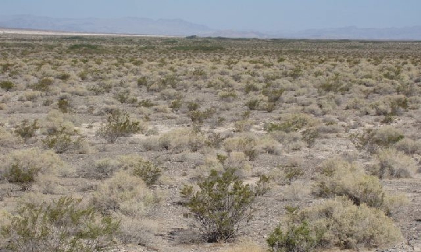
This site occurs on alluvial flats and lake plains. Slopes range from 0 to 8 percent, but slope gradients of 0 to 4 percent are typical. Elevations are 1000 to 4500 feet. The soils associated with this site are deep alluvium derived from mixed sources. Available water capacity is low to high, runoff is negligible to medium, and the soils are well drained to somewhat excessively drained.
This site is part of group concept R030XB046NV.
Associated sites
| R030XB004NV |
SANDY 5-7 P.Z. |
|---|---|
| R030XB005NV |
Arid Active Alluvial Fans |
| R030XY047NV |
ALLUVIAL PLAIN |
Similar sites
| R030XY047NV |
ALLUVIAL PLAIN AMDU2 and LATR2 minor shrubs |
|---|---|
| R030XB065NV |
SODIC SAND More productive site; PLRI3 dominant plant |
| R030XB050NV |
Calcic Dry Wash Less productive site; occurs within, and immediately adjacent, to active floodplain of ephemeral stream channels |
Table 1. Dominant plant species
| Tree |
Not specified |
|---|---|
| Shrub |
(1) Atriplex polycarpa |
| Herbaceous |
Not specified |
Physiographic features
This site occurs on alluvial flats and lake plains. Slopes range from 0 to 8 percent, but slope gradients of 0 to 4 percent are typical. Elevations are 1000 to 4500 feet.
Table 2. Representative physiographic features
| Landforms |
(1)
Alluvial flat
(2) Lake plain |
|---|---|
| Flooding duration | Very brief (4 to 48 hours) |
| Flooding frequency | Rare |
| Ponding frequency | None |
| Elevation | 1,000 – 4,500 ft |
| Slope | 8% |
| Aspect | Aspect is not a significant factor |
Climatic features
The climate is arid characterized by mild winters and very hot dry summers. Precipitation is greatest in the winter with a lesser secondary peak in summer, typical of the Mojave Desert. Average annual precipitation is 3 to about 7 inches. Mean annual air temperature is 56 to over 70 degrees F. The average growing season is about 190 to 330 days.
Table 3. Representative climatic features
| Frost-free period (average) | 330 days |
|---|---|
| Freeze-free period (average) | |
| Precipitation total (average) | 7 in |
Figure 1. Monthly average minimum and maximum temperature
Influencing water features
There are no influencing water features associated with this site.
Soil features
The soils associated with this site are deep alluvium derived from mixed sources. Available water capacity is low to high, runoff is negligible to medium, and the soils are well drained to somewhat excessively drained. The soils series associated with this site include Corbilt, Corncreek, Glendale, Grapevine, Haymont, Hypoint, Nopah, and Tipnat. The soils have a typic-aridic soil moisture regime. Soil reaction is moderately to very strongly alkaline.
Table 4. Representative soil features
| Surface texture |
(1) Gravelly fine sandy loam (2) Loamy fine sand (3) Very gravelly sandy loam |
|---|---|
| Family particle size |
(1) Loamy |
| Drainage class | Well drained to somewhat excessively drained |
| Permeability class | Moderately slow to rapid |
| Soil depth | 72 – 84 in |
| Surface fragment cover <=3" | 50% |
| Surface fragment cover >3" | 2% |
| Available water capacity (0-40in) |
3.36 – 10.33 in |
| Calcium carbonate equivalent (0-40in) |
1 – 20% |
| Electrical conductivity (0-40in) |
32 mmhos/cm |
| Sodium adsorption ratio (0-40in) |
45 |
| Soil reaction (1:1 water) (0-40in) |
8.4 – 9.2 |
| Subsurface fragment volume <=3" (Depth not specified) |
2 – 30% |
| Subsurface fragment volume >3" (Depth not specified) |
2% |
Ecological dynamics
The plant communities of this site are dynamic in response to changes in disturbance regimes and weather patterns. Community phase changes are primarily driven by long term drought. Historically wildfire was infrequent and patchy, due to widely spaced vegetation and low herbaceous production.
Cattle saltbush flowers from May to August, with fruit ripening from October to December. Seeds are dispersed from November to May. Cattle saltbush is tolerant of alkaline conditions and relatively high pH, however, germination can be reduced if salt concentrations become too high. Large quantities of salt are accumulated in the shoots and on the leaf surface, this is thought to increase its salinity tolerance by reducing the salinity stress of photosynthetically active tissue (Kay et al. 1977).
Cattle saltbush and all Atriplex species are well adapted to the Mojave Desert environment. They are examples of extreme drought resistance, surviving more than a week at -6 Megapascals of water potential. The spatial distribution of vegetation of this site impacts runoff, infiltration, sediment redistribution and nutrient cycling. Patches of vegetation increase fine sediment deposition and reduce runoff producing positive feedback dynamics in the plant community. Shrub canopies shield the soil from radiation and rainfall (Puigdefabregas 2005). Shrubs partition the rainfall into interception, throughfall and stem flow. Interception diminishes net rainfall, while stemflow concentrates the water and results in deeper infiltration (Puigdefabregas 2005).
Fire Ecology:
The historic mean fire return interval for salt-desert shrub communities ranged from 35 to 100 years. Fires were not historically important in salt-desert shrublands where grasses were not abundant. However, frequent fires fueled by exotic annuals are now common in salt-desert shrublands. Cattle saltbush is most common under regimes of infrequent fire and moderate browsing. Fire top-kills or kills fourwing saltbush, depending upon ecotype. Fourwing saltbush may sprout after top-kill.
Fire kills many creosotebush. Creosotebush is poorly adapted to fire because of its limited sprouting ability. Creosotebush survives some fires that burn patchily or are of low severity. Indian ricegrass can be killed by fire, depending on severity and season of burn. Indian ricegrass reestablishes on burned sites through seed dispersed from adjacent unburned areas.
State and transition model

More interactive model formats are also available.
View Interactive Models
More interactive model formats are also available.
View Interactive Models
Click on state and transition labels to scroll to the respective text
Ecosystem states
State 1 submodel, plant communities
State 2 submodel, plant communities
State 3 submodel, plant communities
State 1
Reference State
The Reference State is represenative of the natural range of variability under pristine conditions. The plant community is shrub dominated with few perennial grasses and forbs. Historically, this state experienced an extended fire return interval, which resulted in long-lived stable saltbush plant communities. These communities were sparsely vegetated and soil stability was primarily provided by surface rock fragments and microbiotic soil crust.
Community 1.1
Reference Plant Community
The representative plant community is dominated by cattle saltbush, white bursage, and creosotebush. Potential vegetative composition is about 10 percent perennial grasses and 10 percent annual and perennial forbs and 80 percent shrubs. Approximate ground cover (basal and crown) is 10 percent. This plant community is represenative of a late-seral healthy condition.
Figure 2. Annual production by plant type (representative values) or group (midpoint values)
Table 5. Annual production by plant type
| Plant type | Low (lb/acre) |
Representative value (lb/acre) |
High (lb/acre) |
|---|---|---|---|
| Shrub/Vine | 120 | 240 | 320 |
| Grass/Grasslike | 15 | 30 | 40 |
| Forb | 15 | 30 | 40 |
| Total | 150 | 300 | 400 |
State 2
Invaded State
The Invaded State is characterized by the presence of non-native annuals in the understory. Introduced annuals such as red brome, Mediterranean grass and redstem filaree have invaded the reference plant community. These non-natives annuals are highly flammable and promote wildfires where fires historically have been infrequent. A biotic threshold has been crossed, with the introduction of non-natives that are difficult to remove from the system and have the potential to significantly alter disturbance regimes from their natural or historic range of variability.
Community 2.1
Invaded Plant Community 2.1
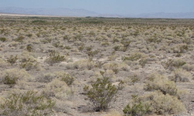
Figure 3. Test
This plant community is similar to the reference plant community with a trace of non-natives in the understory. Ecological processes have been not compromised by the presence of non-native species at this time, however, ecological resilience is reduced. Creosotebush and cattle saltbush persist through invasion by non-native annuals, however, native forbs and grasses are at a competitive disadvantage and suffer reduced vigor and reproductive capacity.
Community 2.2
Invaded Plant Community 2.2
This plant community is characterized reduced perennial vegetative cover and increased non-native biomass. Ecological resilience is severely reduced. Management should be focused on reducing disturbance and protecting native perennial vegetation to ensure a seed source in the future.
Community 2.3
Invaded Plant Community 2.3
This plant community is characterized by a short disturbance return interval. The soil surface is continually disturbed decreasing stability and increasing erosion. Non-native annuals take advantage of the increased availability of resources. This plant community is identified as “at risk”. The loss of vegetative cover has reduced the ecological resistance and resilience. A change in management is needed to prevent this plant community from crossing an irreversible threshold.
Pathway 2.1a
Community 2.1 to 2.2
Further anthropogenic disturbance removes shrubs and microbiotic soil crust reducing soil stability.
Pathway 2.2a
Community 2.2 to 2.1
Changes in management with time, allows woody perennials to recover, contributing to increased ecological resilience.
Pathway 2.2b
Community 2.2 to 2.3
Continued disturbance removes cattle saltbush and other shrubby vegetation. Non-native annuals increase.
Pathway 2.3a
Community 2.3 to 2.2
Changes in management to remove disturbance and over time the shrubby vegetation will re-establish.
State 3
Eroded State
The Eroded State is characterized by a reduction in soil stabilization. Prolonged soil surface disturbance has caused this site to cross an abiotic threshold. The loss of vegetation and soil crust has decreased the stability of the site. Site function is controlled by soil erosion, wind and soil temperature.
Community 3.1
Eroded Plant Community 3.1
Vegetation is dominated by non-native annuals. Soil stability is severely reduced and active erosion easily occurs, even during typical rainfall events.
Community 3.2
Eroded Plant Community 3.2
This plant community is characterized by a total loss of vegetation and soil crust.
Pathway 3.1a
Community 3.1 to 3.2
Continued surface disturbance.
Pathway 3.2a
Community 3.2 to 3.1
Non-native annuals germinate and establish even on a severely eroded site.
Transition T1
State 1 to 2
Introduction of non-natives is attributed to a combination of factors including 1) surface disturbances (anthropogenic), 2) changes in the kinds of animals and their grazing patterns, 3) drought, and 4) changes in fire history.
Transition T2
State 2 to 3
Continued soil surface disturbance, loss of perennial vegetation and soil crust.
Additional community tables
Table 6. Community 1.1 plant community composition
| Group | Common name | Symbol | Scientific name | Annual production (lb/acre) | Foliar cover (%) | |
|---|---|---|---|---|---|---|
|
Grass/Grasslike
|
||||||
| 1 | Perennial Cool Season Bunchgrass (Mid = 1-3') | 4–14 | ||||
| Indian ricegrass | ACHY | Achnatherum hymenoides | 2–8 | – | ||
| desert needlegrass | ACSP12 | Achnatherum speciosum | 2–6 | – | ||
| 2 | Perennial Warm Season Bunchgrass (Mid 1-3') | 2–8 | ||||
| threeawn | ARIST | Aristida | 2–8 | – | ||
| 3 | Perennial Warm Season Bunchgrass (Short < 1') | 2–8 | ||||
| 4 | Annual | 0–9 | ||||
|
Forb
|
||||||
| 5 | Perennial | 6–24 | ||||
| desert globemallow | SPAM2 | Sphaeralcea ambigua | 6–24 | – | ||
| 6 | Annual | 0–10 | ||||
| spineflower | CHORI2 | Chorizanthe | 1–10 | – | ||
| desert trumpet | ERIN4 | Eriogonum inflatum | 1–10 | – | ||
|
Shrub/Vine
|
||||||
| 7 | Primary Shrubs | 135–300 | ||||
| cattle saltbush | ATPO | Atriplex polycarpa | 75–135 | – | ||
| creosote bush | LATR2 | Larrea tridentata | 15–60 | – | ||
| burrobush | AMDU2 | Ambrosia dumosa | 30–60 | – | ||
| 8 | Secondary Shrubs | 15–45 | ||||
| fourwing saltbush | ATCA2 | Atriplex canescens | 3–15 | – | ||
| shadscale saltbush | ATCO | Atriplex confertifolia | 3–15 | – | ||
| desertholly | ATHY | Atriplex hymenelytra | 3–15 | – | ||
| jointfir | EPHED | Ephedra | 3–15 | – | ||
| desert-thorn | LYCIU | Lycium | 3–15 | – | ||
Interpretations
Animal community
Livestock Interpretations:
This site is poorly suited to livestock grazing because of low forage production. Grazing management should be keyed to Indian ricegrass and cattle saltbush. Indian ricegrass has good forage value for domestic sheep, cattle and horses. It supplies a source of green feed before most other native grasses have produced much new growth.
Cattle saltbush is one of the most palatable shrubs in the West. Its protein, fat, and carbohydrate levels are comparable to alfalfa. It provides nutritious forage for all classes of livestock. Palatability is rated as good for domestic sheep and domestic goats; fair for cattle; fair to good for horses in winter, poor for horses in other seasons.
White bursage is an important browse species. Browsing pressure on white bursage is particularly heavy during years of low precipitation, when production of winter annuals is low. White bursage is of intermediate forage value. It is fair to good forage for horses and fair to poor for cattle and sheep. However, because there is often little other forage where white bursage grows, it is often highly valuable to browsing animals.
Many animals bed in or under creosotebush. Domestic sheep dig shallow beds under creosotebush because it provides the only shade in the desert scrub community. Creosotebush is unpalatable to livestock. Consumption of creosotebush may be fatal to sheep.
Stocking rates vary over time depending upon season of use, climate variations, site, and previous and current management goals. A safe starting stocking rate is an estimated stocking rate that is fine tuned by the client by adaptive management through the year and from year to year.
Wildlife Interpretations:
Cattle saltbush provides valuable habitat and year-round browse for wildlife. Cattle saltbush also provides browse and shelter for small mammals. Additionally, the browse provides a source of water for black-tailed jackrabbits in arid environments. Granivorous birds consume the fruits. Wild ungulates, rodent and lagomorphis readily consume all aboveground portions of the plant. White bursage is an important browse species for wildlife.
Many small mammals browse creosotebush or consume its seeds. Desert reptiles and amphibians use creosotebush as a food source and perch site and hibernate or estivate in burrows under creosotebush, avoiding predators and excessive daytime temperatures.
Hydrological functions
Runoff is neglible to medium and permeability is moderately slow to rapid. Sparse shrub canopy and associated litter break provide some protection from raindrop impact. Water flow patterns are rare to common depending on site location relative to major inflow areas from higher landscape positions.
Other products
Indian ricegrass was traditionally eaten by some Native American peoples. The Paiutes used seed as a reserve food source.
White bursage is a host for sandfood, a parasitic plant with a sweet, succulent, subterranean flowerstalk. Sandfood was a valuable food supply for Native Americans.
Creosotebush has been highly valued for its medicinal properties by Native Americans. Twigs and leaves may be boiled as tea, steamed, pounded into a powder, pressed into a poultice, or heated into an infusion.
Other information
Indian ricegrass is well-suited for surface erosion control and desert revegetation although it is not highly effective in controlling sand movement.
White bursage may be used to revegetate disturbed sites in southwestern deserts.
Creosotebush may be used to rehabilitate disturbed environments in southwestern deserts. Once established, creosotebush may improve sites for annuals that grow under its canopy by trapping fine soil, organic matter, and symbiont propagules. It may also increase water infiltration and storage.
Supporting information
Type locality
| Location 1: Nye County, NV | |
|---|---|
| Township/Range/Section | T17S R52E S7 |
| General legal description | About 2 miles west of Nevada Highway 160, Amargosa Desert, Nye County, Nevada. This site is also found in southern Lincoln and Clark Counties, Nevada. |
Other references
Fire Effects Information System (Online; http://www.fs.fed.us/database/feis/plants/).
Kay, B.L., C.R. Brown and W.L. Graves. 1977. Desert Saltbush. Mojave Revegetation Notes. UC Davis. No. 18.
Puigdefabregas, J. 2005. The role of vegetation patterns in structuring runoff and sediment fluxes in drylands. Earth Surface Processes and Landforms. 30:133-147.
USDA-NRCS Plants Database (Online; http://www.plants.usda.gov).
Contributors
HA
Approval
Sarah Quistberg, 2/24/2025
Rangeland health reference sheet
Interpreting Indicators of Rangeland Health is a qualitative assessment protocol used to determine ecosystem condition based on benchmark characteristics described in the Reference Sheet. A suite of 17 (or more) indicators are typically considered in an assessment. The ecological site(s) representative of an assessment location must be known prior to applying the protocol and must be verified based on soils and climate. Current plant community cannot be used to identify the ecological site.
| Author(s)/participant(s) | P.Novak-Echenique |
|---|---|
| Contact for lead author | State Rangeland Management Specialist |
| Date | 10/19/2011 |
| Approved by | Sarah Quistberg |
| Approval date | |
| Composition (Indicators 10 and 12) based on | Annual Production |
Indicators
-
Number and extent of rills:
None -
Presence of water flow patterns:
Water flow patterns are rare to common depending on site location relative to major inflow areas from higher landscape positions. -
Number and height of erosional pedestals or terracettes:
Pedestals are none to rare with occurrence typically limited to areas within water flow patterns. -
Bare ground from Ecological Site Description or other studies (rock, litter, lichen, moss, plant canopy are not bare ground):
Bare Ground up to 85% -
Number of gullies and erosion associated with gullies:
None -
Extent of wind scoured, blowouts and/or depositional areas:
None -
Amount of litter movement (describe size and distance expected to travel):
Fine litter (foliage from grasses and annual & perennial forbs) expected to move distance of slope length during intense summer convection storms. Persistent litter (large woody material) will remain in place except during large rainfall events. -
Soil surface (top few mm) resistance to erosion (stability values are averages - most sites will show a range of values):
Soil stability values should be 1 to 3 on most soil textures found on this site. (To be field tested.) -
Soil surface structure and SOM content (include type of structure and A-horizon color and thickness):
Structure of soil surface will be medium platy or massive. Soil surface colors are pale brown or light gray and soils typified by an ochric epipedon. Organic matter of the surface 2 to 3 inches is less than 1 percent. -
Effect of community phase composition (relative proportion of different functional groups) and spatial distribution on infiltration and runoff:
Sparse shrub canopy and associated litter break provide some protection from raindrop impact. -
Presence and thickness of compaction layer (usually none; describe soil profile features which may be mistaken for compaction on this site):
Compacted layers are none. Massive sub-surface horizons, subsoil calcic horizons are not to be interpreted as compacted layers. -
Functional/Structural Groups (list in order of descending dominance by above-ground annual-production or live foliar cover using symbols: >>, >, = to indicate much greater than, greater than, and equal to):
Dominant:
Tall shrubs (cattle saltbush & creosotebush)Sub-dominant:
associated low-statured, shrubs (white bursage, shadscale) >> deep-rooted, cool season, perennial bunchgrasses > perennial forbs = annual forbs > shallow-rooted, perennial bunchgrasses.Other:
Warm season bunchgrassesAdditional:
-
Amount of plant mortality and decadence (include which functional groups are expected to show mortality or decadence):
Dead branches within individual shrubs common and standing dead shrub canopy material may be as much as 30% of total woody canopy; mature bunchgrasses commonly (<20%) have dead centers. -
Average percent litter cover (%) and depth ( in):
Between plant interspaces and under canopy 5-10%, depth 0.25 inches -
Expected annual annual-production (this is TOTAL above-ground annual-production, not just forage annual-production):
For normal or average growing season ± 300 lbs/ac; favorable 400 lbs/ac, unfavorable 150 lbs/ac -
Potential invasive (including noxious) species (native and non-native). List species which BOTH characterize degraded states and have the potential to become a dominant or co-dominant species on the ecological site if their future establishment and growth is not actively controlled by management interventions. Species that become dominant for only one to several years (e.g., short-term response to drought or wildfire) are not invasive plants. Note that unlike other indicators, we are describing what is NOT expected in the reference state for the ecological site:
Potential invaders include red brome, Mediterranean grass, annual mustards, Russian thistle, and redstem filaree. -
Perennial plant reproductive capability:
All functional groups should reproduce in average and above average growing season years
Print Options
Sections
Font
Other
The Ecosystem Dynamics Interpretive Tool is an information system framework developed by the USDA-ARS Jornada Experimental Range, USDA Natural Resources Conservation Service, and New Mexico State University.
Click on box and path labels to scroll to the respective text.