Natural Resources
Conservation Service
Ecological site R043AX973MT
Montane Fen woollyfruit sedge (Carex lasiocarpa)
Last updated: 4/11/2025
Accessed: 04/12/2026
General information
Provisional. A provisional ecological site description has undergone quality control and quality assurance review. It contains a working state and transition model and enough information to identify the ecological site.
MLRA notes
Major Land Resource Area (MLRA): 043A–Northern Rocky Mountains
This MLRA is located in Montana (43 percent), Idaho (34 percent), and Washington (23 percent). It makes up about 31,435 square miles (81,460 square kilometers). It has no large cities or towns. It has many national forests, including the Okanogan, Colville, Kootenai, Lolo, Flathead, Coeur d’Alene, St. Joe, Clearwater, and Kaniksu National Forests.
This MLRA is in the Northern Rocky Mountains Province of the Rocky Mountain System. It is characterized by rugged, glaciated mountains; thrust- and block-faulted mountains; and hills and valleys. Steep-gradient rivers have cut deep canyons. Natural and manmade lakes are common.
The major Hydrologic Unit Areas (identified by four-digit numbers) that make up this MLRA are: Kootenai-Pend Oreille-Spokane (1701), 67 percent; Upper Columbia (1702), 18 percent; and Lower Snake (1706), 15 percent. Numerous rivers originate in or flow through this area, including, the Sanpoil, Columbia, Pend Oreille, Kootenai, St. Joe, Thompson, and Flathead Rivers.
This area is underlain primarily by stacked slabs of layered sedimentary or metasedimentary bedrock. The bedrock formations range from Precambrian to Cretaceous in age. The rocks consist of shale, sandstone, siltstone, limestone, argillite, quartzite, gneiss, schist, dolomite, basalt, and granite. The formations have been faulted and stacked into a series of imbricate slabs by regional tectonic activity. Pleistocene glaciers carved a rugged landscape that includes sculpted hills and narrow valleys filled with till and outwash. Continental glaciation over road the landscape in the northern half of the MLRA while glaciation in the southern half was confined to montane settings.
The average annual precipitation is 25 to 60 inches (635 to 1,525 millimeters) in most of this area, but it is as much as 113 inches (2,870 millimeters) in the mountains and is 10 to 15 inches (255 to 380 millimeters) in the western part of the area. Summers are dry. Most of the precipitation during fall, winter, and spring is snow. The average annual temperature is 32 to 51 degrees F (0 to 11 degrees C) in most of the area, decreasing with elevation. In most of the area, the freeze-free period averages 140 days and ranges from 65 to 215 days. It is longest in the low valleys of Washington, and it decreases in length with elevation. Freezing temperatures occur every month of the year on high mountains, and some peaks have a continuous cover of snow and ice.
The dominant soil orders in this MLRA are Andisols, Inceptisols, and Alfisols. Many of the soils are influenced by Mount Mazama ash deposits. The soils in the area have a frigid or cryic soil temperature regime; have an ustic, xeric, or udic soil moisture regime; and dominantly have mixed mineralogy. They are shallow to very deep, are very poorly drained to well drained, and have most of the soil texture classes. The soils at the lower elevations include Udivitrands, Vitrixerands and Haplustalfs. The soils at the higher elevations include Dystrocryepts, Eutrocryepts, Vitricryands , and Haplocryalfs. Cryorthents, Cryepts, and areas of rock outcrop are on ridges and peaks above timberline
This area is in the northern part of the Northern Rocky Mountains. Grand fir, Douglas-fir, western red cedar, western hemlock, western larch, lodgepole pine, subalpine fir, ponderosa pine, whitebark pine, and western white pine are the dominant overstory species, depending on precipitation, temperature, elevation, and landform aspect. The understory vegetation varies, also depending on climatic and landform factors. Some of the major wildlife species in this area are whitetailed deer, mule deer, elk, moose, black bear, grizzly bear, coyote, fox, and grouse. Fish, mostly in the trout and salmon families, are abundant in streams, rivers, and lakes.
More than one-half of this area is federally owned and administered by the U.S. Department of Agriculture, Forest Service. Much of the privately-owned land is controlled by large commercial timber companies. The forested areas are used for wildlife habitat, recreation, watershed, livestock grazing, and timber production. Meadows provide summer grazing for livestock and big game animals. Less than 3 percent of the area is cropland.
LRU notes
This ecological site resides in MLRA 43A in the Livingston-Lewis-Apgar Mountains which includes the bulk of Glacier National Park (GNP) and the lower western valley portions along the Flathead River. The landscape is mountains and landforms include glaciated mountains with associated features such as U-shaped valleys, mountain slopes, alpine ridges, cirques, valley floors and moraines. Glaciation of this area was in the form of alpine, icecaps and valley outlet glaciers. It also includes associated alluvium and outwash features. This area includes low valleys to tall mountains with elevation ranging 989-2,762 m (3,250-9,050 ft.). The climate is cold and wet with mean annual air temperature of 3 degrees Celsius (37 degrees F)., mean frost free days of 65 days and mean annual precipitation of 1295 mm (51 in.) and relative effective annual precipitation is 169 cm (66 in.). The soil temperature regime is cryic and the soil moisture regime is udic. The geology of this area is dominated by metasedimentary rocks of the Belt Supergroup (Grinnell argillite and Siyeh limestone) with minor Tertiary sediments. Soils are generally weakly developed on mountain slopes within U-shaped valleys. Parent materials are commonly of colluvium, till, and residuum from metasedimentary rocks. Limestone bedrock within this part of the Belt Supergroup is not highly calcareous and due to high precipitation received in this area most carbonates at mid and upper elevations have been leached from the soil profiles. Bedrock depth varies greatly with location, landform and slope position. Volcanic ash is often found in the soil surface with various degrees of mixing. Thicker volcanic ash can be found on more stable positions on mid and upper elevation slopes that are protected from wind erosion. Volcanic ash is not typically found in low elevation areas on stream and outwash terraces associated with streams and rivers. There are numerous large lakes including St. Mary, Bowman, Kintla, Lake Sherburne, Logging, Upper Waterton and numerous creeks (
Classification relationships
NPS Plant Community Name:
Carex utriculata Herbaceous Vegetation (CEGL001562)
Ecological site concept
Ecological Site Concept
These plant communities are found in depressional areas within larger valley landforms with high water tables and accumulations of undecomposed or partially decomposed organic matter. They are found relatively near toeslope positions of hills or mountains or on glacial valley floors. The landform position allows for groundwater discharge and overland sheet flow of water and, due to its depressional nature, a somewhat greater snow-holding capacity than surrounding flat or sloping positions. This community is dominated by one to two carex species, typically Carex lasciocarpa or Carex utriculata, and to a lesser extent Carex nebrascensis, Carex diandra, Carex arcta and Carex canescens. A variety of forb species are present, including Comarum palustre, Equisetum fluviatile, Mentha arvensis, fragaria species and viola species and Scuttelaria galericulata. The foliar canopy cover is high, ranging 45-63% cover and the community is very productive. This community is dominated by species that are designated wetland obligates and the site is saturated with a high water table for nearly the entire year. It may have brief, frequent ponding and overland sheet flow of water. Soils typical of fens are very poorly drained, very deep and have a water table at or near the surface for much year, except during summer months when evapotranspiration demands are greatest. Soils have a mantle of decomposing organic material (defined for this site as being equal to or above 8 inches or 20cm). Specifically, sites in this ecological site have organic materials ranging from 40-140cm (16-55 in.) thick. Soil parent materials are generally moderately decomposed organic material over till material from metasedimentary parent material from the Belt Supergroup. Thin layers of volcanic ash from Mount Mazama (Crater Lake, Oregon) are commonly found at a depth within the organic material. All soils are classified within the Histosols soil order, specifically either Cryosaprists or Cryohemists.
Associated sites
| F043AX951MT |
Lower Subalpine Cool Dry Coniferous subalpine fir- Engelmann spruce/ Sitka alder/ thinleaf huckleberry/ common beargrass The 43A Montane Fen ecological site is associated with the 43A Lower Subalpine Coniferous Cool Moderately Dry, (ABLA/CLUN2-XETE) ecological site. The 43A Lower Subalpine Coniferous Cool Moderately Dry, (ABLA/CLUN2-XETE) ecological site is found in cool, moderately dry mid-elevations that span the lower subalpine areas. It is found primarily on lateral moraine and glacial valley wall landforms, on back or footslope positions, at elevations ranging 1,000 to 2,100 meters (3,300-6,900 feet), on all aspects and on moderate to steep slopes ranging 10-35 percent.The 43A Montane Fen ecological site is associated with the 43A Lower Subalpine Coniferous Cool Moderately Dry, (ABLA/CLUN2-XETE) ecological site. The 43A Lower Subalpine Coniferous Cool Moderately Dry, (ABLA/CLUN2-XETE) site has soils associated with this Ecological Site that are very deep and well drained. These soils have developed in glacial till or colluvium parent materials derived from metasedimentary rock that typically have varying amounts of influence of volcanic ash in the soil surface layers. The dominant taxonomic soil order associated with these soils is Inceptisols with Andic subgroups indicating that there is 18 to 37 centimeters (7-15 inches) of volcanic ash. 43A Lower Subalpine Coniferous Cool Moderately Dry, (ABLA/CLUN2-XETE). The 43A Lower Subalpine Coniferous Cool Moderately Dry, (ABLA/CLUN2-XETE) ecological site has a reference vegetation community with an overstory of subalpine fir and Engelmann spruce with an understory of Sitka alder, huckleberry, beargrass and queencup bead lily. |
|---|
Similar sites
| R043AP807MT |
Subirrigated Grassland Group These sites are similar in that they both describe fens with subirrigated water flow and organic material in the soil and reference communities dominated by sedge species. |
|---|
Table 1. Dominant plant species
| Tree |
Not specified |
|---|---|
| Shrub |
Not specified |
| Herbaceous |
(1) Carex lasiocarpa |
Physiographic features
These plant communities are found in depressional areas within larger valley landforms with high water tables and accumulations of undecomposed or partially decomposed organic matter. They are found relatively near toeslope positions of hills or mountains or on glacial valley floors. The landform position allows for groundwater discharge and overland sheet flow of water and, due to its depressional nature, a somewhat greater snow-holding capacity than surrounding flat or sloping positions.
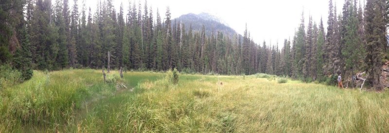
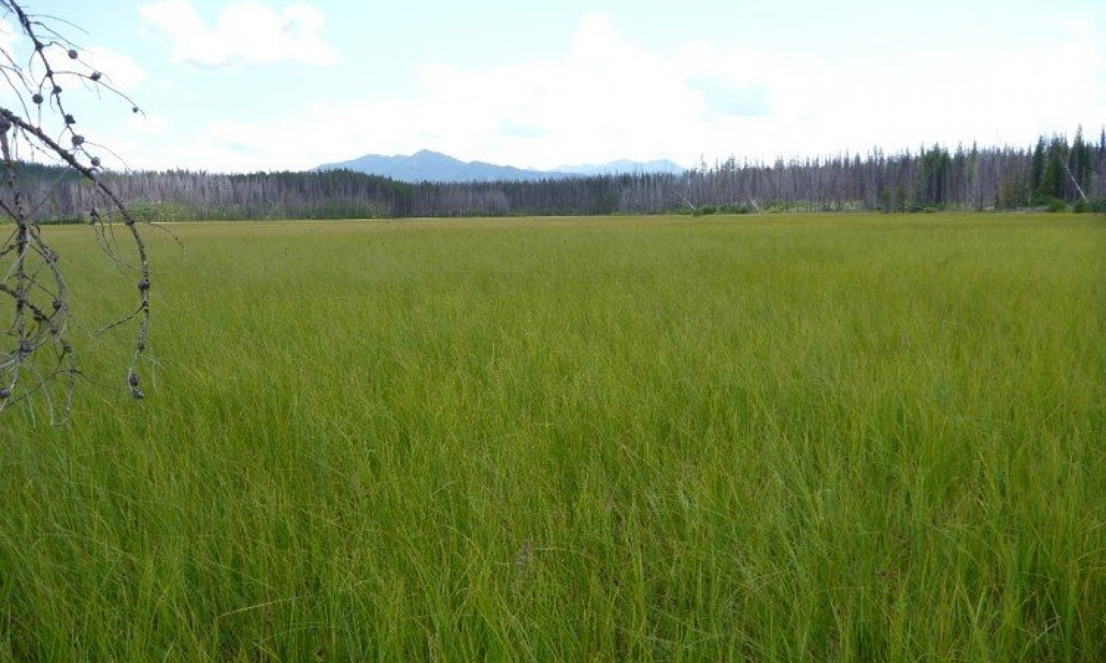
Figure 1. Landscape view of the ecological site with small drain with higher cover of Equisetum species within it.
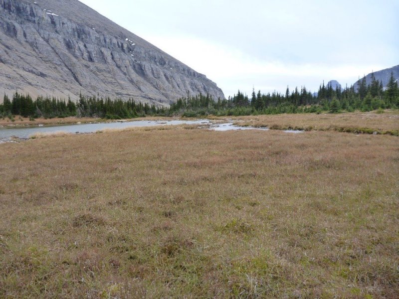
Figure 2. Landscape view at a high elevation site, note the high cover of mosses relative to vascular plants, the small drain within the ecological site.
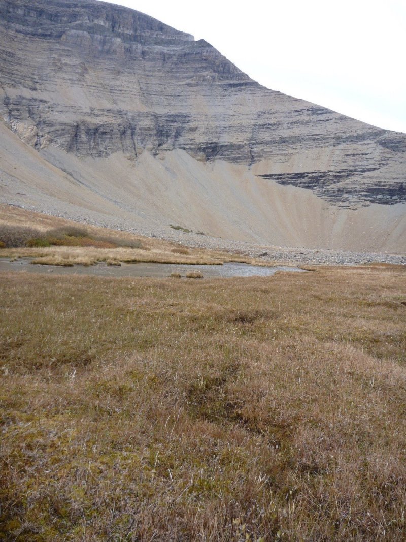
Figure 3. Landscape view at a high elevation site, note the high cover of mosses relative to vascular plants, the small drain within the ecological site.
Table 2. Representative physiographic features
| Landforms |
(1)
Valley
> Glacial-valley floor
> Closed depression
(2) Valley > Glacial-valley floor |
|---|---|
| Ponding duration | Very long (more than 30 days) |
| Ponding frequency | Frequent |
| Elevation | 1,000 – 1,300 m |
| Slope | 0 – 2% |
| Aspect | W, NW, N, NE, E, SE, S, SW |
Climatic features
AQUIC/CRYIC
This ecological site is found in the cryic soil temperature regime and the aquic soil moisture regime. Cryic soils have average annual temperature less than 8 degrees C, with less than 5 degrees C difference from winter to summer. Aquic soil moisture regimes are a reducing regime in a soil that is virtually free of dissolved oxygen because it is saturated by water.
POLEBRIDGE CLIMATE STATION:
Mean Annual Precipitation =25-35 inches
Mean Annual Air Temperature =36-43 degrees Fahrenheit
Frost Free Days =50-70 days
Table 3. Representative climatic features
| Frost-free period (characteristic range) | 17-57 days |
|---|---|
| Freeze-free period (characteristic range) | 76-117 days |
| Precipitation total (characteristic range) | 508-660 mm |
| Frost-free period (actual range) | 6-68 days |
| Freeze-free period (actual range) | 66-127 days |
| Precipitation total (actual range) | 508-711 mm |
| Frost-free period (average) | 37 days |
| Freeze-free period (average) | 97 days |
| Precipitation total (average) | 584 mm |
Figure 4. Monthly precipitation range
Figure 5. Monthly minimum temperature range
Figure 6. Monthly maximum temperature range
Figure 7. Monthly average minimum and maximum temperature
Figure 8. Annual precipitation pattern
Figure 9. Annual average temperature pattern
Climate stations used
-
(1) POLEBRIDGE 1 N [USC00246618], Essex, MT
-
(2) POLEBRIDGE [USC00246615], Essex, MT
-
(3) WEST GLACIER [USC00248809], Kalispell, MT
Influencing water features
Fens are described as minerotrophic environments, which means they receive significant inputs of water and dissolved solids from runoff from surrounding mineral soil areas or ground water discharge. Fens have groundwater within the rooting zone of vascular plants and are perennially saturated, but may have local areas of surface drying during hot summers or drought. Landform patterns are usually depressional relative to the surrounding uplands. Primary water sources supplying a fen are ground water return flow and interflow from surrounding uplands as well as direct precipitation. Hydrologically, fens are dominated by a slow downslope unidirectional water flow. Fens can occur on nearly flat landscapes if ground water discharge is a dominant source to the wetland surface. They lose water primarily by saturation subsurface and surface flows and by evapotranspiration. Channels may develop but serve only to convey water away from the wetland when the rate of water transmission is highest. Fens described in this ESD are considered “sloping” meaning they form at the base of hills or glacial moraines where ground water discharges to the surface as sheet-flows. They can be on slopes or nearly flat. Fens are commonly described as being poor, rich or extremely rich based on the pH of the water within them and other factors (Chadde, 1988). These fens are considered of the “Rich” type with moderate pH of 6.0-7.3 for the entire soil profile using field measurement techniques. Determinations of pH for these soils will be further elucidated with laboratory sampling in the future. These “rich” fens are compared to “Poor” fens with surface pH <5.4 and “extremely rich fens” with surface pH >7.5). These fens have lower to intermediate moss cover, dense and productive vascular plant cover and intermediate calcium concentration. The predominant substrate is Metasedimentary.
Wetland Description
Cowardin System Palustrine/Emergent Persistent
HGM (Hydrogeomorphic) Slope
Wetland description
Wetland Description
Cowardin System Palustrine/Emergent Persistent
HGM (Hydrogeomorphic) Slope
Soil features
Soils typical of fens are very poorly drained, very deep and have a water table at or near the surface for much year, except during summer months when evapotranspiration demands are greatest. Soils have a mantle of decomposing organic material (defined for this site as being equal to or above 8” or 20cm). Sites in this ecological site have organic materials ranging from 40-140cm thick. Soil parent materials are generally moderately decomposed organic material over till material from metasedimentary parent material from the Belt Supergroup. Thin layers of volcanic ash from Mount Mazama (Crater Lake, Oregon) are commonly found at a depth within the organic material. Under seasonally high water tables and cool temperatures, plant material decomposition slows appreciably, allowing for an accumulation of organic material. This deep, accumulated organic material, although defined more specifically within soil science based on the amount of decomposition is parochially referred to as peat with corresponding reference to these areas as peatlands. All soils are classified within the Histosols soil order, specifically either Cryosaprists or Cryohemists. Sapric soil materials are the most highly decomposed (smallest amount of visible plant fibers after rubbing), hemic soil materials are moderately decomposed and Fibric soil materials are the most fiberous and are only slightly decomposed. Associated soils that are capped with organic material of lesser thickness may classify as Cryaquepts in the Inceptisols soil order with a Histic epipedon or organic surface layer. These soils often occur in marginal areas of larger fens or in very small fens that have not accumulated the greater thickness of organic material needed to be classified as Histosols. Vegetation on fens must tolerate saturation and periodic ponding from sheet flow. Soils on these sites are described as being hydric soils and have redoximorphic features from changes in soil saturation, which causes oxidation and/or reduction of iron primarily, but also manganese in the soil. The reduced ion of iron is highly mobile within the soil and some soil layers that undergo prolonged saturation will have a gleyed (blue gray or greenish gray) coloration due to the almost complete removal of iron from that layer. Soils in the Histic Cryaquepts subgroup have diagnostic features including a histic epipedon, endosaturation, fibric, hemic, or sapric soil materials, cambic horizon and reduced matrix. Soils defined as Histosols may have the following diagnostic features: a histic epipedon composed of either fibric, hemic, or sapric soil materials, endosaturation, sapric soil materials at depth and reduced matrix. (Soil Survey Staff, 2015). For more information on soil taxonomy, please follow this link:
http://http://www.nrcs.usda.gov/wps/portal/nrcs/detail/soils/survey/class/?cid=nrcs142p2_053580
CORRELATED SOIL SERIES & TAXONOMIC CLASS NAME
Foolhen Fine-loamy, mixed, superactive Typic Cryaquolls
Sinopah Euic Fluvaquentic Cryosaprists
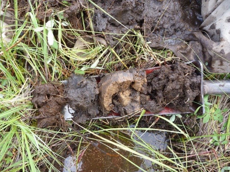
Figure 10. Soil associated with this site. Note the colors of the soils, especially the buff/tan colors of the ash layer and the slightly greyer appearance of the reduced layer.
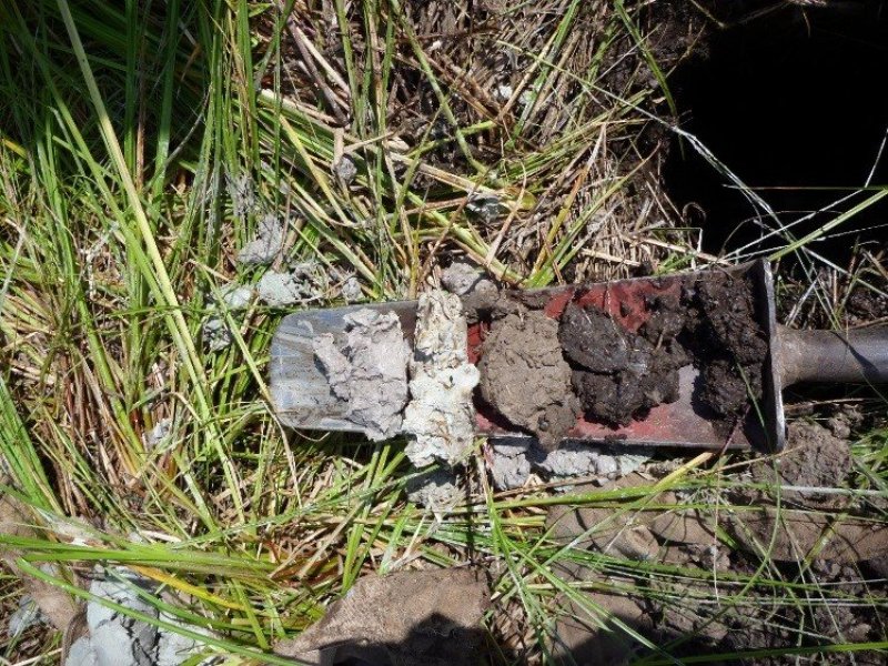
Figure 11. Soils and vegetation at site, note the organic layer in a huge pile, the buff/tan colors of the volcanic ash layer and the grey almost white appearance of the reduced silty glacio-fluvial sediments.
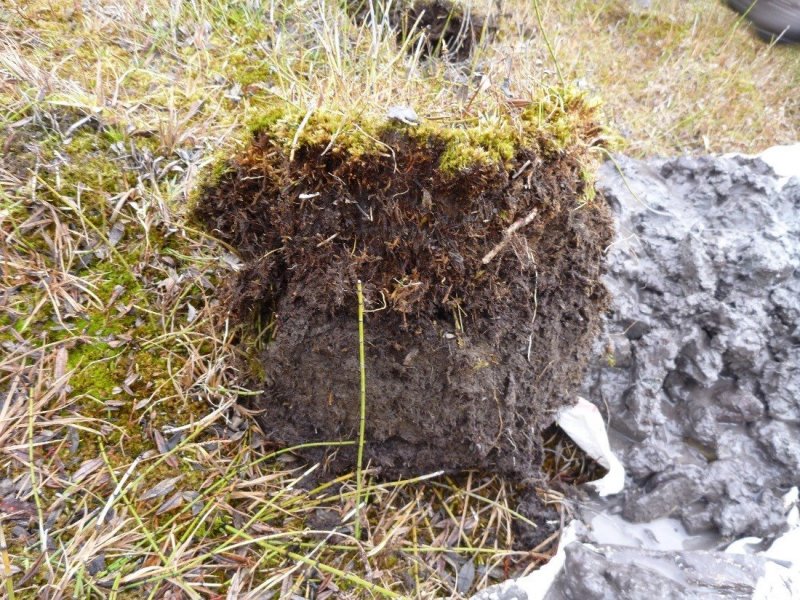
Figure 12. Soils at a high elevation fen site showing the thick organic material layer and the very wet aspect of the grey soil showing redoximorphic features. Note the very high cover of moss at this high elevation fen.
Table 4. Representative soil features
| Parent material |
(1)
Organic material
–
metasedimentary rock
(2) Till – metasedimentary rock |
|---|---|
| Surface texture |
(1) Mucky loam (2) Peaty loam |
| Family particle size |
(1) Fine-loamy |
| Drainage class | Very poorly drained |
| Permeability class | Moderate |
| Soil depth | 152 – 254 cm |
| Surface fragment cover <=3" | 0% |
| Surface fragment cover >3" | 0% |
| Available water capacity (15.5-25.7cm) |
Not specified |
| Soil reaction (1:1 water) (15.2-17.8cm) |
Not specified |
Ecological dynamics
These wetland communities occur in peatlands dominated by all wetland obligate species meaning that they almost always occur (estimated probability greater than 99%) under natural conditions in wetlands. These occur on depressions within meadows in valley or glacial basins near sloping uplands or ground moraines. They are typically surrounded by forested areas, generally of the Abies lasciocarpa/Clintonia uniflora ecological site. These areas have been kept free of upland shrub and conifer species establishment through saturated soils that are generally intolerable to shrub species and conifers of the surrounding areas. Soils are saturated from ground water discharge, sheet flow and periodic ponding. The melt out of snow in spring produces ponding of cold water that, with cold soil temperatures lowers the decomposition rate of plant material leading to accumulation of peat (organic material mantle). Typically, the native plant species within the reference phase are all obligate wetland carex species that have high foliar cover, and are very productive. In other areas with slightly less saturated soils, carr type (shrubby) fens occur which are dominated by wetland affiliated shrubs Betula nana and or Salix drummondiana with an understory of carex and juncus species.
Disturbance dynamics within the natural functioning state include: fire, beaver dams, low precipitation or snowpack years and ungulate grazing. These disturbances are viewed as potentially changing the plant population composition to a minor extent from one phase to another within State 1 but with the ability to return to any phases with time after disturbance. These disturbances affect hydrology which is critically important to this site. Moderate disturbance will increase baltic rush (Juncus balticus) and associated forbs (Hansen), while severe disturbance may lower the water table and cause the site to be dominated by species such as Kentucky bluegrass (Poa pratensis), fowl bluegrass (Poa palustris), common silverweed (Potentilla anserina) or redtop (Agrostis stolonifera) (Hansen, 1992). Moderately disturbed sites will improve rapidly with protection due to the rhizomatous nature of slender sedge (Carex lasciocarpa). This site is flooded long enough to provide nesting habitat for waterfowl, but has limited use by songbirds and small mammals because of the lack of diversity and flooded soils. It is an important habitat for raptors, deer, and elk. Beaver dams assist in controlling the downcutting of channels, bank erosion, and the movement of sediment downstream (Gordon and others 1992). When beaver construct a dam, they raise the water table in the area, which provides water for hydrophytic plants. The beaver dam also slows down the water in the channel, which allows suspended sediment to be deposited behind the dam. The combination of sediment deposition and plant reproduction raises the channel bed (Hansen, 1992).
Fire can occur, though rarely and only in dry years within fens. These fires would eliminate conifer and shrub encroachment on the site and maintain the reference phase community dominated by sedges. Typically, fires would only top burn the current year’s growth of the sedges. In particular, Carex lasciocarpa and Carex utriculata are resistant to damage by fire through their extensive root system and resprouting capabilities, except where hot fires penetrate the peat soil. As well, Carex utriculata can be in the soil seed bank up to 18 inches deep, so it may establish from on-site seed after fire. Fire in fens is highly dependent upon the surrounding vegetation type carrying the fire to these saturated sites. Within Glacier National Park, the subalpine fir/queencup beadlily ecological site typically surrounds these fens, which has low occurrence but high severity and has a fire free interval of approximately 130 years. Generally, these fens are so saturated that fires will move around these low lying areas and stay within the conifer community. Low or mixed severity fires only account for 32% of the fires and have a mean interval of 750 years in the Northwest (USDA, USFS, Fire Effects Information System, Fire Regimes). High severity fires that occur during severe drought years, account for 68% of the fires occurring and have a mean interval of 350 years (USDA, USFS, Fire Effects Information System, Fire Regimes). So, fires are rare within this site, but would serve to limit conifer and shrub encroachment. If a severe fire would occur within a fen and destroy the rhizomes of the sedges, then a threshold would be crossed and major species composition could occur. Fire in surrounding forested communities could also impact the hydrology of the fen and cause increased runoff, and potentially groundwater flow, by decreasing live trees upslope and potentially change the species composition of the fen (Shelly Stevens, personal communication, 2015). As well, extensive epidemics of forest disease or pests that lead to large scale death of trees could attain the same result. Two sites were on the boundary of major fires on the west side of the continental divide (Robert fire in 2003 burned 54,191 acres and the Moose fire in 2001 burned 66,688 acres). However, the sites did not have evidence of burning.
Beaver damming, within the areas that do have some water flow in channels, can lead to changes in plant species composition by flooding one area and concomitantly drying another. These are viewed as naturally functioning disturbances that would lead to ponding and inundation of an area and therefore drying of another area leading to potentially shrub invasion and if long enough, conifer invasion to a small scale. Presence of beaver damming would potentially lead to a mosaic effect on the plant communities potentially as opposed to the typical saturated fen with sedge vegetation within a larger landscape of conifer dominated environment or a less saturated carr type of fen with Betula nana or Salix species.
Low precipitation or drought years that impact precipitation and snow melt could potentially cause change in plant species composition by allowing shrubs in invade the site. Less precipitation and snow melt would decrease current year growth of the dominant sedge species at the reference phase, and allow drier site shrubs to potentially invade, but would not cause a state change since a resumption of normal precipitation would generally lead to resumed saturated conditions that preclude shrub encroachment. A severe drought that would adversely affect the sedge community and allow the establishment of dry site species would have crossed a threshold and cause a state change.
Ungulate grazing would be considered within the range of normal functioning disturbances that may change some species composition within State 1 if it were light grazing, seasonal or rotational, did not lead to extensive trailing, wallowing or cut banking of flow through channels. Ungulate hoof action can break up the rhizomatous sod, which can lead to unvegetated microsites conducive to shrub encroachment; in addition, pugging and hummocking can create some surface flow patterns which may accelerate water loss from the peatland. Urine and feces can change nutrient concentration as well. If the ungulate use is low, then it is viewed as normally functioning. Carex utriculata is considered moderately tolerant of grazing, though it may be replaced by other species when heavily grazed over extended periods. The saturated soils likely are susceptible to trampling and compaction though high water tables throughout the growing season tend to limit access by livestock and thereby reduce impacts. If the ungulate use if high, concentrated or during sensitive periods of plant growth, the impact can be severe and cause a state change by affecting soil compaction, water loss through trailing, pugging, hummocking changing surface flow patterns, severe changes in nutrient concentration through very high levels of urine and feces as well. These disturbances also could be exacerbated by drought or other disturbances higher upslope in the watershed that affect groundwater discharge and surface sheet flow.
Large scale timber harvesting upslope or higher in the adjacent watershed to the fen can cause a state change to occur. If there were a large, extensive clear-cut that caused abrupt changes in the hydrology upslope of the fen and affect groundwater or surface flows these would cross a threshold and cause either a state change to dry site species, or an increase in run-in to the peatland since the removal of trees reduces the water uptake. In addition, loss of shading by adjacent conifers may likely be beneficial to the peatlands as most of the species are shade-intolerant. Very small scale timber harvesting or that was not clear-cut prescription, would not cause a threshold to be crossed and a state change to occur. This dry site species community could be more at risk to weed species invasion including timothy (Phleum pratense), Canada thistle (Cirsium arvense) or reed canarygrass (Phalaris arundinacea). Overstocked surrounding forests can potentially alter the water balance of fens by taking up more water in the trees than a non-overstocked forest.
Road building upslope or higher in the watershed from a fen could cause a threshold to be crossed and a state change to occur if it impacted surface flow to a degree that most of the upslope water is diverted away from the lower fen. Less groundwater or surface flow would cause drying of the site leading to dry site species invading and possibly weedy species as well. Water well establishment in the vicinity or upslope of the fen could cause less groundwater available to maintain saturated soils for the site and could cause a threshold to be crossed and a state change to dry site species to occur. As well, any ditching or draining of fen would cause a threshold to be crossed in the normal functioning hydrology of the fen and a state change to dry site species would occur. This site would be more vulnerable to weedy species invasion. Peat mining could also cause a threshold to be crossed if it greatly impacted the hydrology or was extensive enough that the sedges were unable to recolonize the impacted areas. Point source pollution that degraded the plant community functioning, vigor or changed the hydrology or nutrient concentration significantly could cause a threshold to be crossed and a state change to occur.
This ecological site can occur, though less frequently, in subalpine and alpine areas, in kettles on glacial basin and valley landforms, on flat slopes of all aspects, at elevations ranging 7,000 to 8,000 feet. These fens are included into this report on montane fens as a high elevation variant to low elevation fens. These fens are considered to be intermediate between Rich and Poor types with low to moderate pH (compared to “Poor” fens with pH <5.4 and “Rich” fens with pH 6-7, and “Extremely rich” fens with pH >7), intermediate to high moss cover, intermediate to low plant cover, and intermediate to low productivity of vascular plant and intermediate calcium concentration. The predominant substrate is Metasedimentary. This is in contrast to the low elevation “Rich” fens found in the montane life zone. The growing season in these high elevation sites is short and this may have an effect on shrub and conifer encroachment. The native reference community has high moss cover that is a mixture of species including: sphagnum, drepancladus, aulocomnium and other moss species. The vascular plant species foliar cover is fairly low and is a mixture of mainly equisetum and carex species although juncus, forb and grass species do occur in low to very low cover. The main plant species encountered include field horsetail (Equisetum arvense), variegated scouringrush (Equisetum variegatum), northern bog sedge (Carex gynocrates), Payson’s sedge (Carex paysonis), shortstalk sedge (Carex podocarpa). This community is dominated by species that are wetland obligate to facultative species designated and the site is saturated with a high water table for nearly the entire year and can experience brief, frequent ponding and overland sheet flow of water. The ground cover is predominantly moss with a trace cover of water, lichen, litter and duff. The plant species within the reference phase are all obligate or facultative wetland equisetum and carex species that have low foliar cover, and are not very productive in this high elevation setting. In the surrounding areas, there may be Salix dominated carr fens and upslope forests of Abies lasiocarpa, Pinus albicaulis and Larix lyallii. Carex gynocrates is an obligate wetland species meaning it almost always occur (greater than 99% estimated probability) under natural conditions in wetlands. Carex paysonis is a FACU species meaning it usually occurs in non-wetlands (67-99% probability), but is occasionally found in wetlands. Carex podocarpa is a FAC species, meaning it is equally likely to occur in wetlands and non-wetlands. Equisetum arvense is considered poor forage palatability for cattle, sheep and horses meaning it is not relished and normally is consumed to only a small degree or not at all (Hansen, 1992). Equisetum arvense is a FAC wetland species with low energy and protein value. FAC refers to species that are equally likely to occur in wetlands or non-wetlands. Low energy and protein values denotes that it has poor retention of usable energy and digestible protein during fall and winter (Hansen, 1992). It has poor food value for elk, mule and whitetail deer and antelope. As well, it is poor food value for upland game birds, waterfowl, small non-game birds and small mammals.
COMMUNITY PHASE 1.1: This community is dominated by one to two carex species, typically Carex lasciocarpa or Carex utriculata, and to a lesser extent Carex nebrascensis, Carex diandra, Carex arcta and Carex canescens. A variety of forb species are present, including Comarum palustre, Equisetum fluviatile, Mentha arvensis, fragaria species and viola species and Scuttelaria galericulata. The foliar canopy cover is high, ranging 45-63% cover and the community is very productive. The ground cover is predominantly water (3-40%), litter and duff and embedded litter (30-55%) and fairly high moss cover (0-30%). The vegetation structure of this community is one of tall grasses averaging 40 inches tall which can include Carex canescens, Carex lenticularis, Carex lasiocarpa and Carex utriculata. A lower layer can include Carex nebrascensis at 20 inches and a lower layer, less than 10 inches, that has forbs including purple marshlocks (Comarum palustre) and marsh skullcap (Scutellaria galericulata). This community is dominated by species that are designated wetland obligates and the site is saturated with a high water table for nearly the entire year. It may have brief, frequent ponding and overland sheet flow of water.
Community Phase Pathway 1.1.A
This pathway denotes an increase in the shrub species Betula nana or Salix species, possibly due to slightly drier site conditions that allow these species as well ungulate hoof action that could cause microsites in which they can establish. This pathway may also be due to a lack of fire.
Community Phase Pathway 1.1B
This pathway is a resumption of the hydrology of the reference phase of a saturated site with some seasonal ponding and sheet flow.
COMMUNITY PHASE 1.2
This community has the shrubs Betula nana and or Salix species established and regenerating with an understory of Carex and Juncus species. The dominant species in order of abundance and frequency are: Betula nana, Carex lasciocarpa, Carex utriculata, Carex flava, equisetum fluviatile, Salix boothii, Salix drummondiana, Salix candida, Carex aquatilis and Comarum palustre.
Community Phase Pathway 1.2.A
This pathway denotes an encroachment by the conifer species due to slightly drier site conditions that allow these species to establish as well as ungulate hoof action that could cause microsites in which they can establish.
Community Phase Pathway 1.2B
This pathway is a resumption of increased hydrology flow to the slightly drier than reference phase of the shrubby community 1.2 that has some seasonal ponding and sheet flow. The increased water to the site would give the sedge species a competitive advantage over the shrub species.
COMMUNITY PHASE 1.3
This community would be similar to community phase 1.2 but would have some conifer encroachment.
TRANSITION 1: Abrupt, large scale, extensive or intensive disturbances to the hydrology of groundwater, surface water flow or precipitation including large scale harvesting or clearcutting, road building, water wells, concentrated ungulate use, ditching, draining, peat mining or severe stand replacing fire upslope from site or severe fire within site.
STATE 2
Phase 2.1: Invasion and establishment of dry site species that are not wetland obligates including species found in the riparian wet meadow ecological site. Wetland obligate species may still be present but have lower cover than the dry site species. Dry site species that may be present include: Bromus marginatus, Calamagrostis Canadensis (FACW), Eurybia conspicua, Heracleum maximum (FAC), and Sanicula marilandica (FAC). FACW indicates a facultative wetland species designation or hydrophyte, meaning that it usually occurs in wetlands, but may occur in non-wetlands. FAC indicates a facultative species or hydrophyte, meaning that it occurs in wetlands and non-wetlands.
Phase 2.2: This phase has the dry site species of phase 2.1, but also includes non-native and noxious weed species that may include: Phalaris arundinaceae, Cirsium arvense, Phleum pretense, Poa pratensis, Taraxacum officinale, Hypericum perforatum.
TRANSITION 2: This is point source pollution to the site.
STATE 3: This is species composition change from State 1.0 due to pollution from a point source. The effect of this pollution may be species composition change, loss of plant vigor or loss of plant cover dramatically.
State and transition model
More interactive model formats are also available.
View Interactive Models
Click on state and transition labels to scroll to the respective text
Ecosystem states
State 1 submodel, plant communities
State 3 submodel, plant communities
State 1
Reference
These wetland communities occur in peatlands dominated by all wetland obligate species meaning that they almost always occur (estimated probability greater than 99 percent) under natural conditions in wetlands. These occur on depressions within meadows in valley or glacial basins near sloping uplands or ground moraines. Soils are saturated from ground water discharge, sheet flow and periodic ponding. The melt out of snow in spring produces ponding of cold water that, with cold soil temperatures lowers the decomposition rate of plant material leading to accumulation of peat (organic material mantle). Typically, the native plant species within the reference phase are all obligate wetland carex species that have high foliar cover, and are very productive. In other areas with slightly less saturated soils, carr type (shrubby) fens occur which are dominated by wetland affiliated shrubs Betula nana and or Salix drummondiana with an understory of carex and juncus species. Disturbance dynamics within the natural functioning state include: fire, beaver dams, low precipitation or snowpack years and ungulate grazing. These disturbances are viewed as potentially changing the plant population composition to a minor extent from one phase to another within State 1 but with the ability to return to any phases with time after disturbance. These disturbances affect hydrology which is critically important to this site. Moderate disturbance will increase baltic rush (Juncus balticus) and associated forbs (Hansen, 1992), while severe disturbance may lower the water table and cause the site to be dominated by species such as Kentucky bluegrass (Poa pratensis), fowl bluegrass (Poa palustris), common silverweed (Potentilla anserina) or redtop (Agrostis stolonifera) (Hansen, 1992). Moderately disturbed sites will improve rapidly with protection due to the rhizomatous nature of slender sedge (Carex lasciocarpa). This site is flooded long enough to provide nesting habitat for waterfowl, but has limited use by songbirds and small mammals because of the lack of diversity and flooded soils. It is an important habitat for raptors, deer, and elk. Beaver dams assist in controlling the downcutting of channels, bank erosion, and the movement of sediment downstream (Gordon and others 1992). When beaver construct a dam, they raise the water table in the area, which provides water for hydrophytic plants. The beaver dam also slows down the water in the channel, which allows suspended sediment to be deposited behind the dam. The combination of sediment deposition and plant reproduction raises the channel bed (Hansen, 1992). Fire can occur, though rarely and only in dry years within fens. These fires would eliminate conifer and shrub encroachment on the site and maintain the reference phase community dominated by sedges. Typically, fires would only top burn the current year’s growth of the sedges. In particular, Carex lasciocarpa and Carex utriculata are resistant to damage by fire through their extensive root system and resprouting capabilities, except where hot fires penetrate the peat soil. As well, Carex utriculata can be in the soil seed bank up to 46 cm or 18 inches deep, so it may establish from on-site seed after fire. Fire in fens is highly dependent upon the surrounding vegetation type carrying the fire to these saturated sites. Within Glacier National Park, the subalpine fir/queencup beadlily ecological site typically surrounds these fens, which has low occurrence but high severity and has a fire free interval of approximately 130 years. Generally, these fens are so saturated that fires will move around these low lying areas and stay within the conifer community. Low or mixed severity fires only account for 32% of the fires and have a mean interval of 750 years in the Northwest (USDA, USFS, Fire Effects Information System, Fire Regimes). High severity fires that occur during severe drought years, account for 68% of the fires occurring and have a mean interval of 350 years (USDA, USFS, Fire Effects Information System, Fire Regimes). So, fires are rare within this site, but would serve to limit conifer and shrub encroachment. If a severe fire would occur within a fen and destroy the rhizomes of the sedges, then a threshold would be crossed and major species composition could occur. Fire in surrounding forested communities could also impact the hydrology of the fen and cause increased runoff, and potentially groundwater flow, by decreasing live trees upslope and potentially change the species composition of the fen (Steve Shelly, personal communication, 2015). As well, extensive epidemics of forest disease or pests that lead to large scale death of trees could attain the same result. Two sites were on the boundary of major fires on the west side of the continental divide (Robert fire in 2003 burned 54,191 acres and the Moose fire in 2001 burned 66,688 acres). However, the sites did not have evidence of burning. Beaver damming, within the areas that do have some water flow in channels, can lead to changes in plant species composition by flooding one area and concomitantly drying another. These are viewed as naturally functioning disturbances that would lead to ponding and inundation of an area and therefore drying of another area leading to potentially shrub invasion and if long enough, conifer invasion to a small scale. Presence of beaver damming would potentially lead to a mosaic effect on the plant communities potentially as opposed to the typical saturated fen with sedge vegetation within a larger landscape of conifer dominated environment or a less saturated carr type of fen with Betula nana or Salix species. Low precipitation or drought years that impact precipitation and snow melt could potentially cause change in plant species composition by allowing shrubs in invade the site. Less precipitation and snow melt would decrease current year growth of the dominant sedge species at the reference phase, and allow drier site shrubs to potentially invade, but would not cause a state change since a resumption of normal precipitation would generally lead to resumed saturated conditions that preclude shrub encroachment. A severe drought that would adversely affect the sedge community and allow the establishment of dry site species would have crossed a threshold and cause a state change. Ungulate grazing would be considered within the range of normal functioning disturbances that may change some species composition within State 1 if it were light grazing, seasonal or rotational, did not lead to extensive trailing, wallowing or cut banking of flow through channels. Ungulate hoof action can break up the rhizomatous sod, which can lead to unvegetated microsites conducive to shrub encroachment; in addition, pugging and hummocking can create some surface flow patterns which may accelerate water loss from the peatland. Urine and feces can change nutrient concentration as well. If the ungulate use is low, then it is viewed as normally functioning. Carex utriculata is considered moderately tolerant of grazing, though it may be replaced by other species when heavily grazed over extended periods. The saturated soils likely are susceptible to trampling and compaction though high water tables throughout the growing season tend to limit access by livestock and thereby reduce impacts. If the ungulate use if high, concentrated or during sensitive periods of plant growth, the impact can be severe and cause a state change by affecting soil compaction, water loss through trailing, pugging, hummocking changing surface flow patterns, severe changes in nutrient concentration through very high levels of urine and feces as well. These disturbances also could be exacerbated by drought or other disturbances higher upslope in the watershed that affect groundwater discharge and surface sheet flow. Large scale timber harvesting upslope or higher in the adjacent watershed to the fen can cause a state change to occur. If there were a large, extensive clear-cut that caused abrupt changes in the hydrology upslope of the fen and affect groundwater or surface flows these would cross a threshold and cause either a state change to dry site species, or an increase in run-in to the peatland since the removal of trees reduces the water uptake. In addition, loss of shading by adjacent conifers may likely be beneficial to the peatlands as most of the species are shade-intolerant. Very small scale timber harvesting or that was not clear-cut prescription, would not cause a threshold to be crossed and a state change to occur. This dry site species community could be more at risk to weed species invasion including timothy (Phleum pratense), Canada thistle (Cirsium arvense) or reed canarygrass (Phalaris arundinacea). Overstocked surrounding forests can potentially alter the water balance of fens by taking up more water in the trees than a non-overstocked forest. Road building upslope or higher in the watershed from a fen could cause a threshold to be crossed and a state change to occur if it impacted surface flow to a degree that most of the upslope water is diverted away from the lower fen. Less groundwater or surface flow would cause drying of the site leading to dry site species invading and possibly weedy species as well. Water well establishment in the vicinity or upslope of the fen could cause less groundwater available to maintain saturated soils for the site and could cause a threshold to be crossed and a state change to dry site species to occur. As well, any ditching or draining of fen would cause a threshold to be crossed in the normal functioning hydrology of the fen and a state change to dry site species would occur. This site would be more vulnerable to weedy species invasion. Peat mining could also cause a threshold to be crossed if it greatly impacted the hydrology or was extensive enough that the sedges were unable to recolonize the impacted areas. Point source pollution that degraded the plant community functioning, vigor or changed the hydrology or nutrient concentration significantly could cause a threshold to be crossed and a state change to occur. This ecological site can occur, though less frequently, in subalpine and alpine areas, in kettles on glacial basin and valley landforms, on flat slopes of all aspects, at elevations ranging 7,000 to 8,000 feet. These fens are included into this report on montane fens as a high elevation variant to low elevation fens. These fens are considered to be intermediate between Rich and Poor types with low to moderate pH (compared to “Poor” fens with pH <5.4 and “Rich” fens with pH 6-7, and “Extremely rich” fens with pH >7), intermediate to high moss cover, intermediate to low plant cover, and intermediate to low productivity of vascular plant and intermediate calcium concentration. The predominant substrate is Metasedimentary. This is in contrast to the low elevation “Rich” fens found in the montane life zone. The growing season in these high elevation sites is short and this may have an effect on shrub and conifer encroachment. The native reference community has high moss cover that is a mixture of species including: sphagnum, drepancladus, aulocomnium and other moss species. The vascular plant species foliar cover is fairly low and is a mixture of mainly equisetum and carex species although juncus, forb and grass species do occur in low to very low cover. The main plant species encountered include field horsetail (Equisetum arvense), variegated scouringrush (Equisetum variegatum), northern bog sedge (Carex gynocrates), Payson’s sedge (Carex paysonis), shortstalk sedge (Carex podocarpa). This community is dominated by species that are wetland obligate to facultative species designated and the site is saturated with a high water table for nearly the entire year and can experience brief, frequent ponding and overland sheet flow of water. The ground cover is predominantly moss with a trace cover of water, lichen, and litter. The plant species within the reference phase are all obligate or facultative wetland equisetum and carex species that have low foliar cover, and are not very productive in this high elevation setting. In the surrounding areas, there may be Salix dominated carr fens and upslope forests of Abies lasiocarpa, Pinus albicaulis and Larix lyallii. Carex gynocrates is an obligate wetland species meaning it almost always occur (greater than 99% estimated probability) under natural conditions in wetlands. Carex paysonis is a FACU species meaning it usually occurs in non-wetlands (67-99% probability), but is occasionally found in wetlands. Carex podocarpa is a FAC species, meaning it is equally likely to occur in wetlands and non-wetlands. Equisetum arvense is considered poor forage palatability for cattle, sheep and horses meaning it is not relished and normally is consumed to only a small degree or not at all (Hansen, 1992). Equisetum arvense is a FAC wetland species with low energy and protein value. FAC refers to species that are equally likely to occur in wetlands or non-wetlands. Low energy and protein values denotes that it has poor retention of usable energy and digestible protein during fall and winter (Hansen, 1992). It has poor food value for elk, mule and whitetail deer and antelope. As well, it is poor food value for upland game birds, waterfowl, small non-game birds and small mammals.
Community 1.1
Plant Community 1.1 woolly fruit sedge (northwest Territory sedge-Nebraska sedge)/purple marshlocks-marsh skullcap-field horsetail-variegated scouringrush

Figure 13. Vegetation associated with this ecological site.
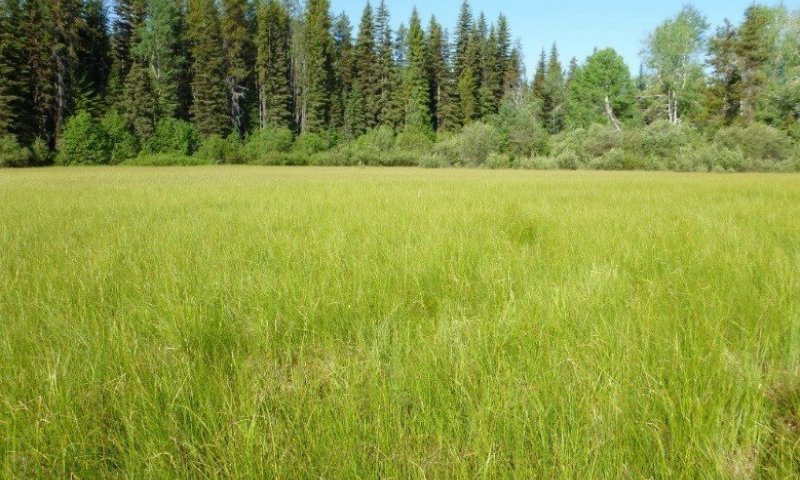
Figure 14. Typical vegetation and soil at community phase 1.1.
This community is dominated by one to two carex species, typically Carex lasciocarpa or Carex utriculata, and to a lesser extent Carex nebrascensis, Carex diandra, Carex arcta and Carex canescens. A variety of forb species are present, including Comarum palustre, Equisetum fluviatile, Mentha arvensis, fragaria species and viola species and Scuttelaria galericulata. The foliar canopy cover is high, ranging 45-63% cover with an average of 61% and the community is very productive. There is very little basal cover since the plant bases are very small. There is high total litter with soil underneath (74%) and very little bare ground 5%. The ground cover is predominantly water (3-40%, average 31%), and fairly high moss cover (0-30%, average 7%). Water dominated in the lower areas of the site, while litter is in the higher islands. It is believed that basal area of the sedges would be 10-20% (from ocular estimation in previous years), but were submerged at time of foliar line point sampling. The vegetation structure of this community is one of tall grasses averaging 102 cm or 40 inches tall which can include Carex canescens, Carex lenticularis, Carex lasiocarpa and Carex utriculata. A lower layer can include Carex nebrascensis at 20 inches and a lower layer, less than 25 cm or 10 inches, that has forbs including purple marshlocks (Comarum palustre) and marsh skullcap (Scutellaria galericulata). This community is dominated by species that are designated wetland obligates and the site is saturated with a high water table for nearly the entire year. It may have brief, frequent ponding and overland sheet flow of water.
Dominant plant species
-
woollyfruit sedge (Carex lasiocarpa), grass
-
Northwest Territory sedge (Carex utriculata), grass
-
Nebraska sedge (Carex nebrascensis), grass
-
lesser panicled sedge (Carex diandra), grass
-
northern cluster sedge (Carex arcta), grass
-
silvery sedge (Carex canescens), grass
-
purple marshlocks (Comarum palustre), other herbaceous
-
wild mint (Mentha arvensis), other herbaceous
-
strawberry (Fragaria), other herbaceous
-
violet (Viola), other herbaceous
-
marsh skullcap (Scutellaria galericulata), other herbaceous
Figure 15. Annual production by plant type (representative values) or group (midpoint values)
Table 5. Annual production by plant type
| Plant type | Low (kg/hectare) |
Representative value (kg/hectare) |
High (kg/hectare) |
|---|---|---|---|
| Grass/Grasslike | 2242 | 3363 | 5604 |
| Forb | 224 | 336 | 560 |
| Total | 2466 | 3699 | 6164 |
Table 6. Soil surface cover
| Tree basal cover | 0% |
|---|---|
| Shrub/vine/liana basal cover | 0% |
| Grass/grasslike basal cover | 0% |
| Forb basal cover | 0% |
| Non-vascular plants | 0-15% |
| Biological crusts | 0-5% |
| Litter | 30-50% |
| Surface fragments >0.25" and <=3" | 0% |
| Surface fragments >3" | 0% |
| Bedrock | 0% |
| Water | 0-40% |
| Bare ground | 0-30% |
Table 7. Canopy structure (% cover)
| Height Above Ground (m) | Tree | Shrub/Vine | Grass/ Grasslike |
Forb |
|---|---|---|---|---|
| <0.15 | – | 0-5% | 0-20% | 0-10% |
| >0.15 <= 0.3 | – | 0-5% | 0-20% | 0-10% |
| >0.3 <= 0.6 | – | 0-5% | 10-30% | – |
| >0.6 <= 1.4 | – | 0-5% | 30-80% | – |
| >1.4 <= 4 | – | – | – | – |
| >4 <= 12 | – | – | – | – |
| >12 <= 24 | – | – | – | – |
| >24 <= 37 | – | – | – | – |
| >37 | – | – | – | – |
Community 1.2
Plant Community 1.2 willow-dwarf birch/ sedge-rush species
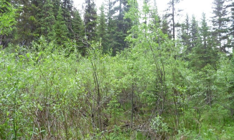
Figure 16. Landscape view of community 1.2, dominated by Salix drummondiana.
This community has the shrubs Betula nana and or Salix species established and regenerating with an understory of Carex and Juncus species. The dominant species in order of abundance and frequency are: Betula nana, Carex lasciocarpa, Carex utriculata, Carex flava, equisetum fluviatile, Salix boothii, Salix drummondiana, Salix candida, Carex aquatilis and Comarum palustre.
Figure 17. Annual production by plant type (representative values) or group (midpoint values)
Community 1.3
Plant Community 1.3 Conifer species/ willow-birch species/ sedge-rush species
This community would be similar to community phase 1.2 but would have some conifer encroachment.
Pathway 1.1A
Community 1.1 to 1.2
Slightly drier site conditions as well as ungulate hoof action that could cause microsites in with they can establish and/or lack of fire.
Pathway 1.2B
Community 1.2 to 1.1
A resumption of the hydrology of the reference phase of a saturated site with some seasonal ponding and sheet flow.
Pathway 1.2A
Community 1.2 to 1.3
Encroachment by the conifer species due to slightly drier site conditions.
Pathway 1.3A
Community 1.3 to 1.2
A resumption of increased hydrology flow that has some seasonal ponding and sheet flow.
State 2
Altered
Community 2.1
Plant Community 2.1 Dry site species state- not obligate
Invasion and establishment of dry site species that are not wetland obligates including species found in the riparian wet meadow ecological site. Wetland obligate species may still be present but have lower cover than the dry site species. Dry site species that may be present include: Bromus marginatus, Calamagrostis Canadensis (FACW), Eurybia conspicua, Heracleum maximum (FAC), and Sanicula marilandica (FAC). FACW indicates a facultative wetland species designation or hydrophyte, meaning that it usually occurs in wetlands, but may occur in non-wetlands. FAC indicates a facultative species or hydrophyte, meaning that it occurs in wetlands and non-wetlands.
Community 2.2
Plant Community 2.2 Weedy species state i.e. timothy, Canada thistle, reed canarygrass
This phase has the dry site species of phase 2.1, but also includes non-native and noxious weed species that may include: Phalaris arundinaceae, Cirsium arvense, Phleum pretense, Poa pratensis, Taraxacum officinale, Hypericum perforatum.
Pathway 2.1A
Community 2.1 to 2.2
Increase of invasives
State 3
Converted
This is species composition change from State 1.0 due to pollution from a point source. The effect of this pollution may be species composition change, loss of plant vigor or loss of plant cover dramatically.
Community 3.1
Plant Community 3.1 Point source pollution
Species change due to point source pollution
Transition T1A
State 1 to 2
Abrupt, large scale water flow changes
Transition T1B
State 1 to 3
Point source pollution
Restoration pathway R2A
State 2 to 1
Hydrology restored
Restoration pathway R3A
State 3 to 1
Reclamation
Additional community tables
Table 8. Community 1.1 plant community composition
| Group | Common name | Symbol | Scientific name | Annual production (kg/hectare) | Foliar cover (%) | |
|---|---|---|---|---|---|---|
|
Forb
|
||||||
| 1 | Perennial and annual forbs | – | ||||
| marsh skullcap | SCGA | Scutellaria galericulata | 0–17 | 0–1 | ||
| northern bedstraw | GABO2 | Galium boreale | 0–11 | 0–3 | ||
| strawberry | FRAGA | Fragaria | 0–11 | – | ||
| western meadow-rue | THOC | Thalictrum occidentale | 0–6 | – | ||
| violet | VIOLA | Viola | 0–6 | – | ||
| purple marshlocks | COPA28 | Comarum palustre | – | 0–10 | ||
| wild mint | MEAR4 | Mentha arvensis | – | 0–2 | ||
| fowl mannagrass | GLST | Glyceria striata | – | 0–1 | ||
|
Grass/Grasslike
|
||||||
| 2 | Grasses, sedges, rushes | – | ||||
| Northwest Territory sedge | CAUT | Carex utriculata | 0–2242 | 0–60 | ||
| woollyfruit sedge | CALA11 | Carex lasiocarpa | 0–2242 | 0–50 | ||
| lakeshore sedge | CALE8 | Carex lenticularis | 0–897 | 0–1 | ||
| silvery sedge | CACA11 | Carex canescens | 0–560 | 0–1 | ||
| mountain brome | BRMA4 | Bromus marginatus | 0–168 | – | ||
| lesser panicled sedge | CADI4 | Carex diandra | 0–135 | 0–20 | ||
| water horsetail | EQFL | Equisetum fluviatile | – | 0–20 | ||
| Nebraska sedge | CANE2 | Carex nebrascensis | – | 0–5 | ||
| mountain rush | JUARL | Juncus arcticus ssp. littoralis | – | 0–2 | ||
| northern cluster sedge | CAAR2 | Carex arcta | – | 0–2 | ||
| bluejoint | CACA4 | Calamagrostis canadensis | – | 0–1 | ||
|
Shrub/Vine
|
||||||
| 3 | Shrubs | – | ||||
| Drummond's willow | SADR | Salix drummondiana | – | 0–1 | ||
Table 9. Community 1.1 forest understory composition
| Common name | Symbol | Scientific name | Nativity | Height (m) | Canopy cover (%) | |
|---|---|---|---|---|---|---|
|
Grass/grass-like (Graminoids)
|
||||||
| Northwest Territory sedge | CAUT | Carex utriculata | – | – | 0.5–75 | |
| woollyfruit sedge | CALA11 | Carex lasiocarpa | – | – | 20–60 | |
| lesser panicled sedge | CADI4 | Carex diandra | – | – | 5–35 | |
| Nebraska sedge | CANE2 | Carex nebrascensis | – | – | 2–10 | |
| silvery sedge | CACA11 | Carex canescens | – | – | 5 | |
| northern cluster sedge | CAAR2 | Carex arcta | – | – | 0.5–1 | |
| blue wildrye | ELGL | Elymus glaucus | – | – | 1 | |
| mountain rush | JUARL | Juncus arcticus ssp. littoralis | – | – | 1 | |
| bluejoint | CACA4 | Calamagrostis canadensis | – | – | 0.5 | |
| mountain brome | BRMA4 | Bromus marginatus | – | – | 0.5 | |
| water sedge | CAAQ | Carex aquatilis | – | – | 0.5 | |
|
Forb/Herb
|
||||||
| purple marshlocks | COPA28 | Comarum palustre | – | – | 0.5–10 | |
| wild mint | MEAR4 | Mentha arvensis | – | – | 0.5–1 | |
| strawberry | FRAGA | Fragaria | – | – | 0.5 | |
| northern bedstraw | GABO2 | Galium boreale | – | – | 0.5 | |
| marsh skullcap | SCGA | Scutellaria galericulata | – | – | 0.5 | |
| hooded lady's tresses | SPRO | Spiranthes romanzoffiana | – | – | 0.5 | |
| Eaton's aster | SYEA2 | Symphyotrichum eatonii | – | – | 0.5 | |
| pioneer violet | VIGL | Viola glabella | – | – | 0.5 | |
| violet | VIOLA | Viola | – | – | 0.5 | |
|
Fern/fern ally
|
||||||
| water horsetail | EQFL | Equisetum fluviatile | – | – | 3–90 | |
| field horsetail | EQAR | Equisetum arvense | – | – | 0.5 | |
|
Shrub/Subshrub
|
||||||
| Drummond's willow | SADR | Salix drummondiana | – | – | 0.5–3 | |
| white spirea | SPBE2 | Spiraea betulifolia | – | – | 0.5 | |
|
Tree
|
||||||
| Engelmann spruce | PIEN | Picea engelmannii | – | – | 0.5 | |
Table 10. Community 1.2 plant community composition
| Group | Common name | Symbol | Scientific name | Annual production (kg/hectare) | Foliar cover (%) | |
|---|---|---|---|---|---|---|
|
Grass/Grasslike
|
||||||
| 1 | Grass | 0–5287 | ||||
| Northwest Territory sedge | CAUT | Carex utriculata | 688–5287 | – | ||
| woollyfruit sedge | CALA11 | Carex lasiocarpa | 0–1974 | – | ||
| Nebraska sedge | CANE2 | Carex nebrascensis | 0–824 | – | ||
| northern cluster sedge | CAAR2 | Carex arcta | 0–372 | – | ||
| lesser panicled sedge | CADI4 | Carex diandra | 0–295 | – | ||
| mountain rush | JUARL | Juncus arcticus ssp. littoralis | 0–94 | – | ||
| reedgrass | CALAM | Calamagrostis | 0–53 | – | ||
|
Forb
|
||||||
| 2 | Forbs | 0–2021 | ||||
| horsetail | EQUIS | Equisetum | 0–2021 | – | ||
| purple marshlocks | COPA28 | Comarum palustre | 0–143 | – | ||
| mint | MENTH | Mentha | 0–99 | – | ||
| Virginia strawberry | FRVI | Fragaria virginiana | 0–13 | – | ||
| northern bedstraw | GABO2 | Galium boreale | 0–13 | – | ||
Table 11. Community 1.2 forest understory composition
| Common name | Symbol | Scientific name | Nativity | Height (m) | Canopy cover (%) | |
|---|---|---|---|---|---|---|
|
Grass/grass-like (Graminoids)
|
||||||
| Northwest Territory sedge | CAUT | Carex utriculata | – | – | 4 | |
| bluejoint | CACA4 | Calamagrostis canadensis | – | – | 4 | |
| water sedge | CAAQ | Carex aquatilis | – | – | 4 | |
| blister sedge | CAVE6 | Carex vesicaria | – | – | 2 | |
| inland sedge | CAIN11 | Carex interior | – | – | 1 | |
|
Forb/Herb
|
||||||
| wintergreen | PYROL | Pyrola | – | – | 1–4 | |
| arctic sweet coltsfoot | PEFR5 | Petasites frigidus | – | – | 3 | |
| buckbean | METR3 | Menyanthes trifoliata | – | – | 1–2 | |
| purple marshlocks | COPA28 | Comarum palustre | – | – | 2 | |
| fragrant bedstraw | GATR3 | Galium triflorum | – | – | 1 | |
| western sweetroot | OSOC | Osmorhiza occidentalis | – | – | 1 | |
| violet | VIOLA | Viola | – | – | 1 | |
|
Fern/fern ally
|
||||||
| woodfern | DRYOP | Dryopteris | – | – | 2 | |
| water horsetail | EQFL | Equisetum fluviatile | – | – | 1 | |
| horsetail | EQUIS | Equisetum | – | – | 1 | |
|
Shrub/Subshrub
|
||||||
| dwarf birch | BENA | Betula nana | – | – | 5 | |
| Bebb willow | SABE2 | Salix bebbiana | – | – | 5 | |
| Booth's willow | SABO2 | Salix boothii | – | – | 4–5 | |
| Drummond's willow | SADR | Salix drummondiana | – | – | 4–5 | |
| western mountain ash | SOSI2 | Sorbus sitchensis | – | – | 4 | |
| twinberry honeysuckle | LOIN5 | Lonicera involucrata | – | – | 4 | |
| alderleaf buckthorn | RHAL | Rhamnus alnifolia | – | – | 4 | |
| prickly currant | RILA | Ribes lacustre | – | – | 4 | |
| arctic raspberry | RUAR | Rubus arcticus | – | – | 1 | |
|
Tree
|
||||||
| Engelmann spruce | PIEN | Picea engelmannii | – | – | 4–5 | |
Interpretations
Supporting information
References
-
Allen, D.R. and C.B. Marlow. 1994. Shoot population dynamics of beaked sedge following catle grazing.. Journal of Range Management 47:64–69.
-
Hansen, P.L. 1992. Classification and management of riparian-wetland shrub sites in Montana.. Pages 68–78 in Clary, Warren P.; McArthur, E. Durant; Bedunah, Don; Wambolt, Carl L., compilers. Proceedings--symposium on ecology and management of riparian shrub communities; 1991 May 29-31; Sun Valley, ID. Gen. Tech. Rep. INT-289.. U.S. Department of Agriculture, Forest Service, Intermountain Research Station, Ogden, UT.
-
Hansen, P.L. 1992. Classification and management of riparian-wetland shrub sites in Montana. Pages in Clary, Warren P.; Chadde, S., J. Shelly, R. Bursik, R. Moseley, A. Evenden, M. Mantas, F. Rabe, B. Heidel. Peatlands on National Forests of the Northern Rocky Mountains: Ecology and Conservation. July 1998.. U.S. Department of Agriculture, Forest Service, Rocky Mountain Research Station. GTR-RMRS-GTR-11..
-
Jones, G.P. 2004 (Date accessed). U.S. National Vegetation Classification Standard: Terrestrial Ecological Classifications.
-
Soil Survey Staff. 2015. Illustrated guide to soil taxonomy. National Soil Survey Center. U.S. Department of Agriculture, Natural Resources Conservation Service, Lincoln, Nebraska.
-
Wakimoto, R.H. and E.E. Willard. 1991. Progress report: Monitoring post-fire vegetation recovery in ponderosa pine and sedge meadow communities in Glacier National Park, NW Montana.. Research Joint Venture Agreement INT-89441. U.S. Department of Agriculture, Forest Service, Intermountain Research Station, Ogden, UT.
-
Willard, E.E., R.H. Wakimoto, and K.C. Ryan. 1995. Vegetation recovery in sedge meadow communities within the Red Bench Fire, Glacier National Park.. Pages 102–110 in Cerulean, Susan I.; Engstrom, R. Todd, eds. Fire in wetlands: a management perspective: Proceedings, 19th Tall Timbers fire ecology conference; 1993 November 3-6; Tallahassee, FL.
Other references
Allen, Douglas R.; Marlow, Clayton B. 1994. Shoot population dynamics of beaked sedge following cattle grazing. Journal of Range Management. 47(1): 64-69.
Hansen, Paul L. 1992. Classification and management of riparian-wetland shrub sites in Montana. In: Clary, Warren P.;
Chadde, S., J. Shelly, R. Bursik, R. Moseley, A. Evenden, M. Mantas, F. Rabe, B. Heidel. Peatlands on National Forests of the Northern Rocky Mountains: Ecology and Conservation. U.S. Department of Agriculture, Forest Service, Rocky Mountain Research Station. GTR-RMRS-GTR-11. July 1998.
Hansen, Paul L. 1992. Classification and management of riparian-wetland shrub sites in Montana. In: Clary, Warren P.;
McArthur, E. Durant; Bedunah, Don; Wambolt, Carl L., compilers. Proceedings--symposium on ecology and management of riparian shrub communities; 1991 May 29-31; Sun Valley, ID. Gen. Tech. Rep. INT-289. Ogden, UT: U.S. Department of Agriculture, Forest Service, Intermountain Research Station: 68-78.
NatureServe, 2007. U.S. National Vegetation Classification Standard: Terrestrial Ecological Classifications. Waterton-Glacier International Peace Park, Local and Global Association Descriptions.
Soil Survey Staff. 2015. Illustrated guide to soil taxonomy. U.S. Department of Agriculture, Natural Resources Conservation Service, National Soil Survey Center, Lincoln, Nebraska.
Wakimoto, Ronald H.; Willard, E. Earl. 1991. Progress report: Monitoring post-fire vegetation recovery in ponderosa pine and sedge meadow communities in Glacier National Park, NW Montana. Research Joint Venture Agreement INT-89441. Ogden, UT: U.S. Department of Agriculture, Forest Service, Intermountain Research Station. 17 p.
Willard, E. Earl; Wakimoto, Ronald H.; Ryan, Kevin C. 1995. Vegetation recovery in sedge meadow communities within the Red Bench Fire, Glacier National Park. In: Cerulean, Susan I.; Engstrom, R. Todd, eds. Fire in wetlands: a management perspective: Proceedings, 19th Tall Timbers fire ecology conference; 1993 November 3-6; Tallahassee, FL. No. 19. Tallahassee, FL: Tall Timbers Research Station: 102-110. [25778].
Rangeland health reference sheet
Interpreting Indicators of Rangeland Health is a qualitative assessment protocol used to determine ecosystem condition based on benchmark characteristics described in the Reference Sheet. A suite of 17 (or more) indicators are typically considered in an assessment. The ecological site(s) representative of an assessment location must be known prior to applying the protocol and must be verified based on soils and climate. Current plant community cannot be used to identify the ecological site.
| Author(s)/participant(s) | |
|---|---|
| Contact for lead author | |
| Date | 12/18/2020 |
| Approved by | Kirt Walstad |
| Approval date | |
| Composition (Indicators 10 and 12) based on | Annual Production |
Indicators
-
Number and extent of rills:
-
Presence of water flow patterns:
-
Number and height of erosional pedestals or terracettes:
-
Bare ground from Ecological Site Description or other studies (rock, litter, lichen, moss, plant canopy are not bare ground):
-
Number of gullies and erosion associated with gullies:
-
Extent of wind scoured, blowouts and/or depositional areas:
-
Amount of litter movement (describe size and distance expected to travel):
-
Soil surface (top few mm) resistance to erosion (stability values are averages - most sites will show a range of values):
-
Soil surface structure and SOM content (include type of structure and A-horizon color and thickness):
-
Effect of community phase composition (relative proportion of different functional groups) and spatial distribution on infiltration and runoff:
-
Presence and thickness of compaction layer (usually none; describe soil profile features which may be mistaken for compaction on this site):
-
Functional/Structural Groups (list in order of descending dominance by above-ground annual-production or live foliar cover using symbols: >>, >, = to indicate much greater than, greater than, and equal to):
Dominant:
Sub-dominant:
Other:
Additional:
-
Amount of plant mortality and decadence (include which functional groups are expected to show mortality or decadence):
-
Average percent litter cover (%) and depth ( in):
-
Expected annual annual-production (this is TOTAL above-ground annual-production, not just forage annual-production):
-
Potential invasive (including noxious) species (native and non-native). List species which BOTH characterize degraded states and have the potential to become a dominant or co-dominant species on the ecological site if their future establishment and growth is not actively controlled by management interventions. Species that become dominant for only one to several years (e.g., short-term response to drought or wildfire) are not invasive plants. Note that unlike other indicators, we are describing what is NOT expected in the reference state for the ecological site:
-
Perennial plant reproductive capability:
Print Options
Sections
Font
Other
The Ecosystem Dynamics Interpretive Tool is an information system framework developed by the USDA-ARS Jornada Experimental Range, USDA Natural Resources Conservation Service, and New Mexico State University.
Click on box and path labels to scroll to the respective text.