Loamy Bighorn Mountains Sub-alpine Zone
Scenario model
Current ecosystem state
Select a state
Management practices/drivers
Select a transition or restoration pathway
-
Transition T1A
Non-use (lack of use) or lack of fire allows Mountain big sagebrush to increase in crown cover and density, making the transition to the sagebrush/mixed grass state. Heavy, continuous season-long grazing and no fire will shift this state to the mixed shrubs/forbs community within state 2.
More details -
Transition T1B
Disturbance of the reference site will encourage the establishment of noxious weeds if a seed source is present. Heavy use, trailing or access roads/routes, as well as drought, season-long use, or impact of insects/disease can open the canopy to non-native/invader species.
More details -
Restoration pathway R2A
Grazing management and possibly brush management with prescribed fire or chemical control may be needed reduce the woody overstory and allow the grasses to recover.
More details -
Transition T2A
Once a site has transitioned to this state, the increased bare ground and weakened plant structure leaves the community vulnerable to encroachment or species creep by non-native species such as Kentucky bluegrass, dandelions, smooth brome, and in some instances conifers. Control of these species is difficult and complete eradication may not be possible.
More details -
Transition T4A
Planned disturbances, seeding, or development activities provides the open niche for invasive species to invade a location. Ground disturbance of a site will encourage weedy species, especially when introduced into the system on equipment.
More details -
No transition or restoration pathway between the selected states has been described
Target ecosystem state
Select a state
Description
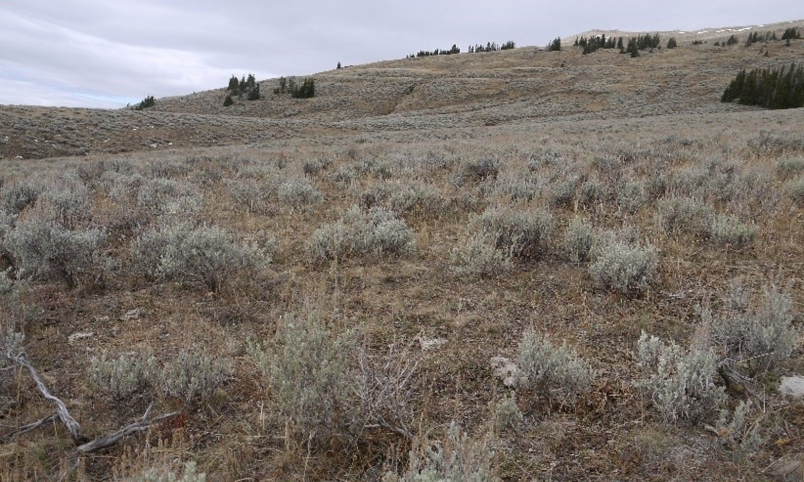
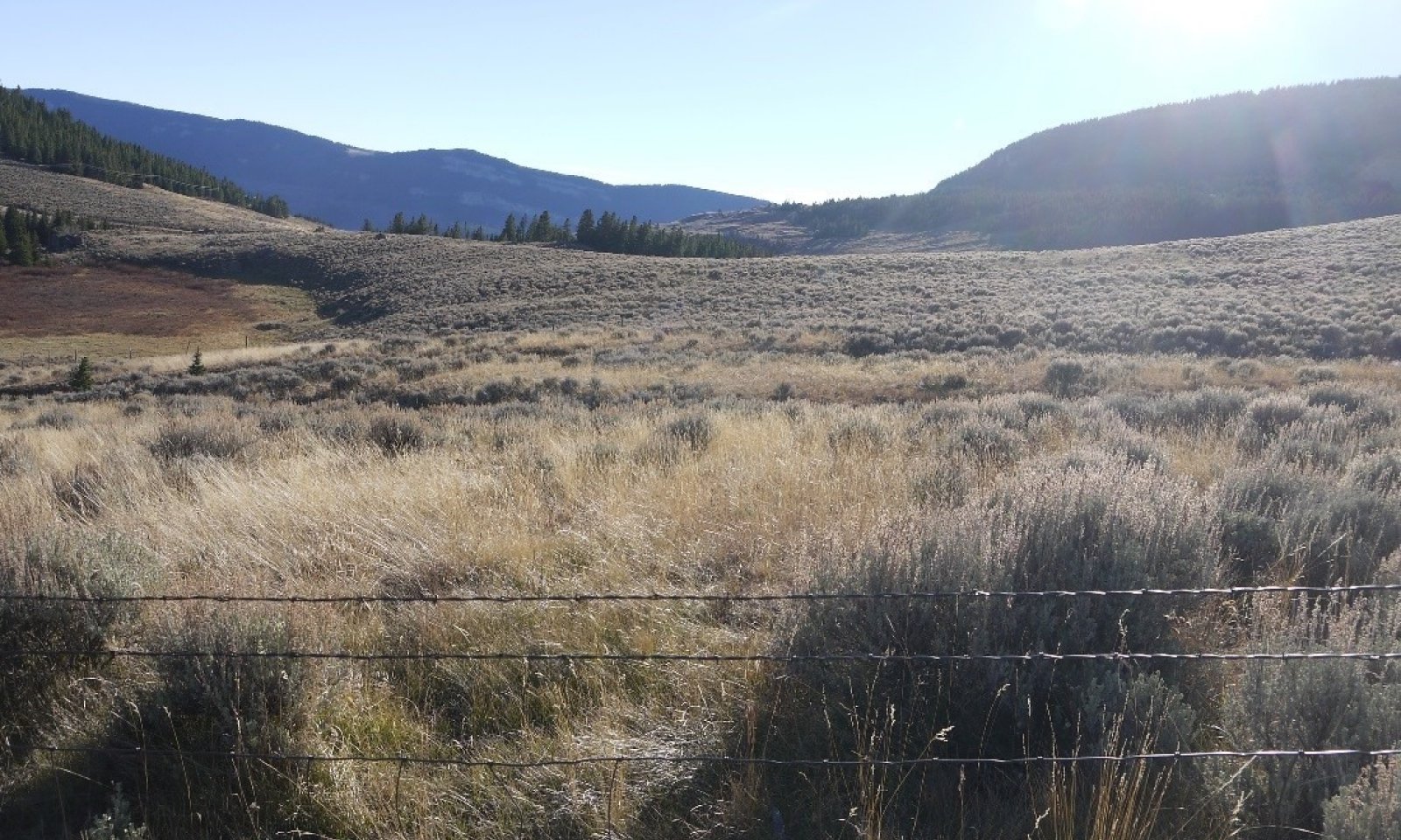
Mixed Bunchgrass/Sagebrush State (State 1 - Reference) evolved with grazing by large herbivores and is well suited for grazing by domestic livestock. Potential vegetation is estimated at 70% grasses or grass-like plants, 20% forbs, and 10% woody plants.
Characteristics and indicators
The community is characterized by the key species including: Columbia needlegrass, slender wheatgrass, needleleaf sedge, Idaho fescue, and bluebunch wheatgrass. Other grasses may include mutton and Cusick’s bluegrass, bentgrasses, prairie junegrass, onespike and timber oatgrass, thickspike wheatgrass, mountain brome and spike trisetum. Forbs include: cutleaf anemone and pale mountain dandelion. Increaser species are: bluegrasses, old man’s whiskers, rosy pussytoes, lupine, field chickweed, phlox and cinquefoil (herbaceous). Mountain big sagebrush is the dominant woody plant, but other species such as fringed sagewort, wood's rose, and shrubby potentilla may occur.
Resilience management
Resiliency of this State is reliant on the persistence of the native grasses and forbs in balance with a sagebrush canopy. Timing and intensity of utilization of the herbaceous species, as well as climatic variability and intensity of disturbance are drivers of change in this system.
Submodel
State 2
Sagebrush Dominated


Description
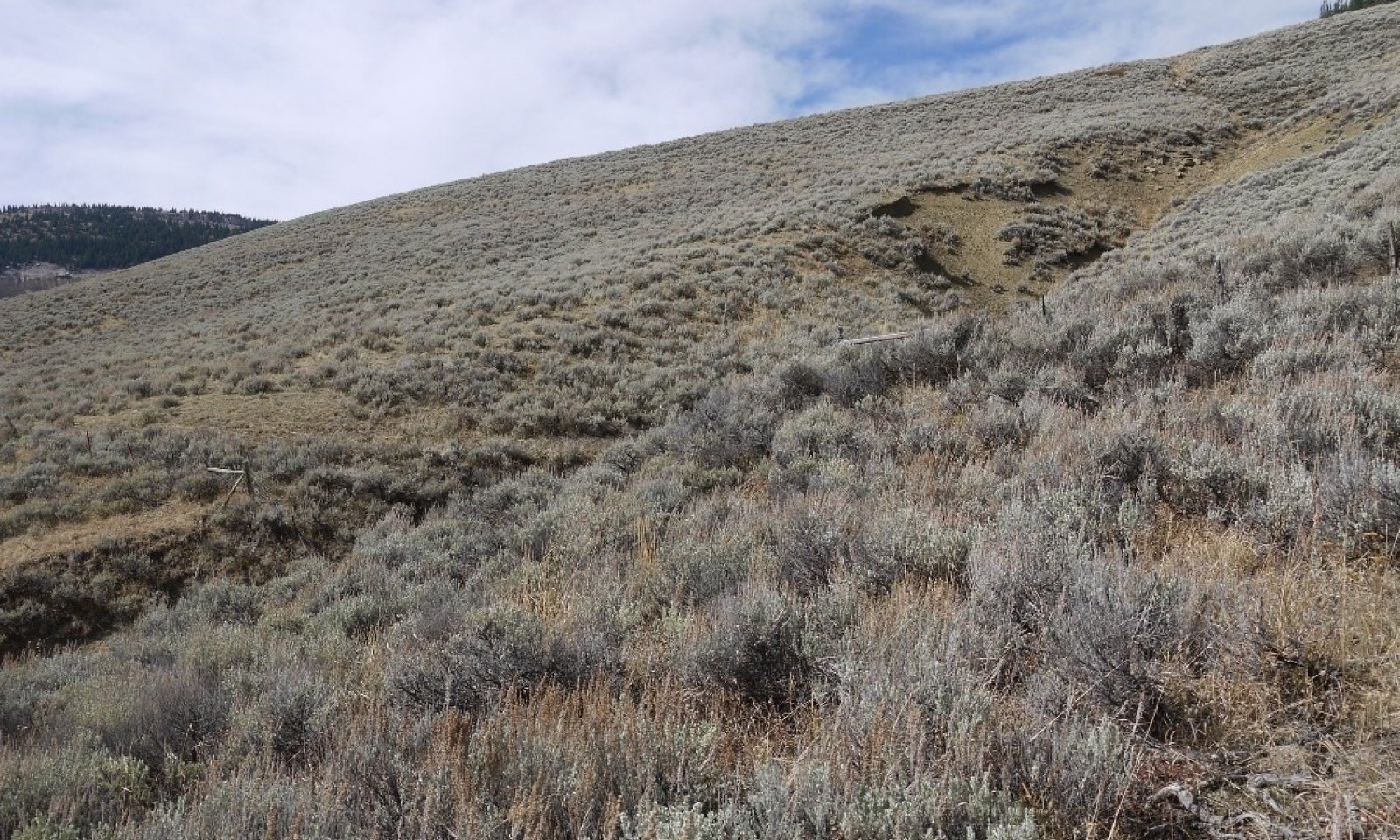
This state is a degraded state, driven by a dense shrub community, predominantly mountain big sagebrush. Initially, grasses persist in the understory, but with continued heavy use, the grass understory will become forb dominated.
Characteristics and indicators
Shrub canopy is 20% and can become greater than 40%. Bluegrasses and Idaho fescue are the prominent grasses that persist in the understory with a variety of forbs such as cinquefoil, geranium, and field chickweed.
Resilience management
Resilience of this State relies on the persistence of the sagebrush canopy and maintaining native vegetation within the understory. This state is vulnerable to encroachment of non-native/invaders species. Fire is also a driver of change for this State.
Submodel
State 3
Non-native/Invader


Description
This state is not easily divided into two distinct communities, nor is it possible to determine a typical composition of any one community. The encroachment of woody species (conifers) into an open or sagebrush park, and the movement of non-native species into an area have increased across the mountain range. There are instances where these communities cross on the landscape, and they are at-risk of further transformation. The occurrence of these communities can be a process of time or of disturbance.
Historic studies have documented conifer encroachment as well as the presence of non-native species such as Kentucky bluegrass and dandelions prior to the early 1950's. Another concern, within the Bighorn National Forest, is the threat of large scale weed invasions. Currently, most of the mountain has retained only small or isolated patches of invasive weeds. Cheatgrass has been identified as a concern on several south facing slopes on the lower flanks of the mountain range. Areas of leafy spurge, toadflax (yellow or dalmation) and thistles have been identified. Although early detection/rapid response techniques are applied for land management, limited resources make it difficult to track all current and new infestation sites. Overall, the weed infestation level is not seen as a critical concern, but the threat is growing and being monitored closely.
Characteristics and indicators
This community is driven by a significant presence (5% composition) of non-native and/or invasive species. The dominant non-native/invader species are Kentucky bluegrass, dandelions, thistles, toadflax (Dalmatian, yellow), cheatgrass, smooth brome, and field pennycress. As new species are found, this list will be adapted to include these species.
Resilience management
Kentucky bluegrass, smooth brome, and other non-native species have a high resiliency once they have established in a community. The management of the native species is difficult, and is dependent on what specific species composition exists in the individual community. The removal or treatment of encroaching woody species is best tackled when they occur at a low intensity, before they may be seen as a concern.
Submodel
Description
Although the more temperate climate of this higher elevation counter-part to the basin and foothills site, the arid nature of this region has played a major role in the development and transitions in land use over time. Many landscapes were treated with a variety of prescriptions to manage sagebrush. Timber harvest recreation, and quarries/mining persist on this landscape, the larger use continues to be grazing. Initially, sheep were the most prominent, but currently cattle are more prominent with a few sheep allotments. Farming and general agricultural practices (hayland, headquarters) are not abundant at the higher elevations. However, development of small “cow camps”, recreational areas, trails, roads, and camp sites has played a major role in creating disturbances on the landscape.
Characteristics and indicators
These sites have been mined, harvested for timber, or had significant soil disturbance that has altered the site. Improved varieties, or species such as crested wheatgrass, Russian wildrye, or other species may be present on the landscape. Signs of seeding or soil manipulations is evident.
Resilience management
Once the soils have been disturbed with tillage, deep ripping, or significant soil loss or mixing, time is the function of resilience for any change of this site. If the process of restoration or reclamation of a community is applied, then the management to maintain this community will depend on the composition of the community planted and the disturbances that are involved on the specific location.
Submodel
Mechanism
Non-use or lack of fire will encourage mountain big sagebrush growth. Increases in crown density inhibiting grass growth begins the transition to a more shrub dominated state. Heavy, continuous season-long grazing, drought, and no fire will shift this community to the sagebrush/mixed grasses community within state 2. Timing of drought will have different effects on different plant species. Drier, more open winters has a greater detrimental impact to sagebrush and other shrubs in the community; while drier and warmer summers has impacts on the grasses and forbs within the community.
Constraints to recovery
Recovery is driven by the need to remove or thin the sagebrush stand. Restrictions on herbicide use, risk of control burns, and the ability to prevent infestation by non-native or invasive species during re-establishment of the desired key species are the constraints on this community's recovery.
Context dependence
Aspect or snow drifting will alter the species that tend to re-establish in the community following any disturbance or change. Wetter, more northerly aspect sites tend to favor sedges and forbs, where the drier more exposed sites tend to favor grasses.
Mechanism
Natural disturbances and/or human driven impacts with the presence of a seed source will encourage the establishment of noxious weeds within this community. Disturbances that disrupt the native canopy exposing soil is the key factor in weed establishment. Heavy use areas by recreationalists, livestock or wildlife, stock drives, roads and trails are major areas for initial establishment. Movement of timber harvest equipment through an area is another point source for weed establishment.
Constraints to recovery
The inability to eradicate non-native and invasive species is the restrictive factor preventing recovery of this community.
Context dependence
The level of severity of the disturbance, the type of disturbance (soil disturbance or disturbances to the vegetation), and the seed sources present determine the specific components of the encroached or invaded plant communities. The level of ground disturbance will determine the risk of invasion and the time required for the community to shift to this degraded state. The ripping that occurs with timber harvest access will require a different successional transition of the plant community than areas that are torn by vehicle traffic on wet soils. The specific species introduction through wildlife movement, livestock, and human activities determine the community composition. Animal fur, tires/vehicles, clothing, and wind/water are all sources that introduce undesirable species into areas. The introduction of species is generally unintentional, and the delivery mechanism is unaware of their contributions.
Mechanism
Grazing management with deferred, rotational, or targeted grazing will encourage grass production, and can assist with reduction in woody species and forbs. Brush management with prescribed fire or herbaceous chemical control may be needed if woody canopy is over 30% cover and the forbs are suppressing the grasses in the community (State 2.2) to return to State 1 – Reference. Applying the intensity of animal impact to reduce the sagebrush cover may hinder or prevent the recovery of key grass species in the community. Risk assessment to determine the most beneficial means of reducing the woody overstory and to improve the native herbaceous understory will need to be completed for each specific community.
Relevant conservation practices
| Practice | External resources |
|---|---|
|
Brush Management |
|
|
Prescribed Burning |
|
|
Critical Area Planting |
|
|
Fence |
|
|
Prescribed Grazing |
|
|
Grazing Land Mechanical Treatment |
|
|
Heavy Use Area Protection |
|
|
Integrated Pest Management (IPM) |
|
|
Upland Wildlife Habitat Management |
|
|
Prescribed Grazing |
|
|
Invasive Plant Species Control |
|
|
Grazing Management Plan |
|
|
Grazing management to improve wildlife habitat |
|
|
Intensive Management of Rotational Grazing |
|
|
Biological suppression and other non-chemical techniques to manage brush, weeds and invasive species |
|
|
Biological suppression and other non-chemical techniques to manage herbaceous weeds invasive species |
|
|
Herbaceous Weed Control |
|
|
Prescriptive grazing management system for grazed lands |
Mechanism
Once a site has transitioned to this state, the increased bare ground and weakened plant structure leaves the community for encroachment or species creep by non-native species such as Kentucky bluegrass, dandelions, smooth brome, and in some instances, conifers. Thistles, toadflax, and houndstounge are quickly becoming significant problems on areas within these weakened plant communities. Increasing bare ground and weakening plant community structure leaves the community vulnerable to invader species such as toadflax and houndstongue.
Constraints to recovery
The inability to effectively eradicate the undesirable species is the known financially limiting constraint to this site recovering.
Mechanism
Following a ground disturbance, whether planned or incidental in nature, provides a niche for non-native species to establish. This same niche is an opportunity for non-typical natives (juniper/spruce) to encroach into the area. Disturbance by means of equipment, vehicles, or human activity, as well as domestic animals and wildlife provide a means for introducing seed sources for these undesirable species into the system.
Planned disturbances, seeding or development activities provides the open niche for invasive species to establish in an area. Ground disturbances of any nature introduces seed sources from surrounding areas into a prime seedbed. In the reclamation or restoration process, if no management is put into place to prevent an infestation of weeds, the community will transition (or possibly revert back) to an invaded state. Wildfire, prescribed burning, drought, or frequent and severe over-use by large herbivores can be a source of the disturbance that either opens the canopy and/or introduces the species to the location. Extended periods of non-use creates a decadent community with a large proportion of dead growth persisting around the crown of the plants, reducing vigor and production. As the plants begin to die-back, the community becomes vulnerable to weed invasions. This invasion triggers the transition to an invaded state.
Constraints to recovery
The inability to eradicate most of the non-native and invasive species is the major factor preventing recovery of this site. Recovery, in this instance, would require reseeding with further ground disturbance. Cost of implementation and risks involved limit the feasibility of reclaiming or restoring a native community.
Model keys
Briefcase
Add ecological sites and Major Land Resource Areas to your briefcase by clicking on the briefcase (![]() ) icon wherever it occurs. Drag and drop items to reorder. Cookies are used to store briefcase items between browsing sessions. Because of this, the number of items that can be added to your briefcase is limited, and briefcase items added on one device and browser cannot be accessed from another device or browser. Users who do not wish to place cookies on their devices should not use the briefcase tool. Briefcase cookies serve no other purpose than described here and are deleted whenever browsing history is cleared.
) icon wherever it occurs. Drag and drop items to reorder. Cookies are used to store briefcase items between browsing sessions. Because of this, the number of items that can be added to your briefcase is limited, and briefcase items added on one device and browser cannot be accessed from another device or browser. Users who do not wish to place cookies on their devices should not use the briefcase tool. Briefcase cookies serve no other purpose than described here and are deleted whenever browsing history is cleared.
Ecological sites
Major Land Resource Areas
The Ecosystem Dynamics Interpretive Tool is an information system framework developed by the USDA-ARS Jornada Experimental Range, USDA Natural Resources Conservation Service, and New Mexico State University.


