
Natural Resources
Conservation Service
Ecological site R047XA557UT
High Mountain Gravelly Loam (tall forb)
Last updated: 2/06/2025
Accessed: 04/03/2026
General information
Provisional. A provisional ecological site description has undergone quality control and quality assurance review. It contains a working state and transition model and enough information to identify the ecological site.
MLRA notes
Major Land Resource Area (MLRA): 047X–Wasatch and Uinta Mountains
MLRA 47 occurs in Utah (86 percent), Wyoming (8 percent), Colorado (4 percent), and Idaho (2 percent). It encompasses approximately 23,825 square miles (61,740 square kilometers). The northern half of this area is in the Middle Rocky Mountains Province of the Rocky Mountain System. The southern half is in the High Plateaus of the Utah Section of the Colorado Plateaus Province of the Intermontane Plateaus. Parts of the western edge of this MLRA are in the Great Basin Section of the Basin and Range Province of the Intermontane Plateaus. The MLRA includes the Wasatch Mountains, which trend north and south, and the Uinta Mountains, which trend east and west. The steeply sloping, precipitous Wasatch Mountains have narrow crests and deep valleys. Active faulting and erosion are a dominant force in controlling the geomorphology of the area. The Uinta Mountains have a broad, gently arching, elongated shape. Structurally, they consist of a broadly folded anticline that has an erosion-resistant quartzite core. The Wasatch and Uinta Mountains have an elevation of 4,900 to about 13,500 feet (1,495 to 4,115 meters).
The mountains in this area are primarily fault blocks that have been tilted up. Alluvial fans at the base of the mountains are recharge zones for the basin fill aquifers. An ancient shoreline of historic Bonneville Lake is evident on the footslopes along the western edge of the area. Rocks exposed in the mountains are mostly Mesozoic and Paleozoic sediments, but Precambrian rocks are exposed in the Uinta Mountains. The Uinta Mountains are one of the few ranges in the United States that are oriented west to east. The southern Wasatch Mountains consist of Tertiary volcanic rocks occurring as extrusive lava and intrusive crystalline rocks.
The average precipitation is from 8 to 16 inches (203 to 406 mm) in the valleys and can range up to 73 inches (1854 mm) in the mountains. In the northern and western portions of the MLRA, peak precipitation occurs in the winter months. The southern and eastern portions have a greater incidence of high-intensity summer thunderstorms; hence, a significant amount of precipitation occurs during the summer months. The average annual temperature is 30 to 50 degrees Fahrenheit (-1 to 15 C). The freeze-free period averages 140 days and ranges from 60 to 220 days, generally decreasing in length with elevation.
The dominant soil orders in this MLRA are Aridisols, Entisols, Inceptisols, and Mollisols. The lower elevations are dominated by a frigid temperature regime, while the higher elevations experience cryic temperature regimes. Mesic temperature regimes come in on the lower elevations and south facing slopes in the southern portion of this MLRA. The soil moisture regime is typically xeric in the northern part of the MLRA, but grades to ustic in the extreme eastern and southern parts. The mineralogy is generally mixed and the soils are very shallow to very deep, generally well drained, and loamy or loamy-skeletal.
LRU notes
Major Land Resource Unit 47A is located in the northern half of the Middle Rocky Mountains Province of the Rocky Mountain System. This MLRA includes the Wasatch Mountains which tend to run north and south. These steeply sloping, precipitous mountains have narrow crests and deep valleys. They are primarily fault blocks that have been tilted up. The alluvial fans located at the base of these mountains are important recharge zones for valley aquifers.
Ecological site concept
The soils of this site formed mostly in slope alluvium, colluvium, or till derived from sandstone and conglomerate. Surface soils are gravelly loam, very gravelly loam to sandy loam in texture. Rock fragments may be present on the soil surface and throughout the profile, and generally make up more than 35 percent of the soil volume. These soils are moderately deep to deep, well-drained, and have moderately slow to moderately rapid permeability. pH is slightly to moderately acidic to slightly alkaline. Available water-holding capacity ranges from 3 to 6 inches of water in the upper 60 inches of soil. The soil moisture regime is mostly udic and the soil temperature regime is cryic. Precipitation ranges from 24 to 34 inches annually.
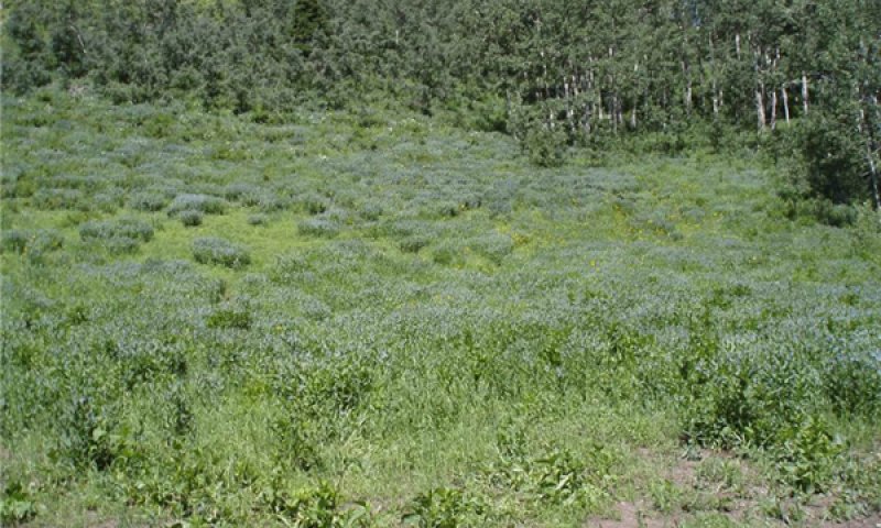
This site is located on very deep gravelly loam soils. This site never has any kind of sagebrush on it or if any dose start it drowns out within two years. The site produces around 25 percent Grasses/Grass-likes, 65 percent Forbs and 10 percent Shrubs. Production is approximately 2000 to 3500 pounds per acre air dry annually. The major plants found on the site are: GRASSES/GRASSLIKES: Mountain brome (15 percent), Slender wheatgrass (10 percent) Columbia needlegrass (5 percent). Forbs: Tall bluebells (30 percent), Western coneflower (25 percent), Western yarrow (20%), Purple Geranium (10 percent), Meadow rue (10 percent), Aspen peavine (10 percent), Seneco (5%), White Jacobs ladder (5 percent), Many flowered sunflower (5 percent), Lupine (5 percent), Tall larkspur (5 percent), and Wild heliotrope (3 percent). Shrubs are always a very minor component of this community with Red elderberry (10 percent), Mountain snowberry (10 percent) and Gooseberry current (3 percent). An example of this site can be found at NAD27 N.40º 22.935 – W.111° 12.448. at this time this site is only found on the Naphide soil.
Associated sites
| F047XA531UT |
High Mountain Stony Loam (quaking aspen) This is another of the Quaking aspen sites that will be found around this site. This one has stones through the profile. |
|---|
Similar sites
| R047XA528UT |
High Mountain Stony Clay (slender wheatgrass) Both of these sites are herbaceously dominated however this site has a higher aspect of grasses than forbs. |
|---|
Table 1. Dominant plant species
| Tree |
Not specified |
|---|---|
| Shrub |
Not specified |
| Herbaceous |
(1) Mertensia ciliata |

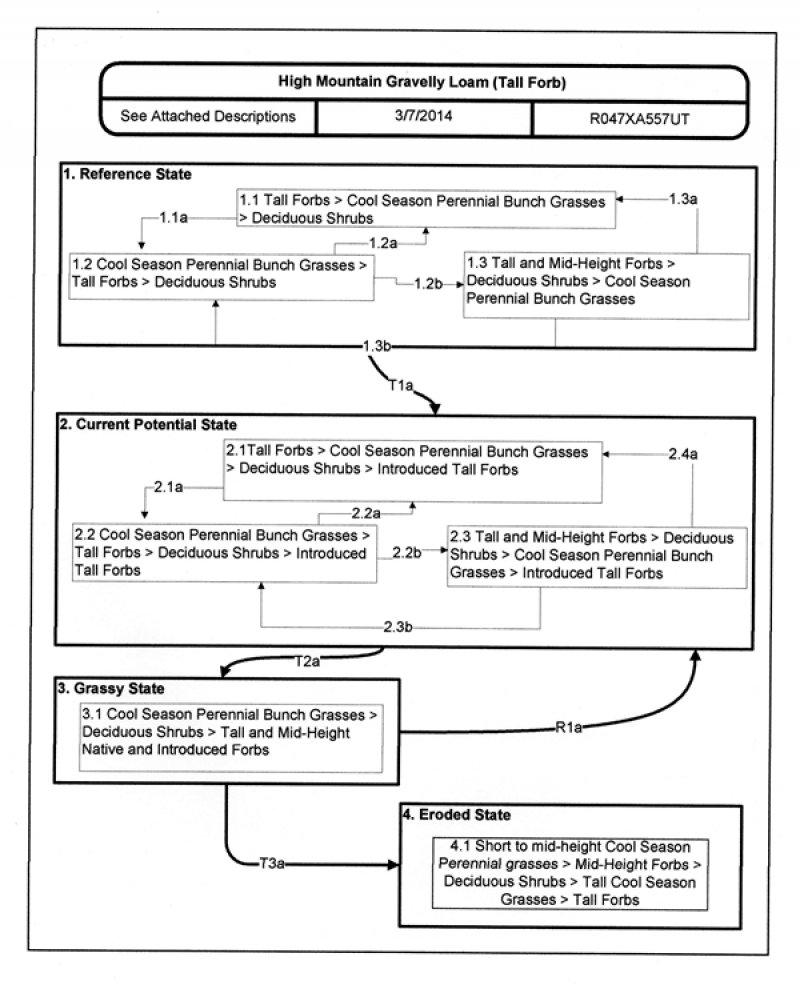
Click on box and path labels to scroll to the respective text.
| T1a | - | Introduction of non-native species |
|---|---|---|
| T2a | - | Lack of fire disturbance and the overuse of the site by large ungulate |
| R1a | - | Time with proper management |
| T3a | - | Prolonged overgrazing, drought, and extended fire interval |