High Mountain Gravelly Loam (tall forb)
Scenario model
Current ecosystem state
Select a state
Management practices/drivers
Select a transition or restoration pathway
-
Transition T1a
Introduction of non-native species
More details -
Transition T2a
Lack of fire disturbance and the overuse of the site by large ungulate
More details -
Restoration pathway R1a
Time with proper management
More details -
Transition T3a
Prolonged overgrazing, drought, and extended fire interval
More details -
No transition or restoration pathway between the selected states has been described
Target ecosystem state
Select a state
Description
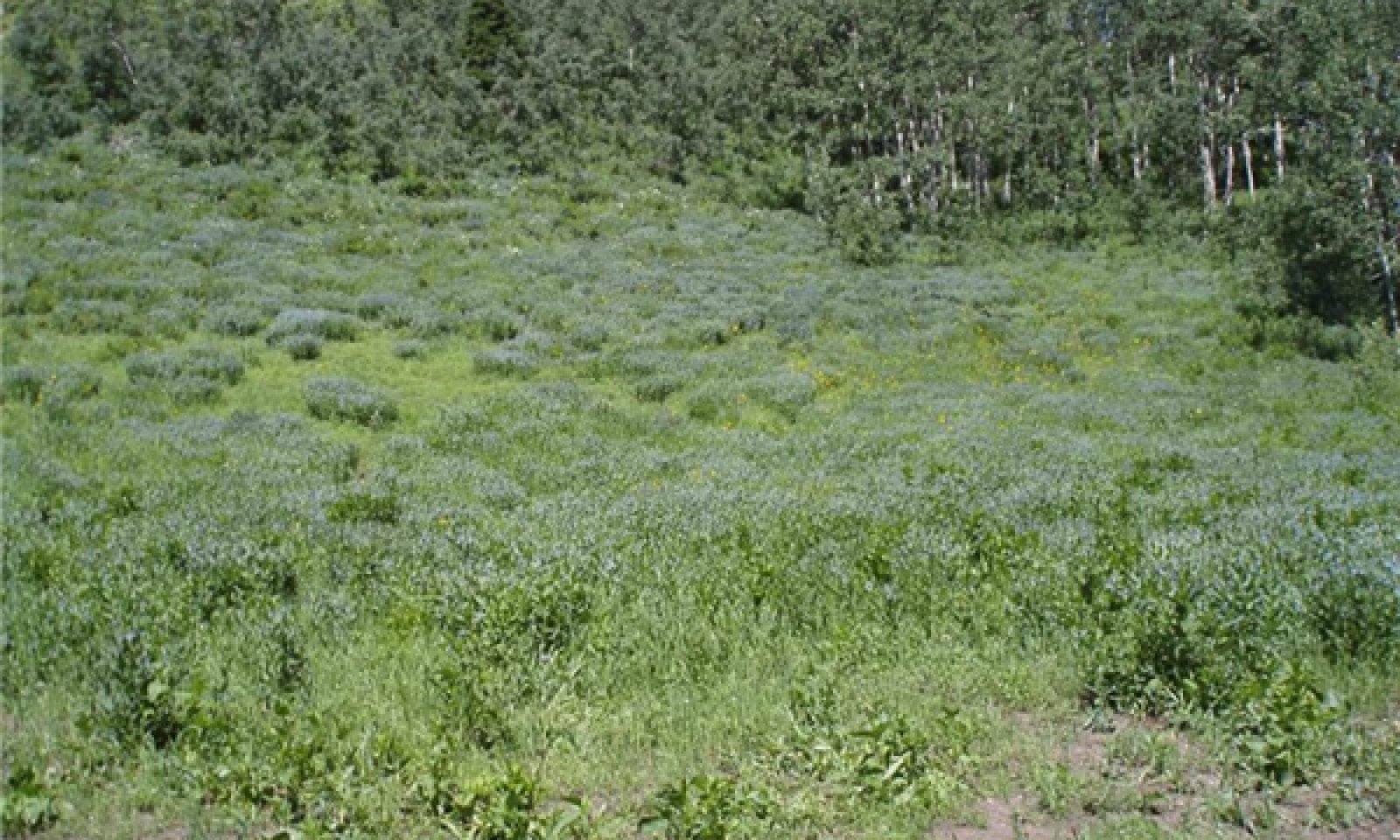
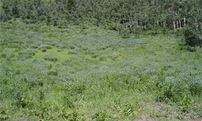
This state includes the plant communities that were best adapted to the unique combination of factors associated with this ecological site prior to European settlement. It was in a natural dynamic equilibrium with the historic biotic, abiotic, climatic factors on its ecological site in North America at the time of European immigration and settlement. This dominant aspect of the plant community is tall forbs and mountain brome. The community is made up of 25 percent Grass 65 percent forbs and 10 percent shrubs on a dry weight base.
This site is impacted by rodents (i.e.) potgut squirrels and pocket gophers. Another major influencing factor in this site is fire because of its association with quaking aspen and the needed fire frequency of 80 to 100 years for the aspen communities to maintain them self.
All of these scenarios are very interrelated and dependent on weather patterns and events as well as fire frequency and intensity and also the amount and intensity of large and small herbivore use. Any set of events that are strong enough to force the plant community out of this pattern can push it over a threshold and push it into another state.
Submodel
Description
This state includes the biotic communities that would become established on the ecological site if all successional sequences were completed without interferences by man under the present environmental conditions. Natural disturbances are inherent in its development. The Current Potential State (CPS) will include acclimatized, naturalized or invasive non-native species. There is no known way to effectively remove these plants from the site once they have become established. The level of occurrence of these plants in the CPS is such that careful management can prevent their domination of the site. This site is under normal circumstances considered an irreversibly changed. Plant communities within the CPS state may be managed and used for various purposes by man without significant alteration in plant community composition or production. It includes all of the plant communities that exist in the RPC state with the inclusion of species that are non-native to this ESD. These non-native plants are not to be considered when considering plants for the rangeland health site evaluation.
All of these scenarios are very interrelated and dependent on weather patterns and events as well as fire frequency and intensity and also the amount and intensity of large and small herbivore use. Any set of events that are strong enough to force the plant community out of this pattern can push it over a threshold and push it into another state.
Submodel
Description
This state is the condition of the site when grazing and other factors damage the forb plant community. It will have a visual and production dominance of grasses, followed by deciduous shrubs and then by those native tall and mid-height forbs and introduced forbs. The community will be 40 percent grasses, 35 percent deciduous shrubs, and 25 percent forbs. At this time forbs like Western coneflower move to the forefront in the forb community. It appears that this community can exist for an extended period of time until environmental conditions set the stage to move back to the more stable state found in the ”Current Potential State”.
Submodel
Description
This is the state that exists when the site has deteriorated to the point where so much of the top soil has eroded away the site can no longer produce the plant community and support the production that it had in the “Reference or Current Potential States” It will often be represented with 15 percent mid-stature grasses, 25 percent short-statured grasses, 35 percent deciduous shrubs, 15 percent mid-stature forbs and 10 percent tall forbs with the forbs being the grazing tolerant ones. At this state there will be twice as much bare ground and rock fragment visible as in the more productive states.
Submodel
Mechanism
Lack of fire disturbance and the overuse of the site by large ungulates.
Prolonged Drought, Overgrazing, Extreme lengthening of the fire interval frequency. Also prolonged drought along with prolonged overgrazing can cause this condition into existence.
Mechanism
Time with proper management that favors the native plants as they increase on site and move back into the site.
Relevant conservation practices
| Practice | External resources |
|---|---|
|
Prescribed Grazing |
|
|
Grazing Management Plan - Applied |
Model keys
Briefcase
Add ecological sites and Major Land Resource Areas to your briefcase by clicking on the briefcase (![]() ) icon wherever it occurs. Drag and drop items to reorder. Cookies are used to store briefcase items between browsing sessions. Because of this, the number of items that can be added to your briefcase is limited, and briefcase items added on one device and browser cannot be accessed from another device or browser. Users who do not wish to place cookies on their devices should not use the briefcase tool. Briefcase cookies serve no other purpose than described here and are deleted whenever browsing history is cleared.
) icon wherever it occurs. Drag and drop items to reorder. Cookies are used to store briefcase items between browsing sessions. Because of this, the number of items that can be added to your briefcase is limited, and briefcase items added on one device and browser cannot be accessed from another device or browser. Users who do not wish to place cookies on their devices should not use the briefcase tool. Briefcase cookies serve no other purpose than described here and are deleted whenever browsing history is cleared.
Ecological sites
Major Land Resource Areas
The Ecosystem Dynamics Interpretive Tool is an information system framework developed by the USDA-ARS Jornada Experimental Range, USDA Natural Resources Conservation Service, and New Mexico State University.