Mountain Swale Gunnison Basin LRU
Scenario model
Current ecosystem state
Select a state
Management practices/drivers
Select a transition or restoration pathway
- Transition T1A More details
- Restoration pathway R2A More details
- Transition T2A More details
- Transition T2B More details
- Transition T3A More details
- Transition R4B More details
- Transition R4A More details
- Transition R5A More details
-
No transition or restoration pathway between the selected states has been described
Target ecosystem state
Select a state
State 1
Reference


Description
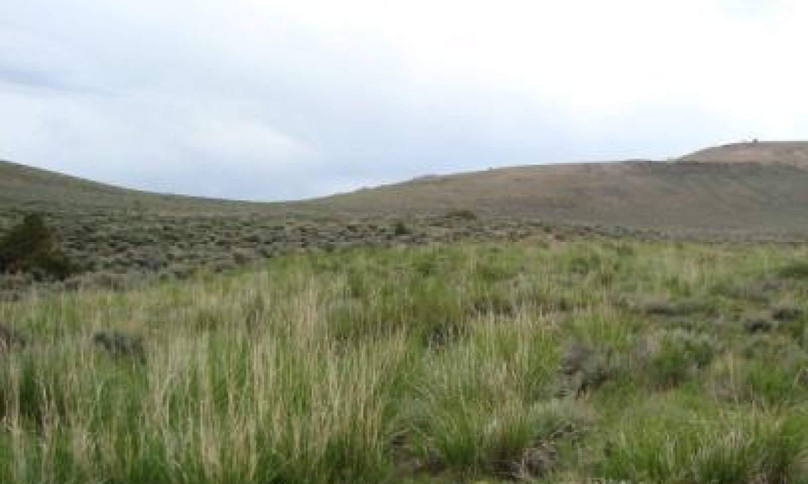
This state is on gently sloping valley bottoms that receive excess runoff from well-managed surrounding uplands. The plant community is very productive because of the extended growing season as compared to the uplands. An ephemeral channel that is not entrenched or downcutting is typical. The reference state is stable and has properly functioning hydrology.
The reference state consists of grassland that has minor amounts of forbs and shrubs. The dominant grasses are basin wildrye, slender wheatgrass, western wheatgrass, Letterman’s needlegrass, pine needlegrass, and sedges. Forbs include geranium, herbaceous cinquefoil, American bistort, and yarrow. Minor amounts of big sagebrush and rabbitbrush are present, but they may become more dominant as the site begins to deteriorate (USDA-SCS, 1976).
Notable patch dynamics influence pockets of vegetation. For example, a greater dominance of western wheatgrass and basin wildrye is near the toeslopes of the hills and in high areas. Western wheatgrass is dominant in drier areas associated with finer textured soils. Basin wildrye is not suited to saturated soils; it commonly is best suited to well drained soils that are subject to periodic water events throughout the growing season. Bunch bluegrasses, bromes, and other wheatgrasses increase in prevalence closer to the channel. Forbs and preferred shrubby species such as snowberry, Woods’ rose, and willows also increase. The high diversity of species in this state allows plants to adapt to periods of additional moisture or drought.
Submodel
Description
Rush, big sagebrush, fleabane, herbaceous cinquefoil, bottlebrush squirreltail, foxtail barley, horsetail, and rabbitbrush are dominant in this state. The hydrologic function of this community is intact throughout the swale; no benches or entrenched channels are present. The water has access to the entire swale, which helps to dissipate the energy and minimize the effects of flooding. This state is unstable and at the edge of a major threshold. If it is left untreated, it likely will transition to a degraded state and a high flow event could permanently alter the hydrologic function.
Degradation of upland areas influences the transition of this site from a functioning hydrology and preferred plant communities to this highly unstable community. Upland areas that develop a dense, old stand of sagebrush and minimal understory dewater swales by increasing the overland flow and loss through evaporation and decreasing the ability to capture and store water. Removal of grasses and herbaceous litter from the soil surface increases the rate of the flow of water and decreases infiltration. Water that could have been transported, infiltrated, stored, and moved to the swale at a later time is added to the already erosive overland flow; thus, larger amounts of water and sediment are flowing into the swale more rapidly and in a shorter period. Minor changes in the microclimate, especially at the periphery of swales, allow sagebrush and other obligate upland species to advance into the swales, which further dries them out.
Submodel
State 3
Degraded


Description
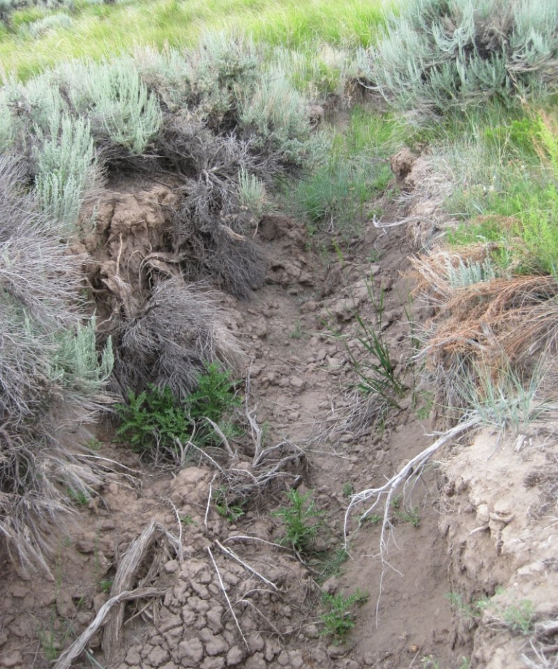
This state is degraded, and the hydrology is altered. The plant community and surface debris are insufficient to slow runoff and dissipate the erosive energy of the water. During flow events, the amount of fine organic material on the surface is not sufficient to stabilize the soil, slow the flow of water, and allow for infiltration. Water from the uplands builds energy as it collects in the swales and forms channels. The swales cannot dissipate the energy; thus, channelization increases and head cuts form. The channel also begins to drain subterranean water, further dewatering the system in a self-perpetuating loop. Soils in these areas may have a thinner A horizon (7 inches or less).
Due to the dewatering of swales that support dominantly sagebrush, production is drastically reduced to 500 to 700 pounds per acre. Diversity of the plant community is limited to three or four species, and rush is one of the major components. The amount of bare ground is 10 to 15 percent or more.
This state has two fluctuating phases. Both phases have an entrenched channel, and water has no access to the flood plain of the swales. The plant community in the channel may be similar to that of the reference state, but the majority of the swale supports a degraded sagebrush community that produces a fraction of its original potential. The least stable fluctuating community phase is subject to excessive erosion during a flow event. No vegetation is on the sidewalls or bottom of the channel. It has a distinctly V-shaped channel that widens and deepens during each flow event. In the other fluctuating community phase, the bottom of the channel is revegetated. The vegetation is similar to that of the reference community. Since the water is consolidated in a smaller area, the soils have a higher potential for exhibiting gleying and redoximorphic features. This is indicative of the low levels of oxygen associated with a water table. Common plants in the channel are those that are tolerant of flooding; thus, the abundance of obligate and facultative wetland species is higher as compared to the reference plant community. The vegetation helps to stabilize the channel during periods of minor or moderate flooding and prevent further degradation. Commonly, the channel in this phase is U-shaped.
Submodel
Description
If sagebrush is removed by chemical treatment, mowing, or fire, resprouting rabbitbrush will become dominant.
Submodel
Mechanism
Sagebrush encroachment from adjacent upland communities as a result of prolonged drought, lack of fire, and improper grazing can alter the plant community, leaving the soils subject to erosion and altering the hydrological function. The mean fire return interval is 12 to 25 years in mesic habitats (Boyd et al., 2014). Lack of wet periods may shift the community from a grass-dominant state (State 1) to a sagebrush-dominant state (State 2).
Mechanism
State 2 can be restored to the reference state (State 1) by removing sagebrush with fire or other treatments and applying proper grazing use by domestic livestock and wildlife. Management practices that restore the health of the upland community are critical to return the community to the reference state. Suitable practices include prescribed fire, shrub management, and proper grazing management. Several consecutive wet years also can decrease the abundance of big sagebrush because its roots are not tolerant of wetness for extended periods.
Mechanism
Due to a lack of protection on the soil surface, large flow events quickly destabilize the site and the hydrological function is altered (State 3). Practices that further reduce the ground cover, such as improper grazing, and prolonged periods of drought can speed up this transition. Fire suppression and lack of shrub management in uplands areas that support decadent sagebrush communities promote alteration of the hydrologic function and destabilization of the swale.
State 3 is an unstable community that affects soil health and the hydrologic function as it becomes invaded by big sagebrush. Gullies and head cuts form due to the lack of adequate herbaceous cover to dissipate the velocity of the water flow and encourage infiltration.
Mechanism
Repetitive burning of big sagebrush favors growth of rabbitbrush and perennial grasses, especially basin wildrye. Mechanical and chemical removal of sagebrush encourages growth of rabbitbrush. This may be affected by the timing of treatment or the weather patterns in years following treatment.
Mechanism
Restoring either of the community phases in State 3 to the reference plant community would require intensive inputs of time, resources, and energy. The level of the water table needs to be returned to the floor of the swale instead of the bottom of the channel. Commonly, a large amount site work is needed to reclaim the community. The site work may include soil movement, brush removal, and installation of check dams. Check dams help to minimize development of head cuts, slow the movement of water, and trap sediment. This helps to raise the channel and the water table, which allows floodwater to cover the entire swale and restores the hydrologic function. Reclaiming these areas also requires management practices that improve the upland communities. The health and restoration of the communities in swales is directly related to the health and function of the surrounding uplands.
Mechanism
Repetitive chemical treatment of rabbitbrush may be needed to restore this community to the reference plant community.
Mechanism
Continued sagebrush encroachment from untreated uplands and improper grazing use can contribute to the transitioning of this rabbitbrush state to that of one dominated by sagebrush.
Mechanism
This pathway requires intensive inputs. Restoration of small areas over very long periods may be possible, but large areas commonly cannot be restored fully. This transition requires continued sedimentation, proper grazing use, and proper hydrologic contributions. The hydrological function of the reference state may be restored if the upland areas provide the hydrologic contributions.
Model keys
Briefcase
Add ecological sites and Major Land Resource Areas to your briefcase by clicking on the briefcase (![]() ) icon wherever it occurs. Drag and drop items to reorder. Cookies are used to store briefcase items between browsing sessions. Because of this, the number of items that can be added to your briefcase is limited, and briefcase items added on one device and browser cannot be accessed from another device or browser. Users who do not wish to place cookies on their devices should not use the briefcase tool. Briefcase cookies serve no other purpose than described here and are deleted whenever browsing history is cleared.
) icon wherever it occurs. Drag and drop items to reorder. Cookies are used to store briefcase items between browsing sessions. Because of this, the number of items that can be added to your briefcase is limited, and briefcase items added on one device and browser cannot be accessed from another device or browser. Users who do not wish to place cookies on their devices should not use the briefcase tool. Briefcase cookies serve no other purpose than described here and are deleted whenever browsing history is cleared.
Ecological sites
Major Land Resource Areas
The Ecosystem Dynamics Interpretive Tool is an information system framework developed by the USDA-ARS Jornada Experimental Range, USDA Natural Resources Conservation Service, and New Mexico State University.

